|
[MAINE ET LOIRE] PHOTOGRAPHE INCONNU
PHOTOGRAPHIE ORIGINALE : LES PONTS DE CÉ - LES PETITES PERRIÈRES - 13 SEPTEMBRE 1939 - PHOTO DU GROUPE DEBOUT DEVANT LA MAISON, LA GRAND-MÈRE AVEC UN PLAT A LA MAIN ET LE GRAND-PÈRE ASSIS AVEC UNE BOUTEILLE POSÉE SUR LA JAMBE,
LES PONTS DE CÉ 1939 une photographie originale argentique en noir, format : 11,2 x 17 cm, découpée autour "à la ficelle", prise le 13 SEPTEMBRE 1939, LES PONTS DE CÉ (49) - LES PETITES PERRIÈRES, noté au dos à l'encre bleue : capitaine Hubert, lieutenant Anastase, Lieutenant Barbier, Lieutenant Rideau, Lieutenant Cyrolles
Riferimento per il libraio : 27234
|
|
|
[Maine Genealogical Society]
York Deeds Book XIII
Bethel Maine: Printed by E. C. Bowder 1904. First Edition. Hardcover. Good. Thick octavo. 3 169 pages 2. Ex-institutional copy from the Long Island Historical Society with blind stamp on he title page page 169 written numbers on the copyright page and rear paste down. Later blue cloth with title on the spine. Blue linen inner hinges. Contents are clean. Printed by E. C. Bowder hardcover
Riferimento per il libraio : 33991

|
|
|
[Maine Genealogical Society]
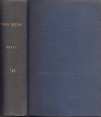
York Deeds Book XVI
Bethel Maine: Printed by E. C. Bowder 1908. First Edition. Hardcover. Good. Thick octavo. 3 148 pages 5. Ex-institutional copy from the Long Island Historical Society with blind stamps on he title page page 148 written numbers on the copyright page and rear paste down. Later blue cloth with title on the spine.Blue linen inner hinges. Contents are clean. Printed by E. C. Bowder hardcover
Riferimento per il libraio : 33992
|
|
|
[Maine Won't Discriminate (Portland, Maine); Cheryl Green (cover design)]
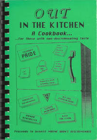
Out in the Kitchen: a Cookbook . for those with non-discriminating taste. Proceeds to benefit Maine Won't Discriminate
Lenexa Kan.: Cookbook Publishers Inc. 1995. Comb-bound octavo 23 x 16 cm. viii 105 viii pages. Introduction; illustrated with a cover design by Cheryl Green. Title from Cover. FIRST EDITION. An important civil rights fundraising cookbook raising awareness and money to help defeat a state referendum question which would have overturned the Portland Human Rights Ordinance which extended protected classifications to "gays and lesbians" the nomenclature of the era. The cookbook itself was issued just as the referendum was defeated and the civil rights of gays and lesbians were upheld. In 2009 Maine was the first state to legalize same-sex marriage though the law was overturned in 2012. The text includes "A brief history of gay rights legislation in Maine". Lightest rubbing to black-printed green card stock covers otherwise fine with black comb-binding. Scarce. OCLC locates six copies. [Cookbook Publishers, Inc.] unknown
Riferimento per il libraio : 10214
|
|
|
[Maine – Maritime History – Caribbean] Higgins, William; Burritt, Elijah H; et al
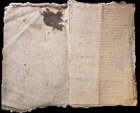
Logbook and Other Materials of William Higgins Sea Captain from Bowdoinham Maine 1830–1898
United States and Caribbean 1898. Approximately twenty-nine pieces: logbook of eighty-four double-sided pages measuring 13 x 20 inches; eight letters seventeen documents and forms and three pieces of miscellany. Much wear and significant damage to logbook including water damage mildew and tearing; log book overall fair to good minus. Other materials good to very good. Overall good. William Higgins 1791–1872 was a farmer sea captain and owner of and investor in ships from Bowdoinham Maine. According to the Maine Maritime Museum which holds his family papers Higgins’ ships traded mainly in lumber which they took from Wilmington North Carolina to the Caribbean.<br /> <br /> Offered here is a logbook recording the travels of several of Higgins’ ships particularly the brigs Mary Jane and Llewellyn alongside related documents and personal letters. The logbook dating between 1832 and 1836 extensively documents the course wind data and weather remarks for travels of the ships between east coast US port cities and various locations in the Caribbean including Barbados St. Thomas and Martinique. The logbook also contains a copy of astronomer and mathematician Elijah Burritt’s illustration “A Plan of the Solar System Exhibiting its Relative Magnitudes and Distances†engraved by W. G Evans and printed in 1835 by F.J. Huntington.<br /> <br /> The letters and documents date from 1830 to 1867 and are also mostly business-related including an insurance document for the brig William Parrington a roll of sailors enlisted to work on a six-month journey between the Caribbean and the US in 1845 a bill of sale for ¼ stake in the brig Mary Jane and receipts and logs for items including various liquors sugar molasses casks and so on. One letter from a young man in Wilmington requests advice on how to start his own business in the style of Higgins’; other letters concern family matters. One interesting undated document is a writ addressed to the Marshal of the District of Maine concerning a lawsuit filed against Higgins and Rufus Carr master of the William Parrington by Zachrisson Nelson Co. The suit alleged that Carr acting as an agent for the ship’s owners that is Higgins had agreed to an affreightment involving shipping from Jamaica to Spain to New York but had then “wholly neglected and refused to do soâ€.<br /> <br /> Of interest to scholars of maritime history and trade in the mid-19th century. unknown
Riferimento per il libraio : List2965
|
|
|
[Maine – Politics] Palmer, Barnabas
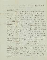
1845 Letter Discussing Maine State Politics
Kennebunk Maine 1845. Two 7 ½ x 9 ¾ inch pages. Near fine. A letter from Barnabas Palmer in Kennebunk to Charles G. Bellamy Esquire in Kittery. Bellamy 1811–1892/1899 was a captain in the Maine militia a member of the Maine House of Representatives 1842–3 and State Senate 1846–7 York County Sheriff and then Inspector of Timber at the Navy Yard in Portsmouth.1 Palmer 1791–1867 may have been military; he appears in Maine state records as an agent for the Kennebunk Gun House which is listed in other records as under the purview of the Quartermaster General.<br /> <br /> Palmer gives Bellamy his opinion on the political prospects of “Pierce†versus “Hammond†commenting:<br /> <br /> “I did not hear of any legislative recommendation of Hammond while I was at Augusta and if there was and their late abolition speeches & Texan resolutions is a specimen of the support they intend to give Mr Polk it should not have much effect.â€<br /> <br /> The US under President Polk had not yet annexed Texas and Palmer is apparently underwhelmed by Maine’s support for the cause. He also remarks on Joshua Herrick’s 1793–1874 bid for re-nomination to Congress; though he feels that he had “been badly treated†by Herrick’s competition “Judge Hayes†Palmer nonetheless feels compelled to vote for Hayes over Herrick. Of interests to historians of Maine state politics.<br /> <br /> 1 John E. Frost Colonial Village Gundalow Club: 1948 28. unknown
Riferimento per il libraio : List2966
|
|
|
[MAINE, George]
The Wind In The Pines A Celtic Miscellany
Edinburgh & London: T.N.Foulis Ltd. 1922. 1922. 4to. ff. 24. printed in red & black. 10 full-page illus. decorative headpieces initials & title vignette. unopened in original cloth-backed gilt bds. First Edition. F. Hardcover. Edinburgh & London: T.N.Foulis, Ltd., [1922]. Hardcover
Riferimento per il libraio : IAIe[MAI58
|
|
|
[Maine, Jonas C]
DOCTOR MAINE'S LIST FOR 1850. MADE AGREEABLY TO THE REQUIREMENT OF THE NEW LAW FOR THE ASSESSMENT AND COLLECTION OF TAXES
Rockville CT: Press of the Tolland County Republican 1850. 8pp untrimmed. Folded fold splitting pinned. Tanned with some spotting. Good. <br /> <br /> The author writes humorous poetry to express his distress at new and excessive tax laws. A complete list of taxable property would take "Methuselah's hours.Although I have little that now commands cash; I've plenty in 'ruins' all broken to smash; A fine dish of 'all-sorts' to publish in form; Would make out a list thrice as long as my arm. So I must abbreviate and name them in groups; then let our great ASSES-ors examine to boot."<br /> OCLC 15328280 9. Press of the Tolland County Republican unknown
Riferimento per il libraio : 25184
|
|
|
[Maine: Casco Bay] Des Barres, Joseph Frederick Wallet
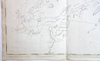
The Harbours and Rivers between Portland Point and Stage Island.
<b>Striking Casco Bay Chart from the Atlantic Neptune 1776</b><br /><br />This is an exceptional chart of the coast of Maine between Cape Elizabeth and Popham from the early Revolutionary War period. It is from Des Barres' monumental <i>Atlantic Neptune</i> a sea atlas published by the British Admiralty during the last quarter of the 18th century. The <i>Atlantic Neptune</i> has been called "the most splendid collection of charts plans and views ever published." <br /><br />The present chart includes all of Casco Bay naming the larger islands and extends east to include Seguin "Segevin Island" and Georgetown Islands. Among the numerous geographic features named are Great Jebieg Chebeague Merrymeeting Bay Segadahock River Arrowsick Island and Halfway Road i.e. Rock. Roads are shown on the chart as are individual buildings. <br /><br />The chart is dated July___ 1776 i.e. with a prominent space after the month as if a date were going to be inserted. There is no type-stamped "15" at the upper right as called for in some copies of state "b" of the Stevens Catalogue. <br /><br />The chart was folded into four vertical panels about 30 1/4 x 12" to accommodate being "bound up in tall narrow form" Stevens' Catalogue p. vii. The chart paper has the LVG watermark consistent with the earlier issues of the chart. <br />A scarce early state of a desirable chart. <br /><br /><b>References:</b> Stevens <i>Catalogue of the Atlantic Neptune</i>: 105 State: b. Sellers & Van Ee <i>Maps and Charts of North America and the West Indies</i> 1750-1789: 855. <br /><br /><b>Condition: </b>A wonderfully clean example of a striking chart of Casco Bay.<br /><br />ICN 3763. From The Atlantic Neptune.
Riferimento per il libraio : 3748
|
|
|
[Maine: Hancock/Mount Desert Island]
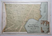
Plan of Heights of Buena Vista. Hancock Me. Dec. 1888.
<p>This attractively executed map/plan is for a proposed development by the Maine Central Railroad conveniently located "near terminus of the Mt. Desert Branch" of the railroad. The plan was "laid out by Joseph H. Curtis landscape engineer from surveys by J.G. Kelley." The completion of the Mt. Desert Branch in 1884 made possible an all-rail journey from Portland and points south to the Mt. Desert area. The proposed development apparently did not occur since a note on OCLC states: "Later maps show no evidence of the planned roads or lots."</p><p>Scarce with OCLC locating examples at the University of Maine at Orono Yale and Columbia. The Osher Map Library also has an example.</p><p><strong>Condition:</strong> Litho in green blue and brown. Very good with a small smudge at the middle of the right blank margin and remnants of mounting tape on the reverse.</p><p>ICN 7807.2</p> Heliotype Printing Co.
Riferimento per il libraio : 3832
|
|
|
[Maine]
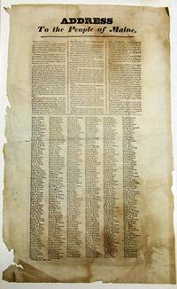
ADDRESS TO THE PEOPLE OF MAINE. FELLOW COUNTRYMEN!.
Portland 1832. Broadside 11-3/4" x 19". Lightly foxed generously margined and untrimmed with lower blank margins chipped some old folds. Else Very Good. Matted. Dated in type at the end: Portland Oct. 25th 1832."<br /> <br /> The text of this rare broadside urging the defeat of President Jackson in the upcoming presidential election is printed in three columns. It is followed by six columns consisting of hundreds of printed names of Portland citizens endorsing its sentiments. <br /> Despite his promises to the contrary Jackson has expanded the power of the presidency reneged on his promise to serve only one term and enthusiastically practiced the Spoils System. "The expenses of his administration have largely exceeded those of any of his six predecessors." He has claimed the power of "interpreting for himself" the Constitution although contradicted by "the Supreme Judiciary." <br /> AI 10824 1- Harvard. OCLC 58786948 3- AAS NYHS Harvard as of November 2023. unknown
Riferimento per il libraio : 34328
|
|
|
[MAINE]
Almanach du département de la Sarthe, pour l'an 1809, augmenté de la liste générale des Curés et Desservants du département de la Mayenne, faisant partie du Diocèse du Mans.
1809 Le Mans, Monnoyer, Imprimeur de la Préfecture, 1809. In-12 broché. Iv pp., (6) ff., 164 pp. Manques au dos. Dans l'état.
Riferimento per il libraio : 6935
|
|
|
[Maine]
Approach to Penobscot Bay
Washington D.C.: Published by the United States Coast and Geodetic Survey 1920. Large folding nautical chart printed on heavy paper stock. Colored. A rare original coastal survey of the approach to Penobscot Bay including Matinicus Island and an inset map of Matinicus Harbor in the bottom right corner.<br/> <br/> Established by President Thomas Jefferson in 1807 as the Survey of the Coast the U.S. Coast and Geodetic Survey was the United States' first civilian scientific agency. This agency has followed its mission to survey the U.S. coastline create nautical charts of the coast and help increase maritime safety since its founding and has often played fascinating roles in significant chapters of U.S. history. It served in all theaters of the Civil War in the service of the Union Army and Navy pioneered acoustic exploration in the wake of the sinking of the Titanic and during WWI it worked to detect enemy submarines. In addition this agency worked to survey and produce detailed maps and renderings of the U.S. coast. These nautical survey maps commonly referred to as "T-sheets" provide fascinating insights into the history of the United States coastline which has and will continue to shift. These maps are the most important data source for understanding the physical and ecological characteristics of the U.S. shoreline. The present map is a highly detailed and accurate sea chart of Penobscot Bay and an important historical view of developing Maine. Published by the United States Coast and Geodetic Survey unknown
Riferimento per il libraio : 41293

|
|
|
[Maine]
Approaches to Blue Hill Bay and Eggemoggin Reach
Washington D.C.: Published by the United States Coast and Geodetic Survey 1920. Large folding nautical chart printed on heavy paper stock. Colored. A rare original coastal survey of Blue Hill Bay including Swans Island Deer Isle Mt Desert and Tremont.<br/> <br/> Established by President Thomas Jefferson in 1807 as the Survey of the Coast the U.S. Coast and Geodetic Survey was the United States' first civilian scientific agency. This agency has followed its mission to survey the U.S. coastline create nautical charts of the coast and help increase maritime safety since its founding and has often played fascinating roles in significant chapters of U.S. history. It served in all theaters of the Civil War in the service of the Union Army and Navy pioneered acoustic exploration in the wake of the sinking of the Titanic and during WWI it worked to detect enemy submarines. In addition this agency worked to survey and produce detailed maps and renderings of the U.S. coast. These nautical survey maps commonly referred to as "T-sheets" provide fascinating insights into the history of the United States coastline which has and will continue to shift. These maps are the most important data source for understanding the physical and ecological characteristics of the U.S. shoreline. The present map is a highly detailed and accurate sea chart of Blue Hill Bay and an important historical view of developing Maine. Published by the United States Coast and Geodetic Survey unknown
Riferimento per il libraio : 41278

|
|
|
[Maine]
Bath and Boothbay Harbor
Washington D.C.: Published by the United States Coast and Geodetic Survey 1919. Large folding nautical chart printed on heavy paper stock. Uncolored. A rare original coastal survey of Bath and Boothbay Harbor including Bath Georgetown Boothbay and Westport and Southport Islands.<br/> <br/> Established by President Thomas Jefferson in 1807 as the Survey of the Coast the U.S. Coast and Geodetic Survey was the United States' first civilian scientific agency. This agency has followed its mission to survey the U.S. coastline create nautical charts of the coast and help increase maritime safety since its founding and has often played fascinating roles in significant chapters of U.S. history. It served in all theaters of the Civil War in the service of the Union Army and Navy pioneered acoustic exploration in the wake of the sinking of the Titanic and during WWI it worked to detect enemy submarines. In addition this agency worked to survey and produce detailed maps and renderings of the U.S. coast. These nautical survey maps commonly referred to as "T-sheets" provide fascinating insights into the history of the United States coastline which has and will continue to shift. These maps are the most important data source for understanding the physical and ecological characteristics of the U.S. shoreline. The present map is a highly detailed and accurate sea chart of Bath and Boothbay Harbor and an important historical view of developing Maine. Published by the United States Coast and Geodetic Survey unknown
Riferimento per il libraio : 41297

|
|
|
[Maine]
Blue Hill Bay and Western Part of Mt Desert Island
Washington D.C.: Published by the United States Coast and Geodetic Survey 1920. Large folding nautical chart printed on heavy paper stock. Uncolored. A rare original coastal survey of Blue Hills Bay in Maine including Ellsworth Surry Tremont Southwest Harbor Swans Island Blue Hill and Acadia National Park.<br/> <br/> Established by President Thomas Jefferson in 1807 as the Survey of the Coast the U.S. Coast and Geodetic Survey was the United States' first civilian scientific agency. This agency has followed its mission to survey the U.S. coastline create nautical charts of the coast and help increase maritime safety since its founding and has often played fascinating roles in significant chapters of U.S. history. It served in all theaters of the Civil War in the service of the Union Army and Navy pioneered acoustic exploration in the wake of the sinking of the Titanic and during WWI it worked to detect enemy submarines. In addition this agency worked to survey and produce detailed maps and renderings of the U.S. coast. These nautical survey maps commonly referred to as "T-sheets" provide fascinating insights into the history of the United States coastline which has and will continue to shift. These maps are the most important data source for understanding the physical and ecological characteristics of the U.S. shoreline. The present map is a highly detailed and accurate sea chart of Blue Hills Bay and an important historical view of developing Maine. Published by the United States Coast and Geodetic Survey unknown
Riferimento per il libraio : 41267

|
|
|
[Maine]
Boothbay Harbor to Bath
Washington D.C.: Published by the United States Coast and Geodetic Survey 1922. Large folding nautical chart printed on heavy paper stock. Colored. Bisected into two maps. A rare original coastal survey of Maine including Boothbay Harbor Bath and Georgetown.<br/> <br/> Established by President Thomas Jefferson in 1807 as the Survey of the Coast the U.S. Coast and Geodetic Survey was the United States' first civilian scientific agency. This agency has followed its mission to survey the U.S. coastline create nautical charts of the coast and help increase maritime safety since its founding and has often played fascinating roles in significant chapters of U.S. history. It served in all theaters of the Civil War in the service of the Union Army and Navy pioneered acoustic exploration in the wake of the sinking of the Titanic and during WWI it worked to detect enemy submarines. In addition this agency worked to survey and produce detailed maps and renderings of the U.S. coast. These nautical survey maps commonly referred to as "T-sheets" provide fascinating insights into the history of the United States coastline which has and will continue to shift. These maps are the most important data source for understanding the physical and ecological characteristics of the U.S. shoreline. The present map is a highly detailed and accurate sea chart of coastal Maine from Boothbay Harbor to Bath and an important historical view of the developing state. Published by the United States Coast and Geodetic Survey unknown
Riferimento per il libraio : 41276

|
|
|
[Maine]
Casco Bay
Washington D.C.: Published by the United States Coast and Geodetic Survey 1921. Large folding nautical chart printed on heavy paper stock. Colored. A rare original coastal survey of Maine around Casco Bay including Cape Elizabeth Portland Yarmouth Freeport and Harpswell.<br/> <br/> Established by President Thomas Jefferson in 1807 as the Survey of the Coast the U.S. Coast and Geodetic Survey was the United States' first civilian scientific agency. This agency has followed its mission to survey the U.S. coastline create nautical charts of the coast and help increase maritime safety since its founding and has often played fascinating roles in significant chapters of U.S. history. It served in all theaters of the Civil War in the service of the Union Army and Navy pioneered acoustic exploration in the wake of the sinking of the Titanic and during WWI it worked to detect enemy submarines. In addition this agency worked to survey and produce detailed maps and renderings of the U.S. coast. These nautical survey maps commonly referred to as "T-sheets" provide fascinating insights into the history of the United States coastline which has and will continue to shift. These maps are the most important data source for understanding the physical and ecological characteristics of the U.S. shoreline. The present map is a highly detailed and accurate sea chart of Casco Bay and an important historical view of developing Maine. Published by the United States Coast and Geodetic Survey unknown
Riferimento per il libraio : 41274

|
|
|
[Maine]
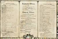
COMPANY C 13TH REGIMENT MAINE VOL. INFANTRY SOLDIERS' MEMORIAL
Cincinnati: Ehrgott Forbriger & Co. Lithographers 1863. Folio lithograph broadside 18" x 22." Matted in a wood frame. Some soil and closed tears. The lists of Regimental Officers Company Officers Musicians Wagoneer and Privates are surrounded by lithograph vignettes of battle flags and rural household and battle scenes. Good.<br /> <br /> The Company was mustered into service on December 4 1861 at Augusta by Lieut. Col. S. Eastman. Ehrgott, Forbriger & Co., Lithographers unknown
Riferimento per il libraio : 38843
|
|
|
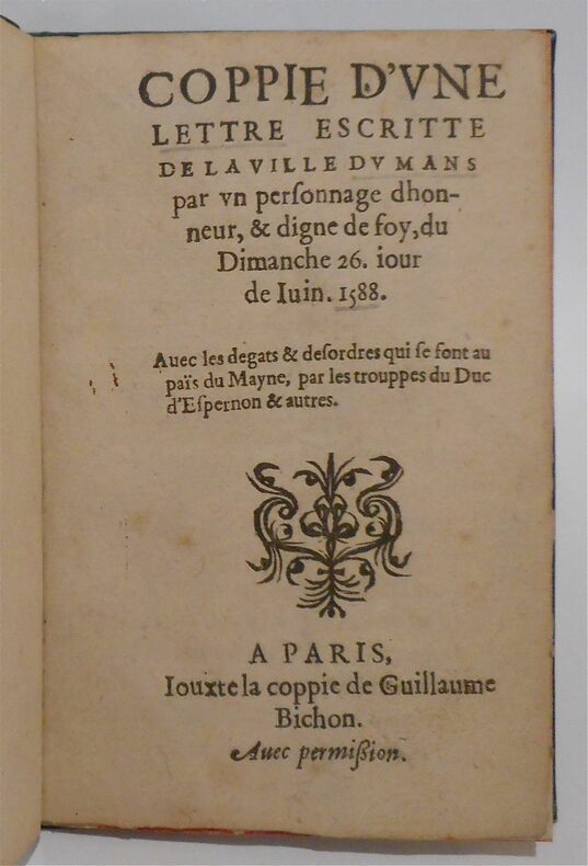
[MAINE]
Coppie d'une lettre escrite de la ville du Mans. par un personnage dhonneur, & digne de foy, du dimanche 26. iour de Iuin 1588. Avec les dégâts & désordres qui se font au païs du Mayne, par les trouppes du Duc d'Espernon & autres
Paris, iouxte la coppie de Guillaume Bichon, s.d. (1588) petit in-8, 6 pp., un f. vierge, cartonnage de papier bouteille, tranches rouges (rel. du XIXe s.).
Riferimento per il libraio : 222018
|
|
|
[Maine]
Cross Island to Nash Island
Washington D.C.: Published by the United States Coast and Geodetic Survey 1920. Large folding nautical chart printed on heavy paper stock. Uncolored. A rare original coastal survey of Maine from Nash Island to Cross Island including Jonesport Jonesboro Great Wass Island Preserve and Bucks Harbor.<br/> <br/> Established by President Thomas Jefferson in 1807 as the Survey of the Coast the U.S. Coast and Geodetic Survey was the United States' first civilian scientific agency. This agency has followed its mission to survey the U.S. coastline create nautical charts of the coast and help increase maritime safety since its founding and has often played fascinating roles in significant chapters of U.S. history. It served in all theaters of the Civil War in the service of the Union Army and Navy pioneered acoustic exploration in the wake of the sinking of the Titanic and during WWI it worked to detect enemy submarines. In addition this agency worked to survey and produce detailed maps and renderings of the U.S. coast. These nautical survey maps commonly referred to as "T-sheets" provide fascinating insights into the history of the United States coastline which has and will continue to shift. These maps are the most important data source for understanding the physical and ecological characteristics of the U.S. shoreline. The present map is a highly detailed and accurate sea chart of coastal Maine from Cross Island to Nash Island and an important historical view of the developing state. Published by the United States Coast and Geodetic Survey unknown
Riferimento per il libraio : 41281

|
|
|
[Maine]
Damariscotta and Medomak Rivers
Washington D.C.: Published by the United States Coast and Geodetic Survey 1920. Large folding nautical chart printed on heavy paper stock. Colored. A rare original coastal survey of the Damariscotta and Medomak rivers including Bristol Waldoboro and Damariscotta.<br/> <br/> Established by President Thomas Jefferson in 1807 as the Survey of the Coast the U.S. Coast and Geodetic Survey was the United States' first civilian scientific agency. This agency has followed its mission to survey the U.S. coastline create nautical charts of the coast and help increase maritime safety since its founding and has often played fascinating roles in significant chapters of U.S. history. It served in all theaters of the Civil War in the service of the Union Army and Navy pioneered acoustic exploration in the wake of the sinking of the Titanic and during WWI it worked to detect enemy submarines. In addition this agency worked to survey and produce detailed maps and renderings of the U.S. coast. These nautical survey maps commonly referred to as "T-sheets" provide fascinating insights into the history of the United States coastline which has and will continue to shift. These maps are the most important data source for understanding the physical and ecological characteristics of the U.S. shoreline. The present map is a highly detailed and accurate sea chart of the Damariscotta and Medomak rivers and an important historical view of developing Maine. Published by the United States Coast and Geodetic Survey unknown
Riferimento per il libraio : 41286

|
|
|
[Maine]
East Penobscot Bay
Washington D.C.: Published by the United States Coast and Geodetic Survey 1920. Large folding nautical chart printed on heavy paper stock. Colored. A rare original coastal survey of Maine at East Penobscot Bay including the Fox Islands Deer Isle Stonington and Isle Au Hunt.<br/> <br/> Established by President Thomas Jefferson in 1807 as the Survey of the Coast the U.S. Coast and Geodetic Survey was the United States' first civilian scientific agency. This agency has followed its mission to survey the U.S. coastline create nautical charts of the coast and help increase maritime safety since its founding and has often played fascinating roles in significant chapters of U.S. history. It served in all theaters of the Civil War in the service of the Union Army and Navy pioneered acoustic exploration in the wake of the sinking of the Titanic and during WWI it worked to detect enemy submarines. In addition this agency worked to survey and produce detailed maps and renderings of the U.S. coast. These nautical survey maps commonly referred to as "T-sheets" provide fascinating insights into the history of the United States coastline which has and will continue to shift. These maps are the most important data source for understanding the physical and ecological characteristics of the U.S. shoreline. The present map is a highly detailed and accurate sea chart of East Penobscot Bay and an important historical view of developing Maine. Published by the United States Coast and Geodetic Survey unknown
Riferimento per il libraio : 41287

|
|
|
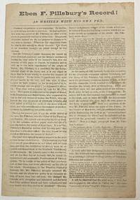
[Maine]
EBEN F. PILLSBURY'S RECORD! AS WRITTEN WITH HIS OWN PEN
Augusta 1866. 4 pp. Folded. Caption title as issued. Printed in two columns per page. Lightly foxed and worn Good.<br /> <br /> Pillsbury the Democrats' candidate for Governor of Maine had been editor of the Farmington Patriot during the Civil War. His editorial comments-- expressing "disloyal sentiments during the very crisis of his country's fate"-- disqualify him from public office. Pillsbury "charged Mr. Lincoln with deception and falsehood" called the draft unconstitutional and otherwise "encouraged the hosts of Rebeldom."<br /> Pillsbury's opponent Joshua Lawrence Chamberlain was meanwhile in the thick of the most crucial battles of the War. His record is "WRITTEN WITH HIS OWN SWORD." "Voters of Maine!! Read them both and choose between them on the 14th of September.!" <br /> Not located on OCLC as of August 2021 or the online sites of Harvard or Bowdoin. unknown
Riferimento per il libraio : 34393
|
|
|
[MAINE]
Essais historiques sur la ville et le pays de Laval. et la province du Maine. Essai sur le régime féodal. Par un ancien magistrat de Laval
Laval, 1837 in-8, 117 pp., broché.
Riferimento per il libraio : 5335
|
|
|
[MAINE]
Essais historiques sur la ville et le pays de Laval. et la province du Maine. Par un ancien magistrat de Laval
Laval, J. Feillé-Grandpré, 1843 in-8, 446 pp., 2 planches dont une repliée, cartonnage demi-percaline rouille (reliure de l'époque). Reliure modeste.
Riferimento per il libraio : 219961
|
|
|
[Maine]
Fox Islands Thoroughfare
Washington D.C.: Published by the United States Coast and Geodetic Survey 1920. Large folding nautical chart printed on heavy paper stock. Uncolored. A rare original coastal survey of the Fox Islands including Vinalhaven and North Haven.<br/> <br/> Established by President Thomas Jefferson in 1807 as the Survey of the Coast the U.S. Coast and Geodetic Survey was the United States' first civilian scientific agency. This agency has followed its mission to survey the U.S. coastline create nautical charts of the coast and help increase maritime safety since its founding and has often played fascinating roles in significant chapters of U.S. history. It served in all theaters of the Civil War in the service of the Union Army and Navy pioneered acoustic exploration in the wake of the sinking of the Titanic and during WWI it worked to detect enemy submarines. In addition this agency worked to survey and produce detailed maps and renderings of the U.S. coast. These nautical survey maps commonly referred to as "T-sheets" provide fascinating insights into the history of the United States coastline which has and will continue to shift. These maps are the most important data source for understanding the physical and ecological characteristics of the U.S. shoreline. The present map is a highly detailed and accurate sea chart of the Fox Islands and an important historical view of developing Maine. Published by the United States Coast and Geodetic Survey unknown
Riferimento per il libraio : 41275

|
|
|
[Maine]
Frenchmans Bay and Eastern Part of Mt. Desert Island
Washington D.C.: Published by the United States Coast and Geodetic Survey 1920. Large folding nautical chart printed on heavy paper stock. Colored. A rare original coastal survey of Frenchman Bay including Acadia National Park Bar Harbor Lamoine Hancock Sullivan.<br/> <br/> Established by President Thomas Jefferson in 1807 as the Survey of the Coast the U.S. Coast and Geodetic Survey was the United States' first civilian scientific agency. This agency has followed its mission to survey the U.S. coastline create nautical charts of the coast and help increase maritime safety since its founding and has often played fascinating roles in significant chapters of U.S. history. It served in all theaters of the Civil War in the service of the Union Army and Navy pioneered acoustic exploration in the wake of the sinking of the Titanic and during WWI it worked to detect enemy submarines. In addition this agency worked to survey and produce detailed maps and renderings of the U.S. coast. These nautical survey maps commonly referred to as "T-sheets" provide fascinating insights into the history of the United States coastline which has and will continue to shift. These maps are the most important data source for understanding the physical and ecological characteristics of the U.S. shoreline. The present map is a highly detailed and accurate sea chart of Frenchman Bay and an important historical view of developing Maine. Published by the United States Coast and Geodetic Survey unknown
Riferimento per il libraio : 41268

|
|
|
[Maine]
Harbors of Camden and Rockport
Washington D.C.: Published by the United States Coast and Geodetic Survey 1920. Nautical chart printed on heavy paper stock. Uncolored. A rare original coastal survey of Maine including Camden and Rockport.<br/> <br/> Established by President Thomas Jefferson in 1807 as the Survey of the Coast the U.S. Coast and Geodetic Survey was the United States' first civilian scientific agency. This agency has followed its mission to survey the U.S. coastline create nautical charts of the coast and help increase maritime safety since its founding and has often played fascinating roles in significant chapters of U.S. history. It served in all theaters of the Civil War in the service of the Union Army and Navy pioneered acoustic exploration in the wake of the sinking of the Titanic and during WWI it worked to detect enemy submarines. In addition this agency worked to survey and produce detailed maps and renderings of the U.S. coast. These nautical survey maps commonly referred to as "T-sheets" provide fascinating insights into the history of the United States coastline which has and will continue to shift. These maps are the most important data source for understanding the physical and ecological characteristics of the U.S. shoreline. The present map is a highly detailed and accurate sea chart of the harbors of Camden and Rockport and an important historical view of developing Maine. Published by the United States Coast and Geodetic Survey unknown
Riferimento per il libraio : 41296

|
|
|
[Maine]
Kennebec and Sheepscot Rivers
Washington D.C.: Published by the United States Coast and Geodetic Survey 1920. Large folding nautical chart printed on heavy paper stock. Colored. A rare original coastal survey of the Kennebec and Sheepscot Rivers including Bath Georgetown Boothbay and Wiscasset.<br/> <br/> Established by President Thomas Jefferson in 1807 as the Survey of the Coast the U.S. Coast and Geodetic Survey was the United States' first civilian scientific agency. This agency has followed its mission to survey the U.S. coastline create nautical charts of the coast and help increase maritime safety since its founding and has often played fascinating roles in significant chapters of U.S. history. It served in all theaters of the Civil War in the service of the Union Army and Navy pioneered acoustic exploration in the wake of the sinking of the Titanic and during WWI it worked to detect enemy submarines. In addition this agency worked to survey and produce detailed maps and renderings of the U.S. coast. These nautical survey maps commonly referred to as "T-sheets" provide fascinating insights into the history of the United States coastline which has and will continue to shift. These maps are the most important data source for understanding the physical and ecological characteristics of the U.S. shoreline. The present map is a highly detailed and accurate sea chart of the Kennebec and Sheepscot Rivers and an important historical view of developing Maine. Published by the United States Coast and Geodetic Survey unknown
Riferimento per il libraio : 41284

|
|
|
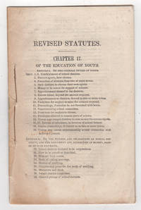
[Maine]
Laws of Maine in Relation to the Education of Youth. Revised Statutes. Chapter 17. May 3 1842
Augusta: William R. Smith & Co. printers 1842. First edition. Stitched paper wrappers. Lacking the wrappers and title page else very good scattered foxing. 27 1 pp. 8vo. Attested to by Philip C. Johnson Secretary of State on May 3 1842. Includes Article I: Of the General Duties of the Towns; Article II: Of the Powers and Obligations of School Districts and the Assessments and Collection of Moneys Raised by such Districts; Article III: Of the Duties and Powers of the Superintending School Committees and School Agents and the Qualifications and Duties of Instructors; Article IV: Special Provisions Relating to the Regulations and Endowment of Schools and Affecting the Government and Discipline of Literary Institutions.<br /> <br /> Very rare. OCLC locates one copy: Trinity College. Sabin and American Imprints report a copy at the Boston Public Library but not found on their online catalogue. The printed version of Sabin lists this item as 43959 but the online version compiled by Gale assigns this number incorrectly to an 1826 version of 11 pages. American Imprints 423157. Sabin 43959. [William R. Smith & Co., printers] unknown
Riferimento per il libraio : 38794
|
|
|
[Maine]
Little River to Petit Manan
Washington D.C.: Published by the United States Coast and Geodetic Survey 1920. Large folding nautical chart printed on heavy paper stock. Uncolored. A rare original coastal survey of Maine from Little River to Petit Manan including Milbridge Addison Great Wass Island Preserve Jonesport Machias and an inset map of Moose-a-Bec Bar and Pig Island in top left corner.<br/> <br/> Established by President Thomas Jefferson in 1807 as the Survey of the Coast the U.S. Coast and Geodetic Survey was the United States' first civilian scientific agency. This agency has followed its mission to survey the U.S. coastline create nautical charts of the coast and help increase maritime safety since its founding and has often played fascinating roles in significant chapters of U.S. history. It served in all theaters of the Civil War in the service of the Union Army and Navy pioneered acoustic exploration in the wake of the sinking of the Titanic and during WWI it worked to detect enemy submarines. In addition this agency worked to survey and produce detailed maps and renderings of the U.S. coast. These nautical survey maps commonly referred to as "T-sheets" provide fascinating insights into the history of the United States coastline which has and will continue to shift. These maps are the most important data source for understanding the physical and ecological characteristics of the U.S. shoreline. The present map is a highly detailed and accurate sea chart of coastal Maine and an important historical view of the developing state. Published by the United States Coast and Geodetic Survey unknown
Riferimento per il libraio : 41272

|
|
|
[Maine]
Monhegan Island to Cape Elizabeth
Washington D.C.: Published by the United States Coast and Geodetic Survey 1929. Large folding nautical chart printed on heavy paper stock. Colored. A rare original coastal survey of Maine from Monhegan Island to Cape Elizabeth including Bristol Damariscotta Wiscasset Boothbay Georgetown Harpswell Bath Brunswick Freeport Yarmouth and Portland.<br/> <br/> Established by President Thomas Jefferson in 1807 as the Survey of the Coast the U.S. Coast and Geodetic Survey was the United States' first civilian scientific agency. This agency has followed its mission to survey the U.S. coastline create nautical charts of the coast and help increase maritime safety since its founding and has often played fascinating roles in significant chapters of U.S. history. It served in all theaters of the Civil War in the service of the Union Army and Navy pioneered acoustic exploration in the wake of the sinking of the Titanic and during WWI it worked to detect enemy submarines. In addition this agency worked to survey and produce detailed maps and renderings of the U.S. coast. These nautical survey maps commonly referred to as "T-sheets" provide fascinating insights into the history of the United States coastline which has and will continue to shift. These maps are the most important data source for understanding the physical and ecological characteristics of the U.S. shoreline. The present map is a highly detailed and accurate sea chart of coastal Maine around Portland and an important historical view of the developing state. Published by the United States Coast and Geodetic Survey unknown
Riferimento per il libraio : 41282

|
|
|
[Maine]
Nash Island to Schoodic Island
Washington D.C.: Published by the United States Coast and Geodetic Survey 1920. Large folding nautical chart printed on heavy paper stock. Colored. A rare original coastal survey of Maine from Nash Island to Schoodic Island including Gouldsboro Prospect Harbor Steuben Milbridge Cherryfield Addison and Harrington.<br/> <br/> Established by President Thomas Jefferson in 1807 as the Survey of the Coast the U.S. Coast and Geodetic Survey was the United States' first civilian scientific agency. This agency has followed its mission to survey the U.S. coastline create nautical charts of the coast and help increase maritime safety since its founding and has often played fascinating roles in significant chapters of U.S. history. It served in all theaters of the Civil War in the service of the Union Army and Navy pioneered acoustic exploration in the wake of the sinking of the Titanic and during WWI it worked to detect enemy submarines. In addition this agency worked to survey and produce detailed maps and renderings of the U.S. coast. These nautical survey maps commonly referred to as "T-sheets" provide fascinating insights into the history of the United States coastline which has and will continue to shift. These maps are the most important data source for understanding the physical and ecological characteristics of the U.S. shoreline. The present map is a highly detailed and accurate sea chart of coastal Maine and an important historical view of the developing state. Published by the United States Coast and Geodetic Survey unknown
Riferimento per il libraio : 41269

|
|
|
[Maine]
Penobscot Bay and Approaches
Washington D.C.: Published by the United States Coast and Geodetic Survey 1920. Large folding nautical chart printed on heavy paper stock. Colored. A rare original coastal survey of Penobscot Bay including Belfast Isleboro Deer Isle Stonington North Haven Vinalhaven Rockland Camden and Rockport.<br/> <br/> Established by President Thomas Jefferson in 1807 as the Survey of the Coast the U.S. Coast and Geodetic Survey was the United States' first civilian scientific agency. This agency has followed its mission to survey the U.S. coastline create nautical charts of the coast and help increase maritime safety since its founding and has often played fascinating roles in significant chapters of U.S. history. It served in all theaters of the Civil War in the service of the Union Army and Navy pioneered acoustic exploration in the wake of the sinking of the Titanic and during WWI it worked to detect enemy submarines. In addition this agency worked to survey and produce detailed maps and renderings of the U.S. coast. These nautical survey maps commonly referred to as "T-sheets" provide fascinating insights into the history of the United States coastline which has and will continue to shift. These maps are the most important data source for understanding the physical and ecological characteristics of the U.S. shoreline. The present map is a highly detailed and accurate sea chart of Penobscot Bay and an important historical view of developing Maine. Published by the United States Coast and Geodetic Survey unknown
Riferimento per il libraio : 41271

|
|
|
[Maine]
Portland Harbor
Washington D.C.: Published by the United States Coast and Geodetic Survey 1920. Large folding nautical chart printed on heavy paper stock. Colored. A rare original coastal survey of Portland Harbor including Cape Elizabeth Westbrook and Portland.<br/> <br/> Established by President Thomas Jefferson in 1807 as the Survey of the Coast the U.S. Coast and Geodetic Survey was the United States' first civilian scientific agency. This agency has followed its mission to survey the U.S. coastline create nautical charts of the coast and help increase maritime safety since its founding and has often played fascinating roles in significant chapters of U.S. history. It served in all theaters of the Civil War in the service of the Union Army and Navy pioneered acoustic exploration in the wake of the sinking of the Titanic and during WWI it worked to detect enemy submarines. In addition this agency worked to survey and produce detailed maps and renderings of the U.S. coast. These nautical survey maps commonly referred to as "T-sheets" provide fascinating insights into the history of the United States coastline which has and will continue to shift. These maps are the most important data source for understanding the physical and ecological characteristics of the U.S. shoreline. The present map is a highly detailed and accurate sea chart of Portland Harbor and an important historical view of developing Maine. Published by the United States Coast and Geodetic Survey unknown
Riferimento per il libraio : 41290

|
|
|
[Maine]
Quoddy Roads to Petit Manan Island
Washington D.C.: Published by the United States Coast and Geodetic Survey 1921. Large folding nautical chart printed on heavy paper stock. Colored. A rare original coastal survey of Maine from Petit Manan to Quoddy Roads including Harrington Addison Jonesport and Machias.<br/> <br/> Established by President Thomas Jefferson in 1807 as the Survey of the Coast the U.S. Coast and Geodetic Survey was the United States' first civilian scientific agency. This agency has followed its mission to survey the U.S. coastline create nautical charts of the coast and help increase maritime safety since its founding and has often played fascinating roles in significant chapters of U.S. history. It served in all theaters of the Civil War in the service of the Union Army and Navy pioneered acoustic exploration in the wake of the sinking of the Titanic and during WWI it worked to detect enemy submarines. In addition this agency worked to survey and produce detailed maps and renderings of the U.S. coast. These nautical survey maps commonly referred to as "T-sheets" provide fascinating insights into the history of the United States coastline which has and will continue to shift. These maps are the most important data source for understanding the physical and ecological characteristics of the U.S. shoreline. The present map is a highly detailed and accurate sea chart of coastal Maine from Quoddy Roads to Petit Manan and an important historical view of the developing state. Published by the United States Coast and Geodetic Survey unknown
Riferimento per il libraio : 41280

|
|
|
[Maine]
Richmonds Island Harbor
Washington D.C.: Published by the United States Coast and Geodetic Survey 1920. Nautical chart printed on heavy paper stock. Uncolored. A rare original coastal survey of Richmond Island Harbor including Cape Elizabeth and Richmond Island.<br/> <br/> Established by President Thomas Jefferson in 1807 as the Survey of the Coast the U.S. Coast and Geodetic Survey was the United States' first civilian scientific agency. This agency has followed its mission to survey the U.S. coastline create nautical charts of the coast and help increase maritime safety since its founding and has often played fascinating roles in significant chapters of U.S. history. It served in all theaters of the Civil War in the service of the Union Army and Navy pioneered acoustic exploration in the wake of the sinking of the Titanic and during WWI it worked to detect enemy submarines. In addition this agency worked to survey and produce detailed maps and renderings of the U.S. coast. These nautical survey maps commonly referred to as "T-sheets" provide fascinating insights into the history of the United States coastline which has and will continue to shift. These maps are the most important data source for understanding the physical and ecological characteristics of the U.S. shoreline. The present map is a highly detailed and accurate sea chart of Richmond Island Harbor and an important historical view of developing Maine. Published by the United States Coast and Geodetic Survey unknown
Riferimento per il libraio : 41292

|
|
|
[Maine]
Rockland Harbor
Washington D.C.: Published by the United States Coast and Geodetic Survey 1920. Nautical chart printed on heavy paper stock. Uncolored. A rare original coastal survey of Rockland Harbor Maine.<br/> <br/> Established by President Thomas Jefferson in 1807 as the Survey of the Coast the U.S. Coast and Geodetic Survey was the United States' first civilian scientific agency. This agency has followed its mission to survey the U.S. coastline create nautical charts of the coast and help increase maritime safety since its founding and has often played fascinating roles in significant chapters of U.S. history. It served in all theaters of the Civil War in the service of the Union Army and Navy pioneered acoustic exploration in the wake of the sinking of the Titanic and during WWI it worked to detect enemy submarines. In addition this agency worked to survey and produce detailed maps and renderings of the U.S. coast. These nautical survey maps commonly referred to as "T-sheets" provide fascinating insights into the history of the United States coastline which has and will continue to shift. These maps are the most important data source for understanding the physical and ecological characteristics of the U.S. shoreline. The present map is a highly detailed and accurate sea chart of Rockland Harbor and an important historical view of developing Maine. Published by the United States Coast and Geodetic Survey unknown
Riferimento per il libraio : 41285

|
|
|
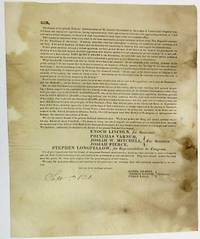
[Maine]
SIR THE FRIENDS OF THE PRESENT NATIONAL ADMINISTRATION OF THE GENERAL GOVERNMENT IN THE COUNTY OF CUMBERLAND COMPOSED BOTH OF FEDERAL AND DEMOCRATIC REPUBLICANS HAVING EXPRESSED THEIR VIEWS AND WISHES IN RELATION TO THE APPROACHING ELECTION.
Maine 1826. Folio sheet folded to 8" x 9-1/2". One printed page followed by three blanks. Addressed on final blank with folds for mailing and remnant of wax seal to William Thomas of Gorham Maine. Spotted Good or so.<br /> <br /> The document is signed in type at the end by Committee Members Daniel Gilbert Thomas Browne and Ethan Earle. It is dated in ink "Sept. 5th 1826." The Committee urges Maine "to send forth from our state an unequivocal voice in favor of the Head of the National Government" by voting for Adams supporters Enoch Lincoln Governor Stephen Longfellow Congress and other members of the State ticket.<br /> Allusions to the bitter 1824 presidential contest are numerous; the wounds inflicted by that campaign are obviously still open: "We have placed the man of our choice at the head of our government." If "we abandon him to the rude tempest of a bitter opposition how shall we answer it to our consciences and our country. What then has the President done that we should leave him to his enemies. We do not profess one thing and intend another-- we do not cry 'Adams' but mean 'Crawford'." <br /> Not located on OCLC as of November 2017. unknown
Riferimento per il libraio : 34420
|
|
|
[Maine]
St. George River and Muscle Ridge Channel
Washington D.C.: Published by the United States Coast and Geodetic Survey 1920. Large folding nautical chart printed on heavy paper stock. Colored. A rare original coastal survey of St. George River and the Muscle Ridge Channel including Thomaston Cushing and St. George.<br/> <br/> Established by President Thomas Jefferson in 1807 as the Survey of the Coast the U.S. Coast and Geodetic Survey was the United States' first civilian scientific agency. This agency has followed its mission to survey the U.S. coastline create nautical charts of the coast and help increase maritime safety since its founding and has often played fascinating roles in significant chapters of U.S. history. It served in all theaters of the Civil War in the service of the Union Army and Navy pioneered acoustic exploration in the wake of the sinking of the Titanic and during WWI it worked to detect enemy submarines. In addition this agency worked to survey and produce detailed maps and renderings of the U.S. coast. These nautical survey maps commonly referred to as "T-sheets" provide fascinating insights into the history of the United States coastline which has and will continue to shift. These maps are the most important data source for understanding the physical and ecological characteristics of the U.S. shoreline. The present map is a highly detailed and accurate sea chart of Maine and an important historical view of the developing state. Published by the United States Coast and Geodetic Survey unknown
Riferimento per il libraio : 41279

|
|
|
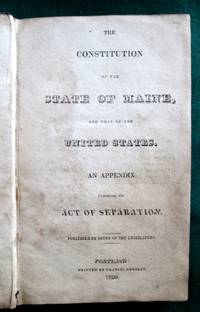
[Maine]
The Constitution of the State of Maine and that of the United States. An Appendix Containing the Act of Separation.
<b>First Official Printing of Maine's Constitution</b><br /><br />A very scarce example of the first printing of the Maine Constitution. As noted on the verso of the title leaf 200 copies were ordered "printed for the use of the Legislature." In contrast the next printing ordered by the Legislature -- in 1825 -- was for 10000 copies. OCLC locates examples at six institutions. <br /><br /><br /><b>References:</b> Noyes <i>Maine Imprints to 1820</i>: 931. Skillin <i>A Bibliography of Maine Imprints 1785-1820</i>: 20-70. Not in Williamson A <i>Bibliography of the State of Maine</i>. Thompson:<i> Important Maine Maps Books Prints and Ephemera</i>: 28A. The Thompson copy sold for $1840 in 2003. Sprague <i>The Mirror of Maine</i>: see 11 for the 1825 edition. Shoemaker <i>A Checklist of American Imprints for 1820</i>: 2075.<br /><br /><b>Condition:</b> Contemporary calf. Boards well-scuffed and with small gouged area. Significant chipping of spine leather; hinges and joints cracked. Age-toned and areas of staining throughout. An unsophisticated but appealing example of a very scarce book. Published by Order of the Legislature. Printed by Francis Douglas. hardcover
Riferimento per il libraio : 3763
|
|
|
[MAINE]
To the Honourable the House of Commons of Great Britain in Parliament assembled. The humble petition of William Armstrong John Evans John Norbourne Daniel Hall Benjamin Devenish Samuel Ball and Albion Thompson.caption title
London 1715. Broadsheet. 1p. plus printed docket title on verso. Small folio. Bound to style in half calf over marbled paper-covered boards. Ornamental border. Minor foxing. Very good. A project for colonizing Maine in 1715. One of only two surviving copies.<br/> <br/> A rare early petition relating to British settlement in the eastern part of present-day Maine. The authors refer to petitioning "his Majesty in Council on the 6th Day of December last for having a Colony settled between New England and Nova Scotia" with "over one thousand disbanded men" and to be funded with the proceeds of a proposed coinage operation. The only copy of this document listed by OCLC and ESTC is at the New-York Historical Society which estimates merely that the document was printed during the 1700s. The historical context the text cited above and discovery of this broadsheet among similar petitions dating almost exclusively to 1714 and 1715 however make 1715 an extremely likely date of printing. In the Treaty of Utrecht 1713 the French ceded the land east of the Kennebec River presumably the area in question here to the British; this event and the reference to "disbanded soldiers" suggest that the War of the Spanish Succession had recently ended which it finally did in 1714. George I succeeded Queen Anne in late 1714 meaning that the petitioning of "December last" could not have been earlier than that year. With the new monarchy and a major upheaval in the House of Commons following the general election of 1715 petitionary literature distributed in the lobby of Parliament surged with this document almost certainly among the examples from that year. The petitioners evidently officers who had served in the recent war call attention to the fact that the lands they hope to settle "were formally survey'd and given by King Charles the Second to the Duke of York" and that the area has been confirmed as rich for farming. They ask that Parliament allow them to present their formal proposals for the settlement or "if not thought proper to have a Colony settled in that part of North-America" at least still to grant them a contract to coin 1000 tons' worth of half-pence and farthings. A very important Maine document one of only two surviving copies. unknown
Riferimento per il libraio : 21151

|
|
|
[Maine]
West Penobscot Bay
Washington D.C.: Published by the United States Coast and Geodetic Survey 1920. Large folding nautical chart printed on heavy paper stock. Colored. A rare original coastal survey of West Penobscot Bay including Camden Rockport Rockland the Fox Islands and Islesboro.<br/> <br/> Established by President Thomas Jefferson in 1807 as the Survey of the Coast the U.S. Coast and Geodetic Survey was the United States' first civilian scientific agency. This agency has followed its mission to survey the U.S. coastline create nautical charts of the coast and help increase maritime safety since its founding and has often played fascinating roles in significant chapters of U.S. history. It served in all theaters of the Civil War in the service of the Union Army and Navy pioneered acoustic exploration in the wake of the sinking of the Titanic and during WWI it worked to detect enemy submarines. In addition this agency worked to survey and produce detailed maps and renderings of the U.S. coast. These nautical survey maps commonly referred to as "T-sheets" provide fascinating insights into the history of the United States coastline which has and will continue to shift. These maps are the most important data source for understanding the physical and ecological characteristics of the U.S. shoreline. The present map is a highly detailed and accurate sea chart of Penobscot Bay and an important historical view of developing Maine. Published by the United States Coast and Geodetic Survey unknown
Riferimento per il libraio : 41277

|
|
|
[Maine]
Winter Harbor
Washington D.C.: Published by the United States Coast and Geodetic Survey. Nautical chart printed on heavy paper stock. Uncolored. A rare original coastal survey of Winter Harbor Maine.<br/> <br/> Established by President Thomas Jefferson in 1807 as the Survey of the Coast the U.S. Coast and Geodetic Survey was the United States' first civilian scientific agency. This agency has followed its mission to survey the U.S. coastline create nautical charts of the coast and help increase maritime safety since its founding and has often played fascinating roles in significant chapters of U.S. history. It served in all theaters of the Civil War in the service of the Union Army and Navy pioneered acoustic exploration in the wake of the sinking of the Titanic and during WWI it worked to detect enemy submarines. In addition this agency worked to survey and produce detailed maps and renderings of the U.S. coast. These nautical survey maps commonly referred to as "T-sheets" provide fascinating insights into the history of the United States coastline which has and will continue to shift. These maps are the most important data source for understanding the physical and ecological characteristics of the U.S. shoreline. The present map is a highly detailed and accurate sea chart of Winter Harbor and an important historical view of developing Maine. Published by the United States Coast and Geodetic Survey unknown
Riferimento per il libraio : 41295

|
|
|
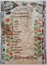
[Maine] [Manuscript Family Register: Porter]
A list of names and births of Seward Porters Family.
<b><i>Family Register of Seward Porter circa 1800</i></b><br /><br /><br />A nicely accomplished though primitive family register of the Seward and Eleanor Porter family. Two colorful plants with birds in their top branches fill the sides of the register. At the top hover two angel-like figures one bearing an hour glass the other blowing a horn. <p>Seward and Eleanor Porter were from Weymouth Massachusetts but relocated to Falmouth in the District of Maine in about 1777 and then to Freeport in about 1782. This family register lists the names birth places and birth dates of the Porter's 13 children from 1778 to 1797. </p>Their fourth son on the list -- also named Seward Porter -- would become a prominent Maine mariner and entrepreneur. He brought the first steamboat to Maine in 1823. In 1837 he published a now-highly-prized set of charts of the Maine coast. For Seward Porter the son see:<i>Tooley's Dictionary of Mapmakers</i>: Vol 3 p. 453 and Guthorn <i>United States Coastal Charts 1783-1861</i>: p. 29. <br /><br /><b>Condition:</b> Approximately 14 x 10." Iron gall ink on wove sheet with colored decorations. The sheet is mounted on a ca. 1815 newspaper and strips of wallpaper about 1" wide have been applied along the left and right sides. The piece is in fair condition with overall cockling and some water damage. There is a small puncture on the left edge. The ink notations of the birth dates and locations are faded but legible.<br /><br />ICN 3198.
Riferimento per il libraio : 3722
|
|
|
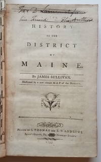
[Maine] Sullivan, James
The History of the District of Maine.Illustrated by a new correct Map of the District.
This is the first general history of Maine written in the post-Revolutionary War time period that saw several state histories published including those by Belknap Jefferson and Ramsay. Despite its distinctly chilly initial reception and the less than impressive editorial standards Sullivan's <i>History</i>is a cornerstone work in any collection of Maine material. <p>The <i>History</i>includes as the frontispiece Osgood Carleton's <i>A Map of the District of Maine Drawn from the latest Surveys and other best Authorities by Osgood Carleton</i>. The map measuring 20 5/16 x 16 3/8" includes an inset titled <i>A Map of those parts of the Country most famous for being harassed sic by the Indians</i>. Carleton's map was the most detailed done of Maine to that time. </p><p>At the head of the title page is an inscription which has been lined out: "For D. Laincourt from his Friend the Author."</p><p><b>References:</b> Evans: 29589. Howes <i>USiana:</i> S-1122. Sabin: 93499. Williamson <i>A Bibliography of the State of Maine</i>: 9608. Thompson: <i>Important Maine Maps Books Prints and Ephemera</i>: 18A. For the map: Wheat & Brun <i>Maps and Charts Published in America before 1800</i>: 171. McCorkle <i>New England in Early Printed Maps 1513-1800</i>: Me795.1. </p><p><b>Condition: </b>vii iv 421 pp. With folding map frontispiece.Original full calf with worn red title label. Boards scuffed and bumped with areas of abrasion; joints cracked. Text block is very tight. Occasional light foxing and staining throughout. The map is in remarkably good condition especially in comparison to the usual state in which it is found. Trimmed close as usual along the binding edge. A sharp dark impression with minimal foxing or offsetting. <br /></p><p>ICN 7660.3.</p> Printed by I. Thomas and E.T. Andrews hardcover
Riferimento per il libraio : 3732
|
|
|
[MAINE] - [CITEAUX].-
Relation d'un voyage à l'abbaye de N. D. de La Trappe du Port-du-Salut, suivie d'une notice sur le Baron de Gerame et d'une lettre sur les établissements religieux de Laval.
1825 Fougères, Vannier, Paris, Tourneux, 1825, petit in 12 broché, 130 pages ; des rousseurs ; couverture fanée.
Riferimento per il libraio : 86048
|
|
|
[MAINE] - [MILITARIA].-
La Flèche, son Prytanée militaire 1604-1808-1958. Ses environs.
Angers, Imprimerie de l'Ecole de Génie, sans date, in 8° broché ; non paginé ; nombreuses illustrations et hors-texte, dont 8 en coulerus ; publicités.
Riferimento per il libraio : 79668
|
|
|
[MAINE] - [MUSET (Mr le Curé)].-
Notice historique sur l'église de Sainte Colombe près La Flèche.
La Flèche, Jourdain, in 8° broché, IV-67 pages ; couverture un peu fanée.
Riferimento per il libraio : 60907
|
|

 Ricevere i risultati per e-mail
 Scaricare i risultati in PDF
 RSS feed
 Link
Link


