|
HILAIRE DE VESVRE
La lignée des Rongefer. Esquisse historique romancée des provinces du Centre. berry, Nivernais, Marche, Bourbonnais. Illustrations de F. Maillaud, P. Rue. S. Christauflour, S. Marchand, R. Robert Barriot, J. L. Boncoeur, A. Roazay, D. fougère, A. Fichot, R. Barrat.
Broché. 130 pages. Exemplaire numéroté sur papier d'Auvergne 96/100. (Non coupé). 18,5x23,5cm.
|
|
|
Hilary March
WET WEATHER
New York: Goldsmith Publishing Co. 1927. First American edition. Hardcover. Very Good/very good. 6 x 8 in. Paper boards. Condition is VERY GOOD ; corners and spine ends bumped with light wear very clean. Binding tight holiday sticker on corner of ffep. DJ is VERY GOOD ; clipped very clean spine sunned a few chips. Fic. Stax. <br/><br/> Goldsmith Publishing Co. hardcover
Bookseller reference : 38268

|
|
|
Hill Aaron Hill Aaron . Walking statue Lintot Bernard bookseller Sanger Egbert bookseller Barton Thomas Pennant
Elfrid or The fair inconstant : a tragedy as it is acted at the Theatre Royal by Her Majesty's Servants : to which is added The walking statue or The devil in the wine-cellar : a farce 1710
2018. Softcover. New. Lang: - eng Pages 64. Reprinted in 2018 with the help of original edition published long back 1710.This book is Printed in black & white sewing binding for longer life with Matt laminated multi-Colour Soft Cover HARDCOVER EDITION IS ALSO AVAILABLE Printed on high quality Paper re-sized as per Current standards professionally processed without changing its contents. As these are old books we processed each page manually and make them readable but in some cases some pages which are blur or missing or black spots. If it is multi volume set then it is only single volume. We expect that you will understand our compulsion in these books. We found this book important for the readers who want to know more about our old treasure so we brought it back to the shelves. Any type of Customisation is possible. Hope you will like it and give your comments and suggestions. paperback
Bookseller reference : PB1111015187303
|
|
|
Hill Aaron Hill Aaron . Walking statue Lintot Bernard bookseller Sanger Egbert bookseller Barton Thomas Pennant
Elfrid or The fair inconstant : a tragedy as it is acted at the Theatre Royal by Her Majesty's Servants : to which is added The walking statue or The devil in the wine-cellar : a farce 1710 Hardcover
2018. Hardcover. New. Lang: - eng Pages 64. Reprinted in 2018 with the help of original edition published long back 1710. This book is Printed in black & white Hardcover sewing binding for longer life with Matt laminated multi-Colour Dust Cover Printed on high quality Paper re-sized as per Current standards professionally processed without changing its contents. As these are old books we processed each page manually and make them readable but in some cases some pages which are blur or missing or black spots. If it is multi volume set then it is only single volume. We expect that you will understand our compulsion in these books. We found this book important for the readers who want to know more about our old treasure so we brought it back to the shelves. Any type of Customisation is possible. Hope you will like it and give your comments and suggestions. hardcover
Bookseller reference : 1111015187303
|
|
|
Hill, Howard
Freedom to Roam : The Struggle for Access to Britain's Moors and Mountains
Name to title page and opposite page. No other marks or inscriptions. A very clean very tight copy with bright unmarked red cloth boards, slight foxing to top of page edges and no bumping to corners. Dust jacket not price clipped or marked or torn or creased with light indenting and with sunning to front spine edge. 139pp. An account of the restrictions on access to land in Britain for walkers and climbers and the various attempts to change that which saw its most determined effort in the 1930s in the Peak District when five men were jailed for trespassing. This contrasts markedly with the Alps which have always been free to walk on.

|
|
|
Hillaby, John
Hillaby's World : Adventures Across Three Continents
4to, 238 pages, illustrated. eng
|
|
|
Hirschl & Adler NY: March 1971
Philip Jamison: Recent Watercolors
1971. Softcover. VG. Wraps. appx. 12 pp. 2 color 9 bw plates. Catalogue lists 44 works and provides one page of professional information along with an essay by Bruce St. John. paperback
Bookseller reference : 119288

|
|
|
Hirschl & Adler NY: March 3 31 1979
Recent Acquisitions of American Art 1769-1938
1979. Softcover. Fine. Color wraps. 60 pp. 2 bw 46 bw repros. Catalogue lists 48 works by 33 artists. Wonderful illustrations and scholarly information on artists such as Seth Eastman Church Cole Cropsey Heade R. Peale Powers et al. Some important works included. paperback
Bookseller reference : 1039
|
|
|
Hirschl & Adler NY: March 22 April 15 1975
Three Realists: John Chumley Ken Davies Michael Filmus
New York: Hirschl & Adler 1975. Softcover. V.G. Wraps. appx. 35 pp. Chumley: 19 works listed 6 are illustrated. Davies: 28 works listed 6 are illustrated. Filmus: 21 works are listed 6 are illustrated. Few color plates. Hirschl & Adler paperback
Bookseller reference : 18
|
|
|
Hirschl & Adler NY: March 1971
Philip Jamison: Recent Watercolors
1971. Softcover. VG. Wraps. appx. 12 pp. 2 color 9 bw plates. Catalogue lists 44 works and provides one page of professional information along with an essay by Bruce St. John. unknown books
Bookseller reference : 119288
|
|
|
Hirschl & Adler NY: March 3 31 1979
Recent Acquisitions of American Art 1769-1938
1979. Softcover. Fine. Color wraps. 60 pp. 2 bw 46 bw repros. Catalogue lists 48 works by 33 artists. Wonderful illustrations and scholarly information on artists such as Seth Eastman Church Cole Cropsey Heade R. Peale Powers et al. Some important works included. unknown books
Bookseller reference : 1039
|
|
|
HKK
Museumswanderungen im Lande Bremen. Wandern in und um Bremens Museen.
Bremen. 1990. 32 S., 21 cm Broschur 0
Bookseller reference : 56269

|
|
|
Hobart Walking Club:
Safety in the Bush : information on bushwalking in Tasmania.
Hobart Walking Club. 1986. Compiled by the Search and Rescue and Training sub-committee of the HWC. Seventh further revised edition. 106pp illustrated. Soft covers. A very good clean copy. . Hobart Walking Club paperback
Bookseller reference : 29111
|
|
|
Hobart Walking Club
SAFETY IN THE BUSH. Information for Bushwalking in Tasmania
Hobart Walking Club paperback stiff pictorial card 6th Edition 1976 88 pages illustrated. Although originally intended for use in Tasmania the book clearly has a wide range of useful advice and information for any bushwalker e.g.: Your Party Food and Equipment On the Track Difficulties and Dangers Weather Lore First Aid Snow If you Get Lost etc. Light wear good copy. No ISBN paperback
Bookseller reference : 6901
|
|
|
HOBART Walking Club.
The Tasmanian Tramp no 6. Annual Magazine of the Hobart Walking Club.
Hobart: HWC. 1945/ 1974. Facsimile reprint first published 1945. 48pp illustrations. Stapled in b&w wrappers as issued. A very good clean copy. The New River country; Hartz to Adamson's; Snowy Mts; Pine Valley; Frenchman's Cap; Critchley Parker obit. . HWC unknown
Bookseller reference : 36327

|
|
|
HOBART Walking Club.
The Tasmanian Tramp no 14. Magazine of the Hobart Walking Club.
Hobart: HWC. December1959. 76pp 4 plates & other illustrations. Staoled in wrappers as issued. A very good clean copy. Port Davey Federation Peak The Flinders Group King River to Cynthia Bay Air Drops. . HWC unknown
Bookseller reference : 8942

|
|
|
HOBART Walking Club
The Tasmanian Tramp no 13. Magazine of the Hobart Walking Club.
1957/ 1974. Facsimile reprint of the 1957 issue. 56pp 4 plates illus & maps. Stapled in b&w wrappers as issued. A little foxing on the wrappers owner's name stamp on title-page. A good to very good clean copy. . unknown
Bookseller reference : 8939

|
|
|
Hobart Walking Club
The Tasmanian Tramp: Journal of the Hobart Walking Club No 35 2004
Hobart: Hobart Walking Club. Minimal wear. . Very Good. Soft cover. 2004. Hobart Walking Club paperback
Bookseller reference : 029460

|
|
|
HOBART Walking Club.
The Tasmanian Tramp no 28. Magazine of the Hobart Walking Club.
Hobart: HWC. 1991. 110pp many illustrations 4pp in colour maps etc. Soft covers as issued. A very good clean copy. . HWC paperback
Bookseller reference : 15201

|
|
|
Hobart Walking Club
The Tasmanian Tramp N.o 6. Magazine of the Hobart Walking Club
Hobart: Hobart Walking Club 1945. pictorial wrappers. Nice copy. octavo. 568pp. index The New River country; Hartz to Adamson's; Snowy Mts; Pine Valley; Frenchman's Cap. Staples rusting o/w a very nice clean copy Hobart Walking Club unknown
Bookseller reference : 136909
|
|
|
HOBART Walking Club.
The Tasmanian Tramp no 10. Magazine of the Hobart Walking Club.
Hobart: HWC. December1951. 48pp 4 plates illustrations & maps. Stapled in the original wrappers. A very good clean copy. Includes Sir John Franklin's journey from David Burn's diary Cradle Mt Lune to Maydena West Coast. . HWC unknown
Bookseller reference : 20113

|
|
|
HOBART Walking Club
The Tasmanian Tramp no 37. Magazine of the Hobart Walking Club.
Hobart: HWC. 2008. 124pp illustrated in colour and b&w. Soft covers. A very good clean copy. Frenchman's Cap Federation Peak Mount Mueller etc. . HWC paperback
Bookseller reference : 28829

|
|
|
HOBART Walking Club
The Tasmanian Tramp no 41. Magazine of the Hobart Walking Club.
Hobart: HWC. 2016. 136pp illustrated in colour and b&w. Soft covers. Fine new. Includes Irenabyss; Flinders Island; Pittosporums; walking in France and Peru; and several obituaries including Jessie Luckman & Allan Christian. . HWC paperback
Bookseller reference : 34852

|
|
|
HOBART Walking Club
The Tasmanian Tramp no 40. Magazine of the Hobart Walking Club.
Hobart: HWC. 2014. 122pp illustrated in colour and b&w. Soft covers. A fine clean copy. Includes the Overland Track; Snowy to Wellington; Peak-Baggers Guide 2013; search & rescue in the 1970s; Frenchmans Cap; some overseas walks Nepal Patagonia UK; obituaries. . HWC paperback
Bookseller reference : 33213

|
|
|
HOBART Walking Club.
The Tasmanian Tramp no 36. Journal of the Hobart Walking Club.
Hobart: HWC. 2006. iv 106pp 16pp colour photos other illustrations and map one folding the Western Arthurs. Soft covers. A very good clean copy. Includes: Western Arthurs Tarkine Jack Thwaites. . HWC paperback
Bookseller reference : 24576

|
|
|
HOBART Walking Club.
The Tasmanian Tramp no 8. Magazine of the Hobart Walking Club.
Hobart: HWC. Oct.1948. 49pp including inside rear wrapper 4pp illustrated. Original wrappers spine a little rubbed the staples replaced. A good clean copy. Snowy Range; Federation Peak; Chudleigh Lakes; Denison Lakes; National Park via Mt Field West; Mt Gell and upper Franklin Valley. . HWC unknown
Bookseller reference : 20115

|
|
|
HOBART Walking Club
The Tasmanian Tramp no 13. Magazine of the Hobart Walking Club.
Hobart: HWC. December1957. 72pp 4 b&w photographic plates maps and other illustrations. Stapled in the original wrappers as issued. A very good clean copy. Mt Wellington a substantial article covering the area's natural history as well as its tracks the South-West Mt Field West Maria Island past and present. . HWC unknown
Bookseller reference : 19013

|
|
|
HOBART Walking Club.
The Tasmanian Tramp no 22. Magazine of the Hobart Walking Club.
Hobart: HWC. 1976. 120pp illustrated. Stapled with wrappers drawn on as issued. Owner's name stamp on title-page. A good to very good clean copy. Includes 'Ten Years on the Ouse-Zeehan Telegraph Line' the Innes Track - Liena to Rosebery The Steppes by Jack Thwaites. . HWC unknown
Bookseller reference : 10210

|
|
|
HOBART Walking Club.
The Tasmanian Tramp no 18. Magazine of the Hobart Walking Club.
Hobart: HWC. Jan.1968. 84pp 4pp illustrated. Stapled in wrappers as issued. A very good clean copy. Prince of Wales Range convict railway on Tasman Peninsula nomenclature of the Western Arthurs the Huon Track the Candlestick snow shelters Rocky Cape geology of Tasmania. . HWC unknown
Bookseller reference : 4707

|
|
|
HOBART Walking Club.
The Tasmanian Tramp no 17. Magazine of the Hobart Walking Club.
Hobart: HWC. Dec.1966. 84pp 4pp b&w photographic illustrations at centre and other illustrations map of Tasman Peninsula. Stapled in wrappers as issued. A very good clean copy. Includes Tasman Peninsula wooden huts eucalypts. . HWC unknown
Bookseller reference : 4706

|
|
|
HOBART Walking Club.
The Tasmanian Tramp no 35. Journal of the Hobart Walking Club.
Hobart: HWC. 2004. 122pp 16pp colour photos other illustrations maps. Soft covers. A very good clean copy. E.T. Emmet Frank Hurley at Frenchman's Cap Gordon Vale Meehan Range Maatsuyker Island etc etc. . HWC paperback
Bookseller reference : 18582

|
|
|
HOBART Walking Club
The Tasmanian Tramp no 39. Magazine of the Hobart Walking Club.
Hobart: HWC. 2012. 140pp illustrated in colour and b&w. Soft covers. Fine. Includes Eastern Arthurs - Federation Peak; Mt Field NP in snow; the Spires Mt Wellington; the Lycian Way Turkey . HWC paperback
Bookseller reference : 30853

|
|
|
HOBART Walking Club
The Tasmanian Tramp no 16. Magazine of the Hobart Walking Club.
Dec.1963. 80pp maps and other illustrations. Stapled in wrappers as issued. A very good clean copy. Tenzig Norgay in Tasmania; Tasmania's first bushwalkers the Aborigines; Western Arthurs; Ernie Bond of 'Gordonvale'; 'The Count of Adamsfield' Stanley Gurney; Pedder to the Gordon; Schouten Island; the Spires; Tasmania's native pines. . unknown
Bookseller reference : 4705

|
|
|
HOBART Walking Club.
The Tasmanian Tramp no 8. Annual Magazine of the Hobart Walking Club.
Hobart: HWC. Oct.1948. 49pp including inside rear wrapper 4pp of photographic illustrations maps and other illustrations. Stapled in the original wrappers as issued. A very good clean copy. Snowy Range; Federation Peak; Chudleigh Lakes; Denison Lakes; National Park via Mt Field West; Mt Gell and upper Franklin Valley. . HWC unknown
Bookseller reference : 4703

|
|
|
HOBART Walking Club.
The Tasmanian Tramp no 15. Magazine of the Hobart Walking Club.
Hobart: HWC. Dec.1961. 72pp 4 b&w photographic plates maps and other illustrations. Stapled in wrappers as issued slightly rubbed. A good to very good clean copy. Includes E.T. Emmett Hillary in the SW PB Mt Anne. . HWC unknown
Bookseller reference : 4704

|
|
|
HOBART Walking Club.
The Tasmanian Tramp no 10. Magazine of the Hobart Walking Club.
Hobart: HWC. December1951. 48pp 4 b&w photographic plates illustrations & maps. Original wrappers the spine a little worn and the staples replaced. A good clean copy. Includes Sir John Franklin's journey from David Burn's diary Cradle Mt Lune to Maydena West Coast. . HWC unknown
Bookseller reference : 14170

|
|
|
HOBART Walking Club.
The Tasmanian Tramp no 15. Magazine of the Hobart Walking Club.
Hobart: HWC. December1961. 72pp 4 b&w photographic plates maps and other illustrations. Issued staple-bound with wrappers but the staples have been removed and the wrappers are loose. There is a little fading and rubbing to the wrapper spine otherwise in good clean condition. Includes E.T. Emmett Hillary in the SW PB Mt Anne. . HWC unknown
Bookseller reference : 23363
|
|
|
HOBART Walking Club.
The Tasmanian Tramp no 29. Magazine of the Hobart Walking Club.
Hobart: HWC. 1993. 116pp 4pp colour photos other illustrations. Soft covers. A very good clean copy. Bass Strait islands Deny King Federation Peak Mt Jupiter Clarence Lagoon to Lake St Clair and more. . HWC paperback
Bookseller reference : 6785

|
|
|
HOBART Walking Club.
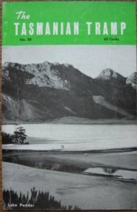
The Tasmanian Tramp no 20. Magazine of the Hobart Walking Club.
Hobart: HWC. Jan.1972. 108pp illustrations maps. Stapled with wrappers drawn on as issued. A very good clean copy. Includes Lake Pedder the Gordon Splits by Olegas Truchanas the Frankland traverse. Also: 'Extracts from an Antarctic Diary' by Mary Harrisson from the diary of Charles Turnbull Harrisson who was on Mawson's 1911-13 expedition pp29-41 3 full-page illus from CTH's original sketches. . HWC unknown
Bookseller reference : 4708
|
|
|
HOBART Walking Club.
The Tasmanian Tramp no 19. Magazine of the Hobart Walking Club.
Hobart: HWC. Jan.1970. 96pp 4pp illus maps. Stapled with soft covers drawn on as issued. Very good. Features Maria Island: also King Williams to Gordon Bend Macquarie Island Cape Pillar Federation Peak Wyld's Crag & the Nut. . HWC paperback
Bookseller reference : 6778

|
|
|
HOBART Walking Club.
The Tasmanian Tramp no 7. Magazine of the Hobart Walking Club.
Hobart: HWC. December1946. 48pp 4 full-page sketch maps snake illustrations identification 5 b&w photos. Stapled in the original wrappers. Some spotting to the wrappers clean inside. A good to very good copy. Mt La Perouse to Pinder's Peak; Precipitous Bluff; Mount Rufus; Walls of Jerusalem; Lake St Clair; the Arthurs; Chain of Lagoons; Tasmanian snakes. . HWC unknown
Bookseller reference : 4702
|
|
|
HOBART Walking Club.
The Tasmanian Tramp no 17. Magazine of the Hobart Walking Club.
Hobart: HWC. 1966/ 1974. Facsimile of the 1966 issue - although about half the sheets are from the original printing. 84pp 4pp illustrated. Stapled in wrappers as issued. Very good. Includes Tasman Peninsula wooden huts eucalypts. . HWC unknown
Bookseller reference : 30673
|
|
|
HOBART Walking Club.
The Tasmanian Tramp no 18. Magazine of the Hobart Walking Club.
Hobart: HWC. 1968/ 1974. Facsimile reprint first published 1968. 84pp 4pp illus. Stapled in wrappers. Very good. Actually about half of the sheets not including the wrappers are the original printing. Prince of Wales Range convict railway on Tasman Peninsula nomenclature of the Western Arthurs the Huon Track the Candlestick snow shelters Rocky Cape geology of Tasmania. . HWC unknown
Bookseller reference : 17792
|
|
|
HOBART Walking Club.
The Tasmanian Tramp no 33. Journal of the Hobart Walking Club.
Hobart: HWC. 2000. 144pp 4pp colour photos other illustrations maps. Soft covers. A very good clean copy. South Cape Rivulet skiing in Tasmania Wellington Range kayaking in Macquarie Harbour Salters Point and more. . HWC paperback
Bookseller reference : 15538

|
|
|
HOBART Walking Club.
The Tasmanian Tramp no 34. Journal of the Hobart Walking Club.
Hobart: HWC. 2002. 132pp 4pp colour photos other illustrations maps. Soft covers. A very good clean copy. Innes Track South Cape track Overland Track Tahune Hut and more. . HWC paperback
Bookseller reference : 15217
|
|
|
HOBART Walking Club.
The Tasmanian Tramp no 32. Journal of the Hobart Walking Club.
Hobart: HWC. 1998. 144pp 4pp colour photos other b&w illustrations maps. Soft covers. A fine clean copy. Brenda Hean Sprent's trig surveys 1833-55 Mt Nelson Federation Peak Tasmania's top 10 mountains and more. . HWC paperback
Bookseller reference : 15537

|
|
|
HOBART Walking Club.
The Tasmanian Tramp no 30. Magazine of the Hobart Walking Club.
Hobart: HWC. 1995. 120pp 4pp colour photos other illustrations maps. Soft covers. A fine clean copy. Journeys to the Upper Huon 1872-82 Henry Judd Mt Nereus the Willsons of Melaleuca Tasmanian coastline Mt Curly Western Arthurs and more. . HWC paperback
Bookseller reference : 14267

|
|
|
HOBART Walking Club
The Tasmanian Tramp no 38. Magazine of the Hobart Walking Club.
Hobart: HWC. 2010. 128pp illustrated in colour and b&w. Soft covers. A very good to fine clean copy. . HWC paperback
Bookseller reference : 30206
|
|
|
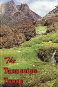
HOBART Walking Club.
The Tasmanian Tramp. INDEX to Numbers 1-16 1933-1963 & Numbers 17-23 1966-1979. Magazine of the Hobart Walking Club.
Hobart: HWC. 1965-79. 2 parts. 22 & 24pp. Stapled in wrappers. Fine. . HWC unknown
Bookseller reference : 4709

|
|
|
HOBART Walking Club.
The Tasmanian Tramp no 27. Magazine of the Hobart Walking Club.
Hobart: HWC. 1989. 60th Anniversary Issue. 90pp 4pp colour photos many b&w illus maps. Soft covers. A very good clean copy. Prince of Wales Range Eldon Bluff Derwent Splits Precipitous Bluff Mt Field West etc etc . HWC paperback
Bookseller reference : 10013

|
|
 Receive by email
 Download as PDF document
 RSS feed


