|
John P Buonaccorsi, Byron JT Morgan, Niels Keiding, Peter Van der Heijden, Terry Speed J T
Measurement Error Chapman & Hall/CRC Interdisciplinary Statistics
Chapman and Hall/CRC 2010. New/New. <p><strong>Author:</strong> John P. Buonaccorsi Byron J.T. Morgan Niels Keiding Peter Van der Heijden Terry Speed</p><p><strong>Publisher:</strong> Chapman and Hall/CRC</p><p><strong>ISBN:</strong> 9781420066562</p><p><strong>Release Date:</strong> 2010</p><p><strong>Languages:</strong> English</p><p><strong>Binding:</strong> Hardcover</p><p><strong>Number Of Pages:</strong> 464</p> Chapman and Hall/CRC hardcover
Riferimento per il libraio : 1420066560 ISBN : 1420066560 9781420066562
|
|
|
John Speed
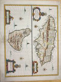
A Map of Jamaica Sold by Thomas Basset in Fleetstreet and Richard Chiswell in St. Pauls Church yard. / BarBados
London c.1676. Very good the lower part of the central fold reinforced and backed with acid free tissue paper for long term preservation. Notes: From Speed's A Prospect of the Most Famous Parts of the World. Size : 389x510 mm 15.31x20.08 Inches Coloring: Hand Colored Reference: Kapp: Printed Maps Of Jamaica 22<br>Campbell: Printed Maps Of Barbados MCS 21 no.5 pl. III Category: Maps West Indies Other Islands; unknown
Riferimento per il libraio : M7404
|
|
|
John Speed
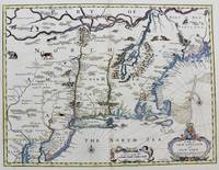
A Map of New England and New York.
London. : Tho: Basset; Richard Chiswell c. 1676. Very Good. Notes: A significant map of the British colonies in North America covering the east coast from Maryland and New Jersey northward through New York and New England to the French possessions in Canada. It depicts the territories acquired by the British with the capture of New Amsterdam in 1664 which changed European influence in the colonies from the Dutch to the English. It is the first appearance of name Boston and the first map to use the term New York for both Manhattan and the colony. It is also one of the first maps to show New Jersey. The map is decorated with various animals in the interior of the map two compass roses two cartouches and a coat of arms. With English text on verso that provides interesting information on the colonies. Size : 381x497 mm 15.00x19.55 Inches Coloring: Hand Colored Category: Maps United States East; Tho: Basset; Richard Chiswell unknown
Riferimento per il libraio : M8290
|
|
|
John Speed; Robert Walton
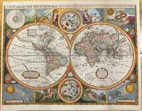
A New And Accurat Map of the World Drawne according to ye truest Descriptions latest Discoucries & best Obseruations yt have beene made by English or Strangers.
London 1659. Very Good backed on acid free tissue paper for long term preservation. Notes: Scarce third state of Robert Walton's decorative map of the World based upon the earlier edition of John Speed's World map.<br>Double hemisphere map of the World with portraits of the four great explorers of the era Sir Francis Drake Thomas Candish Oliver Van Noort and Ferdinand Magellan.<br>California is depicted as an Island with an unusual Northwest Coast of America. The map is surrounded by smaller celestial hemispheres and the four elements with notes on the South Pole & Straits of Magellan. <br>Walton's map is rarer than John Speed's map and is of equal artistic and cartographic importance.<br> Size : 398x530 mm 15.67x20.87 Inches Coloring: Hand Colored Reference: Shirley #397. Category: Maps World; unknown
Riferimento per il libraio : M9858
|
|
|
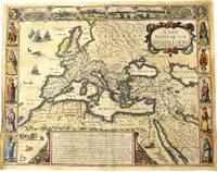
John Speed (1552-1629)
A New Mappe of the Romane Empire newly described by John Speede and are to bee sould in pops head alley by G. Humble.
London 1676. Very Good. Notes: English text on verso.<br>Map of the Roman Empire it is surrounded by views of the cities of Geneva Rome Jerusalem Venice and Constantinople and Alexandria and figures displaying the customary dress of Italians Egyptians Turks and Spaniards with their wives. <br><br>John Speed 1552 –1629 was an English cartographer and historian. He is known as England's most famous Stuart period mapmaker. His maps of English counties are often found framed in homes throughout the United Kingdom. For a series of maps Speed partnered with Dutch engraver Jodocus Hondius. <br><br> Size : 393x509 mm 15.47x20.04 Inches Coloring: Original Hand Coloring Category: Maps Europe Continent; Maps Asia Continent; unknown
Riferimento per il libraio : M10992
|
|
|
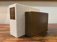
John Speed
A Prospect of the Most Famous Parts of the World - bound with - England Wales Scotland and Ireland Described
London: M. F. for William Humble/George Humble 1646. First Thus. Very Good. An original travel atlas containing an early map of the world maps of the continents several countries and detailed maps of Ireland Wales Scotland and the counties in England. Bound in modern full grain leather over boards with new endpapers. Housed in a custom clamshell box using archival cloth and with a leather and gilded label on the spine. A few names on first blank in 19th century/early 20th century ink dated. Pages are toned some trimmed very close to the plate. Some infrequent soiling all text and maps are legible. With 1 folding map; a short tear to the folded part of the map. General wear to page edges. Complete with an engraved double-hemisphere map of the world 4 maps of the continents 15 other global maps and 63 maps of England Scotland Wales and Ireland. A 64th map is called out in the table of maps but Midia seems to be missing from all examples. This a miniaturized version of John Speed's folio edition.<br /> <br /> Pages: 4 206; 2; 378 Dimensions: 65/16 x 43/16 x 2. M. F. for William Humble/George Humble unknown
Riferimento per il libraio : 6182
|
|
|
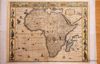
John Speed
Africae Described. The manners of their Habits and buildings newly done into English by I.S. and published at the charges of G. Humble
1626. John Speed was a notable cartographer and historian of Britain. This decorative map is sought after by collectors because it is the first map of Africa prepared by a notable English cartographer. His Theatre of the Empire of Great Britaine was widely influential later editions of which included this map of Africa. The map first was published in A prospect of the most famous parts of the world which was a supplement to Speed's Theatre. Somewhat paradoxically this first English map of Africa was engraved by the famous Abraham Goos from Amsterdam - he was a relative of the Hondius family and therefore knew well the Dutch maps from which this map is derived. The map has a long publication history see Betz: published first by William Humble then his son George first state with date of 1626; then Roger Rea most of whose atlases were destroyed in the Great Fire of London 2nd state. Basset & Chiswell acquired Speed's plates after 1668 and published this 3rd state of the map together with maps of the other continents and the world map. Some time before 1690 Christopher Browne acquired the plates but a map of Africa from him is not known. The map is based maps of Jodocus Hondius whose Latin annotations are translated into English and Willem Blaeu his geography. The geography is typically early seventeenth century with its legendary Ptolemaic mountains rivers and lakes; typically the Nile arises from two lakes. The Europeans knew little about the interior of Africa and therefore there are numerous illustrations of terrestrial animals 'elephants for want of towns' according to Jonathan Swift; the oceans have ships and sea serpents. The English text on verso provides a fascinating view of the European concept concerning the wildlife customs and manners of the African people. There is a description of Anthropophagi cannibals who kill their own babies to avoid the trouble of raising them; but in order to preserve their race steal children from their neighbors. The side borders of this carte-a-figure map comprise sets of 5 decorative costumes of African peoples and the top border displays prospects of eight African Cities. Some of the border illustrations are copied from Willem Blaeu. At top is a panel of panoramas and plans illustrating Tanger Ceuta Alger Tunis Alexandria Cairo Alca Mozambique and the Canary Islands. This example of the map is in attractive colour and in very good condition. a few minor chips along the edges and an old repair on the bottom joint. Acid free mounting tape on the back. unknown
Riferimento per il libraio : 32085
|
|
|
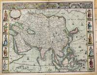
John Speed (1552-1629)
Asia with the Islands adioyning described the atire of the people & Townes of importance all of them newly augmented by JS Ano Dom:1626.
London c.1626. Very Good. Notes: English text on verso.<br>First British map of Asia the map has 8 town plans in upper border and costumes of inhabitants of Asia in side borders. Size : 395x514 mm 15.55x20.24 Inches Coloring: Original Hand Coloring Category: Maps Asia Continent; unknown
Riferimento per il libraio : M10939
|
|
|
John Speed (1552-1629)
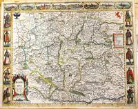
Bohemia newly described by John Speed Anno Dom: 1626.
London: Are to be sold in popshead Alley by G. Humble. 1676. Very Good . Notes: Highly decorative and detailed map of Bohemia the present-day Czech Republic.<br><br>English text on verso.<br><br>John Speed 1552 –1629 was an English cartographer and historian. He is known as England's most famous Stuart period mapmaker. His maps of English counties are often found framed in homes throughout the United Kingdom. For a series of maps Speed partnered with Dutch engraver Jodocus Hondius. <br><br> Size : 415x519 mm 16.34x20.43 Inches Coloring: Original Hand Coloring Category: Maps Europe Czech Republic Slovakia; Are to be sold in popshead Alley by G. Humble. unknown
Riferimento per il libraio : M11228
|
|
|
John Speed
Britain's Tudor Maps County by County
Batsford 2017. Hardcover. Like New. large colorful oblong book in Fine shape Batsford hardcover
Riferimento per il libraio : lib9019282726BC19
|
|
|
John Speed
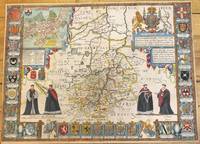
Cambridgshire described with the deuision of the hundreds the Townes situation with the Armes of the Colleges of that famous Vniuersiti.
London: Thomas Bassett & Richard Chiswell c.1676. Very Good. Notes: Map shows 25 university armorials four scholars the Royal Crest and a plan of Cambridge. English text on verso. Size : 385x525 mm 15.16x20.67 Inches Coloring: Original Hand Coloring Category: Maps Europe United Kingdom England Counties; Thomas Bassett & Richard Chiswell, unknown
Riferimento per il libraio : M9963
|
|
|
John Speed (1552-1629)
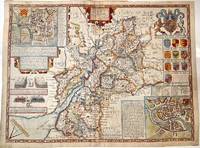
Glocestershire
London 1627. Very Good central fold reinforced. Notes: Detailed and decorative county map of Gloucestershire with inset plans of Bristol and Gloucester also with two battle vignettes and 10 Royal coat of arms.<br>English text on verso. Size : 388x510 mm 15.28x20.08 Inches Coloring: Hand Colored Category: Maps Europe United Kingdom England Counties; unknown
Riferimento per il libraio : M11352
|
|
|
John Speed
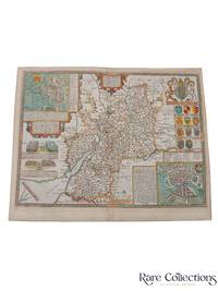
Gloucestershire
Bassett and Chiswell 1676. This map is from John Speed's The Theater of the Empire of Great Britaine with the english text on the back. Presenting well uniform toning later hand-coloring. Border strengthened at the back with acid free tape. 545 by 435mm 21½ by 17¼ inches. Bassett and Chiswell unknown
Riferimento per il libraio : 33174
|
|
|
John Speed & John Arlott, Ed
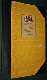
John Speed's England. Part 4
<p>London- UK: Phoenix House Limited 1954. John Speed's England. Part 4- A Coloured Facsimile of the First Edition- John Arlott Ed.- Illustrated- Phoenix House Limited- London-UK- 1954 1st Edition Thus- Hardcover:- Elephant Folio - over 15" - 23" tall- 1/2 Cloth & Boards- G-VG/ no jacket as issued- still tight and square rubs and light chips unpaginated 58 pages only minor faint spotting no tears or writing- SEE PHOTOS- Non-fiction-atlas-travel guide-England-illustrated 4777 Not very heavy but very large book which may require extra shipping. Please inquire. 1st Thus. 1/2 Cloth & Boards. G-VG/No Jacket as Issued. Illus. by Illustrated. Elephant Folio - over 15" - 23" Tall.</p> Phoenix House Limited hardcover
Riferimento per il libraio : 4777
|
|
|
John Speed
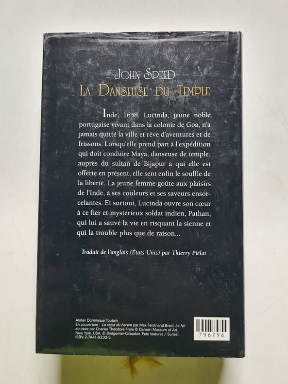
La Danseuse du Temple
France loisirs Sans date.
Riferimento per il libraio : 500256708
|
|
|
John Speed
La Danseuse du Temple - 2006
Sans date.
Riferimento per il libraio : 500278348
|
|
|
John SPEED; SAXTON;
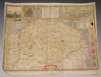
Original Hand-Coloured Engraved Map of Norfolk. Norfolk A Countie Flourishing & Populous Described and Devided with the Armes of Such Noble Families as Have Borne the Titles Therof.
<p>London John Sudbury & George Humble nd. Large Map. Approx 20 x 16 inches engraved area. Hand coloured. Mounted. Double-sided with list of hundreds and Description of the County on reverse. Framed. In very good condition. Lovely colouring. Centre crease. Double glazed Frame. Some masking tape reinforcement to bottom of map. Glass may need to be removed for transit/posting if sent abroad.</p> London, John Sudbury & George Humble nd
Riferimento per il libraio : 75869
|
|
|
John Speed
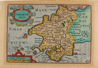
Pembrok Shire
London: George Humble c.1627. Very Good. Notes: A charming map of Pembrokeshire county in Wales during the early 17th century. English text on verso. Size : 85x121 mm 3.35x4.76 Inches Coloring: Hand Colored Category: Maps Europe United Kingdom Wales; George Humble unknown
Riferimento per il libraio : M9234
|
|
|
John Speed Meyers
Planning War with a Nuclear China: US Military Strategy and Mainland Strikes
Paperback / softback. New. paperback
Riferimento per il libraio : B9781621966784 ISBN : 162196678x 9781621966784

|
|
|
John Speed Meyers
Planning War with a Nuclear China: US Military Strategy and Mainland Strikes: US Military Strategy and Mainland Strikes
Hardback. New. hardcover
Riferimento per il libraio : A9781621966777 ISBN : 1621966771 9781621966777

|
|
|
John Speed Meyers
Planning War with a Nuclear China: US Military Strategy and Mainland Strikes
new. unknown
Riferimento per il libraio : 47141101-n ISBN : 162196678x 9781621966784
|
|
|
John Speed Meyers
Planning War with a Nuclear China: US Military Strategy and Mainland Strikes
like new. unknown
Riferimento per il libraio : 47141101 ISBN : 162196678x 9781621966784
|
|
|
John Speed Meyers
Planning War with a Nuclear China: US Military Strategy and Mainland Strikes: US Military Strategy and Mainland Strikes
Hardcover. New. New Book; Fast Shipping from UK; Not signed; Not First Edition; This book is in the Rapid Communications in Conflict and Security RCCS Series General Editor: Thomas G. Mahnken; Founding Editor: Geoffrey R.H. BurnBeginning in 2010 a public debate emerged about the role of so-called ma hardcover
Riferimento per il libraio : ria9781621966777_inp ISBN : 1621966771 9781621966777

|
|
|
John Speed Meyers
Planning War with a Nuclear China: US Military Strategy and Mainland Strikes
Paperback. New. New Book; Fast Shipping from UK; Not signed; Not First Edition; This book is in the Rapid Communications in Conflict and Security RCCS Series General Editor: Thomas G. Mahnken; Founding Editor: Geoffrey R.H. BurnBeginning in 2010 a public debate emerged about the role of so-called ma paperback
Riferimento per il libraio : ria9781621966784_inp ISBN : 162196678x 9781621966784
|
|
|
John Speed (1552-1629); Pieter van den Keere
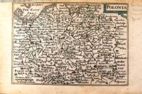
Polonia
London c.1646. Very Good. Notes: Miniature map of Poland with English text on verso.<br>Pieter van den Keere Latin: Petrus Kaerius 1571 – c.1646 was a Flemish engraver publisher and globe maker who worked for the most part of his career in England and the Dutch Republic. Size : 86x122 mm 3.39x4.80 Inches Coloring: Original Hand Coloring Category: Maps Europe Poland Lithuania; unknown
Riferimento per il libraio : M11174
|
|
|
John Speed
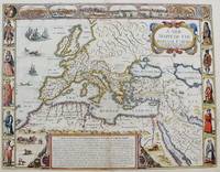
StolenA New Mappe of the Romane Empire.
London: Tho: Basset; Richard Chiswell c. 1651. Very Good. Notes: StolenHighly decorative map of the Roman Empire. Includes illustrations of ships and sea monsters as well as various animals placed in their native lands. <br>Includes a decorative cartouche on the upper right side and a brief historical description of the history of the Roman Empire at the bottom of the map. Illustrations of Rome Geneva Jerusalem Venice Constantinople and Alexandria as well as various native people in costumes are placed around the map. Size : 391x509 mm 15.40x20.05 Inches Coloring: Original Hand Coloring Category: Maps Mediterranean Sea; Maps Asia Near East Turkey; Maps Europe Continent; Maps Africa Continent; Tho: Basset; Richard Chiswell unknown
Riferimento per il libraio : M8291
|
|
|
John Speed
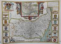
Suffolke described and divided into Hundreds.
London: John Speed c. 1625. Backed on acid free tissue paper for long term preservation central fold reinforced otherwise very good. Notes: A beautifully decorated and coloured map of Suffolk by historian and cartographer John Speed. This map of Suffolk is taken from “Theatre of the Empire of Great Britain†and shows the town plan of Ipswich in an inset at the top of the map. The Inset has the images of the Roman general Petillius Cerealis on the left and Boadicea on the right. The arms of the noble families of the county are also depicted on either side of this artistic map. <br><br>A description of the county of Suffolk is written on verso. Size : 400x545 mm 15.75x21.46 Inches Coloring: Hand Colored Category: Maps Europe United Kingdom England Counties; John Speed unknown
Riferimento per il libraio : M8563
|
|
|
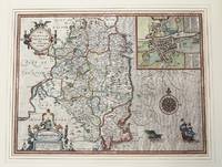
John Speed
The Countie of Leinster with The Citie Dublin Described.
London c.1610. Very Good. Notes: John Speed's map of Leinster county; also with an <br>early plan of Dublin. Size : 382x511 mm 15.04x20.12 Inches Coloring: Original Hand Coloring Category: Maps Europe Ireland; unknown
Riferimento per il libraio : M9855
|
|
|
John Speed; Nigel Nicolson [Introduction]; Alasdair Hawkyard [Commentary];
The Counties of Britain: A Tudor Atlas
Pavilion Books Ltd 1995-04-01. Paperback. New. New. In shrink wrap. Looks like an interesting title! Pavilion Books Ltd paperback
Riferimento per il libraio : Q-1857936124 ISBN : 1857936124 9781857936124
|
|
|
John Speed
The Counties of Britain: A Tudor Atlas.
hardcover. Good. Access codes and supplements are not guaranteed with used items. May be an ex-library book. hardcover
Riferimento per il libraio : 1851451315.G ISBN : 1851451315 9781851451319
|
|
|
John Speed
The Counties of Britain: A Tudor Atlas
Brand: Trafalgar Square Publishing 0000-00-00. Reprint. paperback. New. 8.25x1.00x12.25. Buy with confidence. Excellent Customer Service & Return policy. Brand: Trafalgar Square Publishing paperback
Riferimento per il libraio : DADAX1857936124 ISBN : 1857936124 9781857936124
|
|
|
John Speed
The History and Antiquity of Southampton: With Some Conjectures Concerning the Roman Clausentum Classic Reprint
paperback. Good. Access codes and supplements are not guaranteed with used items. May be an ex-library book. paperback
Riferimento per il libraio : 1331463963.G ISBN : 1331463963 9781331463962
|
|
|
John Speed
The History and Antiquity of Southampton: With Some Conjectures Concerning the Roman Clausentum Classic Reprint
hardcover. Good. Access codes and supplements are not guaranteed with used items. May be an ex-library book. hardcover
Riferimento per il libraio : 0267666942.G ISBN : 0267666942 9780267666942
|
|
|
John Speed
The History of Great Britaine Under the Conquests of Ye Romans Saxons Danes and Normans Their Original Manners Warres Coines & Seales with ye Sucessions Lives acts & Issues of the English Monarchs from Iulius Caesar to our most gracious soveraigne King James
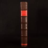
London: William Hall and John Beale 1614. Leather. Very Good. 16.5" by 11". Christoph Schweitzer. A very scarce edition of this highly historically significant work of British history written by an extremely influential historian and cartographer and offering a thorough exegesis of early British history from Julius Caesar to King James. A reissue of the 1611 first edition with imprint date altered as called for. ESTC Citation No. S122020. Folio. The work is very scarce with the 1614 reissue being a particularly scarce edition. Collated lacking errata leaf to the rear of the work and front and rear blank. Leaf 802 is misnumbered as leaf 801 as called for. Pagination is continuous from 'The Theatre of The Empire of Great Britaine' but the work is considered complete as a single volume. Contains the exceptionally scarce three leaves between pi 1 and Mm2 containing the author's preface. This is not present in the ESTC copy. Engraved title page has been trimmed and mounted with slight loss to fore edge. With an engraved title page and vignette engravings throughout by Christoph Schweitzer. John Speed is renowned for his work as both a leading English cartographer and historian and is considered one of the best known English mapmakers of the early modern period. Following encouragement from English antiquarian and historian William Camden Speed began this work published first in 1611 as the 'Historie of Great Britaine'. Many of the historical sources utilised for the work remain unknown although they do include the work of cartographers Christopher Saxton and John Norden. The work is considered a continuation of The Theatre of the Empire of Great Britaine first published between 1611 and 1612 within which is contained the first set of individual county maps of England and Wales. Speed himself considered his History of Great Britaine his major work the majority of which was funded by Sir Fulke Grevillean the Elizabethan poet dramatist and statesman. The work offers a highly detailed summary of Early English history and whilst the work has been criticised for a number of inaccuracies the subsequent frequent citations of the work in later historical pieces reflect its historical significance. Among others the work offers detailed information regarding the early successors and founders of English institutions including The Saxons Henry VIII and Edward IV. Written by one of the most influential historians and cartographers of the early modern period this extremely scarce 1614 edition of The History of Great Britaine is a sought after piece of significant historical and literary non fiction. Rebacked with the original contemporary calf boards preserved. Externally very smart with professional repair to the extremities. Slight rubbing and marking to the boards. Hinges slightly strained but firm. Evidence of bookplate removal to rear pastedown. Internally firmly bound. Engraved title page has been trimmed and mounted with slight loss to fore edge. Lacking front and rear blank and errata leaf to the rear of the work. The occasional light tidemark to the extremity of the occasional leaf. Handling marks and the occasional spot. The occasional contemporary ink annotations heavier to the final leaf. The occasional closed tear. Professional repair to leaf 5A2. Very Good William Hall and John Beale hardcover
Riferimento per il libraio : 655K5
|
|
|
John Speed
The Historie of Great Britaine under the Conquests of ye Romans Saxons Danes and Normans. Their Originals Manners Habits Warres Coines and Seales: with y Successions Lives Acts and Issues of the English Monarchs from Julius Caesar to the most gracious Sovereign King James
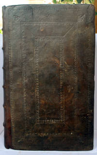
Popes-head alley at y signe of y White Horse: Imprinted by William Hall and John Beale. Sold by John Sudbury and Georg Humble. 1611 A good copy of the extremely rare 1st edition of Speed's comprehensive work. In full leather binding which has been rebacked retaining the original boards which have blind tooled decoration and replacing the spine which has raised bands and gilt title label. This work continued Speed's 'Theatre of Great Britaine' - and the page numbering is continuous with it - the text starting at p155 and finishing at p 894 although the book is complete on its own. With engraved decorative title page; 4 page preface and text completing at p 894; Summary conclusion of the whole - 4 pp; The Second Index - 46 pp; and a one page 'Faults etc Sped'. The work has numerous engravings of coins seals and coats of arms; and is embellished throughout with decorative head and tailpieces and decorated initial capitals. The binding has been expertly repaired with some building up to one of the corners which had been lost. With new endpapers. The title page has been relaid on tissue. There is light nibbling to page edges up to the end of the preface but overall the paper is extremely thick and well-preserved. There is loss to the Faults page bottom corner and p 755 has a corner missing without loss of text. The pages vary from being completely clean to having spotting to having browning. There are occasional water stains to page margins - most usually the bottom margin - occasionally with a pinkish tinge at the page edge. A few pages have small repaired tears without loss. Imprinted by William Hall and John Beale. Sold by John Sudbury and Georg Humble. hardcover
Riferimento per il libraio : 031042
|
|
|
John Speed (1552-1629); Pieter van den Keere
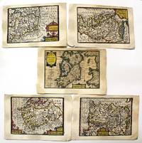
The Kingdome of Irland. Mounster. Ulster.Linster.Connack.
London: Petrus Kaerius caelavit George Humble c.1632 . Very Good. Notes: A set of 5 miniature maps of Ireland and its counties.<br>Pieter van den Keere Latin: Petrus Kaerius 1571 – c. 1646 was a Flemish engraver publisher and globe maker who worked for the most part of his career in England and the Dutch Republic.<br><br>Miniature Speeds<br>A series of 44 plates for the British Isles from about 1599 took a long time to publish. They were based on Christopher Saxton Ortelius and Giovanni Battista Boazio respectively for England and Wales Scotland and Ireland. They appeared in 1617 in a Latin edition of the Britannia of William Camden by Willem Blaeu. Later these plates came to William Humble or George Humble according to Royal Geographical Society fellow Carl Moreland and David Bannister—map dealer—in "Antique Maps" who issued them with some modification and expansion in 1627 as a miniature version of the atlas of John Speed. Thereby van den Keere's works came by the name "Miniature Speeds".<br> Size : 85x123 mm 3.35x4.84 Inches Coloring: Original Hand Coloring Category: Maps Europe Ireland; Petrus Kaerius caelavit [George Humble] unknown
Riferimento per il libraio : M11092
|
|
|
John Speed (1552-1629)
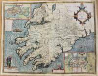
The Province of Mounster.
London 1627. Good backed on acid free tissue paper for long term preservation. Notes: Map of the Province of Munster with inset maps of Cork and Limerick.<br>John Speed was a renown British cartographer 'Theatre of Great Britain' was the first atlas of the British Isles.<br>Munster Old Irish Muma the southwestern province of Ireland comprising the counties of Clare Cork Kerry Limerick Tipperary and Waterford. Size : 388x506 mm 15.28x19.92 Inches Coloring: Hand Colored Category: Maps Europe Ireland; unknown
Riferimento per il libraio : M10917
|
|
|
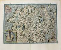
John Speed (1552-1629)
The Province Ulster described.
London 1627. Good backed on acid free tissue paper for long term preservation. Notes: John Speed map of The Province Ulster in Northern Ireland with an inset showing Enis Kelling Fort Fort of Enniskillen.<br>John Speed was a renown British cartographer 'Theatre of Great Britain' was the first atlas of the British Isles. Size : 382x515 mm 15.04x20.28 Inches Coloring: Hand Colored Category: Maps Europe Ireland; unknown
Riferimento per il libraio : M10918
|
|
|
John Speed
The Theatre of the Empire of Great-Britain Kingdom of England Scotland Ireland and the Isles Adjoyning
London: Thomas Bassett; Richard Chiswell 1676. Leather. Good. 17.5" by 13". None. A collection of leaves from the highly sought after geographical work; The Theatre of the Empire of Great Britain. Complete with the maps this is around £100000. Containing; the original title page in both red and black printing two dedication pages "To the Right Honourable Sir Joseph Sheldon" and "To the Most High and Most Potent Monarch James" three leaves of the preface three leaves of poetical works the "Contents of the Chorographical Part The First Book" through to the contents of "The King's Dominions Abroad" the title page to "The Second Book: Containing the Principality of Wales" page 97 and 98 of this work five leaves of road branch diagrams the title page to "The Third Book: Containing a General View of the Kingdom of Scotland" page 129 of this work the title page to "The Fourth Book: Containing the Kingdom of Ireland" page 135 of this work the title page to "A Prospect of the Most Famous Parts of the World" and the complete Index. Rebacked in a full contemporary calf binding with the original calf boards. Externally a trifle rubbed with wear to the extremities and minor cocking to the spine. Both hinges are tender. Internally binding is a little strained in places with some leaves working loose. Work is seriously incomplete with what is present listed above. Some scattered spotting and handling marks. Good Thomas Bassett; Richard Chiswell hardcover
Riferimento per il libraio : LTH20-A-5
|
|
|
John, Harold (Speed)
Who's Who in Major League Baseball
Chicago IL: Buxton Publishing Co. 1933. Book. Good. Hardcover. First Edition. 544pgs. Red Boards embossed gilt lettering baseball and bats. Stain on front panel gilt lettering on the spine is rubbed. adhesive tape reinforcement on the inner hinges.a few pages have tape repairs otherwise clean unmarked. Stats sepia toned photos of the great players coaches executives. Includes Stengel RuthWagner Landis many others from that period and before. . Size: Large 4to. Buxton Publishing Co. Hardcover
Riferimento per il libraio : 024540
|
|
|
Johnson (Speed) Johnon
Who's Who In Major league Baseball with Inscription by Lyn Lary
Buxton Publishing Company. Unknown. Good. Pages can have notes/highlighting. Spine may show signs of wear. ~ ThriftBooks: Read More Spend Less.Dust jacket quality is not guaranteed. Buxton Publishing Company unknown
Riferimento per il libraio : GB01FSX3BTUI3N00
|
|
|
Johnson Harold "Speed
Who's Who in the Major Leagues 3rd Edition
Hardcover. Very Good. 1935 B E Callahan Pristine red cloth hardcover stamped in gilt. Tall octavo. 128; 112 pp. Black and white photographs. Good clipped illustrated dust jacket chipped along edges with edge and tip wear general soiling and scuffing. Binding is sound and pages clean and unmarked. hardcover
Riferimento per il libraio : XC-SGOF-8N7K
|
|
|
JOHNSON, Harold (Speed)
Who's Who in Major League Base Ball
Chicago: Buxton Publishing Co 1933. Hardcover. Very Good. 1933 edition. Large quarto. 544pp. Illustrated from photographs. Red cloth boards. Owner name on the front fly a small spot on the front board slight wear on the spine ends very good. An important and attractive volume heavily illustrated with photographs and full-page biographies of then current baseball stars. A nice presentable copy of a large book usually found well-worn. Buxton Publishing Co hardcover
Riferimento per il libraio : 462916
|
|
|
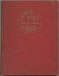
Johnson, Harold (Speed)
Who's Who in Major League Baseball
Chicago: Buxton Publishing Company 1933 First edition. Inscribed by the book's publisher Grover C. Buxton on front free endpaper: "To 'Bobby' / from / Grover / Sept. 27 1933" and signed again by Buxton on p. 11. Original red cloth baseball design and title in gilt to front board titles in gilt to spine frontispiece photograph of High Commissioner of Baseball Kenesaw Mountain Landis. A good copy with a rectangular patch of fading to front board a bit of wear and soiling to exterior hinges slightly loose fairly large chip to p. 47 pages otherwise intact and very clean offsetting and residue from removed bookplate to front free endpaper. Overall a presentable copy of a classic baseball book. Who's Who in Major League Baseball compiled by the sportswriter Harold Speed Johnson is a directory that includes biographical sketches and statistics for the professional baseball players around the time of its publication. It also includes sections with biographies on coaches umpires statisticians and other figures in the world of baseball. Each biography includes a sepia portrait alongside it. This is the first edition of the first book which was issued annually afterwards until 1955. . Signed. First Edition. Hard Cover. Very Good. Chicago: Buxton Publishing Company hardcover
Riferimento per il libraio : HJWW001
|
|
|
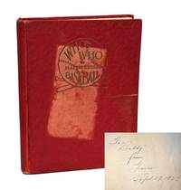
JOHNSON, Harold (Speed)
Who's Who in Major League Base Ball
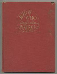
Chicago: Buxton Publishing Co 1933. Hardcover. Very Good. 1933 edition. Large quarto. 544pp. Illustrated from photographs. Red cloth boards. Chip in upper right corner of front board with some light staining on the same board else very good and internally about fine. An important volume heavily illustrated with photographs and full-page biographies of then current baseball stars. A presentable copy of a large book usually found well-worn. Buxton Publishing Co hardcover
Riferimento per il libraio : 537027
|
|
|
Johnson, Harold (Speed) Compiled By
Who's Who in Major League Base Ball
Chicago IL: Buxton Publishing Co 1933. Hardcover. Very Good with no dust jacket. 544 pages. small former owner's name on first page. introduction by Henry P. Edwards. sections on Kenesaw M. Landis biographies of Baseball Officials and Immemoria Sketch on James Iovino and Introduction to Players Umpires Hank O'Day History of Baseball etc. light scuffs to covers with some light spots. light foxing to inside front and rear covers. very bottom edge of last page has bottom one inch mended with clear tape and on page 543 & 544 at bottom are light brownish spots dissimilar to foxing. red cloth covers with gilt titles. spine a little dulled. shipping will be extra for this book please inquire. ; 8 3/4 x 11 1/4 Buxton Publishing Co hardcover
Riferimento per il libraio : 70304
|
|
|
Johnson, Harold (Speed), ed
Who's Who in the Major Leagues
Chicago IL: B. E. Callahan 1935. fair to good. 240 illus. tables discoloration inside boards and flyleaves some darkening to text top & bottom spine edges worn. 2 vols. in one--Book 1: The American League 128 pages and Book 2: The National League 112 pages. Features Yankee manager Joe McCarthy Babe Ruth Dizzy Dean and Casey Stengel among many others. B. E. Callahan hardcover
Riferimento per il libraio : 51494
|
|
|
Johnson, Harold (Speed)
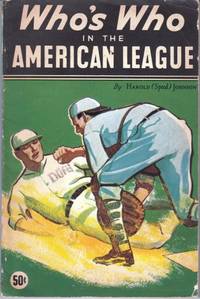
Who's Who in the American League
Callahan Chicago 1935. 1st Edition. Softcover Side-stapled. Very Good Condition. 128 pages. Spine chipped at head. Multiple copies available this title. Quantity Available: 2. Category: Sports & Pastimes; Baseball; Pictures of this item not already displayed here available upon request. Inventory No: 21590. . Callahan paperback
Riferimento per il libraio : 21590
|
|
|
Johnson, Harold (Speed)
Who's Who in Major League Baseball
Buxton Chicago 1933. 1st Edition. Hardcover Original Cloth. Good Condition. Boards discolored from dampness a few crayon marks on eps half-title and Intro. 544 pages. Quantity Available: 1. Category: Sports & Pastimes; Baseball; Pictures of this item not already displayed here available upon request. Inventory No: 21742. . Buxton hardcover
Riferimento per il libraio : 21742
|
|
|
Johnson, Harold (Speed)
Who's Who in the Major Leagues 1937 Edition
B. E. Callahan 1937-01-01. Hardcover. Good. Good hardcover. No DJ. Ex-Library with usual markings. Text is clean and unmarked. Slightly tanned. Covers purple w/gilt show light edge wear/fading and rubbing/light stains. Back strip edge wear. Binding cracked but still intact.; 100% Satisfaction Guaranteed! Ships same or next business day! B. E. Callahan hardcover
Riferimento per il libraio : 1302140076
|
|

 Ricevere i risultati per e-mail
 Scaricare i risultati in PDF
 RSS feed
 Link
Link


