|
Hundt, R. (Bergassessor)
Die Gliederung des Mitteldevons am Nordwestrande der Attendorn-Elsper Doppelmulde
Sonderabdruck des naturhistorischen Vereins der preuss. Rheinlande, Westfalens und des Regierungsbezirks Osnabrück, 54. Jahrgang, 1897. einfache Broschur, ca. DinA 5, Seiten 206-242, 1 beiliegende farbige Faltkarte im Maßstab 1: 80000 (ca. DinA 3), Einband STARK fehlerhaft, stark fleckig, gebräunt, Knickspuren, rissig, Rücken fast vollständig aufgetrennt, Schnitt und Seiten papierbedingt stark gebräunt, Knickspuren, Karte stärker gebräunt und stockfleckig, privater Stempel auf dem Titelblatt, STARKE Gebrauchs- und/oder Altersspuren / very used [4 Warenabbildungen]
Riferimento per il libraio : 51238mg

|
|
|
Hunger, R
Mikrobotan.-stratigraph. Untersuchungen d. Braunkohlen d. südl. Oberlausitz u. d. Pollenanalyse als Mittel z. Deutung d. Flözgenese.
Berlin, Akad.-Vlg. 1953. M. zahlr. Abb. 38 S. Hlwd. (FFH C 8)
Riferimento per il libraio : 803339
|
|
|
HUNGER, RICHARD
Aus dem Tagebuch der Erde
Leipzig, Brockhaus Verlag 1956. Ganzleinen mit Schutzumschlag, 8°, 267 S., mit 92 Abbildungen im Text und 32 farbigen Bildern, Umschlag und Einband von Adelhelm Dietzel, »Der Verfasser berichtet von der Bildung der Gesteine, von der wechselhaften Entwicklung der Landschaften, der Berge und Täler, der Meere und Seen, von den Pflanzen und Tieren der geologischen Vorzeit.«
Riferimento per il libraio : X2986

|
|
|
HUNGER, RICHARD.
Aus dem Tagebuch der Erde.
Mit 92 Abbildungen und 32 farbigen Bildern.
|
|
|
Hunt Sterry T
Special report on the trap dykes and azoic rocks of southeastern Pennsylvania. Part I: Historical introduction
22 cm, rilegatura editoriale in tela, tit. in oro al dorso; pp. xxi, 253; una carta geografica all'antiporta

|
|
|
Hunt, C. Warren
Environment of Violence
Readings of Cataclysm Cast in Stone. Calgary, Alberta, Polar Publishing, 1990. Gr.-8vo. Mit teils farbigen fotografischen Abbildungen. XI, 199 S. Or.-Pp. mit Schutzumschlag; dieser tlw. etwas verblasst.
Riferimento per il libraio : 188385 ISBN : 969450605

|
|
|
Hunter, R.E
Sand a. Gravel Resources of Tazewell County, Illinois.
Urbana, 1966. M. 1 Faltkte. 22 S. OBr. Umschl. fleckig. (Circular of the Illinois State Geolog. Survey 399)
Riferimento per il libraio : 160380
|
|
|
HUNTING GEOLOGY AND GEOPHYSICS LIMITED
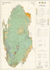
Qatar Geological Map / . Scale 1:200000.
1980. Original large colour-printed map of Qatar 104 x 74 cm. Topography based on 1:100000 scale series 1980 compiled and drawn by Hunting Surveys Limited for the Ministry of Public Works Qatar. Compiled and cartography by Hunting Geology and Geophysics Limited. In very good condition. Showing the maturation of Qatar's Oil and Gas Industries This is an extremely rare 1980 large-format bilingual geological map of Qatar produced by Hunting Geology and Geophysics for the Qatari government. Issued nearly a decade after independence the map played an important role in the country's continued development of its oil and gas industries the wealth from which was successfully leveraged to support wider social and economic development. The map covers the Qatari Peninsula its nearby islands including the Hawar Islands belonging to Bahrain and reclaimed coastal land using colour-shading to indicate a variety of sands gravels clay and stone as explained in the bilingual legends present at right which also indicate geological era. Roads carriageways highways tracks settlements oil wells pipelines waterways including wadis and other features including some maritime features sand banks reefs are recorded as explained in a legend at right. The level of detail is so extraordinary that even power lines and fences are noted. Additional information is also explained at right such as the local grid employed and a reliability diagram based on the surveys that form the basis of the map's data. Qatar's Oil Industry Takes Off The early history of Qatar's oil industry began in the 1920s and 1930s when the small sparsely populated British protectorate first attracted the interest of international oil companies exploring the Persian Gulf. In 1932 the Anglo-Persian Oil Company obtained the first oil concession in Qatar through a subsidiary the Iraq Petroleum Company. Initial exploration efforts included geological surveys and test drilling reflecting British hopes that Qatar might yield oil reserves comparable to those already found in neighbouring Bahrain and Saudi Arabia. The first promising discovery came in 1939 at the Dukhan field on Qatar's western coast. However development was delayed by the outbreak of the Second World War which diverted resources and prevented large-scale extraction. Oil production in Qatar truly began after the war. In 1947 - 1948 the Dukhan field was finally brought into production with the first export shipment departing in December 1949. Revenues from oil began to replace traditional industries like pearling fishing and small-scale trade. Through the 1950s the Qatar Petroleum Company then an operating arm of the concession-holding consortium expanded infrastructure at Dukhan and the growing port of Umm Said Mesaieed which became the centre of refining and export operations. The influx of oil revenue initiated an era of modernisation. Beginning in the 1950s the ruling al-Thani family used oil income to fund public works schools healthcare and roads gradually transforming Qatar from a relatively poor Gulf sheikhdom into a state with rapidly improving infrastructure and services. This map was when Qatar's oil industry entered a period of rapid growth. The discovery and development of new offshore reserves were especially significant during this period including the Bul Hanine field located southeast of the Qatari peninsula. Discovered in 1970 and brought into production in 1972 Bul Hanine became a key contributor to Qatar's output during the 1970s reflecting the country's shift toward offshore exploration that would later define much of its energy sector. Qatar also steadily increased its role in managing the sector especially after independence. In the early 1970s the government negotiated increased participation in concessionary operations aligning with a broader regional trend across the Gulf and the wider Arab world. In 1974 Qatar achieved a majority state share in the Qatar Petroleum Company's operations reflecting the global momentum of resource nationalisation. Oil exports from fields such as Bul Hanine strengthened the young state's financial position enabling even further investments in education housing infrastructure and early industrialisation projects driven by the leadership of Emir Khalifa bin Hamad r. 1972 - 1995. This era also set the stage for the eventual development of Qatar's massive natural gas resources especially the North Field the largest natural gas field in the world which would propel the country into a new phase of energy leadership even as geopolitical incidents the 1973 Oil Embargo the Iranian Revolution and Iran-Iraq War caused turmoil in the oil and gas industries. Publication History and Census This map was compiled and drawn by the firm Hunting Geology and Geophysics in the late 1970s based on their own surveys and those of Seltrust Engineering Limited which prepared an equally rare explanatory booklet for the map OCLC and was published in 1980. In a sense the map can be seen as a successor to a 1970 geological map of Qatar previously sold by us which Hunting had a role in developing with the same title and dimensions as the present map similar involvement of the Qatari government in this case the Industrial Development Technical Centre and equivalent types of data reflected. However the present map is based on later surveys and benefits from a decade of additional technological advances making it a rather unique work rather than a second edition. In any event the present map is very scarce noted only among the holdings of the Library of Congress and with no known market history. Cartographer Hunting Geology and Geophysics Ltd. 1952 - 1987 was a British surveying firm that specialized in cutting-edge methods of mapping especially aeromagnetic surveys and focused on discovering potential reserves of natural resources especially fossil fuels. It was part of the larger Hunting group originally founded in 1874 as a shipping company by Charles Hunting and later moving into aircraft surveying and petroleum. Companies within the Hunting group frequently merged with each other and with outside acquisitions leading to frequent name changes; in this case Hunting Aerosurveys founded 1944 merged with Hunting Geophysics founded 1952 to form Hunting Surveys in 1960. In 1965 a public company was formed called Hunting Associated Industries Ltd. which included Hunting Surveys Holdings Ltd. but not a new entity Hunting Geology and Geophysics Ltd. which remained part of the privately-owned Hunting Group. In 1987 Hunting Geology and Geophysics Ltd. was closed down in a consolidation process that saw the public company now Hunting plc buy out the Hunting Group though the Hunting family retains a significant share of the company's stock and one of its members remains Chairman of the Board. Hunting Geophysics and later Hunting Geology and Geophysics Ltd. made pioneering surveys of Great Britain itself along with several countries in Central Africa seeking uranium and other minerals the Philippines Ethiopia and especially countries in the Middle East where the company conducted critically important surveys that helped to develop the lucrative oil industries of the United Arab Emirates Qatar and Kuwait among others. OCLC 35277935 1980. unknown
Riferimento per il libraio : 65435
|
|
|
Huntting, Marshall T.
Gold In Washington, Division Of Mines And Geology Bulletin No. 42
A clean, unmarked book with a tight binding. Light wear to cover. 158 pages. Fold-out map.

|
|
|
Hunziker, J.C
Zur Geologie u. Geochemie d. Gebietes zwischen Valle Antigorio (Prov.di Novara) u. Valle di Campo (Kt. Tessin). Diss.
Zürich, 1966. (S.-A.). M. 3 Ktn., 6 Tab. u. 28 Abb. 80 S.
Riferimento per il libraio : 222699
|
|
|
HUOT J.J.N.
GEOLOGIE - ENCYCLOPEDIE RORET
RORET, rue hautefeuille, Paris. 1840. In-16. Broché. Etat d'usage, Couv. convenable, Dos satisfaisant, Intérieur frais. 312 pages illustrées de 4 planches en noir et blanc.. . . . Classification Dewey : 551-Géologie
Riferimento per il libraio : R300045201
|
|
|
HUOT Jean Jacques Nicolas.
Nouveau manuel complet de géologie, ou traité élémentaire de cette science (...) Nouvelle édition, revue, corrigée et augmentée par M.C. d'Orbigny.
Paris, A la Libr. Encyclopédique de Roret, 1852, in-16, legatura coeva in mezza pergamena, titolo in oro su tassello in pelle al dorso, pp. (4), VII, 314. Con 4 tavole più volte ripiegate.

|
|
|
Hupfer, P
Die Regionen am Ätna.
Leipzig, 1894. (S.-A.a.: Wiss. Veröff. d. Ver. für Erdk. zu Leipzig 2/2). M. 1 farb. Kte. S. 293-362. Hlwd. Einbd. etwas berieben. S. u. Sign. a. Tit.
Riferimento per il libraio : 169522
|
|
|
Hurlbut Cornelius S.
IL MONDO DEI MINERALI.
(Codice CU/8237) In 4° (29 cm) 301 pp. Illustrato con 217 bellissime foto in nero e a colori, nel testo e fuori testo. Tutta tela editoriale. Buono stato. ~~~ SPEDIZIONE IN ITALIA SEMPRE TRACCIATA

|
|
|
HURLEY Patrick M.
L'età della Terra. Nuove risposte a un vecchio enigma.
Trad. di Gianni Zanarini.<BR>16°, pp.130, numerose ill. n.t. + 8 tavv. fotoinc. f.t. Br. edit.
|
|
|
HURLEY Patrick M. -
L'età della terra. Nuove risposte ad un vecchio enigma.
Bologna, Zanichelli, 1966. 16mo br. pp. 130 con 26 fig. n.t. e VIII tav. f.t.

|
|
|
Hurst, M.E
Arsenic-bearing deposits in Canada.
Ottawa, Acland, 1927. M. zahlr. Tab. u. 19 Abb. IV, 181 S. Kart. St. u. Sign. a. Tit. (Canada Dep. of Mines. Geol. Survey. Econom. Geol. Ser. 4).
Riferimento per il libraio : 631602
|
|
|
HUSEMANN, August & KILLIAS, E.:
Die arsenhaltigen Eisensäuerlinge von Val Sinestra bei Sins (Unter-Engadin). Analysirt von Dr. August Husemann, Prof in Chur, nebst einigen begleitenden Bemerkungen von Dr. E. Killias, Badearzt von Tarasp. Veröff. in Auftrage der Gemeinde Sins.
Chur, In Commission der Hitz’schen Buchhandlung (Hitz & Hail), Buchdr. Gebr. Casanova, 1876, in-8vo, 22 S. + 1 Bl. (Inhalt), Exlibris Peter E. Obergfell, ill. Original-Broschüre.
Riferimento per il libraio : 138670aaf
|
|
|
Husen Dirk van
Die Ostalpen in den Eiszeiten (= Aus der Geologischen Geschichte Österreichs - Populärwissenschaftliche Veröffentlichungen der Geologischen Bundesanstalt)
Wien (Geologische Bundesanstalt) 1987 (= Erste Ausgabe). 8°, illustrierter Orginalumschlag (Klammerheftung) 24 S., Abbildungen, 1 Faltkarte beigelegt, ISBN 3900312583 1
Riferimento per il libraio : Khe04050
|
|
|
Hussak, Eugen
Katechismus der Mineralogie. Mit 154 in den Text gedruckten Abbildungen.
Leipzig, J. J. Weber, 1896. VIII + 192 + 8 S. OLwd.
Riferimento per il libraio : 17315BB
|
|
|
HUSSON (Pharmacien)
Esquisse Géologique de l'Arrondissement de Toul, suivi d'un aperçu Botanique des environs de cette ville
Imprimerie et Librairie de Veuve Bastien, Toul in-8 broché, couverture bleue imprimée, elle-même sous couverture d'attente bleue muette, 106 pp. Edition originale sur papier vergé à la forme toutes marges, quelques petites rousseurs sans gravité ni atteinte au très bon état général. Rare exemplaire.
Riferimento per il libraio : 12733
|
|
|
Hutchinson R. W.
L'antica civilt? cretese Traduzione di Luciana Pecchioli
Saggi 569 - Nota alla prima edizione inglese - Nota all'edizione italiana - Prefazione - Introduzione - L'et? della pietra -I popoli, le lingue e le scritture di Creta - Marina, Commercio e comunicazioni dei Minoici - Arte minoica - L'antico minoico - Il medio minoico - La religione minoica - Vita sociale ed economica, industrie e agricoltura - Declino di Cnosso e sviluppo della potenza di Micene - La decadenza della Creta minoica: l'Impero miceneo - La colonizzazione dorica, le influenze orientali e il sorgere della citt?-stato - Tavola cronologica - Bibliografia - Indice dei luoghi - Indice dei nomi 1 21,5x15 cm., in brossura, sopraccoperta, pp. XX (4), 348 (12), 75 figure nel testo e e 36 illustrazioni in nero su tavole in carta patinata fuori testo, prima edizione italiana, ottimo stato
|
|
|
Huth, Thomas
Erlebnis Geologie : Streifzüge über und unter Tage ; Besucherbergwerke, Höhlen, Museen und Lehrpfade in Baden-Württemberg. LGRB
Freiburg im Breisgau : LGRB 2002. 472 S. : 303 Abb., 94 Ktn; 21 cm kart., Softcover/Paperback, Exemplar in sehr gutem Erhaltungszustand
Riferimento per il libraio : 47296

|
|
|
Huth, W
Die oberschlesischen Mariopteriden.
Berlin, 1913. (S.-A.a.: Abhandl. d. K. Preuß. Geolog. LA N.F. 75). M. 6 beilieg. Taf. u. 2 Abb. S. 84-102. OBr. Rücken etwas angerissen. Umschl. leicht angestaubt., m. Sign. u. Widm. d. Verf.
Riferimento per il libraio : 167497
|
|
|
Huttel, Peter
Das Straßfurt-Karbonat (Ca2) in Süd-Oldenburg - Fazies und Diagnese eines Sediments am Nordhang der Hunte-Schwelle. Dissertation.
Göttingen 1987. 4°. II, 94 pp., Abbildungen im Text, Tafeln im Anhang. Broschur. Signaturschildchen auf Deckel. Stempel verso Titel. Sonst ordentlich.
Riferimento per il libraio : 6050537
|
|
|
HUTTENLOCHER FRIEDRICH
Sonnen- u. Schattenlage. Ihr Klima und ihr Einfluß in den Alpen, sowie im Schwaben- u. Frankenland.
Oehringen. Rau 1923. 8°. 62 S. OKartoniert NaT., leichte Gebrauchsp., gut erhalten.
Riferimento per il libraio : 21410AB
|
|
|
Huttenlocher, Heinrich Ferdinand
Die Erzlagerstätten der Westalpen. Von Heinrich F. Huttenlocher. (= Beiträge zur Geologie der Schweiz, Geotechnische Serie, Kleinere Mitteilungen Nr 4).
Zürich: Gebr. Leemann / Bern: Kümmerly & Frey (1934). Seiten (4), 23-149 und (8) Blatt. Mit Textabbildungen, einer gefalteten Tabelle, einer großen Faltkarte und 8 Tafeln im Anhang. Gr. 8° (22,5-25 cm) Orig.-Broschur. [Softcover / Paperback].
Riferimento per il libraio : 2138601

|
|
|
HUXLEY (Th. H.).-
Physiographie. Introduction à l'étude de la nature. traduction de l'anglais et adaptation par M. Georges Lamy. deuxième édition revue et corrigée d'après la 14e édition anglaise.
P., Alcan, 1892, in 8° relié demi-chagrin rouge, dos à faux nerfs orné, plats de percalilne rouge dont le premier est décoré du fer du Lycée de Saint-Etienne, XVI-415 pages.
Riferimento per il libraio : 67141
|
|
|
HUXLEY Th. H.
Physiographie. Introduction à l'étude de la nature.
Couverture rigide. Reliure toile bleue de l'éditeur . (Livre de prix de la ville de Paris). 415 pages. 128 figures dans le texte et deux planches hors-texte.
Riferimento per il libraio : 76590
|
|
|
HUXLEY Th. H.
Physiographie. Introduction à l'étude de la nature. Introduction à l'étude de la nature.
Couverture rigide. Reliure demi-chagrin rouge. 415 pages. 2 cartes dépliantes.
Riferimento per il libraio : 135270
|
|
|
Huxley, T. H
Physiographie. Eine Einleitung in das Studium der Natur. Für deutsche Leser frei bearbeitet von H. Jordan.
Leipzig, Brockhaus, 1884. Kl. 8°. XX, 521 Seiten. Mit 182 Abbildungen und 8 Karten und Tafeln. HLeinenband mit Rückenvergoldung. Tadellos erhalten.
Riferimento per il libraio : 7951A
|
|
|
Huxley, T. H.
PHYSIOGRAPHY: An Introduction to the Study of Nature. With Illustrations and Coloured Plates.
pp. xix, 384 + 5 Full page color plates. Numerous text drawings and charts. XLib. XLib stamps embossed in blind on title page, page 51 and page 377. One page loose. XLib stamps on all edges. Small 8vo. Original full purple cloth binding, decorated in black and embossed in blind. Head and tail of spine worn with small loss at spine and rear board. XLib call marks on spine. Hardbound. Very good. Scarce. **PRICE JUST REDUCED! JUN5 BOX 6
|
|
|
Huxley, T.H.
Physiography. An Introduction to the Study of Nature.
1891 xix, [1], 384 p., 122 figs, 5 col. pls, red publisher's cloth (spime somewhat worn).
Riferimento per il libraio : GG20956
|
|
|
HUXLEY, Th. H.
Physiographie. Introduction à l’étude de la nature. Traduction de l’anglais et adaptation par G. Lamy. Avec 128 figures dans le texte et deux planches hors texte.
Paris, Germer Baillière 1882, 225x135mm, XVI - 415pages, demi-reliure. Auteur et titre dorés au dos. Cachet et cote de bibliothèque au dos. Couverture et dos frottés.
Riferimento per il libraio : 20028
|
|
|
Huxley, Th.H. (translated by G. Lamy).
Physiographie. Introduction a l'étude de la nature.
1882 (1st ed.) xvi, 415 p., 128 figs, 2 folded col. maps, frontispiece, red embossed/gilt cloth. Prize-binding of the city of Paris.
Riferimento per il libraio : GG15816
|
|
|
Hwang, Cheinway, C.K. Shum und J. Li (Editors)
Satellite Altimetry for Geodesy, Geophysics and Oceanography. Proceedings of the International Workshop on Satellite Altimetry, a joint workshop of IAG Section III Special Study Group SSG3.186 and IAG Section II, September 8-13, 2002, Wuhan, China. International Association of Geodesy Symposia , Vol. 126 CD-ROM including.; (= International Association of Geodesy Symposia , Vol. 126).
Berlin, Springer 2004. XVII, 280 pp. with a lot of Figures and 1 CD-ROM, 4°, Original-Pappband (Hardcover), Bibliotheks-Exemplar (ordnungsgemäß entwidmet), Stempel auf Titel, insgesamt gutes und innen sauberes Exemplar, (library vopy in good condition),
Riferimento per il libraio : 80909

|
|
|
Hyde M.O.
Les secrets du globe terrestre.
Paris, Flammarion, 1969, in-8, cartone editoriale, pp. 128. Con illustrazioni a colori e in b.n. e bibliografia.
|
|
|
Hyde, Margaret O
Vom Erdkern zum Weltall
Ein aktueller Beitrag zum Geophysikalischen Jahr. Stuttgart, Boje, 1958. Mit Illustrationen von Klaus Bürgle. 161 S., 1 Bl. Farbiger Or.-Pp.; Gelenke u. Kapitale mit kl. Läsuren.
Riferimento per il libraio : 74590
|
|
|
Hylckama, T.E.A.v
Water use by saltcedar as measured by the water budget method.
Washington, 1974. 4° M. 35 Abb. IV, 30 S. OBr. (Geological survey professional paper 491 E).
Riferimento per il libraio : 240056
|
|
|
Hylckama, T.E.A.v
Weather a. Evapotranspiration Studies in a Saltcedar Thicket, Arizona.
Washington. 1980. M. 45 Abb. V, 78 S. OBr. (Geological Survey Professional Paper, 491-F)
Riferimento per il libraio : 240055
|
|
|
Hyndman, Donald W
Petrology of Igneous and Metamorphic Rocks. (= Earth & Planetary Science).
McGraw Hill Book Co., New York 1972. 533 S. mit zahlreichen Abbildungen, Groß 8°, Original-Pappband (Hardcover), gutes und innen sauberes Exemplar,
Riferimento per il libraio : 61930

|
|
|
Hynie, O. u. J. Koutek
Geologie d. wichtigsten Schlammarten Europas, die gegenwärtig zu Heilzwecken verwendet werden.
Praha, 1933. M. 1 Falttaf. im Text u. 2 Taf. 96 S. OBr. Etwas randgebräunt. (Knihovna stat. Geol. Ustavu cesk. Rep. Sv. 16).
Riferimento per il libraio : 190102
|
|
|
Hámor, G
Geology of the Nógrád-Cserhát area.
Budapestini, 1985. M. 10 farb. Taf. u. 86 Abb. 307 S. Pp. (Geologica Hungarica / Ser. geol. 22).
Riferimento per il libraio : 240109
|
|
|
Häberle
Die Abhängigkeit d. Geländegestaltung d. deutschen Mittelgebirge v. Gestein.
Berlin, 1917. 16 S. Gering wasserfleck. St. a. Tit. M. Unterstreich. u. Anmerk. (Mitteil. u. Arb. a. d. Geolog. Inst. d. Univ. Heidelberg N.F. 14).
Riferimento per il libraio : 233998
|
|
|
Häberle, D
Der Pfälzerwald. Ein Beitrag zur Landeskunde d. Rheinpfalz.
Braunschweig; Berlin, Westermann, 1913. M. 1 Kte. u. 50 Abb. 91 S. OKart. (Die Rheinlande 3).
Riferimento per il libraio : 170847
|
|
|
Häberle, Daniel
Besprechungen des geologischen Schriftwerkes der Rheinpfalz in den Jahren 1931-1932 (mit Nachträgen): Sonderdruck aus den Badischen Geologischen Abhandlungen Band V Mitteilungen und Arbeiten aus dem Geologischen Institut der Universität Heidelberg Neue Folge (seit 1915) Nr. 267
Karlsruhe, Müller, 1933. 8°, (2) Bl., S. 49-80, kart. Gut erhaltenes Heft, Papier leicht gebräunt, Stempel auf Umschlag, Klammern angerostet.
Riferimento per il libraio : RE1212
|
|
|
HÄBERLE, Daniel
Das Felsenland des Pfälzerwaldes (Pfälzischer Wasgenwald). Ein Beispiel für die Entstehung bizarrer Verwitterungsformen im Buntsandstein.
Kaiserslautern, Kaysers, 1911. 1. Aufl. Mit 5 Abbild. und 17 Bildtafeln, 23 S. Gr.-8°, kartonierter Band späterer Zeit mit eingebundener Originalbroschur.
Riferimento per il libraio : 190574
|
|
|
Häberle, Daniel
Das Rheingold : seine Herkunft, Gewinnung und Verwertung
Leipzig, Teubner, 1930. Sonderabdruck aus der Geographischen Zeitschrift 36. Jahrg. 1930, Heft 7. 8°, 19 S., geheftet (Klammerheftung). Gut erhaltenes Heft mit nur leichten Gebrauchsspuren. Enthält auch ein kleines Literaturverzeichnis zum Thema.
Riferimento per il libraio : RE2914

|
|
|
Häberle, Daniel
Der Meteorit über der Rheinpfalz am 19. Juli 1932
Heidelberg, Brausdruck, 1934. Sonderdruck aus Jahresberichte und Mitteilungen des Oberrheinischen geologischen Vereins, Band XXIII. 8°, 4 S., Klammerheftung. Gut erhaltenes Heft.
Riferimento per il libraio : RE2492

|
|
|
Häberle, Daniel
Die Mineralquellen der Rheinpfalz und ihrer nächsten Nachbargebiete in geologisch-historischer Beziehung
Kaiserslautern, Pfälzerwald-Verein und Kayser, 1912. Sonder-Abdruck aus dem Wanderbüchlein des Pfälzerwald-Vereins 1912. 8°, VII, 103 S., XI schwarz-weiße Bildtafeln, späterer Pappeinband. Ehemaliges Büchereiexemplar, zwei Signaturschilder auf dem Rücken, brauenr Pappband mit handschriftlichem Rückentitel, Barcodeaufkleber auf dem vorderen Vorsatz, Klebereste von entfernten Fristzetteln auf dem hinteren Vorsatz, Papier gebräunt, eine gefaltete Tafel im Falz beidseitig mit Tesa verstärkt, insgesamt Gebrauchsspuren.
Riferimento per il libraio : RE2610

|
|

 Ricevere i risultati per e-mail
 Scaricare i risultati in PDF
 RSS feed
 Link
Link


