|
Fer, Briony and Mark Waldron
Rachel Whiteread: Detached.
2013. 120pp. Cloth 21.6 x 27.9cms. ISBN: 9781935263777. Presents a series of new large-scale works by the British artist furthering her fascination with notions of abstraction and negative space brought to form here through the casting process. Recalling her well known earlier works Ghost 1990 and House 1993 the sculptures shown stand as uncanny sites of memory cast from garden sheds doors and windows with her works on paper evoking similar concerns explored by hand through the trace. 2013. hardcover
Referenz des Buchhändlers : 096598 ISBN : 1935263773 9781935263777
|
|
|
Fer, Briony and Mark Waldron:
Rachel Whiteread: Detached. SIGNED BY AUTHOR
London: Gagosian Gallery 2013. VG/VG near fine both save a for a very small split to 1 edge of the dj. hardcovers. no inscriptions. a. delightful clean copy. From the personal collection of a dealer/collector. Presents a series of new large-scale works by the British artist furthering her fascination with notions of abstraction and negative space brought to form here through the casting process. Recalling her well known earlier works Ghost 1990 and House 1993 the sculptures shown stand as uncanny sites of memory cast from garden sheds doors and windows with her works on paper evoking similar concerns explored by hand through the trace London: Gagosian Gallery, 2013 hardcover
Referenz des Buchhändlers : 52026
|
|
|
Fer, Briony
Rachel Whiteread Detached
Gallery. New. 2014. Hardcover. 1935263773 . FREE UPGRADE to Courier/Priority Shipping Upon Request - IN STOCK AND IMMEDIATELY AVAILABLE FOR SHIPMENT - Flawless copy brand new pristine never opened - -- with a bonus offer-- . Gallery hardcover
Referenz des Buchhändlers : 107026 ISBN : 1935263773 9781935263777
|
|
|
Fer, Briony/ Batchelor, David/ Wood, Paul
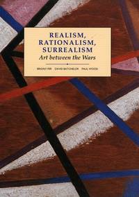
Realism Rationalism Surrealism Art Between the Wars: Art Between the Wars
Yale Univ Pr 1993. Paperback. New. 342 pages. 10.00x7.75x1.00 inches. Yale Univ Pr paperback
Referenz des Buchhändlers : 1-0300055196 ISBN : 0300055196 9780300055191
|
|
|
Fer, Briony, et al
Realism Rationalism Surrealism; Art Between the Wars
New Haven and London: Yale Univiersity Press in Association with the Open Univeirsity 1993. 2d Printing. 342p. colored and b/w illus. original stiff printed wrappers Modern art practices and debates. Yale Univiersity Press in Association with the Open Univeirsity unknown
Referenz des Buchhändlers : 055303 ISBN : 0300055196 9780300055191
|
|
|
Fer, Briony
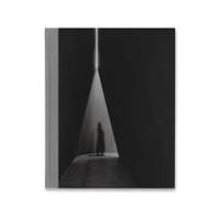
Richard Serra 2016
NY: Gagosian Gallery 2016. Hardcover. Fine/None. Fine hardcover 96 pages glorious b/w images throughout 9 3/4 × 12 inches 24.8 × 30.5 cm.<br /> This book was published on the occasion of three overlapping exhibitions by Richard Serra at Gagosian: NJ-1 at West 21st Street New York; Above Below Betwixt Between Every Which Way Silence For John Cage Through at 555 West 24th Street New York; and NJ-2 Rounds: Equal Weight Unequal Measure Rotate at Britannia Street London.<br /> <br /> The volume documents eight large-scale steel sculptures and an installation drawing by the artist in black-and-white photography. It also includes a text by British art historian critic and curator Briony Fer. Gagosian Gallery hardcover
Referenz des Buchhändlers : 3068 ISBN : 0847861198 9780847861194
|
|
|
Fer, Briony
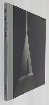
Richard Serra 2016
Gagosian / Rizzoli 2017. Hardcover. New. 156x9x192. BRAND NEW. Still Sealed in Publishers Shrinkwrap. Gagosian / Rizzoli hardcover
Referenz des Buchhändlers : 221101001 ISBN : 0847861198 9780847861194
|
|
|
Fer, Briony
Richard Serra 2016
Rizzoli Intl Pubns 2017. Hardcover. New. 96 pages. 12.00x9.75x0.50 inches. Rizzoli Intl Pubns hardcover
Referenz des Buchhändlers : 1-0847861198 ISBN : 0847861198 9780847861194
|
|
|
Fer, Briony
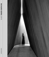
Richard Serra 2016
hardcover. Good. Access codes and supplements are not guaranteed with used items. May be an ex-library book. hardcover
Referenz des Buchhändlers : 0847861198.G ISBN : 0847861198 9780847861194
|
|
|
Fer, Briony
Richard Serra 2016
Gagosian / Rizzoli 05/09/2017. hardcover. Used: Good. 9.80x0.60x12.00. Buy with confidence. Excellent Customer Service & Return policy. Gagosian / Rizzoli hardcover
Referenz des Buchhändlers : SONG0847861198 ISBN : 0847861198 9780847861194
|
|
|
Fer, Briony; Horn, Roni
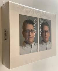
Roni Horn aka Roni Horn
Steidl & Partners 2009. Hardcover. New. 9x7x2. BRAND NEW. Two Volume Set. Still Sealed in Publishers Shrinkwrap. Steidl & Partners hardcover
Referenz des Buchhändlers : 220808007 ISBN : 3865218318 9783865218315
|
|
|
Fer, Briony; De Salvo, Donna; Foster, Carter E;Godfrey, Mark
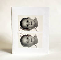
Roni Horn aka Roni Horn
Whitney Museum of American Art New York 2009. Book. New. Flexi-bound. 430 pages 375 illustrations in color. Still in shrink-wrap. Illustrated board. Introduction by Donna De Salvo Carter E. Foster Mark Godfrey. Text by Briony Fer. Whitney Museum of American Art, New York Paperback
Referenz des Buchhändlers : 026388 ISBN : 3865218318 9783865218315
|
|
|
Fer, Briony
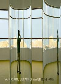
Roni Horn: Vatnasafn/Library of Water
hardcover. Good. Access codes and supplements are not guaranteed with used items. May be an ex-library book. hardcover
Referenz des Buchhändlers : 386521942X.G ISBN : 386521942X 9783865219428
|
|
|
Fer, Briony (Contributor)/ Nachtigall, Jenny (Contributor)/ Fer, Briony (Editor)
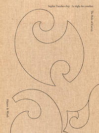
Sophie Taeuber-Arp: La Regle Des Courbes / The Rule Of Curves
Hauser & Wirth 2026. Hardcover. New. 196 pages. 9.65x0.79x11.02 inches. Hauser & Wirth hardcover
Referenz des Buchhändlers : x-3907493168 ISBN : 3907493168 9783907493168
|
|
|
Fer, Briony
The Infinite Line: Re-making Art After Modernism by Briony Fer
Yale University Press 2004-12-11. hardcover. Acceptable. 7x1x10. Used copy with some notations. Exterior has light wear. Missing DJ. Yale University Press hardcover
Referenz des Buchhändlers : 030925010 ISBN : 0300104014 9780300104011
|
|
|
Fer, Briony & Betti-Sue Hertz & Justo Pastor Mellado & Anthony Vidler
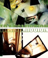
Transmission The Art of Matta And Gordon Matta-Clark
Museum; University of Washington Press Distribution. New. 2006. Paperback. 0937108383 . FREE UPGRADE to Courier/Priority Shipping Upon Request - IN STOCK AND IMMEDIATELY AVAILABLE FOR SHIPMENT - Flawless copy brand new pristine never opened -- 112 pp. With 108 ills. 73 col. . 30 x 25 cm. -- with a bonus offer-- . Museum; University of Washington Press (Distribution) paperback
Referenz des Buchhändlers : 72470 ISBN : 0937108383 9780937108383
|
|
|
Fer, Briony
Transmission: The Art of Matta And Gordon Matta-Clark
Brand: San Diego Museum of Art 0000-00-00. paperback. New. 9.75x0.50x11.50. Buy with confidence. Excellent Customer Service & Return policy. Brand: San Diego Museum of Art paperback
Referenz des Buchhändlers : DADAX0937108383 ISBN : 0937108383 9780937108383
|
|
|
Fer, Briony
William Kentridge and Vivienne Koorland: Conversations in Letters and Lines
Paperback. Very Good. paperback
Referenz des Buchhändlers : GOR008106634 ISBN : 190861241X 9781908612410

|
|
|
Fer, David
Implantable Medical Monitoring Devices
NASA. New. 2013. Soft Cover. Reprint Edition . NASA paperback
Referenz des Buchhändlers : 1391879
|
|
|
Fer, de Nicolaas
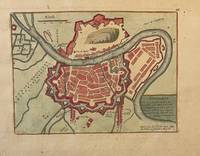
Cartography Grenoble France Grenoble ville considerable Capitale du Dauphine . riviere d'Isere Paris chez le Sr. de fer dans l'Isle du Palais a la Sphere Royale published ca. 1730 1 p.
Original map of Grenoble France. Later colored with the river Iser les Recolets Tour de Natot Porte de Beaune.Engraving with later hand coloring on laid paper in good condition. Total size 270 x 390 mm. Numbered with 46 in the right top.NL Decoratieve historische kaart van Grenoble in Frankrijk. unknown
Referenz des Buchhändlers : PR121919-036
|
|
|
Fer, de Nicolaas
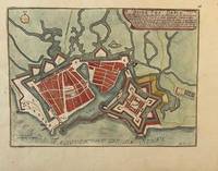
Cartography Le Havre France Havre de Grace . avec une tres belle Citadelle . riviere de Seine made by Nicolas de Fer 1646-1720 published ca. 1730 1 p.
Original map of Le Havre in North of France. Later colored with citadelle la Corderie Fontaine Bassin des Capucins and compass.Engraving with later hand coloring on laid paper in good condition. Total size 280 x 380 mm. Numbered with 26 in the right top.NL Decoratieve historische kaart van Havre de Grâce de vroegere naam van het huidige Le Havre gelegen aan de monding van de Seine in Normandië Frankrijk. Komt waarschijnlijk uit de atlas Les Forces de L'Europe van Nicolas de Fer een bekende Franse cartograaf. Le Havre werd in 1517 gesticht door Frans I als strategische haven. De kaart toont een versterkt Le Havre zoals het eruitzag tijdens de 17e18e eeuw toen de stad een belangrijk militair en handelscentrum was. De citadel werd aangelegd om de monding van de Seine te verdedigen tegen Engelse invallen. unknown
Referenz des Buchhändlers : PR121919-035
|
|
|
Fer, de Nicolaus
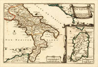
Le Royaume de Naples - Par N. de Fer. Geographie de Monseigneur le Dauphin. A Paris chez lÂ’Auteur sur le Quay de lÂ’Orloge ala Sphere Royale. Avec Privilege du Roy 1705. Fer de – Kingdom of Naples · Copper Engraving Hand Colored · Introduction à la Géographie Paris · 1705
Paris: N. de Fer 1705. Other. In excellent condition. 223 by 335mm 8 by 13 inches. 223 by 335mm 8 by 13 inches. Original antique hand-colored copper engraving published 1705. Depicting Kingdom of Naples this map is a fine example of 0s European cartography. Image: 223 by 335mm 8 by 13 inches. An attractive and historically significant 18th-century map for the discerning collector. Nicolas de Fer 16461720 was a prominent French cartographer engraver and publisher based in Paris. After inheriting his father's mapmaking business de Fer built it into one of the most productive cartographic firms in France eventually becoming Geographer to King Louis XIV of France and King Philip V of Spain. His output was prolificmore than 600 sheet maps town plans and atlasescovering Europe the Americas and beyond. De Fer's maps are known for their decorative cartouches attractive hand coloring and commercial appeal though they were sometimes criticized for prioritizing artistry over accuracy. His maps are particularly associated with the campaigns of the War of the Spanish Succession and are sought by collectors for their decorative quality.This decorative map show the Southern part of Italy with Sicily. Inside the map are many place names rivers mountains etc. engraved. In the upper right corner we see the title cartouche. In the lower right corner we see an inset map which shows the island Sardinia. At the bottom are two mileage scales.A fine example from Introduction à la Géographie Paris sought after by collectors of antique maps of Italy antique maps of Kingdom of Naples and antique hand-colored copper engravings for sale. In very good condition. Light age-toning to the sheet as expected for a 18th-century map. N. de Fer unknown
Referenz des Buchhändlers : 15703
|
|
|
Fer, de Nicolaus
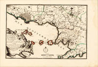
Les Environs De la Ville De Naples Dans la Province de Labour avec la Routte de cette Ville a Rome Par N. de Fer. Fer de – Kingdom of Naples · Copper Engraving Hand Colored · Introduction à la Géographie Paris · 1700
Paris: N. de Fer 1700-05. Other. Full margins as published. In excellent condition. 233 by 343mm 9 by 13 inches. 233 by 343mm 9 by 13 inches. Original antique hand-colored copper engraving published 1700. Depicting Kingdom of Naples this map is a fine example of 0s European cartography. Image: 233 by 343mm 9 by 13 inches. An attractive and historically significant 18th-century map for the discerning collector. Nicolas de Fer 16461720 was a prominent French cartographer engraver and publisher based in Paris. After inheriting his father's mapmaking business de Fer built it into one of the most productive cartographic firms in France eventually becoming Geographer to King Louis XIV of France and King Philip V of Spain. His output was prolificmore than 600 sheet maps town plans and atlasescovering Europe the Americas and beyond. De Fer's maps are known for their decorative cartouches attractive hand coloring and commercial appeal though they were sometimes criticized for prioritizing artistry over accuracy. His maps are particularly associated with the campaigns of the War of the Spanish Succession and are sought by collectors for their decorative quality.This hand-colored copper engraving map of Kingdom of Naples published 1700 exemplifies the cartographic tradition of 1700s Europe. The map is engraved with careful attention to topographic detail depicting towns rivers mountain ranges and political boundaries with the precision expected of the finest cartographic productions of the period. The hand coloring highlights the geographic features and political divisions of Kingdom of Naples making this an attractive piece for both the collector and the scholar.A fine example from Introduction à la Géographie Paris sought after by collectors of antique maps of Italy antique maps of Kingdom of Naples and antique hand-colored copper engravings for sale. In very good condition. Light age-toning to the sheet as expected for a 18th-century map. N. de Fer unknown
Referenz des Buchhändlers : 15700
|
|
|
Fer, de Nicolaus
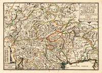
Les Eveschés De Trente et de Brixen. Le Comté de Tirol et les Etats de la Republique de Venise dans le Fond du Golfe. Par N. de Fer Geographe de Sa Maiesté Catolique et de Monseigr. le Dauphin. Fer de – Tyrol & Trentino · Copper Engraving Hand Colored · Introduction à la Géographie Paris · 1705
Paris: N. de Fer 1705. Other. Full margins as published. 252 by 352mm 10 by 13 inches. 252 by 352mm 10 by 13 inches. Original antique hand-colored copper engraving published 1705. Depicting Tyrol & Trentino this map is a fine example of 0s European cartography. Image: 252 by 352mm 10 by 13 inches. An attractive and historically significant 18th-century map for the discerning collector. Nicolas de Fer 16461720 was a prominent French cartographer engraver and publisher based in Paris. After inheriting his father's mapmaking business de Fer built it into one of the most productive cartographic firms in France eventually becoming Geographer to King Louis XIV of France and King Philip V of Spain. His output was prolificmore than 600 sheet maps town plans and atlasescovering Europe the Americas and beyond. De Fer's maps are known for their decorative cartouches attractive hand coloring and commercial appeal though they were sometimes criticized for prioritizing artistry over accuracy. His maps are particularly associated with the campaigns of the War of the Spanish Succession and are sought by collectors for their decorative quality.Ornated in the lower left corner with a small milage scale.A fine example from Introduction à la Géographie Paris sought after by collectors of antique maps of Italy antique maps of Tyrol and antique hand-colored copper engravings for sale. In very good condition. Light age-toning to the sheet as expected for a 18th-century map. N. de Fer unknown
Referenz des Buchhändlers : 15715
|
|
|
Fer, N[icholas] de
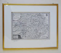
Landkarte - Les XIII cantons des Suisse. Leurs alliez et leurs sujets. Kupferstich C. Inselin sculp. à Paris.
1705. Rahmengrösse: 39 x 48 24 x 33 cm Goldrahmen u. Passepartout tadell. Nicolas de Fer 1646 -1720 in Paris einer der führenden französischen Kartographen und Kartenverleger schuf zahlreiche Atlanten und spezialisierte sich auf die Veröffentlichung von Drucken zu aktuellen Ereignissen: Karten von Grenzverläufen oder neueroberten Gebieten sowie Karten von Städten die vom französischen Festungsbaumeister Vauban ausgebaut wurden. 600 1705 unknown
Referenz des Buchhändlers : 59235
|
|
|
Fer, N[icolaus] de
Les Environs de VIENNE En Autriche. Kupferstichplan.
Paris 1705. Wien - Plangröße: 50 x 165 cm rechter weißer Rand schmal beschnitten ob. Rand etwas ausgefranst mittl. Bugfalte schwach gebr. Ansicht des Donaulaufs von Krems bis Pressburg Wien und Pressburg ringbefestigt. Paris 1705. unknown
Referenz des Buchhändlers : KART0070
|
|
|
Fer, Nicholas de; Nicolas de Fer (1646 - 1720)
Album of City Plans and Views mainly by Nicolas de Fer. Turin Endingen Mont Royal Mayence Ath Pignerol Mont-Melian Landau Casal Verceil Genève Maestricht Huningue Nice Charle-Roy Bonn Calais Coblentz Stetin Juliers Wismar Mons Verüe Berg S. Winox Kamieniec Podolski Donquerque Coni Montmélian Miolans Verue Verrua Savoia Parma. First edition.
Paris: Nicolas de Fer circa 1693. 4to. 23 x 29cm. 18th Century rose cardboard covers. 33 engraved views and plans and 2 hand-drawn plans of Versoi and the col of Grand-Saint-Bernard showing Saint-Rhémy et San Leonardo. Old manuscript table of contents. Most of the plates are 17th Century but 2 are 18th Century. Small losses and browning to most plates.Nicholas de Fer 1646 – 1720 was the son of cartographer Antoine de Fer. Nicholas was established as an engraver cartographer and map publisher in Paris with over 600 maps and atlases to his credit. His work earned a large following because of its considerable decorative appeal. In the late 17th century de Fer’s career culminated in his appointment as Geographer to the King of France. Upon his death in 1720 Nicolas was succeeded by two of his sons-in-law Guillaume Danet and Jacques-François Danet and their heirs who continued the de Fer publishing firm until c. 1760. Recueil de 35 cartes plans et vues de villes fortifiées gravées sur cuivre 33 et manuscrites 2. S.l.n.d. Paris 1693 e.a. In-4 oblong cartonnage rose pièce de titre manuscrite Reliure vers 1800.Le présent ensemble contient :– 27 cartes et plans de villes fortifiées extraites pour la plupart de l'atlas de Nicolas de Fer 1693 montrant Turin Endingen Mont Royal Mayence Ath Pignerol Mont-Melian Landau Casal Verceil Genève Maestricht Huningue Nice Charle-Roy Bonn Calais Coblentz Stetin Juliers Wismar Mons Verüe Berg S. Winox Kamieniec Podolski Donquerque Coni ;– 4 vues gravées de Montmélian Miolans Verue Verrua Savoia et du siège de Genève ;– 2 planches manuscrites : un plan de Versoi et une carte du col du Grand-Saint-Bernard montrant Saint-Rhémy et San Leonardo ;– 2 petites planches gravées postérieures.Exemplaire défraîchi : cartes jaunies présentant parfois des restaurations ; petits manques marginaux à quelques cartes quelques rousseurs et taches d'encre. Paris: Nicolas de Fer, circa 1693. unknown
Referenz des Buchhändlers : 51-3483
|
|
|
FER, Nicholas de
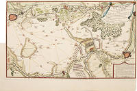
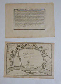
PLAN DES RETRANCHEMENS AT DU CAMP DE DENAIN
Paris. 1717. Detailed map of a battle in the July of 1712 with troop placementsand positions on the map. An explanation of the battle at lower right. Accompanying text on reverse. Published in de Fer's Atlas Curieux ou Le Monde. Copper engraving. Very good condition. Upper left top and right hand margin have been trimmed close to edge of plate Later colouring. Size: 52.5 x 31 cm. unknown
Referenz des Buchhändlers : 52957
|
|
|
FER, Nicolas de
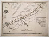
Capitainerie garde-coste de Dunquerque et partie de celle de Sangatte
Map. Engraving with original hand coloring. Image measures 8.75" x 12".<br/> <br/> This charming map of Dunkirk shows the city as it sits on the coast of the southernmost part of the North Sea here labeled as the Sea of Flanders. Working circa 1705 De Fer has represented the city with a schematized drawing of its exterior walls. Canals connecting the city to nearby towns and churches are also depicted and labeled. Sand bars are drawn and mountains are represented pictorically and a decorative compass rose at the upper left points due north. The map is in very good condition with no chips or tears and minor staining. Nicolas de Fer 1646-1720 was a French cartographer engraver and publisher. He became official geographer to the French Dauphin 1691 and to the Spanish King 1702 and was renowned particularly for his maps of the French coast of which this is a fine example.<br/> <br/> unknown
Referenz des Buchhändlers : 239457
|
|
|
Fer, Nicolas de (1646 - 1720, Paris)
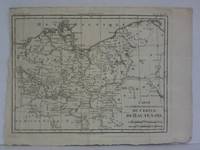
Carte de la Partie Septentrionale du Cercle de Haute Saxe - Karte im Kupferstich
um 1700. Maße: ca. 327 x 25 cm mehrfach gefaltet gering fleckig/Blatt mit kleinen Randläsuren. unknown
Referenz des Buchhändlers : 1841aa
|
|
|
FER, Nicolas de
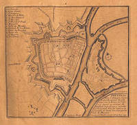
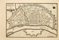
COLOGNE Ville considerable située sur la bord Occidentall du Rhein
Atlas Curieux ou le Monde. Paris 1717. Plan of Cologne with north to the right showing fortifications and old town. Title at top left. Includes accompanying text Copper engraving. Excellent condition good margins. Uncoloured. Size: 34.8 x 24 cm. 13½ x 9½ inches unknown
Referenz des Buchhändlers : 53083
|
|
|
FER, Nicolas de
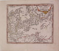
Dane Marq et Sud-Gothlande
Paris: de Fer Nicolas 1725. unbound. very good. Map. Engraving with modern hand coloring. Image measures 5.25" x 6.25".<br/> <br/> Charming miniature map of Denmark with the Coat of Arms incorporated in the cartouche. Map includes both Schleswig and Holstein while today part of the former and all of the latter are northern Germany. Nicolas de Fer 1646-1720 was a French cartographer engraver and publisher. He became official geographer to the French Dauphin 1691 and to the Spanish King 1702.<br/> <br/> de Fer, Nicolas unknown
Referenz des Buchhändlers : 204942
|
|
|
Fer, Nicolas de (1646 - 1720); Pieter Starckman (fl c 1680 - 1730), aka Peter or Petrus, engraver a k a
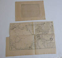
Description de ce qui c'est passé à la journée de Denain le 24 juillet 1712. par N. de Fer. with Pan des retranchemens et du camp de Denain ou est marqué le passage de l’armée du Roy a Neuville sur l’Escaut : Avec la disposition des troupes françoises a l’attaque de ses retranchemens qui furent forcez le 24 juillet 1712. First edition of the map and text.
Paris: chez l'auteur dans l'Isle du Palais sur le quay de l'orloge a la Sphére Royale avec privilége du Roy 1715. Engraved text broadside 27.3 x 38cm. and engraved map 38 x 57cm. Top left trimmed to borderline. Contemporary laid paper uniformly time aged.Published in "L'atlas curieux ou Le monde reÌpreseÌnteÌ dans des cartes geÌneÌrales et particulieres du ciel et de la terre : diviseÌ tant en ses quatre principales parties que par eÌtats et provinces et orneÌ par des plans et descriptions des villes capitales et principales et des plus superbes edifices qui les embelissent comme sont les eglises les palais les maisons de plaisance les iardins les fontaines &c. ". OCLC Number / Unique Identifier:79022119.LThe Atlas Curieux is geographic encyclopedia of images and maps of France with detailed views of the grand waterworks at Marly views of the great palaces and chateaux views and plans of the Paris Observatory and samples of military architecture. Issued in six annual parts from 1700-1705 the maps are based on the new observations of the Académie des Sciences and drawn up with the assistance of Philipe de La Hire.Library of Congress:The French cartographer and engraver Nicolas de Fer was a master at creating maps that were works of art. The maps that he published were printed during the Baroque period when the decorative arts were characterized by ornate detail. De Fer’s detailed maps and atlases were valued more for their decorative content than their geographical accuracy.Nicolas de Fer was born in 1646. His father Antoine de Fer owned a mapmaking firm. At the age of twelve Nicolas was apprenticed to a Parisian engraver named Louis Spirinx. The family business was starting to decline when his father died in 1673. Nicolas de Fer’s mother Genevieve took over the business after the death of her husband. In 1687 the business was passed on to Nicolas and the profits increased after he took over the firm. Nicolas de Fer was a prolific cartographer who produced atlases and hundreds of single maps. He eventually became the official geographer to King Louis XIV of France and King Philip V of Spain.One of de Fer’s major works is an atlas titled L’atlas curieux The curious atlas. Paris: chez l'auteur dans l'Isle du Palais sur le quay de l'orloge a la Sphére Royale avec privilége du Roy, 1715 unknown
Referenz des Buchhändlers : 51-6443
|
|
|
Fer, Nicolas de (1646 - 1720); Pieter Starckman (fl c 1680 - 1730), aka Peter or Petrus, engraver a k a
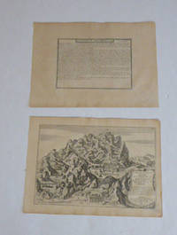
Description de Mont-Serrat and Maison et Chambre Angelique de la Vierge Marie de Mont-Serrat Situee en Catalogne a Sept lieues et au Nord de Barcelone . . . 1705. Par N. de Fer. First edition of the map and text.
Paris: chez l'auteur dans l'Isle du Palais sur le quay de l'orloge a la Sphére Royale avec privilége du Roy 1705-1717. Engraved text broadside and engraved map.Each 27.3 x 38cm. Contemporary laid paper uniformly time aged.Published in "L'atlas curieux ou le monde reÌpreseÌnteÌ dans des cartes geÌneÌrales et particulieres du ciel et de la terre : diviseÌ tant en ses quatre principales parties que par eÌtats et provinces et orneÌ par des plans et descriptions des villes capitales et principales et des plus superbes edifices qui les embelissent comme sont les eglises les palais les maisons de plaisance les iardins les fontaines &c. ". OCLC Number / Unique Identifier:79022119.LThe Atlas Curieux is geographic encyclopedia of images and maps of France with detailed views of the grand waterworks at Marly views of the great palaces and chateaux views and plans of the Paris Observatory and samples of military architecture. Issued in six annual parts from 1700-1705 the maps are based on the new observations of the Académie des Sciences and drawn up with the assistance of Philipe de La Hire.Library of Congress:The French cartographer and engraver Nicolas de Fer was a master at creating maps that were works of art. The maps that he published were printed during the Baroque period when the decorative arts were characterized by ornate detail. De Fer’s detailed maps and atlases were valued more for their decorative content than their geographical accuracy.Nicolas de Fer was born in 1646. His father Antoine de Fer owned a mapmaking firm. At the age of twelve Nicolas was apprenticed to a Parisian engraver named Louis Spirinx. The family business was starting to decline when his father died in 1673. Nicolas de Fer’s mother Genevieve took over the business after the death of her husband. In 1687 the business was passed on to Nicolas and the profits increased after he took over the firm. Nicolas de Fer was a prolific cartographer who produced atlases and hundreds of single maps. He eventually became the official geographer to King Louis XIV of France and King Philip V of Spain.One of de Fer’s major works is an atlas titled L’atlas curieux The curious atlas. Paris: chez l'auteur dans l'Isle du Palais sur le quay de l'orloge a la Sphére Royale avec privilége du Roy, 1705-1717 unknown
Referenz des Buchhändlers : 51-6469
|
|
|
Fer, Nicolas de (1646 - 1720); Antoine Coquart, (1668-1707), engraver
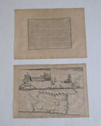
Description de La Ville de Lisbonne and Three Views of Lisbon/ Par N. de Fer. First edition of the map and text.
Paris: chez l'auteur dans l'Isle du Palais sur le quay de l'orloge a la Sphére Royale avec privilége du Roy 1705-1717. Engraved text broadside and engraved map.Each 27.3 x 38cm. Contemporary laid paper uniformly time aged.Map of the fortifications of Lisbon with the city divided into its Old and New Towns. The citadel of the city is prominently marked. Features two views of the Royal Palace and Belem Tower respectively.This map was published during the War of the Spanish Succession a conflict in which Portugal and Lisbon featured prominent hence the depiction of the fortifications of the city.Published in "L'atlas curieux ou le monde reÌpreseÌnteÌ dans des cartes geÌneÌrales et particulieres du ciel et de la terre : diviseÌ tant en ses quatre principales parties que par eÌtats et provinces et orneÌ par des plans et descriptions des villes capitales et principales et des plus superbes edifices qui les embelissent comme sont les eglises les palais les maisons de plaisance les iardins les fontaines &c. ". OCLC Number / Unique Identifier:79022119.LThe Atlas Curieux is geographic encyclopedia of images and maps of France with detailed views of the grand waterworks at Marly views of the great palaces and chateaux views and plans of the Paris Observatory and samples of military architecture. Issued in six annual parts from 1700-1705 the maps are based on the new observations of the Académie des Sciences and drawn up with the assistance of Philipe de La Hire.Library of Congress:The French cartographer and engraver Nicolas de Fer was a master at creating maps that were works of art. The maps that he published were printed during the Baroque period when the decorative arts were characterized by ornate detail. De Fer’s detailed maps and atlases were valued more for their decorative content than their geographical accuracy.Nicolas de Fer was born in 1646. His father Antoine de Fer owned a mapmaking firm. At the age of twelve Nicolas was apprenticed to a Parisian engraver named Louis Spirinx. The family business was starting to decline when his father died in 1673. Nicolas de Fer’s mother Genevieve took over the business after the death of her husband. In 1687 the business was passed on to Nicolas and the profits increased after he took over the firm. Nicolas de Fer was a prolific cartographer who produced atlases and hundreds of single maps. He eventually became the official geographer to King Louis XIV of France and King Philip V of Spain.One of de Fer’s major works is an atlas titled L’atlas curieux The curious atlas. Paris: chez l'auteur dans l'Isle du Palais sur le quay de l'orloge a la Sphére Royale avec privilége du Roy, 1705-1717 unknown
Referenz des Buchhändlers : 51-6472
|
|
|
Fer, Nicolas de (1646 - 1720); Pieter Starckman (fl c 1680 - 1730), aka Peter or Petrus, engraver a k a
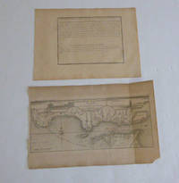
Description de L'Embouchure de la Rivière du Tage and Embouchure de la Rivière du Tage / Par N. de Fer Geographe de sa Majesté Catholique . . . Par N. de Fer. First edition of the map and text.
Paris: chez l'auteur dans l'Isle du Palais sur le quay de l'orloge a la Sphére Royale avec privilége du Roy 1705-1717. Engraved text broadside and engraved map.27.3 x 38cm. and 27.3 x 43cm. Missing piece in lower right corner. Fold mark on right side. Contemporary laid paper uniformly time aged.The Tagus is the longest river in the Iberian Peninsula. The river rises in the Montes Universales between Cuenca and Teruel in mid-eastern Spain flows 1007 km generally westward and empties into the Atlantic Ocean in Lisbon.Published in "L'atlas curieux ou le monde reÌpreseÌnteÌ dans des cartes geÌneÌrales et particulieres du ciel et de la terre : diviseÌ tant en ses quatre principales parties que par eÌtats et provinces et orneÌ par des plans et descriptions des villes capitales et principales et des plus superbes edifices qui les embelissent comme sont les eglises les palais les maisons de plaisance les iardins les fontaines &c. ". OCLC Number / Unique Identifier:79022119.LThe Atlas Curieux is geographic encyclopedia of images and maps of France with detailed views of the grand waterworks at Marly views of the great palaces and chateaux views and plans of the Paris Observatory and samples of military architecture. Issued in six annual parts from 1700-1705 the maps are based on the new observations of the Académie des Sciences and drawn up with the assistance of Philipe de La Hire.Library of Congress:The French cartographer and engraver Nicolas de Fer was a master at creating maps that were works of art. The maps that he published were printed during the Baroque period when the decorative arts were characterized by ornate detail. De Fer’s detailed maps and atlases were valued more for their decorative content than their geographical accuracy.Nicolas de Fer was born in 1646. His father Antoine de Fer owned a mapmaking firm. At the age of twelve Nicolas was apprenticed to a Parisian engraver named Louis Spirinx. The family business was starting to decline when his father died in 1673. Nicolas de Fer’s mother Genevieve took over the business after the death of her husband. In 1687 the business was passed on to Nicolas and the profits increased after he took over the firm. Nicolas de Fer was a prolific cartographer who produced atlases and hundreds of single maps. He eventually became the official geographer to King Louis XIV of France and King Philip V of Spain.One of de Fer’s major works is an atlas titled L’atlas curieux The curious atlas. Paris: chez l'auteur dans l'Isle du Palais sur le quay de l'orloge a la Sphére Royale avec privilége du Roy, 1705-1717 unknown
Referenz des Buchhändlers : 51-6470
|
|
|
Fer, Nicolas de (1646 - 1720)
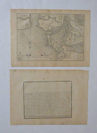
Description de La Ville de Cremone Cremona Italy and Plan de La Ville De Cremone . . .1705. Par N. de Fer. First edition of the map.
Paris: chez l'auteur dans l'Isle du Palais sur le quay de l'orloge a la Sphére Royale avec privilége du Roy 1705-1717. Engraved text broadside and map. Each 27.3 x 38cm. Contemporary laid paper uniformly time aged.This detailed map shows the vicinity of Milan and the important network of canals. The Naviglio Canal shown here connecting Lake Maggiore with Milan was the first artificial canal in Europe probably originating as a defensive ditch dug in the 12th century. It was one of the largest post-medieval engineering projects allowing development of commerce transport and agriculture in the region. Prominently depicted within a large area north of Pavia is the Enclos des Chartreux Certosa di Pavia monastery located within a large hunting park that belonged to the Visconti family of Milan.Evora is the capital of the province of Alentejo east of Lisbon It was captured by the Romans in 80 BC and has a Roman aqueduct and temple of Diana the goddess of hunting. There is also a 13th-century Gothic cathedral. From the 14th to the 16th centuries Evora was the residence of the Kings of Portugal.This map was published during the War of the Spanish Succession a conflict in which Portugal and Lisbon featured prominent hence the depiction of the fortifications of the city.Published in "L'atlas curieux ou le monde reÌpreseÌnteÌ dans des cartes geÌneÌrales et particulieres du ciel et de la terre : diviseÌ tant en ses quatre principales parties que par eÌtats et provinces et orneÌ par des plans et descriptions des villes capitales et principales et des plus superbes edifices qui les embelissent comme sont les eglises les palais les maisons de plaisance les iardins les fontaines &c. ". OCLC Number / Unique Identifier:79022119.LThe Atlas Curieux is geographic encyclopedia of images and maps of France with detailed views of the grand waterworks at Marly views of the great palaces and chateaux views and plans of the Paris Observatory and samples of military architecture. Issued in six annual parts from 1700-1705 the maps are based on the new observations of the Académie des Sciences and drawn up with the assistance of Philipe de La Hire.Library of Congress:The French cartographer and engraver Nicolas de Fer was a master at creating maps that were works of art. The maps that he published were printed during the Baroque period when the decorative arts were characterized by ornate detail. De Fer’s detailed maps and atlases were valued more for their decorative content than their geographical accuracy.Nicolas de Fer was born in 1646. His father Antoine de Fer owned a mapmaking firm. At the age of twelve Nicolas was apprenticed to a Parisian engraver named Louis Spirinx. The family business was starting to decline when his father died in 1673. Nicolas de Fer’s mother Genevieve took over the business after the death of her husband. In 1687 the business was passed on to Nicolas and the profits increased after he took over the firm. Nicolas de Fer was a prolific cartographer who produced atlases and hundreds of single maps. He eventually became the official geographer to King Louis XIV of France and King Philip V of Spain.One of de Fer’s major works is an atlas titled L’atlas curieux The curious atlas. Paris: chez l'auteur dans l'Isle du Palais sur le quay de l'orloge a la Sphére Royale avec privilége du Roy, 1705-1717 unknown
Referenz des Buchhändlers : 51-6477
|
|
|
Fer, Nicolas de (1646 - 1720); Pieter Starckman (fl c 1680 - 1730), aka Peter or Petrus, engraver a k a
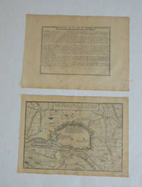
Description de la Ville de Straalsund and Plan de Straalsund. Par N. de Fer. First edition of the map and text.
Paris: chez l'auteur dans l'Isle du Palais sur le quay de l'orloge a la Sphére Royale avec privilége du Roy 1705-1717. Engraved text broadside and engraved map.Each 27.3 x 38cm. Contemporary laid paper uniformly time aged.Published in "L'atlas curieux ou le monde reÌpreseÌnteÌ dans des cartes geÌneÌrales et particulieres du ciel et de la terre : diviseÌ tant en ses quatre principales parties que par eÌtats et provinces et orneÌ par des plans et descriptions des villes capitales et principales et des plus superbes edifices qui les embelissent comme sont les eglises les palais les maisons de plaisance les iardins les fontaines &c. ". OCLC Number / Unique Identifier:79022119.LThe Atlas Curieux is geographic encyclopedia of images and maps of France with detailed views of the grand waterworks at Marly views of the great palaces and chateaux views and plans of the Paris Observatory and samples of military architecture. Issued in six annual parts from 1700-1705 the maps are based on the new observations of the Académie des Sciences and drawn up with the assistance of Philipe de La Hire.Library of Congress:The French cartographer and engraver Nicolas de Fer was a master at creating maps that were works of art. The maps that he published were printed during the Baroque period when the decorative arts were characterized by ornate detail. De Fer’s detailed maps and atlases were valued more for their decorative content than their geographical accuracy.Nicolas de Fer was born in 1646. His father Antoine de Fer owned a mapmaking firm. At the age of twelve Nicolas was apprenticed to a Parisian engraver named Louis Spirinx. The family business was starting to decline when his father died in 1673. Nicolas de Fer’s mother Genevieve took over the business after the death of her husband. In 1687 the business was passed on to Nicolas and the profits increased after he took over the firm. Nicolas de Fer was a prolific cartographer who produced atlases and hundreds of single maps. He eventually became the official geographer to King Louis XIV of France and King Philip V of Spain.One of de Fer’s major works is an atlas titled L’atlas curieux The curious atlas. Paris: chez l'auteur dans l'Isle du Palais sur le quay de l'orloge a la Sphére Royale avec privilége du Roy, 1705-1717 unknown
Referenz des Buchhändlers : 51-6466
|
|
|
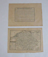
Fer, Nicolas de (1646 - 1720); Pieter Starckman (fl c 1680 - 1730), aka Peter or Petrus, engraver a k a
Description de L'Allemagne with L'Allemagne divisé par Cercles. par N. de Fer. First edition of the map and text.
Paris: chez l'auteur dans l'Isle du Palais sur le quay de l'orloge a la Sphére Royale avec privilége du Roy 1705-1717. Engraved text broadside and engraved map.Each 27.3 x 38cm. Contemporary laid paper uniformly time aged.Published in "L'atlas curieux ou Le monde reÌpreseÌnteÌ dans des cartes geÌneÌrales et particulieres du ciel et de la terre : diviseÌ tant en ses quatre principales parties que par eÌtats et provinces et orneÌ par des plans et descriptions des villes capitales et principales et des plus superbes edifices qui les embelissent comme sont les eglises les palais les maisons de plaisance les iardins les fontaines &c. ". OCLC Number / Unique Identifier:79022119.LThe Atlas Curieux is geographic encyclopedia of images and maps of France with detailed views of the grand waterworks at Marly views of the great palaces and chateaux views and plans of the Paris Observatory and samples of military architecture. Issued in six annual parts from 1700-1705 the maps are based on the new observations of the Académie des Sciences and drawn up with the assistance of Philipe de La Hire.ibrary of Congress:The French cartographer and engraver Nicolas de Fer was a master at creating maps that were works of art. The maps that he published were printed during the Baroque period when the decorative arts were characterized by ornate detail. De Fer’s detailed maps and atlases were valued more for their decorative content than their geographical accuracy.Nicolas de Fer was born in 1646. His father Antoine de Fer owned a mapmaking firm. At the age of twelve Nicolas was apprenticed to a Parisian engraver named Louis Spirinx. The family business was starting to decline when his father died in 1673. Nicolas de Fer’s mother Genevieve took over the business after the death of her husband. In 1687 the business was passed on to Nicolas and the profits increased after he took over the firm. Nicolas de Fer was a prolific cartographer who produced atlases and hundreds of single maps. He eventually became the official geographer to King Louis XIV of France and King Philip V of Spain.One of de Fer’s major works is an atlas titled L’atlas curieux The curious atlas. Paris: chez l'auteur dans l'Isle du Palais sur le quay de l'orloge a la Sphére Royale avec privilége du Roy, 1705-1717 unknown
Referenz des Buchhändlers : 51-6450
|
|
|
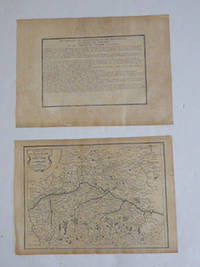
Fer, Nicolas de (1646 - 1720); Pieter Starckman (fl c 1680 - 1730), aka Peter or Petrus, engraver a k a
Description de l'Electorat Duché Palatinat et Cercle de Baviere et du Cercle de Souabe and Cercle Baviere. Par N. de Fer. First edition of the map and text.
Paris: chez l'auteur dans l'Isle du Palais sur le quay de l'orloge a la Sphére Royale avec privilége du Roy 1705-1717. Engraved text broadside and engraved map.Each 27.3 x 38cm. Contemporary laid paper uniformly time aged.Published in "L'atlas curieux ou le monde reÌpreseÌnteÌ dans des cartes geÌneÌrales et particulieres du ciel et de la terre : diviseÌ tant en ses quatre principales parties que par eÌtats et provinces et orneÌ par des plans et descriptions des villes capitales et principales et des plus superbes edifices qui les embelissent comme sont les eglises les palais les maisons de plaisance les iardins les fontaines &c. ". OCLC Number / Unique Identifier:79022119.LThe Atlas Curieux is geographic encyclopedia of images and maps of France with detailed views of the grand waterworks at Marly views of the great palaces and chateaux views and plans of the Paris Observatory and samples of military architecture. Issued in six annual parts from 1700-1705 the maps are based on the new observations of the Académie des Sciences and drawn up with the assistance of Philipe de La Hire.ibrary of Congress:The French cartographer and engraver Nicolas de Fer was a master at creating maps that were works of art. The maps that he published were printed during the Baroque period when the decorative arts were characterized by ornate detail. De Fer’s detailed maps and atlases were valued more for their decorative content than their geographical accuracy.Nicolas de Fer was born in 1646. His father Antoine de Fer owned a mapmaking firm. At the age of twelve Nicolas was apprenticed to a Parisian engraver named Louis Spirinx. The family business was starting to decline when his father died in 1673. Nicolas de Fer’s mother Genevieve took over the business after the death of her husband. In 1687 the business was passed on to Nicolas and the profits increased after he took over the firm. Nicolas de Fer was a prolific cartographer who produced atlases and hundreds of single maps. He eventually became the official geographer to King Louis XIV of France and King Philip V of Spain.One of de Fer’s major works is an atlas titled L’atlas curieux The curious atlas. Paris: chez l'auteur dans l'Isle du Palais sur le quay de l'orloge a la Sphére Royale avec privilége du Roy, 1705-1717 unknown
Referenz des Buchhändlers : 51-6464
|
|
|
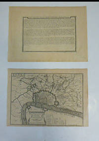
Fer, Nicolas de (1646 - 1720); Pieter Starckman (fl c 1680 - 1730), aka Peter or Petrus, engraver a k a
Description de la Ville d'Anvers. Par N. de Fer. 1704 and Anvers : Le Marquisat Du St. Empire Consistant en la Seule Ville D'Anvers et son Territoire qui fait une des Provinces des Pais Bas au Roy d'Espagne : Avec Privilege du Roy. 1705. First edition of the map and broadside.
Paris: chez l'auteur dans l'Isle du Palais sur le quay de l'orloge a la Sphére Royale avec privilége du Roy 1705-1717. Engraved broadside and engraved map. Each 27.3 x 38cm. Contemporary laid paper uniformly time aged.OCLC Number / Unique Identifier:159878703.Published in "L'atlas curieux ou le monde reÌpreseÌnteÌ dans des cartes geÌneÌrales et particulieres du ciel et de la terre : diviseÌ tant en ses quatre principales parties que par eÌtats et provinces et orneÌ par des plans et descriptions des villes capitales et principales et des plus superbes edifices qui les embelissent comme sont les eglises les palais les maisons de plaisance les iardins les fontaines &c. ". OCLC Number / Unique Identifier:79022119.LThe Atlas Curieux is geographic encyclopedia of images and maps of France with detailed views of the grand waterworks at Marly views of the great palaces and chateaux views and plans of the Paris Observatory and samples of military architecture. Issued in six annual parts from 1700-1705 the maps are based on the new observations of the Académie des Sciences and drawn up with the assistance of Philipe de La Hire.ibrary of Congress:The French cartographer and engraver Nicolas de Fer was a master at creating maps that were works of art. The maps that he published were printed during the Baroque period when the decorative arts were characterized by ornate detail. De Fer’s detailed maps and atlases were valued more for their decorative content than their geographical accuracy.Nicolas de Fer was born in 1646. His father Antoine de Fer owned a mapmaking firm. At the age of twelve Nicolas was apprenticed to a Parisian engraver named Louis Spirinx. The family business was starting to decline when his father died in 1673. Nicolas de Fer’s mother Genevieve took over the business after the death of her husband. In 1687 the business was passed on to Nicolas and the profits increased after he took over the firm. Nicolas de Fer was a prolific cartographer who produced atlases and hundreds of single maps. He eventually became the official geographer to King Louis XIV of France and King Philip V of Spain.One of de Fer’s major works is an atlas titled L’atlas curieux The curious atlas. Paris: chez l'auteur dans l'Isle du Palais sur le quay de l'orloge a la Sphére Royale avec privilége du Roy, 1705-1717 unknown
Referenz des Buchhändlers : 51-6462
|
|
|
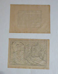
Fer, Nicolas de (1646 - 1720); Charles Inselin, (1673-17.)., engraver
Description des Estats de Milan and Frontières du Milanez du Cremoneses et du Lodesan. Le Bergamas le Bressan et le Cremas. où sont remarquez les endroits ou les Armées des Alliez et des Imperiaux ont campez en 1701 / par N. de F. Par N. de Fer. First edition of the map.
Paris: chez l'auteur dans l'Isle du Palais sur le quay de l'orloge a la Sphére Royale avec privilége du Roy 1705-1717. Engraved text broadside and map. Each 27.3 x 38cm. Contemporary laid paper uniformly time aged.This detailed map shows the vicinity of Milan and the important network of canals. The Naviglio Canal shown here connecting Lake Maggiore with Milan was the first artificial canal in Europe probably originating as a defensive ditch dug in the 12th century. It was one of the largest post-medieval engineering projects allowing development of commerce transport and agriculture in the region. Prominently depicted within a large area north of Pavia is the Enclos des Chartreux Certosa di Pavia monastery located within a large hunting park that belonged to the Visconti family of Milan.Evora is the capital of the province of Alentejo east of Lisbon It was captured by the Romans in 80 BC and has a Roman aqueduct and temple of Diana the goddess of hunting. There is also a 13th-century Gothic cathedral. From the 14th to the 16th centuries Evora was the residence of the Kings of Portugal.This map was published during the War of the Spanish Succession a conflict in which Portugal and Lisbon featured prominent hence the depiction of the fortifications of the city.Published in "L'atlas curieux ou le monde reÌpreseÌnteÌ dans des cartes geÌneÌrales et particulieres du ciel et de la terre : diviseÌ tant en ses quatre principales parties que par eÌtats et provinces et orneÌ par des plans et descriptions des villes capitales et principales et des plus superbes edifices qui les embelissent comme sont les eglises les palais les maisons de plaisance les iardins les fontaines &c. ". OCLC Number / Unique Identifier:79022119.LThe Atlas Curieux is geographic encyclopedia of images and maps of France with detailed views of the grand waterworks at Marly views of the great palaces and chateaux views and plans of the Paris Observatory and samples of military architecture. Issued in six annual parts from 1700-1705 the maps are based on the new observations of the Académie des Sciences and drawn up with the assistance of Philipe de La Hire.Library of Congress:The French cartographer and engraver Nicolas de Fer was a master at creating maps that were works of art. The maps that he published were printed during the Baroque period when the decorative arts were characterized by ornate detail. De Fer’s detailed maps and atlases were valued more for their decorative content than their geographical accuracy.Nicolas de Fer was born in 1646. His father Antoine de Fer owned a mapmaking firm. At the age of twelve Nicolas was apprenticed to a Parisian engraver named Louis Spirinx. The family business was starting to decline when his father died in 1673. Nicolas de Fer’s mother Genevieve took over the business after the death of her husband. In 1687 the business was passed on to Nicolas and the profits increased after he took over the firm. Nicolas de Fer was a prolific cartographer who produced atlases and hundreds of single maps. He eventually became the official geographer to King Louis XIV of France and King Philip V of Spain.One of de Fer’s major works is an atlas titled L’atlas curieux The curious atlas. Paris: chez l'auteur dans l'Isle du Palais sur le quay de l'orloge a la Sphére Royale avec privilége du Roy, 1705-1717 unknown
Referenz des Buchhändlers : 51-6476
|
|
|
Fer, Nicolas de (1646 - 1720); Pieter Starckman (fl c 1680 - 1730), aka Peter or Petrus, engraver a k a
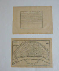
Description de la Ville de Cologne and Cologne Ville Considerable Située Sur le bord Occidental du Rhein Capit. de L'Electorate de meme nom. Par N. de Fer. First edition of the map and text.
Paris: chez l'auteur dans l'Isle du Palais sur le quay de l'orloge a la Sphére Royale avec privilége du Roy 1705-1717. Engraved text broadside and engraved map.Each 27.3 x 38cm. Contemporary laid paper uniformly time aged.Published in "L'atlas curieux ou le monde reÌpreseÌnteÌ dans des cartes geÌneÌrales et particulieres du ciel et de la terre : diviseÌ tant en ses quatre principales parties que par eÌtats et provinces et orneÌ par des plans et descriptions des villes capitales et principales et des plus superbes edifices qui les embelissent comme sont les eglises les palais les maisons de plaisance les iardins les fontaines &c. ". OCLC Number / Unique Identifier:79022119.LThe Atlas Curieux is geographic encyclopedia of images and maps of France with detailed views of the grand waterworks at Marly views of the great palaces and chateaux views and plans of the Paris Observatory and samples of military architecture. Issued in six annual parts from 1700-1705 the maps are based on the new observations of the Académie des Sciences and drawn up with the assistance of Philipe de La Hire.ibrary of Congress:The French cartographer and engraver Nicolas de Fer was a master at creating maps that were works of art. The maps that he published were printed during the Baroque period when the decorative arts were characterized by ornate detail. De Fer’s detailed maps and atlases were valued more for their decorative content than their geographical accuracy.Nicolas de Fer was born in 1646. His father Antoine de Fer owned a mapmaking firm. At the age of twelve Nicolas was apprenticed to a Parisian engraver named Louis Spirinx. The family business was starting to decline when his father died in 1673. Nicolas de Fer’s mother Genevieve took over the business after the death of her husband. In 1687 the business was passed on to Nicolas and the profits increased after he took over the firm. Nicolas de Fer was a prolific cartographer who produced atlases and hundreds of single maps. He eventually became the official geographer to King Louis XIV of France and King Philip V of Spain.One of de Fer’s major works is an atlas titled L’atlas curieux The curious atlas. Paris: chez l'auteur dans l'Isle du Palais sur le quay de l'orloge a la Sphére Royale avec privilége du Roy, 1705-1717 unknown
Referenz des Buchhändlers : 51-6460
|
|
|
Fer, Nicolas de (1646 - 1720); Pieter Starckman (fl c 1680 - 1730), aka Peter or Petrus, engraver a k a
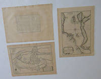
Description de Copenhague et du Detroit du Sond and Le Sund ou detroit du Sond and Copenhague. Ville Capitale du Royaume de Dannemarq et Sejour ordinaire du Roy Située dans l'Isle de Seelande au Detroit du Sond. Par N. de Fer. First edition of the maps and text.
Paris: chez l'auteur dans l'Isle du Palais sur le quay de l'orloge a la Sphére Royale avec privilége du Roy 1705-1717. Engraved text broadside and 2 engraved maps.Each 27.3 x 38cm. Contemporary laid paper uniformly time aged.Published in "L'atlas curieux ou le monde reÌpreseÌnteÌ dans des cartes geÌneÌrales et particulieres du ciel et de la terre : diviseÌ tant en ses quatre principales parties que par eÌtats et provinces et orneÌ par des plans et descriptions des villes capitales et principales et des plus superbes edifices qui les embelissent comme sont les eglises les palais les maisons de plaisance les iardins les fontaines &c. ". OCLC Number / Unique Identifier:79022119.LThe Atlas Curieux is geographic encyclopedia of images and maps of France with detailed views of the grand waterworks at Marly views of the great palaces and chateaux views and plans of the Paris Observatory and samples of military architecture. Issued in six annual parts from 1700-1705 the maps are based on the new observations of the Académie des Sciences and drawn up with the assistance of Philipe de La Hire.Library of Congress:The French cartographer and engraver Nicolas de Fer was a master at creating maps that were works of art. The maps that he published were printed during the Baroque period when the decorative arts were characterized by ornate detail. De Fer’s detailed maps and atlases were valued more for their decorative content than their geographical accuracy.Nicolas de Fer was born in 1646. His father Antoine de Fer owned a mapmaking firm. At the age of twelve Nicolas was apprenticed to a Parisian engraver named Louis Spirinx. The family business was starting to decline when his father died in 1673. Nicolas de Fer’s mother Genevieve took over the business after the death of her husband. In 1687 the business was passed on to Nicolas and the profits increased after he took over the firm. Nicolas de Fer was a prolific cartographer who produced atlases and hundreds of single maps. He eventually became the official geographer to King Louis XIV of France and King Philip V of Spain.One of de Fer’s major works is an atlas titled L’atlas curieux The curious atlas. Paris: chez l'auteur dans l'Isle du Palais sur le quay de l'orloge a la Sphére Royale avec privilége du Roy, 1705-1717 unknown
Referenz des Buchhändlers : 51-6467
|
|
|
Fer, Nicolas de (1646 - 1720); Pieter Starckman (fl c 1680 - 1730), aka Peter or Petrus, engraver a k a
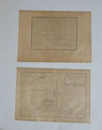
Description de La Bataille d'Almanza and Bataille d'Almanza dans le Royaume de Valence ou l'armée des allies fut deffaite par celle des deux couronnes le 25 avril 1707 / Par N. de Fer. First edition of the map and text.
Paris: chez l'auteur dans l'Isle du Palais sur le quay de l'orloge a la Sphére Royale avec privilége du Roy 1705-1717. Engraved text broadside and engraved map.Each 27.3 x 38cm. Contemporary laid paper uniformly time aged.Published in "L'atlas curieux ou le monde reÌpreseÌnteÌ dans des cartes geÌneÌrales et particulieres du ciel et de la terre : diviseÌ tant en ses quatre principales parties que par eÌtats et provinces et orneÌ par des plans et descriptions des villes capitales et principales et des plus superbes edifices qui les embelissent comme sont les eglises les palais les maisons de plaisance les iardins les fontaines &c. ". OCLC Number / Unique Identifier:79022119.LThe Atlas Curieux is geographic encyclopedia of images and maps of France with detailed views of the grand waterworks at Marly views of the great palaces and chateaux views and plans of the Paris Observatory and samples of military architecture. Issued in six annual parts from 1700-1705 the maps are based on the new observations of the Académie des Sciences and drawn up with the assistance of Philipe de La Hire.Library of Congress:The French cartographer and engraver Nicolas de Fer was a master at creating maps that were works of art. The maps that he published were printed during the Baroque period when the decorative arts were characterized by ornate detail. De Fer’s detailed maps and atlases were valued more for their decorative content than their geographical accuracy.Nicolas de Fer was born in 1646. His father Antoine de Fer owned a mapmaking firm. At the age of twelve Nicolas was apprenticed to a Parisian engraver named Louis Spirinx. The family business was starting to decline when his father died in 1673. Nicolas de Fer’s mother Genevieve took over the business after the death of her husband. In 1687 the business was passed on to Nicolas and the profits increased after he took over the firm. Nicolas de Fer was a prolific cartographer who produced atlases and hundreds of single maps. He eventually became the official geographer to King Louis XIV of France and King Philip V of Spain.One of de Fer’s major works is an atlas titled L’atlas curieux The curious atlas. Paris: chez l'auteur dans l'Isle du Palais sur le quay de l'orloge a la Sphére Royale avec privilége du Roy, 1705-1717 unknown
Referenz des Buchhändlers : 51-6471
|
|
|
Fer, Nicolas de (1646 - 1720); Pieter Starckman (fl c 1680 - 1730), aka Peter or Petrus, engraver a k a
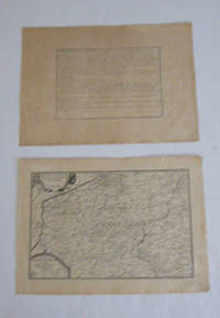
Description des Pais-Bas catholiques connus sous le nom de Flandre par N. de Fer. First edition of the map and text.
Paris: chez l'auteur dans l'Isle du Palais sur le quay de l'orloge a la Sphére Royale avec privilége du Roy 1705-1717. Engraved text broadside and engraved map.Each 27.3 x 38cm. Contemporary laid paper uniformly time aged.Published in "L'atlas curieux ou Le monde reÌpreseÌnteÌ dans des cartes geÌneÌrales et particulieres du ciel et de la terre : diviseÌ tant en ses quatre principales parties que par eÌtats et provinces et orneÌ par des plans et descriptions des villes capitales et principales et des plus superbes edifices qui les embelissent comme sont les eglises les palais les maisons de plaisance les iardins les fontaines &c. ". OCLC Number / Unique Identifier:79022119.LThe Atlas Curieux is geographic encyclopedia of images and maps of France with detailed views of the grand waterworks at Marly views of the great palaces and chateaux views and plans of the Paris Observatory and samples of military architecture. Issued in six annual parts from 1700-1705 the maps are based on the new observations of the Académie des Sciences and drawn up with the assistance of Philipe de La Hire.Library of Congress:The French cartographer and engraver Nicolas de Fer was a master at creating maps that were works of art. The maps that he published were printed during the Baroque period when the decorative arts were characterized by ornate detail. De Fer’s detailed maps and atlases were valued more for their decorative content than their geographical accuracy.Nicolas de Fer was born in 1646. His father Antoine de Fer owned a mapmaking firm. At the age of twelve Nicolas was apprenticed to a Parisian engraver named Louis Spirinx. The family business was starting to decline when his father died in 1673. Nicolas de Fer’s mother Genevieve took over the business after the death of her husband. In 1687 the business was passed on to Nicolas and the profits increased after he took over the firm. Nicolas de Fer was a prolific cartographer who produced atlases and hundreds of single maps. He eventually became the official geographer to King Louis XIV of France and King Philip V of Spain.One of de Fer’s major works is an atlas titled L’atlas curieux The curious atlas. Paris: chez l'auteur dans l'Isle du Palais sur le quay de l'orloge a la Sphére Royale avec privilége du Roy, 1705-1717 unknown
Referenz des Buchhändlers : 51-6442
|
|
|
Fer, Nicolas de (1646 - 1720); Pieter Starckman (fl c 1680 - 1730), aka Peter or Petrus, engraver a k a
Description de l'Ulm et de Munich and Plan de la Ville d'Ulm. Par N. de Fer. First edition of the map and text.
Paris: chez l'auteur dans l'Isle du Palais sur le quay de l'orloge a la Sphére Royale avec privilége du Roy 1705-1717. Engraved text broadside and engraved map.Each 27.3 x 38cm. Contemporary laid paper uniformly time aged.Published in "L'atlas curieux ou le monde reÌpreseÌnteÌ dans des cartes geÌneÌrales et particulieres du ciel et de la terre : diviseÌ tant en ses quatre principales parties que par eÌtats et provinces et orneÌ par des plans et descriptions des villes capitales et principales et des plus superbes edifices qui les embelissent comme sont les eglises les palais les maisons de plaisance les iardins les fontaines &c. ". OCLC Number / Unique Identifier:79022119.LThe Atlas Curieux is geographic encyclopedia of images and maps of France with detailed views of the grand waterworks at Marly views of the great palaces and chateaux views and plans of the Paris Observatory and samples of military architecture. Issued in six annual parts from 1700-1705 the maps are based on the new observations of the Académie des Sciences and drawn up with the assistance of Philipe de La Hire.Library of Congress:The French cartographer and engraver Nicolas de Fer was a master at creating maps that were works of art. The maps that he published were printed during the Baroque period when the decorative arts were characterized by ornate detail. De Fer’s detailed maps and atlases were valued more for their decorative content than their geographical accuracy.Nicolas de Fer was born in 1646. His father Antoine de Fer owned a mapmaking firm. At the age of twelve Nicolas was apprenticed to a Parisian engraver named Louis Spirinx. The family business was starting to decline when his father died in 1673. Nicolas de Fer’s mother Genevieve took over the business after the death of her husband. In 1687 the business was passed on to Nicolas and the profits increased after he took over the firm. Nicolas de Fer was a prolific cartographer who produced atlases and hundreds of single maps. He eventually became the official geographer to King Louis XIV of France and King Philip V of Spain.One of de Fer’s major works is an atlas titled L’atlas curieux The curious atlas. Paris: chez l'auteur dans l'Isle du Palais sur le quay de l'orloge a la Sphére Royale avec privilége du Roy, 1705-1717 unknown
Referenz des Buchhändlers : 51-6465
|
|
|
FER, Nicolas de
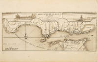
EMBOUCHURE DE LA RIVIERE DU TAGE.
Atlas Curieux ou le Monde. c.1710. The lower half of this attractive engraving shows the mouth of the Tagus from the sea to Lisbon showing the coastline settlement and fortification in detail. Title at top centre flanked by two views- To the left the 'Palais Royal de Lisbonne' and to the right 'Le Chateau de Belem'. Copper engraving. Fine condition. Uncoloured. Size: 405 x 175 mm. 16 x 7 inches. unknown
Referenz des Buchhändlers : 53828
|
|
|
FER, Nicolas de
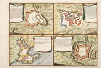
Estremos Villa Viciosa St Juilien ou Giao Aronches.
Paris 1705. An unusual and interesting plan of the fortifications of four villages in Portugal. Published in the 'Atlas Curieux ou Le Monde'. Size: 275 x 410 mm. Copperplate engraving with later hand colour. Good condition. unknown
Referenz des Buchhändlers : 65687
|
|
|
Fer, Nicolas de;
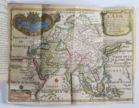
Introduction a la Geographie. Avec une Description Historique Sur touttes les parties de la Terre Introduction to Geography. With a Historical Description on all parts of the Earth
Paris: Guillaume Danet Son-in law of the author 1717. Second edition. Hardcover. Good- to very good condition. Octavo. 197 9pp. 5 folding maps. Original calf with gilt lettering tooling and ruling on spine; raised bands. Decorative endpapers. Title page with copperplate engravings of two hand-colored printed globes and black double-framing California depicted as an island in this and two other maps. Second edition augmented with longitudes and latitudes of major cities. Illustrated headpiece decorative initials and endpieces. All pages with double frames; marginalia. <br /> <br /> Introduction to geography by the French cartographer and engraver Nicolas de Fer 1646–1720 containing five folding copperplate engraved maps four of them hand-colored. The first showing a general map of the globe with America in one Europe Africa and Australia in the second globe both with North and South Poles. The margins are adorned with hand-colored portraits of significant explorers; Columbus Vespuci Shouten etc. The second map is the only one in black and white. It depicts "La Sphere Artificielle." The third map shows Europe the fourth Asia the Middle-East and Oceania with parts of Europe and Africa and finally North and South America depicted on the fifth. Contains list of cities and catalog of Fer publications at rear.<br /> <br /> At the age of twelve Fer became an apprentice of the Parisian engraver Louis Spirinx. After the death of Fer's father in 1673 he also was a cartographer Nicolas took over the business specializing in the production atlases geography and cartography-oriented publications. Well connected to the Royal Court Fer advanced to become the official geographer of the Philip V of Spain and Louis XIV of France. His numerous publications are considered artistic rather than accurate.<br /> <br /> Text in French. Binding rubbed along edges and boards with front joint mostly cracked but holding together. Small plate of previous owner glued to upper inside front cover. Inked and penciled notes on verso of decorative front endpaper. Starting at title page. Some creasing and small closed tears of maps. B/w map with two inch tear reinforced with tape on verso. Map of Europe with four inch closed tear. Map of America also reinforced with three and a half inch paper strip on verso. Page ninety-three with remnants of black glossy paper glued to gutter and part of text some loss of text. Binding in overall good- interior in good to very good condition. Guillaume Danet (Son-in law of the author) hardcover
Referenz des Buchhändlers : 50277
|
|

 Per e-mail erhalten
 Als pdf-Dokument herunterladen
 RSS feed
 Permanenter link


