|
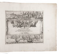
Fer, Nicolas de
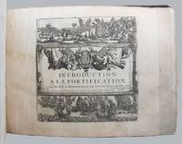
INTRODUCTION A LA FORTIFICATION
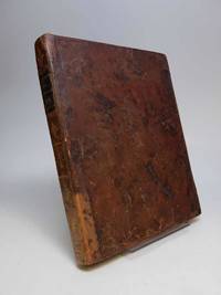
Paris: Chez l'auteur 1695. 188 engraved leaves printed on rectos only comprising the 167 plates 2 folding listed in the table of contents plus 5 plates not listed or numbered 9 plates numbered in French the pictorial title page naval and land battle scenes and 6 leaves of explanatory text for the first few plates plus a folding table of distances and a table of contents listing plates numbered 21-189 as issued; oblong 4to; early calf the spine with gilt lettered red leather title label and gilt decorated compartments between raised bands the boards rubbed with a few small surface grazes edges worn the leather lifting along fore-edge of upper board especially at bottom fore-corner small piece torn from head of spine the upper joint starting at extremities; inked ownership inscription near the bookplate of Alec Hill on the upper pastedown earlier small inked ownership inscription on upper free endpaper pencilled annotation at head of last leaf most plates neatly numbered in an early hand one plate Paris loose some damp stains occasionally large mostly to margins with a few encroaching onto plate surface several small edge chips and splits occasional slight creasing scattered light foxing and soiling; chez l'auteur Paris 1695. First edition. From the collection of Australian military historian and academic Alec Hill 1916-2008. Nicolas de Fer 1646-1720 inherited his father's cartography business which he developed into a flourishing enterprise producing town plans atlases and over 600 sheet maps and becoming one of the most prolific cartographic publishers of his era. In 1690 he was appointed official geographer to the Dauphin the heir to the French throne and when Louis XIV's grandson the Duke of Anjou acceded to the Spanish throne de Fer was proclaimed Geographer of the King of Spain as well. De Fer made maps of places throughout Europe and in North America including one in 1698 depicting beavers building dams near Niagara Falls. Introduction a la Fortification was issued in parts between 1690 and 1695 then re-issued in 1705 with the maps re-dated accordingly. Maps in this copy are dated from 1692 to 1695 with several undated. They depict fortified towns in France the Low Countries Germany Italy Spain and around the Mediterranean. The extra plates in this copy are Chartres Nouveau Canal Echelle Quebec and Batavia. The intricate folding Table Geografique enables the reader to calculate journey distances from Paris to all the principal towns in Europe. Chez l'auteur unknown
Referenz des Buchhändlers : 129558
|
|
|
FER, Nicolas de
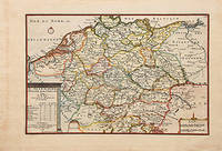
L'Allemagne divisée par Cercles.
Paris: 1705. Nicolas de Fer's excellent map of the German states. From the "Atlas Curieux ou Le Monde". Copper engraving. Hand colouring. Size: 274 x 405 mm Good condition. unknown
Referenz des Buchhändlers : 78548
|
|
|
FER, Nicolas de
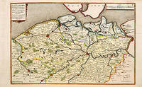
La Flandre Espagnole et la Flandre Hollandoise.
Paris. c.1705. A charming map of Spanish and Dutch Flanders in the early eighteenth century. A number of the larger cities and towns are highlighted together with local physical features in the form of rivers canals woodlands and marshland. Published in de Fer's 'Atlas Curieux ou Le Monde'. Size: 275 x 400 mm. Copperplate engraving with later hand colour. Fine condition. unknown
Referenz des Buchhändlers : 66131
|
|
|
Fer, Nicolas de (1646 - 1720); Pieter Starckman (fl c 1680 - 1730), aka Peter or Petrus, engraver a k a
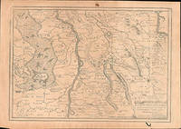
La Haute Gueldres ou se trouvent les Environs de Gueldres Venlo et Ruremonde . . First edition of the map.
Paris: chez l'auteur dans l'Isle du Palais sur le quay de l'orloge a la Sphére Royale avec privilége du Roy 1705-1717. Engraved map. One fold. Worm hole in lower margin 27.3 x 38 cm. Contemporary laid paper uniformly time aged.Published in "L'atlas curieux ou Le monde reÌpreseÌnteÌ dans des cartes geÌneÌrales et particulieres du ciel et de la terre : diviseÌ tant en ses quatre principales parties que par eÌtats et provinces et orneÌ par des plans et descriptions des villes capitales et principales et des plus superbes edifices qui les embelissent comme sont les eglises les palais les maisons de plaisance les iardins les fontaines &c. ". OCLC Number / Unique Identifier:79022119.LThe Atlas Curieux is geographic encyclopedia of images and maps of France with detailed views of the grand waterworks at Marly views of the great palaces and chateaux views and plans of the Paris Observatory and samples of military architecture. Issued in six annual parts from 1700-1705 the maps are based on the new observations of the Académie des Sciences and drawn up with the assistance of Philipe de La Hire.ibrary of Congress:The French cartographer and engraver Nicolas de Fer was a master at creating maps that were works of art. The maps that he published were printed during the Baroque period when the decorative arts were characterized by ornate detail. De Fer’s detailed maps and atlases were valued more for their decorative content than their geographical accuracy.Nicolas de Fer was born in 1646. His father Antoine de Fer owned a mapmaking firm. At the age of twelve Nicolas was apprenticed to a Parisian engraver named Louis Spirinx. The family business was starting to decline when his father died in 1673. Nicolas de Fer’s mother Genevieve took over the business after the death of her husband. In 1687 the business was passed on to Nicolas and the profits increased after he took over the firm. Nicolas de Fer was a prolific cartographer who produced atlases and hundreds of single maps. He eventually became the official geographer to King Louis XIV of France and King Philip V of Spain.One of de Fer’s major works is an atlas titled L’atlas curieux The curious atlas. Paris: chez l'auteur dans l'Isle du Palais sur le quay de l'orloge a la Sphére Royale avec privilége du Roy, 1705-1717 unknown
Referenz des Buchhändlers : 51-6448
|
|
|
Fer, Nicolas de (1646 - 1720); Pieter Starckman (fl c 1680 - 1730), aka Peter or Petrus, engraver a k a
La Partie Septentrionale de la Seigneurie de L'Eveche de Liege et le Limbourg Hollandois ou se trouvement les Environs de Maestricht. . First edition of the map.
Paris: chez l'auteur dans l'Isle du Palais sur le quay de l'orloge a la Sphére Royale avec privilége du Roy 1705-1717. Engraved map. One fold. Worm hole in lower margin 27.3 x 38 cm. Contemporary laid paper uniformly time aged.Published in "L'atlas curieux ou Le monde reÌpreseÌnteÌ dans des cartes geÌneÌrales et particulieres du ciel et de la terre : diviseÌ tant en ses quatre principales parties que par eÌtats et provinces et orneÌ par des plans et descriptions des villes capitales et principales et des plus superbes edifices qui les embelissent comme sont les eglises les palais les maisons de plaisance les iardins les fontaines &c. ". OCLC Number / Unique Identifier:79022119.LThe Atlas Curieux is geographic encyclopedia of images and maps of France with detailed views of the grand waterworks at Marly views of the great palaces and chateaux views and plans of the Paris Observatory and samples of military architecture. Issued in six annual parts from 1700-1705 the maps are based on the new observations of the Académie des Sciences and drawn up with the assistance of Philipe de La Hire.ibrary of Congress:The French cartographer and engraver Nicolas de Fer was a master at creating maps that were works of art. The maps that he published were printed during the Baroque period when the decorative arts were characterized by ornate detail. De Fer’s detailed maps and atlases were valued more for their decorative content than their geographical accuracy.Nicolas de Fer was born in 1646. His father Antoine de Fer owned a mapmaking firm. At the age of twelve Nicolas was apprenticed to a Parisian engraver named Louis Spirinx. The family business was starting to decline when his father died in 1673. Nicolas de Fer’s mother Genevieve took over the business after the death of her husband. In 1687 the business was passed on to Nicolas and the profits increased after he took over the firm. Nicolas de Fer was a prolific cartographer who produced atlases and hundreds of single maps. He eventually became the official geographer to King Louis XIV of France and King Philip V of Spain.One of de Fer’s major works is an atlas titled L’atlas curieux The curious atlas. Paris: chez l'auteur dans l'Isle du Palais sur le quay de l'orloge a la Sphére Royale avec privilége du Roy, 1705-1717 unknown
Referenz des Buchhändlers : 51-6449
|
|
|
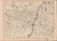
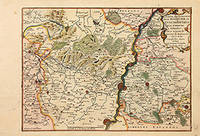
FER, Nicolas de
La Partie Septentrionale de la Seigneurie de l'Eveche de Liege
Paris: 1705. Map of the Bishopric of Liege and the surrounding areas of Maastricht. Published in "Atlas Curieux ou le Monde". Copper engraving. Hand coloured. Size: 273 x 402 mm Very good condition. unknown
Referenz des Buchhändlers : 78854
|
|
|
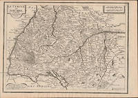
Fer, Nicolas de (1646 - 1720); Pieter Starckman (fl c 1680 - 1730), aka Peter or Petrus, engraver a k a
Le Cercle de Souabe. Par N. de Fer. First edition of the map.
Paris: chez l'auteur dans l'Isle du Palais sur le quay de l'orloge a la Sphére Royale avec privilége du Roy 1705-1717. Engraved map. 27.3 x 38cm. Contemporary laid paper uniformly time aged.Published in "L'atlas curieux ou le monde reÌpreseÌnteÌ dans des cartes geÌneÌrales et particulieres du ciel et de la terre : diviseÌ tant en ses quatre principales parties que par eÌtats et provinces et orneÌ par des plans et descriptions des villes capitales et principales et des plus superbes edifices qui les embelissent comme sont les eglises les palais les maisons de plaisance les iardins les fontaines &c. ". OCLC Number / Unique Identifier:79022119.LThe Atlas Curieux is geographic encyclopedia of images and maps of France with detailed views of the grand waterworks at Marly views of the great palaces and chateaux views and plans of the Paris Observatory and samples of military architecture. Issued in six annual parts from 1700-1705 the maps are based on the new observations of the Académie des Sciences and drawn up with the assistance of Philipe de La Hire.ibrary of Congress:The French cartographer and engraver Nicolas de Fer was a master at creating maps that were works of art. The maps that he published were printed during the Baroque period when the decorative arts were characterized by ornate detail. De Fer’s detailed maps and atlases were valued more for their decorative content than their geographical accuracy.Nicolas de Fer was born in 1646. His father Antoine de Fer owned a mapmaking firm. At the age of twelve Nicolas was apprenticed to a Parisian engraver named Louis Spirinx. The family business was starting to decline when his father died in 1673. Nicolas de Fer’s mother Genevieve took over the business after the death of her husband. In 1687 the business was passed on to Nicolas and the profits increased after he took over the firm. Nicolas de Fer was a prolific cartographer who produced atlases and hundreds of single maps. He eventually became the official geographer to King Louis XIV of France and King Philip V of Spain.One of de Fer’s major works is an atlas titled L’atlas curieux The curious atlas. Paris: chez l'auteur dans l'Isle du Palais sur le quay de l'orloge a la Sphére Royale avec privilége du Roy, 1705-1717 unknown
Referenz des Buchhändlers : 51-6463
|
|
|
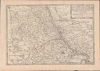
Fer, Nicolas de (1646 - 1720); Pieter Starckman (fl c 1680 - 1730), aka Peter or Petrus, engraver a k a
Le Cours Du Rhein depuis Coblens Jusques a Cologne : ou se trouvent partie des Archevêchez et Electorats de Treves et de Cologne et partie des Duchez de Juliers et de Berg . Par N. de Fer . First edition of the map .
Paris: chez l'auteur dans l'Isle du Palais sur le quay de l'orloge a la Sphére Royale avec privilége du Roy 1705-1717. Engraved map. 27.3 x 38 cm. Contemporary laid paper uniformly time aged.Published in "L'atlas curieux ou Le monde reÌpreseÌnteÌ dans des cartes geÌneÌrales et particulieres du ciel et de la terre : diviseÌ tant en ses quatre principales parties que par eÌtats et provinces et orneÌ par des plans et descriptions des villes capitales et principales et des plus superbes edifices qui les embelissent comme sont les eglises les palais les maisons de plaisance les iardins les fontaines &c. ". OCLC Number / Unique Identifier:79022119.LThe Atlas Curieux is geographic encyclopedia of images and maps of France with detailed views of the grand waterworks at Marly views of the great palaces and chateaux views and plans of the Paris Observatory and samples of military architecture. Issued in six annual parts from 1700-1705 the maps are based on the new observations of the Académie des Sciences and drawn up with the assistance of Philipe de La Hire.ibrary of Congress:The French cartographer and engraver Nicolas de Fer was a master at creating maps that were works of art. The maps that he published were printed during the Baroque period when the decorative arts were characterized by ornate detail. De Fer’s detailed maps and atlases were valued more for their decorative content than their geographical accuracy.Nicolas de Fer was born in 1646. His father Antoine de Fer owned a mapmaking firm. At the age of twelve Nicolas was apprenticed to a Parisian engraver named Louis Spirinx. The family business was starting to decline when his father died in 1673. Nicolas de Fer’s mother Genevieve took over the business after the death of her husband. In 1687 the business was passed on to Nicolas and the profits increased after he took over the firm. Nicolas de Fer was a prolific cartographer who produced atlases and hundreds of single maps. He eventually became the official geographer to King Louis XIV of France and King Philip V of Spain.One of de Fer’s major works is an atlas titled L’atlas curieux The curious atlas. Paris: chez l'auteur dans l'Isle du Palais sur le quay de l'orloge a la Sphére Royale avec privilége du Roy, 1705-1717 unknown
Referenz des Buchhändlers : 51-6457
|
|
|
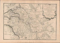
Fer, Nicolas de (1646 - 1720); Pieter Starckman (fl c 1680 - 1730), aka Peter or Petrus, engraver a k a
Le Cours du Rhein depuis Rheinberg jusque a Arnheim ou se trouvent le Duché de Cleves et partie de ce luy de la Gueldres Espagnole et Hollandoise . First edition of the map .
Paris: chez l'auteur dans l'Isle du Palais sur le quay de l'orloge a la Sphére Royale avec privilége du Roy 1705-1717. Engraved map. 27.3 x 38 cm. Contemporary laid paper uniformly time aged.Published in "L'atlas curieux ou Le monde reÌpreseÌnteÌ dans des cartes geÌneÌrales et particulieres du ciel et de la terre : diviseÌ tant en ses quatre principales parties que par eÌtats et provinces et orneÌ par des plans et descriptions des villes capitales et principales et des plus superbes edifices qui les embelissent comme sont les eglises les palais les maisons de plaisance les iardins les fontaines &c. ". OCLC Number / Unique Identifier:79022119.LThe Atlas Curieux is geographic encyclopedia of images and maps of France with detailed views of the grand waterworks at Marly views of the great palaces and chateaux views and plans of the Paris Observatory and samples of military architecture. Issued in six annual parts from 1700-1705 the maps are based on the new observations of the Académie des Sciences and drawn up with the assistance of Philipe de La Hire.ibrary of Congress:The French cartographer and engraver Nicolas de Fer was a master at creating maps that were works of art. The maps that he published were printed during the Baroque period when the decorative arts were characterized by ornate detail. De Fer’s detailed maps and atlases were valued more for their decorative content than their geographical accuracy.Nicolas de Fer was born in 1646. His father Antoine de Fer owned a mapmaking firm. At the age of twelve Nicolas was apprenticed to a Parisian engraver named Louis Spirinx. The family business was starting to decline when his father died in 1673. Nicolas de Fer’s mother Genevieve took over the business after the death of her husband. In 1687 the business was passed on to Nicolas and the profits increased after he took over the firm. Nicolas de Fer was a prolific cartographer who produced atlases and hundreds of single maps. He eventually became the official geographer to King Louis XIV of France and King Philip V of Spain.One of de Fer’s major works is an atlas titled L’atlas curieux The curious atlas. Paris: chez l'auteur dans l'Isle du Palais sur le quay de l'orloge a la Sphére Royale avec privilége du Roy, 1705-1717 unknown
Referenz des Buchhändlers : 51-6459
|
|
|
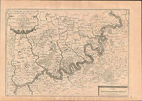
Fer, Nicolas de (1646 - 1720); Pieter Starckman (fl c 1680 - 1730), aka Peter or Petrus, engraver a k a
Le cours de la Moselle depuis l'embouchure de la Saare jusques a Cocheim ou se trouve les environs de Treve et de Traebach. Par N. de Fer. First edition of the map.
Paris: chez l'auteur dans l'Isle du Palais sur le quay de l'orloge a la Sphére Royale avec privilége du Roy 1705-1717. Engraved map. 27.3 x 38cm. Contemporary laid paper uniformly time aged.Published in "L'atlas curieux ou le monde reÌpreseÌnteÌ dans des cartes geÌneÌrales et particulieres du ciel et de la terre : diviseÌ tant en ses quatre principales parties que par eÌtats et provinces et orneÌ par des plans et descriptions des villes capitales et principales et des plus superbes edifices qui les embelissent comme sont les eglises les palais les maisons de plaisance les iardins les fontaines &c. ". OCLC Number / Unique Identifier:79022119.LThe Atlas Curieux is geographic encyclopedia of images and maps of France with detailed views of the grand waterworks at Marly views of the great palaces and chateaux views and plans of the Paris Observatory and samples of military architecture. Issued in six annual parts from 1700-1705 the maps are based on the new observations of the Académie des Sciences and drawn up with the assistance of Philipe de La Hire.ibrary of Congress:The French cartographer and engraver Nicolas de Fer was a master at creating maps that were works of art. The maps that he published were printed during the Baroque period when the decorative arts were characterized by ornate detail. De Fer’s detailed maps and atlases were valued more for their decorative content than their geographical accuracy.Nicolas de Fer was born in 1646. His father Antoine de Fer owned a mapmaking firm. At the age of twelve Nicolas was apprenticed to a Parisian engraver named Louis Spirinx. The family business was starting to decline when his father died in 1673. Nicolas de Fer’s mother Genevieve took over the business after the death of her husband. In 1687 the business was passed on to Nicolas and the profits increased after he took over the firm. Nicolas de Fer was a prolific cartographer who produced atlases and hundreds of single maps. He eventually became the official geographer to King Louis XIV of France and King Philip V of Spain.One of de Fer’s major works is an atlas titled L’atlas curieux The curious atlas. Paris: chez l'auteur dans l'Isle du Palais sur le quay de l'orloge a la Sphére Royale avec privilége du Roy, 1705-1717 unknown
Referenz des Buchhändlers : 51-6461
|
|
|
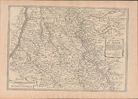
Fer, Nicolas de (1646 - 1720); Pieter Starckman (fl c 1680 - 1730), aka Peter or Petrus, engraver a k a
Le cours du Rhein depuis Cologne jusques a Rheinberg : ou se trouvent le bas electorat de Cologne partie des duchez de Iuliers de Berg et de Gueldres et le comté de Meurs . Par N. de Fer . First edition of the map .
Paris: chez l'auteur dans l'Isle du Palais sur le quay de l'orloge a la Sphére Royale avec privilége du Roy 1705-1717. Engraved map. 27.3 x 38 cm. Contemporary laid paper uniformly time aged.Published in "L'atlas curieux ou Le monde reÌpreseÌnteÌ dans des cartes geÌneÌrales et particulieres du ciel et de la terre : diviseÌ tant en ses quatre principales parties que par eÌtats et provinces et orneÌ par des plans et descriptions des villes capitales et principales et des plus superbes edifices qui les embelissent comme sont les eglises les palais les maisons de plaisance les iardins les fontaines &c. ". OCLC Number / Unique Identifier:79022119.LThe Atlas Curieux is geographic encyclopedia of images and maps of France with detailed views of the grand waterworks at Marly views of the great palaces and chateaux views and plans of the Paris Observatory and samples of military architecture. Issued in six annual parts from 1700-1705 the maps are based on the new observations of the Académie des Sciences and drawn up with the assistance of Philipe de La Hire.ibrary of Congress:The French cartographer and engraver Nicolas de Fer was a master at creating maps that were works of art. The maps that he published were printed during the Baroque period when the decorative arts were characterized by ornate detail. De Fer’s detailed maps and atlases were valued more for their decorative content than their geographical accuracy.Nicolas de Fer was born in 1646. His father Antoine de Fer owned a mapmaking firm. At the age of twelve Nicolas was apprenticed to a Parisian engraver named Louis Spirinx. The family business was starting to decline when his father died in 1673. Nicolas de Fer’s mother Genevieve took over the business after the death of her husband. In 1687 the business was passed on to Nicolas and the profits increased after he took over the firm. Nicolas de Fer was a prolific cartographer who produced atlases and hundreds of single maps. He eventually became the official geographer to King Louis XIV of France and King Philip V of Spain.One of de Fer’s major works is an atlas titled L’atlas curieux The curious atlas. Paris: chez l'auteur dans l'Isle du Palais sur le quay de l'orloge a la Sphére Royale avec privilége du Roy, 1705-1717 unknown
Referenz des Buchhändlers : 51-6458
|
|
|
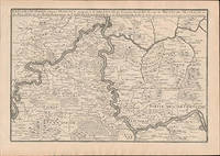
Fer, Nicolas de (1646 - 1720); Pieter Starckman (fl c 1680 - 1730), aka Peter or Petrus, engraver a k a
Le cours du Rhein depuis Mayence jusques a Coblens : ou se trouvent partie des estats de Treves de Mayence et du palatinat du Rhein les comtes de Cazenellenbogen et de Spanheim &c. Par N. de Fer . First edition of the map .
Paris: chez l'auteur dans l'Isle du Palais sur le quay de l'orloge a la Sphére Royale avec privilége du Roy 1705-1717. Engraved map. 27.3 x 38 cm. Contemporary laid paper uniformly time aged.Published in "L'atlas curieux ou Le monde reÌpreseÌnteÌ dans des cartes geÌneÌrales et particulieres du ciel et de la terre : diviseÌ tant en ses quatre principales parties que par eÌtats et provinces et orneÌ par des plans et descriptions des villes capitales et principales et des plus superbes edifices qui les embelissent comme sont les eglises les palais les maisons de plaisance les iardins les fontaines &c. ". OCLC Number / Unique Identifier:79022119.LThe Atlas Curieux is geographic encyclopedia of images and maps of France with detailed views of the grand waterworks at Marly views of the great palaces and chateaux views and plans of the Paris Observatory and samples of military architecture. Issued in six annual parts from 1700-1705 the maps are based on the new observations of the Académie des Sciences and drawn up with the assistance of Philipe de La Hire.ibrary of Congress:The French cartographer and engraver Nicolas de Fer was a master at creating maps that were works of art. The maps that he published were printed during the Baroque period when the decorative arts were characterized by ornate detail. De Fer’s detailed maps and atlases were valued more for their decorative content than their geographical accuracy.Nicolas de Fer was born in 1646. His father Antoine de Fer owned a mapmaking firm. At the age of twelve Nicolas was apprenticed to a Parisian engraver named Louis Spirinx. The family business was starting to decline when his father died in 1673. Nicolas de Fer’s mother Genevieve took over the business after the death of her husband. In 1687 the business was passed on to Nicolas and the profits increased after he took over the firm. Nicolas de Fer was a prolific cartographer who produced atlases and hundreds of single maps. He eventually became the official geographer to King Louis XIV of France and King Philip V of Spain.One of de Fer’s major works is an atlas titled L’atlas curieux The curious atlas. Paris: chez l'auteur dans l'Isle du Palais sur le quay de l'orloge a la Sphére Royale avec privilége du Roy, 1705-1717 unknown
Referenz des Buchhändlers : 51-6456
|
|
|
Fer, Nicolas de, (1646-1720); P Starckman, engraver
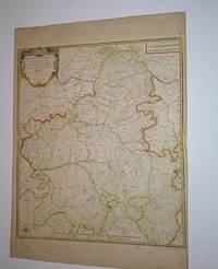
Le Gouvernement General De Champagne et la Province De Brie. Original Map.
Paris: chez l'Auteur dans l'Isle du Palais sur le Quay de l'Orloge a la Sphere Royal avec privilege du Roy 1710. Original handcolored engraved map. 74 x 54 cm. sheet size. On old laid paper with windmill in a necklace watermark.From; Atlas ou Recueil de Cartes Geographiques Dressees Sur les Nouvelles Observations de Mrs. de L'Academie Royale des Sciences Par N. de Fer Geographe de sa Majeste Catolique et de Monseigneur le Dauphin. A Paris chez l'Auteur dans l'Isle du Palais sur le Quay de l'Orloge a la Sphere Royal avec privilege du Roy 1709.Pastoureau describes this large atlas as De Fer's folio atlas. It is described by De Fer in his catalog of 1716 as his highly detailed atlas showing all parts of the world with all the maps available separately. Paris: chez l'Auteur dans l'Isle du Palais sur le Quay de l'Orloge a la Sphere Royal, avec privilege du Roy, 1710 unknown
Referenz des Buchhändlers : 16-3950
|
|
|
FER, Nicolas de
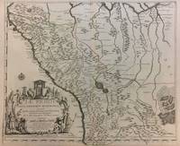
Le Perou Dans L'Amerique Meridionale
Paris 1719. Map. Engraving with original hand outline color. Image measures 19 x 23". Sheet measures 20 x 28".<br/> <br/> Unusual map of Peru from the early 18th century. Includes part of Ecuador Bolivia and Brazil based on Jesuit activity in the area. Amazon rain forest is visualized with a dynamic design. Cartouche describes the mining industry. Nicolas de Fer 1646-1720 was a prolific cartographer engraver and publisher who took over the family map business from his mother when she retired in 1687. The business flourished and he gained a great reputation in his lifetime and was appointed 'Geographer to the King' in 1690. This map demonstrates his skill and provides a curious yet alluring mixture of history and geography.<br/> <br/> unknown
Referenz des Buchhändlers : 291534
|
|
|
Fer, Nicolas De
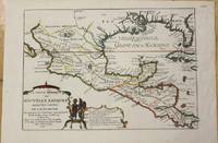
Le Vieux Mexique ou Nouvelle Espagne Avec les Costes de la Floride Faisant-Partie De L’amerique Septentrionale
Paris 1705. Excellent. Notes: This map covers the Gulf of Mexico through Central America and includes parts of Cuba and Jamaica. It extends through Mexico to show the southern tip of Baja California. This is an early map to show the correct location of the Mississippi River delta gleaned from the expeditions of La Salle and Iberville. Two French forts are located: LaSalle's Fort St. Louis in Texas Fortbati en 1685 and another near present-day New Orleans. One of the prominent features in northern Mexico is Les Fameuses Mines de Ste. Barbe the legendary Santa Barbara mines of the Chihuahua-Durango region. Size : 230x335 mm 9x13.125 Inches Coloring: Original Outline Coloring Category: Maps Central America Mexico unknown
Referenz des Buchhändlers : M772
|
|
|
Fer, Nicolas de (1646 - 1720); Pieter Starckman (fl c 1680 - 1730), aka Peter or Petrus, engraver a k a
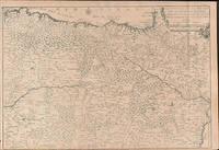
Les Asturies et La Biscaye Les Royaume de Navarre D'Arragon Et De Leon Et Celuy De La Vielle Castille. Par N. de Fer. First edition of the map .
Paris: chez l'auteur dans l'Isle du Palais sur le quay de l'orloge a la Sphére Royale avec privilége du Roy 1714-1717. Engraved map. 27.3 x 38cm and 27.3 x 39.5cm. Fold on right side.lContemporary laid paper uniformly time aged.Published in "L'atlas curieux ou Le monde reÌpreseÌnteÌ dans des cartes geÌneÌrales et particulieres du ciel et de la terre : diviseÌ tant en ses quatre principales parties que par eÌtats et provinces et orneÌ par des plans et descriptions des villes capitales et principales et des plus superbes edifices qui les embelissent comme sont les eglises les palais les maisons de plaisance les iardins les fontaines &c. ". OCLC Number / Unique Identifier:79022119.LThe Atlas Curieux is geographic encyclopedia of images and maps of France with detailed views of the grand waterworks at Marly views of the great palaces and chateaux views and plans of the Paris Observatory and samples of military architecture. Issued in six annual parts from 1700-1705 the maps are based on the new observations of the Académie des Sciences and drawn up with the assistance of Philipe de La Hire.ibrary of Congress:The French cartographer and engraver Nicolas de Fer was a master at creating maps that were works of art. The maps that he published were printed during the Baroque period when the decorative arts were characterized by ornate detail. De Fer’s detailed maps and atlases were valued more for their decorative content than their geographical accuracy.Nicolas de Fer was born in 1646. His father Antoine de Fer owned a mapmaking firm. At the age of twelve Nicolas was apprenticed to a Parisian engraver named Louis Spirinx. The family business was starting to decline when his father died in 1673. Nicolas de Fer’s mother Genevieve took over the business after the death of her husband. In 1687 the business was passed on to Nicolas and the profits increased after he took over the firm. Nicolas de Fer was a prolific cartographer who produced atlases and hundreds of single maps. He eventually became the official geographer to King Louis XIV of France and King Philip V of Spain.One of de Fer’s major works is an atlas titled L’atlas curieux The curious atlas. Paris: chez l'auteur dans l'Isle du Palais sur le quay de l'orloge a la Sphére Royale avec privilége du Roy, 1714-1717 unknown
Referenz des Buchhändlers : 51-6468
|
|
|
FER, Nicolas de
Les Costes de France sur l'Ocean et sur la Mer Mediterranee Corigees Augmentees et Divisees en Capitaineries Garde-Costes
hardcover. Dediees a Monseigneur le Dauphin par Sontres Humble et tres Obeissant Serviteur et Geographe De Fer. Beautiful double-page engraved title page 4 38 2 60 28pp. This splendid atlas is illustrated with 32 engraved coastal charts including a folding wind chart and a general index chart of France. The double page maps have delicate outline hand coloring. An engraved divisional title page number 26 entitled "Les Costes de la Mer Mediterranee" is the 33rd plate. Short 4to 9.5 x 7.75 inches 17th Century calf well-worn; neatly rebacked; marbled endpapers red edges. Inscription in ink first fly leaf. Paris: Chez le Sr. de Fer dans l'Isle du Palais sur Quay de l'Orloge a la Sphere Royale. Avec Pri. du Roy 1690.<br/> <br/> Nicolas de Fer 1646-1720 was a prolific cartographer engraver and publisher who took over the family map business from his mother when she retired in 1687. The business flourished and he gained a great reputation in his lifetime and was appointed 'Geographer to the King' in 1690. This original edition the first atlas to bear his name was published in 1690 on the basis of an atlas published in 1634 by order of Cardinal Richelieu by the publisher Tassin who sold his plates in 1644 to Antoine de Fer Nicolas's father. Scarce.<br/> <br/> unknown
Referenz des Buchhändlers : 156417
|
|
|
Fer, Nicolas de (1646 - 1720); Pieter Starckman (fl c 1680 - 1730), aka Peter or Petrus, engraver a k a
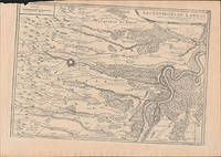
Les Environs de Landau. Par N. de Fer . First edition of the map .
Paris: chez l'auteur dans l'Isle du Palais sur le quay de l'orloge a la Sphére Royale avec privilége du Roy 1705-1717. Engraved map. 27.3 x 38 cm. Contemporary laid paper uniformly time aged.Loss fof paper and borderline upper left.Published in "L'atlas curieux ou Le monde reÌpreseÌnteÌ dans des cartes geÌneÌrales et particulieres du ciel et de la terre : diviseÌ tant en ses quatre principales parties que par eÌtats et provinces et orneÌ par des plans et descriptions des villes capitales et principales et des plus superbes edifices qui les embelissent comme sont les eglises les palais les maisons de plaisance les iardins les fontaines &c. ". OCLC Number / Unique Identifier:79022119.LThe Atlas Curieux is geographic encyclopedia of images and maps of France with detailed views of the grand waterworks at Marly views of the great palaces and chateaux views and plans of the Paris Observatory and samples of military architecture. Issued in six annual parts from 1700-1705 the maps are based on the new observations of the Académie des Sciences and drawn up with the assistance of Philipe de La Hire.ibrary of Congress:The French cartographer and engraver Nicolas de Fer was a master at creating maps that were works of art. The maps that he published were printed during the Baroque period when the decorative arts were characterized by ornate detail. De Fer’s detailed maps and atlases were valued more for their decorative content than their geographical accuracy.Nicolas de Fer was born in 1646. His father Antoine de Fer owned a mapmaking firm. At the age of twelve Nicolas was apprenticed to a Parisian engraver named Louis Spirinx. The family business was starting to decline when his father died in 1673. Nicolas de Fer’s mother Genevieve took over the business after the death of her husband. In 1687 the business was passed on to Nicolas and the profits increased after he took over the firm. Nicolas de Fer was a prolific cartographer who produced atlases and hundreds of single maps. He eventually became the official geographer to King Louis XIV of France and King Philip V of Spain.One of de Fer’s major works is an atlas titled L’atlas curieux The curious atlas. Paris: chez l'auteur dans l'Isle du Palais sur le quay de l'orloge a la Sphére Royale avec privilége du Roy, 1705-1717 unknown
Referenz des Buchhändlers : 51-6454
|
|
|
Fer, Nicolas de (1646 - 1720); Pieter Starckman (fl c 1680 - 1730), aka Peter or Petrus, engraver a k a
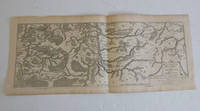
Les environs de Dinant de Philippeville et de Charlemont ou se Trouve encoreLe Condros. . . First edition of the map.
Paris: chez l'auteur dans l'Isle du Palais sur le quay de l'orloge a la Sphére Royale avec privilége du Roy 1705-1717. Engraved map. One fold. Worm holes in lower marginEach 27.3 x 64.2 cm. Contemporary laid paper uniformly time aged.Published in "L'atlas curieux ou Le monde reÌpreseÌnteÌ dans des cartes geÌneÌrales et particulieres du ciel et de la terre : diviseÌ tant en ses quatre principales parties que par eÌtats et provinces et orneÌ par des plans et descriptions des villes capitales et principales et des plus superbes edifices qui les embelissent comme sont les eglises les palais les maisons de plaisance les iardins les fontaines &c. ". OCLC Number / Unique Identifier:79022119.LThe Atlas Curieux is geographic encyclopedia of images and maps of France with detailed views of the grand waterworks at Marly views of the great palaces and chateaux views and plans of the Paris Observatory and samples of military architecture. Issued in six annual parts from 1700-1705 the maps are based on the new observations of the Académie des Sciences and drawn up with the assistance of Philipe de La Hire.ibrary of Congress:The French cartographer and engraver Nicolas de Fer was a master at creating maps that were works of art. The maps that he published were printed during the Baroque period when the decorative arts were characterized by ornate detail. De Fer’s detailed maps and atlases were valued more for their decorative content than their geographical accuracy.Nicolas de Fer was born in 1646. His father Antoine de Fer owned a mapmaking firm. At the age of twelve Nicolas was apprenticed to a Parisian engraver named Louis Spirinx. The family business was starting to decline when his father died in 1673. Nicolas de Fer’s mother Genevieve took over the business after the death of her husband. In 1687 the business was passed on to Nicolas and the profits increased after he took over the firm. Nicolas de Fer was a prolific cartographer who produced atlases and hundreds of single maps. He eventually became the official geographer to King Louis XIV of France and King Philip V of Spain.One of de Fer’s major works is an atlas titled L’atlas curieux The curious atlas. Paris: chez l'auteur dans l'Isle du Palais sur le quay de l'orloge a la Sphére Royale avec privilége du Roy, 1705-1717 unknown
Referenz des Buchhändlers : 51-6447
|
|
|
Fer, Nicolas de (1646 - 1720); Pieter Starckman (fl c 1680 - 1730), aka Peter or Petrus, engraver a k a
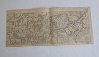
Les environs de Namur de Huy et de Charle-Roy ou se trouve encore La Hasbaye. . . . First edition of the map.
Paris: chez l'auteur dans l'Isle du Palais sur le quay de l'orloge a la Sphére Royale avec privilége du Roy 1714-1717. Engraved map. One fold. 27.3 x 51cm. Contemporary laid paper uniformly time aged.Published in "L'atlas curieux ou Le monde reÌpreseÌnteÌ dans des cartes geÌneÌrales et particulieres du ciel et de la terre : diviseÌ tant en ses quatre principales parties que par eÌtats et provinces et orneÌ par des plans et descriptions des villes capitales et principales et des plus superbes edifices qui les embelissent comme sont les eglises les palais les maisons de plaisance les iardins les fontaines &c. ". OCLC Number / Unique Identifier:79022119.LThe Atlas Curieux is geographic encyclopedia of images and maps of France with detailed views of the grand waterworks at Marly views of the great palaces and chateaux views and plans of the Paris Observatory and samples of military architecture. Issued in six annual parts from 1700-1705 the maps are based on the new observations of the Académie des Sciences and drawn up with the assistance of Philipe de La Hire.ibrary of Congress:The French cartographer and engraver Nicolas de Fer was a master at creating maps that were works of art. The maps that he published were printed during the Baroque period when the decorative arts were characterized by ornate detail. De Fer’s detailed maps and atlases were valued more for their decorative content than their geographical accuracy.Nicolas de Fer was born in 1646. His father Antoine de Fer owned a mapmaking firm. At the age of twelve Nicolas was apprenticed to a Parisian engraver named Louis Spirinx. The family business was starting to decline when his father died in 1673. Nicolas de Fer’s mother Genevieve took over the business after the death of her husband. In 1687 the business was passed on to Nicolas and the profits increased after he took over the firm. Nicolas de Fer was a prolific cartographer who produced atlases and hundreds of single maps. He eventually became the official geographer to King Louis XIV of France and King Philip V of Spain.One of de Fer’s major works is an atlas titled L’atlas curieux The curious atlas. Paris: chez l'auteur dans l'Isle du Palais sur le quay de l'orloge a la Sphére Royale avec privilége du Roy, 1714-1717 unknown
Referenz des Buchhändlers : 51-6446
|
|
|
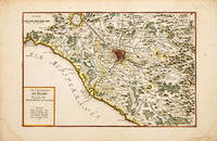
FER, Nicolas de
Les Environs de Rome.
Paris c.1700-05. Nicolas de Fer was the son of Antoine de Fer a Parisian map and print seller. This map from the Atlas Curieux shows the environs of Rome. At the time of publication de Fer was the official cartographer to the French Dauphin but he later became cartographer to both the French and Spanish kings. Size: 290 x 440 mm. Copperplate engraving with later hand colour. Good condition some slight toning and creasing. unknown
Referenz des Buchhändlers : 70256
|
|
|
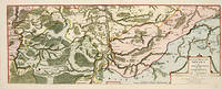
FER, Nicolas de
Les Environs de Dinant de Philippeville et de Charlemont ou se Trouve encore Le Condros
Paris. 1705. An attractive map of part of Belgium showing forests and river valleys. 'de Fer's maps are popular despite or maybe because of their rather flamboyant decoration' Moreland & Bannister p130. Title at lower right. Atlas Curieux ou Le Monde. Copper engraving. Fine condition Later colouring. Size: 59 x 22 cm. Moreland and Bannister unknown
Referenz des Buchhändlers : 52950
|
|
|
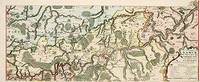
FER, Nicolas de
Les Environs de NAMUR de Huy et de Charle-Roy
Paris. 1717. An attractive map of part of Belgium showing forests and river valleys. 'de Fer's maps are popular despite or maybe because of their rather flamboyant decoration' Moreland & Bannister p130. Title at lower right. Atlas Curieux ou Le Monde. Copper engraving. Fine condition Original colour. Size: 59 x 23 cm. unknown
Referenz des Buchhändlers : 52951
|
|
|
FER, Nicolas de
Les forces de l' Europe ou description des principales villes; avec leurs fortifications. . Premiere partie-dixième partie.
Paris 1702. Oblong 1mo 30 x 37 cm. chez l'auteur" = Nicolas de Fer a false imprint Contemporary tanned sheepskin sewn on 5 cords gold-tooled spine with the title in the 2nd of 6 compartments. Ad 1 with 10 letterpress title pages in red and black for the 10 parts; 5 engraved titles for parts 1-5 that for part 5 repeating that for part 2; plus 234 beautifully engraved plates a few folding with 366 maps and views of fortified cities. Ad 2 with an engraved title page 2 letterpress title pages in red and black and 40 engraved plates including 2 folding labelled A-S in part 1 and T-Oo in part 2. 2 works in 12 parts or volumes bound as 1. Splendid atlas of fortifications of the cities of Europe plus Malta and some other Mediterranean sites combined with a maritime atlas of the French coasts published by Pieter Mortier 1661-1711. Both are based on the similar publications of Nicolas de Fer 1646-1720 and falsely indicate that they were published by him.Ad 1: The atlas of fortified cities of Europe. Many of the plans show the work of the greatest 17th-century masters of the art and science of fortification including Samuel Marolois Simon Stevin and Sébastien Le Prestre de Vauban. The last two parts contain primarily smaller maps printed 4 to the page. Ad 2: The maritime atlas of the coasts of France. It also shows the fortifications along the coasts so it complements the fortifications atlas and was clearly designed to match it in format and style. With the caption of one plate cut off and 2 plates and 1 letterpress title-page somewhat browned. Further in good condition. A couple plates are bound in the wrong volume. A splendid fortifications atlas.l Ad 1: Muller Historieplaten 3034a; cf. Pastoureau Atlas français IX A & H pp. 203-209 213: Paris Fer ed. 1690-1695 & Amsterdam Mortier ed. 1702 with different title; Phillips pp. 256-7 other ed.; Ad 2: Muller Historieplaten 3034a; Pastoureau Les atlas français XVIe-XVIIe siècles Fer VIII B p. 203 cf. pp. 201-203; for Mortier see: Koeman III pp. 4-10 and IV p. 423. unknown
Referenz des Buchhändlers : 23526
|
|
|
FER, Nicolas de
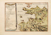
Les Merveilles de Pozzoli ou Pouzzol Cume et Baia ou Bayes.
Paris 1700-05. Pozzoli is a province of Naples and the main city of the Phlegrean Peninsula. It lies some two miles from the once fashionable resort of Baia. The map is well executed and detailed. Nicolas de Fer was the son of Antoine de Fer a Parisian map and print seller. This map from the Atlas Curieux. At the time of publication de Fer was the official cartographer to the French Dauphin but he later became cartographer to both the French and Spanish kings. Size: 270 x 405 mm. Copperplate engraving with later hand colour. Good condition. Slightly toned. unknown
Referenz des Buchhändlers : 70272
|
|
|
Fer, Nicolas de (1646 - 1720); Pieter Starckman (fl c 1680 - 1730), aka Peter or Petrus, engraver a k a
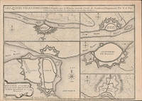
Les Quatre Villes Forestieres Situees Sur le Rhein Sont du Cercle de Souabe et a l'Empereur Par N. de Fer . First edition of the map .
Paris: chez l'auteur dans l'Isle du Palais sur le quay de l'orloge a la Sphére Royale avec privilége du Roy 1705-1717. Engraved map. 27.3 x 38 cm. Contemporary laid paper uniformly time aged.Published in "L'atlas curieux ou Le monde reÌpreseÌnteÌ dans des cartes geÌneÌrales et particulieres du ciel et de la terre : diviseÌ tant en ses quatre principales parties que par eÌtats et provinces et orneÌ par des plans et descriptions des villes capitales et principales et des plus superbes edifices qui les embelissent comme sont les eglises les palais les maisons de plaisance les iardins les fontaines &c. ". OCLC Number / Unique Identifier:79022119.LThe Atlas Curieux is geographic encyclopedia of images and maps of France with detailed views of the grand waterworks at Marly views of the great palaces and chateaux views and plans of the Paris Observatory and samples of military architecture. Issued in six annual parts from 1700-1705 the maps are based on the new observations of the Académie des Sciences and drawn up with the assistance of Philipe de La Hire.ibrary of Congress:The French cartographer and engraver Nicolas de Fer was a master at creating maps that were works of art. The maps that he published were printed during the Baroque period when the decorative arts were characterized by ornate detail. De Fer’s detailed maps and atlases were valued more for their decorative content than their geographical accuracy.Nicolas de Fer was born in 1646. His father Antoine de Fer owned a mapmaking firm. At the age of twelve Nicolas was apprenticed to a Parisian engraver named Louis Spirinx. The family business was starting to decline when his father died in 1673. Nicolas de Fer’s mother Genevieve took over the business after the death of her husband. In 1687 the business was passed on to Nicolas and the profits increased after he took over the firm. Nicolas de Fer was a prolific cartographer who produced atlases and hundreds of single maps. He eventually became the official geographer to King Louis XIV of France and King Philip V of Spain.One of de Fer’s major works is an atlas titled L’atlas curieux The curious atlas. Paris: chez l'auteur dans l'Isle du Palais sur le quay de l'orloge a la Sphére Royale avec privilége du Roy, 1705-1717 unknown
Referenz des Buchhändlers : 51-6453
|
|
|
Fer, Nicolas de (1646 - 1720); Pieter Starckman (fl c 1680 - 1730), aka Peter or Petrus, engraver a k a
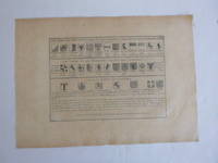
Les XIII Canton des suisses with Les Armes des XIII Canton des Suissep par N. de Fer. First edition of the map and text.
Paris: chez l'auteur dans l'Isle du Palais sur le quay de l'orloge a la Sphére Royale avec privilége du Roy 1705-1717. 2 Engraved maps and coats of arms on two leaves.Each 27.3 x 38cm. Contemporary laid paper uniformly time aged.Published in "L'atlas curieux ou Le monde reÌpreseÌnteÌ dans des cartes geÌneÌrales et particulieres du ciel et de la terre : diviseÌ tant en ses quatre principales parties que par eÌtats et provinces et orneÌ par des plans et descriptions des villes capitales et principales et des plus superbes edifices qui les embelissent comme sont les eglises les palais les maisons de plaisance les iardins les fontaines &c. ". OCLC Number / Unique Identifier:79022119.LThe Atlas Curieux is geographic encyclopedia of images and maps of France with detailed views of the grand waterworks at Marly views of the great palaces and chateaux views and plans of the Paris Observatory and samples of military architecture. Issued in six annual parts from 1700-1705 the maps are based on the new observations of the Académie des Sciences and drawn up with the assistance of Philipe de La Hire.ibrary of Congress:The French cartographer and engraver Nicolas de Fer was a master at creating maps that were works of art. The maps that he published were printed during the Baroque period when the decorative arts were characterized by ornate detail. De Fer’s detailed maps and atlases were valued more for their decorative content than their geographical accuracy.Nicolas de Fer was born in 1646. His father Antoine de Fer owned a mapmaking firm. At the age of twelve Nicolas was apprenticed to a Parisian engraver named Louis Spirinx. The family business was starting to decline when his father died in 1673. Nicolas de Fer’s mother Genevieve took over the business after the death of her husband. In 1687 the business was passed on to Nicolas and the profits increased after he took over the firm. Nicolas de Fer was a prolific cartographer who produced atlases and hundreds of single maps. He eventually became the official geographer to King Louis XIV of France and King Philip V of Spain.One of de Fer’s major works is an atlas titled L’atlas curieux The curious atlas. Paris: chez l'auteur dans l'Isle du Palais sur le quay de l'orloge a la Sphére Royale avec privilége du Roy, 1705-1717 unknown
Referenz des Buchhändlers : 51-6451
|
|
|
FER, Nicolas de
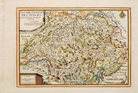
LES XIII CANTONS DES SUISSES.
Atlas Curieux ou le Monde. Paris 1717. Map of Switzerland with title at top left dedication and scales in lower corners Copper engraving. Fine condition Later colour. Size: 348 x 240 mm. 13½ x 9½ iinches unknown
Referenz des Buchhändlers : 53085
|
|
|
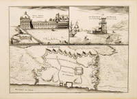
FER, Nicolas de Engraved by Coquart, A
Lisbonne.
Atlas Curieux ou le Monde. c.1710. The lower half of this attractive engraving shows a map of the fortifications of Lisbon. The upper half has two views- To the left the 'Palais Royal de Lisbonne' and to the right 'Le Chateau de Belem'. Copper engraving. Fine condition. Uncoloured. Size: 330 x 240 mm. 13 x 9½ inches. unknown
Referenz des Buchhändlers : 53827
|
|
|
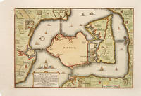
FER, Nicolas de
Mantoue
1705. A plan of the town fortifications and surrounding area Copper engraving. Fine condition Later colouring. Size: 34 x 23 cm. 13½ x 9 inches unknown
Referenz des Buchhändlers : 52739
|
|
|
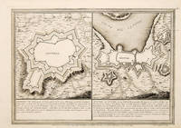
FER, Nicolas de
Olivenca & Setuval.
Paris. 1705. An interesting and unusual map depicting the basic fortifications of two Portuguese towns. Published in the 'Atlas Curieux ou Le Monde'. Size: 275 x 395 mm. Copperplate engraving. Fine condition. unknown
Referenz des Buchhändlers : 65686
|
|
|
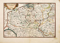
FER, Nicolas de
Pais Bas Catoliques Connues Sous le nom de Flandre
1702. Copper engraving. Later colouring. Size: 33 x 22 cm. 13 x 8½ inches unknown
Referenz des Buchhändlers : 52396
|
|
|
Fer, Nicolas de (1646 - 1720); Pieter Starckman (fl c 1680 - 1730), aka Peter or Petrus, engraver a k a
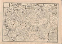
Partie Septentrionale Du Duché De Brabant ou se trouve le Quartier d'Anvers &c aux Espagnols le Marqt. de Bergop-Zoom La Baronnied de Bred Mairie de Bois le Duc &c. aux Hollandois . . . . First edition of the map .
Paris: chez l'auteur dans l'Isle du Palais sur le quay de l'orloge a la Sphére Royale avec privilége du Roy 1714-1717. Engraved map. 27.3 x 38cm. Contemporary laid paper uniformly time aged.Published in "L'atlas curieux ou Le monde reÌpreseÌnteÌ dans des cartes geÌneÌrales et particulieres du ciel et de la terre : diviseÌ tant en ses quatre principales parties que par eÌtats et provinces et orneÌ par des plans et descriptions des villes capitales et principales et des plus superbes edifices qui les embelissent comme sont les eglises les palais les maisons de plaisance les iardins les fontaines &c. ". OCLC Number / Unique Identifier:79022119.LThe Atlas Curieux is geographic encyclopedia of images and maps of France with detailed views of the grand waterworks at Marly views of the great palaces and chateaux views and plans of the Paris Observatory and samples of military architecture. Issued in six annual parts from 1700-1705 the maps are based on the new observations of the Académie des Sciences and drawn up with the assistance of Philipe de La Hire.ibrary of Congress:The French cartographer and engraver Nicolas de Fer was a master at creating maps that were works of art. The maps that he published were printed during the Baroque period when the decorative arts were characterized by ornate detail. De Fer’s detailed maps and atlases were valued more for their decorative content than their geographical accuracy.Nicolas de Fer was born in 1646. His father Antoine de Fer owned a mapmaking firm. At the age of twelve Nicolas was apprenticed to a Parisian engraver named Louis Spirinx. The family business was starting to decline when his father died in 1673. Nicolas de Fer’s mother Genevieve took over the business after the death of her husband. In 1687 the business was passed on to Nicolas and the profits increased after he took over the firm. Nicolas de Fer was a prolific cartographer who produced atlases and hundreds of single maps. He eventually became the official geographer to King Louis XIV of France and King Philip V of Spain.One of de Fer’s major works is an atlas titled L’atlas curieux The curious atlas. Paris: chez l'auteur dans l'Isle du Palais sur le quay de l'orloge a la Sphére Royale avec privilége du Roy, 1714-1717 unknown
Referenz des Buchhändlers : 51-6445
|
|
|
FER, Nicolas de
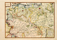
Partie Septentrionale du Duche de Brabant.
Paris. c.1705. An attractive and quite detailed map of the northern regions of Brabant in Belgium and south western Holland by the French cartographer Nicolas de Fer. A number of larger regional towns are highlighted as are local rivers woodlands hills and marshes. Published in the 'Atlas Curieux ou Le Monde'. Size: 275 x 405 mm. Copperplate engraving with later hand colour. Good condition. Some general age toning. unknown
Referenz des Buchhändlers : 66130
|
|
|
FER, Nicolas de
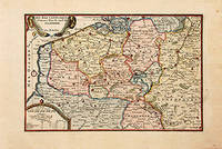
Païs Bas Catoliques connues sous le nom de Flandre.
Paris: 1717. Map of the Catholic Low Countries or current day Belgium. Published in "Atlas Curieux ou le Monde". Copper engraving. Hand coloured. Sheet size: 274 x 405 mm Plate size: 216 x 326 mm Very good condition. unknown
Referenz des Buchhändlers : 78864
|
|
|
Fer, Nicolas de (1646 - 1720); Pieter Starckman (fl c 1680 - 1730), aka Peter or Petrus, engraver a k a
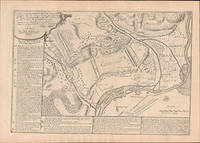
Plan de la bataille de Fredelingue gagnée sur les impériaux par l'armée du roy commandée par Mr. le marquis de Villars le 14 octobre 1702 / mis au jour par N. de Fer . First edition of the map .
Paris: chez l'auteur dans l'Isle du Palais sur le quay de l'orloge a la Sphére Royale avec privilége du Roy 1705-1717. Engraved map. 27.3 x 38 cm. Contemporary laid paper uniformly time aged.Published in "L'atlas curieux ou Le monde reÌpreseÌnteÌ dans des cartes geÌneÌrales et particulieres du ciel et de la terre : diviseÌ tant en ses quatre principales parties que par eÌtats et provinces et orneÌ par des plans et descriptions des villes capitales et principales et des plus superbes edifices qui les embelissent comme sont les eglises les palais les maisons de plaisance les iardins les fontaines &c. ". OCLC Number / Unique Identifier:79022119.LThe Atlas Curieux is geographic encyclopedia of images and maps of France with detailed views of the grand waterworks at Marly views of the great palaces and chateaux views and plans of the Paris Observatory and samples of military architecture. Issued in six annual parts from 1700-1705 the maps are based on the new observations of the Académie des Sciences and drawn up with the assistance of Philipe de La Hire.ibrary of Congress:The French cartographer and engraver Nicolas de Fer was a master at creating maps that were works of art. The maps that he published were printed during the Baroque period when the decorative arts were characterized by ornate detail. De Fer’s detailed maps and atlases were valued more for their decorative content than their geographical accuracy.Nicolas de Fer was born in 1646. His father Antoine de Fer owned a mapmaking firm. At the age of twelve Nicolas was apprenticed to a Parisian engraver named Louis Spirinx. The family business was starting to decline when his father died in 1673. Nicolas de Fer’s mother Genevieve took over the business after the death of her husband. In 1687 the business was passed on to Nicolas and the profits increased after he took over the firm. Nicolas de Fer was a prolific cartographer who produced atlases and hundreds of single maps. He eventually became the official geographer to King Louis XIV of France and King Philip V of Spain.One of de Fer’s major works is an atlas titled L’atlas curieux The curious atlas. Paris: chez l'auteur dans l'Isle du Palais sur le quay de l'orloge a la Sphére Royale avec privilége du Roy, 1705-1717 unknown
Referenz des Buchhändlers : 51-6452
|
|
|
Fer, Nicolas de
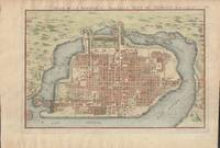
Plan de la Fameuse et Nouvelle Ville de Mexique
Paris. Very Good. 1715. Map. Lovely engraved map depicting Mexico City in the early 18th century. Map is on a 10 ¾" x 15 ¾" sheet that was taken from Nicolas de Fer's "L'Atlas Curieux" of 1715; no content on verso. Date of map was printed in upper margin along with the sheet number "125" and title; content in French. Hand-coloring is still bright. Map has very light toning to edges but is otherwise clean. This detailed map depicts Mexico City when it was surrounded by water and was linked to the mainland by the famous causeways originally designed by the Aztecs. Also pictured are aqueducts and farms and about 50 locations have been numbered on the map but the key is not present likely printed on another page in the Atlas. A beautiful map. . unknown
Referenz des Buchhändlers : 019811
|
|
|
FER, Nicolas de
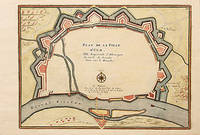
Plan de la Ville d'Ulm.
Paris: 1705. A beautiful city plan of Ulm in the federal German state of Baden-Württemberg. Copper engraving. Hand coloured. Size: 277 x 403 mm Good condition. unknown
Referenz des Buchhändlers : 78550
|
|
|
FER, Nicolas de
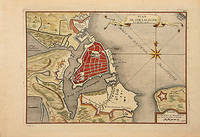
Plan de Straalsund.
Paris: 1716. A beautiful city plan of Stralsund in Germany just off the island of Rugen in the Baltic Sea. Copper engraving. Hand coloured. Sheet size: 275 x 404 mm Plate size: 230 x 332 mm Good condition. unknown
Referenz des Buchhändlers : 78549
|
|
|
Fer, Nicolas de (1646 - 1720); Pieter Starckman (fl c 1680 - 1730), aka Peter or Petrus, engraver a k a
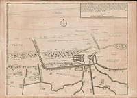
Plan des environs de Dunkerque et de Mardick avec le nouveau canal fait pour l'écoulement des Eaux du paîs etles canaux qui envoient leurs embouchures à la Mer par N. de Fer. 1714. First edition of the map .
Paris: chez l'auteur dans l'Isle du Palais sur le quay de l'orloge a la Sphére Royale avec privilége du Roy 1714-1717. Engraved map. 27.3 x 38cm. Contemporary laid paper uniformly time aged.Published in "L'atlas curieux ou Le monde reÌpreseÌnteÌ dans des cartes geÌneÌrales et particulieres du ciel et de la terre : diviseÌ tant en ses quatre principales parties que par eÌtats et provinces et orneÌ par des plans et descriptions des villes capitales et principales et des plus superbes edifices qui les embelissent comme sont les eglises les palais les maisons de plaisance les iardins les fontaines &c. ". OCLC Number / Unique Identifier:79022119.LThe Atlas Curieux is geographic encyclopedia of images and maps of France with detailed views of the grand waterworks at Marly views of the great palaces and chateaux views and plans of the Paris Observatory and samples of military architecture. Issued in six annual parts from 1700-1705 the maps are based on the new observations of the Académie des Sciences and drawn up with the assistance of Philipe de La Hire.ibrary of Congress:The French cartographer and engraver Nicolas de Fer was a master at creating maps that were works of art. The maps that he published were printed during the Baroque period when the decorative arts were characterized by ornate detail. De Fer’s detailed maps and atlases were valued more for their decorative content than their geographical accuracy.Nicolas de Fer was born in 1646. His father Antoine de Fer owned a mapmaking firm. At the age of twelve Nicolas was apprenticed to a Parisian engraver named Louis Spirinx. The family business was starting to decline when his father died in 1673. Nicolas de Fer’s mother Genevieve took over the business after the death of her husband. In 1687 the business was passed on to Nicolas and the profits increased after he took over the firm. Nicolas de Fer was a prolific cartographer who produced atlases and hundreds of single maps. He eventually became the official geographer to King Louis XIV of France and King Philip V of Spain.One of de Fer’s major works is an atlas titled L’atlas curieux The curious atlas. Paris: chez l'auteur dans l'Isle du Palais sur le quay de l'orloge a la Sphére Royale avec privilége du Roy, 1714-1717 unknown
Referenz des Buchhändlers : 51-6444
|
|
|
FER, Nicolas de
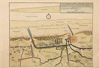
Plan des environs de Dunkerque et Mardick avec le Nouveau Canal.
Paris: c.1717. Map of the towns of Dunkirk and Mardick showing the new canal. Published in "Atlas Curieux ou le Monde". Copper engraving. Hand coloured. Size: 275 x 398 mm Very good condition. unknown
Referenz des Buchhändlers : 78680
|
|
|
FER, Nicolas de
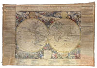
Set of five wall maps: America 1698 Africa 1698 Asia 1696 Europe 1695 and the World 1695.
Paris: chez lauteur / van Loon 1695. Approximately 114 x 165 cm each. Copperplate engravings in original outline colour tissue-backed for stability laid down to modern cartographic linen. All with title banner dated 1698 with the Royal Privilege and text panels dated 1703. Each map printed on four joined sheets with title surmounted and engraved text panels at sides and bottom. A magnificent set of five Enlightenment wall maps of the continents & world all in early states: the only known set of all five unknown in any public or private collection. In the late 17th century mapmaking was emerging from an equal focus on the decorative and descriptive to a more analytic sensibility. Nicolas de Fer 1646-1720 successfully navigated the early Enlightenment era with these monumental wall maps created with the patronage of the Dauphin of France. The dramatic cartouches and vignettes in the maps are masterpieces of baroque imagery capturing the people wonders resources and cultures of faraway lands eagerly sought by Europeans during this dynamic period. A very limited number of large wall maps were produced by the major cartographic houses for the nobility and for wealthy merchants to satisfy curiosity about the world beyond Europe. Grand wall maps such as these were usually mounted for display and their exposure led to the great majority of examples from this period having been lost; the incidence of this type of map passing down to our era is astonishingly small. 1 America: LAmerique divisee selon letendue de ses principales parties et dont les points principaux sont placez sur les observations de messieurs de lAcademie Royale des Sciences 1698. Second state of 1698 first edition adding the dedication to the Dauphin within an ornamental cartouche. One of the most glorious cartographic expressions of the spirit of 17th century French expansionism in North America. The geography is of the type in fashion at Paris during the short interval between La Salles descent of the Mississippi in 1682 and the founding of Louisiana in 1699. De Fer properly aligned Hudson Bay above the Great Lakes which are portrayed with exceptional accuracy and the southern reaches to the Great Lakes are better aligned with the east coast. The map shows advanced knowledge of the Mississippi River drainage although still emptying in the Gulf of Mexico in Texas too far to the west following the school of Coronelli. Two of the most iconic 18th century images of America those of beavers at work and of a cod-fishery were introduced on this map before being made famous by the English cartographer Herman Moll. The beaver scene shows dozens of the industrious creatures against a backdrop of Niagara Falls which is most likely based on Hennepins first printed view of the falls published a year earlier in 1697. 2 Africa: LAfrique divisée selon letendue de ses principales parties et dont les points principaux sont placez sur les observations de messieurs de lAcadémie Royale des Sciences 1698. The African continent on a fantastic scale with extensive annotations and panelled legends throughout; dedicatory cartouche in the southern Indian Ocean. The side panels have extensive text entries for the division of the continent cities islands capes rivers mountains and a lengthy description of the source of the Nile. Richly decorated with more than 20 elaborate scenes showing art industry clothing customs farming hunting trade battle and landscapes. Numerous animals include ostrich monkey crocodile lion elephant and camel. With a plan of the Dutch fort at the Cape of Good Hope in a draped paneled inset. The Arabian Peninsula is shown in its entirety. Based in part on the work of de lIsle it shows an early conception of the Middle East: in particular it omits the Sinai Peninsula included in several of de Fers earlier efforts. Among the toponyms along the coast of the Gulf are Abadan Sur Ahsa Janama Bahr El Catif Bischa Borou Godo Vodana Calba Dadana and Pinder. Although the coastlines are well mapped there is a notable lack of understanding of the interior: the Niger delta is shown divulging on the west coast instead of the Gulf of Benin while the massive extent of the Congo rivers drainage basin is here only hinted at. The Nile is finally freed from the twin Ptolemaic lakes and begins to take on its more accurate course.3 Asia: LAsie divisée selon letendue de ses principales parties et dont les points principaux sont placez sur les observations de messieurs de lAcadémie Royale des Sciences 1696. The earliest known state dated 1696 in the dedication. Includes the rare letterpress historical text panels dated 1703. Much of the continent is well-charted based largely on Dutch for the Philippines Malaysia Southeast Asia and Jesuit sources for areas such as China. The coastlines north of Korea correctly shown as a peninsula curving west and northward begin and end in ambiguity. Inset map of Arctic Asia; two inset maps of Northeast China based on the writings of the Jesuits Martino Martini and Ferdinand Verbiest. The richly decorated borders depict the people art religion commerce and cultures of Asia. Vignettes show Chinese Japanese Turks Indians Tartars Philippines inhabitants of the Molucca and Sunda islands Ceylonese Arabs peoples from Goa and Mongolia Armenians Georgians people from Golconda Malaysia Siam Cochin and Tonkin. Among the images are those of the faithful during the Hajj visiting the Kaaba at Mecca. The rare letterpress panels provide extensive text references; rivers towns capes lakes and straights including more detailed descriptions of Turkey Arabia China Persia India Russia and Arabic islands in the Indian Ocean. 4 Europe: LEurope divisée selon letendue de ses principales parties et dont les points principaux sont placez sur les observations de messieurs de lAcadémie Royale des Sciences 1695. The earliest known state dated 1695 within the dedication. With 16 legends in elaborate Baroque vignettes describing the French Polish Germans Austrians English and other peoples the vignettes interspersed with views of cities hunting coats of arms pageantry and other fascinating glimpses of a dynamic continent with culture flowering everywhere. The side panels have extensive text entries for the division of the continent countries principalities nobility cities principal islands capes rivers mountains etc. Widely acknowledged as one of the foremost French cartographers of the late 17th century Nicolas de Fer published more than 600 maps and many atlases documenting French fortified towns strongholds and the explorations and discoveries of new territories. Unlike most Dutch cartographers who mainly made maps for navigational purposes he worked in the French decorative style creating a total of 26 large wall maps to adorn walls in the palaces and castles of European royalty clergy and wealthy merchants.A superb set previously unobtainable: no other set of the de Fer wall maps of the continents in their earliest incarnation with or without the side panels other than the present example are known to have survived. Examples of individual continental maps in the earliest states as here rarely appear on the market. Later states of the map often appear without the surmounted title and text panels. No comparable set traced in auction records; an example of the first-state America map alone sold by Cohen & Taliaferro in 2010 commanded $185000.Provenance: Long in an aristocratic collection based near Novara. Acquired in the U.S. trade. Absolutely untouched by facsimile only some reinstatement of paper in text panels and much less so to very minor loss in maps. Old outline colour retouched; cartouches and vignettes with recent colour. Stabilised cracks occasional scuffing overall age toning.l Burden P. The Mapping of North America II no. 744; Dahl E. The Original Beaver Map: De Fers 1698 Wall Map of America in: The Map Collector 29 Dec. 1984 pp. 22-26; Suarez T. Shedding the Veil Singapore 1992 no. 48; not in WorldCat. chez lauteur / van Loon, hardcover
Referenz des Buchhändlers : ABC_49413
|
|
|
Fer, Nicolas De
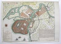
StolenDe Petersbourg
Paris 1717. margins trimmed and laid down on 18th century paper otherwise very good. Notes: StolenRare map of the Imperial capital city during the reign of Alexander I with its traditional regular street layout and eleven districts. The map provides excellent detail of the public buildings docks and shipyards fortifications palaces churches hospitals universities etc Size : 365x473 mm 14.375x18.625 Inches Coloring: Hand Colored Category: ; Maps Russia; Maps City Maps unknown
Referenz des Buchhändlers : M3039
|
|
|
FER, Nicolas de
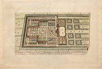
Veue generale de la Maison et des Jardins de Nieuburg pres du village de Riswick
Paris: 1705. Nicolas de Fer's excellent plan of the Nieuburg House where the treaty of Ryswick in the Netherlands was signed in 1697 and not 1705 as stated in the print. From the "Atlas Curieux ou Le Monde". Copper engraving. Hand colouring. Size: 275 x 400 mm Good condition. unknown
Referenz des Buchhändlers : 78538
|
|
|
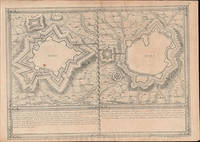
Fer, Nicolas de (1646 - 1720); Antoine Coquart, (1668-1707), engraver
Views and Plans of Elvas and Evora Portugal. Par N. de Fer. First edition of the map.
Paris: chez l'auteur dans l'Isle du Palais sur le quay de l'orloge a la Sphére Royale avec privilége du Roy 1705-1717. Engraved map. 27.3 x 38cm. Contemporary laid paper uniformly time aged.Elvas is a fortified hilltop town on the Spanish border east of Lisbon. The Portuguese too the city fromthe Moors in 1226 and it was captured by Spain in 1580. The fortifications date mostly from the 17th century and there is a 16th-century aqueduct.Evora is the capital of the province of Alentejo east of Lisbon It was captured by the Romans in 80 BC and has a Roman aqueduct and temple of Diana the goddess of hunting. There is also a 13th-century Gothic cathedral. From the 14th to the 16th centuries Evora was the residence of the Kings of Portugal.This map was published during the War of the Spanish Succession a conflict in which Portugal and Lisbon featured prominent hence the depiction of the fortifications of the city.Published in "L'atlas curieux ou le monde reÌpreseÌnteÌ dans des cartes geÌneÌrales et particulieres du ciel et de la terre : diviseÌ tant en ses quatre principales parties que par eÌtats et provinces et orneÌ par des plans et descriptions des villes capitales et principales et des plus superbes edifices qui les embelissent comme sont les eglises les palais les maisons de plaisance les iardins les fontaines &c. ". OCLC Number / Unique Identifier:79022119.LThe Atlas Curieux is geographic encyclopedia of images and maps of France with detailed views of the grand waterworks at Marly views of the great palaces and chateaux views and plans of the Paris Observatory and samples of military architecture. Issued in six annual parts from 1700-1705 the maps are based on the new observations of the Académie des Sciences and drawn up with the assistance of Philipe de La Hire.Library of Congress:The French cartographer and engraver Nicolas de Fer was a master at creating maps that were works of art. The maps that he published were printed during the Baroque period when the decorative arts were characterized by ornate detail. De Fer’s detailed maps and atlases were valued more for their decorative content than their geographical accuracy.Nicolas de Fer was born in 1646. His father Antoine de Fer owned a mapmaking firm. At the age of twelve Nicolas was apprenticed to a Parisian engraver named Louis Spirinx. The family business was starting to decline when his father died in 1673. Nicolas de Fer’s mother Genevieve took over the business after the death of her husband. In 1687 the business was passed on to Nicolas and the profits increased after he took over the firm. Nicolas de Fer was a prolific cartographer who produced atlases and hundreds of single maps. He eventually became the official geographer to King Louis XIV of France and King Philip V of Spain.One of de Fer’s major works is an atlas titled L’atlas curieux The curious atlas. Paris: chez l'auteur dans l'Isle du Palais sur le quay de l'orloge a la Sphére Royale avec privilége du Roy, 1705-1717 unknown
Referenz des Buchhändlers : 51-6473
|
|
|
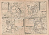
Fer, Nicolas de (1646 - 1720); Antoine Coquart, (1668-1707), engraver
Views and Plans of Estremos; Villa Viciosa; St. Julien out St. Giao; Aronches. Par N. de Fer. First edition of the map.
Paris: chez l'auteur dans l'Isle du Palais sur le quay de l'orloge a la Sphére Royale avec privilége du Roy 1705-1717. Engraved map. 27.3 x 38cm. Contemporary laid paper uniformly time aged.Elvas is a fortified hilltop town on the Spanish border east of Lisbon. The Portuguese too the city fromthe Moors in 1226 and it was captured by Spain in 1580. The fortifications date mostly from the 17th century and there is a 16th-century aqueduct.Published in "L'atlas curieux ou le monde reÌpreseÌnteÌ dans des cartes geÌneÌrales et particulieres du ciel et de la terre : diviseÌ tant en ses quatre principales parties que par eÌtats et provinces et orneÌ par des plans et descriptions des villes capitales et principales et des plus superbes edifices qui les embelissent comme sont les eglises les palais les maisons de plaisance les iardins les fontaines &c. ". OCLC Number / Unique Identifier:79022119.LThe Atlas Curieux is geographic encyclopedia of images and maps of France with detailed views of the grand waterworks at Marly views of the great palaces and chateaux views and plans of the Paris Observatory and samples of military architecture. Issued in six annual parts from 1700-1705 the maps are based on the new observations of the Académie des Sciences and drawn up with the assistance of Philipe de La Hire.Library of Congress:The French cartographer and engraver Nicolas de Fer was a master at creating maps that were works of art. The maps that he published were printed during the Baroque period when the decorative arts were characterized by ornate detail. De Fer’s detailed maps and atlases were valued more for their decorative content than their geographical accuracy.Nicolas de Fer was born in 1646. His father Antoine de Fer owned a mapmaking firm. At the age of twelve Nicolas was apprenticed to a Parisian engraver named Louis Spirinx. The family business was starting to decline when his father died in 1673. Nicolas de Fer’s mother Genevieve took over the business after the death of her husband. In 1687 the business was passed on to Nicolas and the profits increased after he took over the firm. Nicolas de Fer was a prolific cartographer who produced atlases and hundreds of single maps. He eventually became the official geographer to King Louis XIV of France and King Philip V of Spain.One of de Fer’s major works is an atlas titled L’atlas curieux The curious atlas. Paris: chez l'auteur dans l'Isle du Palais sur le quay de l'orloge a la Sphére Royale avec privilége du Roy, 1705-1717 unknown
Referenz des Buchhändlers : 51-6475
|
|
|
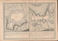
Fer, Nicolas de (1646 - 1720); Antoine Coquart, (1668-1707), engraver
Views and Plans of Olivenca and Setuval Portugal. Representa la fortaleza de Olivenza y de Setúbal. Par N. de Fer. First edition of the map.
Paris: chez l'auteur dans l'Isle du Palais sur le quay de l'orloge a la Sphére Royale avec privilége du Roy 1705-1717. Engraved map. 27.3 x 38cm. Contemporary laid paper uniformly time aged.Elvas is a fortified hilltop town on the Spanish border east of Lisbon. The Portuguese too the city fromthe Moors in 1226 and it was captured by Spain in 1580. The fortifications date mostly from the 17th century and there is a 16th-century aqueduct.Published in "L'atlas curieux ou le monde reÌpreseÌnteÌ dans des cartes geÌneÌrales et particulieres du ciel et de la terre : diviseÌ tant en ses quatre principales parties que par eÌtats et provinces et orneÌ par des plans et descriptions des villes capitales et principales et des plus superbes edifices qui les embelissent comme sont les eglises les palais les maisons de plaisance les iardins les fontaines &c. ". OCLC Number / Unique Identifier:79022119.LThe Atlas Curieux is geographic encyclopedia of images and maps of France with detailed views of the grand waterworks at Marly views of the great palaces and chateaux views and plans of the Paris Observatory and samples of military architecture. Issued in six annual parts from 1700-1705 the maps are based on the new observations of the Académie des Sciences and drawn up with the assistance of Philipe de La Hire.Library of Congress:The French cartographer and engraver Nicolas de Fer was a master at creating maps that were works of art. The maps that he published were printed during the Baroque period when the decorative arts were characterized by ornate detail. De Fer’s detailed maps and atlases were valued more for their decorative content than their geographical accuracy.Nicolas de Fer was born in 1646. His father Antoine de Fer owned a mapmaking firm. At the age of twelve Nicolas was apprenticed to a Parisian engraver named Louis Spirinx. The family business was starting to decline when his father died in 1673. Nicolas de Fer’s mother Genevieve took over the business after the death of her husband. In 1687 the business was passed on to Nicolas and the profits increased after he took over the firm. Nicolas de Fer was a prolific cartographer who produced atlases and hundreds of single maps. He eventually became the official geographer to King Louis XIV of France and King Philip V of Spain.One of de Fer’s major works is an atlas titled L’atlas curieux The curious atlas. Paris: chez l'auteur dans l'Isle du Palais sur le quay de l'orloge a la Sphére Royale avec privilége du Roy, 1705-1717 unknown
Referenz des Buchhändlers : 51-6474
|
|
|
FER, Ph
Code civil du canton de Vaud. Nouvelle ÂŽdition conforme quant au texte ˆ lՎdition officielle. Avec des notes indiquant la correspondance des articles entrÕeux ainsi que les modifications exceptions et dÂŽrogations quÕune disposition a reÂue par une autre et une table alphabÂŽtique et raisonnÂŽe des matiÂres.
Lausanne : Lacombe 1823. 170x105mm. XXII - 266Êpages reliure demi-basane. Plats papier marbr. Titre dor au dos. 350 Lacombe unknown
Referenz des Buchhändlers : 45312
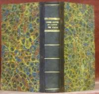
|
|
|
Fer, Yannick
Femmes et pentecôtismes: Enjeux d'autorité et rapports de genre
paperback. Good. Access codes and supplements are not guaranteed with used items. May be an ex-library book. paperback
Referenz des Buchhändlers : 283091578X.G ISBN : 283091578X 9782830915785
|
|
|
Fer, Yannick
L'offensive évangélique: Voyage au coeur des réseaux militants de Jeunesses en Mission
paperback. Good. Access codes and supplements are not guaranteed with used items. May be an ex-library book. paperback
Referenz des Buchhändlers : 2830913817.G ISBN : 2830913817 9782830913811

|
|

 Per e-mail erhalten
 Als pdf-Dokument herunterladen
 RSS feed
 Permanenter link


