|
NANSOUTY Max de
LA VIE SCIENTIFIQUE sous la Direction de Max de NANSOUTY. Revue Universelle des Inventions nouvelles et sciences pratiques du cyclisme et de l'automobilisme. Secrétaire de la rédaction: Gaston JOUGLA.
P., E. Juven & Cie, 1899, 1900, 1901. Six volumes 18x27 cm, 500-540-520-520-520-520 pages, nombreux croquis, reproductions photographiques, cartonnage illustré à thème automobile.
Riferimento per il libraio : N39

|
|
|
NANSOUTY Max de
Les trains ?lectriques Article (3 pages 3 gravures) dans l'Illustration.
Num?ro complet.
|
|
|
NANSOUTY Max de - LENA L.-F.
Les freins de chemins de fer.- Les nouveaux chemin de fer de montagne, dans l'Oberland Bernois. Article (1 page, 5 dessins) et (2 pages, 5 gravures) dans l'Illustration.
Num?ro complet.
|
|
|
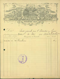
Napoleon Chaix Imprimerie ey Libraries Centrales des Chemins de Fer (Rue Berger 20 Pres Du Boulevard Montemartre).
Receipt from Napoleon Chaix Rue Berger 20 Pres Du Boulevard Montemartre Paris to Societe Generale Pour L'Industrie en Russie 53 Rue de Chateaudun 31 Mai 1900.
Paris: Imprimerie Chaix 1900. 21 x 27 cm. Receipt on Chaix letterhead filled out in ink stamped by recipient July 25 1919. Good with toning minor losses and tiny marginal tears to bottom edge. Engraved letterhead. En Francais. Paris: Imprimerie Chaix, 1900. unknown
Riferimento per il libraio : 63-8138
|
|
|
NAPOLEON CHAIX
Carte générale des Chemins de Fer et Voies Navigables de la France - 1859 -
1859 une carte dépliante en couleurs entoilée in-octavo ( Format plié :16,7 x 11,2 cm), format déplié : 67 x 88,5 cm, avec son étui de percaline rouge décoré or et à froid, 1859 Paris Napoleon Chaix et Cie Editeur,
Riferimento per il libraio : 18282
|
|
|
Napoléon NEY,
En Asie centrale à la vapeur, la mer noire, la Crimée, le Caucase, la mer caspienne, les chemins de fer sibériens et asiatiques, inauguration du chemin de fer transcaspien, l'Asie centrale, Merv, Bokhara, Samarkand, Notes de voyage.
Paris, Garnier frères, 1888. demi reliure , 464p.
Riferimento per il libraio : 67

|
|
|
NARJOUX
Histoire d’un pont
in 12 pleine toile bleue décorée,d’éditeur.Faux-titre, titre,II,282 pages,tranches rouges,89 illustrations dans et hors-texte de l’auteur.Hachette 1884 rousseurs,fortes à certaines pages .mors supérieur droit fendu. ponts anciens,ponts du moyen âge,ponts de fer,ponts de pierre,pont suspendu
Riferimento per il libraio : 4033

|
|
|
Natali Antonio e Natali Elvio
L'eredità di un maestro. Opere dalla Fondazione Salvatore Cipolla, Sesto Fiorentino, Comune di Sesto Fiorentino, 2011
Sesto fiorentino, Palazzo comunale, 17 aprile - 8 maggio 2011. Sesto Fiorentino, 2011; br., pp. 32, ill. e tavv. b/n e col., cm 24x31.

|
|
|
Natati Carlo. Telleri Nives
Archi e Balestre nel Medioevo. Manuale tecnico di ricostruzione storica, Tuscania, Edizioni Penne & Papiri, 2006
Tuscania, 2006; br., pp. 240, ill., 96 tavv. col., cm 17x24. (I Papiri. 33).

|
|
|
Nationale Maatschappij van Belgische Spoorwegen
Het Dispatching System in België
8pp.met enige ills., geïll.omslag, 24cm., stempeltje, goede staat
|
|
|
Nationale Maatschappij van Belgische Spoorwegen
Het Dispatching System in België
Brussel, Nationale Maatschappij van Belgische Spoorwegen 1930 8pp.met enige ills., geïll.omslag, 24cm., stempeltje, goede staat
Riferimento per il libraio : B42179
|
|
|
NAUD Louis
LES VOIES FERREES FRANCAISES ET LES PRINCIPALES LIGNES DU RESEAU EUROPEEN
1932 plaquette éditeur in-octavo, couverture verte, illustrations : 6 cartes schématiques et 2 cartes densemble, 16 pages, 1932 Paris Bureaux du Courrier des Examens,
Riferimento per il libraio : 6347
|
|
|
NAVA Maria Luisa -
Aspetti e problemi delle stele “Daunie” .
Varese, 1976, 8vo stralcio con copertina posticcia muta, pp. 249/286 con 24 tavole. - !! ATTENZIONE !!: Con il termine estratto (o stralcio) intendiamo riferirci ad un fascicolo contenente un articolo, completo in se, sia che esso sia stato stampato a parte utilizzando la stessa composizione sia che provenga direttamente da una rivista. Le pagine sono indicate come "da/a", ad esempio: 229/231 significa che il testo è composto da tre pagine. Quando la rivista di provenienza non viene indicata é perché ci è sconosciuta. - !! ATTENTION !!: : NOT A BOOK : “extract” or “excerpt” means simply a few pages, original nonetheless, printed in a magazine. Pages are indicated as in "from” “to", for example: 229/231 means the text comprises three pages (229, 230 and 231). If the magazine that contained the pages is not mentioned, it is because it is unknown to us.

|
|
|
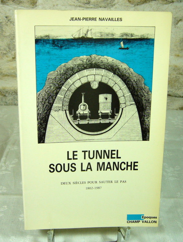
NAVAILLES Jean-Pierre
Le tunnel sous la manche.Deux siècles pour sauter le pas, 1802-1987.
Broché, 24X15 cm, 1987, 275 pages, illustrations en noir, collection époques, Champ Vallon. Bon exemplaire.
Riferimento per il libraio : 20439
|
|
|
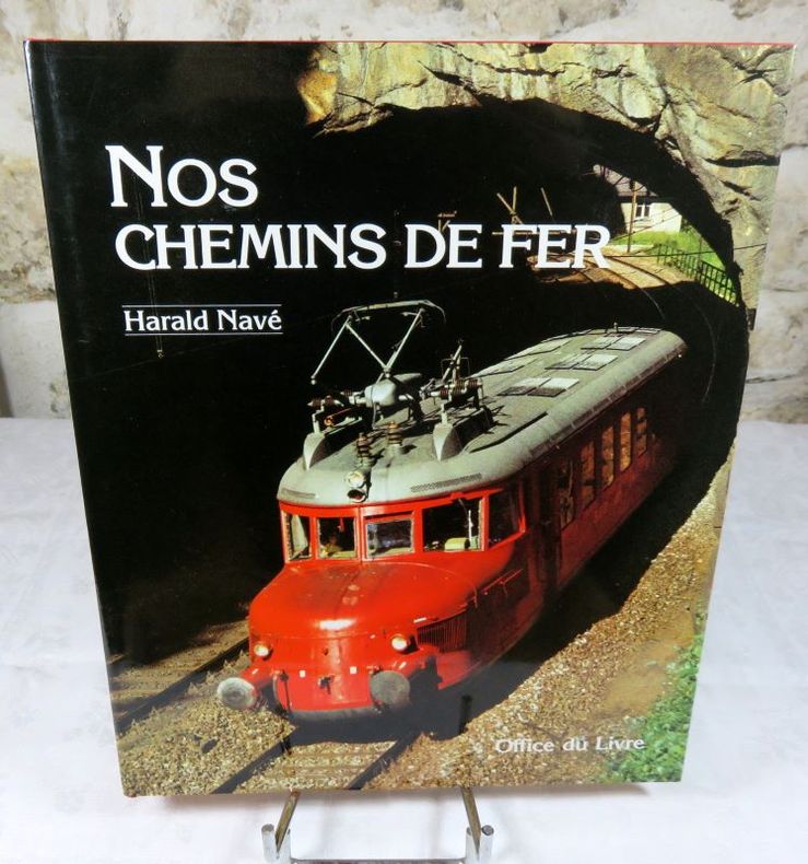
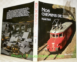
NAVE Harald
Nos chemins de fer (Suisse).
Reliure toile de l'éditeur sous jaquette, 30X24 cm, 1985, 200 pages, nombreuses photos en noir et en couleurs, éditions office du livre. Très bon état.
Riferimento per il libraio : 24853
|
|
|
NAVE, Harald.
Alaska - Terre de Feu. En train à travers les deux Amériques.
Lausanne - Neuchâtel, 24 Heures - Avanti sans date, vers 1985, 290x220mm, 160pages, reliure d'éditeur sous jaquette.
Riferimento per il libraio : 62726
|
|
|
NAVE, Harald.
Nos chemins de fer.
Fribourg - Zurich, Office du Livre - Silva 1985, 305x245mm, 200pages, reliure d'éditeur sous jaquette. Petits accrocs sur le haut du dos de la jaquette, autrement très bel exemplaire.
Riferimento per il libraio : 98551
|
|
|
Navé Harald
Alaska - Terre de Feu. En train à travers les deux Amériques
Payot Beaux Livres Cartonnage d'éditeur 1986 In-4 (22 * 29 cm.), cartonnage toilé rouge de l'éditeur, 160 pages, bel album illustré de photographies couleur et noir et blanc ; jaquette manquante, intérieur frais, très bon état. Livraison a domicile (La Poste) ou en Mondial Relay sur simple demande.
Riferimento per il libraio : qi1375

|
|
|
NEGRONI CATACCHIO Nuccia - FUSCO Vincenzo -
Scavi a Pianvalle (Como) : rinvenimenti di epoca La Tène. Esame osteologico.
Como, 1982, 8vo stralcio con copertina posticcia muta, pp. 315/356 con 17 tavole. - !! ATTENZIONE !!: Con il termine estratto (o stralcio) intendiamo riferirci ad un fascicolo contenente un articolo di rivista, sia che esso sia stato stampato a parte utilizzando la stessa composizione sia che provenga direttamente da una rivista. Le pagine sono indicate come "da/a", ad esempio: 229/231 significa che il testo è composto da tre pagine. Quando la rivista di provenienza non viene indicata é perchè ci è sconosciuta. - !! ATTENTION !!: : NOT A BOOK : “estratto” or “stralcio” means simply a few pages, original nonetheless, printed in a magazine. Pages are indicated as in "from” “to", for example: 229/231 means the text comprises three pages (229, 230 and 231). If the magazine that contained the pages is not mentioned, it is because it is unknown to us.

|
|
|
Neher André
Mosè
(Collana : Enciclopedia Popolare Mondadori) Vol. corredato da ill. in b.n. n.t.

|
|
|
Neri Diana
Le coppe fenicie della tomba Bernardini nel museo di Villa Giulia, La Spezia, Edizioni Agorà , 2000
La Spezia, 2000; br., pp. 93, 27 ill. b/n, 16 tavv. b/n e col., cm 21x30. (Studi e Ricerche sui Beni Culturali). (Monumenti fenici. 2). (Studi e ricerche sui Beni Culturali. Collana diretta da Enrico Acquaro e Tatiana Kirova. 3). italiano 88-87218-1 Studi e Ricerche sui Beni Culturali br.

|
|
|
Nesti Paolo
Archibuseria pistoiese. Maffio Archibusiere del XVI sec. e la sua fabbrica di Candeglia, Pistoia, Istituto Storico Prov. Resistenza, 2015
Pistoia, 2015; br., pp. 126, ill. b/n, cm 16x22.

|
|
|
NETTER J.
Voitures et wagons.Matériel. Freinage. Eclairage. Chauffage.
P., Baillière, 1927. In-8, 602pp., 484pp., pl. percaline.
Riferimento per il libraio : CF97
|
|
|
Neuman, F. A
Werkstätten für Eisenkonstruktionen aller Art
Verzinkerei. Eschweiler 2. (Katalog: Sonder-Erzeugnisse: Gas u. Wasserbehälter. 6. Auflage. Februar 1902). Mit zahlr. (1 farb.) Abb. meist nach Photographien. Eschweiler, Selbstverlag (Druck: Aachener Verlags- und Druckerei-Ges.), 1902. 4to. (32,0 x 24,0 cm). 151, (1) S. Farbig illustrierter Orig.-Leinwandband mit geprägter Vignette auf dem Vorderdeckel.
Riferimento per il libraio : 6057

|
|
|
NEVEUX F. / HENRY Leon
Traité pratique du laminage du fer.
Gauthier-Villars, 1881, 64 p., 13 planches en fin de volume, demi-basane, coin supérieur des pages rongé sans atteinte au texte, bon état pour le reste.
Riferimento per il libraio : 84859
|
|
|
New Jersey Steel and Iron Co
Useful Information For Engineers Architects And Constructors And Tables Of Rolled Beams Channels Angles &c
like new. unknown
Riferimento per il libraio : 45049405 ISBN : 1018815899 9781018815893

|
|
|
New York Iron Bridge Co
Autograph letter signed from the agent of the New York Iron Bridge Co. to George W. Strong of Rutland Vermont who was involved with the Rutland and Washington Railroad Company
New York 1850. Very good overall. An interesting letter detailing the negotiation over wooden vs. iron railroad bridges. In this letter addressed to Strong M. M. White agent of the New York Iron Bridge Co. seeking to persuade the Vermont railroad to eschew a wooden bridge and setting out advantageous terms for purchasing an iron bridge.<br /> <br /> Strong was "liable as endorser on paper for the Rutland and Washington Railroad Company which subsequently failed to an amount considerable exceeding all his property." He was sued in the Supreme Court of Vermont lter in the 1850s and looks to have been bankrupted losing his real estate marble quarry share etc. See "Reports of Cases Argued and Determined in the Supreme Court of Vermont vol. 42 Montpelier Vt 1870 by Wheelock Veazey a Vermont Civil War hero.<br /> <br /> Letter written on blue laid paper 4pp 8 x 10 1/4"written on 1pp docketed on the verso with period folds. A small raised oval in the top left corner unreadable by this cataloguer. Verso a little marked a little creased. unknown
Riferimento per il libraio : 23992

|
|
|
NEW YORK STATE IRON WORKERS' CONVENTIONS
General Convention of the Friends of Domestic Industry Assembled at New York October 26 1831
Albany 1831. First. hardcover. very good-. Reports of Committees. On the Product and Manufacture of Iron and Steel. 32pp. Bound with: Proceedings of a Convention of Iron Workers Held at Albany N. Y. on the 12th day of Dec. 1849. 58 2pp. 8vo modern red cloth light foxing a few pages slightly underlined in pencil. New York and Albany 1831 1849. First Editions.<br/> <br/> unknown
Riferimento per il libraio : 231927
|
|
|
NEW YORK STATE IRON WORKERS' CONVENTIONS
General Convention of the Friends of Domestic Industry Assembled at New York October 26 1831
Albany 1831. First. hardcover. very good-. Reports of Committees. On the Product and Manufacture of Iron and Steel. 32pp. Bound with: Proceedings of a Convention of Iron Workers Held at Albany N. Y. on the 12th day of Dec. 1849. 58 2pp. 8vo modern red cloth light foxing a few pages slightly underlined in pencil. New York and Albany 1831 1849. First Editions.<br/><br/> unknown books
Riferimento per il libraio : 231927
|
|
|
NEW YORK...
Terrible panique, deux trains en feu sur le viaduc de Brooklyn. Article et gravure couleurs pleine page dans le Petit Journal suppl?ment illustr?.
Num?ro complet. D?fra?chi.
|
|
|
Newlook
NewlookStinger, missile de poche - Fier-à-bras de fer - Le dragon de Komodo - Twist again, les années 50 - Gadins sur patins, Iceball - La grande casse, formule 1 - Duo en mono
N° 40 - décembre 1986 - Mensuel illustrée - broché
Riferimento per il libraio : 39174
|
|
|
Newman, Peter C.; Dickson, Doris; Moon, Barbara; Bodsworth, Fred; Robert, Marika; Allen, Robert Thomas; Goldbloom, Dr. Alton; Frayne, Trent; Richler, Mordecai
Maclean's - Canada's National Magazine, 3 December 1960 - I Went Back Behind the Iron Curtain
80 pages. Features: The nuclear dilemma of the Western peoples - part I; My parents were deaf and dumb; The second coming of Morley Callaghan; An interim report on the next Ice Age - research on Heiberg Island; I went back behind the Iron Curtain - Marika Robert's account of her return to Czechoslovakia which she escaped 12 years ago - article with photos; Holiday weekend in San Francisco; The one doctor in four talks back - a warning about M.D.s flogging pills and cure-alls on TV; Montreal's grey-flannel hockey cartel - How Frank Selke's system has brought success to the Montreal Canadiens - with photo of Toe Blake, Selke and a group of players on the ice; You too can have a beautiful body - Ben Weider brings an International Federation of Body Builders' event to Montreal - article with great photos; Nice colour photo ad display's several Kodak cameras; The Spartacus movie receives a glowing review; Colour photo full-page ad for coloured phones - a big innovation back then!; Nice colour ad for the 1961 Dodge Dart; Beautiful colour photo ad for the 1961 Buick shoes a black Electra 225 4-door Riviera Sedan in front of a black office building - Gorgeous!; Foster Hewitt photo as part of ad for Swiss watches; Nice full-page colour photo ad for the1961 Chevrolet Impala Sedan including photos of the Nomad station wagon and the Biscayne; Nice two-page black and white photo ad for TCA (Trans-Canada Airlines) and more. Moderate wear. Unmarked. Binding intact. A nice vintage copy. Magazine

|
|
|
Newman, Peter C.; Moon, B.; Frayne, T.; Roy, Andrew W.; Fraser, B.; Allen, R.T.; Barkey, Frank R.; Et al
Maclean's Magazine, July 7, 1956 - The Rothschild's Fabulous Stake in Canada
64 pages. Features: The Rothschilds' fabulous stake in Canada - very rare 6-page article by Peter C. Newman, with photos; What you don't need to know about rock 'n roll - "it works on man's emotions like the music of the heathen in Africa"; Just look at the old ice-creem parlor now - George Dawson's drive-in can have twelve thousand people drop in on a Sunday; The Great Cross-Canada hike - five people walked from Halifax to Vancouver - here's the footrace that stirred all Canada back in 1921; The alarming truth about Konrad Adenauer - we call him a friend but this Grand Old Man of Germany is really a threat to pro-Western policy; When Every woman looked like Regina Lee - Blance Howard discusses the Liberal stranglehold on Ottawa; How to handle your kids in the holidays; The miracle that saved our son's mind - Frank Barkey's 'perfect baby' was on the dim edge of consciousness, his body wracked by convulsions, his brain a shattered blank - this is the story of that ordeal. Interesting ad inside back cover shows iron lungs with Caterpillar backup power. Somewhat above-average wear. Please note that page 5/6 is missing. It appears to have contained the London letter by Beverley Baxter. Fantastic colour ad for the 1956 Buick on page 10. Nice colour Coke ad on back cover. Bit of writing atop back cover. Magazine

|
|
|
Nicholas de Fer ; [ Ginville, Vincent de ( engraver ) ]
Cartography Les Costes Aux Environs De La Riviere de Misisipi Decouvertes par Mr. de la Salle en 1683 et reconnues par Mr. le Chevallier d'Iberville en 1698 et 1699 par N. de Fer Geographe de Monseigneur le Dauphon 1701
Paris: Nicolas De Fer 1701. First Edition. Very Good. Ginville Vincent de. Ginville Vincent de. First Edition. Paper size 42.5 cm x 28.5 cm. Plate mark 34 x 22.5 cm. Marginal paper clip stain inked '109' upper right corner some marginal chipping to the paper and old penciled price lower right. A few unobtrusive spots inside the plate marks. Copperplate engraving by Vincent de Ginville with later awfully bright hand color. This map would frame up nicely. There appears to be several versions of this map. The David Rumsey Collection has an example dated on the cartouch 1705 which he notes as being from Nicolas De Fer's Atlas Curieux published later. <br /> <br /> The Library of Congress has an example of the map offered here with the 1701 date and a separate page with explanations of the map. We don't know where this 1701 example came from separately issued or another atlas. The map highlights locations of Indian villages found by La Salle during his explorations of the coastal areas of the United States. We see the Gulf of Mexico Cap de la Floride and many inland village names. A nice map showing some early history of the southern United States. It includes parts of modern-day Louisiana Mississippi Alabama and Florida as well as the Bahamas and Cuba. Nicolas De Fer unknown
Riferimento per il libraio : 23030

|
|
|
Nicholas de Fer
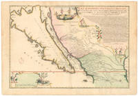
La Californie ou Nouvelle Caroline Teatro De Los Trabajos Apostolicos De La Compa. E. Jesus En La America Septe…
<p>This exquisite and scarce map was published in Paris in 1720. The maker Nicolas de Fer was one of the most prolific and influential French cartographers of the late 17th and early 18th centuries who worked for the French King and <em>dauphin </em>crown prince.</p><p>The map depicts the most iconic cartographic myth in the European exploration of the Americas: California as a large island. This notable misconception impacted the accuracy of mapmaking for centuries and full acceptance that California was part of the continental mainland was not achieved until the mid-18th century.</p><p><strong>But why '<em>Nouvelle Caroline</em>'</strong></p><p>We can actually start at the eastern edge of the map where we see the great Mississippi River emptying into the Gulf. At first its position seems somewhat anachronistic as it follows an antiquated 17th-century notion of the Mississippi Delta located far to the west. Cartographers began rejecting this configuration after French explorer Sieur de la Salle navigated the entire lower river in 1682. Yet De Fer's choice to position the delta further west was in fact a keen political move executed in service to his patron the <em>dauphin</em>. By positioning the Mississippi so far west as to include it in this map he automatically implies a significantly enlarged French Louisiana even if it remains unseen.</p><p>The French were gradually beginning to encroach on the silver-rich regions in Upper Mexico which at that time belonged firmly to New Spain. But a great upheaval had recently taken place in Spain altering the entire political landscape of Europe. When the Spanish King Charles II died in 1700 this closed the chapter on the powerful dynasty of the Spanish Habsburgs following a long period of decline. When power subsequently transferred to Charles' nephew Phillipe of Anjou who became Philip V of Spain it passed from the Habsburgs to the Bourbons to which the French kings belonged. It was almost a personal victory for De Fer as Philip was the son of the French <em>dauphin</em> who in turn was De Fer's main patron.</p><p>A political element of cartographic land grabbing is echoed in the map's title which refers to the island as 'California or New Carolina' <em>Nouvelle Caroline</em>. This bold new proposal for an alternate name was loaded with political meaning. Following the Spanish succession some still challenged Philip's claim just as some feared an amalgamation of French and Spanish interests and power in the New World. De Fer's maps were part of the counter-propaganda touting the ambitions of his patrons as fact to exaggerate their global influence. While the term 'California' was very much tied to the envisioned island renaming the entire region <em>Nouvelle Caroline</em> New Carolina would make borders more fluid and national ownership less defined.</p><p>Beneath the title De Fer has included extensive text that constitutes an invaluable record of late 17th century missions and Indian villages in this remote part of the New World. The inclusion of this text helped cement De Fer's map as a seminal contribution to West Coast cartography. The mapmaker seems to have been well aware of the importance of this annotation as he surrounded it with fascinating vignettes depicting scenes of Native American life and the abundance of the land. He further compliments these scenes with depictions of fauna in the lower-left corner including an aardvark a sloth and a pelican or spoonbill set around the scale bar.</p><p><strong>Census and details</strong></p><p><em>La Californie ou Nouvelle Caroline </em>was published in the <em>Atlas ou recueil de cartes gegraphiques</em>. It is not only one of the most significant depictions of the California island theory but also its largest separate <em>i.e.</em> regional representation on a printed map. It is essentially an enlarged and far more focused version of his <em>Californie et Nouveau Mexique</em> published twenty years prior in <em>L'Atlas Curieux ou le Monde</em>.</p><p>De Fer's California maps drew on information provided by the Jesuit missionary Father Eusebio Kino who traveled throughout the region in the 1680s and 90s and made extensive observations including the compilation of his own maps. We know that Kino was a significant source because the map's title is taken directly from his original expedition notes and important discoveries made by Kino – such as the mouth of the St. Thomas River discovered in 1684 – have been copied directly onto De Fer's map from his original. The source is hardly a secret: De Fer uses the inset text in the upper right corner to note how his work was drawn from a map that came via the Viceroy of New Spain to the <em>Academie de Sciences in France</em>. The text also provides a history of California's exploration and subjugation up until 1695 – including the initial discovery of Baja California by Hernan Cortes – further underscoring the original author.</p><p>De Fer made several significant changes for the present map. He plots more than 300 towns and villages including many locations on the mainland and in what today is known as New Mexico and southern Arizona. The toponyms generally confirm the influence of Father Kino. Among the many places listed we find the ruins of Casa Grande identified by Kino in 1694 and appeared on this map for the first time. Important towns like San Diego Santa Fe and Mexico City are noted clearly if not prominently. We even see the first inkling of the settlements that soon would grow into Tucson and Phoenix. The spelling of many of the place names also changed on this new map just as De Fer incorporated the first Indian toponyms along the Gila River.</p><p>While the southern coastline is relatively accurately documented there are almost no place names present along the northern mainland or on the eastern side of the island reflecting how little was known about this region at the time. Along California's exterior coast we do find some toponyms in many cases related to the coves and inlets that ships would have frequented. Yet even at this early stage we are already seeing multiple toponymic references to Saint Francis San Francisco in Spanish in the island's northern part.</p><p>Turning to the toponyms of the northern interior we find <em>Gran Quivira</em> which refers to the legend of Cibola or the Seven Cities of Gold supposedly discovered by the Spanish explorer Francisco Vasquez de Coronado in 1539. While we know this terminology from many iconic early West Coast charts like Cornelis de Jode's famous map of the Northwest Pacific 1593 the myth had such pervasive power that the notion persisted well into the 18th century. In this case it has even been complimented by a second quasi-mythological eldorado reference in the toponym <em>Gran Teguaio Coqui</em>. This term originates from the <em>Benevides Memorial </em>1630 which describes it as rivaling Quivira in wealth.</p><p><strong>Context</strong></p><p>Between 1500 and 1747 confusion ensued over whether or not California previously documented in medieval folklore as a mysterious island filled with an abundance of gold was considered part of a series of various mythical islands in an unknown ocean. The "island theory" was perpetuated by Spanish explorers including Juan de la Fuca who suggested in reports published in 1592 that the large opening identifying the mouth of Mexico's Baja peninsula joined a grand bay in the northern part of the continent.</p><p>In 1622 Henry Briggs produced a map based on these reports and the travels of Samuel Purchas. Published in London Briggs' map was accompanied by an article that referred to California as a large island off the coast of <em>Newe Spaine</em>. This "island" appeared to have a rough and rocky coastline complete with smaller islands offshore. Brigg's map became the standard outline for depicting California's insularity and was copied and incorporated onto the maps of influential publishers and geographers throughout Europe.</p><p>Father Kino would eventually dispel the Island of California myth when he discovered Baja California was indeed landbound. Father Kino published this insight in Paris in 1705 some fifteen years before our map was issued quickly becoming the authoritative source for rejecting the island hypothesis. The notion stubbornly persisted despite Kino's publication of his latest observations and map. In addition to influential French cartographers like Nicolas de Fer and Philippe Buache one of the great English mapmakers of the period Herman Moll remained convinced of California's insularity. He even went so far as to claim that he had met sailors who had circumnavigated it. Soon however even the most ardent defenders would have to yield when Ferdinand VII of Spain decreed California to be a peninsula in 1747.</p><p>Cartographers:</p><p><strong>Nicolas De Fer 1646–1720</strong> was a French cartographer and geographer who also worked as an engraver and publisher. He was renowned for his massive output and his pleasant visual designs. He was the son of a Parisian cartographer and began apprenticing at an early age. By twelve however he shifted his apprenticeship to the closely associated field of engraving – a move his father no doubt encouraged as it might enhance his competitive position on the market with his son as a trained engraver.</p><p>De Fer's father died in 1673 but Nicolas did not take over the company until 1687 at which point it had been virtually run into the ground. Nevertheless Nicolas had a knack for business and soon turned things around. By 1690 he was so successful that he won employment as the official geographer to Louis <em>Le Grand Dauphin</em> of France and son of the reigning French king Louis XIV. Soon after with support from the Spanish and French courts De Fer was appointed the official geographer for King Louis XIV. In 1720 shortly before his death he was even appointed royal geographer to Philip V king of Spain.</p><p>De Fer's popularity in the Bourbon royal circles was primarily due to his appreciation of the propagandistic effects of strategic cartography. But no doubt his keen sense of aesthetics helped as well. Whatever the case his maps were hugely popular well-funded and widely distributed. He was impressively productive publishing over 600 sheets from his atelier and covering everything from town plans to world maps. Many of his maps rode the political conjunctures of the age. Hardly would a territory have been won or surrendered before De Fer's atelier was working on a map delineating the new realities.</p>
Riferimento per il libraio : NL-01644
|
|
|
Nicholas de Fer ; Ginville Vincent de engraver
MAP Les Costes Aux Environs De La Riviere de Misisipi Decouvertes par Mr. de la Salle en 1683 et reconnues par Mr. le Chevallier d'Iberville en 1698 et 1699
Paris: Nicolas De Fer 1701. First Edition. Very Good. Ginville Vincent de. Ginville Vincent de. First Edition. Paper size 42.5 cm x 28.5 cm. Plate mark 34 x 22.5 cm. Marked "sculpsit Vincent de Ginville" lower left. Paper clip mark just to the plate mark upper margin '109' inked upper right corner some marginal chipping to the paper marginal old pencil price lower right. A few unobtrusive spots inside the plate marks. Copperplate engraving with later hand color. From Nicolas De Fer's Atlas Curieux. Highlights locations of Indian villages found by La Salle during his explorations of the coastal areas of the United States. LOC online We see the Gulf of Mexico Cap de la Floride and many inland village names. A nice map showing some early history of the southern United States. Nicolas De Fer unknown books
Riferimento per il libraio : 23030
|
|
|
NICHOLLS H.G.
Nicholl's 'Forest of Dean' and 'Iron Making in the Olden Times'. [New Edition. With an Introduction by Cyril Hart, Senior Verderer of the Forest of Dean].
2 works in 1 vol., 8vo., 8vo., First Edition thus, with numerous illustrations in the text and a folding map; cloth, gilt back, a fine copy in unclipped dustwrapper. Much-needed, high-quality facsimile reprint, of Nicholls' two scarce works first published in 1858 and 1866 respectively. This edition itself is now scarce, especially in this condition.
|
|
|
Nicola Ferro
Bridging Between Information Retrieval and Databases: PROMISE Winter School 2013 Bressanone Italy February 4-8 2013. Revised Tutorial Lectures
new. unknown
Riferimento per il libraio : 21306912-n ISBN : 3642547974 9783642547973

|
|
|
Nicola Ferro
Bridging Between Information Retrieval and Databases: PROMISE Winter School 2013 Bressanone Italy February 4-8 2013. Revised Tutorial Lectures
like new. unknown
Riferimento per il libraio : 21306912 ISBN : 3642547974 9783642547973
|
|
|
NICOLAI, E
Neuzeitliche Probleme der Gütertarifpolitik der Deutschen Reichsbahn. Dissertation,.
Berlin, 1928. 106 S. Geheftet (Stempel auf Titel, Bibliotheksschild).
Riferimento per il libraio : 3613810
|
|
|
Nicolas De Fer
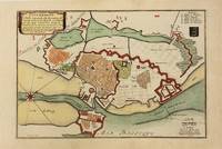
Copenhague Ville Capitale du Royaume de Dannemarq et Sejour ordinaire du Roy.
Paris 1700. Very Good. Notes: Map of Copenhagen Capital of Denmark. Size : 227x337 mm 8.94x13.27 Inches Coloring: Hand Colored Category: Maps Europe Scandinavia Countries; Maps City Maps; unknown
Riferimento per il libraio : M10974
|
|
|
Nicolas De Fer
Histoire Des Rois De France Depuis Pharamond Jusqu'a Notre Auguste Monarque Louis Quinze 1722
New. unknown
Riferimento per il libraio : B9781166040611 ISBN : 1166040615 9781166040611

|
|
|
Nicolas de Fer
Introduction à la Geographie: Avec une Description Historique sur Touttes les Parties de la Terre Classic Reprint French Edition
hardcover. Good. Access codes and supplements are not guaranteed with used items. May be an ex-library book. hardcover
Riferimento per il libraio : 0332085511.G ISBN : 0332085511 9780332085517

|
|
|
Nicolas de Fer
Introduction a la Fortification
Paris: Nicolas de Fer c. 1705. Upper fore-corner of the Toulon Grenoble St. Esprit Verceil and Veue de Verue plates all repaired professionally; otherwise a very good copy text and maps are clean and crisp. Binding: Recent ½ calf with contemporary marbled boards spine in five compartments of raised bands gilt title on two endpapers renewed. With 172 engraved plates by Nicolas de Fer and 8 in-text plates including the title. Notes: Introduction a la Fortification was a famous atlas at its timefirst published in 1690-1695. <br>The author Nicolas de Fer inherited his father’s cartography business. Being a prolific cartographer his reputation grew such that he became the official geographer of King Louis XIV of France and King Philip V of Spain. He made maps of both North America and Europe notably including maps of the War of Spanish Succession. <br> Size: Oblong folio Illustration: With 172 engraved plates by Nicolas de Fer and 8 in-text plates including the title. Lacks 9 plates St. Malo Environs de St. Malo Gravelines Nieuport Combat de Leuse Liege Camp de Weil and Civita Vecchia; but has 5 extras not called for in the plate list Aire Hesdin Menin Batavia and Quebec. Pages: P. plate index title engraved maps and text plates. Category: Book Atlas & Cartography; Book Military Nicolas de Fer hardcover
Riferimento per il libraio : B2350
|
|
|
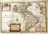
Nicolas De Fer (1646-1720)
L'Amerique Meridionale et Septentrionale
Paris: Chez l'autheur dans l'Isle du Palais sur le Quay de l'Orloge a la Sphere Royale 1717. Very Good. Notes: Beautiful example of the map of the Americas by renowned 17th century French cartographer Nicolas De Fer.<br><br> Size : 225x337 mm 8.86x13.27 Inches Coloring: Hand Colored Category: Maps North America; Maps South America Countries; Chez l'autheur dans l'Isle du Palais sur le Quay de l'Orloge a la Sphere Royale unknown
Riferimento per il libraio : M11008
|
|
|
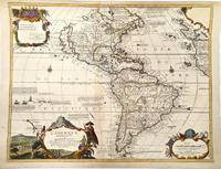
Nicolas De Fer (1646-1720)
L'Amerique Meridionale Et Septentrionale Dressee Selon les dernieres Relations et suivant les Nouvelles Decouvertes.
Paris c.1705. Very Good. Notes: Detailed French map of the Americas with decorative cartouches.<br>Nicolas de Fer 1646–1720 was a French cartographer and geographer. He also was an engraver and publisher. His work was most often praised for being beautiful and artistic. Size : 464x600 mm 18.27x23.62 Inches Coloring: Hand Colored Category: Maps North America; Maps South America Continent; unknown
Riferimento per il libraio : M11362
|
|
|
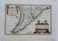
Nicolas De Fer (1646-1720)
Le Chili et Les Provinces qui Composent Celle de Rio de la Plata avec Les Terres Magellanique.
Paris 1704. Excellent. Notes: French Map of Chile by renowned French cartographer. Size : 235x340 mm 9.25x13.375 Inches Coloring: Original Outline Coloring Category: Maps South America Countries; unknown
Riferimento per il libraio : M5174
|
|
|
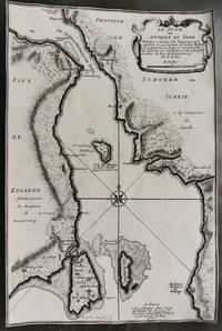
Nicolas De Fer
Le Sund ou Detroit du Sond.
Paris 1700. Very Good margins are trimmed. Notes: Map of Oresund strait between Denmark and Sweden. Size : 328x218 mm 12.91x8.58 Inches Coloring: Black & White Category: Maps Europe Scandinavia Countries; unknown
Riferimento per il libraio : M10800
|
|
|
Nicolas De Fer (1646-1720); Desnos
Les Etats de la Couronne de Pologne sous les quels sont compris la Grande et la Petite Pologne le Grand Duche de Lithuanie Les Prusses et la Curlande. Divisez en provinces et Palatinats.
Paris: Desnos 1760. Very Good. Notes: French map of Poland Lithuania and the surrounding region.<br>1760 edition of rare Nicolas De Fer's map. Size : 480x590 mm 18.875x23.25 Inches Coloring: Hand Colored in Outline Category: Maps Europe Poland Lithuania Desnos unknown
Riferimento per il libraio : M5799
|
|
|
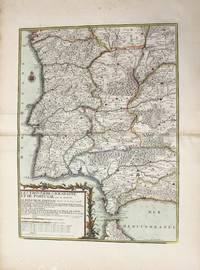
Nicolas De Fer
Les Frontieres D'Espagne Et De Portugal ou se Trouve Le Royaume de Portugal
Paris: Chez Desnos 1790. Very Good. Notes: Detailed map of Portugal and western Spain showing Gibraltar region. Size : 580x432 mm 22.83x17.01 Inches Coloring: Original Hand Coloring Category: Maps Europe Portugal; Maps Europe Spain; Chez Desnos unknown
Riferimento per il libraio : M10223
|
|

 Ricevere i risultati per e-mail
 Scaricare i risultati in PDF
 RSS feed
 Link
Link


