National Oceanic and Atmospheric Administration. Used - Good. Good condition. 42nd edition. Slightly dampstained. Flight Maps National Oceanic and Atmospheric Administration unknown
National Oceanic and Atmospheric Administration 2013. Map. Very Good. Folded map. No tears but some age tanning. Printed on both sides. One side has a spot about the size of a quarter. Measures 36x40 inches unfolded. National Oceanic and Atmospheric Administration unknown
Washington DC: NOAA 1995. 26th edition broadside color map 36 x 44 in 1:4860700 scale; soundings and traffic guidance; ex-University of Chicago with their stamp on verso else fine. Nautical chart catalog No. 2 Panels B C D E Q R and Catalog No. 3 Panels H I M N. 530. NOAA unknown
Not Specified:: Rhode Island Dept of Environmental Management 1998. Paperback. VERY GOOD. Large white paperback black plastic comb binding clear plastic protective cover paginated within sections about 5/8" thick. Ex library otherwise like new. We provide professional service and individual attention to your order daily shipments and sturdy packaging. FREE TRACKING ON ALL SHIPMENTS WITHIN USA. Rhode Island Dept of Environmental Management, paperback
US Department of Commerce 1992. Map. Good. Edition 28 October 1992. Folded color map in folder. Map measures 33x15 inches. Sticker shadow on folder and some age tanning. The National Oceanic and Atmospheric Administration or NOAA is responsible for providing nautical charts for most of the United States. This vintage map was issued in 1992. US Department of Commerce unknown
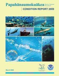
<p>Washington DC: U.S. Government Printing Office 1987. Paperback. Used - Very Good/No Jacket. 11x8.5x.25 with 123 pages. Black covers. Illustrated with photos. Some in color.</p> U.S. Government Printing Office, paperback
As in previous editions the symbols used on paper nautical charts produced by NOAA and the NGA and digital raster representations of those charts such as NOAA Raster Nautical Chart NOAA RNC's are presented in lettered sections organized in categories such as Landmarks Depths and Lights. unknown
Bookseller reference : BIBUP61025-A51926 ISBN : 1937196291 9781937196295
Paradise Cay Publications. 13. Good. It's a preowned item in good condition and includes all the pages. It may have some general signs of wear and tear such as markings highlighting slight damage to the cover minimal wear to the binding etc. but they will not affect the overall reading experience. Paradise Cay Publications unknown
Bookseller reference : 1937196291-11-1 ISBN : 1937196291 9781937196295
National Oceanic and Atmospheric Administration. Used - Good. Good condition. 42nd edition. Slightly dampstained. Flight Maps Visual Flight Rules Maryland-DC Area National Oceanic and Atmospheric Administration unknown
National Oceanic and Atmospheric Administration. Used - Good. Good condition. 41st edition. Slightly dampstained. Flight Maps Visual Flight Rules DC Area National Oceanic and Atmospheric Administration unknown
National Oceanic and Atmospheric Administration. Used - Good. Good condition. 48th edition. Flight Maps DC Area National Oceanic and Atmospheric Administration unknown
CreateSpace Independent Publishi 3/22/2016 12:00:01 A. paperback. Good. 0.1600 in x 9.0000 in x 6.0000 in. CreateSpace Independent Publishi paperback
Bookseller reference : mon0001348187 ISBN : 1530666686 9781530666683
 Receive by email
 Download as PDF document
 RSS feed