|
|
|
[SEGALEN] - TAYLOR (Michael)
Vent des royaumes, ou les voyages de Victor Segalen.
Gr. In-8, 252p. Avec un cahier photographique central. Enrichi d'un envoi autographe signé de l'auteur.
|
|
|
[SERIZAWA KEIGO]. 芹澤馨吾
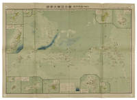
標準大東亞分圖・南洋群島 内南洋. Hyojun Daito-A bunzu: Nanyo gunto nai Nanyo. Standard Sectional Map of the Greater East Asia: the South Sea Islands Inner South Sea.
統正社 Tōseisha . Showa 18 1943. Colour folded map 54. x 76.5cm. Pinholes at corners light even browning good copy. This Japanese map of Micronesia shows the Mariana Islands Eastern and Western Caroline Islands Marshall Islands and Gilbert Islands. The separate maps around the edge are clockwise from the upper right corner: Jaluit Atoll Guam Island Rota Island Saipan Island Palau Islands Yap Island Hall Islands Pohnpei Island Truk Islands and Kusaie Island. . 統正社 [Tōseisha ]. unknown
Referentie van de boekhandelaar : 155215
|
|
|
[Shanghai and the Xinhai Revolution].
Photograph album. Shanghai, early 20th century.
Oblong folio (362 x 274 mm). Contemporary block-bound silk album of 111 photographs. Various sizes; largest 212 x 155 mm. A photograph album comprising 111 personal photographs of Shanghai, including several images of battleships, various English-language shop signs for local businesses (such as "Hsing Loong Carpenter Mason and Painter"), and 12 photographs showing the burial procession of the mother of Shanghai businessman Pau Ching Po. Also, there are several photographs of the 1911 Xinhai Revolution in Shanghai: in November 1911, Shanghai citizens organised a rebellion and captured the city, establishing the Shanghai military on 8 November that same year. The photographs offered here depict the uprising in the streets as well as scenes of destroyed homes and weapons used when taking the city. The revolution resulted in the overthrow of the last imperial monarchy in China and the establishment of the Republic of China in 1912. - Also includes images of the German Theatre at the Lyceum, founded in 1930 as an amateur dramatics society, a photograph of Prince Adalbert of Prussia (1884-1948) at the Club Concordia in 1904 laying the foundation stone to the new German Club in Shanghai, and three photographs of the wedding of Wilhelm Knappe (1855-1910), the German Consul General in Shanghai from 1899 to 1906. - Very well preserved. Provenance: From the collection of Johannes Gottfried William Schröder (1870-1942). Born in India, the brother of the German poet Rudolf Alexander Schröder grew up in Bremen, trained as a merchant and visited India, China, Japan, and America. He established his own business in Shanghai in 1906. His intimate knowledge of East Asia led him to embrace the philosophy of anthroposophy.
|
|
|
[Shanghai, Huangpu River, Moganshan, Hangzhou].
Photograph album. Shanghai, Huangpu River, Moganshan, Hangzhou, ca. 1900.
Oblong folio (363 x 274 mm). Contemporary block-bound silk album of 167 photographs. Various sizes; largest 297 x 218 mm. A photograph album comprising 167 images of the life of a German merchant family in China around the turn of the century. Includes several views of the interior of the Schröders' art-deco residence in Shanghai and of their Chinese domestic workers dressed in late Qing costumes with house puppies and pet monkey, with several portraits of Schröder's wife, showing her feeding the chicken in the courtyard or seated on a horse carriage in the streets of Shanghai, many photographs were taken during the Schröder family's extensive travels in and around Shanghai, for example along the Huangpu River to the mountain retreat in Moganshan and to Hangzhou, showing not only scenic views but also the life of locals they met en route. - Extremeties somewhat rubbed with slight flaws to silk, but still well preserved. Provenance: From the collection of Johannes Gottfried William Schröder (1870-1942). Born in India, the brother of the German poet Rudolf Alexander Schröder grew up in Bremen, trained as a merchant and visited India, China, Japan, and America. He established his own business in Shanghai in 1906. His intimate knowledge of East Asia led him to embrace the philosophy of anthroposophy.
|
|
|
[Sheridan, Frances]
The History of Nourjahad
London: J Dodsley. G : in good condition. 20th century rebind with new eps. Prelims stained. 1767. First Edition. Marbled hardback boards with brown leather spine. 180mm x 120mm 7" x 5". 240pp. . J Dodsley hardcover
Referentie van de boekhandelaar : j5038

|
|
|
[SHIHAN GAKKŌ] 師範学校編輯.
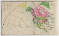
北亜米利加洲. Kita Amerika-shū. The States of North America.
Kyoto.: 村上勘兵衛 文部省刊行. Murakami Kanbē; Monbushō kankō. Meiji 10 1877. Colour woodblock map of North and Central America. From the Journal of World Geography 萬國地誌略 published in 1877. Printed area measures 33.5 x 21cm a good copy with occasional soiling. . 村上勘兵衛, 文部省刊行. [Murakami Kanbē; Monbushō kanko& unknown
Referentie van de boekhandelaar : 159812
|
|
|
[Sieur Mouette]
Les Aventures de deux captifs français dans le royaume de Fez et de Maroc par le Sieur Mouette, compagnon de leur disgrâce.
Paris, Bibliophiles du Maroc, 1934; in-4° en feuilles, couverture, chemise et étui.Gravures sur cuivre de Josso, coloriées par Maillart. Tiré à 150 exemplaires sur vélin blanc de Rives; le nôtre porte le n° 86 et est enrichi d’une suite en noir et de la décomposition des couleurs du frontispice.
Referentie van de boekhandelaar : EXE-6
|
|
|
[SINGAPOUR] - TALABOT (Marcel) -
Singapour troisieme Chine.
Paris, Robert Laffont, 1973 ; in-8, 253 pp., br.
Referentie van de boekhandelaar : 201408082
|
|
|
[Siam - Thailand]. McFarland, Samuel Gamble, ed.
Siamese hymnal. Phetchaburi (in Thailand), Samuel Gamble McFarland, 1876.
8vo. 148 pp. (collates: [1]2 2-194 = 74 ff.). With western round-head letterpress music notation, a decorated rule on the title-page and each page in a frame of rules. Set in Thai type with incidental roman and the place of publication in a decorative textura. This copy with the letterpress presentation slip on blue paper tipped in (from McFarland and his wife), for people who contributed to the project. Contemporary half tanned sheepskin, sewn on 3 recessed cords, gold dotted fillets on spine, bubble-grain grey-brown cloth sides, probably bound for presentation. Very rare first edition (first issue) of McFarland's Thai (Siamese) hymnal, one of the first books printed by the mission press at Phetchaburi (Petchabury) in Thailand, with the 86 hymns selected by donors who contributed at least five dollars for the production of the hymnal. Each hymn appears on a single double-page spread (with the music at the head of the left page) except the last, whose text continues on nine additional pages. The texts of the hymns themselves appear only in Thai, but the title, introductory note and hymn titles also appear in English and each hymn gives the name of the person or organisation that selected it in English only. Some of the donors who selected the hymns lived in Thailand (both Europeans and natives) but most lived in the United States. Each hymn also indicates the metre, either with abbreviations for the common, long, short, hallelujah or particular metre, or with an indication of the number of syllables per line. The music was apparently set and electrotyped by J.M. Armstrong in Philadelphia and the electrotype blocks shipped to Phetchaburi for printing, for the Newberry Library copy of the second issue has a manuscript note "Music typography by J.M. Armstrong, Philadelphia, Pa." (Armstrong advertised his services for music typesetting and electrotyping at the 1876 Centennial Exhibition). - The first European book printed in Thai type is said to be Jean Baptiste Pallegoix's 1854 Thai dictionary (with Latin, French and English translations) by the Imprimerie Impériale in Paris, but missionaries printed Thai books in Asia decades earlier. The Missionary George H. Hough set up a printing office in Yangon (Rangoon), Burma, where he had Thai type made and used it in 1819. His materials were taken to the mission press in Calcutta soon after. Claudius Henry Thomsen of the London Missionary Society brought a printing press to Singapore in 1822 and operated it with another missionary, Samuel Milton, who brought a fount of Thai type from the Calcutta mission, along with a set of matrices to cast more. Thomsen sold the press and materials to the American Board of Commissioners for Foreign Missions (ABCFM) in 1834 and John Taylor Jones printed Thai for them there in 1835. The ABCFM missionary Dan Bradley took one press and the Thai type to Bankok in July 1835 and produced Thailand's first printing with Thai type in 1836, and Jones moved there to take charge of the press. The Thai King Mongkut (Rama IV)'s interest in printing features in the musical "The King and I", based on Anna Leonowens's 1870 memoires. In 1861 Samuel McFarland, Daniel McGilvary and their wives set up the first Thai mission outside Bankok at Phetchaburi, where McFarland printed the present hymnal in 1876 (he is said to have printed a dictionary in 1866). A second edition appeared in 1885 and the fifth and last in 1920. - We have located five other copies of the 1876 edition. The four recorded in WorldCat have 181 pages, but the Pittsburg Theological Seminary has a second copy that has 148 pages, like the present copy. The preliminary note explicitly says the hymnal includes 86 hymns and they are all present, and there is no evidence that any leaves ever followed page 148, so the additional leaves sometimes included were probably added after copies had been distributed to donors. They probably add further hymns or possibly some other supplementary text. The presentation slip for the donors notes that the hymnal is already being used by the missionaries' congregations, so the present copy probably shows the book as the Thai people first saw it. Cf. KVK & WorldCat (4 copies of the 2nd issue); not in Cordier, Indosinica; for the history of the presses: eresources.nlb.gov.sg/infopedia/articles/SIP_1074_2008-12-20.html; J.F. Coakley, "Printing offices of the American Board of Commissioners for Foreign Missions ...", in: Harvard Library Bulletin IX (1998), pp. 5-34, at pp. 26-27.
|
|
|
[Siebenbürgen].
Elenchus civitates, oppida et pagos in m. principatu Transylvaniae existentes, distincta serie iuxta comitatus, districtus, et sedes exhibens. O. O. u. Dr. [wohl Wien?], [um 1775].
54 SS., l. w. Bl. Blaue Interimsbroschur der Zeit. 8vo. Seltenes Verzeichnis der Städte und Dörfer Siebenbürgens. Über Bibliothekskataloge nur 3 Exemplare nachweisbar (Wienbibliothek, Siebenbürgische Bibliothek Gundelsheim, BSB München [incpl.]). - Sehr sauberes, gutes Exemplar mit hs. Deckeltitel in rosafarbenem Buntstift (um 1900).
|
|
|
[Simpkin, Marshall and Co]
Rambles in Teesdale by the Authors of Holiday Rambles on the Yorkshire Moors
London: Simpkin Marshall and Co. G : in Good condition without dust jacket. Cover rubbed with wear to spine ends. Stain on fore and lower edge of rear board. Contents G. 1877. First Edition. Red hardback cloth cover. 190mm x 130mm 7" x 5". 228pp. 5 tinted plates. . Simpkin, Marshall, and Co hardcover
Referentie van de boekhandelaar : r9639
|
|
|
[Singapore - Photographs]. Sachtler, August, and others.
Views of Singapore and surroundings. Singapore, ca. 1870.
20 large uniform albumen prints (210 x 270 mm), all but one in landscape format. Each print mounted on paper boards (245 x 325 mm) with a manuscript series number and a German caption. Stored in a modern black cloth clamshell box with a red morocco label ("Singapore"). A uniform set of large photographic albumen prints of Singapore, including exterior views of traditional, European, and mixed-style buildings, landscapes, the botanical gardens, etc., many with European and/or Malay people in the scene and some with horse-drawn carriages, or boats. The two views from Fort Canning have been attributed to August Sachtler (ca. 1839-73): one looking southwest toward Telok Blanagah village and its hill, with a Malay man in the foreground; the other looking southeast toward the roadstead, with many ships in the background and a canon in the foreground, at least the former published in the National Museum of Singapore's catalogue "The Image of Our Landscape" (2009). Sachtler gained experience as a photographer in the Prussian expedition to Japan and China (1860-62), came to Singapore in 1863 and worked there as a commercial photographer until his death in April 1873. He may be the author of some of the other photographs as well. They show the Jamae Mosque (ca. 1835) and Sri Mariamman Hindu temple (ca. 1827; the tower and wall to the left differ only slightly from those in a dated view of 1866: the tower was completely changed in the early 20th century); six views of the botanical gardens established by Whampoa (1816-80); a jungle plantation in operation (with 4 boats); jungle houses built on wooden stilts with roofs and some walls of reed; the Hôtel de l'Europe (either that on St Andrew's Road, demolished in 1906, or its predecessor on Beach Road); the mission chapel; the gothic revival St Andrew's Cathedral (ca. 1861); Raffles Square (named Commercial Square by Stamford Raffles in 1823 but changed to Raffles Place in 1858, the name in the photograph apparently retaining the older name); the town hall (ca. 1862: the offices moved elsewhere in 1893). The view of Raffles Place clearly shows the signboards of the shops: G. Schiller; Geokteat & Co; John Little (department store established 1845), and Singapore Dispensary (these last two are also visible in an album presented to Prince Alfred, Duke of Edinburgh in 1869). - Two of the photographs have lettered captions and numbers as part of the photographic prints themselves, in white sans-serif capitals in the lower right corner: "Bot. Garden S. 200" and "Raffles Square S. 212". Most have a number in the lower left corner, written after the print was made, ranging from 3 to 200 (matching the number in the print, but the print with number 212 has no written number). Each has a number written on the mount, along one long edge (the head except in the one photograph in portrait format) ranging from 109 to 139, not corresponding to the other numbers. - As usual for albumen prints, the sky in the background shows little or no cloud detail, and two or three have lost a bit of detail in the background, but all further preserve very detailed images and are in very good condition, with only occasional minor spots. A remarkable set of large, detailed and well-preserved historical images of Singapore ca. 1870. For Sachtler, see the report of a lecture by Sebastian Dobson on oag.jp.
|
|
|
[SOCIETE DE GEOGRAPHIE]
Bulletin de la Société de Géographie... Année 1894.
Paris, Société de Géographie, 1894. In-8°, 618p. Reliure demi-toile grenat.
Referentie van de boekhandelaar : 22546
|
|
|
[SOCIETE DE GEOGRAPHIE]
Bulletin de la Société de Géographie... Année 1894.
In-8, 618p. Avec 9 cartes dépliantes. Bel exemplaire. Détails sur demande.
|
|
|
[SOCIETE DE GEOGRAPHIE]
Compte rendu de la Société de Géographie... Année 1894.
In-8, 500p. Avec 4 cartes dépliantes. Bel exemplaire. Détails sur demande.
|
|
|
[SOCIETE DE GEOGRAPHIE]
Compte rendu des séances de la Société de Géographie... Année 1895.
In-8, 398p. Avec 2 cartes dépliantes. Bel exemplaire.
|
|
|
[SOCIETE DE GEOGRAPHIE]
Compte rendu des séances de la Société de Géographie... Année 1899.
In-8, 410p. Avec 2 cartes dépliantes. Bel exemplaire.
|
|
|
[SOCIETE DE GEOGRAPHIE]
Compte rendu des séances de la Société de Géographie... Année 1893.
In-8, 496p. Avec 2 cartes dépliantes. Bel exemplaire.
|
|
|
[SOUTH ASIA - MAP]. NEELE, SAMUEL JOHN
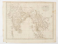
Map of the East Indies from the Best Authorities.
London & Glasgow.: W. and D. Brownlie. 1805. Engraved map 18.7 x 23.9 cm original folds age toned and spotted inner margin a trifle ragged paper thinning in a few spots in good condition. Attractive map engraved for "A System of Geography; or A Descriptive Historical and Philosophical View of the Several Quarters of the World" published in 1805. . (W. and D. Brownlie) unknown
Referentie van de boekhandelaar : 175148
|
|
|
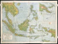
[SOUTHEAST ASIA - WORLD WAR II ERA MAP]
East Indies. Mercators Projection. Map No. 316.
Sydney.: H.E.C. Robinson Pty. Ltd. circa1940. Full colour folding map 71 x 97 cms; 76.2 x 10² cms sheet blank on verso save for a neat inked stamp "East Indies" inset map of New Guinea and Papua heights shown by colour very good clean condition. Large scale World War II era map by Sydney publisher H. E. C. Robinson. Extremely detailed map it is coloured according to height above sea level and showing naval bases railways shipping routes air routes. Includes smaller inset map of "New Guinea & Papua" showing the eastern part of the island. . H.E.C. Robinson Pty. Ltd. unknown
Referentie van de boekhandelaar : 211106
|
|
|
[Soviet General Staff Maps] - China 1:1,000,000.
General'nyí shtab. (China 1:1,000,000). [Moscow, General Staff], 1971-1989.
A total of 25 topographic maps, colour-printed, ca. 57 x 59.5 cm - 58 x 66.5 cm. Constant ratio linear horizontal scale. In Russian (Cyrillic). The Soviet Union's 1:1,000,000 General Staff map quadrangles showing China: from the Russian series of maps produced during the Cold War, based on high-quality satellite imagery, but usually also ground reconnaissance. While there are a few lacunae mostly concerning central China, the South ranging from Myanmar to Fuzhou and parts of the East Coast including Nantong and Beijing are well covered. Assembled continuously, the quadrangles would form an enormous map spanning more than 5 x 6.5 metres!. - Products of a massive, clandestine cartographic project begun under Stalin and ultimately encompassing the entire globe, the Soviet General Staff maps are today noted for their extreme precision. Indeed, even in post-Soviet times they provide the most reliable mapping for many remoter parts of the world: "Soviet-era military maps were so good that when the United States first invaded Afghanistan in late 2001, American pilots relied on old Russian maps of Afghanistan. For almost a month after the United States began a bombing campaign to help oust the Taliban government, American pilots were guided by Russian maps dating back to the Soviet occupation of Afghanistan in the 1980s" (Davies/Kent, p. xi). - Although the details of the cartographic programme evolved over the decades, its overall system and plan remained remarkably constant. "The basic quadrangle is the 1:1,000,000 sheet spanning 4° latitude by 6° longitude. The quadrangles are identified by lettered bands north from the equator and by numbered zones east from longitude 180° [...] Each 1:1,000,000 sheet is subdivided into four 1:500,000 sheets (from northwest to southeast), labeled [by] the first four letters of the Russian alphabet" (ibid., p. 19-21). "Printing such large-format plans in so many colors with near-perfect print registration itself testifies to the skill of the printers in the military map printing factories across the former Soviet Union. The quality of printing reflects the level of training and the reliability of humidity-control equipment and the electricity supply at the time" (ibid., p. 6f.). Although the details of the cartographic programme evolved over the decades, its overall system and plan remained remarkably constant. "The basic quadrangle is the 1:1,000,000 sheet spanning 4° latitude by 6° longitude. The quadrangles are identified by lettered bands north from the equator and by numbered zones east from longitude 180° [...] Each 1:1,000,000 sheet is subdivided into four 1:500,000 sheets (from northwest to southeast), labeled [by] the first four letters of the Russian alphabet" (ibid., p. 19-21). "Printing such large-format plans in so many colors with near-perfect print registration itself testifies to the skill of the printers in the military map printing factories across the former Soviet Union. The quality of printing reflects the level of training and the reliability of humidity-control equipment and the electricity supply at the time" (ibid., p. 6f.). - Although the general terrain evaluation maps and operational maps produced at the smaller scales of 1:1,000,000 and 1:500,000 were not separately marked as classified (larger-scale maps were often specifically labelled "Secret" or "For Offical Use"), all General Staff maps de facto constituted closely guarded military material, none of which became available in the West before the end of the Cold War in the early 1990s. - Light traces of folds and occasional wrinkles, but altogether in excellent condition. Cf. J. Davies / A. J. Kent, The Red Atlas (Chicago/London, 2017).
|
|
|
[Soviet General Staff Maps] - China 1:200,000.
General'nyí shtab. (China 1:200,000). [Moscow, General Staff], mainly 1970s and 1980s.
A total of 1,618 topographic maps, colour printed, ca. 45 x 51.5 cm. Constant ratio linear horizontal scale. In Russian (Cyrillic). The Soviet Union's 1:200,000 General Staff map quadrangles showing China: from the Russian series of maps produced during the Cold War, based on high-quality satellite imagery, but usually also ground reconnaissance. While there are a few lacunae in the north and south, western and central China as well as the east coast including Taiwan are well-covered, ranging as far as Vladivostok. Assembled continuously, the quadrangles would form an enormous map spanning roughly 27 x 34 metres!. - Products of a massive, clandestine cartographic project begun under Stalin and ultimately encompassing the entire globe, the Soviet General Staff maps are today noted for their extreme precision. Indeed, even in post-Soviet times they provide the most reliable mapping for many remoter parts of the world: "Soviet-era military maps were so good that when the United States first invaded Afghanistan in late 2001, American pilots relied on old Russian maps of Afghanistan. For almost a month after the United States began a bombing campaign to help oust the Taliban government, American pilots were guided by Russian maps dating back to the Soviet occupation of Afghanistan in the 1980s" (Davies/Kent, p. xi). - Although the details of the cartographic programme evolved over the decades, its overall system and plan remained remarkably constant. "The basic quadrangle is the 1:1,000,000 sheet spanning 4° latitude by 6° longitude [...] Each 1:1,000,000 sheet is [...] subdivided into 36 1:200,000 sheets in a six-by-six grid [... They] normally contain on the reverse side a detailed written description of the districts (towns, communications, topography, geology, hydrology, vegetation, and climate) together with a geological sketch map" (ibid., p. 19-21). "Printing such large-format plans in so many colors with near-perfect print registration itself testifies to the skill of the printers in the military map printing factories across the former Soviet Union. The quality of printing reflects the level of training and the reliability of humidity-control equipment and the electricity supply at the time" (ibid., p. 6f.). - Somewhat curled at the sides, including the odd edge flaw, but altogether very well preserved. Cf. J. Davies / A. J. Kent, The Red Atlas (Chicago/London, 2017).
|
|
|
[Soviet General Staff Maps] - China 1:500,000.
General'nyí shtab. (China 1:500,000). [Moscow, General Staff], 1970-1989.
A total of 108 topographic maps, colour-printed, ca. 52.5 x 57.5 cm - 56 x 68.5 cm. Constant ratio linear horizontal scale. In Russian (Cyrillic). The Soviet Union's 1:500,000 General Staff map quadrangles showing China: from the Russian series of maps produced during the Cold War, based on high-quality satellite imagery, but usually also ground reconnaissance. While central and southern China are well covered, ranging from Myanmar over Hongkong to Hefei, and far Western quadrangles include parts of Kashmir, a few quadrangles of the East coast and the far North are lacking. Assembled continuously, the quadrangles would form an enormous map spanning roughly 10 x 15 metres!. - Products of a massive, clandestine cartographic project begun under Stalin and ultimately encompassing the entire globe, the Soviet General Staff maps are today noted for their extreme precision. Indeed, even in post-Soviet times they provide the most reliable mapping for many remoter parts of the world: "Soviet-era military maps were so good that when the United States first invaded Afghanistan in late 2001, American pilots relied on old Russian maps of Afghanistan. For almost a month after the United States began a bombing campaign to help oust the Taliban government, American pilots were guided by Russian maps dating back to the Soviet occupation of Afghanistan in the 1980s" (Davies/Kent, p. xi). - Although the details of the cartographic programme evolved over the decades, its overall system and plan remained remarkably constant. "The basic quadrangle is the 1:1,000,000 sheet spanning 4° latitude by 6° longitude. The quadrangles are identified by lettered bands north from the equator and by numbered zones east from longitude 180° [...] Each 1:1,000,000 sheet is subdivided into four 1:500,000 sheets (from northwest to southeast), labeled [by] the first four letters of the Russian alphabet" (ibid., p. 19-21). "Printing such large-format plans in so many colors with near-perfect print registration itself testifies to the skill of the printers in the military map printing factories across the former Soviet Union. The quality of printing reflects the level of training and the reliability of humidity-control equipment and the electricity supply at the time" (ibid., p. 6f.). - Five of the maps carry the Russian air defense grid ("setka PVO") printed in pink. Although the general terrain evaluation maps and operational maps produced at the smaller scales of 1:1,000,000 and 1:500,000 were not usually marked as classified (larger-scale maps were routinely labelled "Secret" or "For Offical Use"), all General Staff maps de facto constituted closely guarded military material, none of which became available in the West before the end of the Cold War in the early 1990s. - Light traces of folds and occasional wrinkles, but altogether in excellent condition. Cf. J. Davies / A. J. Kent, The Red Atlas (Chicago/London, 2017).
|
|
|
[Soviet General Staff Maps] - Japan 1:200,000.
General'nyí shtab. (Japan 1:200,000). [Moscow, General Staff], 1968-2002.
A total of 152 topographic maps, colour-printed, ca. 45 x 45 cm - 47 x 55 cm. Constant ratio linear horizontal scale. In Russian (Cyrillic). The Soviet Union's 1:200,000 General Staff map quadrangles showing Japan: from the Russian series of maps produced during the Cold War, based on high-quality satellite imagery, but usually also ground reconnaissance. All three main islands are very well covered, showing many large cities including Sappora, Tokyo, Hiroshima and Fukuoka, as well as Busan in North Korea and several small islands. Assembled continuously, the quadrangles would form an enormous map spanning roughly 17 x 16 metres!. - Products of a massive, clandestine cartographic project begun under Stalin and ultimately encompassing the entire globe, the Soviet General Staff maps are today noted for their extreme precision. Indeed, even in post-Soviet times they provide the most reliable mapping for many remoter parts of the world: "Soviet-era military maps were so good that when the United States first invaded Afghanistan in late 2001, American pilots relied on old Russian maps of Afghanistan. For almost a month after the United States began a bombing campaign to help oust the Taliban government, American pilots were guided by Russian maps dating back to the Soviet occupation of Afghanistan in the 1980s" (Davies/Kent, p. xi). - Although the details of the cartographic programme evolved over the decades, its overall system and plan remained remarkably constant. "The basic quadrangle is the 1:1,000,000 sheet spanning 4° latitude by 6° longitude [...] Each 1:1,000,000 sheet is [...] subdivided into 36 1:200,000 sheets in a six-by-six grid [... They] normally contain on the reverse side a detailed written description of the districts (towns, communications, topography, geology, hydrology, vegetation, and climate) together with a geological sketch map" (ibid., p. 19-21). "Printing such large-format plans in so many colors with near-perfect print registration itself testifies to the skill of the printers in the military map printing factories across the former Soviet Union. The quality of printing reflects the level of training and the reliability of humidity-control equipment and the electricity supply at the time" (ibid., p. 6f.). - Traces of folds, occasional odd edges, but altogether very well preserved. Cf. J. Davies / A. J. Kent, The Red Atlas (Chicago/London, 2017).
|
|
|
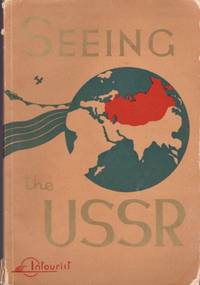
[Soviet Union] [Travel]
Seeing the USSR
Moscow: Intourist Printed in the Soviet Union 1930. Seventh printing. Wraps. Good. Stapled illustrated wraps with title on the front cover. 68 pages. Illustrated with numerous photographs. Light edge wear and chips to the spine and covers. A date of 1934 found in the text. Contents also include maps heroes trains old cars buildings the Statue of Lenin a page photograph of "A Young Communist woman on a Ukrainian collective farm" places to visit etc. All text in English. Travel agency stamp of "John T. North Steamship Agency 14 Marietta St. Atlanta Ga." on the title page and illustrated back cover. Intourist Printed in the Soviet Union unknown
Referentie van de boekhandelaar : 33609
|
|
|
[SPORTS] - PICCARD (Bernard), JONES (Brian) -
Le tour du monde en 20 jours.
Paris, Robert Laffont, 1999 ; in-8, 256 pp., broché, couverture illustr. Broché en très bon état.
Referentie van de boekhandelaar : 201611112
|
|
|
[SPORTS] - PICCARD (Bernard), JONES (Brian) -
Le tour du monde en 20 jours.
Paris, Robert Laffont, 1999 ; in-8, 256 pp., broché, couverture illustr. Broché en très bon état.
Referentie van de boekhandelaar : 201405392
|
|
|
[SPLIT] - ETERDVIC (Ivo ) -
Split image d une ville aimée.
, Ivo eterovic et spectra , 1987 ; in-4, 187 pp., cartonnage de l'éditeur.
Referentie van de boekhandelaar : 201016331
|
|
|
[SPACE TRAVEL -- APOLLO XI].
Cadillac challenge of excellence. Facsimile brass plaque of the stainless steel original fastened to the Apollo XI lunar lander with simulated facsimile signatures of Neil Armstrong Michael Collins and Buzz Aldrin.
Detroit MI: Cadillac General Motors Corp. 1970. 4to. One brass-finish coated aluminum plaque preserved in embossed printed sleeve minor soiling edgewear minor bumping to portfolio still NF. First edition of this Cadillac dealership sales promotion honoring the Apollo XI and Neil Armstrong’s first walk upon the moon. These were used to exhort Cadillac sales managers to increase their sales and that if they delivered twice the number of eligible units they would earn certificates and a sterling silver plated credit card to buy luxury merchandise from Tiffany & Co. Cadillac, General Motors Corp., unknown
Referentie van de boekhandelaar : 56601
|
|
|
[SPACE TRAVEL -- ASTRONOMY]. SIMAK, Clifford D
The Solar System: our new front yard.
New York: St. Martin’s Press 1962. 8vo. 4 290 pp. Double-page photo-illustrated title numerous photo plates. Blue cloth yellow lettering on spine bumping & minor tidemark to upper corners on covers w/ d.j. cover photo art by Joan Wall slight chipping head of spine couple closed tears minor chipping lower fore-edge faint bumping & tidemark at corners still G/G copy. First edition of Simak’s remarkably scarce foray into space travel and planetary astronomy with descriptions of rocketry satellites and the forthcoming Apollo lunar missions. St. Martin’s Press, hardcover
Referentie van de boekhandelaar : 62768
|
|
|
[Spanien und Portugal] - Schrämbl, F. A.
Neueste Generalkarte von Portugal und Spanien. Nach den astronomischen Beobachtungen und Karten des Gerrn Thomas Lopez Geographen S. M. des Koenigs von Spanien vergasst von Herrn Michael Votésky. Wien, [Joseph Philipp Schalbacher], 1790.
2 (statt 6) grenzkolorierte Kupferstiche, je ca. 865:630 mm (Plattenmaß 665:534 mm). Iberische Halbinsel aus dem Schalbacher-Schrämbl'schen "Großen Allgemeinen Atlas" (1786-1803); hier die Bll. Nr. 41 (Galicien) und 41 D (Murcia). Es fehlen Bll. 41 A-C und E. Gestochen von H. Benedicti; Maßstab ca. 1:940.000. - Im breiten w. Rand minimal angestaubt bzw. kl. Einrisse, sonst sauberes, gutes Exemplar. Dörflinger/Hühnel I, 134, 41.
|
|
|
[Sri Lanka - Photographie]. Scowen, Charles T.
Kandy Lake & Cabbage Palms. Kandy, 1880er Jahre.
Albuminabzug (Vintage). 222:282 mm. Aufgezogen auf Karton. Schöne Aufnahme der Sabalpalmen am Ufer des Kandy-Sees, daneben zum Größenvergleich ein Einheimischer. - Charles Scowen kam Anfang der 1870er Jahre nach Ceylon, wo er innerhalb weniger Jahre ein erfolgreiches Photostudio aufbaute. "His photographs have been judged technically and compositionally superior to the work of other British photographers working in the area. His prints show the natives at home and at work as well as the natural beauty of the island and its plant species" (National Galleries of Scotland). Seine Aufnahmen der Insel finden sich in zahlreichen bedeutenden Sammlungen, darunter die British Library, das Boston Museum of Fine Arts, das Getty Museum sowie das New York Metropolitan Museum. - Mit einbelichtetem Titel. Wohlerhalten und auch in den Rändern ungebleicht.

|
|
|
[Sri Lanka].
Manuscript map of the interior of Ceylon. [Kandy, Ceylon?, ca. 1815].
Drawn in watercolour and pen on laid paper, mounted on contemporary linen (310 x 475 mm). (Bound in): Fellowes, Robert ("Philalethes"). The history of Ceylon, from the earliest period to the Year MDCCCXV; with characteristic details of the religion, laws, & manners of the people and a collection of their moral maxims & ancient proverbs ... To which is subjoined Robert Knox's historical relation of the island, with an account of his captivity during a period of near twenty years ... (With): Knox, Robert. An historical relation of the Island of Ceylon in the East Indies: together with an account of the detaining in captivity the author, and divers other Englishmen now living there; and of the author's miraculous escape. London, Joseph Mawman, 1817. 4to. 2 parts in one. XXII, 341; (1), VIII, 383 pp. With a folding engraved map of Sri Lanka by J. Smith, dated 1816, mounted on contemporary linen, an engraved portrait of Knox by Smith, dated 1816, and 15 engraved plates. Contemporary half calf with gold-tooled spine, marbled edges, marbled endpapers. Manuscript map of the middle third of the island of Ceylon (now Sri Lanka), made before any detailed map of this area had been published. Bound in a book containing the first edition of Fellowes's history of Sri Lanka, published together with a then-current edition of Robert Knox's own account of his stay in Sri Lanka (first edition 1681). - The manuscript map provides great detail for inland Sri Lanka, ranging from Puttalam (upper left) to Kalutara (lower left) and from Batticaloa (upper right) to Kataragama (lower right). This area spans several provinces, including the ancient Kingom of Kandy, showing many roads, towns and villages in great detail, especially around the city of Kandy. The various provinces are distinguished by colour. The map is contemporary with the book, made on English paper watermarked "G L Paine 1813", indicating George Leeds Paine of Kent (cf. Shorter 1971, p. 198). The map thus dates between 1813 and 1817, the period leading up to the last armed conflict between the British colonial government and the Kingdom of Kandy, which resulted in the final defeat of Kandy and the British seizing control of the entire island. - The first part of the book has several manuscript annotations in the same hand as the manuscript map, primarily concerning the bureaucracy and administration of the Kingdom of Kandy. Several corrections are written in the margins of chapter LVI (Offices, Casts and Miscellaneous Particulars), and the list of Singhalese sovereigns on the last page of the first work is expanded in manuscript up to the year 1815, ending with: "The English government established 2 March 1815 - Esto perpetua (may it always be so)". There is no owner's inscription, but the person who drew the map and added the annotations was evidently an Englishman with special interest in Kandy, and the notes, the paper and the circumstances suggest a British officer with a knowledge of the Singhalese language and cartography stationed in Kandy at the time of its capture. - In 1821 John Davy published his new map of Sri Lanka, which for the first time showed especially fine detail in the area around Kandy. No earlier map provided detailed information on the topography of the interior of Sri Lanka, as only the coastal areas were well documented. The present manuscript map is therefore a very early - or maybe even the first - attempt to record the topography of the interior. It was a forerunner to Davy's map and might have provided Davy with information, lending it great importance for the history of Sri Lankan cartography. - Several manuscript corrections in ink in the margins of the first work and several faded annotations in pencil in the margins of the second work. Folding engraved map foxed and first title-page slightly foxed. Spine repaired. The manuscript map has a tear at the foot of the fold, otherwise in good condition. For the manuscript map cf. Ian J. Barrow, Surveying and Mapping in Colonial Sri Lanka: 1800-1900. - For Knox: Cox I, 276f. Henze III, 46f.
|
|
|
[STAR] - MAILLET (Monseigneur) -
Les petits chanteurs a la croix de bois.
Paris, Flammarion, 1946 ; in-8, 206 pp., broché, couverture illustr.
Referentie van de boekhandelaar : 200502687
|
|
|
[STENDHAL] - GOUIN (Thierry).-
Stendhal aller-retour ou les romans d'un voyageur.
Lyon, PUL, Presses Universitaires de Lyon, 1989, in 8° broché, 162 pages ; couverture illustrée.
Referentie van de boekhandelaar : 71033
|
|
|
[STERNE (Laurence)]
Voyage sentimental.
1841 À Paris, Ernest Bourdin, sans date [1841].
Referentie van de boekhandelaar : 87

|
|
|
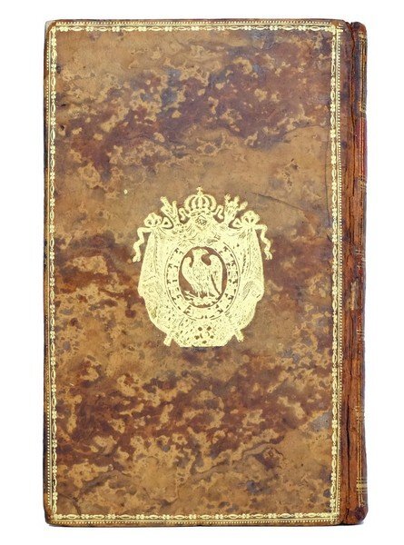
[STRUVE (Johann Christoph Gustav von)] ; DELAMARRE (L. H., trad.)
Voyage en Krimée, suivi de la Relation de l'Ambassade envoyée de Pétersbourg à Constantinople en 1793. Publié par un jeune Russe, attaché à cet ambassade. Traduit de l'allemand par L. H. Delamarre
Paris : Maradan, an X (1802). L'EXEMPLAIRE DE L'EMPEREUR ET DE L'IMPÉRATRICE AU CHÂTEAU DE MALMAISON
Referentie van de boekhandelaar : 1383
|
|
|
[Stereoscopic Cards].
Collection of 22 Stereoscopic Cards published by Sunbeam Tours, Underwood & Underwood, and others. London, Ottawa (Kansas), Philadelphia, and Burnley, ca. 1897-1918.
Ca. 178 x 97 mm. In original brown book-shaped card case with silver-stamped spine by Underwood & Underwood. Together with two cards with test images and instructions for the use of the stereoscope by Underwood & Underwood. Twelve cards published by Sunbeam Tours which document a naval journey to Mesopotamia with views of the Arabian coastline, the banks of the Shatt al-Arab, the railway from the port of Al-Maqal to Basra, a gunboat and a hospital ship on the river Tigris, the town of Amara, and scenes of everyday life in the region. Six of seven Underwood & Underwood stereoscopic cards depict the coronation procession of King Edward VII on 9 August 1902. One card shows the arrival of King Edward VII and Queen Alexandra "at St. Paul's Cathedral on Thanksgiving Day". A card published by Excelsior Telescopic Tours depicts the kennels of the famous Scottish breeder Robert Chapman. "The Lake in the Gardens" of Fontainebleau and the "Captured German submarine of the 'Deutschland' type", dating to WWI, by two different publishers, are added to the collection. - Insignificant foxing to some photographs, with occasional tears and creases.
|
|
|
[Sun Line - Stella Maris].
Menu of a 1960s Farewell Gala Diner. (Genoa, Tormena), [early 1960s].
4to (185 x 250 mm). 4 pp. on a printed card bifolium with colour illustration (Roman mosaic paving) on the upper cover. The menu for a farewell dinner given on board the famous luxury liner Stella Maris that was operated between 1958 and 1965 by the Sun Line under the label of Odyssey Cruises. The sumptuous menu included (starters) médaillons de foie gras, St Daniele raw ham, Russian canapés or red caviar, followed by beef broth Portuguese style, then lobster in mayonnaise sauce. For the next course, voyagers were offered a choice of roast Vermont turkey in cranberry cause, potatnes Duchesse, artichokes and sautéd green peas. After a course of asparagus "à la Polonaise", desserts included "Gala" farewell cake, "Bombe Norvégienne", and fruits, accompanied by Royal Club sparkling wine. - In excellent state of preservation.
|
|
|
[SURVEYING BUREAU OF THE PEOPLE'S LIBERATION ARMY GENERAL STAFF DEPARTMENT]. 总参谋部测绘局.
抗震救灾专用地图: 四川省全图./汶川县及周边地势图. Sichuan sheng quan tu./Wenchuan xian ji zhou bian di shi tu. Special Maps for Earthquake Disaster Relief: Map of Sichuan Province./ Map of Wencuan County and Its Vicinity.
北京.Beijing.: 星球地图出版社.Xing qiu di tu chu ban she. May2008. Two large coloured maps printed on double sided on a single sheet folded issued shortly after the devastating 2008 Wenchuan Earthquake which was occurred on 12 May 2008. Small tears along folds mended by both non-acidic tape and cello tape some creasing generally good. Text in Chinese. Sheet measures 84.9 x 119.7cm. <br> <br>Map of Sichuan Province: scale 1: 1100000 inset map lower right corner showing the provincial capital city Chengdu a statistical chart lower section listing counties within Sichuan Province their population and territory size. <br> <br>Map of Wenchuan County and Its Vicinity: 1: 300000 various colour representing altitude differences inset map showing the position Wenchuan County within Sichuan Province a mileage chart listing the distance between Wenchuan County to nearby cities. A brief introduction of Wenchuan on left section accompanying the images of the rescue forces. The Great Wenchuan Earthquake was the biggest earthquake in Chinese history with a casualty over 69000 people. . 星球地图出版社.[Xing qiu di tu chu ban she]. unknown
Referentie van de boekhandelaar : 169215

|
|
|
[SWIFT Jonathan]
VOYAGES DU CAPITAINE GULLIVER EN DIVERS PAYS ELOIGNES
La Haye Jean Swart 1778 in-12 plein-veau 3 tomes en 2 volumes , reliure plein veau raciné (binding full calfskin) blond in-douze (16,6 x 10,6 cm), dos long (spine without raised band) décoré or (gilt) à filets et roulettes or (gilt line and fillets), pièce de titre et de tomaison sur fond vert foncé avec filets et roulettes or, entre-nerfs à fleurons or dans un encadrement à double filets et roulette or, double filet or en place des nerfs avec roiulette or de part et d'autre, triple roulette or en pied, plats légèrement épidermés, coins écornés, toutes tranches lisses marbrées bleues marine, Nouvelle édition. Ouvrage orné de 3 vignettes gravées sur bois en noir en bas de la page de titre + 6 jolies gravures hors texte gravées sur bois en noir non signées (Cohen 560), (2 ff + XIV+ 174) + (2 ff +189 + 3 p de table) + (8 ff + 267 + 2 ff. de table) Pages, 1778 à La Haye chez Jean Swart Editeur,
Referentie van de boekhandelaar : 19295
|
|
|
[Sächsische Schweiz].
Ansichten aus der sächsischen Schweiz. Dresden, Otto & Lehmann, um 1840.
15 lithographierte topographische Ansichten. Originaler Pappband in originalem Pappschuber mit gedrucktem Deckeltitel. Kl.-12mo. Unter den Ansichten eine Aussicht vom Dresdner Borsberg, Lohmen, die Basteibrücke, Königstein und Lilienstein, der Amselfall, der Hockstein, Schandau, das Prebischtor, Tetschen etc. - Teils gering braunfleckig; die Bindung stärker gelockert.

|
|
|
[TAIGA, VOYAGES] - PESKOV (Vassili) -
Ermtes dans la Taiga.
Paris, Actes sud l'aire - terres d'aventure, 1992 ; in-8, 237 pp., br. Broché bon état - traduit du russe par Yves Gauthier.
Referentie van de boekhandelaar : 201803997
|
|
|
[TAYLOR (Baron Isidore)] - PLAZAOLA (Juan).-
Le baron Taylor. Portrait d'un homme d'avenir.
1989 Paris, Fondation Taylor, 1989, frot volume in 4° carré, cartonnage illustré en couleurs de l'éditeur, 526 pages ; bibliographie et index des noms cités in-fine ; innombrables illustrations, en noir et en couleurs.
Referentie van de boekhandelaar : 84508
|
|
|
[TARN] - AUÉ (Michele) -
Les gorges du tarn les grands causses.
Vic-en-bigorre, Msm, 1999 ; in-8, 127 pp., br.
Referentie van de boekhandelaar : 201405964
|
|
|
[TABAC] - VOGES (Ernst) -
Tabakreise nach brasilien.
Mainz, Mainzer verlagsanstalt und druckerei Will & Rothe, s.d. ; in 16, 188 pp., broché, couverture illustr. Auf den spuren der charitos.
Referentie van de boekhandelaar : 200811967
|
|
|
[TANZANIE] - ROTTER (Peter) -
Tanzania kilimanjaro safari und zanzibar.
, Kultur und trekking-reisefuhrer , s.d. ; in-8, br. Avec une carte.
Referentie van de boekhandelaar : 201414450
|
|
|
[Tapis Rouge]
TAPIS ROUGE
Un ouvrage de 234 pages, format 255 x 255 mm, illustré, relié cartonnage couleurs, s.d., Impr. Caractère, bon état
Referentie van de boekhandelaar : LFA-126729284
|
|
|
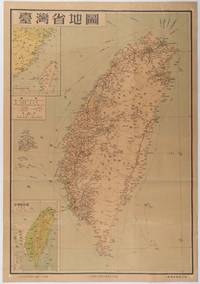
[TAIWAN PROVINCE MAP].
台灣省地圖. Taiwansheng ditu. Map of Taiwan Province.
地圖出版社. Reprint. 1954. Colour folding map of Taiwan showing all major cities towns and villages railways highways roads rivers and sea routes. Topographical inset map at lower left Taiwan Straits with mainland coast inset map at top left. Each map has its own scale. Text in traditional Chinese characters. Washi repairs along some folds on reverse pin marks at corners evenly browned and a little faded. A nice map of Taiwan in fair condition. 77 x 53.8cm. . 地圖出版社. unknown
Referentie van de boekhandelaar : 215869
|
|
|
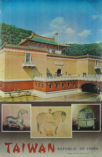
[TAIWAN TRAVEL POSTER].
Taiwan. Republic of China.
Taiwan Visitors Association. No date. Circa1975. Colour photographic travel poster for Taiwan measures Small pin holes at corners and on upper and lower margins a little minor wear and creasing along edges and at corners. Stamp of Australian travel agent Lance Lloyd World Travel Deniliquin NSW lower right corner. 90 x 59.4cm. . Taiwan Visitors Association. unknown
Referentie van de boekhandelaar : 143942
|
|
|

 De zoekresultaten per email ontvangen
 Zoekresultaten downloaden als PDF
 RSS feed
 Permanente link


