|
[WALLIS].-
Nouvelle bibliothèque des voyages, ou Choix des voyages les plus intéressans [sic pour intéressants]. Tome vingt-deuxième : VOYAGE autour du MONDE, par WALLIS.
P., Lecointe, 1830, petit in 12, cartonnage de papiper crème de l'éditeur, 252 pages ; des rousseurs ; galeries de vers marginales en pied de toutes les pages ; les pages 7 à 10 manquent.
Referenz des Buchhändlers : 62767
|
|
|
[Wendt, I C W / Kappelhoff, C E L] (Hrsg).
Hamburgs Vergangenheit und Gegenwart. Eine Sammlung von 192 Ansichten vom 11. Jahrhundert bis auf unsere Zeit. In 1 Bd. Nach alten Radierungen Stichen Gemälden Aquarellen Handzeichnungen Lithographieen u. photographischen Originalaufnahmen.
Hamburg Wendt & Co. / Allein-Vertrieb von F. Dörling ca. 1911. . Vgl. Rapp S. 5 Ac 902 Qt. - Kanten beschabt RDeckel mit Kratzspuren Vors. geknickt. Innen gut. - Auswahl vornehmlich aus dem Hauptband der Sammlung Wendt/Kappelhoff vgl. unsere # 16714. - "Diese Illustrationen sind photographisch getreue Wiedergaben solcher Originalbilder die sich nur noch in den hamburgischen Museen und in einigen Patrizierfamilien vorfinden". - Von der Zerstörung Hamburgs durch die Wenden 1072 bis zur Brooksbrücke im Freihafen 1888. - Anzeigen zu "Das lustige alte Hamburg" "Vetter Kirchhoff" "Mattler sin Hahnrieder" "De Reis na'n Hamborger Dom" "Ut Vadders Tiden" "Der Grillenscheucher" u. "Die Kriegsfahrten der Hamburger". - Ordentliches Exemplar. Hamburg, Wendt & Co. / Allein-Vertrieb von F. Dörling, [ca. 1911]. unknown
Referenz des Buchhändlers : 59152
|
|
|
[West India - Pilot Guide].
The West India Directory. Volume I. Containing Directions for Navigating the Caribbean Sea and the Gulf of Mexico; with a Description of the Coast of Colombia, Yucatan, Mexico, and Florida, and the adjacent Islands and Shoals. London, G. Duckworth for the Hydrographical Office, Admiralty, 1829.
8vo. (10), 340, (12), 12 pp. (appendix). Contemporary half calf, marbled sides, gold title on spine, marbled endpapers. Extremely rare first edition (with an appendix printed in 1857, so perhaps reissued at that time) of a pilot guide for parts of the Caribbean, stating explicitly that there is still no adequate information for all parts. Although it calls itself volume 1, it is not clear that any of the various publications under the title "The West India Directory" was intended as a companion volume to the present one. It clearly covers different content than "The West India Directory" published by John William Norie in 1827. - With library stamps of the Marinens Bibliothek, Copenhagen (the library of the Danish Royal Navy): in gold in the centre of the front board and in ink on the title-page. Head of spine cracked, front hinge weak, corners bumped, front endpapers loose, but still in good condition. OCLC 47915720.
|
|
|
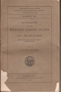
[Western Americana] [Travel] Darton, N H; and others
Guidebook of the Western United States Part C. The Santa Fe Route with a Side Trip to the Grand Canyon of the Colorado. Department of the Interior United States Geological Survey Bulletin 613
Washington DC: Government Printing Office 1915. First Edition. Soft cover. Fair. Octavo. iv 194 pages. Illustrated with 24 folding map sheets photographs and figures. Brown paper covers with title on front and spine. Paper cover is chipped on the front. Paper spine mostly vanished. Covers detached. Stitching starting to come loose. Fair only. Map illustrations in very good condition. Government Printing Office unknown
Referenz des Buchhändlers : 35385
|
|
|
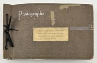
[Western Photographica]: [Travel]
Vernacular Photograph Album Documenting Travel Through Virginia Beach Chicago New Orleans Texas and Arizona
Various places 1930. Very good. Ninety-nine photographs on fifty leaves various sizes but many approximately 7 x 6 inches. Oblong octavo. Original brown covers typed paper label; black paper leaves. Covers a bit worn corners heavily so. Minor soiling to contents a few photos with some light silver mirroring. Images each with typed captions in the negative. A handsome vernacular vacation album with images taken by a skilled photographer with a keen eye for composition and lighting. Each image has a typed caption printed in the negative and most photos are one per page and quite large. The cover label indicates trips to Chicago Virginia Beach New Orleans Houston San Antonio Tucson and Phoenix over the course of three years. The album opens with several handsome panoramic shots of the Chicago skyline and Grant Park before moving on to scenes of sand dunes at Virginia Beach. The remaining forty leaves however show images of New Orleans and the Southwest all captured in artistic detail. Among the more interesting scenes are "Civil War Tenements - Church Street - New Orleans"; "At Twilight the Old Mission Concepcion San Antonio - Texas"; "U.S. Veterans Hospital - Tucson". There are many sweeping scenes of desert scenery and cactus some well-composed tourist shots in San Antonio at the zoo and Brackenridge Park and a series of three images of the Rodeo Parade in Tucson in 1930 showing the cowboys cowgirls and "Indians" marching in the parade.<br /> <br /> There are also street scenes in each city documenting the growing urban landscape and its buildings. One such shows the Alamo and is captioned "The famous Alamo and the Medical Arts Building. The old and the new - San Antonio Texas." Though the photographer is unidentified he has taken a self-portrait in Audubon Park in New Orleans which shows a middle-aged man in spectacles wearing a fedora and a plaid suit. An unusually nice vernacular photo album comprised of sharp and artistic photographs documenting scenes of tourism and travel in the late 1920s. unknown
Referenz des Buchhändlers : 2033
|
|
|
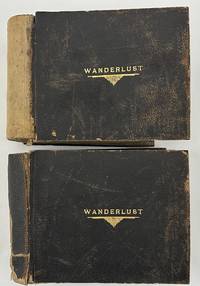
[Western Photographica]: [Travel]: [Railroads]
Wanderlust caption title
Various locations in the American Southwest and West 1923. About very good. Two oblong folio photograph albums bound in brown pebbled leather each titled in gilt on front cover "WANDERLUST" containing a total of 266 full-page vernacular and professional photographs. First albums: 146 leaves illustrated with 128 full-page landscape photographs each around 6 x 8 inches or slightly larger and occasional manuscript or hand-fashioned sectional title pages and maps. Second volume: 148 leaves illustrated with 138 photographs and occasional manuscript or hand-fashioned sectional title pages. All contents mounted one per page to recto of each leaf. Spines perished but holding strong boards worn scuffed and soiled. Contents noticeably curled with minor to moderate dust-soiling throughout. A studio photograph of a young man is laid-in to the first album likely the compiler of the albums but sadly unidentified. An elaborately-produced pair of vernacular photograph albums documenting an epic cross-country train excursion in 1923 by a well-to-do but anonymous traveler from New York comprised of over 260 full-page photographs. The photographs are a mixture of silver gelatin images printing out paper prints handcolored photographs and a handful of cyanotypes. Most of the images appear to be taken by the traveler en route but some images may have been bought along the way. The images largely picture the landscape or architecture seen along the way with a healthy number of images showing the railroad and the railcars themselves with many images taken at train depots. The occasional manuscript sectional title pages denote the regions of travel as the compiler moved west to California and then eventually back east towards home.<br /> <br /> The first album begins with a manuscript title leaf quoting the text of Gerald Gould's poem "Wanderlust" supplemented by two small drawings and two thumbnail photographs. A map on the second leaf traces the voyage from New York down through the American South and Southwest to California and back to New York through Arizona Colorado and the Midwest. Thereafter the album is comprised mostly of full-page photographs grouped together by location with anywhere from a few to several images per section. The first section in the first album shows the first major stop on the trip -- Washington D.C. and Mount Vernon; this section contains photographs of the Capitol the Lincoln Monument other D.C. buildings and several on the grounds of George Washington's home at Mount Vernon. The album then includes sections featuring New Orleans six photographs; the route between New Orleans and El Paso five images including the train depot at Langtry Texas; El Paso five shots featuring the city and street views; Juarez Mexico eight shots mostly either street scenes or a bullfight; "Thru New Mexico and Arizona" four images; The Apache Trail in Arizona nineteen shots mostly desert landscapes but with some buildings along the trail; and onward through the Carriso Gorge seven photos to California beginning at Coronado Beach eight photographs. The remainder of the first album features California locations namely San Diego sixteen images mostly missions; Pasadena ten photos mostly featuring gardens; Catalina Island eight shots of the island scenery or the bay; Los Angeles eight views in Santa Monica Venice and Ocean Park; and ending with fourteen images featuring missions and other notable structures in Santa Barbara.<br /> <br /> The second volume picks up the excursion in Del Monte California featuring fifteen scenes in Carmel by the Sea and Monterey. The photographic journey of California then continues to Santa Cruz and the Big Trees five shots; San Francisco eleven views around the city and in the Japanese gardens; Mt. Tamalpais a dozen shots of elevated vistas big trees and forests; Yosemite National Park twenty park views; Mariposa Big Trees seven shots; and ends with the Glenwood Mission Inn in Riverside twenty-two images of the hotel grounds and other local scenery and missions around Riverside. The remainder of the album features photographs from the Grand Canyon in Arizona twenty-six images mostly landscapes but with a few featuring Native American ceremonies and Colorado Springs twenty landscapes and other views of the city surrounding desert Pikes Peak and so forth. Concerned mostly with scenery of the American South Southwest and West Coast the compiler did not see fit to record photographs of the remainder of his trip back home to New York. In addition to the information contained in the photographs here the elaborate materiality custom matching albums with matching gilt titles to the front board handcrafted sectional title pages the hand-drawn and traced map and the nature of the organization of the albums arranged in the order of travel from east to west and back east again speaks volumes about the importance the compiler placed on the trip.<br /> <br /> Substantially documented western travel albums are growing rare in the market and the present example is one of the most carefully-assembled examples we have ever seen. unknown
Referenz des Buchhändlers : 5280
|
|
|
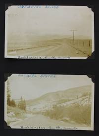
[Western Travel]. [Royse Family]
Annotated Vernacular Photograph Album Documenting the Travels of the Royse Family Across the American West With Much Content on Early Automobile Culture and Industry in the Far West
Various locations including Montana Wyoming Missouri California 1931. Very good. 45 leaves illustrated with 185 original photographs from 2.75 x 2 inches to 6.5 x 4 inches the great majority measuring 5.75 x 3.5 inches and a few postcards most with manuscript annotations on the borders of the images or on the album pages. Oblong folio. Contemporary textured black cloth gilt title on front cover string tied. Moderate rubbing to covers bottom edge worn corners creased. Internally clean photographs in very nice shape. A well-annotated vernacular photograph album chronicling about two decades of the travels and experiences of Ray Royse and his family as they trekked from Illinois to California through the Upper West in the first quarter of the 20th century. The Royse family started in Aledo Illinois and numerous photographs feature various family members here. They then traveled through Casper Wyoming Great Falls and Butte Montana and other locations before settling in Long Beach where Ray and his brother-in-law worked at the shipyards. The images here document Ray's training at the Sweeney Automobile & Tractor School in Kansas City driving Harley-Davidson motorcycles attempting to repair a nearly destroyed family sedan visiting the Custer Battlefield and the monument to Buffalo Bill Cody among other western sites scenes in Yellowstone Park and a family drive up Pike's Peak among many others. Ray's efforts to move West reflect the expansion and increasingly wide availability of automobiles and the growing industry in the West following the First World War.<br /> <br /> The photographs here record numerous locations in the American West to which Ray Royse along with his family and friends traveled or worked in in a 1922 Nash and later a Ford Model T. They traveled across the Continental Divide Ray worked for a time at the Anaconda Mines near Great Falls and Butte Montana and later the Standard Oil Refinery at Shelby Montana. Many images show a wrecked Ford Model T with Roy diligently at work trying to repair it before finally resigning his efforts by attaching a sign reading "Rest in Pieces" on the radiator. Another picture shows another Ford weighed down with a huge sack of wool in Bear Creek Wyoming. There are also images emanating from Dublin Gulch near Butte; Livingston Montana; Wind River Canyon in Thermopolis Wyoming; Salt Creek Wyoming; ; and several park scenes in Kansas City. A handful of images feature the Warren family in Butte. Several photographs memorialize the Royse family trip to Yellowstone Park in 1923 with many of the geysers and surrounding landscapes the Old Faithful Inn in Yellowstone and more. There are also interesting photos from a Royse family drive to the top of Pike's Peak with views from the peak with additional shots from the Garden of the Gods cliff dwellings near Colorado Springs scenes in New Mexico and Arizona in 1929 dams near Great Falls the Beaver Dam in Wyoming a picture of the "Million Dollar Fire" in Casper in 1921 and a beached fifty-five-foot whale in Long Beach dated December 28 1929. Altogether the images clearly illustrate the wandering nature of the Royse family across several states in the American West.<br /> <br /> Ray Royse 1903-1942 was an automobile mechanic metal worker and sheet metal specialist who worked in the Long Beach shipyards from 1929 until 1942 when he was killed in a shipyard accident. He also worked as a coal miner in Wyoming and on the Douglas Sheep Ranch in Wyoming both of which are chronicled in photographs in the present album. He met and married Sylvia Lambert in 1934 in South Dakota before returning to California.<br /> <br /> A wide-ranging and eclectic mixture of original and unique photographs of the West documenting an interesting family who began in Illinois and eventually settled in California. unknown
Referenz des Buchhändlers : 2702
|
|
|
[Western Travel]. [Railroads]
Memories of the Trip and of Associates on the Red Special cover title
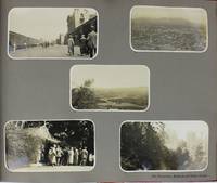
Various locations in the American Southwest West Coast and Pacific Northwest 1925. Very good. 30 leaves illustrated with 270 photographs of various sizes including two multi-panel panoramic photographs each leaf with a single printed caption identifying the subjects or location. Contemporary red leather gilt titles on front cover. Oblong folio. Some scuffing and abrading to covers a few short edge tears. Internally clean. A handsome annotated photograph album produced to commemorate a railroad trip by a well-to-do party of travelers from Kansas City through New Mexico Arizona Colorado California and up the West Coast to British Columbia and Alberta in 1925. The first photograph in the album is a panorama of a large group of well-dressed men and women at the Mission Hills Country Club in Kansas City captioned in the negative indicating the traveling party emanated from Kansas City as part of the "N.E.L.A. Red Special Delegation to San Francisco Convention" who were "Guests of K.C.P and L Co" presumably the Kansas City Power & Light Company. The second and much larger panoramic photograph is comprised of fifteen 5-x-8-inch photographs picturing the travelers posed outside the numerous Pullman cars that comprise the Red Special. The preponderance of the photographs are organized by location generally five or six photographs per page with a single printed caption per page mostly indicating the location. The body of photographs begins with facing pages of images featuring the travelers and some scenery in Colorado Springs and Garden of the Gods in Colorado. A sampling of subsequent groups of photographs feature the travelers at Pike's Peak Albuquerque the Grand Canyon San Bernardino Redlands Los Angeles Santa Barbara Del Monte Yosemite Valley Glacier Point Mariposa Grove San Francisco Shasta the Columbia River Victoria Vancouver Canadian Rockies Lake Louise Lake Agnes Moraine Lake Johnson's Canyon Banff and other locations. The album closes with four pages of photos picturing "Fellow Travelers Here and There" and a group photo of "The Train Crew." The latter photograph is the only one featuring African Americans who were likely working as Pullman porters on the Red Special. A wide-ranging series of photographs featuring much of the American and Canadian West before the Great Depression. unknown
Referenz des Buchhändlers : 4849
|
|
|
[WIKING] - MIEDNER (Felir) -
Islands kultur zur wikingerzeit.
Bielefeld, Verlag von Belhagen & Klasing, 1920 ; in-12, 187 pp., cartonnage de l'éditeur. (thule altnordische dichtung und prosa - einleitungsband).
Referenz des Buchhändlers : 200619015
|
|
|
[WILKES, J].
Shropshire.
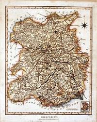
London.: J. Wilkes. 1827. Attractive hand coloured map of Shropshire 27.5 x 21.5 cm. very occasional light foxing on reverse but not visible on the image itself. A most attractive map. . [J. Wilkes.] unknown
Referenz des Buchhändlers : 61872
|
|
|
[WOMEN -- TRAVEL]. MORRIS, Mrs James Edwin [ie MORRIS, Ida Margaret Dorman]. i e
A Pacific coast vacation. Illustrated from photographs taken en route by James Edwin Edison Morris.
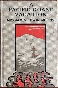
New York London & Montreal: Abbey Press Publishers 1901. 8vo. 14 255 1 pp. including 1 leaf of publisher’s ads for Morris. Title in red & black. Portrait photo frontisp. w/ tissue guard numerous photo plates. Pictorial beige publisher’s cloth front cover illustrated w/ image of Alaska glacier w/ gilt red & black black lettering minor scuffing wear to cloth a couple signatures poorly opened w/ minor closed tears rough cut fore-edges slightly shaken still a VG- copy. First edition of this breezy fast-paced travel memoir of Ida & her husband James traveling from Arcola & Arthur IL through Chicago and points West to fulfill her lifelong dream of seeing Alaska and the Aurora Borealis. She was insatiably curious and frequently writes of Native Americans as they traveled by rail across the Northern United States including tribes in Minnesota Lakes region Dakotas Montana the Pacific Northwest British Columbia and Alaska. She also observes in Havre Montana the African-American “Twenty-Fourth United States Infantry came aboard. . . stalwart colored soldiers who will do credit to the uniforms they wear. . . how many of these brave men would return from the deadly Philippines.†She writes details about the Salish Northwest Coast Indian legends the First Nations peoples’ potlatches in British Columbia and their banning by the Provincial government along with making frequent mentions of Japanese-Americans Chinese-Americans and more. The couple visits the Muir Glacier Alaska gold fields Walla Walla in Washington State as well as Yosemite and Yellowstone National Parks. Morris 1859-1927 was a school teacher in Mattoon IL who married James Morris 1848-1925 local banker and merchant in 1887 and the pair traveled often. Abbey Press, Publishers, hardcover
Referenz des Buchhändlers : 60698
|
|
|
[WOMEN-- TRAVEL]. FAUST-NEWTON, Cosette
The rainbow-hued trail around the World. Illustrated with author’s photographs maps line drawings and cover design by Margaret Ann Scruggs.
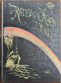
Dallas TX: Cosette Faust-Newton 1932. Tall 8vo. xxiii 1 310 2 pp. Photo frontisp. w/ original textured tissue guard colour-tinted photo plate w/ tissue guard numerous photo plates photo & text illustrations throughout hand-illuminated limitation page. Black silk moire cover art w/ colour rainbow arching over a steam ship decorative gilt lettering front cover & spine pictorial illustrated map endpapers by Scruggs minor rubbing very minor shelfwear still a VG bright copy inscribed by both author & artist from the library of Dallas socialite and intrepid traveler Annette “Nettie†Hawkins Jones 1870-1936. First edition signed & numbered 465 of this lavishly illustrated memoir by the eccentric author through Hawaii Japan China the Philippines Indonesia India relating historical anecdotes travel tips cultural mores and snippets of poetry by the author. She includes a prospective travel reading list bibliography at the end for the aspiring traveler along with detailed index. Faust-Newton 1889-1975 was an avid traveler earned several degrees gave lectures on her excursions and amassed a sizable collection of antiquities and Asian artifacts later used to fill their museum. She is perhaps best remembered in her former Highland Park neighborhood of Dallas for the decades-long legal fights with the city over her mock 3-story yacht S.S. Miramar scene of parties and tourist attraction the 1938 kidnapping of an African-American employee accused of stealing a “priceless†jade ring never found and the sustained pranking and vandalism campaign contributing to her deepening sense of paranoia. Scruggs 1892-1988 was a noted Dallas TX etcher illustrator writer author designer and artist descendant of noted Kentucky Portrait Painter Sam Woodson Price and taught at SMU. See: China Galland The Prisoner of Highland Park: Coming Home in Search of a Vanished Childhood D magazine Nov. 1 1977; Elizabeth Ygartua Backyard-Boat Couple Made Plenty of Waves in Their Day People Newspapers Sept. 11 2023. Cosette Faust-Newton, unknown
Referenz des Buchhändlers : 60560
|
|
|
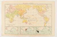
[WORLD MAP OF MAJOR RELIGIONS].
Religions of the World.
London.: Times Atlas of the World. 1895. Map printed in colour 23.2 x 35.9 cm. two edges gilt with three inset maps key to religions outlined in colour bottom margin chipped edges browned a few silverfish abrasions affecting the verso but in good condition. . (Times Atlas of the World) unknown
Referenz des Buchhändlers : 175135
|
|
|
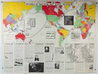
[WORLD MAP - WORLD WAR II]
World News of the Week. Monday Apr. 13 1942. Covering period Apr. 3 to Apr. 9. Military Edition.
Army Orientation Course. / News Map of the Week Inc. Volume 4 No. 32. 13 April1942. Folding colour pictorial map on sheet 88 x 119 cms blank on verso inset maps two photographic diagrams and black and white photographic illustrations descriptive text top edge chipped a few short edge tears and lower corner torn no loss pinholes at the corners inoffensive tidemark at a lower corner in good condition. Colour world map showing political boundaries and military events of World War II from April 3 to 9 1942. with descriptive text beneath including: the loss of two British Cruisers off Ceylon; the occupation of Bataan by the Japanese and their landing on Manus; Japanese war tactics revealed by Malay prisoners and the increasing importance of Central Africa to the Allied war effort. The. Map is indexed according to these notes. Two inset maps of Europe chart Hitler's gains in 1941 and activity on the Russian Front. Additional diagrams on the main world map show war spending and the civilian and war output of US industries. . Army Orientation Course. / News Map of the Week, Inc. unknown
Referenz des Buchhändlers : 202620
|
|
|
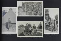
[World Travel]. [Lien, Robert E]
Extensively Annotated Photograph Album Documenting Travel Around the World Including California Hawaii Panama China and More
Various locations 1924. Very good. 65 leaves illustrated with 329 photographs between 2.5 x 1.75 inches and 5 x 7 inches plus a small selection of ephemeral items. Oblong quarto. Contemporary limp black cloth photograph album string tied. Minor scuffing to edges some rubbing to boards. A wide-ranging annotated vernacular photograph album documenting the worldwide travels of Robert E. Lien of California. The album opens with an interesting manuscript note pasted in by the compiler reading: "This Album is the Property of Robert e. Lien. Please do not rub your hands over the white ink it rubs off." The photographs begin in Edison County California showing the landscape of the Sierra mountains local buildings and businesses orange growers in Yuba an oil well fire in Santa Fe Springs aerial views of San Francisco views of the wrecked Union Oil tanker Lyman Stewart and more. The California images account for roughly the first third of the album. One image of a steamship gives a clue to Lien's career with the caption reading: "My home for 14 months. S.S. Columbia." Other images show Lien dressed in ship's officer gear so he was perhaps a captain or sailor on oceangoing oil tankers. This would account for his keen interest in ships and boats which feature prominently in numerous images in the present album which were presumably taken by Lien while he was on the Columbia. Lien also visited numerous locations around the world which he documents in the album with several images in the Panama Canal; shots of locals and other scenes in Manzanilla Mexico and Corinto Nicaragua; scenes in Melbourne Newcastle and Sydney Australia; images of locals and local color in Saigon Shanghai and the Philippines; and more. Lien's detailed manuscript captions throughout provide vital identifications of locations settings and names for individuals he both knew and met along the way around the world. unknown
Referenz des Buchhändlers : 3758
|
|
|
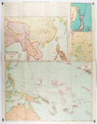
[WORLD WAR II MAPS]
China Burma India War Sector etc. Chronology of Important War Events since December 7 1941.
Chicago.: Geographical Publishing Company. 1943. 10 printed colour maps on a large single sheet 91 x 71 cms small inset map of the European theatre chronology of events original folds a few short fold splits archivally sealed; in very good condition. A suite of numbered U.S. war maps with Allied action overstamped in red by the publisher that for Germany and France with pictorial stamps for strategic targets including "Chemical Factories" and "Airplane Factories". The maps numbered 1 to 10: English Channel; Italy; Southern Greece; Western Mediterranean Sea; Germany and France; Baltic Sea and Scandinavia; China Burma India; Japan; Tokyo; and Greater Pacific Battle Zone: a large half sheet map noting the placement of US and Japanese bases. The "Chronology of Important War Events" lists action from the bombing of Pearl Harbour: "Japan's day of Infamy: Japanese air attack cripples American Fleet at Pearl Harbour" to March 21 1944 "Germans take over key political posts in Bulgaria and Romania". <br> <br>Issued by the Geographical Publishing Company of Chicago this educational sheet includes an advertisement for WLS Chicago "The prairie farmer station" with a list of their war broadcasts and a world clock. . Geographical Publishing Company. unknown
Referenz des Buchhändlers : 206908
|
|
|
[WORLD WAR II MAP] TURNER, STANLEY (CARTOGRAPHER).
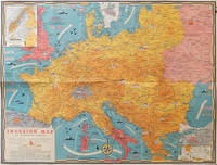
Dated Events Invasion Map of Fortress Europe.
Toronto.: C.C. Petersen. 1944. Colour pictorial map 51 x 67 cms two small inset maps of Scandinavia and the Baltic and South Greece and the Dodecanese on the verso a black and white world map showing the Pacific Theatre marking keys events of the war and in European world history folding into the original pictorial pocket a little toned and marked 25.8 x 17.7 cms small fold split but in very good condition. A scarce map in the "Dated Events" series published by C.C. Petersen in Canada and distributed throughout North America commemorating D-Day. The colour map by Stanley Turner encompasses the area from England as far south as the French border with Spain and as far east as the USSR and Turkey. "With this invasion map you will be able to follow the progress of the Allied troops on their way to smash Germany.". The text at lower left goes on to elaborate on the features shown on the map from elevation "major battles are seldom fought on the tops of mountains" to pictographs of bombs falling. <br> <br>The black and white map on the verso shows the Far Eastern theatre of war centring on the Pacific Ocean with the Asian landmass including India and the USSR at upper left Australia at lower left and North America and the coast of South America at right of the map. Naval bases are shown and significant events in the war are noted in text boxes. <br> <br>A handsome production of a scarce map rarely seen with the original pictorial pocket. . C.C. Petersen. unknown
Referenz des Buchhändlers : 206781
|
|
|
[WORLD WAR II MAPS] THOMPSON, KENNETH W (ARTIST); ELIOT, GEORGE FIELDING
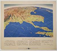
Five WWII Bird's-eye View Maps including the Pacific and Southeast Asia.
Remington Rand. 1944. Five printed colour maps each: 31.4 x 47 cms; 46.3 x 53.3 cms sheet central fold marginal edge wear chips and a few small edge tears tidemark affecting the ocean at the outer edge of Map VII but all the maps in very good condition. From a series of World War II battlefront maps "for the delight of arm-chair strategists" published by the Library Bureau of Remington Rand seven were published. Taken from a bird's eye view of the globe and with relief artistically rendered by artist Kenneth Thompson 1907-1996 and descriptive text by George Fielding Eliot 1894-1971. Eliot spent his youth in Australia attending Melbourne University serving with distinction in the Australian Infantry in WWI. Moving to the United States after a short stint in Canada serving with the RCMP her served as a reserve officer in the U.S. Army reserve in military intelligence from 1922 to 1933 and during WWII Eliot famously broadcast the first extended television coverage following the attack on Pearl Harbor. He continued to write books and articles about military strategy and world politics into the 1960s. <br> <br>In keeping with the "aviation-age" cartography of Richard Edes Harrison the unusual perspective of the maps--from above and often with a direction other than north at the top of the map--challenges the viewer to reconsider the geopolitical situation with the text of Eliot as a further prompt his captions below: <br> <br>Map III Italy & South France "Hannibal Caesar and Napoleon made their reputations here" <br>Map IV The Western Front "Will the cockpit of 1918 see the decisive battles of 1944" <br>Map V Southeastern Asia "The road to Mandalay -- and to China --along which bombs for Tokyo must travel" <br>Map VI The Southwest Pacific "Island-hopping toward Japan -- in short and long hops" <br>Map V11 The North Pacific "Here the enemy trusts in the protection of vast ocean distances" . Remington Rand. unknown
Referenz des Buchhändlers : 200808
|
|
|
[WORLD WAR II - MAP] BURKE, HOWARD; CAB C A B
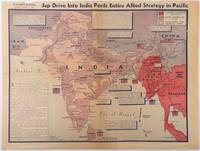
Jap Drive into India perils entire Allied strategy in Pacific
Los Angeles.: Los Angeles Examiner. April 31944. Colour pictorial map on a single newspaper leaf 37 x 50 cms; 41.5 x 54.6 cms sheet unrelated text on the verso although with an interesting account from a soldier's letter about an air raid in China toning more marked at the central fold two small splits no loss to the map edge wear with several small marginal edge tears neatly repaired on the verso with archival washi map unaffected in good condition. A dynamic map prepared and illustrated by the Examiner's art critic and editor Howard Burke covering the area surrounding India and Central Asia showing Japanese conquered territory in Malaya Thailand Indo-China and Burma; and in India British-controlled states and native feudal and protected states. <br> <br>Text boxes and pictographs give an overview of the geopolitical situation from the Allied perspective. One box notes "Chanda Bose has many adherents and fanatical followers in Bengal. They may prove to be a powerful fifth column in India". Text at lower edge opines "The situation in India is critical and has grown more so as the all-out offensive against Japan has been delayed. If the Allies do not act at once and with great force all our gains may be wiped out and the war in the Pacific prolonged indefinitely." <br> <br>The decisive and devastating bombings that were to signal such an end were four months away. <br> <br>Rare on the market. . Los Angeles Examiner. unknown
Referenz des Buchhändlers : 214362
|
|
|
[WORLD WAR II MAP OF EAST ASIA].
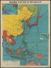
The Daily Mail War Map of the Far East.
London.: George Philip & Son. 1944. Full colour folding map 101.5 x 76cm sheet inset maps legend folding into title wrapper 25.7 x 19.4 cms covers a little dusty and discoloured a few short fold splits without loss but the map in very good bright condition. Map of the Pacific Theatre of World War II with borders drawn as they stood in 1937 - complete with Chinese claims on Mongolia Tuva and Tibet. <br> <br>Shows transportation routes principal railways oil fields Allied naval bases territory occupied by the British Empire French Empire and the United States. This map shows only the northernmost section of Australia which allows for much better detail of the countries of East Asia. Small inset map of the Hawaiin Islands at mid right. Inset map of the Pacific Ocean at upper left. . George Philip & Son. unknown
Referenz des Buchhändlers : 205765
|
|
|
[Xiamen].
Two panoramic views of Xiamen (Amoy) Island. No place, circa 1870.
2 panoramas, each composed of four consecutive albumen prints. 1100 x 210 mm. Two of the earliest panoramic views of Xiamen, formerly romanized as Amoy. Xiamen Island was considered to possess one of the world's great natural harbors in Yundang Bay, and its served as China's main port for exporting tea. It was one of five Chinese Treaty ports agreed on by the Treaty of Nanjing in 1842. Under Deng Xiaoping Xiamen became one of the original four special economic zones opened to foreign investment and trade in the early 1980s. - Slightly foxed and browned. Rare.
|
|
|
[ZEPPELIN] - MIETHE (A), HERGESELL (H) -
MIT ZEPPELIN NACH SPITZBERGEN.
Berlin, Deutsches verlagshaus bong & co, 1911 ; petit in-4, 291 pp., cartonnage de l'éditeur. Bilder von der studienreise der deutschen arktischen zeppelin expedition - mit 269 reproduktionen.
Referenz des Buchhändlers : 200618215
|
|
|
[ZHANG YONGRU]. (EDITED BY).
袖珍中華人民共和國分省新圖. Zhenxiu Zhonghua renmin gongheguo fensheng xintu. Pocket Sized Atlas of People's Republic of China by Province.
大陸輿地社. 1952. Charming pocket size atlas with double page coloured map showing China as a whole and the provinces with inset maps of special geographical features and a description of key information about each province vertical text. Text in traditional Chinese characters names on map read from right to left or vertically. Light wear little light browning but maps very clean and bright very good condition 14.5 x 9.8cm. . 大陸輿地社. unknown
Referenz des Buchhändlers : 215851

|
|
|
[ZHU, YULIAN]. (CARTOGRAPHER). 朱育蓮 繪.
美國在日本的主要軍事基地圖. Meiguo zai Riben de zhu yao jun shi di tu. Map of Major U.S. Military Bases in Japan.
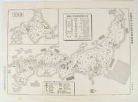
No publication details. Circa1955. Chinese black and white military map of Japan based on a map issued by 赤旗報 Shimbun Akahata on 24 June 1953. No scale given inset map of Hokkaido upper left corner legend lower section showing air and navy bases military exercise bases ammunition dump shooting ranges for the air force and navy headquarters of the coast guard etc. Text upper section provides details of the different types of US military bases and infrastructure. Text in traditional Chinese. 25.8 x 35.8cm. . No publication details. unknown
Referenz des Buchhändlers : 172396
|
|
|
[ZIEM (Félix)].-
Félix Ziem. Peintre voyageur, 1821 - 1911. Oeuvre graphique. Catalogue des collections du Musée Ziem.
Martigues, Musée Ziem, et Actes Sud, 1995, in 4° broché, 327 pages ; bibliographie et index ; innombrables illustrations ; couverture illustrée en couleurs.
Referenz des Buchhändlers : 61390
|
|
|
[Île Bourbon] YVAN, Melchior-Honoré
La Chine et la presqu'île malaise, relation d'un voyage accompli en 1843, 1844, 1845 et 1846. / par le Dr Melchior Yvan
Paris, Boulé 1850 In-8 22,5 x 16 cm. Broché, couverture d’attente, 158 pp. édition originale d’un ouvrage d’une relative rareté. Exemplaire en bon état.
Referenz des Buchhändlers : 120347

|
|
|
[ŌBUCHI ZENKICHI]. 大淵善吉.
最新京都市街地圖. Saishin Kyōto shigai chizu. Most Recent Map of Kyoto City.
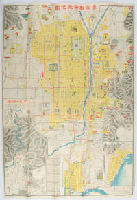
京都. Kyoto.: 山中書房. Yamanaka Shobō. 大正 11 1922. Attractive colour folding map of Kyoto with a quite detailed illustrated tourist guide printed in blue and white on the reverse some light browning holes at some folds good copy. 78.5 x 54cm This 1922 colour folding tourist map of Kyoto offers sightseeing information each panel showing a photographic monochrome image of the site discussed. <br> <br>The two inset maps on the Kyoto map show Otsu city on the shore of Lake Biwa and the Arashiyama area north of Kyoto. The main map highlights the major temples and famous sights in red geographic features such as rivers and hills are shown and an inset chart shows distances of sights from the nearby stations. The information on the reverse gives more detail on the famous sights a calendar of events seasonal highlights and details of the Imperial graves around Kyoto. . 山中書房. [Yamanaka Shobō]. unknown
Referenz des Buchhändlers : 171899
|
|
|
A A Kok
Guide to Amsterdam
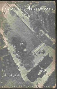
Amsterdam: C V Allert de Lange 1947. Hardcover. Good. 5" x 7. 108 pages. 15th edition guide to Amsterdam in English with line drawings to illustrate. Some wear externally with tanning to the pages. Still a tidy book. All orders processed promptly and shipped from the UK. 5"x7 <br/> <br/> C V Allert de Lange hardcover
Referenz des Buchhändlers : 028526
|
|
|
A Book of Travel, History, Information, and Entert
The Seven Kingdoms
paperback. Good. Access codes and supplements are not guaranteed with used items. May be an ex-library book. paperback
Referenz des Buchhändlers : 1334056684.G ISBN : 1334056684 9781334056680

|
|
|
A Bryan Williams
Game Trails in British Columbia
London: John Murray 1925. A detailed history of big game and other sport in the wilds of British Columbia 360 pages in overall clean condition but with medium to light foxing throughout many old period photographs. Outer boards have light speckling to boards and light wear to edges embossed gold stag on front is bright gold lettering on spine is a little dulled. A sound copy SEE IMAGE. DETAILED IMAGES AVAILABLE ON REQUEST. First Edition. Gold Decorated Boards. Good/No Jacket. 9 x 5¾ Inches. Hardcover. John Murray Hardcover
Referenz des Buchhändlers : 004837

|
|
|
A C Newcombe
Village Town and Jungle Life in India
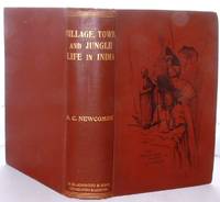
Edinburgh: William Blackwood and Sons 1905. Very informative book on Village Town and Jungle Life in India 417 pages in overall clean condition just light browning to outer edges of pages and very occasional small light foxing spots many B/w photographs and illustrations all present as listed plus very informative text NO dustwrapper outer boards are lightly bumped to corners and very lightly rubbed to edges. A pleasing example of this book SEE IMAGES. DETAILED IMAGES AVAILABLE ON REQUEST. First Edition. Illustrated Boards. Good Plus/No Jacket. 9 x 6 Inches. Hardcover. William Blackwood and Sons Hardcover
Referenz des Buchhändlers : 008186
|
|
|
A Cura Di Filippo Bettini
Migrazioni Il Viaggio in Poesia Da Omero Ai Nostri Giorni
pp. 99 edizione fuori commercio
|
|
|
A cura di M. Bossi e C. Greppi.
Viaggi e scienza. Le istruzioni scientifiche per i viaggiatori nei secoli XVII-XIX.
cm. 17 x 24, liv-380 pp. con 2 figg. f.t. Gabinetto Scientifico Letterario G.P. Vieusseux Le istruzioni scientifiche per i viaggiatori sono parte essenziale della sistematica ricognizione della terra tra il XVII e il XIX secolo. Tramite le loro prescrizioni si cerca di disciplinare e stimolare, sia nell?esplorazione extraeuropea sia nell?indagine sulle aree interne al continente europeo, l?osservazione delle diverse realt? fisiche e culturali. I testi delle istruzioni rappresentano non solo una componente fondamentale della pratica del viaggio, ma un?espressione particolarmente significativa dell?intero sistema di conoscenze occidentale. Instructional guides for travellers form an essential part of the systematic exploration of the world from the seventeenth to the nineteenth centuries. The advice they contain tends to discipline as well as to stimulate observation of the various physical and cultural realities both within and outside the European continent. The texts are not only an integral part of the literature of travel ? they constitute a very significant expression of the western system of knowledge as a whole. 776 gr. liv-380 p.
|
|
|
A cura di M. Ciacci.
Viaggio e viaggiatori nell?et? del turismo. Per una riqualificazione dell?offerta turistica nelle citt? d?arte.
cm. 17 x 24, 302 pp. con 10 ill. f.t. Fondazione Carlo Marchi - Quaderni Ventuno saggi divisi in 3 sezioni (Il viaggio e lo sguardo, Consumi turistici e stili di vita, Per un sistema dell?offerta turistica nelle citt? d?arte) affrontano, con approccio interdisciplinare, gli spunti che il turismo culturale offre alle comunit? locali, agli operatori turistici e agli amministratori pubblici. Twentyone essays gathered in three sections (The travel and the glimpse, Touristic consumption and lifestyles, Enterprise and system marketing in art cities) investigate, through a wholly interdisciplinary approach, the challenges that cultural tourism offers to the local community, to tour-operators and to public administrators. 660 gr. 302 p.
|
|
|
A cura di S. Teroni.
Occhio (L') del viaggiatore. Scrittori francesi degli Anni Trenta. Atti del Convegno (11-12 gennaio 1985).
cm. 17 x 24, 212 pp. Gabinetto Scientifico Letterario G.P. Vieusseux 440 gr. 212 p.
|
|
|
A de Bertha
La Hongrie moderne. de 1848 a 1909
Étude historique vol in4, 23x15, demi toile bel état, 358pp Paris, Plon 1901 ref/10
Referenz des Buchhändlers : CZC-8735

|
|
|
A de Bertha
La Hongrie moderne. de 1848 a 1909
Étude historique vol in4, 23x15, demi toile bel état, 358pp Paris, Plon 1901 ref/10
Referenz des Buchhändlers : CZC-8735
|
|
|
a et c HOLLANDE
Si Tahiti m'était conté
Editions Imprimerie saint Joseph (Tarbes) 1956.In 4 broché de 182 p.
Referenz des Buchhändlers : 25518
|
|
|
A Egmont Hake
Gordon in China and the Soudan
London: John Macqueen 1896. Very informative book on Charles Gordon and his travels in China.397 pages text plus 10 pages adverts for other books at rear all in overall clean condition just some browning to first and last couple of pages pages are untrimmed on bottom and sides NO dustwrapper outer boards are marked SEE IMAGE. A pleasing example of this book SEE IMAGES. DETAILED IMAGES AVAILABLE ON REQUEST . Illustrated Boards. Good/No Jacket. 8 ½ x 5¾ Inches. Hardcover. John Macqueen Hardcover
Referenz des Buchhändlers : 008945

|
|
|
A G Macdonell:
A VISIT TO AMERICA
VG no dj. blue cloth rounded both ends of spine. neat inscription to reverse of front board. 1st A three months visit to America.
|
|
|
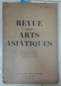
A La Librairie Des Arts Et Voyages
Revue des Arts Asiatiques Vol. 3/1 1926
Paris: White Lotus Press 1926. Paperback. Good/no dj. 0.50. Revue des Arts Asiatiques Vol. 3/1 1926 White Lotus Press paperback
Referenz des Buchhändlers : R7055
|
|
|
A la Recherche de l'Or, Voyage du Yukon
Le Sorcier de l Isle d Anticosti
paperback. Good. Access codes and supplements are not guaranteed with used items. May be an ex-library book. paperback
Referenz des Buchhändlers : 1333187750.G ISBN : 1333187750 9781333187750

|
|
|
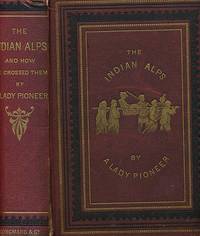
A Lady Pioneer [Mazuchelli, Elizabeth Sarah]
The Indian Alps and How we Crossed Them Being a Narrative of Two Years Residence in the Eastern Himalaya and Two Months' Tour into the Interior
London: Longman's Green & Co. G : in good condition. Cover lightly rubbed with minor wear to outer joint of upper board and at spine head. Small chip at top of fore edge. Some offsetting. Aeg. 1876. First Edition. Maroon/gilt hardback cloth cover with bevelled edges. 270mm x 190mm 11" x 7". 249pp. Fold out map and 10 chromolithograph coloured illustrations by the author with text drawings. Heavy item - shipping supplement may apply for overseas. . Longman's Green & Co hardcover
Referenz des Buchhändlers : g8725
|
|
|
A Merchant Long Resident At Tahiti.
Rovings in the Pacific, From 1837 to 1849: With a Glance at California. Vol. II.
Hardcover. Acceptable condition. First edition. No dust jacket. Several marks and stains on boards. Light bump on lower edge of front board. Spine is cocked. Spine ends and edges are worn, bumped and nicked. Leading corners are worn, bumped and split. Hinges are cracked. Minor ink marking on FEP and rear pastedown. Minor foxing at a few points. Contents are clear. AF Used
|
|
|
A Narrative of the First Voyage to Maryland
A Relation of the Colony of the Lord Baron of Baltimore in Maryland Near Virginia
paperback. Good. Access codes and supplements are not guaranteed with used items. May be an ex-library book. paperback
Referenz des Buchhändlers : 0243269013.G ISBN : 0243269013 9780243269013

|
|
|
A Narrative of the Voyage of the Wildfire to Calif
Romance of the Ocean
paperback. Good. Access codes and supplements are not guaranteed with used items. May be an ex-library book. paperback
Referenz des Buchhändlers : 1333897340.G ISBN : 1333897340 9781333897345

|
|
|
A R Glen,Alexander Richard Glen,N A C Croft
Under the Pole Star: The Oxford University Arctic Expedition 1935-6
London: Methuen 1937. First edition. Hardcover. Very Good/No dustjacket. Smaller 4to. pp. 365 48 plates in sepia22 maps diagrams 1 folding map. Overall a nice copy. Methuen hardcover
Referenz des Buchhändlers : 287422
|
|
|
A Record of Voyages and Experiences in the Western
The South Sea Islanders and the Queensland Labour Trade
paperback. Good. Access codes and supplements are not guaranteed with used items. May be an ex-library book. paperback
Referenz des Buchhändlers : 0282221301.G ISBN : 0282221301 9780282221300

|
|
|
A Story of Travel and Adventure
Sunny Shores or Young America in Italy and Austria
paperback. Good. Access codes and supplements are not guaranteed with used items. May be an ex-library book. paperback
Referenz des Buchhändlers : 028215471X.G ISBN : 028215471X 9780282154714
|
|
|
A travers le monde (supplément au tour du monde) - Voyage - géoographie
A travers le monde 1895
1895 N° année complète avec sa carte de Madagascar de 1895 - demi basane brune (reliure frottée)
Referenz des Buchhändlers : 8402
|
|

 Per e-mail erhalten
 Als pdf-Dokument herunterladen
 RSS feed
 Permanenter link


