|
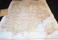
GARRAF - Granollers c. 1949
Granollers, Edit. Alpina, s/f. Mapa topográfico excursionista. Escala 1: 25.000. Entelado. Cerrado con funda de tela con cinta. Firma antiguo propietario. Muy buen ejemplar.
|
|
|
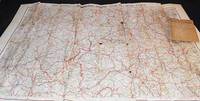
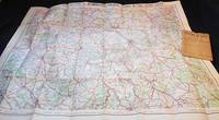
GARRAF - Granollers c. 1949 - Mapa
Granollers, Edit. Alpina, s/f. Mapa topográfico excursionista. Escala 1: 25.000. Entelado. Cerrado on funda de tela con cinta. Firma antiguo propietario. Muy buen ejemplar.
|
|
|
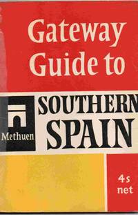
Gateway Guide to Southern Spain
London: Methuen 1965. Soft cover. Good. 4.5" x 6.5. 64 pages. A pocket travel guide to southern Spain Some reading wear but still a tidy copy. Previous owner's signature at the head of the first page. All orders processed promptly and shipped from the UK. <br/> <br/> Methuen paperback
Referentie van de boekhandelaar : 027870
|
|
|
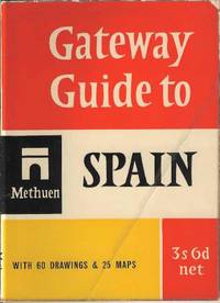
Gateway Guide to Spain
London : Methuen 1958. Soft cover. Good/No Jacket as published. 4.5" x 6.5. A guide to Spain for the tourist including 18 tours. Some reading wear and the front cover has been folded at some stage. Stilla tidy copy available for prompt dispatch from the UK <br/> <br/> Methuen paperback
Referentie van de boekhandelaar : 023944
|
|
|
GATEWAY TO GERMANY - Bonn 1953 - Muy ilustrado
Bonn, Édit. für Publizistik GMBH, 1953. Numerosas fotografías y dibujos en b/n. s/p. 8º mayor. Rústica editorial ilustrada, levemente deslucida. Book in English. Buen ejemplar.
|
|
|
GATEWAY TO GERMANY - Bonn 1954 - Muy ilustrado
Bonn, Édit. für Publizistik GMBH, 1954. Numerosas fotografías y dibujos en b/n. 72 p. 8º mayor. Rústica editorial ilustrada. Book in English. Muy buen ejemplar.
|
|
|
Gent Belgium
28 pages, illustrated, English, German, Flemish and French text. eng
|
|
|
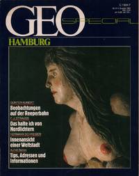
Geo Special Hamburg. Hrsg. v. Henri Nannen.
Hamburg Gruner & Jahr 1983. . (Hamburg, Gruner & Jahr, 1983). unknown
Referentie van de boekhandelaar : 14176
|
|
|
GEOGRAFIA UNIVERSAL (5 vol. - Completo) - Barcelona 1963-1965 - Ilustrado
Barcelona, Edit. Instituto Gallach, 1963-65. Numerosas ilustraciones y mapas en b/n. 487 p. 4º. Tela editorial algo deslucida con dorados en la cubierta y el lomo. Buen ejemplar. Enciclopedia de geografía universal en cinco volúmenes: la Tierra, regiones polares, Europa, Asia, América, África y Oceanía.
|
|
|
GEOGRAFÍA - ATLAS. Primer Grado - Barcelona 1927 - Muy ilustrado
Barcelona, Edi. Coello, 1927. Numerosas ilustraciones en b/n. Mapas coloreados. 88 p. 8º mayor apaisado. Holandesa. Guardas coloreadas. Ex libris. Muy buen ejemplar.
|
|
|
GEOGRAFÍA UNIVERSAL (3 vol. - Completo) - Barcelona 1959
Barcelona, Edit. Planeta, 1959. Numerosas ilustraciones en color y b/n. Unas 400 p. por tomo. 4º. Cartoné editorial con sobrecubierta ilustrada algo deslucida. Buen ejemplar.
|
|
|
GEOGRAFÍA UNIVERSAL (5 vol. - Completo) - Barcelona 1963-1965 - Ilustrado
Barcelona, Edit. Instituto Gallach, 1963-65. Numerosas ilustraciones y mapas en b/n. 487 p. 4º. Tela editorial algo deslucida con dorados en la cubierta y el lomo. Buen ejemplar. Enciclopedia de geografía universal en cinco volúmenes: la Tierra, regiones polares, Europa, Asia, América, África y Oceanía.
|
|
|
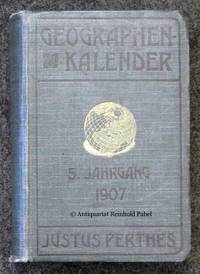
Geographen-Kalender. JG. 5. In Verbindung mit vielen Fachgenossen hrsg. von Hermann Haack.
Gotha Justus Perthes 1907. . Kap. beschabt StaT. - Enthält u.a. eine Biographie des italienischen Geographen Giuseppe Dalla Vedova 1834-1919 ital./dt. eine "geographische Chronik" 1906 sowie Verzeichnisse geographischer Forschungsreisen u. geographischer Literatur 1906. - Der Geograph Hermann Haack 1872-1966 seit 1897 Mitarbeiter der Geographischen Anstalt Justus Perthes war u.a. maßgeblich beteiligt an der Entwicklung von Schulwandkarten. Gotha, Justus Perthes, 1907. unknown
Referentie van de boekhandelaar : 49558
|
|
|
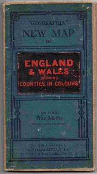
Geographia New Map of England & Wales showing Counties in Colour. Scale 4 miles to the inch.
London: Geographia Ltd . Soft cover. Fair/No Jacket as published. 5" x 8. A map of England Wales on cloth. Not dated but believed to be circa 1920. Shows some signs of handling / use. Some neat annotations to highlight railways. All orders processed and shipped promptly from the UK. Please email with your questions. <br/> <br/> Geographia Ltd paperback
Referentie van de boekhandelaar : 025641
|
|
|
Geographisch-statistisches Comtoir- und Zeitungs-Lexikon. Nach den neuesten Bestimmungen. Oder Beschreibung der Länder, Meere, Seen, Flüsse, Inseln (...) in Hinsicht der Lage, Grösse, Produkte, Merkwürdigkeiten (...) In alphabetischer Ordnung. Für Geschäftsmänner, öffentliche Bureaus, Comtoirs, Kaufleute (...).
Reutlingen, J. J. Mäcken, 1830. 8°. IV S., S.5-779. Goldgepr. Lederband mit goldgepr. Wappensuplalibros u. 3-s. Goldschnitt + Wichtig: Für unsere Kunden in der EU erfolgt der Versand alle 14 Tage verzollt ab Deutschland / Postbank-Konto in Deutschland vorhanden +, 28913A (bestossen, vord. Gelenk restauriert).
Referentie van de boekhandelaar : 28913AB

|
|
|
Giornale di notizie spettanti il viaggio per la Francia del sommo pontefice Pio Settimo - Allocuzione dalla santità di nostro signore Pio Settimo fatta nel concistoro segreto il 26 giugno 1805 - Sanctissimi domini nostri Pii divina providentia Papae VII allocutio habita in consistorio secreto XXIX octobris 1804
In-4°; pp. 135, (1), 15, (1), su carta azzurrina, stemma pontificio al front.; pp. VIII. Legatura coeva in mezza pelle con angoli e fregi in oro al dorso, tagli marmorizzati. Estesa annotazione manoscritta “Memoria scritta l’anno 1814” sul primo foglio di guardia, prosegue al verso del front. di “Sanctissimi domini nostri Pii...”, con trasferimento di inchiostro al recto, e all’ultimo foglio di guardia. Interessante fonte per la storia della cerimonia dell’Incoronazione di Napoleone Imperatore, avvenuta a Notre Dame il 2 dicembre, e della festa che ne seguì. E anche resoconto del viaggio con cui il pontefice Pio VII (1800-23) si recò in Francia; vengono accuratamente descritti i dettagli della partenza, gli approvvigionamenti, il clero al seguito. L’itinerario, suddiviso in Fogli, si snoda da Roma a Modena, Milano, fino a Parigi e rientro passando per Firenze, Perugia, Foligno.
|
|
|
GIPUZKOA. Mapa - Donosti 1979 - Ilustrado
Donostia, Edit. Caja Aho. Municial San Sebastian, 1979. Gran mapa desplegable de Guipuzcoa. Folio. Plegado y guardado en una carpeta en rústica ilustrada. Muy buen ejemplar.
|
|
|
Glasers Annalen. Zeitschrift fur Eisenbahnwesen und Verkehrstechnik - 27. April - 6. Mai 1958
Georg Siemens 1958. Book. Very Good. Soft cover. 1st Edition. Georg Siemens 1958. Very good softcover. . Georg Siemens Paperback
Referentie van de boekhandelaar : 016969
|
|
|
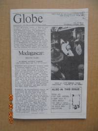
Globe - Newsletter of the Globetrotters Club London Vol.32 No.4 July/August 1984
Globetrotters Club London 1984. Pamphlet. Very Good. Single horizontal crease and other faint random crease marks from being circulated in the mail. 21 x 297 cm. 12 pages. Clean unmarked no tears or stains. <br/> <br/> Globetrotters Club (London) unknown
Referentie van de boekhandelaar : 021934
|
|
|
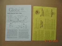
Globe - Newsletter of the Globetrotters Club London Vol.37 No.5 September/October 1989
Globetrotters Club London 1989. Pamphlet. Good. Staple mark to top foredge corner one article 4 pages on motorbiking in Portugal has underlining otherwise clean and in excellent state. 145 x 21 cm. 24 pages. <br/> <br/> Globetrotters Club (London) unknown
Referentie van de boekhandelaar : 021937
|
|
|
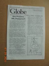
Globe - Newsletter of the Globetrotters Club London Vol.30 No.5 September/October 1982
Globetrotters Club London 1982. Pamphlet. Good. Single horizontal crease and other random crease marks from being circulated in the mail. A few pen marks in page margins on four pages. 21 x 297 cm. 12 pages. Includes in separata membership application trifold with 3 panels and one page. <br/> <br/> Globetrotters Club (London) unknown
Referentie van de boekhandelaar : 021933
|
|
|
Gobernacion De Antioquia: Departamento Administrativo De Planeacion Direccion De Desarrollo: Region Sur
Medellin: Imprenta Deptal De Antioquia. 1981. Book. Very Good. Soft cover. 4to - over 9¾" - 12" tall. Softcover 1981 edition. Ex-library book with stamps and labels attached. Binding firm. Pages unmarked and clean. Covers and text in very good condition. 241 pages. Imprenta Deptal De Antioquia. Paperback
Referentie van de boekhandelaar : 004875
|
|
|
Gouffre de Padirac Riviere Souterraine: Historique et Visite Guidee
Editions As de Coeur 1989. Couverture souple. Comme neuf. Color photos; staplebound; visitor's guide sold exclusively on site. <br/> <br/> Editions As de Coeur unknown
Referentie van de boekhandelaar : 000069

|
|
|
GRAN ATLAS UNIVERSAL Y DE ESPAÑA - Carroggio 1998 - Muy ilustrado
Barcelona, Carroggio, 1998. Numerosas fotografías e ilustraciones a color en el texto. 352 p. Folio mayor. Símil piel editorial. Muy buen ejemplar.
|
|
|
Grand Duchy of Luxembourg Tourist Guide
96 pages, maps of cantons, 215 colour photos. eng
|
|
|
Grande Carte Routiere No. 17: Midi de la France: Section Est Htes et Bses Alpes Provence Cote d'Azur
Paris: A. Taride Editeur 1915. Map. Very Good -. 1 folded map 95 x 75 cm. in an envelope 19 x 13 cm. "Carte Routière pour Automobilistes & Cyclists -- Sud de la France Section Est" -- at upper edge of map. "Cartes Taride" -- at upper edge of envelope. Map in color showing roads paths canals and railroads. Back of envelope has map of France showing the 34 areas covered by the "Nouvelle Carte de France a l'usage des Cyclistes et Automobilistes." No date of publication. This series of maps was issued from 1904 to 1925. Front of envelope lists recommended hotels and garages. Map is in Very Good- Condition: starting to separate at folds; clean and complete. Envelope is in Good Condition: edges are rubbed; starting to separate along one edge. A. Taride Editeur unknown
Referentie van de boekhandelaar : 005831
|
|
|
Grande Carte Routiere No. 12: Centre de la France Section Ouest: Berry -- Poitou -- Touraine
Paris: A. Taride Editeur 1915. Map. Very Good -. 1 folded map 70 x 100 cm. in an envelope 19 x 13 cm. "Carte Routière pour Automobilistes & Cyclists -- Centre de la France Auvergne" -- at upper edge of map. "Cartes Taride" -- at upper edge of envelope. Map in color showing roads paths canals and railroads. Back of envelope has map of France showing the 34 areas covered by the "Nouvelle Carte de France a l'usage des Cyclistes et Automobilistes." No date of publication. This series of maps was issued from 1904 to 1925. Front of envelope lists recommended hotels and garages. Map is in Very Good- Condition: starting to separate at folds; clean and complete. Envelope is in Good Condition: closed tears at edges; otherwise intact and clean. A. Taride Editeur unknown
Referentie van de boekhandelaar : 005828
|
|
|
Grande Carte Routiere No. 7: Environs de Paris Section Sud Est
Paris: A. Taride Editeur 1915. Map. Fine. 1 folded map 72 x 91 cm. in an envelope 19 x 13 cm. "Carte Routière pour Automobilistes & Cyclists" -- at upper edge of map. "Cartes Taride" -- at upper edge of envelope. Map in color showing roads paths canals and railroads. Back of envelope has map of France showing the 34 areas covered by the "Nouvelle Carte de France a l'usage des Cyclistes et Automobilistes." No date of publication. This series of maps was issued from 1904 to 1925. Front of envelope lists recommended hotels and garages. Map is in Fine Condition: clean and crisp. Envelope is in Very Good Condition: corners are rubbed; lightly creased; intact and clean. A. Taride Editeur unknown
Referentie van de boekhandelaar : 005826
|
|
|
Grande Carte Routiere No. 15: Centre de la France: Section Sud-Est Auvergne et Limousin
Paris: A. Taride Editeur 1915. Map. Very Good -. 1 folded map 72 x 93 cm. in an envelope 19 x 13 cm. "Carte Routière pour Automobilistes & Cyclists -- Centre de la France: Section Sudest" -- at upper edge of map. "Cartes Taride" -- at upper edge of envelope. Map in color showing roads paths canals and railroads. Back of envelope has map of France showing the 34 areas covered by the "Nouvelle Carte de France a l'usage des Cyclistes et Automobilistes." No date of publication. This series of maps was issued from 1904 to 1925. Front of envelope lists recommended hotels and garages. Map is in Very Good- Condition: starting to separate at folds; clean and complete. Envelope is in Good Condition: edges are rubbed; closed tear at lower edge; partially separated along one glued edge; clean. A. Taride Editeur unknown
Referentie van de boekhandelaar : 005830

|
|
|
Grande Carte Routiere No. 14 bis: Des Alpes: Savoie et Haute Savoie
Paris: A. Taride Editeur 1915. Map. Very Good -. 1 folded map 75 x 53 cm. in an envelope 19 x 13 cm. "Carte Routière pour Automobilistes & Cyclists -- Frontiere des Alpes" -- at upper edge of map. "Cartes Taride" -- at upper edge of envelope. Map in color showing roads paths canals and railroads. Back of envelope has map of France showing the 34 areas covered by the "Nouvelle Carte de France a l'usage des Cyclistes et Automobilistes." No date of publication. This series of maps was issued from 1904 to 1925; this map has a note about a road that opened to automobiles in June 1912. Front of envelope lists recommended hotels and garages. Printed label with "Prix: 3 fr. net" covering earlier price on front of envelope. Map is in Very Good- Condition: light soiling in margins; pencilled notations in lower margins; bright and intact. Envelope is in Very Good- Condition: edges are rubbed; intact and clean. A. Taride Editeur unknown
Referentie van de boekhandelaar : 005829

|
|
|
Grande Carte Routiere No. 32: Italie Méridionale et Sicile
Paris: A. Taride Editeur 1910. Map. Fine. 1 folded map 94 x 75 cm. in an envelope 19 x 13 cm. "Cartes Taride" -- at upper edge of envelope. Map in color showing roads paths canals and railroads with captions in French and Italian. Back of envelope has map of France and adjacent territory showing the 34 areas covered by the "Nouvelle Carte de France a l'usage des Cyclistes et Automobilistes." No date of publication. This series of maps was issued from 1904 to 1925. Printed label with "Prix: 2 fr. net" covering earlier price on front of envelope. Map is in Fine Condition: clean and bright; fully intact. Envelope is in Good Condition: both the glued side and lower edge have opened; lightly soiled. A. Taride Editeur unknown
Referentie van de boekhandelaar : 005833

|
|
|
Grande Carte Routiere No. 30: Italie: Section Nord
Paris: A. Taride Editeur 1915. Map. Good -. 1 folded map 66 x 90 cm. in an envelope 19 x 13 cm. "Cartes Taride" -- at upper edge of envelope. Map in color showing roads paths canals and railroads with captions in French and Italian. Back of envelope has map of France and adjacent territory showing the 34 areas covered by the "Nouvelle Carte de France a l'usage des Cyclistes et Automobilistes." No date of publication. This series of maps was issued from 1904 to 1925. Printed label with "Prix: 3 fr. net" covering earlier price on front of envelope. Map is in Good- Condition: separating at folds; upper and lower halves are completely separated; minimal archival repairs on back along some folds; pencilled notations in lower margins. Envelope is in Good- Condition: open along one side; starting along other edges. A. Taride Editeur unknown
Referentie van de boekhandelaar : 005832

|
|
|
Grande Carte Routiere No. 8: Environs de Paris Section Sud Ouest
Paris: A. Taride Editeur 1915. Map. Fine. 1 folded map 72 x 91 cm. in an envelope 19 x 13 cm. "Carte Routière pour Automobilistes & Cyclists" -- at upper edge of map. "Cartes Taride" -- on front of envelope. Map in color showing roads paths canals and railroads. Back of envelope has map of France showing the 34 areas covered by the "Nouvelle Carte de France a l'usage des Cyclistes et Automobilistes." No date of publication. This series of maps was issued from 1904 to 1925. Front of envelope lists recommended hotels and garages. Map is in Fine Condition: clean and crisp. Envelope is in Very Good- Condition: corners are rubbed; closed tear at lower edge; lightly creased; intact and clean. A. Taride Editeur unknown
Referentie van de boekhandelaar : 005827

|
|
|
GRANDES CIUDADES DEL MUNDO. LONDRES.
Fotografias en color.
|
|
|
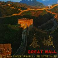
Great Wall
Beijing: Cultural Relics Publishing House 1996. Very good condition large format also contains a certificate of climbing The Great Wall. Clear bright and tight. First Edition. Paperback. Very Good/No Dust Jacket. Used. Cultural Relics Publishing House Paperback
Referentie van de boekhandelaar : 190652 ISBN : 780069111X 9787800691119
|
|
|
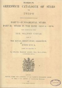
Greenwich Catalogue of Stars for 1910.0. Part I Fundamental Stars Part II Stars in the Zone 24 to 32
HMSO 1920. Hardcover. Good/No Jacket as published. 10" x 12. Tables for observations with the transit circle made at the Royal Observatory Greenwich 1906 - 1914. Astronomy. All orders processed and shipped promptly from the UK. Please email with your questions. Some evidence of life in a university library but still clean and sound. This is a 1920 edition and not a modern reproduction. <br/> <br/> HMSO hardcover
Referentie van de boekhandelaar : 006761
|
|
|
Grenoble, Capitale Des Alpes Francaises et Ses Environs
No date of publication, illustrated, map. eng
|
|
|
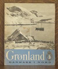
GRONLAND
Berlingske Forlag 1947. Paperback. Good . Unpaginated. 10 1/2 x 12 3/4 in. Paperbound guide to Greenland. B&W illustrations. Condition is GOOD ; corners worn covers slightly faded brown spot on front text very clean owner's stamp on ffep overall quite good. Berlingske Forlag paperback
Referentie van de boekhandelaar : 4107
|
|
|
GRÈCE - S.L. S.A. - Ilustrado - Livre en français
S.L, S.E, S.A. Numerosas ilustraciones en color. S.N. 8º. Rústica editorial ilustrada. Algunas páginas recortadas. Buen ejemplar. Livre en français.
|
|
|
Guam Today!
Guam Chamber of Commerce 1957. Book. VG. Soft cover. 8vo - over 7¾" - 9¾" tall. Stiff b&w pictorial wraps stapled binding. Modest wear with light foxing to portions of front cover slight rubbing to corners. Clean interior firm binding. Former owner's signature on contents page with interior mildly toned typical of issue. Unpaginated 100 pp. well-illus. many local ads. Dated Dec. 1957. Guam Chamber of Commerce Paperback
Referentie van de boekhandelaar : 041298
|
|
|
GUIA COCA-COLA DE CASAS RURALES DE ESPAÑA, 2001.
|
|
|
GUIA DE GUIPUZCOA, EDITADA POR LA EXCMA. DIPUTACIÓN DE GUIPZCOA.
Dibujos, fotografías, mapas, planos y croquis en sepia sobre papel cuché.
|
|
|
GUIA OFICIAL DE CAMPINGS DE ESPAÑA 2010 + CD ROM + MAPA /CAMPING GUIDE SPAIN 2010 + CD ROM + MAP /GUIDE DES CAMPINGS ESPAGNE 2010+ CD ROM + CARTE /CAMPINGFÜHRER SPANIEN 2010 + CD ROM + LANDKARTE.
Mapa a color .
|
|
|
GUIA TELSTAR DE CATALUNYA - Barcelona 1970 - Molt il·lustrat
Barcelona, Edit. Telstar, 1970. Nombroses il·lustracions en color. 515p. 4º. Guaflex editorial ilustrada. Buen ejemplar.
|
|
|
GUIDA D'ITALIA DEL TOURING CLUB ITALIANO: SICILIA.
Very faint shelfwear. Pages tanned. Includes plastic cover (which has some tears). ; Guida D'Italia Del T. C. I. 22; 791 pages
|
|
|
GUIDA RAPIDA D'ITALIA. 5 volumi - Milano 1986 - Libro en italiano
Milano. Edit. Touring Club Italiano, 1986. Guida rapida d'Italia - 5 Volumi 1- Liguria Piemonte Valle d'Aosta Lombardia 2- Veneto Trentino-Alto Adige Friuli-Venezia Giulia Emilia-Romagna 3- Toscana Umbria Marche 4- Lazio Abruzzo Molise Sardegna 5- Campania Puglia Basilicata Calabria SiciliaUnas 200 p. por tomo. Tela editorial ilustrada con estuche de piel ilustrado algo deslucido. Buen ejemplar.
|
|
|
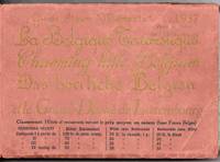
Guide Album Memento 1937 La Belgique Touristique Charming Little Belgium Das berrliche Belgien et le Grand-Duche de Luxembourg
Bruxelles: Inter-Agemce Des Bureaux de Voyages 1937. Soft cover. Good/No Jacket as published. 7.5" x 5. A guide to hotels tourist attractions routes etc in Belgium and Luxembourg. main language is French but with some English and German. Some reading wear and tears to the fold out maps. All orders processed promptly and shipped from the UK. <br/> <br/> Inter-Agemce Des Bureaux de Voyages paperback
Referentie van de boekhandelaar : 026600
|
|
|
Guide Bleu France
Paris: Nagel 1949. cloth. Black cloth silver lettering on front cover and spine corners bumped fold out maps very good. 8 vo 808 pp. Many ads. Travel guide. Sticker "Published in the U.S.A. by Crown Publishers N.Y. printed in France" on title page. Book condition VG-. Nagel hardcover
Referentie van de boekhandelaar : LI7831
|
|
|
Guide bleu. Israël
vol. 165x110, parfait état, 522pp, bien complet de ses cartes dépliantes couleurs et de sa grande carte d’Israël Hachette 1966 ref/253
Referentie van de boekhandelaar : CZC-10343

|
|
|
Guide bleu. Israël
vol. 165x110, parfait état, 522pp, bien complet de ses cartes dépliantes couleurs et de sa grande carte d’Israël Hachette 1966 ref/253
Referentie van de boekhandelaar : CZC-10343
|
|
 De zoekresultaten per email ontvangen
 Zoekresultaten downloaden als PDF
 RSS feed


