|
|
|
DUVAL Pierre (1618 - 1683)
La Hongrie…
Acquaforte, 1656 circa, con coloritura coeva dei contorni, in buone condizioni.Esemplare del secondo stato di due, con l’imprint di Jacques Lagniet e la data del 1661.La mappa proviene dal rarissimo foglio intitolato “L’Europe par P. Du Val Geographe du Roy”, dal quale è stato ritagliato all’epoca - come anche certificato dalle antiche iscrizioni a inchiostro su alcune delle mappe - venendo applicato su un supporto di carta contemporanea, a formare un piccolo atlante in-sedicesimo oblungo.Non abbiamo trovato bibliografia su questo foglio d’Europa, pertanto ci riferiamo alla scarsa letteratura sui fogli che rappresentano gli altri continenti.Secondo Philip Burden (che descrive la carta dell’America), lo scopo di questa rara curiosità cartografica di Pierre Duval non è noto. Fa parte di un insieme di quattro tavole raffiguranti i continenti. Può essere datato, per motivi cartografici, all’incirca nel 1656. Burden descrive un solo esemplare di primo stato e due prove con l’indirizzo di Lagniet.La mappa dell'Asia è stata recentemente descritta da Jason Hubbard, che elenca un solo esemplare di primo stato e 5 di secondo (cfr. Japoniae Insulae, The Mapping of Japan, p. 201).Richard Betz descrive 3 stati del foglio dell’Africa: senza la data, con l’imprint di Jacques Lagniet e la data del 1661, e con tracce di cancellazione sui suoi indirizzi (cfr Betz, The Mapping of Africa, pp. 294, 295). Elenca un solo esemplare di primo stato, tre copie di quello stampato da Lagniet e tre del foglio con l’indirizzo abraso. Di un secondo stato del foglio del continente europeo, siamo stati di censire solo l’esemplare conservato presso la Bibliotheque National de France, unica istituzione che vanta nella propria raccolta tutti e quattro i fogli dei continenti di Pierre Duval e Jacques Lagniet. Etching, circa 1656, with contemporary outline colour, good condition.Example of the second state, with the imprint of Jacques Lagniet and the date 1661.The map comes from the very rare sheet entitled “L’Europe Par le Sieur Du Val Geographe Ord. du Roy”, from which it was cut at the time and laid down on contemporary laid paper support, to form a small atlas, as certified by the ancient ink inscriptions on some of the maps.We have not found bibliography on this sheet of Europe, we therefore refer to the scarce literature on the sheets representing the other continents.According with Philip Burden “The purpose of this rare curiosity by Pierre Duval is not known. It forms part of a set of the four known continents. It can be dated to apporximately 1656 […] The second state bears the additional imprint of Jacques Lagniet and the date 1661” (cf. Burden, The Mapping of North America, pp. 417-418, n. 322). The map of Asia is recently described by Jason Hubbard: “This miniature map of Japan is on a sheet of maps of Asia. Besides the map of the Asian continent there are 17 detailed maps including Turkey, the Holy Land, Georgia and Arabia. […] This map was issued as a loose sheet of Asia maps; similar maps are known for Africa, America and Europe” (cf. Japoniae Insulae, The Mapping of Japan, p. 201).Richard Betz describes 3 states of the broadsheet of Africa: without the date, with the imprint of Jacques Lagniet and the date 1661, and with traces of erasure on his addres (cf. Betz, The Mapping of Africa, pp. 294, 295). According Hubbard the third state of the map of Asia is only an assumption.Of a second state of the broadsheet of Europe, we are able to find only the example at the Bibliotheque National de France. cf. J. Hubbard, Japoniae Insulae. The Mapping of Japan, pp. 199-201, n. 28; cf. Burden, The Mapping of America, n. 322, II/II; cf. Pastoureau (1984) p. 136; cf. Betz, The Mapping of Africa, pp. 294, 295, n. 85.

|
|
|
DUVAL Pierre (1618 - 1683)
La Lorraine… / La Curlande…
Acquaforte, 1656 circa, con coloritura coeva dei contorni, in buone condizioni.Esemplare del secondo stato di due, con l’imprint di Jacques Lagniet e la data del 1661.La mappa proviene dal rarissimo foglio intitolato “L’Europe par P. Du Val Geographe du Roy”, dal quale è stato ritagliato all’epoca - come anche certificato dalle antiche iscrizioni a inchiostro su alcune delle mappe - venendo applicato su un supporto di carta contemporanea, a formare un piccolo atlante in-sedicesimo oblungo.Non abbiamo trovato bibliografia su questo foglio d’Europa, pertanto ci riferiamo alla scarsa letteratura sui fogli che rappresentano gli altri continenti.Secondo Philip Burden (che descrive la carta dell’America), lo scopo di questa rara curiosità cartografica di Pierre Duval non è noto. Fa parte di un insieme di quattro tavole raffiguranti i continenti. Può essere datato, per motivi cartografici, all’incirca nel 1656. Burden descrive un solo esemplare di primo stato e due prove con l’indirizzo di Lagniet.La mappa dell'Asia è stata recentemente descritta da Jason Hubbard, che elenca un solo esemplare di primo stato e 5 di secondo (cfr. Japoniae Insulae, The Mapping of Japan, p. 201).Richard Betz descrive 3 stati del foglio dell’Africa: senza la data, con l’imprint di Jacques Lagniet e la data del 1661, e con tracce di cancellazione sui suoi indirizzi (cfr Betz, The Mapping of Africa, pp. 294, 295). Elenca un solo esemplare di primo stato, tre copie di quello stampato da Lagniet e tre del foglio con l’indirizzo abraso. Di un secondo stato del foglio del continente europeo, siamo stati di censire solo l’esemplare conservato presso la Bibliotheque National de France, unica istituzione che vanta nella propria raccolta tutti e quattro i fogli dei continenti di Pierre Duval e Jacques Lagniet. Etching, circa 1656, with contemporary outline colour, good condition.Example of the second state, with the imprint of Jacques Lagniet and the date 1661.The map comes from the very rare sheet entitled “L’Europe Par le Sieur Du Val Geographe Ord. du Roy”, from which it was cut at the time and laid down on contemporary laid paper support, to form a small atlas, as certified by the ancient ink inscriptions on some of the maps.We have not found bibliography on this sheet of Europe, we therefore refer to the scarce literature on the sheets representing the other continents.According with Philip Burden “The purpose of this rare curiosity by Pierre Duval is not known. It forms part of a set of the four known continents. It can be dated to apporximately 1656 […] The second state bears the additional imprint of Jacques Lagniet and the date 1661” (cf. Burden, The Mapping of North America, pp. 417-418, n. 322). The map of Asia is recently described by Jason Hubbard: “This miniature map of Japan is on a sheet of maps of Asia. Besides the map of the Asian continent there are 17 detailed maps including Turkey, the Holy Land, Georgia and Arabia. […] This map was issued as a loose sheet of Asia maps; similar maps are known for Africa, America and Europe” (cf. Japoniae Insulae, The Mapping of Japan, p. 201).Richard Betz describes 3 states of the broadsheet of Africa: without the date, with the imprint of Jacques Lagniet and the date 1661, and with traces of erasure on his addres (cf. Betz, The Mapping of Africa, pp. 294, 295). According Hubbard the third state of the map of Asia is only an assumption.Of a second state of the broadsheet of Europe, we are able to find only the example at the Bibliotheque National de France. cf. J. Hubbard, Japoniae Insulae. The Mapping of Japan, pp. 199-201, n. 28; cf. Burden, The Mapping of America, n. 322, II/II; cf. Pastoureau (1984) p. 136; cf. Betz, The Mapping of Africa, pp. 294, 295, n. 85.

|
|
|
DUVAL Pierre (1618 - 1683)
La Moscovie…
Acquaforte, 1656 circa, con coloritura coeva dei contorni, in buone condizioni.Esemplare del secondo stato di due, con l’imprint di Jacques Lagniet e la data del 1661.La mappa proviene dal rarissimo foglio intitolato “L’Europe par P. Du Val Geographe du Roy”, dal quale è stato ritagliato all’epoca - come anche certificato dalle antiche iscrizioni a inchiostro su alcune delle mappe - venendo applicato su un supporto di carta contemporanea, a formare un piccolo atlante in-sedicesimo oblungo.Non abbiamo trovato bibliografia su questo foglio d’Europa, pertanto ci riferiamo alla scarsa letteratura sui fogli che rappresentano gli altri continenti.Secondo Philip Burden (che descrive la carta dell’America), lo scopo di questa rara curiosità cartografica di Pierre Duval non è noto. Fa parte di un insieme di quattro tavole raffiguranti i continenti. Può essere datato, per motivi cartografici, all’incirca nel 1656. Burden descrive un solo esemplare di primo stato e due prove con l’indirizzo di Lagniet.La mappa dell'Asia è stata recentemente descritta da Jason Hubbard, che elenca un solo esemplare di primo stato e 5 di secondo (cfr. Japoniae Insulae, The Mapping of Japan, p. 201).Richard Betz descrive 3 stati del foglio dell’Africa: senza la data, con l’imprint di Jacques Lagniet e la data del 1661, e con tracce di cancellazione sui suoi indirizzi (cfr Betz, The Mapping of Africa, pp. 294, 295). Elenca un solo esemplare di primo stato, tre copie di quello stampato da Lagniet e tre del foglio con l’indirizzo abraso. Di un secondo stato del foglio del continente europeo, siamo stati di censire solo l’esemplare conservato presso la Bibliotheque National de France, unica istituzione che vanta nella propria raccolta tutti e quattro i fogli dei continenti di Pierre Duval e Jacques Lagniet. Etching, circa 1656, with contemporary outline colour, good condition.Example of the second state, with the imprint of Jacques Lagniet and the date 1661.The map comes from the very rare sheet entitled “L’Europe Par le Sieur Du Val Geographe Ord. du Roy”, from which it was cut at the time and laid down on contemporary laid paper support, to form a small atlas, as certified by the ancient ink inscriptions on some of the maps.We have not found bibliography on this sheet of Europe, we therefore refer to the scarce literature on the sheets representing the other continents.According with Philip Burden “The purpose of this rare curiosity by Pierre Duval is not known. It forms part of a set of the four known continents. It can be dated to apporximately 1656 […] The second state bears the additional imprint of Jacques Lagniet and the date 1661” (cf. Burden, The Mapping of North America, pp. 417-418, n. 322). The map of Asia is recently described by Jason Hubbard: “This miniature map of Japan is on a sheet of maps of Asia. Besides the map of the Asian continent there are 17 detailed maps including Turkey, the Holy Land, Georgia and Arabia. […] This map was issued as a loose sheet of Asia maps; similar maps are known for Africa, America and Europe” (cf. Japoniae Insulae, The Mapping of Japan, p. 201).Richard Betz describes 3 states of the broadsheet of Africa: without the date, with the imprint of Jacques Lagniet and the date 1661, and with traces of erasure on his addres (cf. Betz, The Mapping of Africa, pp. 294, 295). According Hubbard the third state of the map of Asia is only an assumption.Of a second state of the broadsheet of Europe, we are able to find only the example at the Bibliotheque National de France. cf. J. Hubbard, Japoniae Insulae. The Mapping of Japan, pp. 199-201, n. 28; cf. Burden, The Mapping of America, n. 322, II/II; cf. Pastoureau (1984) p. 136; cf. Betz, The Mapping of Africa, pp. 294, 295, n. 85.

|
|
|
DUVAL Pierre (1618 - 1683)
La Pologne…
Acquaforte, 1656 circa, con coloritura coeva dei contorni, in buone condizioni.Esemplare del secondo stato di due, con l’imprint di Jacques Lagniet e la data del 1661.La mappa proviene dal rarissimo foglio intitolato “L’Europe par P. Du Val Geographe du Roy”, dal quale è stato ritagliato all’epoca - come anche certificato dalle antiche iscrizioni a inchiostro su alcune delle mappe - venendo applicato su un supporto di carta contemporanea, a formare un piccolo atlante in-sedicesimo oblungo.Non abbiamo trovato bibliografia su questo foglio d’Europa, pertanto ci riferiamo alla scarsa letteratura sui fogli che rappresentano gli altri continenti.Secondo Philip Burden (che descrive la carta dell’America), lo scopo di questa rara curiosità cartografica di Pierre Duval non è noto. Fa parte di un insieme di quattro tavole raffiguranti i continenti. Può essere datato, per motivi cartografici, all’incirca nel 1656. Burden descrive un solo esemplare di primo stato e due prove con l’indirizzo di Lagniet.La mappa dell'Asia è stata recentemente descritta da Jason Hubbard, che elenca un solo esemplare di primo stato e 5 di secondo (cfr. Japoniae Insulae, The Mapping of Japan, p. 201).Richard Betz descrive 3 stati del foglio dell’Africa: senza la data, con l’imprint di Jacques Lagniet e la data del 1661, e con tracce di cancellazione sui suoi indirizzi (cfr Betz, The Mapping of Africa, pp. 294, 295). Elenca un solo esemplare di primo stato, tre copie di quello stampato da Lagniet e tre del foglio con l’indirizzo abraso. Di un secondo stato del foglio del continente europeo, siamo stati di censire solo l’esemplare conservato presso la Bibliotheque National de France, unica istituzione che vanta nella propria raccolta tutti e quattro i fogli dei continenti di Pierre Duval e Jacques Lagniet. Etching, circa 1656, with contemporary outline colour, good condition.Example of the second state, with the imprint of Jacques Lagniet and the date 1661.The map comes from the very rare sheet entitled “L’Europe Par le Sieur Du Val Geographe Ord. du Roy”, from which it was cut at the time and laid down on contemporary laid paper support, to form a small atlas, as certified by the ancient ink inscriptions on some of the maps.We have not found bibliography on this sheet of Europe, we therefore refer to the scarce literature on the sheets representing the other continents.According with Philip Burden “The purpose of this rare curiosity by Pierre Duval is not known. It forms part of a set of the four known continents. It can be dated to apporximately 1656 […] The second state bears the additional imprint of Jacques Lagniet and the date 1661” (cf. Burden, The Mapping of North America, pp. 417-418, n. 322). The map of Asia is recently described by Jason Hubbard: “This miniature map of Japan is on a sheet of maps of Asia. Besides the map of the Asian continent there are 17 detailed maps including Turkey, the Holy Land, Georgia and Arabia. […] This map was issued as a loose sheet of Asia maps; similar maps are known for Africa, America and Europe” (cf. Japoniae Insulae, The Mapping of Japan, p. 201).Richard Betz describes 3 states of the broadsheet of Africa: without the date, with the imprint of Jacques Lagniet and the date 1661, and with traces of erasure on his addres (cf. Betz, The Mapping of Africa, pp. 294, 295). According Hubbard the third state of the map of Asia is only an assumption.Of a second state of the broadsheet of Europe, we are able to find only the example at the Bibliotheque National de France. cf. J. Hubbard, Japoniae Insulae. The Mapping of Japan, pp. 199-201, n. 28; cf. Burden, The Mapping of America, n. 322, II/II; cf. Pastoureau (1984) p. 136; cf. Betz, The Mapping of Africa, pp. 294, 295, n. 85.

|
|
|
DUVAL Pierre (1618 - 1683)
Les Isle Britaniques… / Le Portugal…
Acquaforte, 1656 circa, con coloritura coeva dei contorni, in buone condizioni.Esemplare del secondo stato di due, con l’imprint di Jacques Lagniet e la data del 1661.La mappa proviene dal rarissimo foglio intitolato “L’Europe par P. Du Val Geographe du Roy”, dal quale è stato ritagliato all’epoca - come anche certificato dalle antiche iscrizioni a inchiostro su alcune delle mappe - venendo applicato su un supporto di carta contemporanea, a formare un piccolo atlante in-sedicesimo oblungo.Non abbiamo trovato bibliografia su questo foglio d’Europa, pertanto ci riferiamo alla scarsa letteratura sui fogli che rappresentano gli altri continenti.Secondo Philip Burden (che descrive la carta dell’America), lo scopo di questa rara curiosità cartografica di Pierre Duval non è noto. Fa parte di un insieme di quattro tavole raffiguranti i continenti. Può essere datato, per motivi cartografici, all’incirca nel 1656. Burden descrive un solo esemplare di primo stato e due prove con l’indirizzo di Lagniet.La mappa dell'Asia è stata recentemente descritta da Jason Hubbard, che elenca un solo esemplare di primo stato e 5 di secondo (cfr. Japoniae Insulae, The Mapping of Japan, p. 201).Richard Betz descrive 3 stati del foglio dell’Africa: senza la data, con l’imprint di Jacques Lagniet e la data del 1661, e con tracce di cancellazione sui suoi indirizzi (cfr Betz, The Mapping of Africa, pp. 294, 295). Elenca un solo esemplare di primo stato, tre copie di quello stampato da Lagniet e tre del foglio con l’indirizzo abraso. Di un secondo stato del foglio del continente europeo, siamo stati di censire solo l’esemplare conservato presso la Bibliotheque National de France, unica istituzione che vanta nella propria raccolta tutti e quattro i fogli dei continenti di Pierre Duval e Jacques Lagniet. Etching, circa 1656, with contemporary outline colour, good condition.Example of the second state, with the imprint of Jacques Lagniet and the date 1661.The map comes from the very rare sheet entitled “L’Europe Par le Sieur Du Val Geographe Ord. du Roy”, from which it was cut at the time and laid down on contemporary laid paper support, to form a small atlas, as certified by the ancient ink inscriptions on some of the maps.We have not found bibliography on this sheet of Europe, we therefore refer to the scarce literature on the sheets representing the other continents.According with Philip Burden “The purpose of this rare curiosity by Pierre Duval is not known. It forms part of a set of the four known continents. It can be dated to apporximately 1656 […] The second state bears the additional imprint of Jacques Lagniet and the date 1661” (cf. Burden, The Mapping of North America, pp. 417-418, n. 322). The map of Asia is recently described by Jason Hubbard: “This miniature map of Japan is on a sheet of maps of Asia. Besides the map of the Asian continent there are 17 detailed maps including Turkey, the Holy Land, Georgia and Arabia. […] This map was issued as a loose sheet of Asia maps; similar maps are known for Africa, America and Europe” (cf. Japoniae Insulae, The Mapping of Japan, p. 201).Richard Betz describes 3 states of the broadsheet of Africa: without the date, with the imprint of Jacques Lagniet and the date 1661, and with traces of erasure on his addres (cf. Betz, The Mapping of Africa, pp. 294, 295). According Hubbard the third state of the map of Asia is only an assumption.Of a second state of the broadsheet of Europe, we are able to find only the example at the Bibliotheque National de France. cf. J. Hubbard, Japoniae Insulae. The Mapping of Japan, pp. 199-201, n. 28; cf. Burden, The Mapping of America, n. 322, II/II; cf. Pastoureau (1984) p. 136; cf. Betz, The Mapping of Africa, pp. 294, 295, n. 85.

|
|
|
DUVAL Pierre (1618 - 1683)
Transilvanie, Valachie, Moldavie…
Acquaforte, 1656 circa, con coloritura coeva dei contorni, in buone condizioni.Esemplare del secondo stato di due, con l’imprint di Jacques Lagniet e la data del 1661.La mappa proviene dal rarissimo foglio intitolato “L’Europe par P. Du Val Geographe du Roy”, dal quale è stato ritagliato all’epoca - come anche certificato dalle antiche iscrizioni a inchiostro su alcune delle mappe - venendo applicato su un supporto di carta contemporanea, a formare un piccolo atlante in-sedicesimo oblungo.Non abbiamo trovato bibliografia su questo foglio d’Europa, pertanto ci riferiamo alla scarsa letteratura sui fogli che rappresentano gli altri continenti.Secondo Philip Burden (che descrive la carta dell’America), lo scopo di questa rara curiosità cartografica di Pierre Duval non è noto. Fa parte di un insieme di quattro tavole raffiguranti i continenti. Può essere datato, per motivi cartografici, all’incirca nel 1656. Burden descrive un solo esemplare di primo stato e due prove con l’indirizzo di Lagniet.La mappa dell'Asia è stata recentemente descritta da Jason Hubbard, che elenca un solo esemplare di primo stato e 5 di secondo (cfr. Japoniae Insulae, The Mapping of Japan, p. 201).Richard Betz descrive 3 stati del foglio dell’Africa: senza la data, con l’imprint di Jacques Lagniet e la data del 1661, e con tracce di cancellazione sui suoi indirizzi (cfr Betz, The Mapping of Africa, pp. 294, 295). Elenca un solo esemplare di primo stato, tre copie di quello stampato da Lagniet e tre del foglio con l’indirizzo abraso. Di un secondo stato del foglio del continente europeo, siamo stati di censire solo l’esemplare conservato presso la Bibliotheque National de France, unica istituzione che vanta nella propria raccolta tutti e quattro i fogli dei continenti di Pierre Duval e Jacques Lagniet. Etching, circa 1656, with contemporary outline colour, good condition.Example of the second state, with the imprint of Jacques Lagniet and the date 1661.The map comes from the very rare sheet entitled “L’Europe Par le Sieur Du Val Geographe Ord. du Roy”, from which it was cut at the time and laid down on contemporary laid paper support, to form a small atlas, as certified by the ancient ink inscriptions on some of the maps.We have not found bibliography on this sheet of Europe, we therefore refer to the scarce literature on the sheets representing the other continents.According with Philip Burden “The purpose of this rare curiosity by Pierre Duval is not known. It forms part of a set of the four known continents. It can be dated to apporximately 1656 […] The second state bears the additional imprint of Jacques Lagniet and the date 1661” (cf. Burden, The Mapping of North America, pp. 417-418, n. 322). The map of Asia is recently described by Jason Hubbard: “This miniature map of Japan is on a sheet of maps of Asia. Besides the map of the Asian continent there are 17 detailed maps including Turkey, the Holy Land, Georgia and Arabia. […] This map was issued as a loose sheet of Asia maps; similar maps are known for Africa, America and Europe” (cf. Japoniae Insulae, The Mapping of Japan, p. 201).Richard Betz describes 3 states of the broadsheet of Africa: without the date, with the imprint of Jacques Lagniet and the date 1661, and with traces of erasure on his addres (cf. Betz, The Mapping of Africa, pp. 294, 295). According Hubbard the third state of the map of Asia is only an assumption.Of a second state of the broadsheet of Europe, we are able to find only the example at the Bibliotheque National de France. cf. J. Hubbard, Japoniae Insulae. The Mapping of Japan, pp. 199-201, n. 28; cf. Burden, The Mapping of America, n. 322, II/II; cf. Pastoureau (1984) p. 136; cf. Betz, The Mapping of Africa, pp. 294, 295, n. 85.

|
|
|
DUVERGER Maurice
L'EUROPA DEGLI UOMINI. Una metamorfosi imperfetta.
In-8 (cm. 22.30), cartonato editoriale, sovracoperta editoriale illustrata, pp. 207, (7). Traduzione di Elena Rusconi e Monica Zardoni. Prima edizione. Tracce di polvere alla sovracoperta; peraltro, volume in ottimo stato (nice copy).
|
|
|
Duverger, Maurice
L'europa Degli Uomini
Mm 140x225 Volume in copertina rigida con sovraccoperta illustrata a colori, 211 pagine. Ottimo stato. Spedizione entro 24 ore dalla conferma dell'ordine.
|
|
|
DUVERNEY Jacques GIRARDERT Karl
Un tour en Suisse. Histoire, science, monuments, paysages
- Alfred Mame & fils, Tours 1877, 11,5x18,5cm, 2 volumes reliés en 1. - Troisième édition. Reliure en demi chagrin rouge, dos à quatre fins nerfs orné de sextuples caissons dorés et à froid, légères éraflures sur les mors, encadrement d'un jeu de filets à froid sur les plats de cartonnage rouge, gardes et contreplats de soie moirée blanche, toutes tranches dorées, reliure de l'époque. Ouvrage orné d'illustrations de Karl Girardet. Quelques petites rousseurs sans gravité affectant essentiellement les tous premiers et tous derniers feuillets. [ENGLISH DESCRIPTION ON DEMAND]

|
|
|
Duxbury-Neumann, Susan
What Have the Germans Ever Done For Us?: A History of the German Population of Great Britain
Paperback, like new condition. Unread shop stock. LS. Used
|
|
|
Dvorak, Frantisek [ed]
Videt Prague
Prague: Jaroslav Spousta 1948 Book. Illus. by Photographs by Josef Hanka. Near Fine. Original Wraps. First Edition. Domov a svet ve fotografi sv.1 This book is a celebration of the Ciity of Prague combining an anthology of poems by Jaroslav Seifert Julius Zeyer Svatopluk Cech Karel Toman Josef Hora Jaroslav Vrchlický Vítezslav Nezval Antonín Sova Jan Neruda Frantisek Dvorák and illustrated with vintage photographs by Josef Hanka. 95p. index.Text neat and complete but paper covers slightly scuffed. else near fine. NOTE : Large format 30x21x1cm Only 10 copies of original edition in Worldcat. Jaroslav Spousta paperback
Riferimento per il libraio : 047462
|
|
|
Dwork, Debórah
Kinder mit dem gelben Stern, Europa 1933 - 1945. Aus dem Engl. von Gabriele Krüger-Wirrer.
München : Beck, 1994. 384 S. : Ill., Kt. ; 23 cm. Originalleinen mit illustr. Schutzumschlag.
Riferimento per il libraio : 1158481

|
|
|
Dwork, Debórah
Kinder mit dem gelben Stern, Europa 1933 - 1945. Aus dem Engl. von Gabriele Krüger-Wirrer / Teil von: Anne-Frank-Shoah-Bibliothek
München : Beck Verlag 1994. 384 S. : 39 Abb., 1 Kte ; 23 cm, mit Schutzumschlag Top Zustand, Gewebe, gebundene Ausgabe, Leinen, Exemplar in sehr gutem Erhaltungszustand
Riferimento per il libraio : 51120

|
|
|
Dwyer (Philip)
Napoleon Passion, Death and Resurrection, 1815 -1840.
Bloomsbury Publishing, 2018 23,6 x 15,3 x 2,8 cm., 390 pp, Broché Annotations crayon.
Riferimento per il libraio : 241536

|
|
|
Dwyer (Philip)
Napoleon The Path to Power, 1769-1799.
Bloomsbury, 2007 24,13 x 16,51 x 6,35 cm., 651 pp, Couverture rigide Annotations crayon.
Riferimento per il libraio : 241540

|
|
|
Dyczek, Piotr
Rhizon. antyczna perla Czarnogóry anticki biser Crne Gore ancient pearl of Montenegro. [Von Piotr Dyczek].
Warsawa, Risan (Warschau): Center for Research on the Antiquity of Southeastern Europe 2014. 143, (1) Seiten. Mit zahlreichen farbigen Abbildungen. 4° (27 x 23 cm). Farbig illustrierter Orig.-Pappband. [Hardcover / fest gebunden].
Riferimento per il libraio : 2122975

|
|
|
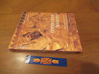
Dyfri Willams
Grecheskoe Zoloto. Yuvelirnoe Iskusstvo Klassicheskoy Epohi V-Iv Vv. Do N.E./ Greek Gold.
St. Petrsburg: Slaviya / British Museum Press 1995. 1st Edition 1st Printing. Soft cover. Fine. 271 Pp. Very Large Format Soft Cover Finely Printed Color Illustrations And Russian Text Throughout. Fine. With The Special Bookmark For This Book. <br/> <br/> Slaviya / British Museum Press paperback
Riferimento per il libraio : 050606 ISBN : 5886540032 9785886540031
|
|
|
Dykyjová, Dagmar and J. Kvet (Eds.)
Pond littoral ecosystems. Structure and functioning: Methods and results of quantitative ecosystem research in the Czechoslovakian IBP Wetland Project. (= Ecological Studies - Volume 28).
Springer, Berlin 1978. XIV, 464 S. mit 183 Abbildungen, Groß 8°, Original-Pappband (Hardcover), sehr gutes und innen sauberes Exemplar, (very good copy),
Riferimento per il libraio : 32502

|
|
|
Dylik, J
Województwo ze stolica bez antenatów. Geografia historyczna województwa lódzkiego.
Lódz, 1971. M. 8 Ktn.-Beil., 1 Kte., 1 Tab. u. 81 Abb. teils auf Taf. 187 S. (Szlakami nauki 15).
Riferimento per il libraio : 238011
|
|
|
DYMCHITZ Valery (choix de textes de)
Contes populaires juifs d'Europe orientale: Contes merveilleux, légendes et traditions, contes de moeurs, histoires et anecdotes,
Traduit du russe par Sophie Benech, glossaire établi par Myrial Anissimov, José Corti, Merveilleux n° 25, 2004, 570 pp., broché, bon état.
Riferimento per il libraio : 26970

|
|
|
Dyroff, Hans-Dieter (Hrsg.)
Protection and Cultural Animation of Monuments, Sites and Historic Towns in Europe The present situation in Belgium, Bulgaria, Canada, the Federal Republic of Germany, France, Greece, Hungary, Italy, The Netherlands, Poland, the United Kingdom, and Yugoslavia
Bonn, German Commission for UNESCO, [1980]. 29,5 cm. 394 S. Mit zahlreichen Ill., Abb. und Karten. Illustrierter Originalkarton (Softcover). Kurzer Vermerk auf Titel, sonst gut erhaltenes Exemplar. Architecture and protection of monuments and sites of historical interest ; 12.
Riferimento per il libraio : 4489AB
|
|
|
Dyson, Stephen L
ROME; A Living Portrait of an Ancient City
Johns Hopkins University Press. 2010. Hardcover. Very Good in No Dust Jacket dust jacket. Minor shelfwear to book.; Stephen L. Dyson has spent a lifetime studying and teaching the history of ancient Rome. That unparalleled knowledge is reflected in his magisterial overview of the Eternal City. Rather than look only at the physical development of the city-its buildings monuments and urban spaces-Dyson also explores its social economic and cultural histories. This unique approach situates Rome against a background of comparative urban history and theory allowing Dyson to examine the dynamic society that once thrived there. In his personal effort to reconstruct the city Dyson populates its streets with the hurried politicians hawking vendors and animated students that once lived worked and studied there bringing the ancient city to life for a new generation of students and tourists. Dyson follows Rome as it developed between the third century BC and the fourth century AD dividing the great megalopolis into distinct neighborhoods and locales. He shows how these communities each with its own unique customs and colorful inhabitants eventually grew into the great imperial capital of the Italian Empire. Dyson integrates the full range of sources available-literary artistic epigraphic and archaeological-to create a comprehensive history of the monumental city. In doing so he offers a dramatic picture of a complex and changing urban center that despite its flaws flourished for centuries.; Ancient Society And History; 6 X 1.39 X 9 inches; 488 pages . 0801892538 . Johns Hopkins University Press hardcover
Riferimento per il libraio : 39747 ISBN : 0801892538 9780801892530

|
|
|
Dzierzykraj-Rogalski, T
Crania et alia ossa Polonica, cmentarzyska neolityczne w Stoku i Lesie Stockim.
Wroclaw, 1958. M. mehr. Abb. (teils auf Taf.) 70 S. (Materialy i prace antopol. 30).
Riferimento per il libraio : 237913
|
|
|
Dänemark
Dänemark 1936. (Handbuch / Nachschlagewerk).
Kopenhagen, Kgl. Dänisches Ministerium des Außeren und dem Staatlichen statistischen Departement, 1936.
Riferimento per il libraio : 172137

|
|
|
Dänemark - Hielscher, Kurt
Danmark. Landschaft, Baukunst, Volksleben. Mit einem Geleitwort von Karin Michaelis. 1. Auflage.
Berlin, Brockhaus Verlag, 1932.
Riferimento per il libraio : 91702

|
|
|
Däniken, Erich von
Im Namen von Zeus : Griechen - Rätsel - Argonauten.
München : Bertelsmann, 1999. 287 S. Ill., Kt. 8°. 1. Aufl. Bibl.- Einbd.
Riferimento per il libraio : 42252
|
|
|
Décsy, Gyula
Die linguistische Struktur Europas. Vergangenheit, Gegenwart, Zukunft.
Wiesbaden, Harrassowitz, 1973. Gr. 8°, 3 Blätter, 300 Seiten. Orig.Leinen mit OSU.
Riferimento per il libraio : 10687
|
|
|
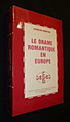
Dédéyan Charles
Le drame romantique en Europe
Sedes Dos carré collé 1982 In-12 broché dos carré collé, (12 * 18,5 cm), 408 pages ; bon état. Livraison a domicile (La Poste) ou en Mondial Relay sur simple demande.
Riferimento per il libraio : pf1405
|
|
|
Dédéyan Charles
Le Cosmopolitisme européen sous la Révolution et l'Empire (2 volumes)
Société d'Edition d'Enseignement Supérieur Broché 1976 Deux volumes in-12 (12 x 18,5 cm), brochés, pagination continue (652 pages) ; bords des plats un peu brunis, par ailleurs bon état. Livraison a domicile (La Poste) ou en Mondial Relay sur simple demande.
Riferimento per il libraio : gm4171

|
|
|
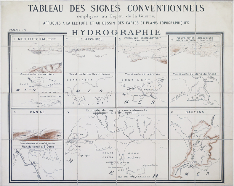
DÉPÔT de la GUERRE.
Tableau des signes conventionnels employés au Dépôt de la Guerre, appliqués à la lecture et au dessin des cartes et plans topographiques. Hydrographie.
Dépôt de la Guerre, [circa 1880]. En 24 sections montées sur toile et repliées, formant une carte de 0,94 x 1,13 m.
Riferimento per il libraio : LBW-8467
|
|
|
Dépôt des cartes et plans de la Marine
Carte particulière de la còte de Norwège, depuis Alvöe jusqu'à Egefield…
Carta nautica della costa norvegese sudoccidentale.Incisione su rame, in ottimo stato di conservazione. Nautical map coverig the Norway South-West coastline.Copperplate in very good condition.

|
|
|
Dépôt des cartes et plans de la Marine
Carte particulière de la còte de Norwège, depuis Egefield jusqu'à Christiansand
Carta nautica della costa norvegese compresa tra Staltland e Kristiansand.Incisione su rame, in ottimo stato di conservazione. Nautical map coverig the Norway coastline from Statland to Kristiansand.Copperplate in very good condition.

|
|
|
Dépôt des cartes et plans de la Marine
Carte particulière de la còte de Norwège, depuis Grib – Oerne et Christiansund à Statland
Carta nautica incentrata sull’area della costa settentrionale della Norvegia.Incisione su rame, in ottimo stato di conservazione. Nautical chart focused on the northern coastline of the Norway.Copperplate, in good condition.

|
|
|
Dépôt des cartes et plans de la Marine
Carte particulière de la còte de Norwège, depuis Statland jusqu'à Alvoe
Carta nautica della costa norvegese compresa tra Staltland e Alvoe.Incisione su rame, in ottimo stato di conservazione Nautical map coverig the Norway coastline from Statland to Alvoe.Copperplate in very good condition

|
|
|
Dépôt des cartes et plans de la Marine
Carte réduite de la Mer Baltique 1.ére feuille Contenant les entrées de cette Mer et les Côtes des îles Danoises, les C
Carta nautica incentrata sul versante più meridionale del mar Baltico, che comprende l'arcipelago delle Faroe, la costa meridionale della Svezia, da Kullen a Kristianopel e le coste della Germania e Polonia, da Travemünde Kolonrzeg (in tedesco Kolberg).Incisione su rame, in ottimo stato di conservazione. Nautical map focusing on the southernmost part of the Baltic Sea, which includes the Faroe archipelago, the southern coast of Sweden, from Kullen to Kristianopel and the coasts of Germany, from Travemünde to Kolberg, issued by Depot de la Marine.Copperplate, in good condition.

|
|
|
Dépôt des cartes et plans de la Marine
Carte réduite de la Mer Baltique : Ve. Feuille Contenant le golfe de Bothnie…
Carta nautica incentrata sull'area del golfo di Botnia, la parte settentrionale del mar Baltico, che si estende tra la costa occidentale della Finlandia e quella orientale della Svezia.Incisione su rame, in ottimo stato di conservazione. Five sheet, of six, of a large Chart of the Baltic Sea, focused on Gulf of Bothnia, issued bu Depot de la Marine.Copperplate, in good condition.

|
|
|
Dépôt des cartes et plans de la Marine
Carte réduite de la Mer Baltique IIe. Feuille Contenant partie de l'île d'Oland et de la Côte Sud-Est de la Suède, les C
Carta nautica della parte del Mar Baltico che comprende la costa sud-orientale della Svezia con l'isola di Öland; la linea costiera continentale si estende dal Kolonrzeg (in tedesco Kolberg), in Polonia, (in tedesco Kolberg) fino a Liepāja (ted. Libau), in Lettonia.Foglio 2, di 6, della grande carta nautica dedicati del Mar Baltico.Incisione su rame, in ottimo stato di conservazione. Second sheet, of six, of a large Chart of the Baltic Sea, which includes the south-eastern coast of Sweden with the island of Öland; the continental coastline extends from the Kolonrzeg (in German Kolberg), in Poland, (in German Kolberg) to Liepāja (ted. Libau) in Latvia.Copperplate, in good condition.

|
|
|
Dépôt des cartes et plans de la Marine
Carte réduite de la Mer Baltique IIIe. Feuille Contenant partie de la Côtes de Suède, de l'île d'Oland à Stockholm, les
Carta nautica della parte del Mar Baltico (foglio 3, di sei dedicati alla rappresentazione del Mar Baltico) che comprende parte della costa della Svezia, con le isole di Gotland, Saaremaa (Osel), Hiiumaa (Dago) e le coste del golfo di Riga. Incisione su rame, in ottimo stato di conservazione. Third sheet, of six, of a large Chart of the Baltic Sea, with the Swedish coast, Gotland, and the coasts of Latvia and Estonia (included Saaremaa and Hiiumaa island). Copperplate, in good condition.

|
|
|
Dépôt des cartes et plans de la Marine
Carte réduite de la Mer du Nord comprenant les côtes orientales des Îles britanniques et les Cotes opposées du Continent
Grande mappa nautica, su due fogli, che raffigura il mare del Nord, compreso tra la Gran Bretagna a Ovest, le coste della Francia settentrionale, delle Fiandre, dei Paesi Bassi e della Frisia a S, le coste occidentali dello Jylland (Danimarca) e della Scandinavia (Norvegia) a Est. Si apre ampiamente a Nord verso l’Oceano Atlantico, con cui comunica tra le coste della Scozia e le isole Orcadi (Stretto di Pentland) e tra le isole Orcadi e le isole Shetland e tra queste ultime e la costa norvegese.Incisione su rame, in ottimo stato di conservazioneDue fogli da 945x615 mm. Large map, on two sheets, of the North sea, the northeastern arm of the Atlantic Ocean, located between the British Isles and the mainland of northwestern Europe. The sea is bordered by the island of Great Britain to the southwest and west, the Orkney and Shetland islands to the northwest, Norway to the northeast, Denmark to the east, Germany and the Netherlands to the southeast, and Belgium and France to the south. It is connected to the Atlantic by the Strait of Dover and the English Channel and opens directly onto the ocean between the Orkney and Shetland islands and between the Shetland Islands and Norway. The Skagerrak, an eastward extension of the North Sea between Norway and Denmark, connects the North and Baltic seas via the Kattegat and the Danish straits.Copperplate, in very good conditionTwo sheets of 945x615 mm.

|
|
|
Dépôt des cartes et plans de la Marine
Carte réduite du Cattegat comprenat comprenant la côte de Suède depuis Marstrand jusqu' à Landscrone la côte du Jutland
Carta nautica dello stresso di Kattegat, il braccio di mare che congiunge il Mar Baltico con il Mare del Nord; è situato fra la penisola dello Jylland e la costa occidentale della Svezia meridionale. Incisione su rame, in ottimo stato di conservazione. Detailed map of the Kattegat sea, the strait forming part of the connection between the Baltic Sea and the North Sea. The strait trends north-south between the Jutland (Jylland) peninsula and Sjælland (Zealand) island of Denmark (west and south) and Sweden (east); it connects through the Skagerrak (north) with the North Sea and through The Sound and the Great Belt and Little Belt (south) with the Baltic Sea.Copperplate, in very good condition.

|
|
|
Dépôt des cartes et plans de la Marine
Carte réduite du Skagerat comprenant la côte de Norwège, de Lindersnæs à Færder, et la côte de Suède, de Frédérich
Carta nautica incentrata sullo Skagerrak, l’ampio braccio di mare che dal Mare del Nord si insinua tra la penisola scandinava a Nord (Norvegia) e quella dello Jütland a Sud fino al limite convenzionale che lo separa dall'altro braccio di mare più interno, il Kattegat.Incisione su rame, in ottimo stato di conservazione. Nautical chart of the Skagerrak, rectangular arm of the North Sea, trending southwest to northeast between Norway on the north and the Jutland peninsula of Denmark on the south. The Skagerrak narrows between Cape Skagen (the Skaw), Denmark, and the Swedish coast before turning south into the Kattegat toward the Danish sounds and the Baltic Sea.Copperplate in very good condition

|
|
|
Dépôt des cartes et plans de la Marine
Carte réduite du Sunt contenant les côtes de l'île Séelande, de Gilleley à Stevens Klint, et les côtes de la Skanie…
Dettagliata carta nautica incentrata sullo stretto di Oresund, il braccio più a oriente dei tre (gli altri due sono il Grande e il piccolo Belt) che pongono in comunicazione il Baltico con il Kattegat. Lo stretto s'interna tra la Penisola Scandinava (Svezia) e l'isola danese di Seeland; il punto più stretto si trova nella parte più settentrionale, mentre a sud si slarga in un'ampia baia che immette nel Baltico vero e proprio. In un riquadro, la pianta della rada di Copenaghen.Incisione su rame, in ottimo stato di conservazione Detailed nautical map focused on Oresund Strait, which separates Denmark from Sweden. Oresund is one of three waterways that connect the Atlantic Ocean and the Baltic Sea.The other two are Great and Little Belt. The principal ports are Copenhagen and Helsingør (Elsinore) on the Danish side and Malmö and Helsingborg on the Swedish side.Copperplate, in very good condition.

|
|
|
DÉRY (Charles).
Les Charbonnages hongrois. Description des entreprises représentées à l'Exposition universelle de 1900 à Paris. Édition de la Commission du groupe X1
Budapest, Imprimerie Werböczy, s.d. (1900) in-8, [3] ff. n. ch., 231 pp., broché. Première couverture un peu salie.
Riferimento per il libraio : 231620

|
|
|
Dérens Jean-Arnault, Geslin Laurent
Voyage au pays des Gorani : (Balkans, début du XXIe siècle)
Cartouche, coll. « Voyage au pays des... » 2010 In-8 20,1 cm sur 12,4. 146 pages. Très bon état d’occasion.
Riferimento per il libraio : 56632
|
|
|
DÉSORGUES (Théodore)
Recueil de 6 textes.
Paris, An V-An VIII in-8, Broché sous couverture d'attente factice de papier bleu postérieur.
Riferimento per il libraio : 170293
|
|
|
Désailloud Philippe.
LA GUERRE DES TUNNELS. Histoire du Tunnel Routier sous le Mont-Blanc. 1946-1965.
(Codice LO/0968) In 8° (23,5 cm) 137 pp. Avec 3 cartes et 7 planches hors texte. Couverture souple. Trés bon état. ~~~ SPEDIZIONE IN ITALIA SEMPRE TRACCIATA

|
|
|
DÉTIS Elisabeth ( Textes recueillis par ) / COLLECTIF
INTERFACES ARTISTIQUES ET LITTERAIRES DANS L'EUROPE DES LUMIÈRES. Le Spectateur européen - The European Spectator, volume 2
Montpellier Université Paul-Valéry Montpellier III 2000 in 8 (21x15) 1 volume broché, 277 pages [2]. Le spectateur européen, volume 2. Edition bilingue (anglais/ français). Bel exemplaire
Riferimento per il libraio : 056057
|
|
|
DÉTIS Elisabeth et KNOPPER Françoise ( Etudes, textes et gravures réunis par )
S'AMUSER EN EUROPE AU SIÈCLE DES LUMIÈRES. Etudes, textes et gravures réunis par Elisabeth Détis et Françoise Knopper
Toulouse Presses Universitaires du Mirail 2007 in 8 (22x13,5) 1 volume broché, couverture illustrée, 245 pages, avec de nobreuses illustrations. Collection interlangues - civilisations. Très bel exemplaire
Riferimento per il libraio : 055936
|
|
|
Döbler, Hannsferdinand
Die Germanen. Legende u. Wirklichkeit von A - Z; ein Lexikon z. europ. Frühgeschichte.
Gütersloh, Berlin, München, Wien, Bertelsmann-Lexikon-Verlag, 1975. 1. Aufl. ; 24 cm. 320 S., zahlr. Ill. (z. T. farb.), graph. Darst., Kt. Pp., OU. Rück. d. OU etwas verblichen, innen sauber u. gut erhalten. Besitzerverm. a. Tit.-Bl. 1
Riferimento per il libraio : 55278AB
|
|
|
Döbler, Hannsferdinand
Die Germanen. Legende u. Wirklichkeit von A - Z. Ein Lexikon z. europ. Frühgeschichte.
Gütersloh, Berlin, München, Wien, Bertelsmann-Lexikon-Verlag, 1975. 1. Aufl. 24 cm. 320 S. zahlr. Ill. (z. T. farb.), graph. Darst., Kt. OLwd., mit Schutzumschl. Su mit 2 randl. Einrissen, Seiten mit geringer randl. Bräunung. 1
Riferimento per il libraio : 29225BB
|
|
|

 Ricevere i risultati per e-mail
 Scaricare i risultati in PDF
 RSS feed
 Link
Link


