|
|
|
De Girardin Emile
Journal d'un Journaliste au secret – Francia
Ottima copia gr 200
|
|
|
DE GIRARDIN Emile
L'empereur Napoléon III et l'Europe
54pp., 23cm., br., qqs.rousseurs, cachet, br.orig.(dos restauré), G68773
|
|
|
DE GIRARDIN Emile
L'empereur Napoléon III et l'Europe
Bruxelles, Librairie de l'office de publicité 1859 54pp., 23cm., qqs. rousseurs, cachet, br.orig. (dos restauré), G68773
Referenz des Buchhändlers : G68773
|
|
|
De Goncourt, translated by Alys Hallard
Renee Mauperin The French Classical Romances
New York: P.F. Collier & Son 1902 Book. Very Good -. Hardcover. With a critical introduction by James Fitzmaurice-Kelly. Illustrated with a frontispiece and numerous other portraits with descriptive notes by Octave Uzanne. Has some foxing marks on back cover. P.F. Collier & Son hardcover
Referenz des Buchhändlers : 102320
|
|
|
de Gontaut, Duchesse; Mrs. J. W. Davis (transl.)
Memoirs of the Duchesse de Gontaut Gouvernante to the Children of France during the Restoration 1773-1836 Vol. I of 2
New York: Dodd Mead and Co. 1894. Book. VG-. Hardcover. 1st Edition. 8vo - over 7¾" - 9¾" tall. NOTE!: Volume I only of 2 bound in tan cloth lettered/decorated in orange and gilt deckled text block edges with top edge in gilt. x11-226 pp. illus. w/ guarded b&w plates. Minor binding lean spine panel toned to brown cover cloth partially foxed/soiled. Firm binding a few minor interior marks. Dodd, Mead and Co. Hardcover
Referenz des Buchhändlers : 068641
|
|
|
De Grada Raffaele - Le Cannu Marc - Henze Anton - Penny Nicholas B.
Giornale di viaggio in Italia. L'attività dei pittori europei in Italia nell'800: occasioni e memorie [Italiano/Français/Deutsch/English]
134 illustrazioni in nero e a colori

|
|
|
De Grada Raffaele - Scotti Aurora - Zannier Italo - Magni Marica
Pittura '800
illustrazioni a colori e in nero

|
|
|
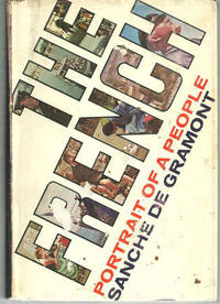
De Gramont, Sanche
FRENCH Portrait of a People
New York NY: G. P. Putnam's. 1969. Book Club Edition. Hardcover. Very Good in Very Good dust jacket; Edgewear. DJ is worn and torn at edges. DJ price clipped. Sticker tears on front of DJ; 479 pages . G. P. Putnam's hardcover
Referenz des Buchhändlers : 21581
|
|
|
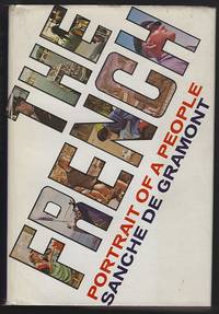
De Gramont, Sanche
FRENCH Portrait of a People
New York NY: G. P. Putnams. 1969. Book Club Edition. Hardcover. Very Good in Very Good dust jacket; DJ is worn at edges. ; 479 pages . G. P. Putnams hardcover
Referenz des Buchhändlers : 3939
|
|
|
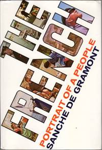
de Gramont Sanche
The French: Portrait of a People
NY: G>P Putnam's Sons 1969. Textblock very clean and tight; Binding lightly edge and corner rubbed; Dust jacket in mylar lightly edge and corner worn. 479p. including index. Book Club Edition. Cloth. Very Good/Very Good in mylar. 8vo - 7 3/4" - 9 3/4 " Tall. Hardcover. G>P Putnam's Sons Hardcover
Referenz des Buchhändlers : EW6986
|
|
|
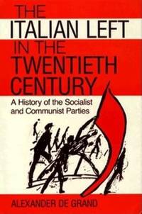
De Grand, Alexander J
The Italian Left in the Twentieth Century
Indiana University Press 1989. 182pp. Cover slightly warped o/w very good in slightly worn dj. Hardback. Indiana University Press hardcover
Referenz des Buchhändlers : 010132 ISBN : 0253331072 9780253331076
|
|
|
De Grauwe, P. and Peeters, T. (Eds.)
The ECU and European Monetary Integration
Palgrave Macmillan 1988. This is an ex-library book and may have the usual library/used-book markings inside.This book has hardback covers. In good all round condition. Please note the Image in this listing is a stock photo and may not match the covers of the actual item500grams ISBN:0333464427 Palgrave Macmillan hardcover
Referenz des Buchhändlers : 9552818 ISBN : 0333464427 9780333464427
|
|
|
De Grazia, Victoria
How Fascism Ruled Women : Italy 1922-1945
Berkeley CA: University of California Press. 1993. Large octavo size 16x24cm approx. Very Good condition.Illustrated with Black and White Photographs. Previous owner's details to preliminary pages. Robust professional packaging and tracking provided for all parcels. 350 pages. . 1st Paperback Edition. Softcover. University of California Press paperback
Referenz des Buchhändlers : BIB325084 ISBN : 0520074572 9780520074576
|
|
|
De Grazia, Victoria
How Fascism Ruled Women: Italy 1922-1945
USA: Univ of California Press 1992. Book. Good. Hardcover. First Edition. 8vo - over 7¾" - 9¾" tall. 350 pages. Index. Footnotes. Several black and white illustrations. "The first study of women's experience under Italian fascism this book offers a compelling treatment of the making of contemporary Italian society." - from dust jacket. Average wear. Binding intact. Usual library markings. Front free endpaper removed. A sound working copy. Univ of California Press Hardcover
Referenz des Buchhändlers : 113c6012 ISBN : 0520074564 9780520074569
|
|
|
DE GRECE, Michel.
Quand Napoléon faisait trembler l’Europe.
in-8, 402 pp., illustrations, carte, broché. Bel exemplaire. [CA33-5]
|
|
|
DE GROËR, Léon:
Decorative arts in Europe. 1790 - 1850.
New York, Rizzoli, 1986, in-4to, 357 p. with 620 illustrations including 60 in colour, original clothbound, original jacket. Fine copy.
Referenz des Buchhändlers : 87011aaf
|
|
|
De Grunwald, Constantin. (trans Atkinson, C. F.)
Baron Stein. Enemy of Napoleon
London: Jonathan Cape 1940. 321pp index bibliography bw plates folding map. Or red cloth. Spine and edges faded top corner bumped. Biography of Baron Stein of Prussia. Includes his service as a Knight of the Holy Roman Empire his service to Prussia his relationship with Napoleon the relationship between Germany and France during the French revolution and much more. Reprint. Hard Cover. Near Very Good/No Jacket. 8vo. Jonathan Cape Hardcover
Referenz des Buchhändlers : 009672
|
|
|
DE GUBERNATIS A.
STORIA COMPARATA DEGLI USI FUNEBRI IN ITALIA E PRESSO GLI ALTRI POPOLI INDO-EUROPEI. Terza edizione.
In-16, bross. muta mod., conserv. bross. orig., pp. 138. Testo in buono stato (text in good condition).
|
|
|
De Heidenstam, O.-G. (editor); Stephens, Winifred; Jackson, Mrs. Wilfred (translators)
The Letters of Marie Antoinette Fersen and Barnave
London: John Lane the Bodley Head. 1926. xiii 244pp index bw ills. Or blue cloth lacking jacket. Spine slightly faded. Some toning and foxing old price blacked out on front free endpaper. Letters of Marie Antoinette in translation from the French. First English Language Edition. Hard Cover. Good/No Jacket. 8vo. John Lane the Bodley Head. Hardcover
Referenz des Buchhändlers : 029786
|
|
|
de Hooghe Romeyn
Carte Nouvelle De La Mer Mediterranee
Carte Nouvelle De La Mer Mediterranee ou sont Exactement Remarques tous les Ports, Golfes, Rochers, Banks, de Sable &c: a l’usage des Arméès, du Roy de la Grande Bretagne. Dressé sur le Memoires les Plus Nouveaux par le Sr. Romain de Hooge.Acquaforte e bulino, dimensioni 585x1390 mm, firmata in lastra nel cartiglio in basso, dove figura l’imprint: A Amsterdam chez Pierre Mortier. Avec Privilége 1694.Esemplare nel raro primo stato di quattro, con la data 1694 e prima della correzione del titolo, dove si legge Mediteranee al luogo di Mediterranee. Magnifica coloritura coeva, in perfetto stato di conservazione.Opera tratta da: Cartes Marines a l'Usage des Armées du Roy de la Grande Bretagne: Faites sur les Memoires les plus nouveaux, des plus experts Ingenieurs et Pilotes, et enrichies des porfils des plus fameaux Ports de Mer et villes Maritimes de l'Europe. (…) Gravéès et recuillies par le Sr. Romain De Hooge Commissaire de Sa Majesté. A Amsterdam. Chez Pierre Mortier Libraire sur le Vygen Dam. M.DC. LXXXXIII. Avec Privilege de Nos Seigneurs les Etats de Hollande et West-Frise. Monumentale carta nautica del Mar Mediterraneo di Romeyn De Hooghe (1645 - 1708). L’opera è impreziosita da 38 mappe e vedute dei principali porti del Mediterraneo, ed è decorata da numerosi galeoni, galee, figure allegoriche e mostri marini. La carta è inserita in una sezione speciale del Neptune François di Pierre Mortier, intitolata Cartes Marines a l’Usage des Armées du Roy de la Grande Bretagne; le nove carte che compongono questa sezione, tutte incise dallo stesso de Hooghe, sono descritte da Koeman come “la più spettacolare cartografia nauica mai prodotta ad Amsterdam del XVII secolo”. La carta del Mediterraneo è la più grande, decorata e spettacolare della serie. Pierre Mortier fece stampare l’atlante in onore di Guglielmo III d’Orange (in olandese Willem Hendrik van Oranje-Nassau, anche noto come Guglielmo III d’Inghilterra), re olandese sul trono britannico. Le dimensioni dell’atlante, senza precedenti, e il ricorso ad artisti del calibro di de Hooghe hanno reso questa raccolta una delle più sontuose dell’epoca. Koeman lo definisce “l’atlante nautico più costoso del periodo”, inteso più come pubblicazione spettacolare che come un reale strumento ad uso dei navigatori. La carta è conosciuta in diverse edizioni o stati: la prima stesura reca nel titolo la parola Mediteranée con una sola “R”. Il termine viene corretto successivamente, mentre nella terza stesura la data è abrasa. L’ultima edizione della tavola ha l’imprint editorial corretto in: A Amsterdam chez J. Covens & C. Mortier. Le edizioni successive alle prime due ricorrono ne Le Neptune françois, ou Atlas nouveau des cartes marines: leveés et gravées par ordre exprés du Roy, pour lª usage de ses armées de mer dans lequel on voit la description exacte de toutes les côtes de la Mer Oceane, & de la Mer Baltique, depuis la Norwege au Detroit de Gibraltar. Où sont exactement marquées les routes quªil faut tenir, les bancs de sables, rochers & brasses dªeau; & generalement tout ce qui concerne la navigation reveu et mis en meilleur ordre par les Sieurs Pene, Cassini & autres.Bibliografia: T. Campbell, Early Maps, New York, 1981, pp. 96-7; C. Koeman, Atlantes Neerlandici: Bibliography of Terrestrial, Maritime and Celestial Atlases and Pilot Books Published in the Netherlands up to 1880 Vol. IV, pp. 423-431, M. Mor 5 (9); Mare Nostrum, a historic voyage across the Mediterranean Sea, Lussemburgo, 2003, p. 38; National Maritime Museum, Catalogue of the Library - Vol. Three, Atlas & Cartography, Londra, 1971, pp. 282-284, n. 238 (38); R. Putman, Early Sea Charts, New York, 1983, pp. 22-3, tav. 7; cfr. R. Shirley, Maps in the Atlases of the British Library, Londra, 2004, pp. 1236-1241; P. Whitfield, The Charting of the Oceans: Ten Centuries of Maritime Maps, British Library, 1996, pp. 86-7. Carte Nouvelle De La Mer Mediterranee ou sont Exactement Remarques tous les Ports, Golfes, Rochers, Banks, de Sable &c: a l’usage des Arméès, du Roy de la Grande Bretagne. Dressé sur le Memoires les Plus Nouveaux par le Sr. Romain de Hooge.Etching and engraving, 585x1390, signed in the lower cartouche with the imprint: A Amsterdam chez Pierre Mortier. Avec Privilége 1694.RARE FIRST STATE, of four, dated 1694, before the correction of the title.Magnificient example with fine original colouring, in excellent condition.The map is embellished with 38 inset maps and views of the major ports and harbors of the Meditereanean Sea, and numeorus galleons, allegorical figures and sea monsters.From: Cartes Marines a l'Usage des Armées du Roy de la Grande Bretagne: Faites sur les Memoires les plus nouveaux, des plus experts Ingenieurs et Pilotes, et enrichies des porfils des plus fameaux Ports de Mer et villes Maritimes de l'Europe. (…) Gravéès et recuillies par le Sr. Romain De Hooge Commissaire de Sa Majesté. A Amsterdam. Chez Pierre Mortier Libraire sur le Vygen Dam. M.DC. LXXXXIII. Avec Privilege de Nos Seigneurs les Etats de Hollande et West-Frise. This chart is the most decorative map of the Mediterranean issued for inclusion in an atlas.This beautiful map is included in a special section of the Neptune François by Pierre Mortier, titled Cartes Marines a l’Usage des Armées du Roy de la Grande Bretagne, that contains maps engraved by de Hooghe; these charts were judged by Koeman to be the most spectacular type of maritime cartography ever produced.According to Koeman the Neptune François was: …the most expensive sea-atlas ever published in Amsterdam.. Its charts are larger and more lavishly decorated than those of any preceding book of this kind. For the engraving and etching Mortier had recruited the most qualified artists. This magnificent work was intended more as a show piece than something to be used by pilots at sea.Bibliografia: T. Campbell, Early Maps, New York, 1981, pp. 96-7; C. Koeman, Atlantes Neerlandici: Bibliography of Terrestrial, Maritime and Celestial Atlases and Pilot Books Published in the Netherlands up to 1880 Vol. IV, pp. 423-431, M. Mor 5 (9); Mare Nostrum, a historic voyage across the Mediterranean Sea, Lussemburgo, 2003, p. 38; National Maritime Museum, Catalogue of the Library - Vol. Three, Atlas & Cartography, Londra, 1971, pp. 282-284, n. 238 (38); R. Putman, Early Sea Charts, New York, 1983, pp. 22-3, tav. 7; cfr. R. Shirley, Maps in the Atlases of the British Library, Londra, 2004, pp. 1236-1241; P. Whitfield, The Charting of the Oceans: Ten Centuries of Maritime Maps, British Library, 1996, pp. 86-7. S. Bifolco, "Mare Nostrum, Cartografia nautica a stampa del Mar Mediterraneo" (2020), pp. 158-159, tav. 68.

|
|
|
DE JANZE, Charles Alfred (Ancien député)
Les Huguenots - Cent ans de persécution 1685-1789
1886 Paris, Grassart, Libraire-Editeur - 1886 - In-8; reliure demi-cuir rouge; dos à 4 nerfs; frise dorée sur les nerfs; titre, filets et fleurons en doré au dos; ex-libris de Henry de Watteville en contrecollé sur la page de garde, signet vert - 327 pages
Referenz des Buchhändlers : 124251

|
|
|
DE JODE Cornelis (c. 1509 - 91)
Nova Exactissimaqve Descriptio Danvbii…
Rara carta geografica del corso del Danubio tratta dalla seconda edizione dell'atlante del De Jode, curata dal figlio Cornelis e denominata Speculum Orbis Terrae, 1593. Il foglio raffigura solo la parte occidentale del corso del Danubio. La carta venne disegnata da Christian Sgrooten.Incisione in rame, firmata in lastra dai fratelli van Deutecum, in perfetto stato di conservazione. Rare map taken from the second edition of the atlas of De Jode, edited by his son Cornelis and called Speculum Orbis Terrae, 1593. The depiction of Croatia on the map Nova exactissimaqve descriptio Danvbii, was made by Christian Sgrooten.Egraved by Lucas & Johannes van Deutecum. Copper engraving, whit full margins, in perfect condition. D. Mlinari?, J. Fari?i?, L. Miroševi? p. 163.

|
|
|
DE JODE Gerard (1509 - 1591)
Europa Totius Orbis Partium amoenissima commoda iam recens absolutaque Descriptio
Acquaforte e bulino, prima del 1573, firmata in lastra nel cartiglio da Joannes e Lucas Doetecum. Esemplare nel secondo stato, pubblicato nella prima edizione del 1578. Magnifica prova, con bellissima coloritura coeva, con margini, in perfetto stato di conservazione. Al verso, testo latino e numero di pagina in carattere romano, V. Gerard de Jode, era cartografo, incisore, tipografo ed editore nella città di Anversa, attivo all’incirca nello stesso periodo di Ortelius. Nel 1547 ottenne il privilegio per l’attività editoriale, tuttavia non fu mai in grado di rappresentare un’effettiva minaccia per il suo rivale in affari. Per ironia della sorte, pubblicò il famoso Mappamondo del rivale, in otto fogli, nel 1564. Il suo atlante più importante, lo Speculum Orbis Terrarum, oggi estremamente raro, non poté essere pubblicato fino al 1578, ovvero otto anni dopo il Theatrum Orbis Terraum di Ortelius, che aveva ottenuto il monopolio per l’editoria cartografica ad Anversa. Le carte del De Jode furono finemente tradotte su rame nel tipico stile fiammingo dai fratelli Joannes e Lucas van Doetecum, i migliori intagliatori di mappe del tempo. Alla morte di Gerard, il figlio Cornelis pubblicò, nel 1593, una ristampa accresciuta dell’atlante. - FIRST EDITIONS WITH CONTEMPORY COLOUR -Etching with engraving, before 1573, signed on plate in the title by Joannes and Lucas Doetecum. Example in the second state, published in the first edition of 1578. Magnificent proof, contemporary colour, with margins, in perfect condition. In verse, Latin text and page number in roman font, V. Gerard de Jode, was a cartographer, engraver, printer and publisher in Antwerp, active around the same period of Ortelius. In 1547 he obtained the privilege for the publishing business, but was never able to represent a real threat to his business rival. Ironically, he published a major rival of the Globe, in eight sheets, in 1564. His most important atlas, Speculum Orbis Terrarum, now extremely rare, could not be released until 1578, ie eight years after the Theatrum Orbis Terraum of Ortelius, who had obtained a monopoly for the Cartographic Publishing Antwerp. The maps of De Jode were finely translated copper in typical Flemish brothers Joannes and Lucas van Doetecum, the best engravers of maps of the time. On the death of Gerard, the son Cornelis published in 1593, a reprint of the atlas increased. The New Hollstein, The Doetecum Family part III, p. 37, 561.

|
|
|
DE JODE Gerard (1509 - 1591)
Palatinatum Superioris Seu Bavariae vera Descriptio Avtore Erhardo Reych/Wirtenberge:nsis Dvcatvs Elegans Delineatio Avtore
Acquaforte e bulino, prima del 1573. Esemplare pubblicato nella prima edizione del 1578. Magnifica prova, con bellissima coloritura coeva, con margini, in perfetto stato di conservazione. Al verso, testo latino e numero di pagina in carattere romano, XX. Gerard de Jode, era cartografo, incisore, tipografo ed editore nella città di Anversa, attivo all’incirca nello stesso periodo di Ortelius. Nel 1547 ottenne il privilegio per l’attività editoriale, tuttavia non fu mai in grado di rappresentare un’effettiva minaccia per il suo rivale in affari. Per ironia della sorte, pubblicò il famoso Mappamondo del rivale, in otto fogli, nel 1564. Il suo atlante più importante, lo Speculum Orbis Terrarum, oggi estremamente raro, non poté essere pubblicato fino al 1578, ovvero otto anni dopo il Theatrum Orbis Terraum di Ortelius, che aveva ottenuto il monopolio per l’editoria cartografica ad Anversa. Le carte del De Jode furono finemente tradotte su rame nel tipico stile fiammingo dai fratelli Joannes e Lucas van Doetecum, i migliori intagliatori di mappe del tempo. Alla morte di Gerard, il figlio Cornelis pubblicò, nel 1593, una ristampa accresciuta dell’atlante. Etching with engraving, before 1573. Exemple of the first edition published in 1578. Magnificent impression, with great contemporary coloring, with margins, in perfect condition. Latin text and page number in roman font, XX. Gerard de Jode, was a cartographer, engraver, printer and publisher in Antwerp, active around the same period of Ortelius. In 1547 he obtained the privilege for the publishing business, but was never able to represent a real threat to his business rival. Ironically, he published a major rival of the Globe, in eight sheets, in 1564. His most important atlas, Speculum Orbis Terrarum, now extremely rare, could not be released until 1578, ie eight years after the Theatrum Orbis Terraum of Ortelius, who had obtained a monopoly for the Cartographic Publishing Antwerp. The maps of De Jode were finely translated copper in typical Flemish brothers Joannes and Lucas van Doetecum, the best engravers of maps of the time. On the death of Gerard, the son Cornelis published in 1593, a reprint of the atlas increased .

|
|
|
DE JODE Gerard (1509 - 1591)
Wirtenberge:nsis Dvcatvs Elegans Delineatio Avtore Geogio Garner/Palatinatvm Svperioris Sev Bava:riae vera Descriptio Avtore
Rara carta geografica tratta dalla seconda edizione dell'atlante del De Jode, curata dal figlio Cornelis e denominata Speculum Orbis Terrae, 1593. Incisione in rame, in perfetto stato di conservazione. Rare map taken from the second edition of the atlas of De Jode, edited by his son Cornelis and called Speculum Orbis Terrae, 1593. Copper engraving, in perfect condition.

|
|
|
DE JONG Marijnke & VAN JOLE Marcelnke
The power of example: 20 years of Europa Nostra Awards, Le pouvoir de l'exemple: 20 ans prix Europa Nostra, Het voorbeeld aan de macht: 20 jaar Europa Nostra Awards
375pp., 30cm., cloth, illustrated dustwrapper, VG, [trilingual: English-French-Dutch], weight: 2.7kg., G61595
|
|
|
DE JONG Marijnke & VAN JOLE Marcelnke
The power of example: 20 years of Europa Nostra Awards, Le pouvoir de l'exemple: 20 ans prix Europa Nostra, Het voorbeeld aan de macht: 20 jaar Europa Nostra Awards
Den Haag, GEV & Europa Nostra 1999 375pp., 30cm., cloth, illustrated dustwrapper, VG, [trilingual: English-French-Dutch], weight: 2.7kg., G61595
Referenz des Buchhändlers : G61595
|
|
|
DE JONG Martien J.G.
Vadertaal en Moederland. Over het Nederlands in de Lage Landen en Europa
140pp., 21cm., gecart., mooie staat
|
|
|
DE JONG Martien J.G.
Vadertaal en Moederland. Over het Nederlands in de Lage Landen en Europa
Leuven, Davidsfonds / Clauwaert 1996 140pp., 21cm., gecart., mooie staat
Referenz des Buchhändlers : T65000
|
|
|
De Jong, AP. A. P.
Verordend om Te Bestraffen - Bijbellezingen Over Den Profeet Elia
Netherlands: Publilsher 1930. Book. Fair. Hardcover. Reprint. 8vo - over 7¾" - 9¾" tall. 285 pages. Text in Dutch. Above-average wear. Home-made clear plastic cover protects boards. Some markings to contents. Binding intact. Year of publication uncertain - possibly 1930s. Publilsher Hardcover
Referenz des Buchhändlers : 742a5942
|
|
|
De Jong, A.P.
Verordend om Te Bestraffen - Bijbellezingen Over Den Profeet Elia
285 pages. Text in Dutch. Above-average wear. Home-made clear plastic cover protects boards. Some markings to contents. Binding intact. Year of publication uncertain - possibly 1930s?. Book

|
|
|
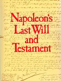
De Jonge, Alex (Trans. )
Napoleon's Last Will and Testament
London: Paddington Press Ltd. Fine in Near Fine dust jacket. 1977. First Edition Thus. 1. Hard Cover. 044822190X . Publisher's full black cloth gilt lettering on spine illustrated endpapers. B&W frontispiece illustrated with full-page reproductions of Napoleon's will. . The volume is in excellent unmarked square and clean. Price-clipped Mylar-wrapped dust jacket shows slight sunning on flaps else fine. FINE/NEAR FINE . 4to 11" - 13" tall. 106 6 pp . Paddington Press, Ltd. hardcover
Referenz des Buchhändlers : 491 ISBN : 044822190X 9780448221908
|
|
|
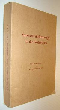
De Josselin De Jong, PE. P. E.
Structural Anthropology in the Netherlands - A Reader: Koninklijk Instituut Translation Series 17 Seventeen
The Hague: Martinus Nijhoff 1977. Book. Good. Paperback. First Edition. 8vo - over 7¾" - 9¾" tall. 399 pages plus fold-out maps at back. Three black and white photographic plates. Glossarial index. Inscribed and signed atop half-title page using wording which suggests it is in the author's hand yet the signature does not appear to match. No other markings. Average wear. Binding intact. A sound copy. Martinus Nijhoff Paperback
Referenz des Buchhändlers : 742G2030 ISBN : 9024719445 9789024719440
|
|
|
De Josselin De Jong, P.E.
Structural Anthropology in the Netherlands - A Reader: Koninklijk Instituut Translation Series 17 (Seventeen)
399 pages plus fold-out maps at back. Three black and white photographic plates. Glossarial index. Inscribed and signed atop half-title page using wording which suggests it is in the author's hand, yet the signature does not appear to match. No other markings. Average wear. Binding intact. A sound copy. Book

|
|
|
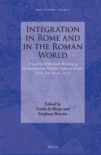
De Kleijn, Gerda & Stephane Benoist (Eds. )
INTEGRATION IN ROME AND IN THE ROMAN WORLD Proceedings of the Tenth Workshop of the International Network Impact of Empire Lille June 23-25 2011
Brill Academic Pub. Very Good with no dust jacket. 2013. Hardcover. 9004255982 . Lower corners bumped. ; Integration in the empire under the political control of the city of Rome her princeps and the different authorities in the provinces and cities includes processes of inclusion and exclusion. These multifaceted processes take place at various levels in society and at different places over a long period of time. In this volume these processes are analysed and reflected on from different perspectives. Juridical political social and religious points of view are articulated elaborating on epigraphic literary juridical and numismatic evidence. Notions of personal and collective identities have been linked to relevant Roman realia so that various contents of Romanitas can be defined through contextualization. ; Impact of Empire Volume 17; 302 pages . Brill Academic Pub hardcover
Referenz des Buchhändlers : 16130 ISBN : 9004255982 9789004255982
|
|
|
De Kovatsi, Rudolph Bardy.
ADVENTURES OF RUDOLPH BARDY DE KOVATSI, A HUNGARIAN EXILE, IN ITALY, HUNGARY AND TURKEY. Written By Himself.
235p. Heavily foxed and age stained. 12mo. Original full brown cloth binding embossed in blind. Spine decorated and lettered in gold. Edges worn with slight loss at head of spine. Hardbound. Nice example of the vintage First American Edition. Quite Scarce thus. **PRICE JUST REDUCED! TRAVEL/1
|
|
|
De Kuyper, Eric
Al Mare. Scene D'infanzia
Mm 100x200 Introduzione di Silvia Calamandrei. Brossura originale con copertina figurata a colori, 123 pagine. Leggere fioriture ai tagli, peraltro buona copia. SPEDIZIONE IN 24 ORE DALLA CONFERMA DELL'ORDINE.
|
|
|
DE L ' ISLE ( Delisle ) - BUACHE
Carte de Suisse où sont les cantons . . les Alliez . les 3 Ligues . et les dix Droitures . par G Delisle augmentée en 1769 par Ph Buache.
Paris , chez Dezauche , 1769 , carte 65 x 50 cm Limites coloriées à l' époque. Une mouillure claire au centre de la carte .
Referenz des Buchhändlers : M5423
|
|
|
De L'Ardeche, M. Laurent
History of Napoleon: Vols. 1 & 2
London U.K.: Willoughby & Co. 1900. No dust jacket. Hardcover. Two-volume set. This book was not published in 1900; it does not have a publication date but was probably published around 1840. Leather-bound spines and leading corners. Boards spines and leading corners are considerably worn and rubbed. Spine head of Vol. 1and left edge of Vol. 2 are chipped. Leading corners are bumped and have some leather loss. Page block is very taned and has one or two small marks. Marbled pastedowns and endpapers. Pages are rather tanned and grubby with some age-spotting throughout. Hinges of both volumes are cracked and binding is a little loose throughout both volumes. Text and illustrations remain clear. AF. Hardcover. Good/No Dust Jacket. Illus. by Vernet Horace. Used. Willoughby & Co. Hardcover
Referenz des Buchhändlers : 419500
|
|
|
De L'Ardeche, M. Laurent
History of Napoleon: Vols. 1 & 2
No dust jacket. Hardcover. Two - volume set. This book was not published in 1900; it does not have a publication date, but was probably published around 1840. Leather - bound spines and leading corners. Boards, spines and leading corners are considerably worn and rubbed. Spine head of Vol. 1and left edge of Vol. 2 are chipped. Leading corners are bumped and have some leather loss. Page block is very taned and has one or two small marks. Marbled pastedowns and endpapers. Pages are rather tanned and grubby, with some age - spotting throughout. Hinges of both volumes are cracked and binding is a little loose throughout both volumes. Text and illustrations remain clear. AF Used

|
|
|
DE L'ECOTAIS Yann
L'Europe sabotée
Bruxelles/ Paris, Rossel 1976, 262pp.+ 16pp. ills. hors texte, br., bon état, G22136
|
|
|
DE L'ECOTAIS Yann
L'Europe sabotée
, Bruxelles/ Paris, Rossel 1976, 262pp.+ 16pp. ills. hors texte, br., bon état, G22136
Referenz des Buchhändlers : G22136
|
|
|
DE L'ISLE
Carte de Suisse ou sont les cantos de Zurich, Berne, Lucerne, Uri, etc.
Paris, Dezauche succ. De l'Isle et Buache, 1780. (Parte incisa mm. 480 x 630). Bella carta geografica, in coloritura coeva, proveniente da Atlas géographique des quatre parties du monde par Guillaume De L'Isle et P. Buache.

|
|
|
DE L'ISLE
Carte des couronnes du Nord dediée au très puissant et tres invincible prince Charles XII, roy de Suede des gots et des vandales, gran duc de Finlande, &c.
Paris, Dezauche succ. De l'Isle et Buache, 1780. Due carte. (Parte incisa mm. 480 x 630). Due belle carte geografiche che formano il nord europa, in coloritura coeva, provenienti dall' Atlas géographique des quatre parties du monde par Guillaume De L'Isle et P. Buache.

|
|
|
DE L'ISLE
Carte des provinces unies de Pays Bas
Paris, Dezauche, 1780. (Parte incisa mm. 480 x 630). Bella carta geografica, in coloritura coeva, proveniente da Atlas géographique des quatre parties du monde par Guillaume De L'Isle et P. Buache. Incisa da Liebaux le fils.
|
|
|
DE L'ISLE
L'Allemagne. Dressée sur les observations de Tycho Brahé de Kepler, de Snellius sur celles de l'Academie Royale des sciences &c.
Paris, Dezauche succ. De l'Isle et Buache, 1780. (Parte incisa mm. 480 x 630). Bella carta geografica, in coloritura coeva, proveniente da Atlas géographique des quatre parties du monde par Guillaume De L'Isle et P. Buache.

|
|
|
De L'Isle Guillaume ( Delisle )
LES ISLES BRITANNIQUES . Le tout rectifié par diverses observations par G Delisle .Revu et corrigé en 1772.
1772 Paris , Dezauche, 1772 , carte 63 x 48 cm , limites colorées , cartouche décoratif , quelques petites taches d' encre , une déchirure marginale très habilement restaurée .
Referenz des Buchhändlers : M5422

|
|
|
de l'Isle, Guillaume
Carte de la Grece. Dressé sur un grand nombre de memoires anciens et nouveaux, sur Ceux de Mrs. Wheler et Tournefort sur les Observation Astronomiques de Mr. Vernon du P. Feuillée Minime & C. -
Paris:, 1707. Alt- grenzkolorierter Kupferstich 45 x 60 cm, Blattgröße 51 x 70 cm.
Referenz des Buchhändlers : 901492AG

|
|
|
de L'Isle, Guillaume
Europa Delineata juxta observationes Excell.orum Virorum Accademia ...
Acquaforte, mm. 465x590 alla battuta + piccoli marg. bianchi. Leggera cquarellatura coeva con scale, cartiglio e annotazioni. Interventi di restauro
|
|
|
De La Barrera Anton, Jose Luis
Los Capiteles Romanos de Merida
Museo Nacional de Arte Romano, coll. « Monografias emeritenses », n° 2 1984 Livre en espagnol. In-4 broché 30 cm sur 21. 110 pages. 109 photographies en noir et blanc. Bon état d’occasion.
Referenz des Buchhändlers : 109708
|
|
|
 Per e-mail erhalten
 Als pdf-Dokument herunterladen
 RSS feed


