|
DYMCHITZ Valery (choix de textes de)
Contes populaires juifs d'Europe orientale: Contes merveilleux, légendes et traditions, contes de moeurs, histoires et anecdotes,
Traduit du russe par Sophie Benech, glossaire établi par Myrial Anissimov, José Corti, Merveilleux n° 25, 2004, 570 pp., broché, bon état.
Referentie van de boekhandelaar : 26970

|
|
|
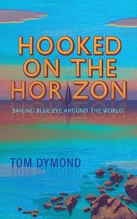
Dymond, Tom
Hooked on the Horizon: Sailing Blue Eye Around the World The Sailing Blue Eye Around the World Series
Hardstone House 2021. Book. Very Good. Soft cover. Reading crease to spine. Pages of text are clean bright and free of markings. Binding is tight and secure. Shipped within 24 hours from the beautiful Baltimore inner harbor area. First class service; accurate descriptions. Most items packed in boxes not envelopes. . Hardstone House Paperback
Referentie van de boekhandelaar : 000072 ISBN : 1916900100 9781916900103
|
|
|
Dyos, H. J. & Wolff, Michael, Eds
The Victorian City Images and Realities 2 volumes
London: Routledge & Kegan Paul 1973. 2 volumes. Library markings; dust wrappers in protective sleeves; 957p plates index. NB: This is a very heavy set set which will incur a non-standard postage charge. Size: Sm 4to. First Edition. Hard Cover. Very Good/Very Good. Ex-Academic Library. Routledge & Kegan Paul Hardcover
Referentie van de boekhandelaar : 81054 ISBN : 0710073844 9780710073846
|
|
|
Dyroff, Hans-Dieter (Hrsg.)
Protection and Cultural Animation of Monuments, Sites and Historic Towns in Europe The present situation in Belgium, Bulgaria, Canada, the Federal Republic of Germany, France, Greece, Hungary, Italy, The Netherlands, Poland, the United Kingdom, and Yugoslavia
Bonn, German Commission for UNESCO, [1980]. 29,5 cm. 394 S. Mit zahlreichen Ill., Abb. und Karten. Illustrierter Originalkarton (Softcover). Kurzer Vermerk auf Titel, sonst gut erhaltenes Exemplar. Architecture and protection of monuments and sites of historical interest ; 12.
Referentie van de boekhandelaar : 4489AB
|
|
|
Dyson K. ed
European Detente
Frances Pinter 1986. This is an ex-library book and may have the usual library/used-book markings inside.This book has hardback covers. In fair condition suitable as a study copy. Dust jacket in fair condition. Please note the Image in this listing is a stock photo and may not match the covers of the actual item550grams ISBN:9780861876068 Frances Pinter hardcover
Referentie van de boekhandelaar : 9266786 ISBN : 0861876067 9780861876068
|
|
|
Dyson, John
Business in Great Waters: The Story of British Fishermen
London: Angus & Robertson Publishers 1977. 336pp illustrated with b/w photos line drawings appendices bibliography index pictorial end-papers. Scattered foxing throughout. Cloth boards gilt spine titles and decoration. The life and work of fishermen of the Dogger Bank and North Sea. First Edition. Hard Cover. Very Good/No Jacket. Illus. by Iain Rae. 8vo. Angus & Robertson, Publishers Hardcover
Referentie van de boekhandelaar : 028118 ISBN : 0207957061 9780207957062
|
|
|
Dyson, K (ed)
Enlarging the Euro Area: External Empowerment and Domestic Transformation in East Central Europe
Oxford University Press 2006. This is an ex-library book and may have the usual library/used-book markings inside.This book has hardback covers. With owner's name inside cover. In good all round condition. Dust jacket in good condition. Library sticker on front cover. Please note the Image in this listing is a stock photo and may not match the covers of the actual item800grams ISBN:9780199277674 Oxford University Press hardcover
Referentie van de boekhandelaar : 9789346 ISBN : 0199277672 9780199277674

|
|
|
Dyson, Stephen L.
ROME A Living Portrait of an Ancient City
Johns Hopkins University Press. Very Good with no dust jacket. 2010. Hardcover. 0801892538 . Minor shelfwear to book. ; Stephen L. Dyson has spent a lifetime studying and teaching the history of ancient Rome. That unparalleled knowledge is reflected in his magisterial overview of the Eternal City. Rather than look only at the physical development of the city-its buildings monuments and urban spaces-Dyson also explores its social economic and cultural histories. This unique approach situates Rome against a background of comparative urban history and theory allowing Dyson to examine the dynamic society that once thrived there. In his personal effort to reconstruct the city Dyson populates its streets with the hurried politicians hawking vendors and animated students that once lived worked and studied there bringing the ancient city to life for a new generation of students and tourists. Dyson follows Rome as it developed between the third century BC and the fourth century AD dividing the great megalopolis into distinct neighborhoods and locales. He shows how these communities each with its own unique customs and colorful inhabitants eventually grew into the great imperial capital of the Italian Empire. Dyson integrates the full range of sources available-literary artistic epigraphic and archaeological-to create a comprehensive history of the monumental city. In doing so he offers a dramatic picture of a complex and changing urban center that despite its flaws flourished for centuries.; Ancient Society And History; 6 X 1.39 X 9 inches; 488 pages . Johns Hopkins University Press hardcover
Referentie van de boekhandelaar : 39747 ISBN : 0801892538 9780801892530

|
|
|
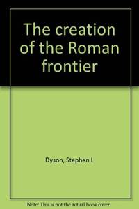
Dyson, Stephen L.
THE CREATION OF THE ROMAN FRONTIER
Princeton University Press. Very Good- in Very Good dust jacket. 1985. Hardcover. 0691035776 . Creasing through pages closed improperly at one time . Minor shelfwear to DJ. ; Gathers the scattered and often ambiguous classical references into a coherent description of Roman strategic thinking. Finds the Roman frontier policy to have been much more disciplined than previously supposed. ; 1 x 9.5 x 6 Inches; 337 pages . Princeton University Press hardcover
Referentie van de boekhandelaar : 42029 ISBN : 0691035776 9780691035772
|
|
|
Dyson, Stephen L.
THE CREATION OF THE ROMAN FRONTIER
Princeton University Press. Good with no dust jacket. 1985. Hardcover. 0691035776 . Ex-library copy with usual stamps call numbers and pocket. ; Gathers the scattered and often ambiguous classical references into a coherent description of Roman strategic thinking. Finds the Roman frontier policy to have been much more disciplined than previously supposed. ; 1 x 9.5 x 6 Inches; 337 pages . Princeton University Press hardcover
Referentie van de boekhandelaar : 39771 ISBN : 0691035776 9780691035772
|
|
|
Dyson, Stephen L.
THE CREATION OF THE ROMAN FRONTIER
Princeton University Press. Very Good. 1985. Softcover. 0691102325 . Scholar's bookplate to inner cover G. P. Goold. Else fine. ; Gathers the scattered and often ambiguous classical references into a coherent description of Roman strategic thinking. Finds the Roman frontier policy to have been much more disciplined than previously supposed. ; 1 x 9.5 x 6 Inches; 337 pages . Princeton University Press paperback
Referentie van de boekhandelaar : 27124 ISBN : 0691102325 9780691102320
|
|
|
Dzierzykraj-Rogalski, T
Crania et alia ossa Polonica, cmentarzyska neolityczne w Stoku i Lesie Stockim.
Wroclaw, 1958. M. mehr. Abb. (teils auf Taf.) 70 S. (Materialy i prace antopol. 30).
Referentie van de boekhandelaar : 237913
|
|
|
Dänemark
Dänemark 1936. (Handbuch / Nachschlagewerk).
Kopenhagen, Kgl. Dänisches Ministerium des Außeren und dem Staatlichen statistischen Departement, 1936.
Referentie van de boekhandelaar : 172137

|
|
|
Dänemark - Hielscher, Kurt
Danmark. Landschaft, Baukunst, Volksleben. Mit einem Geleitwort von Karin Michaelis. 1. Auflage.
Berlin, Brockhaus Verlag, 1932.
Referentie van de boekhandelaar : 91702

|
|
|
Däniken, Erich von
Im Namen von Zeus : Griechen - Rätsel - Argonauten.
München : Bertelsmann, 1999. 287 S. Ill., Kt. 8°. 1. Aufl. Bibl.- Einbd.
Referentie van de boekhandelaar : 42252
|
|
|
Décsy, Gyula
Die linguistische Struktur Europas. Vergangenheit, Gegenwart, Zukunft.
Wiesbaden, Harrassowitz, 1973. Gr. 8°, 3 Blätter, 300 Seiten. Orig.Leinen mit OSU.
Referentie van de boekhandelaar : 10687
|
|
|
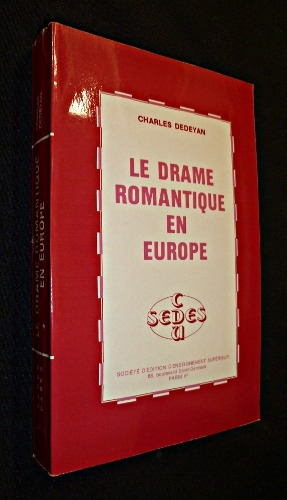
Dédéyan Charles
Le drame romantique en Europe
Sedes Dos carré collé 1982 In-12 broché dos carré collé, (12 * 18,5 cm), 408 pages ; bon état. Livraison a domicile (La Poste) ou en Mondial Relay sur simple demande.
Referentie van de boekhandelaar : pf1405
|
|
|
Dédéyan Charles
Le Cosmopolitisme européen sous la Révolution et l'Empire (2 volumes)
Société d'Edition d'Enseignement Supérieur Broché 1976 Deux volumes in-12 (12 x 18,5 cm), brochés, pagination continue (652 pages) ; bords des plats un peu brunis, par ailleurs bon état. Livraison a domicile (La Poste) ou en Mondial Relay sur simple demande.
Referentie van de boekhandelaar : gm4171

|
|
|
DÉPÔT de la GUERRE.
Tableau des signes conventionnels employés au Dépôt de la Guerre, appliqués à la lecture et au dessin des cartes et plans topographiques. Hydrographie.
Dépôt de la Guerre, [circa 1880]. En 24 sections montées sur toile et repliées, formant une carte de 0,94 x 1,13 m.
Referentie van de boekhandelaar : LBW-8467

|
|
|
Dépôt des cartes et plans de la Marine
Carte particulière de la còte de Norwège, depuis Alvöe jusqu'à Egefield…
Carta nautica della costa norvegese sudoccidentale.Incisione su rame, in ottimo stato di conservazione. Nautical map coverig the Norway South-West coastline.Copperplate in very good condition.

|
|
|
Dépôt des cartes et plans de la Marine
Carte particulière de la còte de Norwège, depuis Egefield jusqu'à Christiansand
Carta nautica della costa norvegese compresa tra Staltland e Kristiansand.Incisione su rame, in ottimo stato di conservazione. Nautical map coverig the Norway coastline from Statland to Kristiansand.Copperplate in very good condition.

|
|
|
Dépôt des cartes et plans de la Marine
Carte particulière de la còte de Norwège, depuis Grib – Oerne et Christiansund à Statland
Carta nautica incentrata sull’area della costa settentrionale della Norvegia.Incisione su rame, in ottimo stato di conservazione. Nautical chart focused on the northern coastline of the Norway.Copperplate, in good condition.

|
|
|
Dépôt des cartes et plans de la Marine
Carte particulière de la còte de Norwège, depuis Statland jusqu'à Alvoe
Carta nautica della costa norvegese compresa tra Staltland e Alvoe.Incisione su rame, in ottimo stato di conservazione Nautical map coverig the Norway coastline from Statland to Alvoe.Copperplate in very good condition

|
|
|
Dépôt des cartes et plans de la Marine
Carte réduite de la Mer Baltique 1.ére feuille Contenant les entrées de cette Mer et les Côtes des îles Danoises, les C
Carta nautica incentrata sul versante più meridionale del mar Baltico, che comprende l'arcipelago delle Faroe, la costa meridionale della Svezia, da Kullen a Kristianopel e le coste della Germania e Polonia, da Travemünde Kolonrzeg (in tedesco Kolberg).Incisione su rame, in ottimo stato di conservazione. Nautical map focusing on the southernmost part of the Baltic Sea, which includes the Faroe archipelago, the southern coast of Sweden, from Kullen to Kristianopel and the coasts of Germany, from Travemünde to Kolberg, issued by Depot de la Marine.Copperplate, in good condition.

|
|
|
Dépôt des cartes et plans de la Marine
Carte réduite de la Mer Baltique : Ve. Feuille Contenant le golfe de Bothnie…
Carta nautica incentrata sull'area del golfo di Botnia, la parte settentrionale del mar Baltico, che si estende tra la costa occidentale della Finlandia e quella orientale della Svezia.Incisione su rame, in ottimo stato di conservazione. Five sheet, of six, of a large Chart of the Baltic Sea, focused on Gulf of Bothnia, issued bu Depot de la Marine.Copperplate, in good condition.

|
|
|
Dépôt des cartes et plans de la Marine
Carte réduite de la Mer Baltique IIe. Feuille Contenant partie de l'île d'Oland et de la Côte Sud-Est de la Suède, les C
Carta nautica della parte del Mar Baltico che comprende la costa sud-orientale della Svezia con l'isola di Öland; la linea costiera continentale si estende dal Kolonrzeg (in tedesco Kolberg), in Polonia, (in tedesco Kolberg) fino a Liepāja (ted. Libau), in Lettonia.Foglio 2, di 6, della grande carta nautica dedicati del Mar Baltico.Incisione su rame, in ottimo stato di conservazione. Second sheet, of six, of a large Chart of the Baltic Sea, which includes the south-eastern coast of Sweden with the island of Öland; the continental coastline extends from the Kolonrzeg (in German Kolberg), in Poland, (in German Kolberg) to Liepāja (ted. Libau) in Latvia.Copperplate, in good condition.

|
|
|
Dépôt des cartes et plans de la Marine
Carte réduite de la Mer Baltique IIIe. Feuille Contenant partie de la Côtes de Suède, de l'île d'Oland à Stockholm, les
Carta nautica della parte del Mar Baltico (foglio 3, di sei dedicati alla rappresentazione del Mar Baltico) che comprende parte della costa della Svezia, con le isole di Gotland, Saaremaa (Osel), Hiiumaa (Dago) e le coste del golfo di Riga. Incisione su rame, in ottimo stato di conservazione. Third sheet, of six, of a large Chart of the Baltic Sea, with the Swedish coast, Gotland, and the coasts of Latvia and Estonia (included Saaremaa and Hiiumaa island). Copperplate, in good condition.

|
|
|
Dépôt des cartes et plans de la Marine
Carte réduite de la Mer du Nord comprenant les côtes orientales des Îles britanniques et les Cotes opposées du Continent
Grande mappa nautica, su due fogli, che raffigura il mare del Nord, compreso tra la Gran Bretagna a Ovest, le coste della Francia settentrionale, delle Fiandre, dei Paesi Bassi e della Frisia a S, le coste occidentali dello Jylland (Danimarca) e della Scandinavia (Norvegia) a Est. Si apre ampiamente a Nord verso l’Oceano Atlantico, con cui comunica tra le coste della Scozia e le isole Orcadi (Stretto di Pentland) e tra le isole Orcadi e le isole Shetland e tra queste ultime e la costa norvegese.Incisione su rame, in ottimo stato di conservazioneDue fogli da 945x615 mm. Large map, on two sheets, of the North sea, the northeastern arm of the Atlantic Ocean, located between the British Isles and the mainland of northwestern Europe. The sea is bordered by the island of Great Britain to the southwest and west, the Orkney and Shetland islands to the northwest, Norway to the northeast, Denmark to the east, Germany and the Netherlands to the southeast, and Belgium and France to the south. It is connected to the Atlantic by the Strait of Dover and the English Channel and opens directly onto the ocean between the Orkney and Shetland islands and between the Shetland Islands and Norway. The Skagerrak, an eastward extension of the North Sea between Norway and Denmark, connects the North and Baltic seas via the Kattegat and the Danish straits.Copperplate, in very good conditionTwo sheets of 945x615 mm.

|
|
|
Dépôt des cartes et plans de la Marine
Carte réduite du Cattegat comprenat comprenant la côte de Suède depuis Marstrand jusqu' à Landscrone la côte du Jutland
Carta nautica dello stresso di Kattegat, il braccio di mare che congiunge il Mar Baltico con il Mare del Nord; è situato fra la penisola dello Jylland e la costa occidentale della Svezia meridionale. Incisione su rame, in ottimo stato di conservazione. Detailed map of the Kattegat sea, the strait forming part of the connection between the Baltic Sea and the North Sea. The strait trends north-south between the Jutland (Jylland) peninsula and Sjælland (Zealand) island of Denmark (west and south) and Sweden (east); it connects through the Skagerrak (north) with the North Sea and through The Sound and the Great Belt and Little Belt (south) with the Baltic Sea.Copperplate, in very good condition.

|
|
|
Dépôt des cartes et plans de la Marine
Carte réduite du Skagerat comprenant la côte de Norwège, de Lindersnæs à Færder, et la côte de Suède, de Frédérich
Carta nautica incentrata sullo Skagerrak, l’ampio braccio di mare che dal Mare del Nord si insinua tra la penisola scandinava a Nord (Norvegia) e quella dello Jütland a Sud fino al limite convenzionale che lo separa dall'altro braccio di mare più interno, il Kattegat.Incisione su rame, in ottimo stato di conservazione. Nautical chart of the Skagerrak, rectangular arm of the North Sea, trending southwest to northeast between Norway on the north and the Jutland peninsula of Denmark on the south. The Skagerrak narrows between Cape Skagen (the Skaw), Denmark, and the Swedish coast before turning south into the Kattegat toward the Danish sounds and the Baltic Sea.Copperplate in very good condition

|
|
|
Dépôt des cartes et plans de la Marine
Carte réduite du Sunt contenant les côtes de l'île Séelande, de Gilleley à Stevens Klint, et les côtes de la Skanie…
Dettagliata carta nautica incentrata sullo stretto di Oresund, il braccio più a oriente dei tre (gli altri due sono il Grande e il piccolo Belt) che pongono in comunicazione il Baltico con il Kattegat. Lo stretto s'interna tra la Penisola Scandinava (Svezia) e l'isola danese di Seeland; il punto più stretto si trova nella parte più settentrionale, mentre a sud si slarga in un'ampia baia che immette nel Baltico vero e proprio. In un riquadro, la pianta della rada di Copenaghen.Incisione su rame, in ottimo stato di conservazione Detailed nautical map focused on Oresund Strait, which separates Denmark from Sweden. Oresund is one of three waterways that connect the Atlantic Ocean and the Baltic Sea.The other two are Great and Little Belt. The principal ports are Copenhagen and Helsingør (Elsinore) on the Danish side and Malmö and Helsingborg on the Swedish side.Copperplate, in very good condition.

|
|
|
DÉRY (Charles).
Les Charbonnages hongrois. Description des entreprises représentées à l'Exposition universelle de 1900 à Paris. Édition de la Commission du groupe X1
Budapest, Imprimerie Werböczy, s.d. (1900) in-8, [3] ff. n. ch., 231 pp., broché. Première couverture un peu salie.
Referentie van de boekhandelaar : 231620

|
|
|
Dérens Jean-Arnault, Geslin Laurent
Voyage au pays des Gorani : (Balkans, début du XXIe siècle)
Cartouche, coll. « Voyage au pays des... » 2010 In-8 20,1 cm sur 12,4. 146 pages. Très bon état d’occasion.
Referentie van de boekhandelaar : 56632
|
|
|
DÉSORGUES (Théodore)
Recueil de 6 textes.
Paris, An V-An VIII in-8, Broché sous couverture d'attente factice de papier bleu postérieur.
Referentie van de boekhandelaar : 170293
|
|
|
Désailloud Philippe.
LA GUERRE DES TUNNELS. Histoire du Tunnel Routier sous le Mont-Blanc. 1946-1965.
(Codice LO/0968) In 8° (23,5 cm) 137 pp. Avec 3 cartes et 7 planches hors texte. Couverture souple. Trés bon état. ~~~ SPEDIZIONE IN ITALIA SEMPRE TRACCIATA

|
|
|
DÉTIS Elisabeth ( Textes recueillis par ) / COLLECTIF
INTERFACES ARTISTIQUES ET LITTERAIRES DANS L'EUROPE DES LUMIÈRES. Le Spectateur européen - The European Spectator, volume 2
Montpellier Université Paul-Valéry Montpellier III 2000 in 8 (21x15) 1 volume broché, 277 pages [2]. Le spectateur européen, volume 2. Edition bilingue (anglais/ français). Bel exemplaire
Referentie van de boekhandelaar : 056057
|
|
|
DÉTIS Elisabeth et KNOPPER Françoise ( Etudes, textes et gravures réunis par )
S'AMUSER EN EUROPE AU SIÈCLE DES LUMIÈRES. Etudes, textes et gravures réunis par Elisabeth Détis et Françoise Knopper
Toulouse Presses Universitaires du Mirail 2007 in 8 (22x13,5) 1 volume broché, couverture illustrée, 245 pages, avec de nobreuses illustrations. Collection interlangues - civilisations. Très bel exemplaire
Referentie van de boekhandelaar : 055936
|
|
|
Döbler, Hannsferdinand
Die Germanen. Legende u. Wirklichkeit von A - Z; ein Lexikon z. europ. Frühgeschichte.
Gütersloh, Berlin, München, Wien, Bertelsmann-Lexikon-Verlag, 1975. 1. Aufl. ; 24 cm. 320 S., zahlr. Ill. (z. T. farb.), graph. Darst., Kt. Pp., OU. Rück. d. OU etwas verblichen, innen sauber u. gut erhalten. Besitzerverm. a. Tit.-Bl. 1
Referentie van de boekhandelaar : 55278AB
|
|
|
Döbler, Hannsferdinand
Die Germanen. Legende u. Wirklichkeit von A - Z. Ein Lexikon z. europ. Frühgeschichte.
Gütersloh, Berlin, München, Wien, Bertelsmann-Lexikon-Verlag, 1975. 1. Aufl. 24 cm. 320 S. zahlr. Ill. (z. T. farb.), graph. Darst., Kt. OLwd., mit Schutzumschl. Su mit 2 randl. Einrissen, Seiten mit geringer randl. Bräunung. 1
Referentie van de boekhandelaar : 29225BB
|
|
|
Dölger, Franz
Byzantinische Diplomatik. 20 Aufsätze zum Urkundenwesen der Byzantiner.
Ettal, Buch- und Kunstverlag, (1956). Gross Oktav. XVI, 419 Seiten. Mit 27 gefalteten Tafeln mit zahlreichen Abbildungen. Original-Leinen mit Umschlag. - Sehr gutes Exemplar. Die Versandkosten für Kunstwerke und mehrbändige Werke können von den Standard-Versandkosten abweichen.
Referentie van de boekhandelaar : 14382CB
|
|
|
Dömer, C
Mütter, Machos u. Marginalität. Themen d. Literatur v. Frauen in Argentinien im 20. Jahrhundert.
Köln, Böhlau, 1994. 154 S. OBr. (Forum Ibero-Americanum 11).
Referentie van de boekhandelaar : 634705
|
|
|
Dönhoff, Marion Gräfin
Bilder, die langsam verblassen. Ostpreußische Erinnerungen.
Augsburg, Weltbild Verlag, 2009. 4°; 135 Seiten, teils farbigen Abbildungen, Farbaufnahmen von Wladimir Federenko; Orig.-Glanzfolienpappband Ecken minimal angestoßen, sonst kaum Gebrauchsspuren
Referentie van de boekhandelaar : 27527

|
|
|
DÖRR, O
Der europäisierte Rechtsschutzauftrag deutscher Gerichte. Artikel 19 Absatz 4 GG unter dem Einfluß des europäischen Unionrechts.
Tübingen, Mohr, 2003. XVIII, 298 S. OLwd (mit OUmschlag) (Jus publicum, 96)
Referentie van de boekhandelaar : 3472759
|
|
|
Dörrer, Anton (edit):
Tiroler Umgangsspiele. Ordnungen und Sprechtexte der Bozner Fronleichnamsspiele und verwandter Figuralprozessionen vom Ausgang des Mittelalters bis zum Abstieg des aufgeklärten Absolutismus.
25 cm. XVI, 568 (4) Seiten und 40 Tafeln mit 50 Abb. und 1 Karte. Orig.-Halbleinen mit Schutzumschlag. *Älterer Stempel auf Titelrücksetie, ansonsten unbenutzt und sehr gut erhalten. Bücher de
|
|
|
Dörrer, Anton (edit):
Tiroler Umgangsspiele. Ordnungen und Sprechtexte der Bozner Fronleichnamsspiele und verwandter Figuralprozessionen vom Ausgang des Mittelalters bis zum Abstieg des aufgeklärten Absolutismus.
25 cm. XVI, 568 (4) Seiten und 40 Tafeln mit 50 Abb. und 1 Karte. Orig.-Halbleinen mit Schutzumschlag. *Älterer Stempel auf Titelblatt, ansonsten unbenutzt und sehr gut erhalten. Bücher de
|
|
|
Dörries, Hans
Die Städte im oberen Leinetal: Göttingen, Northeim und Einbeck. Ein Beitrag zur Landeskunde Niedersachsens und zur Methodik der Stadtgeographie.
Göttingen, Vandenhoeck & Ruprecht, 1925. Gr. 8°. Mit 16 Karten, Plänen und Abbildungen im Text, 3 Merianschen Städteansichten, 20 Abbildungen auf 10 Tafeln und 3 (von 6) Kartenbeilagen. VIII, 198 S. Ppbd der Zeit mit Rückenschild.
Referentie van de boekhandelaar : 1317AB
|
|
|
Döry, Ludwig
Die Eisenbahn auf der Medaille - In Mitteleuropa von den Anfängen bis 1945 - Ikonographische Studie,
Frankfurt am Main, Eigenverlag L. Döry, 1985. gr.4°. 192 S. mit zahlreichen s/w-Abbildungen, illustr. original Pappband (Hardcover), Erstausgabe sehr schönes, sauberes Exemplar
Referentie van de boekhandelaar : 22216CB

|
|
|
Dübi, Heinrich.
Die ersten fünfzig Jahre des Schweizer Alpenclub. Denkschrift.
26,5 cm. VI, 304 S. und mehrere Falttabellen. Illustr. Orig.-Broschur (Kapitale bestoßen). Bücher de
|
|
|
Dülberg, F
Holland. Ein Land das lohnt. 3. Aufl.
Haag, o.J. (ca. 1930). M. einigen Abb. 151 S. OBr. Rücken leicht angerissen. Vorderumschl. geknickt, lose u. m. St. Tit. m. St.
Referentie van de boekhandelaar : 169750
|
|
|
Dülmen, Richard van (Herausgeber) und Sina Rauschenbach (Herausgeber)
Denkwelten um 1700 : zehn intellektuelle Profile ; [Publikation der Arbeitsstelle für Historische Kulturforschung, Universität des Saarlandes]. hrsg. von Richard van Dülmen und Sina Rauschenbach
Köln ; Weimar ; Wien : Böhlau, 2002. VIII, 219 S. : Ill., graph. Darst., Noten ; 24 cm broschiert
Referentie van de boekhandelaar : 45543
|
|
 De zoekresultaten per email ontvangen
 Zoekresultaten downloaden als PDF
 RSS feed


