|
|
|
Mercure de France Politique, Historique et Littéraire
Mercure de France Politique, Historique et Littéraire (Politique de l'Europe)
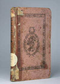
12 Numéros In-12 - Brochés - Environ 50 pages par fascicules -N°38 à 42 du 16/09/1780 au14/10/1780 -N° 45 à49 du 4/11/1780 au 2/12/1780 - 51 & 52 du 16/12au 23/12/1780 - rousseurs d'usage - Envoi rapide et soigné
Riferimento per il libraio : 46020
|
|
|
Merveilles des Palais Italiens.
Merveilles des palais italiens.
hachette realite 1968 In-4 relié. Bon état d’occasion. Jaquette abîmée avec des manques.
Riferimento per il libraio : 60227
|
|
|
MERLIN (Maria de Las Mercedes, comtesse)
Souvenirs et mémoires. Publiés par elle-même
Paris, Charpentier, 1836 4 vol. in-8, maroquin prune à grain long, dos lisse orné en long, large bande de filets dorés en encaddrement sur les plats, fleurons en écoinçon, fer doré dans les angles, monogramme P. F. de P. au centre des plats, tranches dorée, roulette intérieure, gardes de moire blanche à décor floral (Simier r. du Roi).
Riferimento per il libraio : 236770
|
|
|
MERIMEE Prosper
Épisode de l'Histoire de Russie - Les Faux Démétrius - Édition originale.
Édition originale. Paris, Michel Lévy Frères - 1853 - 448 pages.Reliure demi basane de l'époque. Dos lisse orné de filets dorés, avec titre, et auteur. Rousseurs. Assez bon état. Format in-12°(18x12).
Riferimento per il libraio : 18984
|
|
|
MERIMEE Prosper
Épisode de l'Histoire de Russie - Les Faux Démétrius - Édition originale.
Édition originale. Paris, Michel Lévy Frères - 1853 - 452 pages.Belle reliure demi maroquin brun à coins signée L. Issac. Dos à nerfs orné et richement doré. Tête dorée sur témoins, non rogné. Filet doré bordant les plats. Couverture et dos conservés. Signet. Rousseurs pales. Très bon état. Format in-12°(19x13).
Riferimento per il libraio : 15294
|
|
|
MERCATOR (Kremer) Gerard (1512 - 1594)
Cornubia, Devonia, Somersetus, Dorcestria, Wiltonia …
La carta del Sud-Ovest dell'Inghilterra e del Galles; include i territori di Cornovaglia, Devon, Sommerset, Dorset, Wilton, Glouchester, Glamorgan, Caermarden, Penbroke, Cardigan, Radnor Breknoke, Hereford e Wigorn. La carta viene preparata da Gerard Mercator per l’Atlantis Pars Altera (1595) pubblicato postumo alla morte dell’autore, sotto la supervisione del figlio Rumold Mercator, dallo stampatore di Duisburg Albert Buys. Composto da sei parti – pubblicate separatamente tra il 1589 e il 1594 – comprende 107 mappe, tutte tranne la carta del mondo di Rumold, firmate da Gerard Mercator. Le lastre vennero poi acquistate da Jodocus Hondius, che tra il 1606 e il 1630 le utilizzò per il suo Atlas Sive Cosmographicae Meditationes de Fabrica Mundi, integrandole ed aggiornandole con proprie “nuove” carte. Delle mappe di Mercator sono note anche ristampe curate da Johannes Janssonius. Le edizioni Hondius e Janssonius ebbero un grande successo commerciale e furono stampate in più lingue, con il testo al verso della carta in latino, francese, tedesco e olandese. La carta è incisa con i connotati tipici dell'opera mercatoriana. Le montagne sono allineate in un concetto di area montuosa, non per indicare vere catene o valli, ed hanno una struttura con qualche differenza nella dimensione, ma simile per quanto riguarda la forma, con pendici verticali e cime piatte. Le città sono mostrate attraverso castelli più o meno grandi caratterizzati da tetti slanciati ed aguzzi, simili a cappelli di mago. Esemplare tratto da Atlas Sive Cosmographicae Meditationes de Fabrica Mundi di Jodocus Hondius. Incisione in rame, in buono stato di conservazione. Bibliografia cfr. Koeman II Me 11 e Koeman II Me 13A, 1595); Van der Krogt 1:002; J. Keuning, The History of an Atlas, in “Imago Mundi” IV (1947) pp. 37-43; World Encompassed p. 134. A reissue of Mercator's regional map of South-West England by Hondius, in which the original cartouche has been replaced and Mercator's name erased. Includes the countries of Cornwall, Devon, Sommerset, Dorset, Wilton, Glouchester, Glamorgan, Caermarden, Penbroke, Cardigan, Radnor Breknoke, Hereford and Wigorn. The map is prepared by Gerard Mercator for his Atlantis Pars Altera (1595) published posthumously after the death of Mercator, by the Duisburg printer Albert Buys, under the supervision of his son Rumold Mercator. Composed of six parts - published separately between 1589 and 1594 - it includes 107 maps, all except Rumold's map of the world, made by Gerard Mercator. The plates were then purchased by Jodocus Hondius, who between 1606 and 1630 used them for his Atlas Sive Cosmographicae Meditationes de Fabrica Mundi, integrating and updating them with his own "new" maps. Of Mercator's maps are also known reprints edited by Johannes Janssonius. The Hondius and Janssonius editions had a great commercial success and were printed in several languages, with the text on the back of the map in Latin, French, German and Dutch. The map is engraved with the typical connotations of Mercatorian work. The mountains are aligned in a mountainous area concept, not to indicate true chains or valleys, and have a structure with some differences in size, but similar in shape, with vertical slopes and flat tops. The cities are shown through more or less large castles characterized by slender and pointed roofs, similar to wizard hats. Example from Atlas Sive Cosmographicae Meditationes de Fabrica Mundi by Jodocus Hondius. Copper engraving, in good condition. Bibliografia cfr. Koeman II Me 11 e Koeman II Me 13A, 1595); Van der Krogt 1:002; J. Keuning, The History of an Atlas, in “Imago Mundi” IV (1947) pp. 37-43; World Encompassed p. 134.
|
|
|
MERCATOR (Kremer) Gerard (1512 - 1594)
EUR: VIII TAB: (Europae Tabula Octava)
Carta tolemaica dell'antica regione della Sarmazia corrispondente all'attuale territorio di Ucraina e Russia. Mappa tratta dal Cl. Ptolemaei Alexandrini, Geographiae Libri Octo, pubblicata prima a Colonia da Gottfried von Kempen (1578) e poi ristampata dallo stesso editore nel 1584 (Van der Krogt 1, 502) e poi da Isaac Elsevier per il Theatrum Geographiae veteris di Petrus Bertius (Leyden 1618). Di tutte le edizioni di Tolomeo, quella di Gerard Kremer (Mercatore), pubblicata nel 1578, e forse tecnicamente la più bella. A questo punto la Geografia di Tolomeo perdeva però ogni pretesa di “attualità”, laddove lo scopo di Mercatore era quello di produrre un atlante del mondo classico che servisse da complemento al suo atlante moderno (per tale ragione egli aveva tentato di recuperare la forma originale dell’atlante tolemaico, scartandone le moderne accrezioni). L'interpretazione di Mercatore del testo tolemaico, per le 28 carte che illustrano la sua Geographia è stata, quindi, una delle più veritiere. Egli aveva passato 13 anni a ricercare, disegnare e incidere le carte, rinunciando anche alla pubblicazione delle sue carte “moderne”. Questo esemplare proviene dal Theatrum Geographia Veteris di Petrus Bertius edita a Leida nel 1618, che combina il Tolomeo di Mercator, le 8 tavole del Moretus per rappresentare la Tabula Peutingeriana e 14 mappe storiche delle regioni d'Europa derivate dal Parergon di Ortelius. Acquaforte su rame, in buone condizioni. Ptolemaic map of ancient Sarmatia the region between the Baltic, Adriatic and Black Seas. Map taken from the Cl. Ptolemaei Alexandrini, Geographiae Libri Octo, first published in Cologne by Gottfried von Kempen (1578) and then reprinted by the same publisher in 1584 (Van der Krogt 1, 502) and then by Isaac Elsevier for the Petrus Bertius’ Theatrum Geographiae veteris (Leyden 1618). Mercator's interpretation of the 28 Ptolemaic text was possibly one of the truest undertaken up until that time. He had spent 13 years researching, drawing and engraving the maps at much commercial sacrifice to himself, having seen Ortelius's Theatrum and De Jodes Speculum published, to become both technical and commercial successes. In later life he devoted himself to his edition of the maps in Ptolemy's Geographia, reproduced in his own engraving as nearly as possible in their original form. This example comes from the Theatrum Geographia Veteris of Petrus Bertius published in Leiden in 1618, which combines Mercator's Ptolemy, the 8 plates of Moretus to represent the Tabula Peutingeriana and 14 historical maps of the regions of Europe derived from the Parergon of Ortelius. Copperplate, in good condition.
|
|
|
MERCATOR (Kremer) Gerard (1512 - 1594)
Europa III Tab
Mappa tratta dal Cl. Ptolemaei Alexandrini, Geographiae Libri Octo, pubblicata prima a Colonia da Gottfried von Kempen (1578) e poi ristampata dallo stesso editore nel 1584 (Van der Krogt 1, 502) e poi da Isaac Elsevier per il Theatrum Geographiae veteris di Petrus Bertius (Leyden 1618). Di tutte le edizioni di Tolomeo, quella di Gerard Kremer (Mercatore), pubblicata nel 1578, e forse tecnicamente la più bella. A questo punto la Geografia di Tolomeo perdeva però ogni pretesa di “attualità”, laddove lo scopo di Mercatore era quello di produrre un atlante del mondo classico che servisse da complemento al suo atlante moderno (per tale ragione egli aveva tentato di recuperare la forma originale dell’atlante tolemaico, scartandone le moderne accrezioni). L'interpretazione di Mercatore del testo tolemaico, per le 28 carte che illustrano la sua Geographia è stata, quindi, una delle più veritiere. Egli aveva passato 13 anni a ricercare, disegnare e incidere le carte, rinunciando anche alla pubblicazione delle sue carte “moderne”. Questo esemplare proviene dal Theatrum Geographia Veteris di Petrus Bertius edita a Leida nel 1618, che combina il Tolomeo di Mercator, le 8 tavole del Moretus per rappresentare la Tabula Peutingeriana e 14 mappe storiche delle regioni d'Europa derivate dal Parergon di Ortelius. Acquaforte su rame, in buone condizioni. Map taken from the Cl. Ptolemaei Alexandrini, Geographiae Libri Octo, first published in Cologne by Gottfried von Kempen (1578) and then reprinted by the same publisher in 1584 (Van der Krogt 1, 502) and then by Isaac Elsevier for the Petrus Bertius’ Theatrum Geographiae veteris (Leyden 1618). Mercator's interpretation of the 28 Ptolemaic text was possibly one of the truest undertaken up until that time. He had spent 13 years researching, drawing and engraving the maps at much commercial sacrifice to himself, having seen Ortelius's Theatrum and De Jodes Speculum published, to become both technical and commercial successes. In later life he devoted himself to his edition of the maps in Ptolemy's Geographia, reproduced in his own engraving as nearly as possible in their original form. This example comes from the Theatrum Geographia Veteris of Petrus Bertius published in Leiden in 1618, which combines Mercator's Ptolemy, the 8 plates of Moretus to represent the Tabula Peutingeriana and 14 historical maps of the regions of Europe derived from the Parergon of Ortelius. Copperplate, in good condition.
|
|
|
MERCATOR (Kremer) Gerard (1512 - 1594)
Europa IIII Tab.
Mappa tratta dal Cl. Ptolemaei Alexandrini, Geographiae Libri Octo, pubblicata prima a Colonia da Gottfried von Kempen (1578) e poi ristampata dallo stesso editore nel 1584 (Van der Krogt 1, 502) e poi da Isaac Elsevier per il Theatrum Geographiae veteris di Petrus Bertius (Leyden 1618). Di tutte le edizioni di Tolomeo, quella di Gerard Kremer (Mercatore), pubblicata nel 1578, e forse tecnicamente la più bella. A questo punto la Geografia di Tolomeo perdeva pero ogni pretesa di “attualità”, laddove lo scopo di Mercatore era quello di produrre un atlante del mondo classico che servisse da complemento al suo atlante moderno (per tale ragione egli aveva tentato di recuperare la forma originale dell’atlante tolemaico, scartandone le moderne accrezioni). L'interpretazione di Mercatore del testo tolemaico, per le 28 carte che illustrano la sua Geographia è stata, quindi, una delle più veritiere. Egli aveva passato 13 anni a ricercare, disegnare e incidere le carte, rinunciando anche alla pubblicazione delle sue carte “moderne”. Acquaforte su rame, in buone condizioni. Map taken from the Cl. Ptolemaei Alexandrini, Geographiae Libri Octo, first published in Cologne by Gottfried von Kempen (1578) and then reprinted by the same publisher in 1584 (Van der Krogt 1, 502) and then by Isaac Elsevier for the Petrus Bertius’ Theatrum Geographiae veteris (Leyden 1618). Mercator's interpretation of the 28 Ptolemaic text was possibly one of the truest undertaken up until that time. He had spent 13 years researching, drawing and engraving the maps at much commercial sacrifice to himself, having seen Ortelius's Theatrum and De Jodes Speculum published, to become both technical and commercial successes. In later life he devoted himself to his edition of the maps in Ptolemy's Geographia, reproduced in his own engraving as nearly as possible in their original form. Copperplate, in good condition.
|
|
|
MERCATOR (Kremer) Gerard (1512 - 1594)
EUROPAE I TAB
Mappa tratta dal Cl. Ptolemaei Alexandrini, Geographiae Libri Octo, pubblicata prima a Colonia da Gottfried von Kempen (1578) e poi ristampata dallo stesso editore nel 1584 (Van der Krogt 1, 502) e poi da Isaac Elsevier per il Theatrum Geographiae veteris di Petrus Bertius (Leyden 1618). Di tutte le edizioni di Tolomeo, quella di Gerard Kremer (Mercatore), pubblicata nel 1578, e forse tecnicamente la più bella. A questo punto la Geografia di Tolomeo perdeva però ogni pretesa di “attualità”, laddove lo scopo di Mercatore era quello di produrre un atlante del mondo classico che servisse da complemento al suo atlante moderno (per tale ragione egli aveva tentato di recuperare la forma originale dell’atlante tolemaico, scartandone le moderne accrezioni). L'interpretazione di Mercatore del testo tolemaico, per le 28 carte che illustrano la sua Geographia è stata, quindi, una delle più veritiere. Egli aveva passato 13 anni a ricercare, disegnare e incidere le carte, rinunciando anche alla pubblicazione delle sue carte “moderne”. Questo esemplare proviene dal Theatrum Geographia Veteris di Petrus Bertius edita a Leida nel 1618, che combina il Tolomeo di Mercator, le 8 tavole del Moretus per rappresentare la Tabula Peutingeriana e 14 mappe storiche delle regioni d'Europa derivate dal Parergon di Ortelius. Acquaforte su rame, in buone condizioni. Ptolemaic map of British Isles. Showing landmarks, major cities and towns, rivers and parks. The map is decorated with a strapwork title cartouche, a sea monster and a fishing scene in the North Sea. Map taken from the Cl. Ptolemaei Alexandrini, Geographiae Libri Octo, first published in Cologne by Gottfried von Kempen (1578) and then reprinted by the same publisher in 1584 (Van der Krogt 1, 502) and then by Isaac Elsevier for the Petrus Bertius’ Theatrum Geographiae veteris (Leyden 1618). Mercator's interpretation of the 28 Ptolemaic text was possibly one of the truest undertaken up until that time. He had spent 13 years researching, drawing and engraving the maps at much commercial sacrifice to himself, having seen Ortelius's Theatrum and De Jodes Speculum published, to become both technical and commercial successes. In later life he devoted himself to his edition of the maps in Ptolemy's Geographia, reproduced in his own engraving as nearly as possible in their original form. This example comes from the Theatrum Geographia Veteris of Petrus Bertius published in Leiden in 1618, which combines Mercator's Ptolemy, the 8 plates of Moretus to represent the Tabula Peutingeriana and 14 historical maps of the regions of Europe derived from the Parergon of Ortelius. Copperplate, in good condition.
|
|
|
MERCATOR (Kremer) Gerard (1512 - 1594)
EUROPAE V TABULA
Carta tolemaica incentrata sulle antiche provincie romane della Rezia, Norico, Pannonia e Illiria, lungo la costa adriatica. Mappa tratta dal Cl. Ptolemaei Alexandrini, Geographiae Libri Octo, pubblicata prima a Colonia da Gottfried von Kempen (1578) e poi ristampata dallo stesso editore nel 1584 (Van der Krogt 1, 502) e poi da Isaac Elsevier per il Theatrum Geographiae veteris di Petrus Bertius (Leyden 1618). Di tutte le edizioni di Tolomeo, quella di Gerard Kremer (Mercatore), pubblicata nel 1578, e forse tecnicamente la più bella. A questo punto la Geografia di Tolomeo perdeva però ogni pretesa di “attualità”, laddove lo scopo di Mercatore era quello di produrre un atlante del mondo classico che servisse da complemento al suo atlante moderno (per tale ragione egli aveva tentato di recuperare la forma originale dell’atlante tolemaico, scartandone le moderne accrezioni). L'interpretazione di Mercatore del testo tolemaico, per le 28 carte che illustrano la sua Geographia è stata, quindi, una delle più veritiere. Egli aveva passato 13 anni a ricercare, disegnare e incidere le carte, rinunciando anche alla pubblicazione delle sue carte “moderne”. Questo esemplare proviene dal Theatrum Geographia Veteris di Petrus Bertius edita a Leida nel 1618, che combina il Tolomeo di Mercator, le 8 tavole del Moretus per rappresentare la Tabula Peutingeriana e 14 mappe storiche delle regioni d'Europa derivate dal Parergon di Ortelius. Acquaforte su rame, in buone condizioni. Ptolemaic map of the Roman Empire' provinces of Raetia, Noricum, Illyria, Noricum. Map taken from the Cl. Ptolemaei Alexandrini, Geographiae Libri Octo, first published in Cologne by Gottfried von Kempen (1578) and then reprinted by the same publisher in 1584 (Van der Krogt 1, 502) and then by Isaac Elsevier for the Petrus Bertius’ Theatrum Geographiae veteris (Leyden 1618). Mercator's interpretation of the 28 Ptolemaic text was possibly one of the truest undertaken up until that time. He had spent 13 years researching, drawing and engraving the maps at much commercial sacrifice to himself, having seen Ortelius's Theatrum and De Jodes Speculum published, to become both technical and commercial successes. In later life he devoted himself to his edition of the maps in Ptolemy's Geographia, reproduced in his own engraving as nearly as possible in their original form. This example comes from the Theatrum Geographia Veteris of Petrus Bertius published in Leiden in 1618, which combines Mercator's Ptolemy, the 8 plates of Moretus to represent the Tabula Peutingeriana and 14 historical maps of the regions of Europe derived from the Parergon of Ortelius. Copperplate, in good condition.
|
|
|
MERCATOR (Kremer) Gerard (1512 - 1594)
Forum Iulium, Karstia, Carniola, Histria et Windorum Marchia
Mappa regionale dettagliata delle regioni del Golfo di Venezia e del Golfo di Trieste, che comprende Friuli e Istria. Include la Slovenia, la Croazia nordoccidentale e parti dell'Italia e dell'Austria. La carta viene preparata da Gerard Mercator per il suo Italia, Sclavoniae et Graeciae tabula geographicae (Duisburg, 1589) che comprende un frontespizio allegorico e 22 carte geografiche della penisola, dei Balcani e della Grecia. Successivamente le carte sono ristampate nell’Atlantis Pars Altera (1595) pubblicato postumo alla morte del Mercatore, dallo stampatore di Duisburg Albert Buys, sotto la supervisione del figlio Rumold Mercator. Composto da sei parti – pubblicate separatamente tra il 1589 e il 1594 – comprende 107 mappe, tutte tranne la carta del mondo di Rumold, firmate da Gerard Mercator. Le lastre vennero poi acquistate da Jodocus Hondius, che tra il 1606 e il 1630 le utilizzò per il suo Atlas Sive Cosmographicae Meditationes de Fabrica Mundi, integrandole ed aggiornandole con proprie “nuove” carte. Delle mappe di Mercator sono note anche ristampe curate da Johannes Janssonius. Le edizioni Hondius e Janssonius ebbero un grande successo commerciale e furono stampate in più lingue, con il testo al verso della carta in latino, francese, tedesco e olandese. La carta è incisa con i connotati tipici dell'opera mercatoriana. Le montagne sono allineate in un concetto di area montuosa, non per indicare vere catene o valli, ed hanno una struttura con qualche differenza nella dimensione, ma simile per quanto riguarda la forma, con pendici verticali e cime piatte. Le città sono mostrate attraverso castelli più o meno grandi caratterizzati da tetti slanciati ed aguzzi, simili a cappelli di mago. Esemplare tratto da Atlas Sive Cosmographicae Meditationes de Fabrica Mundi di Jodocus Hondius. Acquaforte e bulino. Magnifica prova, impressa su carta vergata coeva, con margini, coloritura coeva, piccole ossidazioni, per il resto in perfetto stato di conservazione. Bibliografia cfr. Koeman II Me 11 e Koeman II Me 13A, 1595); Van der Krogt 1:002; J. Keuning, The History of an Atlas, in “Imago Mundi” IV (1947) pp. 37-43; World Encompassed p. 134. Detailed regional map of the Gufl of Venice and Gulf of Trieste regions, including Friuli and Istria. Includes Slovenia, northwestern Croatia and parts of Italy and Austria. The map is prepared by Gerard Mercator for his Italia, Sclavoniae et Graeciae tabula geographicae (Duisburg, 1589), which includes an allegorical frontispiece and 22 maps of Italy, the Balkans and Greece. Later, the maps are reprinted in the Atlantis Pars Altera (1595) published posthumously after the death of Mercator, by the Duisburg printer Albert Buys, under the supervision of his son Rumold Mercator. Composed of six parts - published separately between 1589 and 1594 - it includes 107 maps, all except Rumold's map of the world, made by Gerard Mercator. The plates were then purchased by Jodocus Hondius, who between 1606 and 1630 used them for his Atlas Sive Cosmographicae Meditationes de Fabrica Mundi, integrating and updating them with his own "new" maps. Of Mercator's maps are also known reprints edited by Johannes Janssonius. The Hondius and Janssonius editions had a great commercial success and were printed in several languages, with the text on the back of the map in Latin, French, German and Dutch. The map is engraved with the typical connotations of Mercatorian work. The mountains are aligned in a mountainous area concept, not to indicate true chains or valleys, and have a structure with some differences in size, but similar in shape, with vertical slopes and flat tops. The cities are shown through more or less large castles characterized by slender and pointed roofs, similar to wizard hats. Example taken from the Atlas Sive Cosmographicae Meditationes de Fabrica Mundi by Hondius. Copper engraving, in good condition. Bibliografia cfr. Koeman II Me 11 e Koeman II Me 13A, 1595); Van der Krogt 1:002; J. Keuning, The History of an Atlas, in “Imago Mundi” IV (1947) pp. 37-43; World Encompassed p. 134.
|
|
|
MERCATOR (Kremer) Gerard (1512 - 1594)
Sclavonia, Croatia, Bosnia Cum Dalmatiae Parte .
La carta viene preparata da Gerard Mercator per il suo Italia, Sclavoniae et Graeciae tabula geographicae (Duisburg, 1589) che comprende un frontespizio allegorico e 22 carte geografiche della penisola, dei Balcani e della Grecia. Successivamente le carte sono ristampate nell’Atlantis Pars Altera (1595) pubblicato postumo alla morte del Mercatore, dallo stampatore di Duisburg Albert Buys, sotto la supervisione del figlio Rumold Mercator. Composto da sei parti – pubblicate separatamente tra il 1589 e il 1594 – comprende 107 mappe, tutte tranne la carta del mondo di Rumold, firmate da Gerard Mercator. Le lastre vennero poi acquistate da Jodocus Hondius, che tra il 1606 e il 1630 le utilizzò per il suo Atlas Sive Cosmographicae Meditationes de Fabrica Mundi, integrandole ed aggiornandole con proprie “nuove” carte. Delle mappe di Mercator sono note anche ristampe curate da Johannes Janssonius. Le edizioni Hondius e Janssonius ebbero un grande successo commerciale e furono stampate in più lingue, con il testo al verso della carta in latino, francese, tedesco e olandese. La carta è incisa con i connotati tipici dell'opera mercatoriana. Le montagne sono allineate in un concetto di area montuosa, non per indicare vere catene o valli, ed hanno una struttura con qualche differenza nella dimensione, ma simile per quanto riguarda la forma, con pendici verticali e cime piatte. Le città sono mostrate attraverso castelli più o meno grandi caratterizzati da tetti slanciati ed aguzzi, simili a cappelli di mago. ESEMPLARE DALLA PRIMA EDIZIONE DI ATLANTIS PARS ALTERA. Incisione in rame, in buono stato di conservazione. Bibliografia cfr. Koeman II Me 11 e Koeman II Me 13A, 1595); Van der Krogt 1:002; J. Keuning, The History of an Atlas, in “Imago Mundi” IV (1947) pp. 37-43; World Encompassed p. 134. The map is prepared by Gerard Mercator for his Italia, Sclavoniae et Graeciae tabula geographicae (Duisburg, 1589), which includes an allegorical frontispiece and 22 maps of Italy, the Balkans and Greece. Later, the maps are reprinted in the Atlantis Pars Altera (1595) published posthumously after the death of Mercator, by the Duisburg printer Albert Buys, under the supervision of his son Rumold Mercator. Composed of six parts - published separately between 1589 and 1594 - it includes 107 maps, all except Rumold's map of the world, made by Gerard Mercator. The plates were then purchased by Jodocus Hondius, who between 1606 and 1630 used them for his Atlas Sive Cosmographicae Meditationes de Fabrica Mundi, integrating and updating them with his own "new" maps. Of Mercator's maps are also known reprints edited by Johannes Janssonius. The Hondius and Janssonius editions had a great commercial success and were printed in several languages, with the text on the back of the map in Latin, French, German and Dutch. The map is engraved with the typical connotations of Mercatorian work. The mountains are aligned in a mountainous area concept, not to indicate true chains or valleys, and have a structure with some differences in size, but similar in shape, with vertical slopes and flat tops. The cities are shown through more or less large castles characterized by slender and pointed roofs, similar to wizard hats. Copper engraving, in good condition. Bibliografia cfr. Koeman II Me 11 e Koeman II Me 13A, 1595); Van der Krogt 1:002; J. Keuning, The History of an Atlas, in “Imago Mundi” IV (1947) pp. 37-43; World Encompassed p. 134
|
|
|
MERCATOR (Kremer) Gerard (1512 - 1594)
Tab. IX Europae continens Daciam, Misiam, Thraciam ac Macedonia
Mappa tolemaica della regione, originalmente preparata per illustrare il Cl. Ptolemaei Alexandrini, Geographiae Libri Octo, pubblicato prima a Colonia da Gottfried von Kempen (1578), ristampato dallo stesso editore nel 1584 (Van der Krogt 1, 502) e poi da Isaac Elsevier per il Theatrum Geographiae veteris di Petrus Bertius (Leyden 1618). Di tutte le edizioni di Tolomeo, quella di Gerard Kremer (Mercatore), pubblicata nel 1578, e forse tecnicamente la più bella. A questo punto la Geografia di Tolomeo perdeva pero ogni pretesa di “attualità”, laddove lo scopo di Mercatore era quello di produrre un atlante del mondo classico che servisse da complemento al suo atlante moderno (per tale ragione egli aveva tentato di recuperare la forma originale dell’atlante tolemaico, scartandone le moderne accrezioni). L’opera è celebre anche per la sua longevità, poiché le lastre originali risultavano ancora in uso nel 1730, oltre centocinquanta anni dopo la loro incisione. Esemplare tratto dalla Tabulae geographicae Cl: Ptolemei di François Halma, stampata tra Utrecht, Amsterdam e Leida nel 1695, 1698, 1704 (2 tirature) e 1730.Le lastre sono emendate e i cartigli completamenti cambiati; più piccoli e realizzati sopra i precedenti – abrasi – lasciando ampie aree bianche sulla stampa. Acquaforte su rame, in buone condizioni. Ptolemaic map prepared for the Cl. Ptolemaei Alexandrini, Geographiae Libri Octo, first published in Cologne by Gottfried von Kempen (1578) and then reprinted by the same publisher in 1584 (Van der Krogt 1, 502) and then by Isaac Elsevier for the Petrus Bertius’ Theatrum Geographiae veteris (Leyden 1618). Mercator's interpretation of the 28 Ptolemaic text was possibly one of the truest undertaken up until that time. He had spent 13 years researching, drawing and engraving the maps at much commercial sacrifice to himself, having seen Ortelius's Theatrum and De Jodes Speculum published, to become both technical and commercial successes. In later life he devoted himself to his edition of the maps in Ptolemy's Geographia, reproduced in his own engraving as nearly as possible in their original form. The work is also famous for its longevity, since the original plates were still in use in 1730, over one hundred and fifty years after their engraving. Example taken from the Tabulae geographicae Cl: Ptolemei by François Halma, printed between Utrecht, Amsterdam and Leiden in 1695, 1698, 1704 (2 printings) and 1730. The plates are amended and the cartouches completely changed; smaller and made over the previous ones - erased - leaving large white areas on the print. Copperplate, good condition.
|
|
|
MERCATOR (Kremer) Gerard (1512 - 1594)
Walachia, Servia, Bulgaria, Romania
Decorativa carta della regione danubiana meridionale, comprendente la Bulgaria, la Romania, Serbia e Macedonia. La carta viene preparata da Gerard Mercator per l’Atlantis Pars Altera (1595) pubblicato postumo alla morte dell’autore, sotto la supervisione del figlio Rumold Mercator, dallo stampatore di Duisburg Albert Buys. Composto da sei parti – pubblicate separatamente tra il 1589 e il 1594 – comprende 107 mappe, tutte tranne la carta del mondo di Rumold, firmate da Gerard Mercator. Le lastre vennero poi acquistate da Jodocus Hondius, che tra il 1606 e il 1630 le utilizzò per il suo Atlas Sive Cosmographicae Meditationes de Fabrica Mundi, integrandole ed aggiornandole con proprie “nuove” carte. Delle mappe di Mercator sono note anche ristampe curate da Johannes Janssonius. Le edizioni Hondius e Janssonius ebbero un grande successo commerciale e furono stampate in più lingue, con il testo al verso della carta in latino, francese, tedesco e olandese. La carta è incisa con i connotati tipici dell'opera mercatoriana. Le montagne sono allineate in un concetto di area montuosa, non per indicare vere catene o valli, ed hanno una struttura con qualche differenza nella dimensione, ma simile per quanto riguarda la forma, con pendici verticali e cime piatte. Le città sono mostrate attraverso castelli più o meno grandi caratterizzati da tetti slanciati ed aguzzi, simili a cappelli di mago. Esemplare tratto dall’ Atlas Contractus, pubblicato dagli eredi di Lanssonius nel 1666. Incisione in rame, in buono stato di conservazione. Bibliografia cfr. Koeman II Me 11 e Koeman II Me 13A, 1595); Van der Krogt 1:002; J. Keuning, The History of an Atlas, in “Imago Mundi” IV (1947) pp. 37-43; World Encompassed p. 134. Decorative example of Mercator's map of the region centered on the Lower Danube, Bulgaria, Romania, Serbia and Macedonia. The map is prepared by Gerard Mercator for his Atlantis Pars Altera (1595) published posthumously after the death of Mercator, by the Duisburg printer Albert Buys, under the supervision of his son Rumold Mercator. Composed of six parts - published separately between 1589 and 1594 - it includes 107 maps, all except Rumold's map of the world, made by Gerard Mercator. The plates were then purchased by Jodocus Hondius, who between 1606 and 1630 used them for his Atlas Sive Cosmographicae Meditationes de Fabrica Mundi, integrating and updating them with his own "new" maps. Of Mercator's maps are also known reprints edited by Johannes Janssonius. The Hondius and Janssonius editions had a great commercial success and were printed in several languages, with the text on the back of the map in Latin, French, German and Dutch. The map is engraved with the typical connotations of Mercatorian work. The mountains are aligned in a mountainous area concept, not to indicate true chains or valleys, and have a structure with some differences in size, but similar in shape, with vertical slopes and flat tops. The cities are shown through more or less large castles characterized by slender and pointed roofs, similar to wizard hats. Taken from Atlas Contractus, a two-volume atlas, published two years after Jansson's death by his son-in-law, Jan Jansson van Waesbergen. Latin text. Copper engraving, in good condition. Bibliografia cfr. Koeman II Me 11 e Koeman II Me 13A, 1595); Van der Krogt 1:002; J. Keuning, The History of an Atlas, in “Imago Mundi” IV (1947) pp. 37-43; World Encompassed p. 134; KOEMAN: Me 184 & 185.
|
|
|
Merche, Salvatore
Cronaca Di Oniferi: 1914-1942: Luci ed ombre di un paese di Barbagia
Nuoro: Coop. Grafica Nuorese 1987. Paperback very good condition. Light shelfwear to the covers and the spine is a little sunned. Page block is slightly tanned but the text remains bright and clear throughout. Text in Italian. DP. Paperback. Very Good. Used. Coop. Grafica Nuorese Paperback
Riferimento per il libraio : 513310
|
|
|
Merche, Salvatore
Cronaca Di Oniferi: 1914-1942: Luci ed ombre di un paese di Barbagia
Paperback, very good condition. Light shelfwear to the covers and the spine is a little sunned. Page block is slightly tanned but the text remains bright and clear throughout. Text in Italian. DP Used
|
|
|
MERCIER, Louis-Sébastien.
Le Tableau de Paris. Introduction et choix de textes par Jeffry Kaplow
in-16 (11x18), broché, couverture illustrée. Très bel exemplaire. [LP-4]
|
|
|
Mercure de France Politique, Historique et Littéraire
Mercure de France Politique, Historique et Littéraire (Politique de l'Europe)
12 Numéros In-12 - Brochés - Environ 50 pages par fascicules -N°38 à 42 du 16/09/1780 au14/10/1780 -N° 45 à49 du 4/11/1780 au 2/12/1780 - 51 & 52 du 16/12au 23/12/1780 - rousseurs d'usage - Envoi rapide et soigné Le Mercure historique et politique est une revue française publiée aux Pays-Bas. Fondée en 1686 elle a disparu en 1782. Elle faisait chaque mois la relation de nouvelles provenant de France et de ... ce sujet"; En début 1781, le titre est changé en "Mercure historique, politique et littéraire" avant de revenir au titre initial.
|
|
|
Mercurio Gianni - Paparoni Demetrio (a cura di)
Dirty Corner. Anish Kapoor [Italiano] [2011]
illustrazioni
|
|
|
MEREDITH J.L.J.
The Story of the Seventh Battalion The Somerset Light Infantry (Prince Albert's). Collected and told by Captain J.L.J. Meredith. Designs and Illustrations by L.R. Stokes. A SCARCE SURVIVAL
4to., First and Sole Edition, with several illustrations (one full-page) in the text and a folding map, free endpapers lightly spotted; original boards, printed coloured label incorporating battalion, divisional and army crests mounted on upper board; cloth back, boards mildly scuffed and age-marked, backstrip lightly frayed at head and tail else a very good, clean copy of a scarce unit history. With the printed exclusion slip ('This book is for the Somerset Light Infantry, for the men of the Seventh Battalion and for their next-of-kin. It is not for public sale') bound in facing half-title. Includes ROH, commanders and commanding officers, officers and warrant officers, and decoration and awards (with extracts from citations). The battalion formed part of 214 Infantry Brigade in Thomas's renowned 43rd Wessex Division. As part of Horrocks' 30 Corps the division captured Mount Picon, the key to Normandy, forced the crossing of the Seine, took part in Operation GARDEN, were the first British troops to fight in Germany, and turned the tide in the Reichswald enabling the Allies to close with the Rhine. IN THIS CONDITION, A SCARCE SURVIVAL. Sutcliffe, p.96; White, p.66.
|
|
|
Merian Matteo
Nova Totius Germaniae Descriptio Deutschland.
Carta geografica dell'Europa centro settentrionale. Piega centrale editoriale
|
|
|
Merian, Matthäus
Pillav. - [Pillau] - [Baltisk, Kaliningrad Oblast]. -
Frankfurt/M.:, Merian, um 1650. Kupferstich 24,5 x 34 cm, Blattgröße 32 x 40 cm.
Riferimento per il libraio : 902082AG
|
|
|
Merian, Matthäus [d.J.,]
Eigentliche Abbildung des unvergleichlich schleunigen Marches ? - Marche der Churfürstlichen Brandenburgischen Armee über das Churische Hafftt, Jan 1697. -
Frankfurt:, Merian, 1682. Kupferstich 32,5 x 41 cm, Blattgröße 33,5 x 42,5 cm.
Riferimento per il libraio : 902085AG
|
|
|
Merisio, Pepi (photography) & Luigi Chiodi (text)
Terra di Bergamo 3 volume set
<p>Bergamo Italy: Banca Popolare di Bergamo 1969. 221pp. 255pp 227pp. illus. decorated hardback small quartos: Fine in slipcase. Three large volumes depicting the northern Italian city of Bergamo in high quality color and black & white photographs from half a century ago. Limited text is in Italian. A deluxe production.</p> Bergamo, Italy: Banca Popolare di Bergamo hardcover
Riferimento per il libraio : 23334
|
|
|
Merivale, Charles
History of Rome to the Reign of Trajan
Name and date to front end paper. No other marks or inscriptions. No creasing to covers or to spine. A very clean very tight copy with unmarked boards, clear gilt lettering to sunned spine and no bumping to corners. 560pp. Roman history written by the Dean of Ely with an introduction by Oliphant Smeaton. Undated but date on front end paper is 1910.
|
|
|
Merk, Thomas A. / Schmid, Max
Norwegen
Hamburg, Ellert & Richter GmbH, 2001. 4°; 183 Seiten, mit teils farbigen Fotos; Sonderausgabe Orig.-Pappband mit OU geringe Gebrauchsspuren
Riferimento per il libraio : 49045
|
|
|
Merkel, Ingrid; Debus, Allen G (Editors)
Hermeticism and the Renaissance: Intellectual History and the Occult in Early Modern Europe
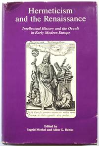
Washington: Folger Books 1988. Hard cover in very good condition with unclipped dust jacket in acceptable condition. Jacket is shelfworn; tanned with notable creasing and wear to cover edges and corners particularly to spine head with small open tears nicks and chips to edges. Light creasing to board head and spine otherwise in fine condition. Within pages are tightly bound content unmarked. CN. Hardcover. Very Good/Acceptable. Used. Folger Books Hardcover
Riferimento per il libraio : 612812 ISBN : 0918016851 9780918016850
|
|
|
Merkert, Jorn; Tannert, Christoph; Vattenfall Europe Mining & Generation (Hg)
Ronald de Bloeme - Piracy Merkert Jörn; Tannert Christoph; Vattenfall Europe Mining & Generation Hg.
KEHRER Verlag 2008. 2008. Hardcover. Ronald de Bloeme - Piracy <br/><br/>Ronald de Bloeme - Piracy Merkert Jörn; Tannert Christoph; Vattenfall Europe Mining & Generation Hg. KEHRER Verlag hardcover
Riferimento per il libraio : BN153965 ISBN : 3939583839 9783939583837
|
|
|
Merkes, J G W (Johannes Gerrit Willem).
Het beleg van Maastricht in 1579. Met geschied- en krygskundige krijgskundige aantekeningen.
Arnhem Thieme 1827. 1st Edition . Hardcover. . ~ ~ NOTE: THE PRICE OF THIS BOOK IS CURRENTLY REDUCED! ~ ~ . Duodecimo. Pp. 147. HARDCOVER bound in the original publisher's illustrated boards engraved armorial emblem to each side within decorative frame shelf tickets to spine old institutional stamps to title and prelims title bit browned boards worn faded soiled in places. In a very good condition. ~ FIRST EDITION. Not in Jordan. Preserving the extremely scarce original armorial binding very solid and still with a charm. ~ Johannes Gerrit Willem Merkes van Gendt 1798-1859. Engineer Lieutenant Colonel Knight of the Order of the Netherlands Lion Knight of the Order of the White Falcon Knight and later Officer of the Legion of Honour Knight of the Swedish Order of the Sword Knight of the Order of the Crown Württemberg. Prolific and brilliant writer he wrote extensively on military fortification engineering and fortress warfare. He died as Mayor of the City of Gendt. ~ FIRST EDITION of Merkes' "Verhandeling over het belang der vestingen voor den staat" in two volumes Brussel 1826-27 is also available by Librarium. H-2 IN <br/> <br/> Arnhem, Thieme hardcover
Riferimento per il libraio : 5534
|
|
|
Merkle, Hans L
Kultur der Wirtschaft : Betrachtungen am Rande d. Politik.
Stuttgart : Dt. Verl.-Anst., 1988. 304 S. 8°. OLwd mit Rückenschild u. SU.
Riferimento per il libraio : 19760
|
|
|
MERKUR. - PESCHKE, Hans / Joachim MORAS (Hrsg.)
Merkur. Deutsche Zeitschrift für europäisches Denken. Gesamtregister für die Jahrgänge I-XXXII. 1947-1978 (Heft 1-367).
Stuttgart:, Klett-Cotta., (1986). Gr.8°. 169 S. Original Leinwand mit Rückentitel und Deckel-Vignette. Einband leicht berieben, innen tadellos, sauber und ordentlich.
Riferimento per il libraio : 32778A
|
|
|
MERKUR. - BOHRER, Karl Heinz/ Kurt SCHEEL (Hrsg.)
Merkur. Deutsche Zeitschrift für europäisches Denken. Gesamtregister für die Jahrgänge 33-46. 1997-1992 (Heft 368-525).
Stuttgart:, Klett-Cotta., (1993). Gr.8°. 165 S. Original Leinwand mit Rückentitel und Deckel-Vignette. Einband leicht berieben, kleiner Fleck auf vorderem Deckel, innen tadellos, sauber und ordentlich.
Riferimento per il libraio : 32777A
|
|
|
MERKUR. - BOHRER, Karl Heinz/ Kurt SCHEEL (Hrsg.):
Merkur. Deutsche Zeitschrift für europäisches Denken. Gesamtregister für die Jahrgänge 33-46. 1997-1992 (Heft 368-525).
Gr.8°. 165 S. Original Leinwand mit Rückentitel und Deckel-Vignette. Einband leicht berieben, kleiner Fleck auf vorderem Deckel, innen tadellos, sauber und ordentlich.
|
|
|
MERKUR. - PESCHKE, Hans / Joachim MORAS (Hrsg.):
Merkur. Deutsche Zeitschrift für europäisches Denken. Gesamtregister für die Jahrgänge I-XXXII. 1947-1978 (Heft 1-367).
Gr.8°. 169 S. Original Leinwand mit Rückentitel und Deckel-Vignette. Einband leicht berieben, innen tadellos, sauber und ordentlich.
|
|
|
Merle d'Aubigné, J. H. (Jean Henri)
Geschichte der Reformation des sechszehnten Jahrhunderts. Band 2 und 4 (von 5 Bänden). Aus dem Französischen von Martin Runkel.
Stuttgart, J. F. Steinkopf, 1848-1850. VIII, 343, [1]; X, 414 S. Halblederbände mit geprägtem Rückentitel. 2 Bände. Exlibris, Blätter teils etwas braunfleckig, Schnitt stärker, teils angestaubt u. gebräunt. Einbände teils berieben u. an den Ecken bestossen.
Riferimento per il libraio : 32761AB
|
|
|
Merle Robert
Week-end a Zuydcoote
trad. di Almerico Ribera bross. edit. ill., firma di appartenenza
|
|
|
Merlin, Paul (1788-1864):
Promenades Alsaciennes. Par P.M. 2 Teile in einem Band mit 6 lithographierten Tafeln.
104 + VI, 134 Seiten, 1 Bl. Mit 6 lithographierten Tafeln mit Ansichten, 2 Portraits und 1 Faltkarte. Pappband der Zeit mit Rückentitel. *Sehr seltenes Werk des Pariser Schriftstellers. Es war eine wichtige Quelle für Georg Büchners Erzählung "Lenz". - Sauber und gut erhalten, vollständig mit allen Tafeln. Bücher fr
|
|
|
MERMET, GERARD.
Die Europäer, Länder, Leute, Leidenschaften.
Deutsche EA. Mit zahlreichen Karten, Tabellen und Abbildungen.
|
|
|
MERRITT Giles
Quoi de neuf ? l'Est ? Des enjeux pour les managers europ?ens. Photos hors texte.
Broch?. 253 pages.
|
|
|
MERRUAU Paul
Les marines secondaires de la Baltique et de la mer du nord
- Revue des deux mondes, Paris 1877, 15,5x25cm, agrafé. - Extrait de la Revue des deux mondes. Edition originale. Sous couverture muette. Rare. [ENGLISH DESCRIPTION ON DEMAND]
|
|
|
Merry E. Wiesner
Le donne nell'Europa moderna 1500-1750
PBE 233 <BR>ISBN 9788806155599
|
|
|
Merseburger, Georg (Hrsg.)
Leipziger Kalender. Illustriertes Jahrbuch und Chronik. 9. Jahrgang.
Leipzig, Richter, 1912. 307, 76 S. Anzeigen. Mit zahlreichen Abbildungen. Illustr. OLwd.
Riferimento per il libraio : 9878AB
|
|
|
Mersey Tunnel Joint Committee
The Story of the Mersey Tunnel : Officially named Queensway
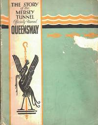
Liverpool: Charles Birchill & Sons Ltd 1934. No marks or inscriptions to contents. Creasing to covers. Clean tight pages with slightly ink marked well rubbed boards and spine and with some tears to covers and spine ends. 30 pages of advertisements plus 110pp. Published to celebrate the opening of the Mersey Tunnel in 1934 by His Majesty King George V whose full page photograph opens the book. With photographs of the engineering works and construction processes plans and the persons involved in designing and commissioning the project. Scarce. First Edition. Soft Cover. Fair. 13 x 10 inches. Charles Birchill & Sons Ltd Paperback
Riferimento per il libraio : 027228
|
|
|
Merten, Elke W
ZWEI HERRSCHERFESTE IN DER HISTORIA AUGUSTA; Untersuchungen Zu Den Pompae Der Kaiser Gallienus Und Aurelianus
Rudolf Habelt Verlag. 1968. Hardcover. Very Good in No Dust Jacket dust jacket. Very minor shelfwear. Very light bump to base of spine.; Contents: Kapitel I: Die Decennalienfeier des Gallienus.; Kapitel II: Die Pompa triumphalis des Kaisers Aurelianus.; Antiquitas 4 Band 5; 163 pages . Rudolf Habelt Verlag hardcover
Riferimento per il libraio : 9816
|
|
|
Mertins, Günter (Hrsg.)
Untersuchungen zur spanischen Arbeitsmigration. (= Marburger Geographische Schriften, Bd. 95).
Selbstverlag des Geographischen Instituts der Universität, Marburg 1984. 214 Seiten mit zahlreichen Abbildungen und Falttafeln, Groß 8°, Original-Karton (Softcover), Name auf Vortitel, insgesamt gutes und innen sauberes Exemplar,
Riferimento per il libraio : 55737
|
|
|
Merula, Paul
Cosmographia generalis libris tres: Item geographiae particularis libri quatuor: Quibus Europa in genere; speciatim Hispania, Gallia, Italia, describuntur.
Amsterdam, Hondius, 1621 (Am Ende: Elzevier für Hondius, 1620). 6 Bll., 1075 (recte 1065) S., 1 Kupfertitel mit 57 kleinen Kupferstichkarten im Text und 1 Textholzschnitt. 4°. Blindgeprägtes Schweinsleder der Zeit (stark bestoßen, beschabt und etw. verzogen, Schließbänder fehlen). [5 Warenabbildungen]
Riferimento per il libraio : 546
|
|
|
Merz, John Theodore
A History of European Thought in the Nineteenth Century: Vol. I
No dust jacket. Hardcover. Gilt lettering on spine. Boards are a little worn and rubbed. Boards have two or three light stains and surface marks. Spine ends are worn, rubbed and bumped. Leading corners are worn, bumped and frayed. Considerable age - spotting on page block. Minor liquid staining to inner corners of front pastedown, front endpaper and first few pages. Moderate age - spotting on first and last few pages. Light liquid staining on lower edges of several pages near end of book. Binding is sound, pages are tight and text is clear throughout. AF Used
|
|
|
Mesterhazi, Lajos
Budapest Anno
Corvina 1984 In-4 reliure éd. sous jaquette 30,5 cm sur 24,3. ATTENTION: jaquette effrangée en tête et pied du dos. Jaquette en état moyen. Bon état d’occasion.
Riferimento per il libraio : 117120
|
|
|
Meschi, Alfredo - Farulli, Ilaria
100 Modi Per Cambiare Vita Ed Essere Felici
Mm 115x165 Brossura editoriale di 225 pagine, copertina figurata,ottimo stato. Spedizione entreo 24 ore dalla conferma dell'ordine.
|
|
|