|
|
|
ZIZEK Slavoj,
Que veut l'Europe? Réflexions sur une nécessaire réappropriation,
Flammarion, Champs, 2007, 198 pp., poche, bon état.
Bookseller reference : 35277

|
|
|
Zlamal, Miloslav
The Partisan Captain
Hamilton ON: Miloslav Zlamal 1970 Book. Fine. Hardcover. Inscribed by Authors. 1st Can Ed. Preface by Stanley Burke " An autobiographical novel. a moving book about war and love and hatred and brutality It is however much more than a good story well told because it is in fact an historical document giving behind-the-scenes information on the communist seizure of power in Czechoslovakia told by a man who was there. 320p.Author inscription on title page else as new . Miloslav Zlamal hardcover
Bookseller reference : 046001
|
|
|
ZMIGRODSKI M. de.
Le folk-lore polonais, Cracovie et ses environs
- La tradition, Paris 1890, 16x25cm, broché. - Tiré à part du tome IV de la tradition. Petits manques marginaux affectant les plats de couverture. [ENGLISH DESCRIPTION ON DEMAND]
|
|
|
Znidarsic, Joco
Bohinj / Einleitungsessay Janez Milcinski. Bildunterschriften Zeljko Kozinc.
Ljubljana : Drza vna Zalozba Slovenije, 1986. [167] S. Überw. Ill. 4°. OLwd mit Blind- u. Weißpräg. u. SU (Reihe "Slowenien")
Bookseller reference : 5333
|
|
|
Zoege von Manteuffel, Claus (Hg.)
Baden und Württemberg im Zeitalter Napoleons. Bd. 1,1. Katalog. 1. Band (von 3 Bänden).
Stuttgart : Ed. Cantz, 1987. 504 S.; zahlr. Abb. Fadengehefteter Originalpappband.
Bookseller reference : 1022543

|
|
|
Zoesi, Henrici
Commentarius ad Digestorum seu Pandectarum Juris Civilus Libros .
Lovanii Leuven: Hieronymi Nempæ. G : in good condition. Cover rubbed and soiled with wera to lower spine. 1667. First Edition. Cream hardback vellum cover. 320mm x 210mm 13" x 8". viii 1000pp xxx. Heavy item - shipping supplement may apply for overseas. . Hieronymi Nempæ hardcover
Bookseller reference : k3943

|
|
|
ZOLA EMILE
Europe 83-84
Paris, nov./déc. 1952 14 x 23, 252 pp., quelques illustrations photo. N/B, non coupé, broché, bon état
Bookseller reference : 1859
|
|
|
Zollner (Erich)
Histoire de l’Autriche. des origines à nos jours
Horvath 1966 Traduit du par M. Berger et M. Flecher. In-8 cartonnage éditeur sous jaquette illustrée. Jaquette un peu fendillée en tête, sinon intérieur frais. 730 pages. Poids sans emballage : 1430 grammes.
Bookseller reference : 54147
|
|
|
Zola Emile
Al paradiso delle signore
trad. di Ferdinando Martini e Guido Mazzoni n. 237-239 in 16°, cartone edit. con titoli al piatto e al dorso entro tasselli oro

|
|
|
Zola Emile
L'assommoir
trad. di L.G. Tenconi n. 2053-2057 in 16°, bross. edit. con titoli

|
|
|
Zola Emile
Lavoro
bross. edit. con titoli entro cornice, rotture restaurate in cop., minime fioriture

|
|
|
Zola Emile
Nanà
trad. di U. Caimpenta bross. edit. ill., lieve piega in cop., firma di appartenenza

|
|
|
Zola Emile
Nanà
trad. di Maria Bellonci n. 5 in 16°, bross. edit. ill.

|
|
|
Zola Emile - Ruocco G.G.
Io accuso - Storia del processo Dreyfus Saggio introduttivo di Vincenzo Vitale
in 16°, bross. edit. ill. con bandelle, fioriture, firma di appartenenza

|
|
|
Zola, Emile
MRIYA [THE DREAM]
Original Wrappers. 8vo. 192 pages. 23 cm. In Ukrainian. Emile Zolaâs sixteenth novel from the Rougon-Macquart series. Zolaâs work was sporadically translated into Ukrainian in the late 19th century, but his entire works were first published in Ukrainian between 1929-1930 in Kiev. This particular edition, presumably by the same translator, was published by the active Ukrainian Publishing Co. Of Canada, and includes advertisements on the inside and back covers sponsored by the Winnipeg based Ukrainian language newspaper âThe Ukrainan Voice.  Subjects: French fiction -- 19th century -- Translations into Ukrainian. OCLC lists 9 copies worldwide. Light age wear and age toning. ½ inch piece missing from top of backstrip. Some shelf wear. Front hinge loose. Very good condition. (UKR-1-25)

|
|
|
ZOLI Corrado -
Modificazioni in corso alla carta politica dell'Europa.
Roma, 1939, 8vo stralcio con copertina posticcia muta, pp. 801/814 con sette cartine. - !! ATTENZIONE !!: Con il termine estratto (o stralcio) intendiamo riferirci ad un fascicolo contenente un articolo, completo in se, sia che esso sia stato stampato a parte utilizzando la stessa composizione sia che provenga direttamente da una rivista. Le pagine sono indicate come "da/a", ad esempio: 229/231 significa che il testo è composto da tre pagine. Quando la rivista di provenienza non viene indicata é perché ci è sconosciuta. - !! ATTENTION !!: : NOT A BOOK : “extract” or “excerpt” means simply a few pages, original nonetheless, printed in a magazine. Pages are indicated as in "from” “to", for example: 229/231 means the text comprises three pages (229, 230 and 231). If the magazine that contained the pages is not mentioned, it is because it is unknown to us.

|
|
|
Zoli, Sergio
L'Europa Libertina. Bibliografia Generale
Mm 170x245 Volume cartonato rigido di pagine 487, sovraccoperta figurata. Pari al nuovo. Spedizione in 24 ore dalla conferma dell'ordine.

|
|
|
Zoller, Franz Carl:
Geschichte und Denkwürdigkeiten der Stadt Innsbruck und der umliegenden Gegend von den ältesten Zeiten bis zur Erlöschung der österreichisch-tirolischen Linie mit Erzherzog Sigmund Franz. Mit einer illuminirten Karte.
XII + 387 Seiten, 1 Faltkarte.19 x 11 cm. Schlichter kartonierter Interuimseinband. *Die grenzkolorierte Karte betitelt: "Reis Route des Venantius Fortunatus von Augsburg durch Rhaetien nach Agunt im Noricum". - Leicht gebräunt. Bücher de
|
|
|
Zonneveld, I.S
De Brabantse Biesbosch. Een studie van bodem en vegetatie van zoetwatergetijdendelta. A Study of Soil and Vegetation of a Freshwater Tidal Delta. Volume A: English Summary with text Fgures and Tables; Volume B: Dutch Text; Volume C: Appendices. (= Mededelingen van de Stichting voor Bodemkartering / Bodemkundige Studies, No. 4). 3 Volumes, (3 Bände),
STIBOKA (Stichting voor Bodemkartering), Wageningen 1960. 210 S. mit zahlreichen Abbildungen - 396 S. - 17 mehrfach gefaltete Tafeln (mit Tabellen) und Karten, Groß 8°, Original-Karton (Softcover), Vorsatz mit Namensstempel, insgesamt gutes und innen sauberes Exemplar mit allen Beilagen,
Bookseller reference : 70953

|
|
|
Zoppi Giuseppe.
LA SVIZZERA. Unità e diversità d'un paese.
(Codice SV/0148) In 8° 34 pp. La Svizzera degli anni '30 illustrata con 32 foto in nero, 4 tavole a colori e 2 cartine. Stralcio brossurato. ~~~ SPEDIZIONE IN ITALIA SEMPRE TRACCIATA

|
|
|
Zoppi, Mariella, Massimo Gregorini
Paesaggio in Toscana : il più umano di questi mondi.
Firenze : Consulenza e Servizi per il Territorio, c 2012. 183 S. : überw. Ill. 4°. Ill. orig. engl. Broschur.
Bookseller reference : 34548
|
|
|
ZORGBIBE Charles
L'insécurité européenne.
Couverture souple. Broché. 128 pages.
Bookseller reference : 126780

|
|
|
ZORGBIBE Charles
L'insécurité européenne.
Couverture souple. Broché. 128 pages.
Bookseller reference : 126781

|
|
|
ZORGBIBE Charles
L'insécurité européenne.
Couverture souple. Broché. 128 pages.
Bookseller reference : 133073

|
|
|
Zoran Drvenkar
Sorry
cartone edit. con sovrac. ill. - prima edizione it. - trad. di Vincenzo Gallico, Fabio Lucaferri, Violeta Marotta

|
|
|
ZORGBIBE Charles
L'INSECURITE EUROPEENNE
PUF Que Sais Je ? 1974, In-12 broché, 127 pages. Bon état.
|
|
|
Zorjana, E [ Edward Sedlaczek ]
Dwaj bracia : powies´c z dziejów starozytnej Grecji
Warszawa: G. Centnerszwer 1899. First edition. Good. . 12mo; 70 67 77 54 pages quarter leather black cloth; bookplate and rubber stamp of the Biblioteki Polskiej South Bend IN. <br/><br/>The only copy on OCLC is in Poland. Sedlaczek's work concerns the 1410 Battle of Tannenberg Grunwald. Bound with SYN KMIECY by Teresa Jadwigi / Jadwiga Teresa Papi. Warszawa 1897 Fiction. First published Chicago 1892. Bound with Zorjana E. W WALCE Z PHOANCAMI. Warszawa 1900. 1st Ed. OCLC lists only 1927 edition. Bound with SPRAWA O WOZ CZYLI. By Wiktor Olszewski. Warszawa 1901. This edition not cited on OCLC however OCLC credits a 1913 edition to Mieczyslaw. Brzezinski . G. Centnerszwer hardcover
Bookseller reference : 0009259
|
|
|
Zorn, Michael
Zwischen Strom und Steppe : e. Theißfischer-Roman.
Berlin : Wegweiser Verlag (Volksverb. d. Bücherfreunde), 1937. 348 S. Mit 8 Abb. in Kupfertiefdr. 8°. OHLdr. mit Rückengoldpräg., ill. Einband, Kopfbuntschnitt u. Lesebändchen.
Bookseller reference : 42011
|
|
|
Zorzi Renzo (direttore)
Comunità. Rivista mensile di informazione culturale fondata da Adriano Olivetti. Anno xix, N. 127, febbraio 1965
<p>24 cm, brossura illustrata; p. (6), 98. Numerose ill. in nero nel testo. Scritti di: Levi, Sandri. Numero completamente dedicato all' Europa. Abrasione alla seconda copertina.</p>

|
|
|
Zorzi, Giongiorgio und Andrea Palladio
Le chiese e i ponti di Andrea Palladio.
Vincenza, Neri Pozza. 1967. 4°. 4 Bl., 294 S., 273 Abb. auf Tafeln, mit Schutzumschlag gebundene Ausgabe, Leinen im Schuber, Exemplar in gutem Erhaltungszustand
Bookseller reference : 49467

|
|
|
Zorzi, Giongiorgio und Andrea Palladio
Le opere pubbliche e i palazzi privati di Andrea Palladio
Vincenza, Neri Pozza. 1965. 4°. 6 Bl., 373 S., 12 Tafeln Grundrisse, und 385 Abb. auf ca. 150 Tafeln, mit Schutzumschlag gebundene Ausgabe, Leinen, im Schuber, Exemplar in gutem Erhaltungszustand
Bookseller reference : 49466

|
|
|
Zorzi, Giongiorgio und Andrea Palladio
Le ville e i teatri di Andrea Palladio. 514 illustrazioni in nero, 8 tavole a colori, 18 planimetrie. Opere di Giangiorgio Zorzi su Andrea Palladio,
Vicenza, Neri Pozza 1969. Folio. 353 S. und 514 Tafel, mit Schutzumschlag gebundene Ausgabe, Hardcover/Pappeinband, mit Schuber, Schuber oben lose, sonst Exemplar in gutem Erhaltungszustand
Bookseller reference : 49465

|
|
|
Zschackwitz, J. E
Historisch=Genealogischer Schau = Platz/ Auf welchem so wohl Des Durchlauchtigsten ErtzHertzoglichen Hauses Oesterreichs/ Als auch Der weltlichen Chur= und alten Fuerstlichen Haeuser Genealogien ... vorgestellet... Auch Zur Erleuterung der Historie/ Und des Juris Publici...
Lemgo, Meyers, 1724. 8°. 18 Bll., 508 S., 8 Bll. und 4 gefalt. Tabellen. Pergamentband der Zeit.
Bookseller reference : 7882A
|
|
|
ZSCHOKKE F.
Die romanischen glasgemalde des Strassburger Munsters
in 4°; pp. 222 (ill. bn. e col.); leg. Testo in tedesco

|
|
|
Zschokke H.
Histoire de la Suisse – traduite de l'Allemand par J.L. Magnet – 4 vol. - svizzera
Ottima copia
|
|
|
Zschokke, H
Des Schweizerlandes Geschichte f. d. Schweizervolk. 5. Aufl.
Aarau, Sauerländer, 1834. 243 S. Pp. d. Zt.
Bookseller reference : 810174
|
|
|
Zschokke, H
Die klassischen Stellen der Schweiz und deren Hauptorte in Originalansichten dargestellt. Erste Abtheilung.
Karlsruhe u. Leipzig, Kunstvlg. 1842. Mit 46 Stahlstich. 214 S. HLederbd. 22x14 cm.
Bookseller reference : 3088
|
|
|
Zschokke, Heinrich
Alamontade.
London, Taylor, 1826. Oktav. 98 Seiten. Pappband der Zeit. Die Versandkosten für Kunstwerke und mehrbändige Werke können von den Standard-Versandkosten abweichen. Rücken ergänzt, durchgehend stockfleckig.
Bookseller reference : 15833CB
|
|
|
ZSCHOKKE, Heinrich
Wanderungen durch die Schweiz u. deren Hauptorte ... 2 Bde. (Nachdruck der Ausgabe Karlsruhe 1836-38).
Hildesheim: Olms 1976. zus. 423 S., zahlr. Taf. Kart.mS:
Bookseller reference : 20729
|
|
|
Zschokke, Heinrich (Text)
Die klassischen Stellen der Schweiz und deren Hauptorte in Originalansichten dargestellt, gezeichnet von Gust. Adolph Müller, auf Stahl gestochen von Henry Winkles und den besten englischen Künstlern. Mit Erläuterungen von Heinrich Zschokke. 2 Abtheilungen in 1 Band.
Karlsruhe und Leipzig, Kunst-Verlag, 1836-1838. 2 S., Seiten 1-376 (Teil 2 ohne Titelei, Register u. S. 377-423 = Schluss) mit 76 (statt 85) Stahlstichen (Teil 1 ohne den gestochenen Titel). Halbleder der Zeit mit Rücken-Goldprägung. Titelei, Vorsätze, äusserste Ränder u. wenige Blätter teils etwas braunfleckig. Einband mit Feuchtigkeitsspuren: Bezug beschabt, stockfleckig u. mit kurzen Einrissen, Ecken u. -kanten teils bestossen bzw. berieben. Rücken leicht beschabt, Rückenprägung be
Bookseller reference : 13371AB

|
|
|
Zschokke, Heinrich.:
Des Schweizerlands Geschichte für das Schweizervolk. 2., verbesserte Original-Auflage.
1 Bl., 335 S. Schlichter Pappband d. Zt. Rücken verblasst. *Vgl. Goed. X, 99, 87. Slg. Borst 1413. Barth 10268. - Die Aufsätze zur Schweiz Geschichte erschienen zuerst im "Schweizerboten" 1820f. - Stempel der Bibl. Fürstenberg auf Titel. Bücher de
|
|
|
Zsuzsanna Papp Reed
Matthew Paris on the Mongol Invasion in Europe
, Brepols, 2022 Hardback, 469 pages, Size:156 x 234 mm, Illustrations:12 b/w, 1 col., 2 tables b/w., Language(s):English, Latin. ISBN 9782503595528.
Bookseller reference : 64580
|
|
|
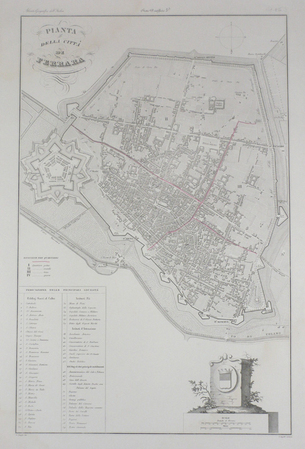
ZUCCAGNI ORLANDINI (Attilio);
[FERRARA] Pianta della città di Ferrara.
circa 1850 525 x 340 mm.
Bookseller reference : LBW03595
|
|
|
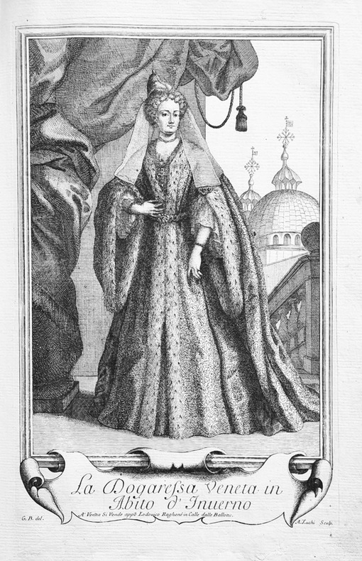
ZUCHI (Andrea) — BALDUINO (Giacomo).
Imagini degl'abiti con cui Va uestita la Nobiltà della Serenis.ma Republica di Venezia.
Venezia, Ragheno, 1702. In-folio, vélin rigide, étiquette de maroquin rouge recollée sur le plat supérieurportant l’inscription «M. de Souzy» (reliure de l’époque).
Bookseller reference : LBW-7981
|
|
|
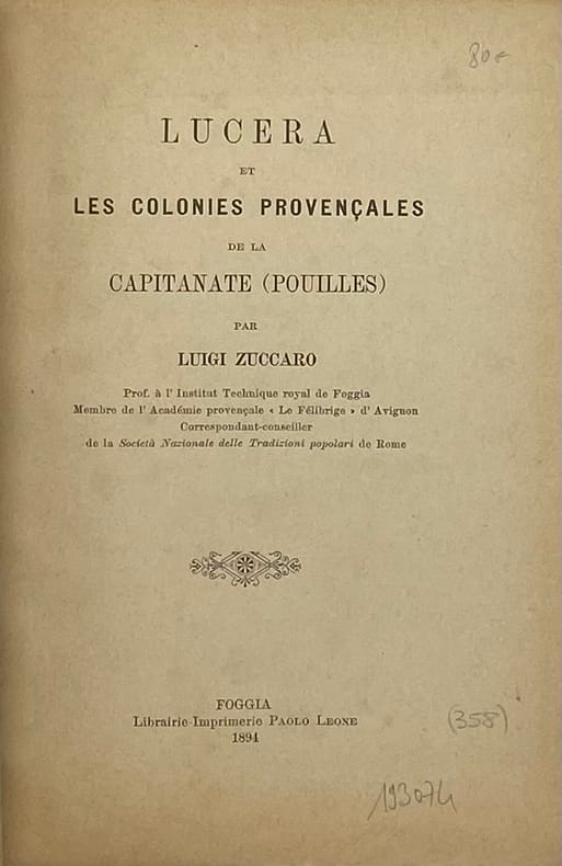
ZUCCARO (Luigi)
Lucera et les colonies provençales de la Capitanate (Pouilles).
Foggia, Leone, 1894 petit in-8, 93 pp., 2 planches, carte dépliante en couleurs, broché.
Bookseller reference : 193074
|
|
|
Zucca, Lorenzo
A Secular Europe: Law and Religion in the European Constitutional Landscape
Oxford University Press 2012. This is an ex-library book and may have the usual library/used-book markings inside.This book has hardback covers. In good all round condition. No dust jacket. Library sticker on front cover. Please note the Image in this listing is a stock photo and may not match the covers of the actual item550grams ISBN:9780199592784 Oxford University Press hardcover
Bookseller reference : 9794850 ISBN : 0199592780 9780199592784

|
|
|
ZUCCAGNI ORLANDINI Attilio (Fiesole 1784 - Firenze 1872)
Abbadia di Altacomba in Savoja
Veduta pubblicata nel noto Atlante illustrativo, ossia Raccolta dei principali monumenti italiani antichi, del Medio evo e moderni, e di alcune vedute pittoriche… di Attilio Zuccagni-Orlandini, edito in 3 tomi nel 1845 a Firenze, per servire di corredo alla Corografia fisica, storica e statistica dell'Italia…, opera in 12 volumi, pubblicati dal 1837 al 1845, corredata - oltre che dall'Atlante illustrativo sopra descritto - anche da un Atlante geografico degli Stati italiani, in due tomi. Attilio Zuccagni Orlandini (1784-1872) nacque a Fiesole con il nome di Giuseppe Orlandini. In seguito all’adozione da parte del facoltoso zio materno Attilio Zuccagni (1754-1807), botanico e georgofilo, assunse il nome di Attilio Zuccagni Orlandini. La sua più importante opera è la relazione geografico-cartografica di tutti gli Stati preunitari italiani, la grandiosa Corografia fisica, storica e statistica dell’Italia e delle sue Isole (Firenze 1835-1845), in dodici volumi per diciannove tomi, con un volume introduttivo sull’intera penisola italiana. L’opera costituì la summa delle centinaia di opere geografiche generali, regionali e locali allora disponibili e presentava, per ogni Stato preunitario, la trattazione fisica, storica, topografica e un inquadramento statistico. Nel 1844-45, la Corografia fu arricchita con cinque volumi di cartografie, vedute e altre illustrazioni di luoghi e monumenti: Atlante geografico degli Stati italiani delineato sopra le migliori e più moderne mappe (due volumi con 144 tavole inclusa la grande carta della penisola in 15 fogli) e Atlante illustrativo ossia raccolta dei principali monumenti italiani antichi, del medio evo e moderni e di alcune vedute pittoriche (tre volumi con 413 illustrazioni, stampate su 269 fogli). Le tavole furono incise, sempre a Firenze, in due apposite officine, da quattro valenti artisti lombardi (Vittorio Angeli, Giacinto Maina, Pietro Manzoni e Giuseppe Pozzi). Soprattutto il primo dei due atlanti rappresenta, ancora oggi, una pietra miliare nella storia della cartografia e dell’iconografia geografica italiana. Fu veramente ‘un’ardua impresa’, dal momento che spesso mancavano ancora (come, ad esempio, per il Ducato di Lucca e lo Stato Pontificio) prodotti cartografici compiutamente geometrici. I due prodotti furono presentati ai Georgofili nel 1843 e nel 1844, insieme alla mappa della Repubblica di San Marino. L’opera si rivelò oltremodo costosa e non ottenne il successo commerciale sperato, ma servì da base per tante altre iniziative editoriali successive che vi attinsero, talora senza neppure rispettarne i diritti d’autore. Incisione su rame all'acquaforte, in ottimo stato di conservazione. Bibliografia: Anna Guarducci - Dizionario Biografico degli Italiani - Volume 100 (2020). View published in the famous Atlante illustrativo, ossia Raccolta dei principali monumenti italiani antichi, del Medio evo e moderni, e di alcune vedute pittoriche... di Attilio Zuccagni-Orlandini, published in 3 volumes in Florence, 1845, to accompany the Corografia fisica, storica e statistica dell'Italia..., a work in 12 volumes, published from 1837 to 1845, accompanied - in addition to the Atlante illustrativo described above - also by a Atlante geografico degli Stati italiani, in two volumes. Attilio Zuccagni Orlandini (1784-1872) was born in Fiesole under the name of Giuseppe Orlandini. Following adoption by his wealthy maternal uncle Attilio Zuccagni (1754-1807), a botanist and georgofile, he took the name Attilio Zuccagni Orlandini. His most important work is the geographic-cartographic report of all the pre-unification Italian states, the great Corografia fisica, storica e statistica dell'Italia e delle sue Isole (Florence 1835-1845), in twelve volumes for nineteen tomes, with an introductory volume on the entire Italian peninsula. The work constituted the sum of hundreds of general, regional and local geographic works then available and presented, for each pre-unification state, the physical, historical, topographical and statistical framework. In 1844-45, the Corografia was enriched with five volumes of maps, views and other illustrations of places and monuments: Atlante geografico degli Stati italiani delineato sopra le migliori e più moderne mappe (two volumes with 144 plates including the large map of the peninsula in 15 sheets) and Atlante illustrativo ossia raccolta dei principali monumenti italiani antichi, del medio evo e moderni e di alcune vedute pittoriche (three volumes with 413 illustrations, printed on 269 sheets). The plates were engraved, again in Florence, in two special workshops, by four talented Lombard artists (Vittorio Angeli, Giacinto Maina, Pietro Manzoni and Giuseppe Pozzi). Especially the first of the two atlases represents, even today, a milestone in the history of cartography and Italian geographic iconography. It was truly 'an arduous undertaking', since cartographic products were often still lacking (as, for example, for the Duchy of Lucca and the Papal States) fully geometric. The two products were presented to the Georgofili in 1843 and 1844, along with the map of the Republic of San Marino. The work proved to be very expensive and did not achieve the commercial success hoped for, but served as a basis for many other subsequent publishing initiatives that drew on it, sometimes without even respecting the copyright. Etching, in excellent condition. Literature: Anna Guarducci - Dizionario Biografico degli Italiani - Volume 100 (2020).

|
|
|
ZUCCAGNI ORLANDINI Attilio (Fiesole 1784 - Firenze 1872)
Anfiteatro di Cimella
Veduta pubblicata nel noto Atlante illustrativo, ossia Raccolta dei principali monumenti italiani antichi, del Medio evo e moderni, e di alcune vedute pittoriche… di Attilio Zuccagni-Orlandini, edito in 3 tomi nel 1845 a Firenze, per servire di corredo alla Corografia fisica, storica e statistica dell'Italia…, opera in 12 volumi, pubblicati dal 1837 al 1845, corredata - oltre che dall'Atlante illustrativo sopra descritto - anche da un Atlante geografico degli Stati italiani, in due tomi. Incisione su rame all'acquaforte, in ottimo stato di conservazione. View published in the famous Atlante illustrativo, ossia Raccolta dei principali monumenti italiani antichi, del Medio evo e moderni, e di alcune vedute pittoriche... di Attilio Zuccagni-Orlandini, published in 3 volumes in Florence, 1845, to accompany the Corografia fisica, storica e statistica dell'Italia..., a work in 12 volumes, published from 1837 to 1845, accompanied - in addition to the Atlante illustrativo described above - also by a Atlante geografico degli Stati italiani, in two volumes. Etching, in excellent condition.

|
|
|
ZUCCAGNI ORLANDINI Attilio (Fiesole 1784 - Firenze 1872)
Gole Montuose presso la Scarena
Veduta pubblicata nel noto Atlante illustrativo, ossia Raccolta dei principali monumenti italiani antichi, del Medio evo e moderni, e di alcune vedute pittoriche… di Attilio Zuccagni-Orlandini, edito in 3 tomi nel 1845 a Firenze, per servire di corredo alla Corografia fisica, storica e statistica dell'Italia…, opera in 12 volumi, pubblicati dal 1837 al 1845, corredata - oltre che dall'Atlante illustrativo sopra descritto - anche da un Atlante geografico degli Stati italiani, in due tomi. Attilio Zuccagni Orlandini (1784-1872) nacque a Fiesole con il nome di Giuseppe Orlandini. In seguito all’adozione da parte del facoltoso zio materno Attilio Zuccagni (1754-1807), botanico e georgofilo, assunse il nome di Attilio Zuccagni Orlandini. La sua più importante opera è la relazione geografico-cartografica di tutti gli Stati preunitari italiani, la grandiosa Corografia fisica, storica e statistica dell’Italia e delle sue Isole (Firenze 1835-1845), in dodici volumi per diciannove tomi, con un volume introduttivo sull’intera penisola italiana. L’opera costituì la summa delle centinaia di opere geografiche generali, regionali e locali allora disponibili e presentava, per ogni Stato preunitario, la trattazione fisica, storica, topografica e un inquadramento statistico. Nel 1844-45, la Corografia fu arricchita con cinque volumi di cartografie, vedute e altre illustrazioni di luoghi e monumenti: Atlante geografico degli Stati italiani delineato sopra le migliori e più moderne mappe (due volumi con 144 tavole inclusa la grande carta della penisola in 15 fogli) e Atlante illustrativo ossia raccolta dei principali monumenti italiani antichi, del medio evo e moderni e di alcune vedute pittoriche (tre volumi con 413 illustrazioni, stampate su 269 fogli). Le tavole furono incise, sempre a Firenze, in due apposite officine, da quattro valenti artisti lombardi (Vittorio Angeli, Giacinto Maina, Pietro Manzoni e Giuseppe Pozzi). Soprattutto il primo dei due atlanti rappresenta, ancora oggi, una pietra miliare nella storia della cartografia e dell’iconografia geografica italiana. Fu veramente ‘un’ardua impresa’, dal momento che spesso mancavano ancora (come, ad esempio, per il Ducato di Lucca e lo Stato Pontificio) prodotti cartografici compiutamente geometrici. I due prodotti furono presentati ai Georgofili nel 1843 e nel 1844, insieme alla mappa della Repubblica di San Marino. L’opera si rivelò oltremodo costosa e non ottenne il successo commerciale sperato, ma servì da base per tante altre iniziative editoriali successive che vi attinsero, talora senza neppure rispettarne i diritti d’autore. Incisione su rame all'acquaforte, in ottimo stato di conservazione. Bibliografia: Anna Guarducci - Dizionario Biografico degli Italiani - Volume 100 (2020). View published in the famous Atlante illustrativo, ossia Raccolta dei principali monumenti italiani antichi, del Medio evo e moderni, e di alcune vedute pittoriche... di Attilio Zuccagni-Orlandini, published in 3 volumes in Florence, 1845, to accompany the Corografia fisica, storica e statistica dell'Italia..., a work in 12 volumes, published from 1837 to 1845, accompanied - in addition to the Atlante illustrativo described above - also by a Atlante geografico degli Stati italiani, in two volumes. Attilio Zuccagni Orlandini (1784-1872) was born in Fiesole under the name of Giuseppe Orlandini. Following adoption by his wealthy maternal uncle Attilio Zuccagni (1754-1807), a botanist and georgofile, he took the name Attilio Zuccagni Orlandini. His most important work is the geographic-cartographic report of all the pre-unification Italian states, the great Corografia fisica, storica e statistica dell'Italia e delle sue Isole (Florence 1835-1845), in twelve volumes for nineteen tomes, with an introductory volume on the entire Italian peninsula. The work constituted the sum of hundreds of general, regional and local geographic works then available and presented, for each pre-unification state, the physical, historical, topographical and statistical framework. In 1844-45, the Corografia was enriched with five volumes of maps, views and other illustrations of places and monuments: Atlante geografico degli Stati italiani delineato sopra le migliori e più moderne mappe (two volumes with 144 plates including the large map of the peninsula in 15 sheets) and Atlante illustrativo ossia raccolta dei principali monumenti italiani antichi, del medio evo e moderni e di alcune vedute pittoriche (three volumes with 413 illustrations, printed on 269 sheets). The plates were engraved, again in Florence, in two special workshops, by four talented Lombard artists (Vittorio Angeli, Giacinto Maina, Pietro Manzoni and Giuseppe Pozzi). Especially the first of the two atlases represents, even today, a milestone in the history of cartography and Italian geographic iconography. It was truly 'an arduous undertaking', since cartographic products were often still lacking (as, for example, for the Duchy of Lucca and the Papal States) fully geometric. The two products were presented to the Georgofili in 1843 and 1844, along with the map of the Republic of San Marino. The work proved to be very expensive and did not achieve the commercial success hoped for, but served as a basis for many other subsequent publishing initiatives that drew on it, sometimes without even respecting the copyright. Etching, in excellent condition. Literature: Anna Guarducci - Dizionario Biografico degli Italiani - Volume 100 (2020).

|
|
|
ZUCCAGNI ORLANDINI Attilio (Fiesole 1784 - Firenze 1872)
Ingresso del Porto di Nizza
Veduta pubblicata nel noto Atlante illustrativo, ossia Raccolta dei principali monumenti italiani antichi, del Medio evo e moderni, e di alcune vedute pittoriche… di Attilio Zuccagni-Orlandini, edito in 3 tomi nel 1845 a Firenze, per servire di corredo alla Corografia fisica, storica e statistica dell'Italia…, opera in 12 volumi, pubblicati dal 1837 al 1845, corredata - oltre che dall'Atlante illustrativo sopra descritto - anche da un Atlante geografico degli Stati italiani, in due tomi. Attilio Zuccagni Orlandini (1784-1872) nacque a Fiesole con il nome di Giuseppe Orlandini. In seguito all’adozione da parte del facoltoso zio materno Attilio Zuccagni (1754-1807), botanico e georgofilo, assunse il nome di Attilio Zuccagni Orlandini. La sua più importante opera è la relazione geografico-cartografica di tutti gli Stati preunitari italiani, la grandiosa Corografia fisica, storica e statistica dell’Italia e delle sue Isole (Firenze 1835-1845), in dodici volumi per diciannove tomi, con un volume introduttivo sull’intera penisola italiana. L’opera costituì la summa delle centinaia di opere geografiche generali, regionali e locali allora disponibili e presentava, per ogni Stato preunitario, la trattazione fisica, storica, topografica e un inquadramento statistico. Nel 1844-45, la Corografia fu arricchita con cinque volumi di cartografie, vedute e altre illustrazioni di luoghi e monumenti: Atlante geografico degli Stati italiani delineato sopra le migliori e più moderne mappe (due volumi con 144 tavole inclusa la grande carta della penisola in 15 fogli) e Atlante illustrativo ossia raccolta dei principali monumenti italiani antichi, del medio evo e moderni e di alcune vedute pittoriche (tre volumi con 413 illustrazioni, stampate su 269 fogli). Le tavole furono incise, sempre a Firenze, in due apposite officine, da quattro valenti artisti lombardi (Vittorio Angeli, Giacinto Maina, Pietro Manzoni e Giuseppe Pozzi). Soprattutto il primo dei due atlanti rappresenta, ancora oggi, una pietra miliare nella storia della cartografia e dell’iconografia geografica italiana. Fu veramente ‘un’ardua impresa’, dal momento che spesso mancavano ancora (come, ad esempio, per il Ducato di Lucca e lo Stato Pontificio) prodotti cartografici compiutamente geometrici. I due prodotti furono presentati ai Georgofili nel 1843 e nel 1844, insieme alla mappa della Repubblica di San Marino. L’opera si rivelò oltremodo costosa e non ottenne il successo commerciale sperato, ma servì da base per tante altre iniziative editoriali successive che vi attinsero, talora senza neppure rispettarne i diritti d’autore. Incisione su rame all'acquaforte, in ottimo stato di conservazione. Bibliografia: Anna Guarducci - Dizionario Biografico degli Italiani - Volume 100 (2020). View published in the famous Atlante illustrativo, ossia Raccolta dei principali monumenti italiani antichi, del Medio evo e moderni, e di alcune vedute pittoriche... di Attilio Zuccagni-Orlandini, published in 3 volumes in Florence, 1845, to accompany the Corografia fisica, storica e statistica dell'Italia..., a work in 12 volumes, published from 1837 to 1845, accompanied - in addition to the Atlante illustrativo described above - also by a Atlante geografico degli Stati italiani, in two volumes. Attilio Zuccagni Orlandini (1784-1872) was born in Fiesole under the name of Giuseppe Orlandini. Following adoption by his wealthy maternal uncle Attilio Zuccagni (1754-1807), a botanist and georgofile, he took the name Attilio Zuccagni Orlandini. His most important work is the geographic-cartographic report of all the pre-unification Italian states, the great Corografia fisica, storica e statistica dell'Italia e delle sue Isole (Florence 1835-1845), in twelve volumes for nineteen tomes, with an introductory volume on the entire Italian peninsula. The work constituted the sum of hundreds of general, regional and local geographic works then available and presented, for each pre-unification state, the physical, historical, topographical and statistical framework. In 1844-45, the Corografia was enriched with five volumes of maps, views and other illustrations of places and monuments: Atlante geografico degli Stati italiani delineato sopra le migliori e più moderne mappe (two volumes with 144 plates including the large map of the peninsula in 15 sheets) and Atlante illustrativo ossia raccolta dei principali monumenti italiani antichi, del medio evo e moderni e di alcune vedute pittoriche (three volumes with 413 illustrations, printed on 269 sheets). The plates were engraved, again in Florence, in two special workshops, by four talented Lombard artists (Vittorio Angeli, Giacinto Maina, Pietro Manzoni and Giuseppe Pozzi). Especially the first of the two atlases represents, even today, a milestone in the history of cartography and Italian geographic iconography. It was truly 'an arduous undertaking', since cartographic products were often still lacking (as, for example, for the Duchy of Lucca and the Papal States) fully geometric. The two products were presented to the Georgofili in 1843 and 1844, along with the map of the Republic of San Marino. The work proved to be very expensive and did not achieve the commercial success hoped for, but served as a basis for many other subsequent publishing initiatives that drew on it, sometimes without even respecting the copyright. Etching, in excellent condition. Literature: Anna Guarducci - Dizionario Biografico degli Italiani - Volume 100 (2020).

|
|
|

 Receive by email
 Download as PDF document
 RSS feed
 Permanent link


