|
|
|
MOULIN, Leo.
L’Europe à table. Introduction à une psychosociologie des pratiques alimentaires.
in-8°, 204 pages, broche, couverture illustree plast. Tres bel exemplaire DEDICACE par l'auteur. [AR-2][AB-1-]
|
|
|
MOULIN, Léo
L'Europe à table. Dis-moi ce que tu manges.
Coll. "Savoir", Bruxelles, 1975, Edition Originale, Elsevier Séquoia, in-8, br., couv. ill. en noir sur fond vert éd., 204 pp., L'auteur, grand spécialiste de la culture culinaire de l'Europe nous donne ici une étude sociologique des habitudes et curiosités culinaires de l'Europe. Un apport important de ce livre est l'étymologie et l'évolution sémantique de quelques 400 mots liés à la gastronomie. Pas Courant bon état
Referentie van de boekhandelaar : 62209
|
|
|
MOULIN, Léo
Les Liturgies de la Table. Une histoire culturelle du manger et du boire
1989 Editions Albin Michel - 1989 - In-4, cartonnage toilé décoré gris, jaquette rempliée illustrée, emboitage cartonné noir - 423 p. - Riche iconographie en couleurs et en N&B in et hors texte
Referentie van de boekhandelaar : 110303

|
|
|
MOUNT & PAGE
A New Chart of the Mediterranean Sea Composed from the Draughts of the Pilots of Marseilles Corrected by Astronomical Observ
A New Chart of the Mediterranean Sea Composed from the Draughts of the Pilots of Marseilles Corrected by Astronomical Observations: By Order M. GR Le Comte de Maurepas. To which are annexed by the Editor A Draught of the Streight Mouth including the Bays of Cadism Gibraltar and Malaga: also Ports of Leghorne, Naples, Mahon, Smyrna, Salonichi, Scandaroon and Alexandria: with the Course of the Nile from the last place to Cairo.Acquaforte, stampata su tre fogli di carta vergata e applicate su un supporto di carta blu, dimensioni totali 580x1280 mm. Firmata con imprint editoriale in alto a sinistra, sotto al titolo: Sold by William Mount & Tho.s Page Tower Hill. London.Grande carta del Mediterraneo - su tre fogli - basata sulla carta del Dépôt des cartes et plans de la Marine, stampata a Parigi nel 1737 ed incisa da Guillaume Dheulland, o, più probabilmente, sulla replica inglese pubblicata da John Senex nel 1738. Se l’originale francese, infatti, è la fonte delle informazioni nautiche, la versione di Senex è il modello per i piani nautici dei diversi porti del Mediterraneo, perfettamente replicati in questa tavola. La carta è firmata da William Mount e Thomas II Page, rispettivamente figlio di Richard e Thomas I, primi esponenti della tipografia che stampò il The English Pilot fino all’inizio del XIX secolo.La carta appartiene alle cosiddette “blueback charts” che iniziarono ad apparire a Londra nella seconda metà del XVIII secolo; erano carte nautiche di grande o grandissimo formato, così denominate per il loro particolare supporto in carta blu. Il supporto - un foglio blu comunemente disponibile e usato tradizionalmente dagli editori per contenere opuscoli a stampa non rilegati - fu adottato come un modo pratico per rafforzare la carta di bassa qualità utilizzata dagli editori di carte nautiche nel tentativo di ridurre i costi. Le prime carte blueback conosciute sono quella pubblicate dalla tipografia Mount & Page intorno al 1750 e successivamente da Robert Sayer (1787). La tradizione decollò all’inizio del XIX secolo, quando gli editori britannici come John Hamilton Moore, Robert Blachford, James Imray, William Heather, John William Norie, Charles Wilson, David Steel, RH Laurie e John Hobbs iniziarono a dominare il commercio della cartografia nautica. Le bluebacks diventarono così popolari da essere adottate dagli americani Edmund March Blunt e George Eldridge, così come da cartografi scandinavi, francesi, tedeschi, russi e spagnoli. Le carte blueback rimasero popolari fino alla fine dell’800, quando organizzazioni sovvenzionate dal governo, come la British Admiralty Hydrographic Office e la United States Coast Survey, iniziarono a pubblicare le proprie tavole nautiche su carta di alta qualità che non richiedeva rinforzi.Bibliografia: cfr. S. Fisher, The Blueback Charts, in “The Map Collector” n. 31, Londra 1985, pp. 18-23; S. Fisher, The Makers of the Blueback Charts, History of Imray Laurie Norie & Wilson Ltd, Londra 2001; cfr. National Maritime Museum, Catalogue of the Library - Vol. Three, Atlas & Cartography, Londra, 1971, pp. 460-462; cfr. R. Shirley, Maps in the Atlases of the British Library, Londra, 2004, pp. 1236-1266; cfr. The Compleat Plattmaker: essays on Chart, Map and Globe Making in England in the Seventeenth and Eighteenth Centuries, Berkeley, 1978. A New Chart of the Mediterranean Sea Composed from the Draughts of the Pilots of Marseilles Corrected by Astronomical Observations: By Order M. GR Le Comte de Maurepas. To which are annexed by the Editor A Draught of the Streight Mouth including the Bays of Cadism Gibraltar and Malaga: also Ports of Leghorne, Naples, Mahon, Smyrna, Salonichi, Scandaroon and Alexandria: with the Course of the Nile from the last place to Cairo.Etching, printed on three sheets of laid paper and applied on a blue paper support, total dimensions 580x1280 mm. Signed with editorial imprint at the top left, under the title: Sold by William Mount & Tho.s Page Tower Hill. London.Large map of the Mediterranean - on three sheets - based on the work of the Dépôt des cartes et plans de la Marine, printed in Paris in 1737 and engraved by Guillaume Dheulland, or, more probably, on the English copy published by John Senex in 1738. If l the French original, in fact, is the source of the nautical information, the version of Senex is the model for the nautical plans of the different harbours of the Mediterranean, perfectly replicated in this work.The map is signed by William Mount and Thomas II Page, respectively son of Richard and Thomas I, first exponents of the typography who printed "The English Pilot" until the beginning of the nineteenth century.The map belongs to the so-called "blueback charts" which began to appear in London in the second half of the 18th century; they were nautical charts of great or very large format, so named for their particular blue paper support. The media - a blue sheet commonly available and traditionally used by publishers to contain unblocked printed pamphlets - was adopted as a practical way to reinforce the low quality paper used by nautical charts publishers in an effort to reduce costs. The first known blueback cards are the ones published by Mount & Page typography around 1750 and later by Robert Sayer (1787).Tradition took off in the early 19th century, when British publishers such as John Hamilton Moore, Robert Blachford, James Imray, William Heather, John William Norie, Charles Wilson, David Steel, RH Laurie and John Hobbs began to dominate the cartography trade boating. The bluebacks became so popular as to be adopted by the Americans Edmund March Blunt and George Eldridge, as well as by Scandinavian, French, German, Russian and Spanish cartographers. The blueback cards remained popular until the end of the 1800s, when government-subsidized organizations, such as the British Admiralty Hydrographic Office and the United States Coast Survey, began to publish their own nautical tables on high-quality paper that did not require reinforcements.Bibliografia: cfr. S. Fisher, The Blueback Charts, in “The Map Collector” n. 31, Londra 1985, pp. 18-23; S. Fisher, The Makers of the Blueback Charts, History of Imray Laurie Norie & Wilson Ltd, Londra 2001; cfr. National Maritime Museum, Catalogue of the Library - Vol. Three, Atlas & Cartography, Londra, 1971, pp. 460-462; cfr. R. Shirley, Maps in the Atlases of the British Library, Londra, 2004, pp. 1236-1266; cfr. The Compleat Plattmaker: essays on Chart, Map and Globe Making in England in the Seventeenth and Eighteenth Centuries, Berkeley, 1978. S. Bifolco, "Mare Nostrum, Cartografia nautica a stampa del Mar Mediterraneo" (2020), pp. 226-227, tav. 105.

|
|
|
MOUNT & PAGE
The English pilot. Part III: Describing the Sea-coasts, Capes, Head-lands, Bays, Roads, Harbours, Rivers and Ports, together
The English pilot. Part III: Describing the Sea-coasts, Capes, Head-lands, Bays, Roads, Harbours, Rivers and Ports; together with the Soundings, Sands, Rocks and Dangers in the whole Mediterranean Sea, likewise the Courses and Distances from one Place to another. The Setting of the Tides and Currents. The Ebbing and Flowing of the Sea. The Bearing, Distance and Prospect of the Land, and how thwy shew themselves at Sea. Carefully corrected, with new Additions of several Ports, Harbours, Bays, and Prospects of Land, never before made Public, London, Printed for J. Mount, and T. Page on Tower-Hill MDCCLXXXI (1781).Volume in-folio (480x310 mm), legatura coeva in pelle, 86+38 pp., 17 carte geografiche incise a doppioa pagina, una più volte ripiegata raffigurante l'intero Mediterraneo pubblicata per la prima volta da Charles Price nel 1730.Il The English Pilot fu un importante atlante nautico britannico, pubblicato dal 1671 al 1803.Ideato da John Seller, venne proseguito dltri editori tra cui Charles Price, John Thornton e la ditta Mount & Page.La parte III copre tutto il Mar Mediterraneo, in 14 sezioni, con frontespizio, testo descrittivo e un set di diciassette mappe. Le carte dell'Englis Pilot erano intese come carte per la navigazione, quindi ci fu uno sforzo per renderle accurate. L'opera include la grande carta nautica del Mar Mediterraneo, arricchita da cartigli contenenti piani nautici di Civitavecchia, Livorno, Nettuno e delle baie di Tunisi e Alessandretta. La carta è firmata da William Mount e Thomas II Page, rispettivamente figlio di Richard e Thomas I. Un esemplare della tavola, con la data 1730 è conservato in una raccolta di carte - senza titolo e data - di Charles Price nella collezione della British Library (Maps C.8.b.16, cfr. Shirley p. 1270, M.PRI-1a, 19). Charles Price finì in prigione (1731) per non aver onorato i propri debiti economici; probabile quindi che la lastra passò nelle mani della tipografia Mount & Page. La troviamo inclusa nel volume III del The English Pilot, curata dagli editori John Mount e Thomas II Page tra il 1730 ed il 1771 (cfr. Shirley, p. 1260, M.M&P-8°, 6). La data “1730” viene abrasa nelle tirature successive dell’opera. Il terzo volume dell’English Pilot, è noto in 19 diverse edizioni, a partire dal 1703 e fino al 1803. Basato sulle carte del Mediterraneo stampate da John Seller nel 1677, viene in seguito aggiornato da nuove e migliori carte.Bibliografia: cfr. National Maritime Museum, Catalogue of the Library - Vol. Three, Atlas & Cartography, Londra, 1971, pp. 460-462; R. Shirley, Maps in the Atlases of the British Library, Londra, 2004, pp. 1257, M.M&P-7c, (1, 2); p. 1260, M.M&P-8a (6); pp. 1263-1264, M.M&P-13b (11); p. 1270, M.PRI-1a (19); cfr. The Compleat Plattmaker: essays on Chart, Map and Globe Making in England in the Seventeenth and Eighteenth Centuries, Berkeley, 1978. The English pilot. Part III: Describing the Sea-coasts, Capes, Head-lands, Bays, Roads, Harbours, Rivers and Ports; together with the Soundings, Sands, Rocks and Dangers in the whole Mediterranean Sea, likewise the Courses and Distances from one Place to another. The Setting of the Tides and Currents. The Ebbing and Flowing of the Sea. The Bearing, Distance and Prospect of the Land, and how thwy shew themselves at Sea. Carefully corrected, with new Additions of several Ports, Harbours, Bays, and Prospects of Land, never before made Public, London, Printed for J. Mount, and T. Page on Tower-Hill MDCCLXXXI (1781).Folio (480 x 310 mm), J. Mount, T. Page, 1781, Contemporary calf, woodcut Royal arms on title, 17 engraved maps, woodcut coastal profiles and illustrations in the text.The English Pilot was an important British sea-atlas published from 1671 to 1803. Initially published by John Seller, publication of the atlas changed hands periodically, with other publishers including Charles Price, John Thornton, and the Mount & Page firm. Part III covers the whole Mediterranean Sea, in 14 sections, with title page, descriptive text, and set of seventeen maps. Features a large folding map titled "A Correct Chart of the Mediterranean Sea from the Coast of Portugal to the Levant." and 16 other maps which are double-page folio sheets covering parts of the Mediterranean and are all embellished with compass roses, rhumb lines and costal profiles.The charts from the English Pilot were intended as working charts so there was an effort to make them accurate, although predictably, many seamen complained that the charts were consistently out of date and that changes were slow to appear, a charge levelled at virtually every British, French and American Chart maker, including the respective governments of these nations. Ironically, it was in no small part due to the proprietary nature of the information included in the maps and sailing directions that there was a tendency for commercial pilots to pass the information from mariner to chart-maker more slowly than might otherwise have been the case, although the chart makers on the Thames and otherwise were undoubtedly reluctant to immediately make each and every necessary correction, for fear of undermining the economic viability of their businesses.Bibliografia: cfr. National Maritime Museum, Catalogue of the Library - Vol. Three, Atlas & Cartography, Londra, 1971, pp. 460-462; R. Shirley, Maps in the Atlases of the British Library, Londra, 2004, pp. 1257, M.M&P-7c, (1, 2); p. 1260, M.M&P-8a (6); pp. 1263-1264, M.M&P-13b (11); p. 1270, M.PRI-1a (19); cfr. The Compleat Plattmaker: essays on Chart, Map and Globe Making in England in the Seventeenth and Eighteenth Centuries, Berkeley, 1978. S. Bifolco, "Mare Nostrum, Cartografia nautica a stampa del Mar Mediterraneo" (2020), pp. 218-219, tav. 100.

|
|
|
Mountfield David
BRITAIN
(Codice VR/0739) In 8° (26x23) 96 pp. Many colour illustrations. Hard cover, gilt title, dust jacket. Dedication + ex libris. Very good. ~~~ SPEDIZIONE IN ITALIA SEMPRE TRACCIATA

|
|
|
MOUNTFIELD David
The Partisans. NEAR FINE COPY IN UNCLIPPED DUSTWRAPPER
8vo., First Edition, with photographs throughout, and pictorial endpapers; black cloth, gilt back, a near fine copy in unclipped dustwrapper.

|
|
|
Mountfield, David
The Railway Barons
Light foxing to eps and page edges. No inscriptions or other marks. A very clean very tight copy with unmarked black cloth boards and no bumping to corners. Dust jacket not price clipped or marked or torn with slight creasing to upper edge. 224pp. How the Industrial Revolution led to the emergence of hard thrusting entrepreneurs who covered the world with a web of iron and steel. The railways of today survive as a lasting monument to their success. The author covers railway mania in Britain, Europe and the USA from the 1830s onwards and then charts the careers of six railway 'Barons', two in Britain and four in the USA.

|
|
|
Moureau, Francois
LE MERCURE GALANT DE DUFRESNY 1710-1714 OU LE JOURNALISME A LA MODE
The Voltaire Foundation 1982. 161pp. Blue hardback VG slight cup circle stain on back coverText in French c.10pp pencil underlining / notes index bibliography indices LE MERCURE GALANT DE DUFRESNY 1710-1714 OU LE JOURNALISME A LA MODE . Hard Cover. Very Good/No Jacket. The Voltaire Foundation Hardcover
Referentie van de boekhandelaar : w190526831 ISBN : 0729402843 9780729402842
|
|
|
Mourgue d'Algue, Gaetan, und André-Jean Lafaurie
Europas schönste Golfplätze / Übers. [aus d. Franz.]: Marie-Luise Pongratz. Red.: Werner Löcher.
München : Mosaik-Verl., 1985. 230 S. : überw. Ill., Kt. 4°. 2., aktualis. Ausg. OPpbd. mit SU im ill. OSchuber.
Referentie van de boekhandelaar : 36142
|
|
|
MOURGUE d'ALGUE, Gaétan - LAFAURIE, André-Jean
Golf - Les plus beaux parcours d'Europe
FRIBOURG, Office du Livre S.A. - 1984 - In-4 - Reliure éditeur avec jacquette illlustrée en couleur - Nombreuses photographies couleurs - 229 pages
Referentie van de boekhandelaar : 6749
|
|
|
MOURGUE d'ALGUE, Gaétan - LAFAURIE, André-Jean
Golf - Les plus beaux parcours d'Europe
FRIBOURG, Office du Livre S.A. - 1984 - In-4 - Reliure éditeur avec jacquette illlustrée en couleur - Nombreuses photographies couleurs - 229 pages
|
|
|
MOURIN, Maxime:
Histoire des Grandes Puissances de 1918 a 1958: France - Allemagne - Angleterre _ Italie - U.R.S.S. - Etats-Unis -Chine - Japon. ‘Bibliothèque historique’. 3e éd. revue et complétée.
Paris, Payot, 1958, gr. in-8°, 654 p., demi-toile , couverture conservée. Bel ex.
Referentie van de boekhandelaar : 45439aaf
|
|
|
MOURIQUAND Jacques et Laurence PIVOT
L'Europe des protestants de 1520 à nos jours.
Paris, J.C.Lattès, Le monde en marche, 1993, broché, couverture illustrée, 14x22,5 cm, 334 pages.
Referentie van de boekhandelaar : 4794
|
|
|
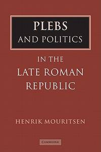
Mouritsen, Henrik
PLEBS AND POLITICS IN THE LATE ROMAN REPUBLIC
Cambridge University Press. 2001. Hardcover. Very Good in Very Good dust jacket. Scholar's name to ffep R. E. Fantham. Else book is fine. Minor shelfwear to DJ.; 0.7 x 8.9 x 6 Inches; 170 pages; This book deals with popular political participation in republican Rome. It contributes to an ongoing debate about the role of the people in the running of the Roman state asking whether they had any real say or had been marginalized by the elite. It approaches the issue from a practical perspective looking at the way political meetings and assemblies functioned and at the crowds that took part. The book thus puts the current discussion about Roman "democracy" on a new footing and places it in a social context. . 0521791006 . Cambridge University Press hardcover
Referentie van de boekhandelaar : 26356 ISBN : 0521791006 9780521791007
|
|
|
Mouritsen, Henrik
PLEBS AND POLITICS IN THE LATE ROMAN REPUBLIC
Cambridge University Press. 2001. Hardcover. Fine in Near Fine dust jacket. Book is fine. DJ has very light shelfwear now in plastic sleeve.; 0.7 x 8.9 x 6 Inches; 170 pages; This book deals with popular political participation in republican Rome. It contributes to an ongoing debate about the role of the people in the running of the Roman state asking whether they had any real say or had been marginalized by the elite. It approaches the issue from a practical perspective looking at the way political meetings and assemblies functioned and at the crowds that took part. The book thus puts the current discussion about Roman "democracy" on a new footing and places it in a social context. . 0521791006 . Cambridge University Press hardcover
Referentie van de boekhandelaar : 16836 ISBN : 0521791006 9780521791007
|
|
|
Mourlon, M
Geologie de la Belgique. Tome 1-2.
Bruxelles, Hayez, 1880-81. M. 2 lith. Taf. u. zahlr. Abb. 317 S.; XVI, 392 S. In 1 Hlwd. m. handschrftl. Rtit. Einbd. beschabt u. bestoßen. Name a. Vorsatz.Handschrftl. Widm. d. Verfassers a. Tit.
Referentie van de boekhandelaar : 210083
|
|
|
Mourousy, Paul, Simone Chevallier u. Max Frantel (Hrsg.)
Paris à deux mille ans.
Les Cahiers d'Art et d'Amitié, Paris 1949. 204 S. mit mehreren Abbildungen. Gr.-8°. Illustr.-Brosch. Leichte Gebrsp. Gebräunt, etwas berieben u. bestoßen. Französische Widmung auf Titel.
Referentie van de boekhandelaar : 8251

|
|
|
MOUSNIER Roland
Histoire générale des civilisations . Tome IV : Les XVIe et XVIIe siècles. Les progrès de la civilisation européenne et le déclin de l'ORIENT (1492-1715)
relié avec jacquette - 19,5x23,5 - 605 pp - 1954 - éditions Presses Universitaires de France, Paris. Publié sous la direction de Maurice CROUZET. 48 planches hors texte.
Referentie van de boekhandelaar : 8723
|
|
|
Mousnier Roland
Les XVIe et XVIIe siècles. Les progrès de la Civilisation européenne et le déclin de l’Orient (1492-1715)
Presses Universitaires de France, coll. « Histoire générale des Civilisations » 1954 In-8 cartonnage éditeur toile bleue en bon état. 23 cm sur 18. Jaquette en état moyen effrangée. Bon état d’occasion.
Referentie van de boekhandelaar : 98321
|
|
|
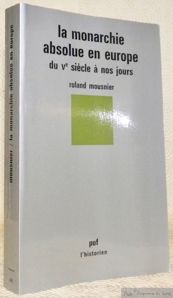
Mousnier, Roland
La monarchie absolue en Europe du V. siecle a nos jours.
Paris : Presses Universitaires de France (puf l'historien), 1982. 245 S. (21 cm) Broschierte Ausgabe
Referentie van de boekhandelaar : 25133 ISBN : 2130373313
|
|
|
MOUSNIER, Roland.
La monarchie absolue en europe du Ve siècle à nos jours. 1re édition. Coll. : L’Historien.
Paris, P.U.F. Presses Universitaires de France 1982, 210x135mm, 245pages, broché. Bon état.
Referentie van de boekhandelaar : 65340
|
|
|
Mousset Jean-Luc
Die Ansicht Luxemburgs auf einer Berliner Vase, 1840. Musée National D'Histoire t D'Art Luxembourg. Ausstellung vom 2. bis 21. März 1996. Deutsche Ausgabe.
Luxembourg. 1996. 96, (4) Seiten. Mit zahlreichen teils farbigen Abbildungen. Farbig illustrierte Originalbroschur. 21x21 cm
Referentie van de boekhandelaar : 127199

|
|
|
MOYEN, Jean - Avec une introduction par Jules de Seynes
Les champignons. Traité élémentaire et pratique de mycologie suivi de la description des espèces utiles, dangereuses, remarquables
1889 J. Rothschild, Editeur, Paris - 1889 - Fort In-8, reliure éditeur pleine percaline verte ornée de décors en noir, titre et auteur en doré sur le premier plat et au dos, tranches marbrés - XXIV-760 pages et 20 planches en couleurs - Ouvrage orné de bandeaux, culs-de-lampe, lettrines et de 334 vignettes en N&B
Referentie van de boekhandelaar : 124298

|
|
|
MOÜY (Ch. de)
Louis XIV et le Saint Siège. L'Ambassade du duc de Créqui. (1662-1665)
Paris, Hachette, 1893 2 vol. in-8, X-484 et 432 pp., gravures, demi-chagrin vert, dos à nerfs orné (reliure de l'époque). Mouillures claires, papier gondolé. Cachet.
Referentie van de boekhandelaar : 98345
|
|
|
MOÜY (Ch. de)
Louis XIV et le Saint Siège. L'Ambassade du duc de Créqui. (1662-1665)
Paris, Hachette, 1893 2 vol. in-8, X-484 pp. et 432 pp., portr.-front. au tome I, fac-similé dépl., demi-maroquin rouge, dos à nerfs, têtes dorées (rel. de l'époque). Bon exemplaire.
Referentie van de boekhandelaar : 152531

|
|
|
MPIG - Lehmann, Hartmut
Säkularisierung, Dechristianisierung, Rechristianisierung im neuzeitlichen Europa. Bilanz und Perspektiven der Forschung. [Herausgegeben von Hartmut Lehmann]. (= Veröffentlichungen des Max-Planck-Instituts für Geschichte, Band 130).
Göttingen: Vandenhoeck und Ruprecht 1997. 335 Seiten. Gr. 8° (25 x 17,5 cm). Orig.-Leinenband mit goldgeprägtem Titel auf Deckel und Rücken. [Hardcover / fest gebunden].
Referentie van de boekhandelaar : 2134016

|
|
|
Mr Baron, Escuyer Revue et augmentee par Mr Playne
L'Art Heraldique Contenant La Maniere D'Apprendre Facilement Le Blason. Enrichy des Figuresnecessaires pour l'intelligence des Termes
Charles Osmont dans la grande Salle du Palais Paris 1695. Nouvelle Edition Revue & augmentee. Hardcover. Very Good Condition/No Dust Jacket. Re-backed with new banded leather spine with previous spine strip overlaid and previous leather covers. Gilt decoration at edges and on spine and "Mr Dubois du Haut Breil" in gilt lettering on the front same name is handwritten onto the title-page and on the reverse of the rear free end-paper. Red block edges with slight bleeding into the edges of the free front end-paper. Binding is tight and re-backing has used earlier end-papers. In this copy all plates frontis and 35 plates showing heraldic shields plumed helmets and crowns are brilliantly hand-coloured mainly in red blue and turquoise and occasionally also with yellow and black. The book is divided into three main parts. There is an introduction A la Noblesse 6; Avis sur cette Nouvelle Edition 5; Table des Chapiters 4; 1; Part I pages 1-135; Seconde Partie Des Ornamens Exterieurs de l'Ecu pages 136-218; Troiseme Partie De la Litre et Ceinture Funebre des Pavilions de diverses Nations etc. page 219-260; Table Index 15 First printing in this edition. Text is in French. Contains many colour plates full page illustrations. No dust jacket as published. Quantity Available: 1. Shipped Weight: under 1 kg. Pictures of this item not already displayed here available upon request. Inventory No: 41020011119. All our books music and maps are sent by a tracked mail service. Charles Osmont, dans la grande Salle du Palais hardcover
Referentie van de boekhandelaar : 41020011119
|
|
|
Mr Rapin de Thoyras, N Tindal
The History of England 2 vols with the Continuation from the Revolution to the Accession of King George II Summary and Lists 2 vols
Published by James John & Paul Knapton The Crown Inn Ludgate-Street near the West End of St. Pauls 1732. First Edition. Hardcover. Good Condition/No Dust Jacket. The History of England. Written in French by Mr. Rapin de Thoyras. Translated into English with additional notes by N. Tindal Vicar of Great Waltham in Essex Vols. I & II and Continued from the Revolution to the Accession of King George II by N. Tindal Vols. III & IV. Packed weight approx. 10kg. Four matching contemporary full leather large folio volumes with some wear at spine-ends and rubbed edges front joint/hinge of Volume II is split with cover attached by cords. Volume III has short split at head of front joint. Binding is otherwise sound. End-papers are a little darkened. Pages plates fold-out maps and tables are all clean. There is occasional light foxing to margins. Volume I Books I-XV 15.Published 1732. Bookplate on inside front cover. Bookplate Francis Dixon John on reverse of front end-paper. Frontis: hand-coloured map of England and Wales. Fold-out linen-backed map colour has darkened on Warwickshire and Carmarthenshire. Title-page in red and black with vignette illustration. Dedication to His Royal Highness Frederic Prince of Wales. Preface. Some Particulars of the Life of Mr. de Rapin Thoyras. Clean fold-out map of Britannia Romana. Introduction with vignette. Vignette and decorated capital at the head of each book and where space footers. Contains Fold-out map of Britannia Saxonica: Fold-out Table of the Seven Kingdoms of the Anglo-Saxons; A New Map of England Scotland and Ireland; Plate of The Monument of King John; Fold-out Map of France. Includes Genealogies as Inserts. The Genealogies of: The Kings of Mercia and Ye Kings of Northumberland; The Kings of East Anglia Posterity of Woden; The Kings of Kent Essex and Sussex; The Kings of Wessex and the Kings of England after the Heptarchy; William the Conqueror: Henry II Posterity of Edward III; Royal Family of Scotland from Malcolm II to Robert II; Volume II Books XVI-XXIV 16-24. 807 pages plus index 16. Published 1733. Bookplate on inside front cover. Frontis: Plate of Nicolas Tindal. Title-page in red and black with vignette illustration. Includes Plates of: Edward VI; Mary; Philip of Spain; Elizabeth; Mary Queen of Scots; Henry Lord Darnly; James I; Henry Prince of Wales; Elisabeth of Bohemia; Charles I; Algernoon Piercy Earl of Northumberland; Oliver Cromwell; Charles II; Henry Duke of Glocester; James II; A Genealogical Table of James I. Extract of a letter from Mr. Rapin to M. Robethon 1; Catalogue 12. Volume III Books XXV- XXVI 25-26. 796 pages. Published 1744. The History of England by Mr. Rapin de Thoyras continued from the Revolution to the Accession of King George II by N. Tindal. Frontis: Portrait of William III. Printed for John & Paul Knapton at The Crown Inn Ludgate-Street. Dedication to His Royal Highness William Duke of Cumberland. Catalogue 12. Introduction xxviii Contains Plates of: Queen Mary; Great Seal of William III and Queen Mary; The Battle of the Boyne July 1 1690; Great Seal of William III; Blenheim House. Index to Volumes III and IV 31 pages. Volume IV Book XXVI 26 Section II 2. 714 pages. p. 714 misnumbered as p. 706. Published 1745. Volume IV Part II. Published 1747. No plates in this volume. A Summary of the History of England from the Invasion of Julius Caesar to the Death of King George I p.1-233; various Lists p.234-274; The Metalic History of the Last Three Reign: Or a Series of Medals representing all the Remarkable Events from the Revolution to the Death of King George I p.1-40; 1-22. Vols 1 & 2 2nd edition vols 3 & 4 1st edition. Size: Large folio. 4-volume set complete. No dust jacket as published. Quantity Available: 1. Shipped Weight: over 4 kg. Pictures of this item not already displayed here available upon request. Inventory No: 42015121229. All our books music and maps are sent by a tracked mail service. These books are much heavier than 1kg and may incur significant additional delivery charges to some delivery services to some locations. Published by James, John & Paul Knapton hardcover
Referentie van de boekhandelaar : 42015121229

|
|
|
Mraz, Jan [ed]
Nizke Tatry - Horstvo Buducnosti = Low Tatras - Mountains of the Future
Bratislava: Nakladaiefstvo Press Foto 1973 Book. Illus. by Photograps O. Fogel J.Blazek a archive CSTK. Fine. Portfolio. First Thus. A tri-fold card portfolio containing a set 35 large format 21x18cm glossy photographs taken in the Low Tatra mountains in Slovakia.NOTE One plate is missing Descriptive letterpress on the verso of each plate is in Slovak Czech Russian German English and French. Of the introductory pages only 2 - one in Slovak one English- describe the attractions of the region for visitors and that "The door to the attractive beauty of the Low Tatras has in fact only just been set ajar. The Golden age is still to come" Slight scuffing to the folder but plates otherwise as new. Only ONE copy found in Worldcat. Nakladaiefstvo Press Foto hardcover
Referentie van de boekhandelaar : 046052
|
|
|
MRAZEK WILHELM E ALTRI
CURT STENVERT. L'ART POUR L'HOMME. CATALOGO DELLA MOSTRA, FERRARA, GALLERIA CIVICA ARTE MODERNA, PALAZZO DEI DIAMANTI, 13 APRILE - 1 MAGGIO 1969
24 tavole a colori e in bianco e nero
|
|
|
Mrosevic, A
Kosovo.
Beograd, 1965. M. 2 Ktn. u. 8 Taf. 248 S. (Srpski etnogr. zbornik 78 / Naselja i poreklo stanovnistva 39).
Referentie van de boekhandelaar : 242954
|
|
|
Mrusek, Hans-Joachim
Burgen in Europa.
Herrsching., Pawlak-Verlag - Lizenz Edition Leipzig., 1975. 156 Seiten mit zahlreichen Abbildungen, Guter Zustand. 8°. OPappband.
Referentie van de boekhandelaar : 061061
|
|
|
Mrusek, Hans-Joachim
Castles of Europe. Text in Englisch.
Leipzig, Edition Leipzig 1974. Mit zahlreichen Abbildungen., 155 Seiten., quer Gr.-8°. illustrierte OHalbleinwand im OPappschuber.,
Referentie van de boekhandelaar : 42234
|
|
|
MUCHEMBLED Robert
L'orgasme & l'Occident : une histoire du plaisir du XVIe siècle à nos jours.
Le Grand Livre du Mois Seuil 2005 Le Grand Livre du Mois, 2005, 382 p., reliure souple Club, bon état.
Referentie van de boekhandelaar : 114968
|
|
|
Muchembled, Robert
Die Verwandlung der Lust. Eine Geschichte der abendländischen Sexualität. Aus dem Franz. von Ursel Schäfer.
München : DVA, 2008. 383 S. Gebundene Ausgabe mit Schutzumschlag.
Referentie van de boekhandelaar : 922094

|
|
|
Mueller, H.F., Grosse, N
Energie in Westeuropa.
H. Resch, München 1961. 235 S. mit 5 Bildern und 141 Tabellen, Groß 8°, Original-Leinen, Stempel auf Vorsatz und Innendeckel, gutes Exemplar,
Referentie van de boekhandelaar : 105196

|
|
|
Mueller, Walter Felix (Hrsg.)
Die europäische Lebensordnung im Wandel von der Zeitenwende bis zum Ersten Weltkrieg.
Stuttgart: Kohlhammer, 1959. 107 S., gebundene Ausgabe mit Umschl.
Referentie van de boekhandelaar : 34638

|
|
|
MUELLER-ARMACK, A., Einf
Europas Märkte wachsen zusammen. Aktuelle Möglichkeiten f. d. Unternehmerpraxis.
Stgt., Forkel, (1961). 280 S. OLwd. m. OU.
Referentie van de boekhandelaar : 205132BB
|
|
|
Muhlstein Anka
Victoria Regina
trad. di Riccardo Mainardi bross. edit. ill., lievi tracce d'uso

|
|
|
Muhr, Rudolf, Josep Àngel Mas Castells and Jack Rueter (eds.)
European pluricentric languages in contact and conflict. Österreichisches Deutsch - Sprache der Gegenwart ; Band 21.
Berlin : Peter Lang, 2020. 276 S., 13 Abb. Originalhardcover.
Referentie van de boekhandelaar : 1157308

|
|
|
MUIR, Ramsay
The expansion of Europe
LONDON, Constable - 1926 - In-8 - Reliure toile tachée - 8 cartes dépliantes, index - Exemplaire de travail - 380 pages - Propre intérieurement
|
|
|
MUIR, Ramsay
The expansion of Europe
1926 LONDON, Constable - 1926 - In-8 - Reliure toile tachée - 8 cartes dépliantes, index - Exemplaire de travail - 380 pages - Propre intérieurement
Referentie van de boekhandelaar : 7505
|
|
|
Muir, Richard
The English Village
208 pages. Index. 174 illustrations, 22 in colour. "The illustrations are chosen with scholarly sensitivity which, when allied to a lively and perceptive text, lift the whole volume above the repetitious level of many otherwise well-illustrated compilations." - Geopgraphical Magazine. Average wear. Unmarked. Good working copy. Book
|
|
|
Muir, Rory
Britain and the Defeat of Napoleon 1807-1815
New Haven CT: Yale Univ Pr 1996. 466 pp/illustrations/maps. This book is based on a thorough examination of the vast archives left by the Duke of Wellington. Muir offers new insights into the personalities of the Napoleonic Wars along with fresh information on the financial background of Britain's campaigns against Napoleon. DJ has light scratch. Text clean. First Edition. Cloth. Near Fine/Very Good. 8vo - over 7¾" - 9¾" tall. Yale Univ Pr hardcover
Referentie van de boekhandelaar : 007129 ISBN : 0300064438 9780300064438

|
|
|
MUIRHEAD Findlay
The Blue Guides: North-Eastern France. North-Eastern France. Second Edition.
Sm. 8vo., Second Edition, with 4 folding coloured maps (one very large at rear), 28 double-page coloured maps, 4 full-page coloured maps, 9 full-page maps and numerous smaller maps in the text, and front and endpaper maps in red on yellow; original blue cloth, gilt back, marbled top, two 2ilk markers, backstrip mildly faded (but all gilt wholly legible), a very good, clean copy. Mounted on title verso is the separately printed slip confirming that the atlas-maps intended for this edition were destroyed by enemy action: 'It is impossible to replace them exactly for this edition; but the entire area is covered by the folding map at the end of the book'. Muirhead's Blue Guides are renowned for their immense assembly of factual information and finely detailed maps and plans. First issued in 1922 NE France includes a large section on the War Area, with maps of battle-lines and other such data. From the third impression, issued later in the same year, a particular feature was the inclusion of all general maps as an atlas at the end, but enemy action prevented this from the second edition onwards.
|
|
|
Muirhead Russell L.
England
in inglese in 16°, tela edit. molto lisa
|
|
|
MUIRHEAD, Findlay
The Blue Guides; Wales
12mo [15.5 x 11 cm]; lvi, 260 pp, 22 maps and plans, almost all colored and folding, glossary, index. original blue cloth with gilt title lettering on spine and front cover, original ribbon bookmark, slightly rubbed at edge, a clean, unmarked and near fine copy. A picture of this book is available upon request by email. Divided into north, central and south Wales, each city and town, together with each sight that a traveller might want to visit with details on transportation, history. The introduction includes history, welsh language, books on Wales, railways, postal, hotels, motoring, notes for fishermen.
|
|
|
Mukerjee, Radhakamal
The Rural Economy Of India
Longmans, Green & Co., London 1926. 262 S., 8°, Original-Pappband (Hardcover), Bibliotheks-Exemplar, Stempel auf Deckel und Titel, Außendeckel und Rücken mit kleiner Papier-Signatur, insgesamt gutes und innen sauberes Exemplar, (library copy in good condition),
Referentie van de boekhandelaar : 55515

|
|
|
Mukerji, K.P
Imperialismus. Seine Wirkungen im Osten. Diss.
Heidelberg, 1935. 116 S. Sign. a. Umschl.
Referentie van de boekhandelaar : 624740
|
|
|

 De zoekresultaten per email ontvangen
 Zoekresultaten downloaden als PDF
 RSS feed
 Permanente link


