|
|
|
Paul GUITON
La Suisse, la Suisse romande
Arthaud | Grenoble 1929 | 16.50 x 21 cm | broché
书商的参考编号 : 2565
|
|
|
Paul-Henri-Benjamin d' ESTOURNELLES DE CONSTANT
La vie de province en Grèce. Dis mois de séjour en Achaïe. Extrait de la Revue des Deux Mondes
Extrait de La Revue des deux mondes | s. l. [Paris] 1876 | 15.50 x 25 cm | agrafé
书商的参考编号 : 18619
|
|
|
Paul Perret
Le Pays Basque et la Basse-Navarre.
Biarritz - Bayonne - Pau - Les Eaux-Bonnes Table; Le Pays Basque, la cote - Le pays de Labourd - Le pays de la soule - Chants Basques & Béarnais. Reliure Cartonnage éditeur en percaline rouge, noir et or, premier plat avec une grande composition polychrome de Paul Souze, 260x170. 496pp. Paris, H. Lecène & Oudin, vers 1880.
书商的参考编号 : CZC-7675

|
|
|
Paul Perret
Le Pays Basque et la Basse-Navarre.
Biarritz - Bayonne - Pau - Les Eaux-Bonnes Table; Le Pays Basque, la cote - Le pays de Labourd - Le pays de la soule - Chants Basques & Béarnais. Reliure Cartonnage éditeur en percaline rouge, noir et or, premier plat avec une grande composition polychrome de Paul Souze, 260x170. 496pp. Paris, H. Lecène & Oudin, vers 1880.
书商的参考编号 : CZC-7675
|
|
|
Paul MERRUAU
Les marines secondaires de la Baltique et de la mer du nord
La Revue des deux mondes | Paris 1877 | 15.50 x 25 cm | agrafé
书商的参考编号 : 20078
|
|
|
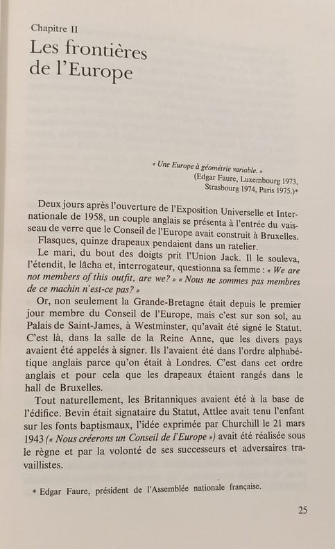
Paul M.G. Levy
Sauver l'Europe
Duculot 1978 in8. 1978. Broché.
书商的参考编号 : 100147815
|
|
|
Paul BOURGET
Sur la Toscane
Editions des horizons de France | Paris 1929 | 11.50 x 17.50 cm | broché
书商的参考编号 : 42440
|
|
|
PAULY (Marie-Hélène).
Université de Paris. - Faculté des lettres. Les Voyageurs français en Irlande au temps du romantisme. Thèse pour le doctorat de l'Université de Paris
Paris, Gabriel Enault, 1939 in-8, VIII pp., 292 pp., broché. Petits manques de papier au dos.
书商的参考编号 : 243622
|
|
|
Paul de Musset
Voyage pittoresque en Italie et en Sicile ( partie méridionale)
Paul de Musset est un écrivain français du XIXe siècle, frère du célèbre poète Alfred de Musset. L'Italie et la Sicile sont des destinations réputées pour leur beauté pittoresque, leur patrimoine historique et artistique. De nombreux voyageurs ont exploré ces régions au fil des siècles et ont partagé leurs expériences à travers des récits de voyages. Dans cet ouvrage, l'auteur relate son voyage en Italie et en Sicile, décrivant de manière vivante et pittoresque les paysages, les villes, les coutumes et les rencontres qu'il a faites lors de son périple. Il offre une perspective personnelle et souvent poétique de son expérience de voyage. "Voyage pittoresque en Italie et en Sicile" est considéré comme un classique de la littérature de voyage. Il offre aux lecteurs une vision romantique de ces régions et est apprécié pour son style d'écriture captivant et ses observations intéressantes. Illustrations de MM. Rouargue Frères 23 planches dont 5 en couleurs. Table : Florence - route de Rome par Sienne - Arqua, Ferrare, Ravenne - route de Rome par Trasimène - Rome - de Rome à Naples - environs de Naples - de Messine à Catane - de Catane à Palerme - Palerme vol relié, demi chagrin vert, dos à nerfs, 270x185, toutes tranches dorées, 524pp. Bon exemplaire de cet ouvrage recherché. Paris Morizot 1856 Envoi sécurisé avec suivi et assurance.
书商的参考编号 : CZC-8103

|
|
|
Paul de Musset
Voyage pittoresque en Italie et en Sicile ( partie méridionale)
Paul de Musset est un écrivain français du XIXe siècle, frère du célèbre poète Alfred de Musset. L'Italie et la Sicile sont des destinations réputées pour leur beauté pittoresque, leur patrimoine historique et artistique. De nombreux voyageurs ont exploré ces régions au fil des siècles et ont partagé leurs expériences à travers des récits de voyages. Dans cet ouvrage, l'auteur relate son voyage en Italie et en Sicile, décrivant de manière vivante et pittoresque les paysages, les villes, les coutumes et les rencontres qu'il a faites lors de son périple. Il offre une perspective personnelle et souvent poétique de son expérience de voyage. "Voyage pittoresque en Italie et en Sicile" est considéré comme un classique de la littérature de voyage. Il offre aux lecteurs une vision romantique de ces régions et est apprécié pour son style d'écriture captivant et ses observations intéressantes. Illustrations de MM. Rouargue Frères 23 planches dont 5 en couleurs. Table : Florence - route de Rome par Sienne - Arqua, Ferrare, Ravenne - route de Rome par Trasimène - Rome - de Rome à Naples - environs de Naples - de Messine à Catane - de Catane à Palerme - Palerme vol relié, demi chagrin vert, dos à nerfs, 270x185, toutes tranches dorées, 524pp. Bon exemplaire de cet ouvrage recherché. Paris Morizot 1856 Envoi sécurisé avec suivi et assurance.
书商的参考编号 : CZC-8103
|
|
|
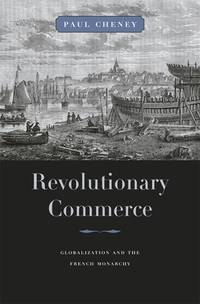
Paul Cheney
Revolutionary Commerce: Globalization and the French Monarchy Harvard Historical Studies
Cambridge: Harvard University Press 2010. First edition. hardcover. very good/very good. 8vo. pp.305 Harvard University Press hardcover
书商的参考编号 : 327532 ???????? : 0674047265 9780674047266
|
|
|
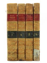
Paul Henri Mallet
Histoire des Suisses ou Helvetiens: Depuis les tems les plus recules jusques a nos jours Complete 4 volume set
Geneve Genf / Geneva: G.J. Manget Libraire 1803. 1st Edition . Hardback. Printed pages: 8vo. xii 491 1 2 Table 2 ads 1 Errata; 405 1 2 Table; 431; 328. Very Good Minus. 5.25 x 8.25 inches 13 x 20.5 cm. First printing. Complete four volume set. Full tree calf leather bindings. Spines with red morocco title labels black morocco volume labels and gilt decoration. Gilt border to boards. Gilt ruled board edges marbled page edges and endpapers. Volume four lacking lower section of spine. Rubbing to spines and patches of rubbing to boards. Slight wear to ends of spines and corners of boards. Good solid bindings. Clean text throughout. Engraved vignette to all title pages. Complete with the large fold-out map in Volume I: La Republique Helvetique ou sont distingues les cantons qui la composent suivant les derniers decrets with a few short tears and some light foxing. French language. Overall condition is Very Good Minus. Please Note: This is a heavy item and international postage will be more than the standard rate. Actual Royal Mail postage costs are: Europe £19.00; USA £33.00; Oceania £40.00; Rest of World £37.00. A postage supplement will be requested after the order has been placed. Size: 5.25 x 8.25 inches 13 x 20.5 cm. G.J. Manget Libraire hardcover
书商的参考编号 : 1245E136
|
|
|
Paul Hervieu - a cura di Ruggero Jacobbi
L'ignoto
bross. edit. ill. con bandelle

|
|
|
Paul Lendvai / Biografie - Lendvai, Paul
Best of Paul Lendvai : Begegnungen, Erinnerungen, Einsichten.
Salzburg : Ecowin 2008. 271 S. ; 22 cm, mit Schutzumschlag Top Zustand, Pp., gebundene Ausgabe, Hardcover/Pappeinband, Exemplar in sehr gutem Erhaltungszustand
书商的参考编号 : 15524

|
|
|
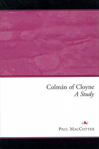
Paul MacCotter
Colman of Cloyne: A Study
Dublin: Four Courts Press Ltd 2004 Book condition: Near Fine. Jacket: Near Fine. A bright copy. Four Courts Press Ltd hardcover
书商的参考编号 : 017923 ???????? : 1851827935 9781851827930
|
|
|
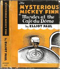
Paul, Elliot
THE MYSTERIOUS MICKEY FINN; or Murder at the Cafe du Dome
N.Y.: Modern Age Books 1940. 4th printing September 1940 1st printing was September 1939. Covers and page edges lightly spotted else very good in dust jacket chipped at head and foot of spine small piece out at lower front lightly soiled not price clipped $1.00 price intact at front flap now in protective mylar cover. Very scarce. The first in a series of adventures of Homer Evans.The Mysterious Mickey Finn "has the delicious irresponsibility of a Woodhouse plot. . . It's one of the funniest books we've read in a long time. It contains a great deal of shrewd satire. "The New York Times" . The satiric tone of the novel is entirely intentional for Paul intended to parody the famous Philo Vance stories of S.S. Van Dine. Later Edition. Hardcover. Very Good/Very Good. Book. Modern Age Books
书商的参考编号 : 020676
|
|
|
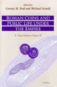
Paul, George MacKay & Michael Ierardi (eds)
ROMAN COINS AND PUBLIC LIFE UNDER THE EMPIRE; E. Togo Salmon Papers II
University of Michigan Press. 1999. Hardcover. Fine in Near Fine dust jacket. 0.72 x 9.48 x 6.2 Inches; 216 pages; Roman coins often shed light on Roman public life and society through the legends portraits and images they bear. The papers collected in this volume were originally presented at the Second E. Togo Salmon Conference on Roman Studies. The eight contributors are specialists in Roman coins or Roman history and in the relations between them. Coins are a unique source of information about the Roman world. In the case of the Roman Empire they were issued by or with the approval of the ruling power. The representations and legends they show therefore present an official view of contemporary affairs. The coins themselves minted for official purposes such as paying the army when studied carefully can help reconstruct official policies. They can also occasionally reveal what monuments now lost may have looked like. It is not infrequent to come across pleas that the ancient historian should make more frequent use of numismatic evidence. These essays make clear that efforts are being made both by numismatists and by historians to bring the two disciplines together. At the same time the papers reveal that the task is by no means a straightforward one. The survival of Roman coins is variable and so attempts to reconstruct the size and distribution of issues calls for skilled and experienced analysis. This collection of papers provides evidence for the kind of deductions that the historian may make from Roman coins as well as the illustrations of the pitfalls that await the unwary. Those interested in Roman history amateur coin collectors and professional numismatists will all find much here to widen their knowledge of the public context of Roman coins. Contributors: William E. Metcalf P. Bruun Barbara Levick R. P. Duncan-Jones Anthony Barrett Duncan Fishwick C. E. King Andrew Burnett. . 0472108751 . University of Michigan Press hardcover
书商的参考编号 : 30218 ???????? : 0472108751 9780472108756
|
|
|
Paul, George MacKay & Michael Ierardi (eds)
ROMAN COINS AND PUBLIC LIFE UNDER THE EMPIRE; E. Togo Salmon Papers II
University of Michigan Press. 1999. Hardcover. Fine in Fine dust jacket. Dustjacket is protected in mylar.; 0.72 x 9.48 x 6.2 Inches; 216 pages; Roman coins often shed light on Roman public life and society through the legends portraits and images they bear. The papers collected in this volume were originally presented at the Second E. Togo Salmon Conference on Roman Studies. The eight contributors are specialists in Roman coins or Roman history and in the relations between them. Coins are a unique source of information about the Roman world. In the case of the Roman Empire they were issued by or with the approval of the ruling power. The representations and legends they show therefore present an official view of contemporary affairs. The coins themselves minted for official purposes such as paying the army when studied carefully can help reconstruct official policies. They can also occasionally reveal what monuments now lost may have looked like. It is not infrequent to come across pleas that the ancient historian should make more frequent use of numismatic evidence. These essays make clear that efforts are being made both by numismatists and by historians to bring the two disciplines together. At the same time the papers reveal that the task is by no means a straightforward one. The survival of Roman coins is variable and so attempts to reconstruct the size and distribution of issues calls for skilled and experienced analysis. This collection of papers provides evidence for the kind of deductions that the historian may make from Roman coins as well as the illustrations of the pitfalls that await the unwary. Those interested in Roman history amateur coin collectors and professional numismatists will all find much here to widen their knowledge of the public context of Roman coins. Contributors: William E. Metcalf P. Bruun Barbara Levick R. P. Duncan-Jones Anthony Barrett Duncan Fishwick C. E. King Andrew Burnett. . 0472108751 . University of Michigan Press hardcover
书商的参考编号 : 2537 ???????? : 0472108751 9780472108756
|
|
|
PAULI G.
Die Kunst des Klassizismus und der Romantik.
pp. 538 con centinaia di gr. ill. in b/n e alcune ill. a col. applicate. Volume XIV della collana Propyläen-Kunstgeschichte. Elegante ediz. riccamente illustrata di questa storia dell'arte europea fra il XVIII e XIX sec. testo in tedesco. Indice (Inhalt): Einleitung, Architektur, Beildnerei, Malerei. Piccola etichetta di libraio viennese applicata alla II° di copertina.
|
|
|
Pauli, Gustav
Die Kunst des Klassizismus und der Romantik.
Bln., Propyläen-Vlg. (1925). 4°, 526 S., mit 45, zumeist mont. Farbtaf. u. zahlr., tls. farb. Textabb., OHldr. m. gepr. Rü. u. 2 roten RüSch., gepr. Deckelvign., an Kanten u. Ecken berieben u. bestoß., an den Kapitalen gröbere Läsuren, unten eine kl. Fehlst., Vorsätze stockfleck., Farbschnitt. (= Propyläen Kunstgeschichte; 14).
书商的参考编号 : EEzz5061K1
|
|
|
Pauli, Gustav
Die Kunst des Klassizismus und der Romantik. 2. Aufl. 6. - 8. Tsd.
Bln., Propyläen-Vlg. (1925). Lex.-8°, 533(1)S., mit 45, zumeist mont. Farbtaf. u. zahlr., tls. farb. Textabb., OHdr. m. gepr. Rü. u. 2 roten RüSch., gepr. Deckelvign., unwesentl. berieb., Farbschnitt. (= Propyläen Kunstgeschichte; 14).
书商的参考编号 : EEzz5055aK1
|
|
|
Pauli, Gustav
Venedig. Berühmte Kunststätten ; Bd. 72 5. Aufl.
Leipzig : E. A. Seemann 1926. 240 S. : Mit 185 Abb. ; 8°, ohne Schutzumschlag Lw., gebundene Ausgabe, Leinen, Exemplar in gutem Erhaltungszustand
书商的参考编号 : 44317

|
|
|
PAULIN H.
Le fer et le charbon. Conditions de la paix future. Avec une carte.
Paris, Editions Bossard, 1919, in-8, br. edit., pp. 30, [2]. Con una cartina all'antiporta.
|
|
|
Paulmann, Johannes
Pomp und Politik : Monarchenbegegnungen in Europa zwischen Ancien Régime und Erstem Weltkrieg
Paderborn, Schöningh 1999. Gr.-8°. 482 S. m. 29 s/w Abb., OLn. mit OUmschlag, tadellos.
书商的参考编号 : HIST1382
|
|
|
Paulsen, Dr. Sigurd
Die Europapolitik der Sowjet-Union
Troisdorf: Kammweg-Verlag, 1969. 18,5 cm ; kart.
书商的参考编号 : 109252

|
|
|
Pausanias
Graeciae descriptio. Ed. graeca emendavit, apparatum criticum ad. H. Hitzig. Comm. H. Hitzig et H. Bluemner. Vol. 2/2: Elica II et Achaica.
Leipzig, Reisland, 1904. M. 2 Taf. S. 451-846. Unaufgeschn. Ex.
书商的参考编号 : 407665
|
|
|
Pausanias
Viaggio istorico della Grecia. Bd. 3-4 (v. 5).
Rom, 1793. Gr.-8°. 2 Bl., 286 S.; 2 Bl., 256 S. Hldr. d. Zt. m. Rsch., Rverg. u. Rsign. Einbde. etwas beschabt. Teils leicht fleckig.
书商的参考编号 : 173571
|
|
|
Pausanias.
Beschreibung von Griechenland. Aus dem Griechischen übersetzt von Joh. Heinrich Chr. Schubart. 2 Teile in 1 Band.
833, 126 (1) Seiten. Schlichtes Halbleinen der Zeit (Kapitale leicht bestoßen). *Vollständige Schubart`sche Übersetzung der klassischen antiken Beschreibung von Griechenland. - Stempel auf Titel. Gelegentlich etwas gebräunt. Insgesamt ordentliches Exemplar. Bücher de
|
|
|
Pavl na Rychterov (ed)
Pursuing a New Order II. Late Medieval Vernacularization and the Bohemian Reformation
, Brepols, 2019 Paperback, 321 pages, Size:156 x 234 mm, Illustrations:5 tables b/w., Language: English. ISBN 9782503581828.
书商的参考编号 : 66033
|
|
|
Pavl na Rychterov (ed)
Pursuing a New Order I. Religious Education in Late Medieval Central and Eastern Central Europe
, Brepols, 2019 Paperback, 265 pages, Size:156 x 234 mm, Illustrations:4 b/w, Language: English. ISBN 9782503581804.
书商的参考编号 : 66079
|
|
|
Pavel TIGRID
Révoltes ouvrières à l'est : 1953-1981.
Editions Complexe, 1981, 192 p. au format de poche.
书商的参考编号 : 1675
|
|
|
Pavia, Rosario
L'Idea di Città: XV-XVIII Secolo.
Mm 140x220 " Collana di Storia Urbana ". Brossura originale con copertina illustrata a colori, 275 pagine con 84 figure in nero comprese nel testo. Un timbro di biblioteca dismessa alla prima carta bianca ed un'altro di tipo commerciale al frontespizio, peraltro il libro è in perfette condizioni e non risulta essere stato mai aperto. Spedizione in 24 ore dalla conferma dell'ordine.
|
|
|
Pavkovic, Mladen
Istinom protiv sile iIi Kako Se Stvarala Jedna Ratna IPD-c Sluzba
Koprivnica: Klub pripadnika Hrvatske vojske 117. Brigade 1994 Book. As New. Laminated Hardcover. 1st Croatian Edition. Translation of title "The Truth Against Force or How One Wartime IPD Service Was Created" llustrations some from the magazine Gardist of the activities 1991-1992 of the Croatian Army's 177th.Koprivnica Brigade involving the conflicts during the break up of Yugoslavia. Contains multiple pictures of soldiers brandishing weapons damaged buildings some of victims. NO copy found in WorldCat. Klub pripadnika Hrvatske vojske 117. Brigade hardcover
书商的参考编号 : 046119
|
|
|
Pavlychenko, T. K.
RUKH NATSIONALIEDNOSTY: Z PRYVODU IUVILEINOÃ KONFERENTSIÃ UNO KANADY. [MOVEMENT OF NATIONAL UNITY: FROM THE ANNIVERSARY CONFERENCE OF THE UNF CANADA.]
Original Wrappers. 12mo. 30 pages. 19 cm. Illustrated. First Edition. Black and white portraits of members of the Ukrainian National Federation. History and information regarding the activities of the Ukrainian National Federation on the occasion of the organizations 20th anniversary. "The Ukrainian National Federation was founded on Sunday, July 17, 1932 at a historic meeting in Edmonton, Alberta. In the first four years, 50 Branches were established across Canada. The UNF was incorporated by an Act of Parliament on June 1, 1950. The UNF is dedicated to the preservation of Ukrainian Canadian history and the cultural heritage of Ukraine." (unfcanada. Ca) Subjects: Ukrainian National Federation. T. K. Pavlychenko. OCLC lists 9 copies worldwide. Light age toning and shelf wear. Minimal previous institutional markings. Very good. Condition. (UKR-1-47) xx

|
|
|
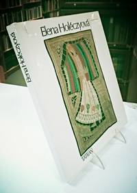
Pavol, Michalides
Elena Holeczyova
Bratislava: Tatran 1981. 1981 Edition. Hardcover. Near Fine Condition/Very Good. Tatran Bratislava 1981. 1981 Edition. Near Fine Condition/Very Good. Foreign Language Book Moderate edgewear to the dust jacket; one approx. inch closed tear to the top front. Book is near fine. "A showcase of the magnificent work of the Slovakian lace designer Elena Holczyov 1906-1983. A graduate of the School of Fine Arts in Prague 1926 she became the driving force behind the 'art lace' movement in Slovakia. -- Packed with many photographs of her wonderful contemporary lace works many of them in colour There is also a short biography and an appreciation of her life and work as well as a bibliography and lists of solo exhibitions and others in which she participated. Except for a short summary of her life in English the text is in the Slovak language".-roseground. Size: Quarto. 174 pages. Text is in Slovak . Item Type: Foreign Language Book. Quantity Available: 1. Category: Crafts & Hobbies; Needle Arts; Europe; Slovakia ; Slovak Language; Arts - Modern; Pictures of this item not already displayed here available upon request. Inventory No: 8615. Tatran hardcover
书商的参考编号 : 8615
|
|
|
Pavone, Claudio
A Civil War: A History of the Italian Resistance
Paperback. Upper leading corner of front cover is dog eared, as are first 50 pages. Covers are unmarked, pages are clean, and the text is clean. TH Used
|
|
|
Pawlowski Christophe
Tony Garnier. Le radici del funzionalismo
105 illustrazioni

|
|
|
PAXTON, John
European communities.
New Brunswick, Transaction Publishers, 1992. XXIII, 182 S. Mit Kartenskizze. OPpbd.
书商的参考编号 : 3469509
|
|
|
PAYEN
LES VOYAGES DE MONSIEUR PAYEN, LIEUTENANT GENERAL DE MEAUX. Seconde édition augmentée de quelques avantures arrivées à l’Autheur....
In-16 p. (mm. 152x85), p. pelle settecentesca (con abrasioni e picc. manc.), dorso a cordoni con decoraz. e tit. oro su tassello, pp. (12),181,(15), ornato da fregi e finali inc. su legno. Nell’opera “sont contenues les descriptions d’Angleterre, de Flandre, de Brabant, d’Holande, de Dennemarc, de Suede, de Pologne, d’Allemagne & d’Italie: où l’on voit les moeurs des Nations, leurs maximes & leur politique, la monnoye, la religion, le gouvernement & les interests de chaque pays”. Al fine una interessante “Table de la route & des commoditez qu’on peut prendre pour voir les villes cy-dessus décrites, des auberges ou on logera & de la dépense qu’on doit faire”. Pagine ingiallite per la qualità della carta ma buon esemplare.

|
|
|
PAYER Jules
L'expédition du Tegetthoff. Voyage de découvertes aux 80e-83e degrés de latitude nord
- Hachette & Cie, Paris 1878, 15,5x24cm, reliure de l'éditeur. - Edition illustrée de 2 cartes et 168 gravures sur bois. Reliure en demi chagrin cerise, dos à quatre fins nerfs ornés de triples caissons dorés agrémentés de motifs typographiques dorés, encadrements d'un jeu de filets à froid sur les plats de cartonnage cerise, gardes et contreplats de soie moirée blanche, étiquette de classement de bibliothèque encollée sur une garde, toutes tranches dorées. Rousseurs affectant principalement les premiers et derniers feuillets. [ENGLISH DESCRIPTION ON DEMAND]

|
|
|
Payer, J
Die südlichen Ortler-Alpen. Nach d. Forschungen u. Aufnahmen.
Gotha, Perthes, 1869. 4°. M. 1 farb. gefalt. Kte., 1 farb. Taf. u. 3 Profilen im Text. 30 S. Ohne Umschl. M. Kleberest v. ehemaliger Bind. (Petermanns geogr. Mitteil. Erg.-H. 27).
书商的参考编号 : 214279
|
|
|
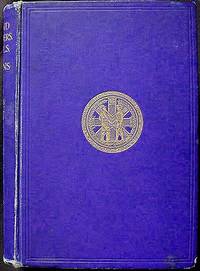
Payne, AA A A
A Handbook of British and Foreign Orders War Medals and Decorations Awarded to the Army and Navy Chiefly described from those in the collection of A.A. Payne of which there are some 2500; More than 500 of these have been awarded to officers whose services are therein recorded; Illustrated with nearly Sixty Portraits Orders and Medals
Sheffield England: J.W. Northend printer and lithographer 1911. Hardcover. Very Good. lxix 3 811 p.: tissue-guarded frontispiece portrait of the author and 58 leaves of plates from photographs chiefly reproduced by Furniss of Sheffield; 25 cm. Printer's royal blue cloth with gilt-stamped spine title and illustrations of crown and drum and gilt-stamped Loyal and True medallion on the front-cover. Lacking dust jacket. Title page in red and black. Includes addenda and corrigenda; indices by medal and officer; lists of military officers colonels of regiments naval officers and and officers connected with the peerage baronetage and knightage and an index of the services of naval officers all whose decorations were in the author's collection. Top page edges gilt. Beige endpapers. Inscribed "With the Author's compliments" on the dedication page doubtless to one of the 80 subscribers listed after the dedication page. First Edition. In Very Good Condition: edges rubbed; back hinge cracked; pages and illustrations are clean and tight. J.W. Northend, printer and lithographer hardcover
书商的参考编号 : 002751
|
|
|
Payne, Christopher
19th Century European Furniture.
Antique Collectors Club, Woodbridge, 1989. Reprinted. 504 Seiten / pp., mit zahlreichen Abbildungen / richly illustrated; 4°, 28 x 22 cm, Leinen mit Schutzumschlag / Cloth with Jacket
书商的参考编号 : 37773 ???????? : 1851490019

|
|
|
Payne, Christopher
Stilmöbel Europas.
(Augsburg), Battenberg (1990). 28x22 cm, 501 S., mit über 1423 Abb., tlw. in Farbe, OPpbd. m. farb. ill. OU., nur unwesentl. Gebrauchsspuren.
书商的参考编号 : MOEB0058
|
|
|
Payne, Stanley G.
The Spanish Civil War, the Soviet Union, and Communism
Paperback. Unread shop stock. HCW Used

|
|
|
PAYSAN, Klaus.
Les Oiseaux de nos jardins.
petit in-4 oblong, 51 pages, nombreuses illustrations en noir et en couleurs, cartonnage illustre plastifie. Tres bel exemplaire. [POR-1]
|
|
|
Paz, Marga [Herausgeber
SPEED # 2. La velocidad de las maquinas. Idea de Consuelo Ciscar Casaban y Bigas Luna. Comisaria Marga Paz. Del 22 de febrero al 8 de julio.
Valencia., IVAM - Institut Valencia d'Art Modern., 2007. 31 x 23 cm. 187 S. Gelber OPappband mit schwarzer Titelprägung., 39920A 1. Auflage. Einbandkanten mit minimalen Bereibungen, sonst gutes Exemplar.
书商的参考编号 : 39920AB

|
|
|
PAZZINI CARLI Vincenzo (Siena ? - 1769)
Ciò che fù, e ciò che è al presente la Polonia…
Carta tratta dalla rara raccolta di carte geografiche denominata Atlante Geografico, prima stesura delle opera dell’abate Bartolomeo Borghi, pubblicata in Siena dal Pazzini Carli. Molte delle carte, datate tra il 1788 ed il 1800, sono incise da Agostino Costa e poi successivamente inserite nell’opera Atlante generale dell'ab. Bartolommeo Borghi, pubblicato a Firenze nel 1819.Bartolomeo Borghi, che Vermiglioli (Biografia degli scrittori perugini, 1829) definisce "uno dei migliori geografi dell'Europa", nacque nel 1750 a Monte del Lago, piccola frazione del comune di Magione, in provincia di Perugia, sulle rive del Trasimeno. Ordinato sacerdote nel 1774, trascorse i primi anni del suo mandato nel paese natale, poi a Magione e quindi a Sorbello (Cortona).Appassionato studioso di geografia, applicò dapprima le sue conoscenze all'analisi delle terre a lui più familiari: nel 1770 scrisse Descrizione geografica, fisica e naturale del Lago Trasimeno (che sarà tuttavia data alle stampe per la prima volta solo nel 1821), e nel 1791 pubblicò negli atti dell'Accademia etrusca di Cortona una Dissertazione sopra l'antica geografia dell'Etruria, Umbria e Piceno, arricchendo entrambe le opere di una carta delle regioni descritte. Intanto la sua fama di cartografo, oltre che di geografo, cresceva, tanto da fargli ottenere le nomine a membro delle Accademie Cortonese e Reale di Firenze, e procurargli l'incarico, da parte di Pietro Leopoldo, di delineare la carta del catasto pubblico di Cortona e del contado di Castiglione.Nello stesso tempo gli orizzonti geografici della sua attività si allargavano sensibilmente, e se nell'Atlante Novissimo, illustrato ed accresciuto sulle osservazioni, e scoperte fatte dai più celebri e più recenti cartografi di Antonio Zatta (Venezia 1779-1785) il suo contributo fu ancora legato all'area toscana, nell'Atlante geografico che si pubblicò a Siena da Pazzini Carli tra il 1798 ed il 1800 il Borghi tracciò la maggior parte delle carte e spaziò dalle province del Sud-Est dell'Inghilterra, al Regno di Danimarca, alla Romania.Una sorta di prova generale, quest'ultima, della sua opera più importante, quell'Atlante generale dell'ab. Bartolommeo Borghi, pubblicato a Firenze nel 1819. L'Atlante, corredato da brevi descrizioni storiche, politiche, civili e naturali che introducono le carte relative ai territori afferenti a ciascun Impero o Regno illustrato, rispecchia il nuovo assetto geo-politico attuato dal Congresso di Vienna. Incisione in rame, in buone condizioni. Map taken form the very rare Atlante Geografico, the first draft of the abbot Bartolomeo Borghi, published in Siena by Pazzini Carli. Many of the mapss, dated between 1788 and 1800, are engraved by Agostino Costa and then later incorporated in the work of AB Atlante Generale di Bartolomeo Borghi, published in Florence in 1819.Bartolomeo Borghi, who Vermiglioli (Biography of writers Perugini, 1829) calls "one of the best geographers of Europe", was born in 1750 in Monte del Lago, a small fraction of the town of Mansfield, in the province of Perugia, on the shores of Lake Trasimeno. Ordained in 1774, spent the first years of his term in his hometown, then to Mansfield and then Sorbello (Cortona).A passionate student of geography, first applied his knowledge to the analysis of land more familiar to him: he wrote in 1770 Description geographical, physical and natural Lake Trasimeno (which will however be given to the press for the first time only in 1821), and 1791 published in the Proceedings of Etruscan Cortona a dissertation on the geography of ancient Etruria, Umbria and Piceno, enriching both the works of a map of the regions described. Meanwhile, his fame as a cartographer, as well as a geographer, was growing, so that he get the nomination as a member of the Royal Academies of Florence and Cortona, and give him the job, by Pietro Leopoldo, to outline the paper's public land Cortona and the county of Castiglione.At the same time the geographical horizons of its activities widened considerably, and if in the Atlas Novissimo, illustrated and amplified the observations and discoveries made by the most recent and most famous cartographer Antonio Zatta (Venice 1779-1785) his contribution was still related area of Tuscany, in the Atlas geographic monthly published in Siena by Pazzini Carli between 1798 and 1800 the villages drew most of the cards and spaced from the provinces of South-East of England, the Kingdom of Denmark, Romania.A sort of dress rehearsal, the latter, his most important work, quell'Atlante General of AB. Bartolomeo Borghi, published in Florence in 1819. The Atlas, accompanied by brief descriptions of historical, political, civil and natural to introduce the papers relating to the territories belonging to each United Empire or illustrated, reflects the new geo-political structure implemented by the Congress of Vienna.

|
|
|
PAZZINI CARLI Vincenzo (Siena ? - 1769)
I Governi della Russia che sono all'intorno di Pietroburgo con alcuni Paesi convicini
Carta tratta dalla rara raccolta di carte geografiche denominata Atlante Geografico, prima stesura delle opera dell’abate Bartolomeo Borghi, pubblicata in Siena dal Pazzini Carli. Molte delle carte, datate tra il 1788 ed il 1800, sono incise da Agostino Costa e poi successivamente inserite nell’opera Atlante generale dell'ab. Bartolommeo Borghi, pubblicato a Firenze nel 1819.Bartolomeo Borghi, che Vermiglioli (Biografia degli scrittori perugini, 1829) definisce "uno dei migliori geografi dell'Europa", nacque nel 1750 a Monte del Lago, piccola frazione del comune di Magione, in provincia di Perugia, sulle rive del Trasimeno. Ordinato sacerdote nel 1774, trascorse i primi anni del suo mandato nel paese natale, poi a Magione e quindi a Sorbello (Cortona).Appassionato studioso di geografia, applicò dapprima le sue conoscenze all'analisi delle terre a lui più familiari: nel 1770 scrisse Descrizione geografica, fisica e naturale del Lago Trasimeno (che sarà tuttavia data alle stampe per la prima volta solo nel 1821), e nel 1791 pubblicò negli atti dell'Accademia etrusca di Cortona una Dissertazione sopra l'antica geografia dell'Etruria, Umbria e Piceno, arricchendo entrambe le opere di una carta delle regioni descritte. Intanto la sua fama di cartografo, oltre che di geografo, cresceva, tanto da fargli ottenere le nomine a membro delle Accademie Cortonese e Reale di Firenze, e procurargli l'incarico, da parte di Pietro Leopoldo, di delineare la carta del catasto pubblico di Cortona e del contado di Castiglione.Nello stesso tempo gli orizzonti geografici della sua attività si allargavano sensibilmente, e se nell'Atlante Novissimo, illustrato ed accresciuto sulle osservazioni, e scoperte fatte dai più celebri e più recenti cartografi di Antonio Zatta (Venezia 1779-1785) il suo contributo fu ancora legato all'area toscana, nell'Atlante geografico che si pubblicò a Siena da Pazzini Carli tra il 1798 ed il 1800 il Borghi tracciò la maggior parte delle carte e spaziò dalle province del Sud-Est dell'Inghilterra, al Regno di Danimarca, alla Romania.Una sorta di prova generale, quest'ultima, della sua opera più importante, quell'Atlante generale dell'ab. Bartolommeo Borghi, pubblicato a Firenze nel 1819. L'Atlante, corredato da brevi descrizioni storiche, politiche, civili e naturali che introducono le carte relative ai territori afferenti a ciascun Impero o Regno illustrato, rispecchia il nuovo assetto geo-politico attuato dal Congresso di Vienna. Incisione in rame, in buone condizioni. Map taken form the very rare Atlante Geografico, the first draft of the abbot Bartolomeo Borghi, published in Siena by Pazzini Carli. Many of the mapss, dated between 1788 and 1800, are engraved by Agostino Costa and then later incorporated in the work of AB Atlante Generale di Bartolomeo Borghi, published in Florence in 1819.Bartolomeo Borghi, who Vermiglioli (Biography of writers Perugini, 1829) calls "one of the best geographers of Europe", was born in 1750 in Monte del Lago, a small fraction of the town of Mansfield, in the province of Perugia, on the shores of Lake Trasimeno. Ordained in 1774, spent the first years of his term in his hometown, then to Mansfield and then Sorbello (Cortona).A passionate student of geography, first applied his knowledge to the analysis of land more familiar to him: he wrote in 1770 Description geographical, physical and natural Lake Trasimeno (which will however be given to the press for the first time only in 1821), and 1791 published in the Proceedings of Etruscan Cortona a dissertation on the geography of ancient Etruria, Umbria and Piceno, enriching both the works of a map of the regions described. Meanwhile, his fame as a cartographer, as well as a geographer, was growing, so that he get the nomination as a member of the Royal Academies of Florence and Cortona, and give him the job, by Pietro Leopoldo, to outline the paper's public land Cortona and the county of Castiglione.At the same time the geographical horizons of its activities widened considerably, and if in the Atlas Novissimo, illustrated and amplified the observations and discoveries made by the most recent and most famous cartographer Antonio Zatta (Venice 1779-1785) his contribution was still related area of Tuscany, in the Atlas geographic monthly published in Siena by Pazzini Carli between 1798 and 1800 the villages drew most of the cards and spaced from the provinces of South-East of England, the Kingdom of Denmark, Romania.A sort of dress rehearsal, the latter, his most important work, quell'Atlante General of AB. Bartolomeo Borghi, published in Florence in 1819. The Atlas, accompanied by brief descriptions of historical, political, civil and natural to introduce the papers relating to the territories belonging to each United Empire or illustrated, reflects the new geo-political structure implemented by the Congress of Vienna.

|
|
|
PAZZINI CARLI Vincenzo (Siena ? - 1769)
I Governi di Woronez di Belgorod di Kiow di Mohilow, e di Nuova Russia con parte della piccola Tartaria
Carta tratta dalla rara raccolta di carte geografiche denominata Atlante Geografico, prima stesura delle opera dell’abate Bartolomeo Borghi, pubblicata in Siena dal Pazzini Carli. Molte delle carte, datate tra il 1788 ed il 1800, sono incise da Agostino Costa e poi successivamente inserite nell’opera Atlante generale dell'ab. Bartolommeo Borghi, pubblicato a Firenze nel 1819.Bartolomeo Borghi, che Vermiglioli (Biografia degli scrittori perugini, 1829) definisce "uno dei migliori geografi dell'Europa", nacque nel 1750 a Monte del Lago, piccola frazione del comune di Magione, in provincia di Perugia, sulle rive del Trasimeno. Ordinato sacerdote nel 1774, trascorse i primi anni del suo mandato nel paese natale, poi a Magione e quindi a Sorbello (Cortona).Appassionato studioso di geografia, applicò dapprima le sue conoscenze all'analisi delle terre a lui più familiari: nel 1770 scrisse Descrizione geografica, fisica e naturale del Lago Trasimeno (che sarà tuttavia data alle stampe per la prima volta solo nel 1821), e nel 1791 pubblicò negli atti dell'Accademia etrusca di Cortona una Dissertazione sopra l'antica geografia dell'Etruria, Umbria e Piceno, arricchendo entrambe le opere di una carta delle regioni descritte. Intanto la sua fama di cartografo, oltre che di geografo, cresceva, tanto da fargli ottenere le nomine a membro delle Accademie Cortonese e Reale di Firenze, e procurargli l'incarico, da parte di Pietro Leopoldo, di delineare la carta del catasto pubblico di Cortona e del contado di Castiglione.Nello stesso tempo gli orizzonti geografici della sua attività si allargavano sensibilmente, e se nell'Atlante Novissimo, illustrato ed accresciuto sulle osservazioni, e scoperte fatte dai più celebri e più recenti cartografi di Antonio Zatta (Venezia 1779-1785) il suo contributo fu ancora legato all'area toscana, nell'Atlante geografico che si pubblicò a Siena da Pazzini Carli tra il 1798 ed il 1800 il Borghi tracciò la maggior parte delle carte e spaziò dalle province del Sud-Est dell'Inghilterra, al Regno di Danimarca, alla Romania.Una sorta di prova generale, quest'ultima, della sua opera più importante, quell'Atlante generale dell'ab. Bartolommeo Borghi, pubblicato a Firenze nel 1819. L'Atlante, corredato da brevi descrizioni storiche, politiche, civili e naturali che introducono le carte relative ai territori afferenti a ciascun Impero o Regno illustrato, rispecchia il nuovo assetto geo-politico attuato dal Congresso di Vienna. Incisione in rame, in buone condizioni. Map taken form the very rare Atlante Geografico, the first draft of the abbot Bartolomeo Borghi, published in Siena by Pazzini Carli. Many of the mapss, dated between 1788 and 1800, are engraved by Agostino Costa and then later incorporated in the work of AB Atlante Generale di Bartolomeo Borghi, published in Florence in 1819.Bartolomeo Borghi, who Vermiglioli (Biography of writers Perugini, 1829) calls "one of the best geographers of Europe", was born in 1750 in Monte del Lago, a small fraction of the town of Mansfield, in the province of Perugia, on the shores of Lake Trasimeno. Ordained in 1774, spent the first years of his term in his hometown, then to Mansfield and then Sorbello (Cortona).A passionate student of geography, first applied his knowledge to the analysis of land more familiar to him: he wrote in 1770 Description geographical, physical and natural Lake Trasimeno (which will however be given to the press for the first time only in 1821), and 1791 published in the Proceedings of Etruscan Cortona a dissertation on the geography of ancient Etruria, Umbria and Piceno, enriching both the works of a map of the regions described. Meanwhile, his fame as a cartographer, as well as a geographer, was growing, so that he get the nomination as a member of the Royal Academies of Florence and Cortona, and give him the job, by Pietro Leopoldo, to outline the paper's public land Cortona and the county of Castiglione.At the same time the geographical horizons of its activities widened considerably, and if in the Atlas Novissimo, illustrated and amplified the observations and discoveries made by the most recent and most famous cartographer Antonio Zatta (Venice 1779-1785) his contribution was still related area of Tuscany, in the Atlas geographic monthly published in Siena by Pazzini Carli between 1798 and 1800 the villages drew most of the cards and spaced from the provinces of South-East of England, the Kingdom of Denmark, Romania.A sort of dress rehearsal, the latter, his most important work, quell'Atlante General of AB. Bartolomeo Borghi, published in Florence in 1819. The Atlas, accompanied by brief descriptions of historical, political, civil and natural to introduce the papers relating to the territories belonging to each United Empire or illustrated, reflects the new geo-political structure implemented by the Congress of Vienna.

|
|
|

 ?????????
 ?????PDF???
 RSS feed
 ??
??


