|
RUPPERT, K
Beiträge zur Landeskunde Jugoslawiens. (= Münchner Studien zur Sozial- u. Wirtschaftsgeographie, Bd. 23).
Michael Lassleben, Kallmünz/Regensburg 1983. 230 S. mit zahlreichen Abbildungen und Karten, 4°, Original-Karton (Softcover), Rücken leicht gebräunt, Name auf Vortitel, insgesamt gutes und innen sauberes Exemplar,
Riferimento per il libraio : 54874

|
|
|
Ruppert, K
Sozialgeographische Probleme Südosteuropas. Aspekte raumdifferenzierender Proßezabläufe. (= Münchner Studien zur Sozial- und Wirtschaftsgeographie - Band 7),
Verlag Michael Lassleben, Kallmünz/Regensburg 1973. 130 S. und 28 in Tasche beiliegenden Karten, 4°, Original-Karton (Softcover), Rücken leicht aufgehellt, Stempel des Herausgebers auf Deckel, insgesamt gutes und innen sauberes Exemplar,
Riferimento per il libraio : 52501

|
|
|
Ruppert, K
Sozialgeographische Probleme Südosteuropas. Aspekte raumdifferenzierender Prozeßabläufe.
Kallmünz, Lassleben, 1973. M. 13 beilieg. Ktn. 130 S. Umschl. teils verblichen. (Münchner Stud. z. Sozial- u. Wirtschaftsgeogr. 7).
Riferimento per il libraio : 124409
|
|
|
Rupprecht Kronprinz von Bayern
Reise-Erinnerungen aus dem Süd-Osten Europas und dem Orient. [Erstausgabe].
München, Kösel & Pustet Verlag, 1923. Groß-8°. 24,5 cm. XII, 430 Seiten. Original-Halblederband mit goldgeprägtem Rückentitel und Original-Schutzumschlag.
Riferimento per il libraio : 55792BB

|
|
|
Rupprecht v. Bayern
Reise-Erinnerungen aus dem Süd-Osten Europas und dem Orient.
München, Kösel & Pustet, 1923. M. zahlr. Abb. XII, 430 S. Hlwd. Kanten etwas beschabt. M. Rsign. St. a. Vorsatz.
Riferimento per il libraio : 209872
|
|
|
Rurup, Reinhard (ed)
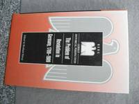
The Problem of Revolution in Germany 1789-1989 German Historical Perspectives
Oxford/New York: Berg 2000. Hardcover in very good condition; content clean and clear. AE. Hardcover. Very Good/No Dust Jacket. Used. Berg Hardcover
Riferimento per il libraio : 454104 ISBN : 1859732763 9781859732762
|
|
|
Rurup, Reinhard (ed)
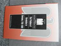
The Problem of Revolution in Germany 1789-1989 German Historical Perspectives
Oxford/New York: Berg 2000. Hardcover in very good condition; content clean and clear. AE. Hardcover. Very Good/No Dust Jacket. Used. Berg Hardcover
Riferimento per il libraio : 454092 ISBN : 1859732763 9781859732762
|
|
|
Rurup, Reinhard (ed.)
The Problem of Revolution in Germany, 1789-1989
Hardcover without jacket in excellent condition throughout. TS Used
|
|
|
Rurup, Reinhard (ed.)
The Problem of Revolution in Germany, 1789-1989 (German Historical Perspectives)
Hardcover in very good condition; content clean and clear. AE Used
|
|
|
Rurup, Reinhard (ed.)
The Problem of Revolution in Germany, 1789-1989 (German Historical Perspectives)
Hardcover in very good condition; content clean and clear. AE Used
|
|
|
RUS, Fernando (Photography) / GUIBERNAU, Julio F. (Text) / Pedro Bonet (Grabado)
BARCELONA Á LA VISTA. - ALBUM DE FOTOGRAFIAS DE LA CAPITAL Y SUS ALREDEDORES: 192 VISTAS.
Barcelona, Antonio Lopéz - Libreria Espanola, no date (ca. 1900). Ca. 180 unnumbered pages, photographically illustrated throughout. - Publisher's gilt and black illustrated titled red-silk blockbook-binding with white moirée-endpapers; oblong-Folio (ca. 28 x 36 cm; ca. 1,35 kg.).
Riferimento per il libraio : 1610191457xbvk
|
|
|
Ruscelli Girolamo (1504-1506)
Europae Tabula VIII
Inserita nell'opera "La Geografia di Claudio Tolomeo alessandrino, già tradotta di greco in italiano da M. Giero. Ruscelli: & hora in questa nuoua editione da M. Gio. Malombra ricorretta, & purgata d'infiniti errori: ... Con l'Espositioni del Ruscelli, ... Con una copiosa tauola de' nomi antichi, dichiarati co' nomi moderni: dal Malombra riueduta, & ampliata. Et con un Discorso di M. Gioseppe Moleto, .. ". Leggero alone al lato sinistro

|
|
|
RUSCELLI Girolamo (Viterbo 1504 – Venezia 1566)
Evropae Tabvla IX
Carta tratta dalla "Geographia di Claudio Tolomeo", a cura del Ruscelli, pubblicata in Venezia in pù edizioni tra il 1561 ed il 1598. La carta è basata sulla "Geografia" di Giacomo Gastaldi, che probabilmente disegnò personalmente anche queste mappe, che vennero incise dai fratelli Sanuto. La peculiarità di queste mappe è che sono incise due per lastra e successivamente tagliate; questo il motivo per cui il segno del rame appare solo in tre lati della mappa. Il testo del Ruscelli e le sue carte sono considerate come il miglior atlante moderno fino alla prima versione del Thatrum di Ortelius, 1570. Solo la loro enorme diffusione ne impedisce una valutazione sostenuta nel mercato antiquario. L'opera infatti ebbe una prima stesura nel 1561, stampata da Vincenzo Valgrisi che ne curò anche la ristampa del 1562. Tre sono le edizioni firmate da Giordano Ziletti (due nel 1564 e una del 1574), mentre nel 1597 viene edita dai fratelli Calignani. Tutte queste edizioni contengono 64 tavole. Nel 1598 e 1599 vengono alla luce le due edizioni curate da Giuseppe Rosaccio e stampate dagli Eredi di Melchior Sessa. Queste ultime due edizioni comprendono 69 tavole; sono infatti aggiunte la carta del planisfero e dei continenti del Rosaccio. Map, taken from Ruscelli edition of Ptolemy's "Geographia", printed in Venice from 1561 to 1598. Ruscelli's Atlas is an expanded edition of Gastaldi's "Geografia" of 1548, which has been called the most comprehensive atlas produced between Martin Waldseemüller's Geographiae of 1513, and the Abraham Ortelius Theatrum of 1570. Ruscelli and Gastaldi's maps were beautifully engraved on copper, marking a turning point in the history of cartography. From that point forward, the majority of cartographic works used this medium. As it was a harder material than wood it gave the engraver the ability to render more detail. Gastaldi sought the most up-to-date geographical information available, making the modern maps in Ruscelli's Geographia among the best modern maps of the period. The maps are engraved by the Sanuto borthers.Only their enormous diffusion prevents a sustained evaluation in the antique market. The work in fact had a first issue in 1561, printed by Vincenzo Valgrisi who also edited the reprint of 1562. There are three editions signed by Giordano Ziletti (two in 1564 and one in 1574), while in 1597 it was edited by the Calignani brothers. All these editions contain 64 engraved maps. In 1598 and 1599 the two editions edited by Giuseppe Rosaccio and printed by the heirs of Melchior Sessa come to light. These last two editions include 69 plates; in fact the map of the planisphere and of the continents of Rosaccio are added.

|
|
|
RUSCELLI Girolamo (Viterbo 1504 – Venezia 1566)
Evropae Tabvla V
Carta tratta dalla "Geographia di Claudio Tolomeo", a cura del Ruscelli, pubblicata in Venezia in pù edizioni tra il 1561 ed il 1598. La carta è basata sulla "Geografia" di Giacomo Gastaldi, che probabilmente disegnò personalmente anche queste mappe, che vennero incise dai fratelli Sanuto. La peculiarità di queste mappe è che sono incise due per lastra e successivamente tagliate; questo il motivo per cui il segno del rame appare solo in tre lati della mappa. Il testo del Ruscelli e le sue carte sono considerate come il miglior atlante moderno fino alla prima versione del Thatrum di Ortelius, 1570. Solo la loro enorme diffusione ne impedisce una valutazione sostenuta nel mercato antiquario. L'opera infatti ebbe una prima stesura nel 1561, stampata da Vincenzo Valgrisi che ne curò anche la ristampa del 1562. Tre sono le edizioni firmate da Giordano Ziletti (due nel 1564 e una del 1574), mentre nel 1597 viene edita dai fratelli Calignani. Tutte queste edizioni contengono 64 tavole. Nel 1598 e 1599 vengono alla luce le due edizioni curate da Giuseppe Rosaccio e stampate dagli Eredi di Melchior Sessa. Queste ultime due edizioni comprendono 69 tavole; sono infatti aggiunte la carta del planisfero e dei continenti del Rosaccio. Map, taken from Ruscelli edition of Ptolemy's "Geographia", printed in Venice from 1561 to 1598. Ruscelli's Atlas is an expanded edition of Gastaldi's "Geografia" of 1548, which has been called the most comprehensive atlas produced between Martin Waldseemüller's Geographiae of 1513, and the Abraham Ortelius Theatrum of 1570. Ruscelli and Gastaldi's maps were beautifully engraved on copper, marking a turning point in the history of cartography. From that point forward, the majority of cartographic works used this medium. As it was a harder material than wood it gave the engraver the ability to render more detail. Gastaldi sought the most up-to-date geographical information available, making the modern maps in Ruscelli's Geographia among the best modern maps of the period. The maps are engraved by the Sanuto borthers.Only their enormous diffusion prevents a sustained evaluation in the antique market. The work in fact had a first issue in 1561, printed by Vincenzo Valgrisi who also edited the reprint of 1562. There are three editions signed by Giordano Ziletti (two in 1564 and one in 1574), while in 1597 it was edited by the Calignani brothers. All these editions contain 64 engraved maps. In 1598 and 1599 the two editions edited by Giuseppe Rosaccio and printed by the heirs of Melchior Sessa come to light. These last two editions include 69 plates; in fact the map of the planisphere and of the continents of Rosaccio are added.

|
|
|
RUSCELLI Girolamo (Viterbo 1504 – Venezia 1566)
Moscovia Nvova Tavola
Carta tratta dalla "Geographia di Claudio Tolomeo", a cura del Ruscelli, pubblicata in Venezia in pù edizioni tra il 1561 ed il 1598. La carta è basata sulla "Geografia" di Giacomo Gastaldi, che probabilmente disegnò personalmente anche queste mappe, che vennero incise dai fratelli Sanuto. La peculiarità di queste mappe è che sono incise due per lastra e successivamente tagliate; questo il motivo per cui il segno del rame appare solo in tre lati della mappa. Il testo del Ruscelli e le sue carte sono considerate come il miglior atlante moderno fino alla prima versione del Thatrum di Ortelius, 1570. Solo la loro enorme diffusione ne impedisce una valutazione sostenuta nel mercato antiquario. L'opera infatti ebbe una prima stesura nel 1561, stampata da Vincenzo Valgrisi che ne curò anche la ristampa del 1562. Tre sono le edizioni firmate da Giordano Ziletti (due nel 1564 e una del 1574), mentre nel 1597 viene edita dai fratelli Calignani. Tutte queste edizioni contengono 64 tavole. Nel 1598 e 1599 vengono alla luce le due edizioni curate da Giuseppe Rosaccio e stampate dagli Eredi di Melchior Sessa. Queste ultime due edizioni comprendono 69 tavole; sono infatti aggiunte la carta del planisfero e dei continenti del Rosaccio. Map, taken from Ruscelli edition of Ptolemy's "Geographia", printed in Venice from 1561 to 1598. Ruscelli's Atlas is an expanded edition of Gastaldi's "Geografia" of 1548, which has been called the most comprehensive atlas produced between Martin Waldseemüller's Geographiae of 1513, and the Abraham Ortelius Theatrum of 1570. Ruscelli and Gastaldi's maps were beautifully engraved on copper, marking a turning point in the history of cartography. From that point forward, the majority of cartographic works used this medium. As it was a harder material than wood it gave the engraver the ability to render more detail. Gastaldi sought the most up-to-date geographical information available, making the modern maps in Ruscelli's Geographia among the best modern maps of the period. The maps are engraved by the Sanuto borthers.Only their enormous diffusion prevents a sustained evaluation in the antique market. The work in fact had a first issue in 1561, printed by Vincenzo Valgrisi who also edited the reprint of 1562. There are three editions signed by Giordano Ziletti (two in 1564 and one in 1574), while in 1597 it was edited by the Calignani brothers. All these editions contain 64 engraved maps. In 1598 and 1599 the two editions edited by Giuseppe Rosaccio and printed by the heirs of Melchior Sessa come to light. These last two editions include 69 plates; in fact the map of the planisphere and of the continents of Rosaccio are added.

|
|
|
RUSCELLI Girolamo (Viterbo 1504 – Venezia 1566)
Polonia et Hungaria Nvova Tavola
Carta tratta dalla "Geographia di Claudio Tolomeo", a cura del Ruscelli, pubblicata in Venezia in pù edizioni tra il 1561 ed il 1598. La carta è basata sulla "Geografia" di Giacomo Gastaldi, che probabilmente disegnò personalmente anche queste mappe, che vennero incise dai fratelli Sanuto. La peculiarità di queste mappe è che sono incise due per lastra e successivamente tagliate; questo il motivo per cui il segno del rame appare solo in tre lati della mappa. Il testo del Ruscelli e le sue carte sono considerate come il miglior atlante moderno fino alla prima versione del Thatrum di Ortelius, 1570. Solo la loro enorme diffusione ne impedisce una valutazione sostenuta nel mercato antiquario. L'opera infatti ebbe una prima stesura nel 1561, stampata da Vincenzo Valgrisi che ne curò anche la ristampa del 1562. Tre sono le edizioni firmate da Giordano Ziletti (due nel 1564 e una del 1574), mentre nel 1597 viene edita dai fratelli Calignani. Tutte queste edizioni contengono 64 tavole. Nel 1598 e 1599 vengono alla luce le due edizioni curate da Giuseppe Rosaccio e stampate dagli Eredi di Melchior Sessa. Queste ultime due edizioni comprendono 69 tavole; sono infatti aggiunte la carta del planisfero e dei continenti del Rosaccio. Map, taken from Ruscelli edition of Ptolemy's "Geographia", printed in Venice from 1561 to 1598. Ruscelli's Atlas is an expanded edition of Gastaldi's "Geografia" of 1548, which has been called the most comprehensive atlas produced between Martin Waldseemüller's Geographiae of 1513, and the Abraham Ortelius Theatrum of 1570. Ruscelli and Gastaldi's maps were beautifully engraved on copper, marking a turning point in the history of cartography. From that point forward, the majority of cartographic works used this medium. As it was a harder material than wood it gave the engraver the ability to render more detail. Gastaldi sought the most up-to-date geographical information available, making the modern maps in Ruscelli's Geographia among the best modern maps of the period. The maps are engraved by the Sanuto borthers.Only their enormous diffusion prevents a sustained evaluation in the antique market. The work in fact had a first issue in 1561, printed by Vincenzo Valgrisi who also edited the reprint of 1562. There are three editions signed by Giordano Ziletti (two in 1564 and one in 1574), while in 1597 it was edited by the Calignani brothers. All these editions contain 64 engraved maps. In 1598 and 1599 the two editions edited by Giuseppe Rosaccio and printed by the heirs of Melchior Sessa come to light. These last two editions include 69 plates; in fact the map of the planisphere and of the continents of Rosaccio are added.

|
|
|
RUSCELLI Girolamo (Viterbo 1504 – Venezia 1566)
Tabvla Evropae I
Carta tratta dalla "Geographia di Claudio Tolomeo", a cura del Ruscelli, pubblicata in Venezia in pù edizioni tra il 1561 ed il 1598. La carta è basata sulla "Geografia" di Giacomo Gastaldi, che probabilmente disegnò personalmente anche queste mappe, che vennero incise dai fratelli Sanuto. La peculiarità di queste mappe è che sono incise due per lastra e successivamente tagliate; questo il motivo per cui il segno del rame appare solo in tre lati della mappa. Il testo del Ruscelli e le sue carte sono considerate come il miglior atlante moderno fino alla prima versione del Thatrum di Ortelius, 1570. Solo la loro enorme diffusione ne impedisce una valutazione sostenuta nel mercato antiquario. L'opera infatti ebbe una prima stesura nel 1561, stampata da Vincenzo Valgrisi che ne curò anche la ristampa del 1562. Tre sono le edizioni firmate da Giordano Ziletti (due nel 1564 e una del 1574), mentre nel 1597 viene edita dai fratelli Calignani. Tutte queste edizioni contengono 64 tavole. Nel 1598 e 1599 vengono alla luce le due edizioni curate da Giuseppe Rosaccio e stampate dagli Eredi di Melchior Sessa. Queste ultime due edizioni comprendono 69 tavole; sono infatti aggiunte la carta del planisfero e dei continenti del Rosaccio. Map, taken from Ruscelli edition of Ptolemy's "Geographia", printed in Venice from 1561 to 1598. Ruscelli's Atlas is an expanded edition of Gastaldi's "Geografia" of 1548, which has been called the most comprehensive atlas produced between Martin Waldseemüller's Geographiae of 1513, and the Abraham Ortelius Theatrum of 1570. Ruscelli and Gastaldi's maps were beautifully engraved on copper, marking a turning point in the history of cartography. From that point forward, the majority of cartographic works used this medium. As it was a harder material than wood it gave the engraver the ability to render more detail. Gastaldi sought the most up-to-date geographical information available, making the modern maps in Ruscelli's Geographia among the best modern maps of the period. The maps are engraved by the Sanuto borthers.Only their enormous diffusion prevents a sustained evaluation in the antique market. The work in fact had a first issue in 1561, printed by Vincenzo Valgrisi who also edited the reprint of 1562. There are three editions signed by Giordano Ziletti (two in 1564 and one in 1574), while in 1597 it was edited by the Calignani brothers. All these editions contain 64 engraved maps. In 1598 and 1599 the two editions edited by Giuseppe Rosaccio and printed by the heirs of Melchior Sessa come to light. These last two editions include 69 plates; in fact the map of the planisphere and of the continents of Rosaccio are added.

|
|
|
Rusconi, Art. Jahn:
La Villa, il Museo e la Galleria Borghese. Con 157 illustrazioni.
28 cm. 196 pp. Contemporary half vellum, leather shield on spine (fine). Bücher it
|
|
|
Rusconi, Jahn
Siena - (Collezione Monografie Illustrate - Serie 1.a - Italia Artistica 9.) Sprache: Italienisch
Bergamo : Istituto Italiono d'Arti Grafiche - Editore 1913. 159 p. mit Abb. Broschur, Softcover/Paperback, leichte Gebrauchsspuren am Einband, sonst guter Zustand
Riferimento per il libraio : 50032

|
|
|
Rushforth, Gordon McNeil
LATIN HISTORICAL INSCRIPTIONS; Illustrating the History of the Early Empire
Oxford Clarendon Press. 1893. First Edition. Hardcover. Good in No Dust Jacket dust jacket. Some pages are uncut. Spine is discolored. Rubbing and minor soiling to boards. Edgewear to spine ends. Small tear to cloth along spine 1cm. Overall a solid copy.; Looks at latin historical inscriptions and deciphers them along with the lessons they teach for modern readers.; 144 pages . Oxford Clarendon Press hardcover
Riferimento per il libraio : 2722
|
|
|
Rusinski, W
Osady tzw. "Oledrów" w dawnym woj. poznanskim.
Kraków, 1947. M. 1 Kte. u. 4 Taf. X, 160 S. (Prace Komisji atlasu histor. Polski 5).
Riferimento per il libraio : 237997
|
|
|
Rusling, James F.
EUROPEAN DAYS AND WAYS
Spine frayed at top and bottom and hinges. Corners of boards chipped. Hinges weakening ; Over sixty illustrations; Ex-Lib; 8vo; 420 pages
|
|
|
Rusling, James F.
EUROPEAN DAYS AND WAYS
Boards with light wear to extremities. ; Over sixty illustrations. A nice thorough description of many European cities and towns ; B&W Photographs; 8vo; 420 pages
|
|
|
Russell John
Seurat
illustrazioni a colori e in bianco e nero
|
|
|
RUSSELL Junior
Denmark.
London, (comienzos del siglo XIX), grabado en cobre, en colores, de 22 x 18'5 cm.
|
|
|
RUSSELL SMITH Joseph
Grassland and farmland as factors in the cyclical development of eurasian history
From the Smithsonian Report for 1944, pages 357-384 (with 1 plate). Estratto dalla relazione annuale per il 1944 dello Smithsonian Institution. 8vo (cm 24,5 x 15,5 ca), cucitura a punti metallici, brossura editoriale; frontespizio + pagine numerate da 357 a 384; 18 figure in b/n nel testo (ma fig. 9 fuori testo ripiegata) + 1 tavola fuori testo in fine (con 2 illustrazioni in b/n). Punti metallici arrugginiti (macchie di ruggine alla carta), una piccola gora sulla copertina posteriore, usura dell'orlo sporgente di alcune carte. Copia discreta.
|
|
|
Russell, Bertrand
La Saggezza dell'Occidente. Panorama Storico della Filosofia Occidentale nei suoi Sviluppi Sociali e Politici
Mm 205x280 Collana "Il Labirinto" - Volume rilegato in tela con titolo oro al dorso, custodia protettiva figurata, 320 pagine con numeroe figure in nero e a colori. Spedizione in 24 ore dalla conferma dell'ordine.
|
|
|
Russell, Bertrand
Philosophie des Abendlandes : ihr Zusammenhang mit der politischen und der sozialen Entwicklung / Übertr. aus d. Engl. von Elisabeth Fischer-Wernecke...
München [u.a.] : Europaverl., 1999. 855 S. Gr. 8°. 8. Aufl. OBroschur.
Riferimento per il libraio : 46032
|
|
|
RUSSELL, BERTRAND.
Legitimacy versus Industrialism 1814 - 1848.
|
|
|
Russell, Charles, Jaroslaw Pluciennik and Arne Melberg (eds.)
Critical theory and critical genres : contemporary perspectives from Poland. Literary and cultural theory ; Vol. 41.
Frankfurt, M. : Lang-Ed., 2014. 219 p. Original brochure, 22 cm.
Riferimento per il libraio : 1089051

|
|
|
Russell, John
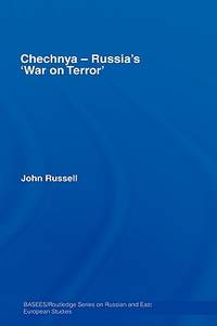
Chechnya - Russia's 'War on Terror': 34 Basees/Routledge Series on Russian and East European Studies
Routledge 2007. This is an ex-library book and may have the usual library/used-book markings inside.This book has hardback covers. Book contains pencil markings. In fair condition suitable as a study copy. No dust jacket. Please note the Image in this listing is a stock photo and may not match the covers of the actual item600grams ISBN:9780415380645 Routledge hardcover
Riferimento per il libraio : 6051871 ISBN : 0415380642 9780415380645
|
|
|
Russell, Rev Fereric William
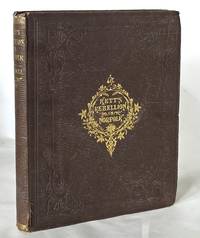
Kett's Rebellion in Norfolk; Being a History of the Great Civil Commotion that Occurred at the Time of the Reformation in the Reign of Edward VI
London: Longman Brown Green Longmans & Roberts 1859. First Edition. Hardcover. Very good. Quarto 240 pp in original brown cloth decorated in gilt illustrated with eight b/w lithographed plates and two mounted original photographs. Slight pull to binding visible at title page possibly also the removal of a tissue guard small losses to cloth at spine ends corners bumped but overall still an attractive very good copy with the bookplate of collector Isabelle Brown on the front pastedown. Also known as the Norfolk Rebellion Kett's rebellion was led by yeoman farmer Robert Kett of Wyndmonham in response to the enclosure of common land. Longman, Brown, Green, Longmans, & Roberts hardcover
Riferimento per il libraio : 24363
|
|
|
Russell, William
The History of Modern Europe, particularly France, England, and Scotland; with a view of the progress of society ...
280p. Abridged from Russell's Modern Europe by A Lady of Massachusetts Hardcover Good condition in full calf! spine rubbed
|
|
|
Russell, William (1741-1793).
THE HISTORY OF ANCIENT EUROPE. With A View Of The Revolutions In Asia And Africa. In A Series Of Letters To A Young Nobleman. Two Volumes.
Two Volumes. Light age stain. Early manuscript ownership of 'Darlington' on both title pages. Likely William Darlington (1782-1863) Chester County physician, botanist, and member of the U.S. House of Representatives Also an early manuscript inscription 'Wm. P. Marshall, Chester County (PA) Atheneum' on both front paste downs. 8vo. 220 mm. Original Philadelphia leather bindings. Original leather spine labels. Hardbound. Very good. SCARCE. S&S/AI 1278. PAIMP 24
|
|
|
RUSSINOW, Andrei
Die große Täuschung. Aufzeichnungen aus Sowjetrußland, die der G.P.U. entgangen sind.
Lpz.,Hesse & Becker (um 1940). 2.Aufl. gr.8°. 318 S. Oln., Einband fleckig, Besitzvermerk am Vorsatz, durchgänig leicht stockfleckig, insges. in gutem Zustand.
Riferimento per il libraio : R0011-A99

|
|
|
Russland - ECKARDT Julius (Wilhelm Albert von)
Russlands ländliche Zustände seit Aufhebung der Leibeigenschaft. Drei Russische Urtheile übersetzt und commentirt von Julius Eckardt.
Leipzig. Duncker & Humblot. 1870. (2), XII, (1), 264 Seiten. Breitrandiges unbeschnittenes Exemplar. Original-Broschur. (Mit geringen Gebrauchsspuren; Papier teils etwas fleckig; 2 Bl. mit Bibl.-Stempeln). 23x15 cm
Riferimento per il libraio : 28921

|
|
|
Russland / Reiseführer - Gerhard, Wolfgang
Praktischer Reiseführer durch Russland. Nebst Grammatik der russischen Sprache, Dolmetscher mit Aussprache-Bezeichnung, vollständigem Wörterbuch und Eisenbahnkarte
Leipzig, Wolfgang Gerhard, (1881). 2 Tle. in 1. OHLwd. 270 S., 1 Bl.; 135 (1) S. gebundene Ausgabe, Hardcover/Pappeinband, Einbd. beschabt u. bestoß.; Karte mit Einriss
Riferimento per il libraio : 6452

|
|
|
Russo Giuseppe (Testo di)
Sonia Kreemers Leonardo Fretta 2
illustrazioni
|
|
|
Russo, Elena
Styles of Enlightenment: Taste, Politics, and Authorship in Eighteenth-Century France
Hardcover in dust jacket. Very good condition. Spine ends are a little bumped. Pages are sound and clear. TA Used
|
|
|
Russo, Enzo
Ursinis großer Coup : ein Tatsachenroman über die moderne Mafia / aus d. Ital. von Werner Raith.
Reinbek bei Hamburg : Rowohlt, 1992. 406 S. 8°. 1. Aufl. Bibl.- Einbd.
Riferimento per il libraio : 32524
|
|
|
Russo, Renato
Federico II e Le Donne
Mm 170x240 Brossura editoriale con alette, copertina illustrata a colori, 119 pagine, illustrazioni nel testo. Ottimo stato. Spedizione entro 24 ore dalla conferma dell'ordine.
|
|
|
RUSSOLI Franco (Presentazione di)
ANNIBALE ZUCCHINI. Sculture dal 1918 al 1969
illustrazioni in bianco e nero
|
|
|
Rutari, A
Londoner Skizzenbuch. Fotogr. Abb. auf Tafeln.
Leipzig, Ludwig Degener 1907. 2. Aufl. 8°. 292 S. OLn. Name auf Vortitel, sonst gutes, festes Expl.! 2 OLn.
Riferimento per il libraio : 37466AB
|
|
|
RUTGERS A
OISEAUX D ' EUROPE.
Gorssel , Littera scripta Manet , 1965 , 2 vols grand in 8 , toile verte éditeur , 167 - 167 pp . Illustré de planches couleurs à pleine page extraites des ouvrages de John Gould Langue: Français
Riferimento per il libraio : M16322
|
|
|
Rutgers, A
Europäische Vögel. Ein Vogelparadies in Farben. Ausgewählt aus John Gould "The Birds of Europe" und "The Birds of Great Britain". Band 1 und Band 2
Gorssel: Verlag Littera Scripta Manet, 1966 - 1970. 167, 167 S. ; 25 x 19 cm ; Leinen.
Riferimento per il libraio : 131200

|
|
|
Ruthner, Anton von
Berg und Gletscher-Reisen in den österreichischen Hochalpen.
Wien, Gerold, 1864. XVII, 414 S. Mit 6 chromolith. Tafeln und 1 gef. lith. Karte. Halblederband der Zeit mit geprägtem Rückentitel und reicher -vergoldung.
Riferimento per il libraio : 15623AB
|
|
|
Rutschke, Erich
Die Wildschwäne Europas : Biologie - Ökologie - Verhalten. 1. Aufl.
Berlin : Dt. Landwirtschaftsverl., 1992. 227 S., Ill. OPp., gebundene Ausgabe.
Riferimento per il libraio : 155757

|
|
|
Rutschke, Erich
Die Wildschwäne Europas. Biologie, Ökologie, Verhalten.
Berlin : Dt. Landwirtschaftsverl., 1992. 1. Auflage; 227 S., mit 18. Karten, 74 Zeichnungen, 4 Farbtafeln und 38 Farbfotos. 8°; gebunden, illustrierter Orig.-Pappband;
Riferimento per il libraio : 124022

|
|
|
Rutten, M. G
The Geology of Western Europe.
Amsterdam. London, New York., Elsevier Publishing Company., 1969. XVIII, 520 Seiten mit 303 Illustrationen und 20 Tabellen (with 303 illustrations and 20 tables). Zuistand: Aus einer Institutsbibliothek ausgeschieden, Vorsatz mit Bibliotheksstempel - entwertet, Titelblatt mit Nummernstempel. 4°. OLeinen.
Riferimento per il libraio : 051529
|
|
|
Rutter, N.K.
A Catalogue of the Ancient Greek Coins in the Collections of The Royal Scottish Museum, Edinburgh: Volume 1
Staplebound paperback in very good condition. Spine is sunned, and edges are slightly discoloured. Pages and text are clear and unmarked throughout. LW Used
|
|

 Ricevere i risultati per e-mail
 Scaricare i risultati in PDF
 RSS feed
 Link
Link


