|
|
|
van Gerven.
HET RECHTELIJK BESLUITVORMINGSPROCES EN DE EENMAKING VAN EUROPA.
, Brussel, Paleis Der Academien, 1979., Gebrocheerd, in-4? , 22pp.
书商的参考编号 : 2324
|
|
|
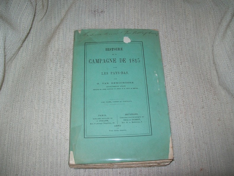
VAN REMOORTERE
HISTOIRE DE LA CAMPAGNE DE 1815 dans les Pays-Bas.
Paris Dumaine, Bruxelles Decq et Duhent 1879. In-8 broché 3 feuillets non chiffrés 8-397pp. Orné de 4 portraits dont celui de Napoléon en frontispice, 6 tableaux (2 sur double page, 2 à pleine page, 2 dans le texte), 5 grandes cartes dépliantes. Dos fendillé, petits manques sur les plats de la couverture, auréole ancienne claire en marge angulaire d'un portrait. Exemplaire sans rousseurs, complet de son texte, des tableaux, des portraits et des cartes. Rare.
书商的参考编号 : GITg541
|
|
|
VAN BENEDEN P.-J.
Histoire naturelle des delphinides des mers d'Europe
Bruxelles, Académie royale (impr. par Hayez) 1889 253pp., publié dans et extrait (et donc sans brochure) des "Mémoires couronnés et autres mémoires publiés par l'Académie Royale des Sciences, des Lettres et des Beaux-Arts de Belgique" coll.in-8 Tome XLIII (43), non coupé, bon état, W57588
书商的参考编号 : W57588
|
|
|
VAN DER MEER (Frédéric).
Images du Christ dans la sculpture au Nord des Alpes et des Pyrénées.
Anvers et Paris Fonds Mercator, Albin Michel 1980 1 vol. relié in-4, cartonnage sous jaquette illustrée, étui cartonné, 328 pp., nombreuses photos en noir et en couleurs de Hans Sibbelee. Très bon état.
书商的参考编号 : 100422
|
|
|
VAN DER MEER (Frédéric).
Images du Christ dans la sculpture au Nord des Alpes et des Pyrénées.
Anvers et Paris Fonds Mercator, Albin Michel 1980 1 vol. relié in-4, cartonnage sous jaquette illustrée, étui cartonné, 328 pp., nombreuses photos en noir et en couleurs de Hans Sibbelee. Très bon état.
书商的参考编号 : 100422
|
|
|
VAN HOLK (Lambert E.).
Introduction bibliographique à l'histoire du droit et à l'ethnologie juridique, C/4. Pays-Bas.
Bruxelles, Editions de l'Institut de Sociologie Université Libre, 1971 in-8, 54 pp., agrafé, sous couverture.
书商的参考编号 : 240250

|
|
|
VANDER LINDEN Herman
Itinéraires de Marie de Bourgogne et de Maximilien d'Autriche (1477-1482)
Bruxelles, Lamertin 1934 xiv + 125pp., 31cm., reliure cart. d'éditeur intacte, imprimé sur papier de luxe, non coupé, quelques rousseurs aux tranches, le texte est frais et sans rousseurs, publication de l'Académie royale de Belgique, bon état, B99752
书商的参考编号 : B99752
|
|
|
Van Ackere Jules
L'europe de la renaissance du baroque et du rococo
Meddens Cartonné avec jaquette 1969 In-4 (29*25.5), cartonné sous jaquette illustrée, 243pp., texte sur deux colonnes, nombreuses illustrations in et hors-texte ; jaquette légèrement usée, très bon état. Livraison a domicile (La Poste) ou en Mondial Relay sur simple demande.
书商的参考编号 : bf3241
|
|
|
VAN JOLE Marcel
Le pouvoir de l'exemple, 40 ans d'Europa Nostra/The power of example, 40 years of Europa Nostra/Het voorbeeld aan de macht, 40 jaar Europa Nostra.
Den Haag, Europa Nostra, 2002. 26 x 30, 455 pp., très nombreuses illustrations en couleurs, reliure d'édition pleine toile + jaquette, très bon état.
书商的参考编号 : 42130
|
|
|
VANDEN ABEELE (dir.)
Le marché commun et le marché de l'art. Journée d'études organisée par l'Institut d'Etudes européennes, Bruxelles 1er mars 1982
Bruxelles, Editions de l'Université de Bruxelles 1982 119pp., br.orig., 24cm., bon état, S84613
书商的参考编号 : S84613
|
|
|
VAN DER ESSEN Alfred
Le Cardinal-Infant et la politique européenne de l'Espagne (1609-1641). Tome premier
Louvain / Bruxelles, Bibliothèque de l'Université / Editions Universitaires 1944 Tome 1 (le seul paru); xxvii + 485pp. + carte dépliante hors-texte + planches hors-texte, 25cm., jolie reliure solide en toile brune, titre doré au dos, qqs. cachets, texte frais, bon état, G116133
书商的参考编号 : G116133
|
|
|
VAN LIER H.H.
Mijnen en mensen in Spanje - de praktijk van het nationaal-syndicalisme
Utrecht-Nijmegen, Dekker & Van de Vegt 1953 [xx +] 392pp.+ kaarten en buitentekstills.+ bijgevoegd: losbladig 11 tabellen, [Academisch proefschrift ter verkrijging van de graad van doctor in de letteren en wijsbegeerte aan de Universiteit van Amsterdam 19 mei 1953], stempel op titelblad, goede staat
书商的参考编号 : G40122
|
|
|
VAN DUIJL C.F.
Onze geschiedenis geschetst in haar verband met de algemeene historie
Kampen, Laurens Van Hulst 1883 407pp., orig.omslag, 1e druk, 20cm., stempeltje
书商的参考编号 : N39320
|
|
|
VAN DER MEER F., LEMMENS G.
Petit atlas de la civilisation occidentale.
Paris/Bruxelles, Editions Sequoia, 1964. 14 x 21, 224 pp., quelques illustrations en N/B, reliure souple d'édition, très bon état.
书商的参考编号 : 78801
|
|
|
VAN DER TUIN (Henri).
Publications de la Faculté des lettres de l'Université de Lille, IX. Les Vieux peintres des Pays-Bas et la critique artistique en France de la première moitié du XIXe siècle.
Paris, Joseph Vrin, 1948 in-8, 256 pp., avec 6 planches hors texte, broché. Manque de papier en queue du dos.
书商的参考编号 : 239551
|
|
|
VAN ROOSBROECK R.
Revolutie over Europa
, Antwerpen, Volksuniversiteit "Herman van den Reeck" 1935, 32pp., G21988
书商的参考编号 : G21988
|
|
|
VAN DIJK H.A.
Répertoire historique et chronologique des Traités conclu par la Hollande depuis 1789 jusqu'à nos jours
Utrecht, Kemink en zoon 1846 xix + 357pp., 22cm., reliure cart.avec dos en toile (charnières restaurées), cachet, intérieur en bel état, peu commun, J46027
书商的参考编号 : J46027
|
|
|
Van Kley (Dale)
The French Idea of Freedom The Old Regime and the Declaration of Rights of 1789.
Stanford University Press, 1994 22,86 x 15,24 x 2,9 cm., 436 pp, Broché
书商的参考编号 : 241855

|
|
|
Van Gelderen Martin
The Political Thought of the Dutch Revolt 1555-1590 (Ideas in Context)
Cambridge University Press 1993 332 pages 3x24x17cm. 1993. Cartonné jaquette. 332 pages.
书商的参考编号 : 100137260 ???????? : 521891639

|
|
|
Vanhaverbeke, J. Poblome, M. Waelkens, F. Vermeulen, R. Brulet (eds.)
Thinking about Space, The potential of surface survey and contextual archaeology in the definition of space in Roman times.
, Brepols, 2008 Paperback, X 255 p., 5 colour ill., 210 x 295 mm, Languages: English. fine condition !!. ISBN 9782503513577.
书商的参考编号 : 42514
|
|
|
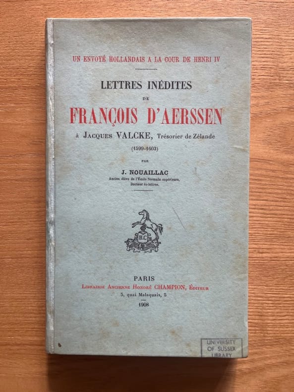
VAN AERSSEN VAN SOMMELSDYK (François).
Un envoyé hollandais à la cour de Henri IV. Lettres inédites à Jacques Valcke. trésorier de Zélande (1599-1603). Par J. Nouaillac
Paris, Champion, 1908 in-8, 215 pp., couverture cartonnée. Cachet annulé de l'University of Sussex Library.
书商的参考编号 : 242419
|
|
|
VAN WILDERODE, Anton;
VERGILIUS, DICHTER VOOR EUROPA,
Leuven, Leuvense Schrijversaktie, 1992 Originele uitgeversomslag, lichtblauwe stevige papieromslag, 135 x 210mm., 16pp.,
书商的参考编号 : 22916
|
|
|
Van Bath B.H. Slicher.
Storia agraria dell'Europa occidentale (500-1850). Presentazione di Ruggiero Romano.
Brossura editoriale, copia molto buona; R. Q2.
|
|
|
VAN BENEDEN P.-J.
Histoire naturelle des delphinides des mers d'Europe
253pp., publié dans et extrait de "Mémoires couronnés et autres mémoires publiés par l'Académie Royale des Sciences, des Lettres et des Beaux-Arts de Belgique" coll.in-8 Tome XLIII, non coupé
|
|
|
Van Bree, L
Joost De "Indiaan"
Rotterdam Netherlands: De Erven De Wed. J. Van Nelle N.V. 1937. Book. Illus. by Van Leeuwen Nans. Fair. Paperback. First Edition. 8vo - over 7¾" - 9¾" tall. 152 pages. Black and white drawings. "Een verhaal voor jongens en meisjes." - from title page. Text in Dutch. Lovely front cover colour illustration of boy and girl skating. Above-average external soiling and wear. Unmarked. Binding leaning but intact. A worthy copy of this delightful and nostalgic work. De Erven De Wed. J. Van Nelle N.V. Paperback
书商的参考编号 : 136c8473
|
|
|
Van Bree, L.
Joost, De "Indiaan"
152 pages. Black and white drawings. "Een verhaal voor jongens en meisjes." - from title page. Text in Dutch. Lovely front cover colour illustration of boy and girl skating. Above-average external soiling and wear. Unmarked. Binding leaning but intact. A worthy copy of this delightful and nostalgic work. Book
|
|
|
Van Caenegam, R.C.
Law, History, The Low Countries and Europe
Hardcover in unclipped dust jacket with light wear to edges and minimal scoring. Spine ends very lightly bumped, pages clean and crisp throughout. AD Used
|
|
|
Van Caenegem, R. C.
Judges, Legislators and Professors: Chapters in European Legal History
Hardcover in dust jacket, in good condition. Goodhart lectures 1984-1985. From the collection of the late Tony Honore, with his name penned on FEP. Jacket spine is faded and inner flaps and edges of rear jacket are tanned. A few scores to jacket front and rear. Page block and edges of pages are tanned. Minor mark to front pastedown and notes in pen on REP. Pen marks in margins of a couple of pages, but pages remain sound and text is clear throughout. TA Used
|
|
|
Van Caenegem, R. C. u. F. L. Ganshof
Kurze Quellenkunde des westeuropäischen Mittelalters. Eine typologische, historische und bibliographie Einführung. Aus dem Niederländischen.
Göttingen, Vandenhoeck & Ruprecht, 1962. Gross-8°. XIII, 2, 365 S. Original-Leinenband mit Farbkopfschnitt u. Schutzumschlag. Schnitt leicht gebräunt u. teils leicht angestaubt, Umschlag lichtrandig u. etwas abgegriffen u. bestossen. Innen sauber.
书商的参考编号 : 31913AB

|
|
|
VAN DE GRAFT J.
De tapijtfabrieken der XVIe en XVIIe eeuw, gevolgd door eene historische beschrijving der zeven tapijthangsels in de groote vergaderzaal der provinciale staten van Zeeland
xii + 194pp., tekst is volledig maar mapje met 7 gravures ontbreekt, 24cm., gecart.band (gemarbreerde platten, lederen rug met titel in goudopdruk), goede staat, S81283
|
|
|
Van de Velde, Ronny [Herausgeber]
The Turn of a Century. 1885 - 1915.
Antwerpen., Ronny van de Velde., 2005. 4°. [40 S.] Illustrierter OKarton., 50664A.jpg 1. Auflage. Einbandkanten stellenweise etwas berieben. Gutes Exemplar.
书商的参考编号 : 50664AB

|
|
|
van der Aa, Pieter
Den Aardbodem na de Zundvloed dor Noachs dri Soonen en hare nakomelingen bevolkt. Gen. 10. -
Leiden:, [um 1730]. Kupferstich 21 x 42 cm, Blattgröße 39 x 49 cm.
书商的参考编号 : 910872CG

|
|
|
Van Der Louw, Andre
Rood Als Je Hart: 'n Geschiedenis Van De AJC
296 pages. Black and white photographic plates. Unmarked. Average wear. Sound copy. Book

|
|
|
VAN DER MEER, F. LEMMENS, G.
PANORAMA DE LA CULTURA OCCIDENTAL.
21x14. 224p. Trad. L. Gil. Ilstr. Fotogr.

|
|
|
Van der Meersch Maxence
Corpi e anime
trad. di Matilde Castaldi Bertone tela edit. con sovrac. ill., piccole rotture e mancanze in sovrac.
|
|
|
VAN DER PALM J.H.
Geschied- en redekunstig gedenkschrift van Nederlands herstelling in den jare 1813
114pp., 2e dr., ingebonden in linnen band (originele omslag bewaard)
|
|
|
van der Veen, Sytze
75 Years Erasmus Boekhandel Amsterdam-Paris
Paperback. The lightest of wear at one or two points on covers and on BEP. Pages are clean and sound - all content is clear. TS Used
|
|
|
Van Der Waerden, B L ; English Translation By Arnold Dresden With Additions Of The Author
Science Awakening. Second English Language Edition With Revisipons
Oxford University Press 1961. Second English Language Edition 1st Printing. Hardcover. Very Good. 300 Pp. Gray Cloth. Second English Language Edition. Light Wear And Browning To Spine No Marks. <br/> <br/> Oxford University Press hardcover
书商的参考编号 : 057315
|
|
|
VAN DIJK H.A.
Répertoire historique et chronologique des Traités conclu par la Hollande depuis 1789 jusqu'à nos jours
xix + 357pp., 22cm., reliure cart.avec dos en toile (charnières restaurées), cachet, intérieur en bel état, peu commun, J46027
|
|
|
VAN DUIJL C.F.
Onze geschiedenis geschetst in haar verband met de algemeene historie
407pp., orig.omslag, 1e druk, 20cm., stempeltje
|
|
|
VAN GERWEN Jef & SWEENEY John 'eds.)
Des chrétiens pensent l'Europe
263pp., 22cm.
|
|
|
VAN GORKOM L.J.C.
De beteekenis van den Fransch-Duitschen oorlog 1870-1871
x + 193pp.+ 3pp.stellingen, 24cm., [Proefschrift ter verkrijging van den graad van doctor in de letteren en wijsbegeerte aan de Rijks-Universiteit te Utrecht, 1927]
|
|
|
Van Hasselt.
BELGIQUE ET HOLLANDE.
(Codice VR/0032) In 8° (22,50x15 cm) IV-551 pp. Edition originale. Volume illustré de 54 (sur 58) planches gravées en acier hors texte et 1 carte rempliée. Jaunissures éparses. Marges non massicotées. Reliure du temps demi toile et titre doré, très bon état. ~~~ SPEDIZIONE IN ITALIA SEMPRE TRACCIATA

|
|
|
VAN HOUTTE J.A.
Het verleden van Europa - twintig eeuwen sociaal-economische geschiedenis
303pp.rijkelijk geïll., gecart.band met geïll.stofwikkel, 30cm.
|
|
|
VAN KEULEN Gerard (1678 - 1726)
Nieuwe Paskaart van ‘t Eerste Gedeelte der Middelansche-Zee tusschen ‘t I. Cadix en ‘t I. Malta
Nieuwe Paskaart van ‘t Eerste Gedeelte der Middelansche-Zee tusschen ‘t I. Cadix en ‘t I. Malta = Nouvelle Carte Marine pour la Premier Partie de la Mer-Mediterranee (...) = The New Sea Map of the First Part of the Midland-Sea (...) = Nueva Carta Maritima la Primera Parte del Mar-Mediteraneo (...) = Nuova Carta Maritima la Prima Parte del Mar- Mediteraneo & Nieuwe Paskaart van ‘t Tweede Gedeelte der Middelandsche-Zee Tusschen ‘t I. Malta en Alexandretta = The New Sea Map of the Seconde Partie of the Midland-Sea (...) = Nouvelle Carte Marine pour la Deuxiesme Partie de la Mer-Mediterranee (...) = Nuova Carta Maritima la Seconda Parte del Mar-Mediteraneo (...).Acquaforte e bulino, stampata su due fogli, rispettivamente di dimensioni 600x990 mm e 595x1000 mm. Rappresentazione nautica del Mar Mediterraneo, suddiviso nella parte occidentale ed in quella orientale.Il titolo della parte occidentale, contenuto nel grande cartiglio decorativo a sinistra, è ripetuto in ben 5 lingue: olandese, francese, inglese, spagnolo e italiano. In basso al centro è riportato l’imprint editoriale: t’ Amsterdam by Ioannes van Keulen Boek Zeeekard Verkooper en Graad boog maker aan de Oost Zyde Vande Nieuwe Brug inde Gekroonde Lootsman met privilegie Nieuwelycks op Gestel door G: v: Keulen. Il titolo della parte orientale, nel grande cartiglio in alto a destra è riportato in 4 lingue ma non in spagnolo. In basso al centro si legge: t’ Amsterdam by Ioannes van Keulen Boek-Zeeekard Verkooper en Graad boog maker aande Oost Zyde van de Nieuwe brug inde Gekroonde Lootsman Opgestelt door G: v: Keulen. met Privilegie.Si tratta di una variante della carta precedente della tipografia Van Keulen - firmata da Johannes I Van Keulen e dal figlio Gerard e databile al 1709 - che vede le lastre emendate e leggermente ridotte (di circa 10 mm): vengono aggiunti degli elementi decorativi nel foglio di destra, dove è disegnato un gruppo di figure in abiti orientali che circonda il cartiglio; nel mare compaiono due navi collocate a largo di Malta e Cipro. Secondo Nils Persson (cfr. Loose printed Sea Charts published by Van Keulen, p. 177) le carte non sono parte di nessuna raccolta nautica, ma venivano vendute singolarmente.Nell’angolo superiore sinistro della tavola occidentale troviamo, fuori scala in un cartiglio, la rappresentazione del Mar Adriatico; nel foglio orientale, in basso a destra, troviamo il particolare della costa libica: Barbaria van I. Zerby tot Tripoli. La prima versione della carta appartiene al terzo volume dello Zee-Fakkel, del quale è una delle tavole aggiunte nel 1709 da Gerard van Keulen. Firmata da Johannes Van Keulen (1654 - 1715), la carta è completata e stampata dal figlio Gerard (1678 - 1726), il cui nome è riportato in entrambi i cartigli. Sebbene, secondo Koeman, la carta sarebbe stampata solo nel 1734 (cfr. AN, IV, p. 341, Keu 95 e V, p. 203), Irene Jacobs conferma che la carta appartiene all’aggiornamento dello Zee-Fakkel del 1709 (cfr. Charts in Zee-Fakkel and Zee-Atlas, p. 204). Il primo atlante Van Keulen nel quale abbiamo riscontrato la presenza della carta è il terzo volume dello Zee-Fakkel, edizione francese del 1723: Le Nouveau & Grand Illuminant Flambeau de la Mer (…) par Nicolas Jansz Vooght, & Gerard van Keulen, Geomêtre, & Maistre en Mathematiques. Imprime a Amsterdam: par Jean Van Ceulen, Marchand Libraire de Cartes Marines. A° 1723. Conservato alla Biblioteca Nacional di Madrid, il volume è citato ma non descritto da Koeman (cfr. AN, IV, p. 345, Keu 103 D). Le raccolte nautiche di Johannes van Keulen non erano composte da carte progettate intenzionalmente per questo tipo di opere: una quarantina di carte furono pubblicate per la prima volta nel 1680, ma il numero delle tavole aumentò sin da subito; nel 1683 - quando furono pubblicate le parti I, II, III, e IV - il numero aumentò a 116 mappe. L’atlante più voluminoso, apparso nel 1695, comprende 160 mappe di Johannes v... Neuwe Paskaart van ‘t Eerste Gedeelte der Middelansche-Zee tusschen ‘t I. Cadix en ‘t I. Malta = Nouvelle Carte Marine pour la Premier Partie de la Mer-Mediterranee (...) = The New Sea Map of the First Part of the Midland-Sea (...) = Nueva Carta Maritima la Primera Parte del Mar-Mediteraneo (...) = Nuova Carta Maritima la Prima Parte del Mar- Mediteraneo & Nieuwe Paskaart van ‘t Tweede Gedeelte der Middelandsche-Zee Tusschen ‘t I. Malta en Alexandretta = The New Sea Map of the Seconde Partie of the Midland-Sea (...) = Nouvelle Carte Marine pour la Deuxiesme Partie de la Mer-Mediterranee (...) = Nuova Carta Maritima la Seconda Parte del Mar-Mediteraneo (...).Etching and engraving, printed on two sheets, respectively 600x900 and 595x1000Nautical representation of the Mediterranean Sea, divided into the western and eastern parts.The title of the western part, contained in the large decorative cartouche on the left, is repeated in 5 languages: Dutch, French, English, Spanish and Italian. At the bottom of the page is the editorial imprint: t 'Amsterdam by Ioannes van Keulen Boek Zeeekard Verkooper en Graad boog maker aan de Oost Zyde Vande Nieuwe Brug inde. The title of the eastern part, in the large cartouche at the top right, is shown in 4 languages but not in Spanish. At the bottom center reads: t 'Amsterdam by Ioannes van Keulen Boek-Zeeekard Verkooper en Graad boog maker aande Oost Zyde van de Nieuwe brug inde Gekroonde Lootsman Opgestelt door G: v: Keulen. met Privileges.It is a variant of the previous map of the Van Keulen's - signed by Johannes I Van Keulen and by his son Gerard and datable to 1709 - which sees the changes and slightly reduced plates (of about 10 mm): decorative elements are added to the sheet on the right, where a group of figures in oriental clothes is drawn surrounding the cartouche; in the sea two ships appear off the coast of Malta and Cyprus. According to Nils Persson (see Loose printed Sea Charts published by Van Keulen, p. 177) the maps are not part of any nautical collection, but were sold individually.In the upper left corner of the western map we find, out of scale in a scroll, the representation of the Adriatic Sea; in the eastern sheet, below on the right, we find the detail of the Libyan coast: Barbaria van I. Zerby tot Tripoli. The first version of the maps belongs to the third volume of the Zee-Fakkel, of which it is one of the tables added in 1709 by Gerard van Keulen. Signed by Johannes Van Keulen (1654 - 1715), the map is completed and printed by his son Gerard (1678 - 1726), whose name is shown in both cartouches. Although, according to Koeman, the map would be printed only in 1734 (see AN, IV, p. 341, Keu 95 and V, p. 203), Irene Jacobs confirms that they belongs to the Zee-Fakkel update of 1709 ( see Charts in Zee-Fakkel and Zee-Atlas, p. 204). The first atlas Van Keulen in which we found the presence of paper is the third volume of the Zee-Fakkel, French edition of 1723: Le Nouveau & Grand Illuminant Flambeau de la Mer (...) par Nicolas Jansz Vooght, & Gerard van Keulen, Geomêtre , & Maistre en Mathematiques. Imprint in Amsterdam: par Jean Van Ceulen, Marchand Libraire de Cartes Marines. A ° 1723. Preserved at the Biblioteca Nacional in Madrid, the volume is quoted but not described by Koeman (see AN, IV, p. 345, Keu 103 D). Johannes van Keulen's nautical collections were published for the first time in 1680, but the number of plates increased immediately; in 1683 - when parts I, II, III, and IV were published - the number increased to 116 maps. The most massive atlas, which appeared in 1695, includes 160 maps by Johannes van Keulen. Later, around 1709, Gerard van Keulen increased the number of plates to 185: the most obsolete ones were replaced by others; the tables were given a new numbering. The book tradition foresaw that a nautical atlas should start with a map of the world; Van Keulen, not being in possession of a copper plate depicting the plani... S. Bifolco, "Mare Nostrum, Cartografia nautica a stampa del Mar Mediterraneo" (2020), pp. 178-179, tav. 79.

|
|
|
VAN KEULEN Johannes (1654 - 1715)
De Kusten van Catalonien, Provence, Yviça, Majorca en Minorca
Xilografia raffigurante il porto di Savona tratta dall'opera "De Nieuwe Groote Lichtende Zee-Fakkel", ovvero un portolano dei mari del mondo pubblicato tra il 1681 e il 1684 in cinque volumi in folio, ai quali - nel 1753 - se ne aggiunse un sesto per la navigazione lungo le coste asiatiche.Folio: 310x530 Xylography depicting the port of Savona from the work "De Nieuwe Groote Lichtende Zee-Fakkel".

|
|
|
VAN KEULEN Johannes (1654 - 1715)
Nieuwe Wassende Graade Paskaart van de Geheele Middelandsche Zee Opgestelt door Nicolaes de Vries Leermeester der Wiskonst d
Acquaforte e bulino, 520x600 mm, firmata in lastra nel cartiglio: ‘t Amsterdam By Iohannes van Keulen Boeck Zeekartverkooper en Graad-boog. Maker By de Nieuwen Brugh inde Gekroonde Lootsman Met Privilegie Voor 15 Jaaren.Magnifica prova, con meravigliosa coloritura coeva, in eccellente stato di conservazione.Carta tratta da: De Nieuwe Groote Lichtende Zee-Fakel, ‘t Derde Deel. Verhoonde de Kunsten van Granaden, Catalonien, Provence, Italien, Dalmatien, Grieken, Thracien, Natolien, Syrien, Egyptne, en de geheele Noordkust van Barbaryen, met alle haer onderhoo rende en tussschen leggende Eylanden. (…) Door Claas Jansz. Vooght, Geometra Leermeester der Wis-konst. Die geen voor de sijnen en kent, als die by Johannes van Keulen gedrukt zijn. t’ Amsterdam, Gedruckt voor Johannes van Keulen, Boeck en Zee-Kaert-verkoper, aen de Nieuw-brugh, in de gekroonde Lootsman. 169. Met Privilegie voor 15 Jaren.Nuova carta del Mediterraneo di Johannes I Van Keulen che compare per la prima volta nell’edizione olandese del De Nieuwe Groote Lichtende Zee-Fakel. Si tratta di una delle otto nuove carte aggiunte alle originali 17 della prima edizione del 1682. Koeman sostiene che, sebbene il frontespizio della raccolta riporti la data - incompleta – 169[.], le carte aggiunte siano state realizzate dopo il 1704, come dimostrerebbe la scena di una battaglia navale riportata sopra una delle tavole nautiche. Inoltre, a tutte le carte nautiche viene aggiunta la scala metrica in miglia italiane, già presente nella versione italiana dello Zee-Fakel, pubblicata nel 1705 con il titolo di Nuova, E Grande Illuminante Face del Mare (cfr. Koeman, AN, IV, p. 346, Keu 108).Bibliografia: C. Koeman, Atlantes Neerlandici: Bibliography of Terrestrial, Maritime and Celestial Atlases and Pilot Books Published in the Netherlands up to 1880 Vol. IV, Amsterdam 1970, pp. 338-347, Keu 88 A (2) 180; cfr. R. Shirley, Maps in the Atlases of the British Library, Londra, 2004, pp. 1200-1213; cfr. D. de Vries, G. Schilder, W. Morzer Bruyns, P. van Iterson, I. Jacobs, The Van Keulen Cartography Amsterdam 1680-1885, Alphen aan den Rijn, 2005. Etching and engraving, 520x600 mm, signed in the cartouche: ‘t Amsterdam By Iohannes van Keulen Boeck Zeekartverkooper en Graad-boog. Maker By de Nieuwen Brugh inde Gekroonde Lootsman Met Privilegie Voor 15 Jaaren.Magnificent proof, with wonderful original coloring, in excellent condition.From: De Nieuwe Groote Lichtende Zee-Fakel, ‘t Derde Deel. Verhoonde de Kunsten van Granaden, Catalonien, Provence, Italien, Dalmatien, Grieken, Thracien, Natolien, Syrien, Egyptne, en de geheele Noordkust van Barbaryen, met alle haer onderhoo rende en tussschen leggende Eylanden. (…) Door Claas Jansz. Vooght, Geometra Leermeester der Wis-konst. Die geen voor de sijnen en kent, als die by Johannes van Keulen gedrukt zijn. t’ Amsterdam, Gedruckt voor Johannes van Keulen, Boeck en Zee-Kaert-verkoper, aen de Nieuw-brugh, in de gekroonde Lootsman. 169. Met Privilegie voor 15 Jaren.New Mediterranean map by Johannes I Van Keulen that appears for the first time in the Dutch edition of De Nieuwe Groote Lichtende Zee-Fakel. This is one of the eight new charts added to the original 17 of the first edition of 1682. Koeman claims that, although the title page of the collection bears the - incomplete - date [169], the added charts were made after 1704, as would be shown the scene of a naval battle reported above one of the nautical charts. Furthermore, the metric scale in Italian miles is added to all nautical charts, already present in the Italian version of the Zee-Fakel, published in 1705 with the title of Nuova, E Grande Illuminante Face del Mare (see Koeman, AN, IV, p 346, Keu 108).Bibliografia: C. Koeman, Atlantes Neerlandici: Bibliography of Terrestrial, Maritime and Celestial Atlases and Pilot Books Published in the Netherlands up to 1880 Vol. IV, Amsterdam 1970, pp. 338-347, Keu 88 A (2) 180; cfr. R. Shirley, Maps in the Atlases of the British Library, Londra, 2004, pp. 1200-1213; cfr. D. de Vries, G. Schilder, W. Morzer Bruyns, P. van Iterson, I. Jacobs, The Van Keulen Cartography Amsterdam 1680-1885, Alphen aan den Rijn, 2005. S. Bifolco, "Mare Nostrum, Cartografia nautica a stampa del Mar Mediterraneo" (2020), p. 167, tav. 73.

|
|
|
VAN KEULEN Johannes (1654 - 1715)
Niewe Paskaartvan 't Tweede Gedeelte der Middelandsche-Zee Fusschen 't I. Malta en Alexandretta
Nieuwe Paskaart van‘t Tweede Gedeelte der Middelandsche-Zee Tusschen ‘t I. Malta en Alexandretta = The New Sea Map of the Seconde Partie of the Midland-Sea (...) = Nouvelle Carte Marine pour la Deuxiesme Partie de la Mer-Mediterranee (...) = Nuova Carta Maritima la Seconda Parte del Mar-Mediteraneo (...).Acquaforte e bulino, finemente colorata in epoca, in ottimo stato di conservazione. Il titolo della parte orientale, nel grande cartiglio in alto a destra è riportato in 4 lingue ma non in spagnolo. In basso al centro si legge: t’ Amsterdam by Ioannes van Keulen Boek-Zeeekard Verkooper en Graad boog maker aande Oost Zyde van de Nieuwe brug inde Gekroonde Lootsman Opgestelt door G: v: Keulen. met Privilegie.Rappresentazione nautica del Mediterraneo orientale; in basso a destra, troviamo il particolare della costa libica: Barbaria van I. Zerby tot Tripoli. La carta appartiene al terzo volume dello Zee-Fakkel, del quale è una delle tavole aggiunte nel 1709 da Gerard van Keulen. Firmata da Johannes Van Keulen (1654- 1715), la carta è completata e stampata dal figlio Gerard (1678 - 1726), il cui nome è riportato in entrambi i cartigli. Sebbene, secondo Koeman, la carta sarebbe stampata solo nel 1734 (cfr. AN, IV, p. 341, Keu 95 e V, p. 203), Irene Jacobs conferma che la carta appartiene all’aggiornamento dello Zee-Fakkel del 1709 (cfr. Charts in Zee-Fakkel and Zee-Atlas, p. 204). Il primo atlante Van Keulen nel quale abbiamo riscontrato la presenza della carta è il terzo volume dello Zee-Fakkel, edizione francese del 1723: Le Nouveau & Grand Illuminant Flambeau de la Mer (…) par Nicolas Jansz Vooght, & Gerard van Keulen, Geomêtre, & Maistre en Mathematiques. Imprime a Amsterdam: par Jean Van Ceulen, Marchand Libraire de Cartes Marines. A° 1723. Conservato alla Biblioteca Nacional di Madrid, il volume è citato ma non descritto da Koeman (cfr. AN, IV, p. 345, Keu 103 D). Le raccoltenautiche di Johannes van Keulen non erano composte da carte progettate intenzionalmente per questo tipo di opere: una quarantina di carte furono pubblicate per la prima volta nel 1680, ma il numero delle tavole aumentò sin da subito; nel 1683 - quando furono pubblicate le parti I, II, III, e IV - il numero aumentò a 116 mappe. L’atlante più voluminoso, apparso nel 1695, comprende 160 mappe di Johannes van Keulen. Più tardi, verso il 1709, Gerard van Keulen aumentò il numero di lastre a 185: quellepiù obsolete furono sostituite da altre; alle tavole venne assegnata una nuova numerazione. La tradizione libraria prevedeva che un atlante nautico dovesse iniziare con una mappa del mondo; Van Keulen, non essendo in possesso di una lastra di rame con raffigurazione del planisfero, ricorreva alle tavole di Johannes de Ram, Claesz Visscher o altri intagliatori. Gerard van Keulen, che successe al padre nel 1704, intraprese una nuova attività nel settore cartografico; ampliò l’atlante nautico con diverse sue carte e lo pubblicò nella forma definitiva, in cinque parti analogamente allo Zee-Fakkel, rinumerando le lastre.Bibliografia: C. Koeman, Atlantes Neerlandici: Bibliography of Terrestrial, Maritime and Celestial Atlases and Pilot Books Published in the Netherlands up to 1880 Vol. IV, Amsterdam 1970, p. 341, Keu 95 (3, 4) 204, 205, pp. 384-385, nn. 204, 205; cfr. R. Shirley, Maps in the Atlases of the British Library, Londra, 2004, pp. 1200-1213; I. Jacobs, Charts in Zee-Fakkel and Zee-Atlas, in “The Van Keulen Cartography”,Amsterdam 1680-1885, Leida, 2005, p. 204, nn. 202-203. Nieuwe Paskaart van ‘t Tweede Gedeelte der Middelandsche-Zee Tusschen ‘t I. Malta en Alexandretta = The New Sea Map of the Seconde Partie of the Midland-Sea (...) = Nouvelle Carte Marine pour la Deuxiesme Partie de la Mer-Mediterranee (...) = Nuova Carta Maritima la Seconda Parte del Mar-Mediteraneo (...).Etching and engraving, of the eastern part of the map, with fine original outline colour.Nautical representation of the Eastern Mediterranean Sea; in the lcartouche at the top right, is shown in 4 languages but not in Spanish. At the bottom center reads: t 'Amsterdam by Ioannes van Keulen Boek-Zeeekard Verkooper en Graad boog maker aande Oost Zyde van de Nieuwe brug inde Gekroonde Lootsman Opgestelt door G: v: Keulen. met Privileges.The first atlas Van Keulen in which we found the presence of paper is the third volume of the Zee-Fakkel, French edition of 1723: Le Nouveau & Grand Illuminant Flambeau de la Mer (...) par Nicolas Jansz Vooght, & Gerard van Keulen, Geomêtre , & Maistre en Mathematiques. Imprint in Amsterdam: par Jean Van Ceulen, Marchand Libraire de Cartes Marines. A ° 1723. Preserved at the Biblioteca Nacional in Madrid, the volume is quoted but not described by Koeman (see AN, IV, p. 345, Keu 103 D). Johannes van Keulen's nautical collections were published for the first time in 1680, but the number of plates increased immediately; in 1683 - when parts I, II, III, and IV were published - the number increased to 116 maps. The most massive atlas, which appeared in 1695, includes 160 maps by Johannes van Keulen. Later, around 1709, Gerard van Keulen increased the number of plates to 185: the most obsolete ones were replaced by others; the tables were given a new numbering. The book tradition foresaw that a nautical atlas should start with a map of the world; Van Keulen, not being in possession of a copper plate depicting the planisphere, resorted to the plates of Johannes de Ram, Claesz Visscher or other carvers. Gerard van Keulen, who succeeded his father in 1704, undertook a new activity in the cartographic sector; he expanded the nautical atlas with several of his maps and published it in its final form, in five parts similarly to the Zee-Fakkel, renumbering the plates. S. Bifolco, "Mare Nostrum, Cartografia nautica a stampa del Mar Mediterraneo" (2020), pp. 170-171, tav. 75.

|
|
|
VAN KEULEN Johannes (1654 - 1715)
Pas-caarte van de Middellandsche Zee, Verthoonende alled de Zee-kusten van Granaden, Catalonien, Provencen, Italien, Griecke
Acquaforte e bulino, 530x590 mm, firmata in lastra nel cartiglio: T’ Amstredam By Iohannes van Keulen Boeckverkooper aende Nieubrugh in de geckroonide Lootsman Mer Privilegie voor 15 Iaaren.Magnifica prova, coloritura coeva, in ottimo stato di conservazione.Carta tratta da: De Nieuwe Groote Lichtende Zee-Fakel, ‘t Derde Deel. Verhoonde de Kunsten van Granaden, Catalonien, Provence, Italien, Dalmatien, Grieken, Thracien, Natolien, Syrien, Egyptne, en de geheele Noordkust van Barbaryen, met alle haer onderhoo rende en tussschen leggende Eylanden. (…) Door Claas Jansz. Vooght, Geometra Leermeester der Wis-konst. Die geen voor de sijnen en kent, als die by Johannes van Keulen gedrukt zijn. t’ Amsterdam, Gedruckt voor Johannes van Keulen, Boeck en Zee-Kaert-verkoper, aen de Nieuw-brugh, in de gekroonde Lootsman. 169[…] . Met Privilegie voor 15 Jaren.Variante della precedente carta del Mediterraneo di Johannes I Van Keulen del 1682, che compare per la prima volta nell’edizione olandese del De Nieuwe Groote Lichtende Zee-Fakel. La lastra viene emendata e aggiornata: in basso a sinistra, le scale metriche sono ora 4 per l’aggiunta della scala grafica in miglia italiane. La carta è presente anche nella versione italiana dello Zee-Fakel, pubblicata nel 1705 con il titolo di Nuova, E Grande Illuminante Face del Mare (cfr. Koeman, AN, IV, p. 346, Keu 108).Bibliografia: C. Koeman, Atlantes Neerlandici: Bibliography of Terrestrial, Maritime and Celestial Atlases and Pilot Books Published in the Netherlands up to 1880 Vol. IV, Amsterdam 1970, pp. 338-347, Keu 88 A (3) 99; Mare Nostrum, a historic voyage across the Mediterranean Sea, Lussemburgo, 2003, p. 22; cfr. R. Shirley, Maps in the Atlases of the British Library, Londra, 2004, pp. 1200-1213; cfr. D. de Vries, G. Schilder, W. Morzer Bruyns, P. van Iterson, I. Jacobs, The Van Keulen Cartography Amsterdam 1680-1885, Alphen aan den Rijn, 2005. Etching and engraving, 530x590 mm, signed in the cartouche: T’ Amstredam By Iohannes van Keulen Boeckverkooper aende Nieubrugh in de geckroonide Lootsman Mer Privilegie voor 15 Iaaren.Magnificient example, contemporary old coloured, very good condition.From: De Nieuwe Groote Lichtende Zee-Fakel, ‘t Derde Deel. Verhoonde de Kunsten van Granaden, Catalonien, Provence, Italien, Dalmatien, Grieken, Thracien, Natolien, Syrien, Egyptne, en de geheele Noordkust van Barbaryen, met alle haer onderhoo rende en tussschen leggende Eylanden. (…) Door Claas Jansz. Vooght, Geometra Leermeester der Wis-konst. Die geen voor de sijnen en kent, als die by Johannes van Keulen gedrukt zijn. t’ Amsterdam, Gedruckt voor Johannes van Keulen, Boeck en Zee-Kaert-verkoper, aen de Nieuw-brugh, in de gekroonde Lootsman. 169[…] . Met Privilegie voor 15 Jaren.Variant of the Mediterranean map by Johannes I Van Keulen of 1682, which appears for the first time in the Dutch edition of De Nieuwe Groote Lichtende Zee-Fakel. The plate is amended and updated: at the bottom left, the metric scales are now 4 for the addition of the graphic scale in Italian miles. The map is also present in the Italian version of the Zee-Fakel, published in 1705 with the title of Nuova, E Grande Illuminante Face del Mare (see Koeman, AN, IV, p. 346, Keu 108).Bibliografia: C. Koeman, Atlantes Neerlandici: Bibliography of Terrestrial, Maritime and Celestial Atlases and Pilot Books Published in the Netherlands up to 1880 Vol. IV, Amsterdam 1970, pp. 338-347, Keu 88 A (3) 99; Mare Nostrum, a historic voyage across the Mediterranean Sea, Lussemburgo, 2003, p. 22; cfr. R. Shirley, Maps in the Atlases of the British Library, Londra, 2004, pp. 1200-1213; cfr. D. de Vries, G. Schilder, W. Morzer Bruyns, P. van Iterson, I. Jacobs, The Van Keulen Cartography Amsterdam 1680-1885, Alphen aan den Rijn, 2005. S. Bifolco, "Mare Nostrum, Cartografia nautica a stampa del Mar Mediterraneo" (2020), p. 166, tav. 72.

|
|
|
VAN KEULEN Johannes (1654 - 1715)
Pascaert van de Middelandsche Zee, vertoonende in twee deelen, zijn van de Miswysing en veel fouten Verbetert
Acquaforte e bulino, 530x590 mm, firmata in lastra nel cartiglio: T’ Amstredam By Iohannes van Keulen Boeckverkooper aende Nieubrugh in de geckroonide Lootsman Mer Privilegie voor 15 Iaaren.Bellissimo esemplare in coloritura d'epoca.Carta tratta da: De Nieuwe Groote Lichtende Zee-Fakel, ‘t Derde Deel. Verhoonde de Kunsten van Granaden, Catalonien, Provence, Italien, Dalmatien, Grieken, Thracien, Natolien, Syrien, Egyptne, en de geheele Noordkust van Barbaryen, met alle haer onderhoo rende en tussschen leggende Eylanden. […] Door Claas Jansz. Vooght, Geometra Leermeester der Wis-konst. T’ Amsterdam, Gedruckt voor Johannes van Keulen, Boeck en Zee-Kaert-verkoper, aen de Nieuw-brugh, in de gekroonde Lootsman. 1682. Met Privilegie voor 15 Jaren.Carta nautica del Mediterraneo, suddiviso in due parti, disegnata da Claes Jansz Vooght; viene per la prima volta inserita nel terzo volume del Nieuwe Lichtende Zee-Fakkel (1682) sul Mediterraneo. La tavola viene ristampata e inclusa in numerose edizioni, anche in altre lingue, dell’opera. A partire dal 1695, la tavola del Mediterraneo è inserita anche nell’altra guida nautica degli editori di Amsterdam, il De Groote Nieuwe Vermeerderde Zee-Atlas ofte Water-werelt (cfr. Koeman, AN, vol. IV, p. 293, Keu 20 B). La dinastia Van Keulen di editori, stampatori mercanti di libri e cartografi produsse i più completi e aggiornati atlanti nautici olandesi. Johannes van Keulen (1654 - 1715) nel 1678 fondò un’attività di vendita di libri e strumenti ad Amsterdam e nel 1680 ottenne il privilegio dall’Olanda e dalla Frisia occidentale di stampare guide e atlanti nautici. La sua prima grande opera fu il Nieuwe Lichtende Zee-Fakkel, illustrato da Jan Luyken, con mappe disegnate da Claes Jansz Vooght; ne furono pubblicati cinque volumi tra il 1681 e il 1684. Van Keulen produsse anche uno Zee-Atlas ofte Water-werelt. L’attività dei Van Keulen continuò per quasi due secoli; Gerard (1678 - 1726) produsse nuove edizioni delle opere del padre, numerose carte manoscritte e nel 1706 fu nominato idrografo della Compagnia olandese delle Indie Orientali (VOC); suo figlio Jan II van Keulen (1704 - 1770) rilevò l’attività nel 1726 e pubblicò una nuova edizione del volume asiatico dello Zee-Atlas; fu nominato cartografo del VOC nel 1743. Dopo la morte di Jan II, i suoi figli Cornelis Buijs e Gerard Hulst van Keulen gestirono l’attività di famiglia. Gerard (1733 - 1801) aggiunse un ulteriore volume allo Zee-Fakkel contenente materiale sulle Indie Orientali derivato dalla VOC. Gerard, oltre ad avere anche pubblicato il primo almanacco nautico in olandese nel 1788, fu uno dei tre membri originari della commissione istituita dal governo olandese nel 1787 per risolvere il problema di trovare la longitudine in mare. Il figlio di Gerard, Jan III, è stato l’ultimo van Keulen a dirigere l’azienda. Bibliografia: C. Koeman, Atlantes Neerlandici: Bibliography of Terrestrial, Maritime and Celestial Atlases and Pilot Books Published in the Netherlands up to 1880 Vol. IV, Amsterdam 1970, pp. 338-347, Keu 87 A (1) 99; National Maritime Museum, Catalogue of the Library - Vol. Three, Atlas & Cartography, Londra, 1971, pp. 110-114, n. 107 (104); cfr. R. Shirley, Maps in the Atlases of the British Library, Londra, 2004, pp. 1200-1213; cfr. D. de Vries, G. Schilder, W. Morzer Bruyns, P. van Iterson, I. Jacobs, The Van Keulen Cartography Amsterdam 1680-1885, Alphen aan den Rijn, 2005. Etching and engraving, 530x590 mm, signed in the cartouche: T ’Amstredam By Iohannes van Keulen Boeckverkooper aende Nieubrugh in de geckroonide Lootsman Mer Privilegie voor 15 Iaaren.Beautiful example in old coloring.Map taken from: De Nieuwe Groote Lichtende Zee-Fakel, ‘t Derde Deel. Verhoonde de Kunsten van Granaden, Catalonien, Provence, Italien, Dalmatien, Grieken, Thracien, Natolien, Syrien, Egyptne, en de geheele Noordkust van Barbaryen, half the haer onderhoo makes en tussschen legends Eylanden. [...] Door Claas Jansz. Vooght, Geometra Leermeester der Wis-konst. T 'Amsterdam, Gedruckt voor Johannes van Keulen, Boeck en Zee-Kaert-verkoper, aen de Nieuw-brugh, in de gekroonde Lootsman. 1682. Met Privilegie voor 15 Jaren.Nautical chart of the Mediterranean, divided into two parts, designed by Claes Jansz Vooght; it was first included in the third volume of the Nieuwe Lichtende Zee-Fakkel (1682) devoted to the Mediterranean. The plate is reprinted and included in numerous editions, also in other languages, of the atlasStarting from 1695, the Mediterranean table is also included in the other nautical guide of the editors of Amsterdam, the De Groote Nieuwe Vermeerderde Zee-Atlas ofte Water-werelt (see Koeman, AN, vol. IV, p. 293, Keu 20 B).Bibliografia: C. Koeman, Atlantes Neerlandici: Bibliography of Terrestrial, Maritime and Celestial Atlases and Pilot Books Published in the Netherlands up to 1880 Vol. IV, Amsterdam 1970, pp. 338-347, Keu 87 A (1) 99; National Maritime Museum, Catalogue of the Library - Vol. Three, Atlas & Cartography, Londra, 1971, pp. 110-114, n. 107 (104); cfr. R. Shirley, Maps in the Atlases of the British Library, Londra, 2004, pp. 1200-1213; cfr. D. de Vries, G. Schilder, W. Morzer Bruyns, P. van Iterson, I. Jacobs, The Van Keulen Cartography Amsterdam 1680-1885, Alphen aan den Rijn, 2005. S. Bifolco, "Mare Nostrum, Cartografia nautica a stampa del Mar Mediterraneo" (2020), p. 153, tav. 65.

|
|
|

 ?????????
 ?????PDF???
 RSS feed
 ??
??


