|
|
|
Vujadinovic, S
Naselja u sliwu Peka. Antropogeografska inspitiwanja.
Beograd, 1949. 63 S. (Posebna izd. Srpskog Geogr. drustva 27).
Referentie van de boekhandelaar : 242930
|
|
|
Vulliemin, L(ouis).
Geschichte der schweizerischen Eidgenossenschaft. Deutsch von J. Keller. 2., verbesserte und vermehrte Auflage (in einem Band).
VIII, 573 S. Halbleinwand d. Zt. mit Rückenvergoldung. Rücken verblasst. *V. (1797-1879), Honorarprof. an der Akademie von Lausanne, war u.a. Übersetzer und Fortsetzer des Geschichtswerkes von J.v. Müller. - Stempel der Bibl. Fürstenberg. Bücher de
|
|
|
Vusio, Don E. M.:
Der Spiegel Dalmatiens und die Zukunft Oesterreichs. Auf Grund statistischer, finanzwirtschaftlicher Angaben.
24 x 16 cm. 39 Seiten. Orig.-Broschur mit Klammerheftung. *Einband gebräunt und mit kleinem Papieraufkleber. Titelblatt mit altem Stempel. Mit handschriftl. Widmung des Verfassers auf dem Frontdeckel. Bücher de
|
|
|
V clav Zapadl¡k
V¡tezové nad casem - V clav Zapadl¡k
Album in 4° oblungo. Contiene 2 fogli sciolti in lingua ceca, inglese, russa e tedesca, 24 tavole a col. riproducenti disegni di automobili di produzione cecoslovacca
|
|
|
VÁCLAV JAMEK (VACLAV)
RICORDI DI UN MITTELEUROPEO ERRANTE. STORIE PRAGHESI
DISPONIBILITÀ GARANTITA AL 99%; SPEDIZIONE ENTRO 12 ORE DALL'ORDINE. FONDO DI MAGAZZINO PARI AL NUOVO. LIEVISSIMI SEGNI DEL TEMPO. Descrizione bibliografica Titolo: Ricordi di un mitteleuropeo errante. Storie praghesi Titolo originale: Traité des courtes merveilles Autore: Václav Jamek Traduzione di: Massimo Porfido Editore: SugarCo, 1990 Lunghezza: 256 pagine; 22 cm ISBN: 887198028X, 9788871980287 Soggetti: Biografie, Memorie, Diari, Europa, Cultura, Repubblica ceca, Intellettuali, Autobiografie, Scrittori cechi, Eberhardt Hauptbahnhof, Treatise on Short Wonders, Omosessualità, Letteratura, Comunismo, Unione sovietica, Regime comunista cecoslovacco, Francia, Aneddoti, Cronache, Novecento, Libertà, Est, Kladno, Politica, Felicità, Rivoluzione di Velluto, Cultura ceca, Libri Vintage, Fuori catalogo, Nezná revolucia, Alexander Dubcek, Narrativa, Biographies, Memories, Journals, Europe, Culture, Czech Republic, Intellectuals, Autobiographies, Czech writers, Homosexuality, Literature, Communism, Soviet Union, Czechoslovak communist regime, Prague, France, Anecdotes, Chronicles, Twentieth century, Freedom, East, Politics, Happiness, Velvet Revolution, Czech Culture, Books Out of print, Fiction, Havel, Cortina di ferro, Guerra Fredda, Rivoluzione, Primavera di Praga, Prix Médicis, Saggistica, Essays, Iron Curtain, Cold War, Revolution, Prague Spring Vaclav Jamek qui vit à Prague a écrit cet essai sur lui-même directement en français. Il y parle de son inaptitude fondamentale au bonheur, de sa propension à ce qu'il appelle "l'exaspération féconde". Il dit également sa situation inconfortable de citoyen d'un pays toujours en porte-à-faux dans l'histoire, ses déboires d'homosexuel, ses séjours en France, pour laquelle il n'est pas tendre. Mais ce sentiment tragique de la vie n'étouffe pas la veine comique et dérisoire si typique de la culture tchèque.

|
|
|
Vöchting, Friedrich
Die Urbarmachung der römischen Campagna.
Max Niehans Verlag, Zürich und Leipzig 1935. XIX, 602 Seiten mit einer mehrfach gefalteten Karte, 8°, Original-Karton (Softcover), Bibliotheks-Exemplar (ordnungsgemäß entwidmet) mit leichten Rückständen vom Rückenschild, Stempel auf Vorsatz und Titel, insgesamt gutes und innen sauberes Exemplar,
Referentie van de boekhandelaar : 304186

|
|
|
Vöchting, Friedrich und Robert Michels
Die Romagna. Eine Studie über Halbpacht und Landarbeiterwesen in Italien. (= Wirtschaftsstudien - Band 8).
Karlsruhe, G. Braun 1927. XXIV, 466 S. mit 1 farbigen gefalteten Karte, Groß 8°, privates Halbleinen unter Einbindung des Originalumschlages, Bibliotheks-Exemplar, Stempel auf Deckel und Titel, Rücken mit kleiner Papier-Signatur, Einband minimal fleckig, eine Falz der Karte sauber hinterlegt, insgesamt gutes und innen sauberes Exemplar,
Referentie van de boekhandelaar : 55571

|
|
|
Vögel - Dahl, Friedrich
Leitfaden zum Bestimmen der Vögel Mittel-Europas, ihrer Jugendkleider und ihrer Nester nach leicht und sicher erkennbaren Merkmalen von Professor Dr. Friedrich Dahl. Mit 55 Abbildungen im Text.
Verlag von Gebrüder Borntraeger, Berlin 1912. V, (3), 162, (2) Seiten. Original-Leinwand-Einband (Einband angestaubt u. teils fleckig.
Referentie van de boekhandelaar : 145650

|
|
|
Vögel - Rutgers, A. (Hrsg.)
Enzyklopädie für den Vogelliebhaber. Erster Band - Zweiter Band - Dritter Band (so in drei Bänden vollständig). Deutsche Übersetzung von Jochen Schatte. Mit 84 Farbtafeln, 168 Fotoseiten, 1008 Textseiten mit 1200 Abbildungen.
Gorssel Holland. Verlag "Littera Scripta Manet" 1966 bis 1970. Drei Bände. 336 Seiten; 298 Seiten und 410 Seiten. Blaue Original-Kunstleder-Einbände. Gutes Exemplar. 30x21x14 cm
Referentie van de boekhandelaar : 148287

|
|
|
Vögel - Voous, Karel Hendrik
Die Vogelwelt Europas und ihre Verbreitung. Ein tiergeographischer Atlas über die Lebensweise aller in Europa brütenden Vögel.
Hamburg (u.a.) : Parey, 1962. 284 S. zahlr. Ill.+Ktn. 4°. OLwd
Referentie van de boekhandelaar : 360
|
|
|
Vögelin, J. Konrad
Geschichte der Schweizerischen Eidgenossenschaft in 4 / vier Bänden. (komplett) Dritte nach dem Hinscheide des Verfassers ganz umgearbeitete Auflage von Dr. Heinrich Escher,
Zürich, Friedrich Schultheiß 1855. XII, 549 / VII, 628 / VII, 486 / V, 436 S. 8° gebundene Ausgabe, Pappbände der Zeit, Rücken bei Band 1 oben beschädigt, Ecken und Kanten berieben, sonst gut
Referentie van de boekhandelaar : 19930

|
|
|
VÖLKER, Angela
Spitzen des Barock aus der Sammlung des Österreichischen Museums für angwandte Kunst.
Wien,Österreichisches Museum für angwandte Kunst 1986. 40 S. mit zahlreichen Abbildungen. Illustr. Okart., Umlag etw. fingerfleckig, kl. Schabstellen, innen tadellos. [3 Warenabbildungen]
Referentie van de boekhandelaar : 0027-23

|
|
|
VÖLKER, Stefan
Passive Dienstleistungsfreiheit im Europäischen Gemeinschaftsrecht.
Berlin, Duncker & Humblot, 1990. 243 S. OKart.
Referentie van de boekhandelaar : 3624639
|
|
|
Völklein, Ulrich
Zigeuner Das verachtete Volk.
Oldenburg ; Hamburg ; München : Stalling, 1981. 203 Seiten, mit Abb. Gr.-8°, Hardcover/Pappeinband mit OU
Referentie van de boekhandelaar : 137697

|
|
|
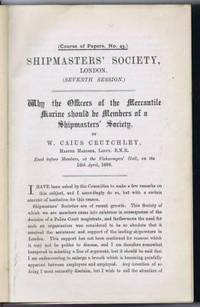
W Caius Crutchley; Charles W Dilke; Benedict W Ginsburg; Capt M J Butcher; Prof F Clownes; William Allingham; Anthony S Thomson;
A Volume containing a Series of Papers from the Shipmasters Society London 1896-1899: Seventh Session Course of Papers No. 4 April 1896; Eighth Session No. 46 October 1896 etc
Shipmasters' Society London 1900. First Edition. Hardcover. Good Condition/No Dust Jacket. A Volume containing a Series of Papers from the Shipmasters Society London 1896-1899. Includes Seventh Session Course of Papers No. 45: April 1896 Why the Officers of the Mercantile Marine Should be Members of a Shipmasters Society by W Caius Crutchley; Eighth Session Course of Papers No. 46 October 1986 Introductory Address to the Members by Rt Hon. Sir Charles W Dilke; Legal Duties of the Shipmaster at Home and Abroad by Benedict W Ginsburg; Course of Papers No. 47 November 1986 Notes on Details of Steamship Construction by Captain M J Butcher; Course of Papers No. 48 January 1897 The Detection of Inflammable Gas and Vapour on board Ships by Professor F Clownes; Course of Papers No. 49 February 1987 Sea Apprentices of the British Merchant Navy by William Allingham; Course of Papers No. 50 & 51 April 1987 Hints on Elementary Stability with Some Remarks on the Carriage of Water Ballast by Anthony S Thomson; Ninth Session Course of Papers No. 52 October 1897 The Personnel of the Mercantile Marine by Commander W F Caborne; Course of Papers No. 53 November 1897 Trimming Tanks by Mr Thomas Walton; Course of papers No. 54 January 1898 The Ventilation of Steamships by Stephen Harding Terry; Course of Papers No. 55 February 1898 British Merchant Seamen: Their Training and Treatment by Commander W F Caborne; Course of Papers No. 56 March 1898 Trim by Mr Thomas Walton; Annual Report for the Year Ending 31st March 1898 List of Members 1897-1898; Course of Papers No. 57 April 1898 Quarantine From a Shipmasters Point of View by W G Romeril; Tenth Session Course of Papers No. 58 October 1898 No. 60 January 1899 & No 61 February 1899 The Evolution of Shipmasters Societies by Edward Blackmore; Course of Papers No. 59 November 1898 Thrift and Nautical Charities by Commander H M W P Johnson; Course of Papers No. 62 March 1899 The Value of Meteorological Observations at Sea and some Hints upon Observing by M W Campbell Hepworth; Annual Report for the Year Ending 31st March 1899; List of Members 1898-1899; Course of Papers No. 63 April 1899 Experience of Shipmasters at Mercantile Marine Offices and at British Consulates by Capt. S R Chandler; Eleventh Session Course of Papers No. 64 Ballasting by H N Wortley The black covers are worn at the corners and the spine is wholly split from the cover on the front external hinge the covers are firmly attached to the text block endpapers are darkened with pencilled letters on the front endpaper internal binding is sound pages are clean. This is a heavy volume and may incur additional delivery charges Quantity Available: 1. Shipped Weight: 1-2kg. Pictures of this item not already displayed here available upon request. Inventory No: 75310100097. All our books music and maps are sent by a tracked mail service. This book is heavier than 1kg and may incur additional delivery charges on some delivery services to some locations. Shipmasters' Society hardcover
Referentie van de boekhandelaar : 75310100097
|
|
|
W St Clair Baddeley
From Cotteswold and Beyond. Poems SIGNED
Painswick: Privately Published 1922. 1st Edition . Hardback. Printed pages: 96. Very Good Minus. 6.75 x 8.5 inches 17 x 22 cm. Signed by Author. Blue buckram binding. Tanning to free endpapers. Ex library book with call number to foot of spine labels and stamp to front pastedown endpaper including attractive Bingham Library woodcut bookplate slight label residue to front free endpaper stamp to title page and a few margins within the text. Presentation copy inscribed by Welbore St. Clair Baddeley to the front free endpaper: 'The Bingham Public Library from the author 1922.' Scarce. Overall condition is Very Good Minus. International postage will be less than the stated rate. Actual costs are Europe £11.00; USA £15.00; Oceania £16.00; Rest of World £18.00. A postage refund will be made after the order has been placed. Size: 6.75 x 8.5 inches 17 x 22 cm. Privately Published hardcover
Referentie van de boekhandelaar : 1124E085
|
|
|
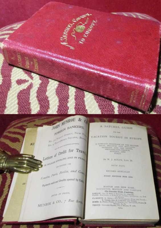
W. J. Rolfe
A Satchel Guide for the vacation tourist in Europe. A compact itinerary of the British Isles, Belgium and Holland, Germany and the Rhine, Switzerland, France, Austria and Italy. With maps.
Houghton, Mifflin & company, Boston/ New York 1904. Hardcover Sehr gut
Referentie van de boekhandelaar : 031354
|
|
|
W. Lepenies
Ascesa e declino degli intellettuali in Europa
Prima edizione <BR>ISBN 884203942X
|
|
|
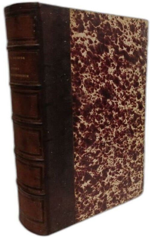
W. Ph. Schimper
Synopsis Muscorum europaeorum - VOL. I. Introductio / Editio secunda valde aucta et emendata
Sumptibus Librariae E. Schweizerbart (E. Koch) 1876 in8. 1876. Relié. Cet ouvrage est la deuxième édition considérablement augmentée et corrigée du 'Synopsis muscorum europaeorum' de Wilhelm Philipp Schimper publiée en 1876 par E. Schweizerbart. Il constitue un traité de bryologie dédié à l'identification et à la description des mousses européennes incluant une introduction aux éléments bryologiques
Referentie van de boekhandelaar : 100151238
|
|
|
W. Southern R
Scholastic Humanism and Unification: Foundations (Scholastic Humanism & the Unification of Europe Band 1)
John Wiley & Sons 1997 364 pages 15 24x2 794x22 098cm. 1997. Broché. 364 pages.
Referentie van de boekhandelaar : 100136423

|
|
|
W. V. Lewis.
Miniature Spits and Embankments on a Lake-Shore, Iceland.
7 pages, including 2 in-text sketch map and photographic plates.. In Original condition with blue wrappers, titles to front, and containing all the ads. This is a complete issue, seldom found in such good and original condition. Series of miniature spits and embankments examined during the Cambridge Expedition to East Iceland in 1937. Grants towards the cost of this expedition were received from the Royal Geographical Society; Lieut. J. N. Jennings surveyed the area. Lewis provides a succinct but valuable report with 3 sketch maps and a few photographic plates.
|
|
|
W.F. Vande Walle, Kazuhiko Kasaya
Dodonaeus In Japan: Translation And The Scientific Mind In The Tokugawa Period
A clean, unmarked copy in excellent condition. Slightly bumped corner. 381 pages. Photo of table of contents available.

|
|
|
Waal, Anton de.:
Der Campo Santo der Deutschen zu Rom. Geschichte der nationalen Stiftung. Mit 4 Abbildungen.
XI, 324 Seiten. Halbleinen der Zeit. *Alter Stempel auf Titel. Sauber und gut erhalten. Bücher de
|
|
|
Waal, Anton de.:
Der Campo Santo der Deutschen zu Rom. Geschichte der nationalen Stiftung. Mit 4 Abbildungen.
XI, 324 Seiten. Originaler Ganzleinenband mit goldgeprägter Deckelsignet. *Alter Stempel auf Titel. Sauber und sehr gut erhalten. Bücher de
|
|
|
Waardenburg Jacques e autori vari.
I MUSULMANI NELLA SOCIETA' EUROPEA.
(Codice IS/0187) In 8º (21 cm) 178 pp. Brossura editoriale, ottimo stato. ~~~ SPEDIZIONE IN ITALIA SEMPRE TRACCIATA

|
|
|
WABER, A.
Bibliographie der Schweizerischen Landeskunde : Unter Mitwirkung der hohen Bundesbehorden, Eidgenossischer und Kantonaler Amtsstellen und zahlreicher Gelehrter; Landes und Reisebeschreibungen; Descriptions Geographiques et Recits de Voyages et Excursions
8vo [21.5 x 14 cm]; 2 volumes in one, xxiii, 440; [ii], xvi, 172, [ii] pp, indexes. original grey cloth, gilt spine title lettering, fine and clean, unmarked. A picture of this book is available upon request by email. Two volumes in one, consisting of Fascicules III and III-2. The full title of first volume is Landes und Reisebeschreibungen; Ein Beitrag zur Bibliographie der schweizerischen Reiselitterature 1479-1890 zusammengestellt von A. Waber, originally published Bern 1899. The second title is Descriptions Geographiques et Recits de Voyages et Excursions en Suisse (fin du fascicle III); Contribution a la Bibliographie de la Literature Suise des Voyages de 1891 a 1900 avec dos supplements relatifs a la periode anterieure a 1891, par A. Waeber, Berne 1909. The combined volumes are a comprehensive bibliography describing thousands of articles, books, on country and descriptions of Swiss travel literature in the period 1479-1890. They are the complete works related to travel, voyages, excursions and descriptions from a larger work on the bibliography of Switzerland.
|
|
|
Wacher, John S
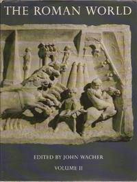
THE ROMAN WORLD 2 VOLUME SET
Routledge Kegan & Paul. 1987. Hardcover. Very Good in Very Good dust jacket. Vol. 1: faint creasing to first few pages. DJ has 1 small tear. Vol. 2: NF with NF DJ. Includes slipcase but slipcase is broken: Fair condition only.; Heavy set; 2 Volume Set COMPLETE; 1-2; 872 pages . 0710099754 . Routledge Kegan & Paul hardcover
Referentie van de boekhandelaar : 39943 ISBN : 0710099754 9780710099754
|
|
|
Wachler, Ludwig
Handbuch der allgemeinen Geschichte der literärischen Cultur. Geschichte der älteren und mittleren Zeit bis zum J. n. Ch. G. 1500. Geschichte der neueren Zeit 1500 - 1800.
Marburg, Neue akademische Buchhandlung, 1804-05. 2 Bde. 8°. XVI, 492 S., X, 493-1184. Halbleder. Rückenschilder, vergold. Rückentitel u. Rückenvergold. Ber. u. best. Papierbedingt l. gebr., Vorsatzbll. stockfl., Bd. 1 m. kl. Kleberest von Exlibris, ansonsten gut erhalten.
Referentie van de boekhandelaar : 42735AB
|
|
|
Wachsmuth, Wilhelm
Europäische Sittengeschichte vom Ursprunge volksthümlicher Gestaltungen bis auf unsere Zeit.
Leizig, Friedrich Christian Wilhelm Vogel, 1831. VORHANDEN: 1. Teil: Bis zum Verfall des karolingischen Reiches (1. und 2. Buch) / 3. Teil, 2. Abtheilung: Die europäischen Völker und Staaten besonders im Zeitalter der Kirchenschwärmerei und der Herrschaft des Papstthums (5. Buch) / 4. Teil: Das Zeitalter des Verfalls mittelalterlicher Zustände (6. und 7. Buch) / 5. Teil, 2. Abtheilung: das Zeitalter der unumschränkten Fürstenmacht und das Revolutionszeitalter (10., 11. und 12. Buch) X, 341 / VI, 598 / VIII, 832 / X, 816 S. Pappbände mit Grünschnitt / gebundene Ausgabe
Referentie van de boekhandelaar : 9998
|
|
|
Wachtel, Joachim
A la mode. 600 Jahre europäische Mode in zeitgenössischen Dokumenten
München: Prestel Verlag, 1963. 18,5 cm ; Leinen
Referentie van de boekhandelaar : 86063

|
|
|
Wachtsmuth, Wolfgang.
Von deutscher Arbeit in Lettland, 1918-1934. Ein Tätigkeitsbericht. Materialien zur Geschichte des baltischen Deutschtums. 3 Bände.
LXXIX, 466; L, 430; XLIII, 462 S. Blaue Orig.-Leinenbände. *Eingeheftet sind 2 Briefkarten des Verfassers, eine maschinenschriftlich, eine handschriftlich. Beide mit eigenhändiger Unterschrift. - Band 1. Die deutsch-baltische Volksgemeinschaft in Lettland 1923-1934. - Band 2. Die autonome deutsche Schule in Lettland 1920-1934. Anhang: Das Herder-Institut zu Riga. - Band 3. Das politische Gesicht der deutschen Volksgruppe in Lettland in der parlamentarischen Periode 1918-1934. Bücher de
|
|
|
Wackerbarth, Horst
Die rote Couch. Ein Porträt Europas und seiner Bewohner. Fotografien von Horst Wackerbarth. Herausgeber: Peter-Matthias Gaede.
Hamburg : GEO im Verl. Gruner und Jahr, 2003. 1. Aufl.; 233 S. mit zahlreichen Farbfotos, 33 cm; gebunden, Orig.-Pappband mit Original-Schutzumschlag;
Referentie van de boekhandelaar : 121016

|
|
|
WACKERMANN Gabriel -REY Violette - AQUATIAS Christine
Mutations en Europe médiane
Paris, Cned, Sedes 1997. In-8 broché de 407 pages. Quelques passages surlignés. Bon état
|
|
|
WACKERMANN Gabriel -REY Violette - AQUATIAS Christine
Mutations en Europe médiane
Paris, Cned, Sedes 1997 Paris, Cned, Sedes 1997. In-8 broché de 407 pages. Quelques passages surlignés. Bon état
Referentie van de boekhandelaar : 23162
|
|
|
Wackernagel, Martin
Basel. Berühmte Kunststätten ; Bd. 57
Leipzig : E. A. Seemann 1912. 244 S. : Mit 127 Abb. ; 8°, ohne Schutzumschlag gebundene Ausgabe, Leinen, Exemplar in gutem Erhaltungszustand
Referentie van de boekhandelaar : 44322

|
|
|
Wadas, S
Oz gostyninski.
Lódz, 1962. M. 1 Kte., 12 Taf., 2 Tab. u. mehr. Abb. 76 S. (Acta geogr. Lodziensia 14).
Referentie van de boekhandelaar : 237882
|
|
|
Waddams, SM S M
SEXUAL SLANDER IN NINETEENTH-CENTURY ENGLAND : Defamation in the Ecclesiastical Courts 1815-1855
University of Toronto Press 2000. 315pp. Hardback with DJ VG index appendices figures and tables "'You are a nasty bloody thundering whore' one Gloucester woman said to another in 1852. Most lawyers and historians are surprised to learn that until 1855 language of this sort was punishable in the ecclesiastical courts. In a study based on court records and lawyers' correspondence Stephen Waddams shows how the law worked not only in theory but in practice" . Hard Cover. Very Good/Very Good. University of Toronto Press Hardcover
Referentie van de boekhandelaar : w130715295 ISBN : 0802047505 9780802047502

|
|
|
Wade, Ira O
The Intellectual Origins of the French Enlightenment
Princeton New Jersey: Princeton University Press 1971. ex-library. Hardcover. Very Good . 8vo 6 x 9.5 xxii 678 pages Repaired binding using original materials Princeton University Press hardcover
Referentie van de boekhandelaar : 000981
|
|
|
Wagemann, Eberhard
Verdrängte Geschichte. Verteidigung und Verfassung in Europa.
München:, Hase und Köhler, 1999. Gr.-8°. 1025 S., Bibliographie, Pappband 2 Bände. (gut erhalten)
Referentie van de boekhandelaar : 14444BB

|
|
|
Wagenaar, Cor
Town Planning in the Netherlands Since 1800
Rotterdam: 010 Publishers 2011. Paperback in very good condition. Very slight crease along lower edge of FEP and half-title page. Slight hinge break at page 175. No other faults clean throughout and pages exellent. AD. Paperback. Very Good. Used. 010 Publishers Paperback
Referentie van de boekhandelaar : 531230 ISBN : 9064506825 9789064506826

|
|
|
Wagenaar, Cor
Town Planning in the Netherlands Since 1800
Paperback in very good condition. Very slight crease along lower edge of FEP and half-title page. Slight hinge break at page 175. No other faults, clean throughout and pages exellent. AD Used
|
|
|
Wagenbach, Klaus
Kafka's Prague: A Travel Reader
Woodstock NY: Overlook Books 1996 Book. New. Cloth. 1st US Edition. Franz Kafka whose cool detached prose and vivid literary images of power and metamorphosis have left a lasting influence on almost all of the world's literatures ever hardly left his home city of Prague during his short life 1883-1924. This travel book-cum-reader provides a journey through both Kafka's reality and imagination permitting the reader or traveller to experience Kafka's milieu as he wrote such books as 'The Trial' and 'Metamorphosis'. Includes 8 maps and 150 B & W photographs - contemporary and vintage. A beautifully printed and bpund 125 p. illus.maps on endpapers. Overlook Books hardcover
Referentie van de boekhandelaar : 045969 ISBN : 0879516445 9780879516444

|
|
|
Wagenfeld, Karl
Das Bilderbuch von Münsterland Das Bilderbuch von Munsterland
Munster Germany: Verlag der Westfalischen Vereinsdruckerei 1939. Book. Illus. by Wilhelm Rosch photographs; Waldemar Mallek maps. Fine. Decorative Cloth. First Edition. 4to - over 9¾" - 12" tall. Royal blue dyed natural linen lettered and illus. in ivory. As issued. Gift inscription in German dated 1939 on front flyleaf; card of Direktor Wilhelm Schmitz Kreisrichter der NSDAP Ratsherr der Stadt Munster mounted on lower front pastedown. 64 pp. fully illus. w/ b&w photographs. Text in German. Exceptionally scarce. Verlag der Westfalischen Vereinsdruckerei Hardcover
Referentie van de boekhandelaar : 032774
|
|
|
Wagenführ, Horst
Handelsfürsten der Renaissance.
Stuttgart, Schuler Verlag, 1957. Groß 8°. Mit 23 farbigen Tafeln und 11 zweifarbigen Bildern im Text. 218 Seiten. Originaler goldgeprägter Halbledereinband im Schuber.
Referentie van de boekhandelaar : 31700

|
|
|
Wagenvoort, H
PIETAS; Selected Studies in Roman Religion
E. J. Brill. 1980. Softcover. Good. Scholar's name to ffep with his underlining and marginalia in red and black pen. Small stains to back wrap. No other defects.; Studies in Greek and Roman Religion Vol 1; 264 pages; Collection of Wagenvoort's papers in an English translation. . 9004061959 . E. J. Brill paperback
Referentie van de boekhandelaar : 9303 ISBN : 9004061959 9789004061958

|
|
|
Waggerl K.H.
L'AUTRICHE. Ses paysages, ses habitants et sa culture.
(Codice VR/0264) In 8°(27 cm) 8 pp.+ 104 planches-photo en noir légendées en allemand, anglais, français. Toile éditeur, sans jaquette. Très bon état. ~~~ SPEDIZIONE IN ITALIA SEMPRE TRACCIATA

|
|
|
Waggerl, Karl Heinrich, Eduard Widmoser u.a
Österreich. Landschaft, Mensch und Kultur. Geleit von Karl Heinrich Waggerl. Einführung von Eduard Widmoser. 9. Auflage.
Pinguin, Innsbruck u. Umschau, Frankfurt 1962. 8 S. u. 101 teils farbigen Tafeln, 1 Karte. 4°. Illustr.-Kart. Geringe Gebrsp. Gutes Exemplar.
Referentie van de boekhandelaar : 12761

|
|
|
WAGHENAER Lucas Janszoon (1533 – 1606 circa)
Universe Europe maritime eiusque navigationis descriptio
Universe Europe maritime eiusque navigationis descriptio = Generale Paschaerte van Europa, soe verre die Zeecusten ende Navigatien streckende zÿn. Gepractizeert Doer Lucas Jansz, Wagenaer va Enchusè. Met Privilegie tot 10. Iaren. 1.5.83. Acquaforte e bulino, 395x555 mm, firmata e datata in lastra in basso a destra Joannes à Doetecum. F.Dall'edizione tedesca dello Spieghel der Zeevaerdt. Terza edizione della carta, con la traduzione del nome di alcuni mari in latino, inserita nello Spieghel der Zeevaerdt a partire dal 1586.Magnifica prova, con piccoli restauri nei margini che interessano anche il bordo graduato, nel complesso in eccellente stato di conservazione.Carta nautica del Mediterraneo occidentale, estesa alle Isole Britanniche e all’Islanda, di Lucas Jansz. Waghenaer. Impreziosita da rose dei venti, mostri marini, velieri e stemmi araldici, la carta è inclusa nello Spieghel der Zeevaerdt di Waghenaer ed è caratterizzata dalla curiosa rappresentazione circolare dell’Islanda, che sarebbe stata rivista e corretta nella successiva versione. La tavola è conosciuta in tre diversi stati: il primo - avanti le aggiunte delle traduzioni in latino nel nome di alcuni dei mari e delle iscrizioni nelle barre della scala metrica - apparve solo nelle prime tre edizioni dello Spieghel der Zeevaerdt, pubblicate a Leida da Christophe Plantin nel 1583, 1584 e 1585; il secondo stato della lastra vede aggiunta l’isola di Rockall, un piccolo scoglio dell’Atlantico a ovest della Scozia, che viene rappresentato, senza il toponimo, a destra del vascello. Secondo Schilder questo stato della carta non sarebbe inserito in nessuna delle edizioni dello Spieghel der Zeevaerdt, ma sarebbe stato venduto separatamente a Leida da Van Raphelingen per la tipografia Plantin intorno al 1586. Il terzo stato della carta, pubblicato per la prima volta nella traduzione latina dello Spieghel der Zeevaerdt - stampata con il titolo di Speculum nauticum nel 1586 - vede alcuni nomi dei mari e delle scale grafiche tradotti per il mercato sud-europeo. Ad esempio, sotto al toponimo Midtlantse Zee, ad ovest della Sardegna, si legge, in piccolo, Mare Mediterraneum.Lo Spieghel di Waghenaer fu il primo atlante nautico a stampa; di conseguenza questa carta nautica dell’Europa e dell’Atlantico occidentale è la prima carta nautica stampata della regione. La data 1583 è incisa in piccolo riquadro sotto il cartiglio con il titolo; tuttavia, è possibile che Waghenaer avesse già realizzato questo carta portolano nel 1579, per venderla separatamente come strumento di navigazione. Incisa da Joannes van Doetecum la carta è impreziosita da numerose rappresentazioni di navi e ricoperta di linee direzionali che si irradiano da rose dei venti, decorazioni tipiche delle carte nautiche manoscritte, senza dubbio fonti cartografiche per questa mappa. I nomi dei luoghi vengono scritti continuamente verso l’interno intorno alla costa, da nord a sud, al fine di facilitarne la lettura al navigatore attraverso la ruotazione della mappa. Nella parte terrestre della tavola troviamo gli stemmi dei vari Paesi europei. La raffinatezza dello stile incisorio di Joannes van Doetecum è molto evidente in questa mappa. Joannes, insieme al fratello Lucas, proveniva da una famiglia di incisori originaria di Deventer, attiva ad Anversa, Haarlem e Amsterdam nella seconda metà del XVI secolo. Oltre alle mappe dello Spieghel, i fratelli Doetecum sono autori delle più belle carte pubblicate da Hieronymus Cock, Gerard de Jode e Abraham Ortelius. Una curiosità cartografica dell’opera è la presenza, a ovest delle coste irlandesi, della piccola isola del Brasile, o Hy Brasil, rappresentata nella consueta forma circolare con un fiume che la taglia in due. L’isola - qui denominata Brasiil – appartiene alla mitologia irlandese: coperta da un costante velo di nebbia, si dice che appaia per un giorno ogni sette anni. L’isola leggendaria apparve per la prima volta in una mappa di An... Universe Europe maritime eiusque navigationis descriptio = Generale Paschaerte van Europa, soe verre die Zeecusten ende Navigatien streckende zÿn. Gepractizeert Doer Lucas Jansz, Wagenaer va Enchusè. Met Privilegie tot 10. Iaren. 1.5.83. Etching with engraving, signed at lower right Joannes à Doetecum. F. From the German edition of the Spieghel der Zeevaerdt.A fine impression, printed on contemporary laid paper, small restorations in the margins that also affect the graduated edge, overall in excellent condition.Third state of Waghenaer's map of Europe, the British Isles, Iceland, and the western Mediterranean, including the Rockall Island and the Latin translation of some of the Sea’s names. Richly embellished with compass roses, sea monsters, sailing ships, coats of arms and rhumb lines, the chart appeared in an early edition of Waghenaer's Speigel der Zeevaerdt and is characterized by the curious circular representation of Iceland, which was revised in later reprints. Waghenaer's Spiegel was the first engraved sea atlas, making this sea chart of Europe and the Western Atlantic the earliest printed sea chart of the region. Because this chart was significantly larger than the others in the atlas, it rarely appears on the market in good condition. The fine engraving work of Joannes Doetecum is very much in evidence on this map. Doetcum came from a family of printmakers from Deventer, although Joannes and his brother Lucas moved to Antwerp. They engraved not only the maps in theS peigel, but also maps for Hieronymus Cock, Gerard de Jode, and Abraham Ortelius.Lucas Jansz Waghenaer (c. 1533–1606) was a navigator and the author of the ‘Spieghel der zeevaerdt’, the first pilot guide. He spent his early career as a naval officer between 1550 and 1579, interacting with other sailors and gaining vital experience for his later work. He then worked as a duties collector in Enkhuizen, before beginning to work on a project to combine accurate sailing directions with detailed maps. Sailors at the time generally relied on small books called rutters, which were often handwritten, or featured crude woodcut maps. They were wary of printed guides, as they could not be updated or personalised as easily as a manuscript and were thought to be less practical. Waghenaer aimed to change this attitude, and chose to do so by publishing his work as a large folio (rather than the traditional oblong), with copper engraved maps and typeset text. The first volume of the ‘Spieghel’ contains instructions on various navigation techniques and the use of the manual, and maps of coasts from Texel to Cadiz, each accompanied by a coastal profile. Portuguese navigators had pioneered the use of coastal profiles in navigation, but Waghenaer was the first to include them for every chart on a consistent scale. The second volume, published a year later, contained charts of the coasts north of Texel. They were engraved by Johannes van Doetecum, one of the finest workers of the age. The charts were based on Waghenaer’s own extensive experience, supplemented by manuscript and printed sources. The accompanying text was based on other sixteenth century navigation manuals. It was a revolutionary success, and was translated into German, Latin and French, as well as an unauthorised English edition. His work was so popular in England that the Anglicized version of his name, ‘Waggoner’, became a generic term referring to sea atlases and charts.Bibliografia: T. Campbell, Early Maps, New York, 1981, p. 86, tav. 39; B. Freitag, Hy Brasil: The Metamorphosis of an Island, From Cartographic Error to Celtic Elysium. Amsterdam, 2013; H.A.M. van der Heijden, De Oudste gedrukte kaarten van Europa, Utrecht, 1992, n. 12; C. Koeman, Lucas Janszoon Waghenaer: A Sixteenth Century Marine Cartographer, in “The Geographical Journal”, Vol. 131, No. 2 (June, 1965), pp. 202-212; C. Koeman, Atlantes Neerlandici: Bibliography of Terrestrial, Maritime and Celestial Atlases a... S. Bifolco, "Mare Nostrum, Cartografia nautica a stampa del Mar Mediterraneo" (2020), pp. 68-69, tav. 16.

|
|
|
Wagner Otto
Architettura moderna e altri scritti
illustrazioni

|
|
|
Wagner, Ernst.
Quellen zur Geschichte der Siebenbürger Sachsen 1191-1975.
429 S. mit Abb. Orig.-Leinen (wie neu). Bücher de
|
|
|

 De zoekresultaten per email ontvangen
 Zoekresultaten downloaden als PDF
 RSS feed
 Permanente link


