|
|
|
Van Iperen, Roxane
Sisters of Auschwitz The: The True Story of Two Jewish Sisters' Resistance in the Heart of Nazi Territory
London England: The Orion Publishing Group 2020. Book. Good. Medium Softcover. First Thus. 8vo - over 7¾ - 9¾" tall. Medium softcover first thus 288gms 302 pages. Book is in good condition with minor general wear and tear and moderate page discolouration/spotting throughout otherwise no other pre-loved markings. . The Orion Publishing Group Paperback
Referentie van de boekhandelaar : BIOEUR9968 ISBN : 1841883751 9781841883755

|
|
|
VAN KEULEN Gerard (1678 - 1726)
Nieuwe Paskaart van ‘t Eerste Gedeelte der Middelansche-Zee tusschen ‘t I. Cadix en ‘t I. Malta
Nieuwe Paskaart van ‘t Eerste Gedeelte der Middelansche-Zee tusschen ‘t I. Cadix en ‘t I. Malta = Nouvelle Carte Marine pour la Premier Partie de la Mer-Mediterranee (...) = The New Sea Map of the First Part of the Midland-Sea (...) = Nueva Carta Maritima la Primera Parte del Mar-Mediteraneo (...) = Nuova Carta Maritima la Prima Parte del Mar- Mediteraneo & Nieuwe Paskaart van ‘t Tweede Gedeelte der Middelandsche-Zee Tusschen ‘t I. Malta en Alexandretta = The New Sea Map of the Seconde Partie of the Midland-Sea (...) = Nouvelle Carte Marine pour la Deuxiesme Partie de la Mer-Mediterranee (...) = Nuova Carta Maritima la Seconda Parte del Mar-Mediteraneo (...).Acquaforte e bulino, stampata su due fogli, rispettivamente di dimensioni 600x990 mm e 595x1000 mm. Rappresentazione nautica del Mar Mediterraneo, suddiviso nella parte occidentale ed in quella orientale.Il titolo della parte occidentale, contenuto nel grande cartiglio decorativo a sinistra, è ripetuto in ben 5 lingue: olandese, francese, inglese, spagnolo e italiano. In basso al centro è riportato l’imprint editoriale: t’ Amsterdam by Ioannes van Keulen Boek Zeeekard Verkooper en Graad boog maker aan de Oost Zyde Vande Nieuwe Brug inde Gekroonde Lootsman met privilegie Nieuwelycks op Gestel door G: v: Keulen. Il titolo della parte orientale, nel grande cartiglio in alto a destra è riportato in 4 lingue ma non in spagnolo. In basso al centro si legge: t’ Amsterdam by Ioannes van Keulen Boek-Zeeekard Verkooper en Graad boog maker aande Oost Zyde van de Nieuwe brug inde Gekroonde Lootsman Opgestelt door G: v: Keulen. met Privilegie.Si tratta di una variante della carta precedente della tipografia Van Keulen - firmata da Johannes I Van Keulen e dal figlio Gerard e databile al 1709 - che vede le lastre emendate e leggermente ridotte (di circa 10 mm): vengono aggiunti degli elementi decorativi nel foglio di destra, dove è disegnato un gruppo di figure in abiti orientali che circonda il cartiglio; nel mare compaiono due navi collocate a largo di Malta e Cipro. Secondo Nils Persson (cfr. Loose printed Sea Charts published by Van Keulen, p. 177) le carte non sono parte di nessuna raccolta nautica, ma venivano vendute singolarmente.Nell’angolo superiore sinistro della tavola occidentale troviamo, fuori scala in un cartiglio, la rappresentazione del Mar Adriatico; nel foglio orientale, in basso a destra, troviamo il particolare della costa libica: Barbaria van I. Zerby tot Tripoli. La prima versione della carta appartiene al terzo volume dello Zee-Fakkel, del quale è una delle tavole aggiunte nel 1709 da Gerard van Keulen. Firmata da Johannes Van Keulen (1654 - 1715), la carta è completata e stampata dal figlio Gerard (1678 - 1726), il cui nome è riportato in entrambi i cartigli. Sebbene, secondo Koeman, la carta sarebbe stampata solo nel 1734 (cfr. AN, IV, p. 341, Keu 95 e V, p. 203), Irene Jacobs conferma che la carta appartiene all’aggiornamento dello Zee-Fakkel del 1709 (cfr. Charts in Zee-Fakkel and Zee-Atlas, p. 204). Il primo atlante Van Keulen nel quale abbiamo riscontrato la presenza della carta è il terzo volume dello Zee-Fakkel, edizione francese del 1723: Le Nouveau & Grand Illuminant Flambeau de la Mer (…) par Nicolas Jansz Vooght, & Gerard van Keulen, Geomêtre, & Maistre en Mathematiques. Imprime a Amsterdam: par Jean Van Ceulen, Marchand Libraire de Cartes Marines. A° 1723. Conservato alla Biblioteca Nacional di Madrid, il volume è citato ma non descritto da Koeman (cfr. AN, IV, p. 345, Keu 103 D). Le raccolte nautiche di Johannes van Keulen non erano composte da carte progettate intenzionalmente per questo tipo di opere: una quarantina di carte furono pubblicate per la prima volta nel 1680, ma il numero delle tavole aumentò sin da subito; nel 1683 - quando furono pubblicate le parti I, II, III, e IV - il numero aumentò a 116 mappe. L’atlante più voluminoso, apparso nel 1695, comprende 160 mappe di Johannes v... Neuwe Paskaart van ‘t Eerste Gedeelte der Middelansche-Zee tusschen ‘t I. Cadix en ‘t I. Malta = Nouvelle Carte Marine pour la Premier Partie de la Mer-Mediterranee (...) = The New Sea Map of the First Part of the Midland-Sea (...) = Nueva Carta Maritima la Primera Parte del Mar-Mediteraneo (...) = Nuova Carta Maritima la Prima Parte del Mar- Mediteraneo & Nieuwe Paskaart van ‘t Tweede Gedeelte der Middelandsche-Zee Tusschen ‘t I. Malta en Alexandretta = The New Sea Map of the Seconde Partie of the Midland-Sea (...) = Nouvelle Carte Marine pour la Deuxiesme Partie de la Mer-Mediterranee (...) = Nuova Carta Maritima la Seconda Parte del Mar-Mediteraneo (...).Etching and engraving, printed on two sheets, respectively 600x900 and 595x1000Nautical representation of the Mediterranean Sea, divided into the western and eastern parts.The title of the western part, contained in the large decorative cartouche on the left, is repeated in 5 languages: Dutch, French, English, Spanish and Italian. At the bottom of the page is the editorial imprint: t 'Amsterdam by Ioannes van Keulen Boek Zeeekard Verkooper en Graad boog maker aan de Oost Zyde Vande Nieuwe Brug inde. The title of the eastern part, in the large cartouche at the top right, is shown in 4 languages but not in Spanish. At the bottom center reads: t 'Amsterdam by Ioannes van Keulen Boek-Zeeekard Verkooper en Graad boog maker aande Oost Zyde van de Nieuwe brug inde Gekroonde Lootsman Opgestelt door G: v: Keulen. met Privileges.It is a variant of the previous map of the Van Keulen's - signed by Johannes I Van Keulen and by his son Gerard and datable to 1709 - which sees the changes and slightly reduced plates (of about 10 mm): decorative elements are added to the sheet on the right, where a group of figures in oriental clothes is drawn surrounding the cartouche; in the sea two ships appear off the coast of Malta and Cyprus. According to Nils Persson (see Loose printed Sea Charts published by Van Keulen, p. 177) the maps are not part of any nautical collection, but were sold individually.In the upper left corner of the western map we find, out of scale in a scroll, the representation of the Adriatic Sea; in the eastern sheet, below on the right, we find the detail of the Libyan coast: Barbaria van I. Zerby tot Tripoli. The first version of the maps belongs to the third volume of the Zee-Fakkel, of which it is one of the tables added in 1709 by Gerard van Keulen. Signed by Johannes Van Keulen (1654 - 1715), the map is completed and printed by his son Gerard (1678 - 1726), whose name is shown in both cartouches. Although, according to Koeman, the map would be printed only in 1734 (see AN, IV, p. 341, Keu 95 and V, p. 203), Irene Jacobs confirms that they belongs to the Zee-Fakkel update of 1709 ( see Charts in Zee-Fakkel and Zee-Atlas, p. 204). The first atlas Van Keulen in which we found the presence of paper is the third volume of the Zee-Fakkel, French edition of 1723: Le Nouveau & Grand Illuminant Flambeau de la Mer (...) par Nicolas Jansz Vooght, & Gerard van Keulen, Geomêtre , & Maistre en Mathematiques. Imprint in Amsterdam: par Jean Van Ceulen, Marchand Libraire de Cartes Marines. A ° 1723. Preserved at the Biblioteca Nacional in Madrid, the volume is quoted but not described by Koeman (see AN, IV, p. 345, Keu 103 D). Johannes van Keulen's nautical collections were published for the first time in 1680, but the number of plates increased immediately; in 1683 - when parts I, II, III, and IV were published - the number increased to 116 maps. The most massive atlas, which appeared in 1695, includes 160 maps by Johannes van Keulen. Later, around 1709, Gerard van Keulen increased the number of plates to 185: the most obsolete ones were replaced by others; the tables were given a new numbering. The book tradition foresaw that a nautical atlas should start with a map of the world; Van Keulen, not being in possession of a copper plate depicting the plani... S. Bifolco, "Mare Nostrum, Cartografia nautica a stampa del Mar Mediterraneo" (2020), pp. 178-179, tav. 79.

|
|
|
VAN KEULEN Johannes (1654 - 1715)
De Kusten van Catalonien, Provence, Yviça, Majorca en Minorca
Xilografia raffigurante il porto di Savona tratta dall'opera "De Nieuwe Groote Lichtende Zee-Fakkel", ovvero un portolano dei mari del mondo pubblicato tra il 1681 e il 1684 in cinque volumi in folio, ai quali - nel 1753 - se ne aggiunse un sesto per la navigazione lungo le coste asiatiche.Folio: 310x530 Xylography depicting the port of Savona from the work "De Nieuwe Groote Lichtende Zee-Fakkel".

|
|
|
VAN KEULEN Johannes (1654 - 1715)
Nieuwe Wassende Graade Paskaart van de Geheele Middelandsche Zee Opgestelt door Nicolaes de Vries Leermeester der Wiskonst d
Acquaforte e bulino, 520x600 mm, firmata in lastra nel cartiglio: ‘t Amsterdam By Iohannes van Keulen Boeck Zeekartverkooper en Graad-boog. Maker By de Nieuwen Brugh inde Gekroonde Lootsman Met Privilegie Voor 15 Jaaren.Magnifica prova, con meravigliosa coloritura coeva, in eccellente stato di conservazione.Carta tratta da: De Nieuwe Groote Lichtende Zee-Fakel, ‘t Derde Deel. Verhoonde de Kunsten van Granaden, Catalonien, Provence, Italien, Dalmatien, Grieken, Thracien, Natolien, Syrien, Egyptne, en de geheele Noordkust van Barbaryen, met alle haer onderhoo rende en tussschen leggende Eylanden. (…) Door Claas Jansz. Vooght, Geometra Leermeester der Wis-konst. Die geen voor de sijnen en kent, als die by Johannes van Keulen gedrukt zijn. t’ Amsterdam, Gedruckt voor Johannes van Keulen, Boeck en Zee-Kaert-verkoper, aen de Nieuw-brugh, in de gekroonde Lootsman. 169. Met Privilegie voor 15 Jaren.Nuova carta del Mediterraneo di Johannes I Van Keulen che compare per la prima volta nell’edizione olandese del De Nieuwe Groote Lichtende Zee-Fakel. Si tratta di una delle otto nuove carte aggiunte alle originali 17 della prima edizione del 1682. Koeman sostiene che, sebbene il frontespizio della raccolta riporti la data - incompleta – 169[.], le carte aggiunte siano state realizzate dopo il 1704, come dimostrerebbe la scena di una battaglia navale riportata sopra una delle tavole nautiche. Inoltre, a tutte le carte nautiche viene aggiunta la scala metrica in miglia italiane, già presente nella versione italiana dello Zee-Fakel, pubblicata nel 1705 con il titolo di Nuova, E Grande Illuminante Face del Mare (cfr. Koeman, AN, IV, p. 346, Keu 108).Bibliografia: C. Koeman, Atlantes Neerlandici: Bibliography of Terrestrial, Maritime and Celestial Atlases and Pilot Books Published in the Netherlands up to 1880 Vol. IV, Amsterdam 1970, pp. 338-347, Keu 88 A (2) 180; cfr. R. Shirley, Maps in the Atlases of the British Library, Londra, 2004, pp. 1200-1213; cfr. D. de Vries, G. Schilder, W. Morzer Bruyns, P. van Iterson, I. Jacobs, The Van Keulen Cartography Amsterdam 1680-1885, Alphen aan den Rijn, 2005. Etching and engraving, 520x600 mm, signed in the cartouche: ‘t Amsterdam By Iohannes van Keulen Boeck Zeekartverkooper en Graad-boog. Maker By de Nieuwen Brugh inde Gekroonde Lootsman Met Privilegie Voor 15 Jaaren.Magnificent proof, with wonderful original coloring, in excellent condition.From: De Nieuwe Groote Lichtende Zee-Fakel, ‘t Derde Deel. Verhoonde de Kunsten van Granaden, Catalonien, Provence, Italien, Dalmatien, Grieken, Thracien, Natolien, Syrien, Egyptne, en de geheele Noordkust van Barbaryen, met alle haer onderhoo rende en tussschen leggende Eylanden. (…) Door Claas Jansz. Vooght, Geometra Leermeester der Wis-konst. Die geen voor de sijnen en kent, als die by Johannes van Keulen gedrukt zijn. t’ Amsterdam, Gedruckt voor Johannes van Keulen, Boeck en Zee-Kaert-verkoper, aen de Nieuw-brugh, in de gekroonde Lootsman. 169. Met Privilegie voor 15 Jaren.New Mediterranean map by Johannes I Van Keulen that appears for the first time in the Dutch edition of De Nieuwe Groote Lichtende Zee-Fakel. This is one of the eight new charts added to the original 17 of the first edition of 1682. Koeman claims that, although the title page of the collection bears the - incomplete - date [169], the added charts were made after 1704, as would be shown the scene of a naval battle reported above one of the nautical charts. Furthermore, the metric scale in Italian miles is added to all nautical charts, already present in the Italian version of the Zee-Fakel, published in 1705 with the title of Nuova, E Grande Illuminante Face del Mare (see Koeman, AN, IV, p 346, Keu 108).Bibliografia: C. Koeman, Atlantes Neerlandici: Bibliography of Terrestrial, Maritime and Celestial Atlases and Pilot Books Published in the Netherlands up to 1880 Vol. IV, Amsterdam 1970, pp. 338-347, Keu 88 A (2) 180; cfr. R. Shirley, Maps in the Atlases of the British Library, Londra, 2004, pp. 1200-1213; cfr. D. de Vries, G. Schilder, W. Morzer Bruyns, P. van Iterson, I. Jacobs, The Van Keulen Cartography Amsterdam 1680-1885, Alphen aan den Rijn, 2005. S. Bifolco, "Mare Nostrum, Cartografia nautica a stampa del Mar Mediterraneo" (2020), p. 167, tav. 73.

|
|
|
VAN KEULEN Johannes (1654 - 1715)
Niewe Paskaartvan 't Tweede Gedeelte der Middelandsche-Zee Fusschen 't I. Malta en Alexandretta
Nieuwe Paskaart van‘t Tweede Gedeelte der Middelandsche-Zee Tusschen ‘t I. Malta en Alexandretta = The New Sea Map of the Seconde Partie of the Midland-Sea (...) = Nouvelle Carte Marine pour la Deuxiesme Partie de la Mer-Mediterranee (...) = Nuova Carta Maritima la Seconda Parte del Mar-Mediteraneo (...).Acquaforte e bulino, finemente colorata in epoca, in ottimo stato di conservazione. Il titolo della parte orientale, nel grande cartiglio in alto a destra è riportato in 4 lingue ma non in spagnolo. In basso al centro si legge: t’ Amsterdam by Ioannes van Keulen Boek-Zeeekard Verkooper en Graad boog maker aande Oost Zyde van de Nieuwe brug inde Gekroonde Lootsman Opgestelt door G: v: Keulen. met Privilegie.Rappresentazione nautica del Mediterraneo orientale; in basso a destra, troviamo il particolare della costa libica: Barbaria van I. Zerby tot Tripoli. La carta appartiene al terzo volume dello Zee-Fakkel, del quale è una delle tavole aggiunte nel 1709 da Gerard van Keulen. Firmata da Johannes Van Keulen (1654- 1715), la carta è completata e stampata dal figlio Gerard (1678 - 1726), il cui nome è riportato in entrambi i cartigli. Sebbene, secondo Koeman, la carta sarebbe stampata solo nel 1734 (cfr. AN, IV, p. 341, Keu 95 e V, p. 203), Irene Jacobs conferma che la carta appartiene all’aggiornamento dello Zee-Fakkel del 1709 (cfr. Charts in Zee-Fakkel and Zee-Atlas, p. 204). Il primo atlante Van Keulen nel quale abbiamo riscontrato la presenza della carta è il terzo volume dello Zee-Fakkel, edizione francese del 1723: Le Nouveau & Grand Illuminant Flambeau de la Mer (…) par Nicolas Jansz Vooght, & Gerard van Keulen, Geomêtre, & Maistre en Mathematiques. Imprime a Amsterdam: par Jean Van Ceulen, Marchand Libraire de Cartes Marines. A° 1723. Conservato alla Biblioteca Nacional di Madrid, il volume è citato ma non descritto da Koeman (cfr. AN, IV, p. 345, Keu 103 D). Le raccoltenautiche di Johannes van Keulen non erano composte da carte progettate intenzionalmente per questo tipo di opere: una quarantina di carte furono pubblicate per la prima volta nel 1680, ma il numero delle tavole aumentò sin da subito; nel 1683 - quando furono pubblicate le parti I, II, III, e IV - il numero aumentò a 116 mappe. L’atlante più voluminoso, apparso nel 1695, comprende 160 mappe di Johannes van Keulen. Più tardi, verso il 1709, Gerard van Keulen aumentò il numero di lastre a 185: quellepiù obsolete furono sostituite da altre; alle tavole venne assegnata una nuova numerazione. La tradizione libraria prevedeva che un atlante nautico dovesse iniziare con una mappa del mondo; Van Keulen, non essendo in possesso di una lastra di rame con raffigurazione del planisfero, ricorreva alle tavole di Johannes de Ram, Claesz Visscher o altri intagliatori. Gerard van Keulen, che successe al padre nel 1704, intraprese una nuova attività nel settore cartografico; ampliò l’atlante nautico con diverse sue carte e lo pubblicò nella forma definitiva, in cinque parti analogamente allo Zee-Fakkel, rinumerando le lastre.Bibliografia: C. Koeman, Atlantes Neerlandici: Bibliography of Terrestrial, Maritime and Celestial Atlases and Pilot Books Published in the Netherlands up to 1880 Vol. IV, Amsterdam 1970, p. 341, Keu 95 (3, 4) 204, 205, pp. 384-385, nn. 204, 205; cfr. R. Shirley, Maps in the Atlases of the British Library, Londra, 2004, pp. 1200-1213; I. Jacobs, Charts in Zee-Fakkel and Zee-Atlas, in “The Van Keulen Cartography”,Amsterdam 1680-1885, Leida, 2005, p. 204, nn. 202-203. Nieuwe Paskaart van ‘t Tweede Gedeelte der Middelandsche-Zee Tusschen ‘t I. Malta en Alexandretta = The New Sea Map of the Seconde Partie of the Midland-Sea (...) = Nouvelle Carte Marine pour la Deuxiesme Partie de la Mer-Mediterranee (...) = Nuova Carta Maritima la Seconda Parte del Mar-Mediteraneo (...).Etching and engraving, of the eastern part of the map, with fine original outline colour.Nautical representation of the Eastern Mediterranean Sea; in the lcartouche at the top right, is shown in 4 languages but not in Spanish. At the bottom center reads: t 'Amsterdam by Ioannes van Keulen Boek-Zeeekard Verkooper en Graad boog maker aande Oost Zyde van de Nieuwe brug inde Gekroonde Lootsman Opgestelt door G: v: Keulen. met Privileges.The first atlas Van Keulen in which we found the presence of paper is the third volume of the Zee-Fakkel, French edition of 1723: Le Nouveau & Grand Illuminant Flambeau de la Mer (...) par Nicolas Jansz Vooght, & Gerard van Keulen, Geomêtre , & Maistre en Mathematiques. Imprint in Amsterdam: par Jean Van Ceulen, Marchand Libraire de Cartes Marines. A ° 1723. Preserved at the Biblioteca Nacional in Madrid, the volume is quoted but not described by Koeman (see AN, IV, p. 345, Keu 103 D). Johannes van Keulen's nautical collections were published for the first time in 1680, but the number of plates increased immediately; in 1683 - when parts I, II, III, and IV were published - the number increased to 116 maps. The most massive atlas, which appeared in 1695, includes 160 maps by Johannes van Keulen. Later, around 1709, Gerard van Keulen increased the number of plates to 185: the most obsolete ones were replaced by others; the tables were given a new numbering. The book tradition foresaw that a nautical atlas should start with a map of the world; Van Keulen, not being in possession of a copper plate depicting the planisphere, resorted to the plates of Johannes de Ram, Claesz Visscher or other carvers. Gerard van Keulen, who succeeded his father in 1704, undertook a new activity in the cartographic sector; he expanded the nautical atlas with several of his maps and published it in its final form, in five parts similarly to the Zee-Fakkel, renumbering the plates. S. Bifolco, "Mare Nostrum, Cartografia nautica a stampa del Mar Mediterraneo" (2020), pp. 170-171, tav. 75.

|
|
|
VAN KEULEN Johannes (1654 - 1715)
Pas-caarte van de Middellandsche Zee, Verthoonende alled de Zee-kusten van Granaden, Catalonien, Provencen, Italien, Griecke
Acquaforte e bulino, 530x590 mm, firmata in lastra nel cartiglio: T’ Amstredam By Iohannes van Keulen Boeckverkooper aende Nieubrugh in de geckroonide Lootsman Mer Privilegie voor 15 Iaaren.Magnifica prova, coloritura coeva, in ottimo stato di conservazione.Carta tratta da: De Nieuwe Groote Lichtende Zee-Fakel, ‘t Derde Deel. Verhoonde de Kunsten van Granaden, Catalonien, Provence, Italien, Dalmatien, Grieken, Thracien, Natolien, Syrien, Egyptne, en de geheele Noordkust van Barbaryen, met alle haer onderhoo rende en tussschen leggende Eylanden. (…) Door Claas Jansz. Vooght, Geometra Leermeester der Wis-konst. Die geen voor de sijnen en kent, als die by Johannes van Keulen gedrukt zijn. t’ Amsterdam, Gedruckt voor Johannes van Keulen, Boeck en Zee-Kaert-verkoper, aen de Nieuw-brugh, in de gekroonde Lootsman. 169[…] . Met Privilegie voor 15 Jaren.Variante della precedente carta del Mediterraneo di Johannes I Van Keulen del 1682, che compare per la prima volta nell’edizione olandese del De Nieuwe Groote Lichtende Zee-Fakel. La lastra viene emendata e aggiornata: in basso a sinistra, le scale metriche sono ora 4 per l’aggiunta della scala grafica in miglia italiane. La carta è presente anche nella versione italiana dello Zee-Fakel, pubblicata nel 1705 con il titolo di Nuova, E Grande Illuminante Face del Mare (cfr. Koeman, AN, IV, p. 346, Keu 108).Bibliografia: C. Koeman, Atlantes Neerlandici: Bibliography of Terrestrial, Maritime and Celestial Atlases and Pilot Books Published in the Netherlands up to 1880 Vol. IV, Amsterdam 1970, pp. 338-347, Keu 88 A (3) 99; Mare Nostrum, a historic voyage across the Mediterranean Sea, Lussemburgo, 2003, p. 22; cfr. R. Shirley, Maps in the Atlases of the British Library, Londra, 2004, pp. 1200-1213; cfr. D. de Vries, G. Schilder, W. Morzer Bruyns, P. van Iterson, I. Jacobs, The Van Keulen Cartography Amsterdam 1680-1885, Alphen aan den Rijn, 2005. Etching and engraving, 530x590 mm, signed in the cartouche: T’ Amstredam By Iohannes van Keulen Boeckverkooper aende Nieubrugh in de geckroonide Lootsman Mer Privilegie voor 15 Iaaren.Magnificient example, contemporary old coloured, very good condition.From: De Nieuwe Groote Lichtende Zee-Fakel, ‘t Derde Deel. Verhoonde de Kunsten van Granaden, Catalonien, Provence, Italien, Dalmatien, Grieken, Thracien, Natolien, Syrien, Egyptne, en de geheele Noordkust van Barbaryen, met alle haer onderhoo rende en tussschen leggende Eylanden. (…) Door Claas Jansz. Vooght, Geometra Leermeester der Wis-konst. Die geen voor de sijnen en kent, als die by Johannes van Keulen gedrukt zijn. t’ Amsterdam, Gedruckt voor Johannes van Keulen, Boeck en Zee-Kaert-verkoper, aen de Nieuw-brugh, in de gekroonde Lootsman. 169[…] . Met Privilegie voor 15 Jaren.Variant of the Mediterranean map by Johannes I Van Keulen of 1682, which appears for the first time in the Dutch edition of De Nieuwe Groote Lichtende Zee-Fakel. The plate is amended and updated: at the bottom left, the metric scales are now 4 for the addition of the graphic scale in Italian miles. The map is also present in the Italian version of the Zee-Fakel, published in 1705 with the title of Nuova, E Grande Illuminante Face del Mare (see Koeman, AN, IV, p. 346, Keu 108).Bibliografia: C. Koeman, Atlantes Neerlandici: Bibliography of Terrestrial, Maritime and Celestial Atlases and Pilot Books Published in the Netherlands up to 1880 Vol. IV, Amsterdam 1970, pp. 338-347, Keu 88 A (3) 99; Mare Nostrum, a historic voyage across the Mediterranean Sea, Lussemburgo, 2003, p. 22; cfr. R. Shirley, Maps in the Atlases of the British Library, Londra, 2004, pp. 1200-1213; cfr. D. de Vries, G. Schilder, W. Morzer Bruyns, P. van Iterson, I. Jacobs, The Van Keulen Cartography Amsterdam 1680-1885, Alphen aan den Rijn, 2005. S. Bifolco, "Mare Nostrum, Cartografia nautica a stampa del Mar Mediterraneo" (2020), p. 166, tav. 72.

|
|
|
VAN KEULEN Johannes (1654 - 1715)
Pascaert van de Middelandsche Zee, vertoonende in twee deelen, zijn van de Miswysing en veel fouten Verbetert
Acquaforte e bulino, 530x590 mm, firmata in lastra nel cartiglio: T’ Amstredam By Iohannes van Keulen Boeckverkooper aende Nieubrugh in de geckroonide Lootsman Mer Privilegie voor 15 Iaaren.Bellissimo esemplare in coloritura d'epoca.Carta tratta da: De Nieuwe Groote Lichtende Zee-Fakel, ‘t Derde Deel. Verhoonde de Kunsten van Granaden, Catalonien, Provence, Italien, Dalmatien, Grieken, Thracien, Natolien, Syrien, Egyptne, en de geheele Noordkust van Barbaryen, met alle haer onderhoo rende en tussschen leggende Eylanden. […] Door Claas Jansz. Vooght, Geometra Leermeester der Wis-konst. T’ Amsterdam, Gedruckt voor Johannes van Keulen, Boeck en Zee-Kaert-verkoper, aen de Nieuw-brugh, in de gekroonde Lootsman. 1682. Met Privilegie voor 15 Jaren.Carta nautica del Mediterraneo, suddiviso in due parti, disegnata da Claes Jansz Vooght; viene per la prima volta inserita nel terzo volume del Nieuwe Lichtende Zee-Fakkel (1682) sul Mediterraneo. La tavola viene ristampata e inclusa in numerose edizioni, anche in altre lingue, dell’opera. A partire dal 1695, la tavola del Mediterraneo è inserita anche nell’altra guida nautica degli editori di Amsterdam, il De Groote Nieuwe Vermeerderde Zee-Atlas ofte Water-werelt (cfr. Koeman, AN, vol. IV, p. 293, Keu 20 B). La dinastia Van Keulen di editori, stampatori mercanti di libri e cartografi produsse i più completi e aggiornati atlanti nautici olandesi. Johannes van Keulen (1654 - 1715) nel 1678 fondò un’attività di vendita di libri e strumenti ad Amsterdam e nel 1680 ottenne il privilegio dall’Olanda e dalla Frisia occidentale di stampare guide e atlanti nautici. La sua prima grande opera fu il Nieuwe Lichtende Zee-Fakkel, illustrato da Jan Luyken, con mappe disegnate da Claes Jansz Vooght; ne furono pubblicati cinque volumi tra il 1681 e il 1684. Van Keulen produsse anche uno Zee-Atlas ofte Water-werelt. L’attività dei Van Keulen continuò per quasi due secoli; Gerard (1678 - 1726) produsse nuove edizioni delle opere del padre, numerose carte manoscritte e nel 1706 fu nominato idrografo della Compagnia olandese delle Indie Orientali (VOC); suo figlio Jan II van Keulen (1704 - 1770) rilevò l’attività nel 1726 e pubblicò una nuova edizione del volume asiatico dello Zee-Atlas; fu nominato cartografo del VOC nel 1743. Dopo la morte di Jan II, i suoi figli Cornelis Buijs e Gerard Hulst van Keulen gestirono l’attività di famiglia. Gerard (1733 - 1801) aggiunse un ulteriore volume allo Zee-Fakkel contenente materiale sulle Indie Orientali derivato dalla VOC. Gerard, oltre ad avere anche pubblicato il primo almanacco nautico in olandese nel 1788, fu uno dei tre membri originari della commissione istituita dal governo olandese nel 1787 per risolvere il problema di trovare la longitudine in mare. Il figlio di Gerard, Jan III, è stato l’ultimo van Keulen a dirigere l’azienda. Bibliografia: C. Koeman, Atlantes Neerlandici: Bibliography of Terrestrial, Maritime and Celestial Atlases and Pilot Books Published in the Netherlands up to 1880 Vol. IV, Amsterdam 1970, pp. 338-347, Keu 87 A (1) 99; National Maritime Museum, Catalogue of the Library - Vol. Three, Atlas & Cartography, Londra, 1971, pp. 110-114, n. 107 (104); cfr. R. Shirley, Maps in the Atlases of the British Library, Londra, 2004, pp. 1200-1213; cfr. D. de Vries, G. Schilder, W. Morzer Bruyns, P. van Iterson, I. Jacobs, The Van Keulen Cartography Amsterdam 1680-1885, Alphen aan den Rijn, 2005. Etching and engraving, 530x590 mm, signed in the cartouche: T ’Amstredam By Iohannes van Keulen Boeckverkooper aende Nieubrugh in de geckroonide Lootsman Mer Privilegie voor 15 Iaaren.Beautiful example in old coloring.Map taken from: De Nieuwe Groote Lichtende Zee-Fakel, ‘t Derde Deel. Verhoonde de Kunsten van Granaden, Catalonien, Provence, Italien, Dalmatien, Grieken, Thracien, Natolien, Syrien, Egyptne, en de geheele Noordkust van Barbaryen, half the haer onderhoo makes en tussschen legends Eylanden. [...] Door Claas Jansz. Vooght, Geometra Leermeester der Wis-konst. T 'Amsterdam, Gedruckt voor Johannes van Keulen, Boeck en Zee-Kaert-verkoper, aen de Nieuw-brugh, in de gekroonde Lootsman. 1682. Met Privilegie voor 15 Jaren.Nautical chart of the Mediterranean, divided into two parts, designed by Claes Jansz Vooght; it was first included in the third volume of the Nieuwe Lichtende Zee-Fakkel (1682) devoted to the Mediterranean. The plate is reprinted and included in numerous editions, also in other languages, of the atlasStarting from 1695, the Mediterranean table is also included in the other nautical guide of the editors of Amsterdam, the De Groote Nieuwe Vermeerderde Zee-Atlas ofte Water-werelt (see Koeman, AN, vol. IV, p. 293, Keu 20 B).Bibliografia: C. Koeman, Atlantes Neerlandici: Bibliography of Terrestrial, Maritime and Celestial Atlases and Pilot Books Published in the Netherlands up to 1880 Vol. IV, Amsterdam 1970, pp. 338-347, Keu 87 A (1) 99; National Maritime Museum, Catalogue of the Library - Vol. Three, Atlas & Cartography, Londra, 1971, pp. 110-114, n. 107 (104); cfr. R. Shirley, Maps in the Atlases of the British Library, Londra, 2004, pp. 1200-1213; cfr. D. de Vries, G. Schilder, W. Morzer Bruyns, P. van Iterson, I. Jacobs, The Van Keulen Cartography Amsterdam 1680-1885, Alphen aan den Rijn, 2005. S. Bifolco, "Mare Nostrum, Cartografia nautica a stampa del Mar Mediterraneo" (2020), p. 153, tav. 65.

|
|
|
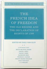
Van Kley, Dale (Editor)
The French Idea of Freedom: The Old Regime and The Declaration of Rights of 1789
Stanford: Stanford University Press 1994. Hardcover with unclipped dust jacket in very good condition. Review slip laid in. Jacket is slightly scuffed and sunned with scores to the rear. Edges are creased and nicked. Board spine ends are bumped. A couple of pages are creased at the lower edge. Boards are clean binding is sound and pages are clear. LW. Hardcover. Very Good/Very Good. Used. Stanford University Press Hardcover
Referentie van de boekhandelaar : 614900 ISBN : 0804723559 9780804723558
|
|
|
van Krieken P J
The Asylum Acquisition Handbook: The Foundation for a Common European Asylum Policy
T.M.C. Asser Press 2000. This is an ex-library book and may have the usual library/used-book markings inside.This book has hardback covers. Clean from markings. In good all round condition. No dust jacket. Please note the Image in this listing is a stock photo and may not match the covers of the actual item800grams ISBN:9789067041225 T.M.C. Asser Press hardcover
Referentie van de boekhandelaar : 3701328 ISBN : 906704122x 9789067041225
|
|
|
Van Krieken, Peter
The Migration Acquisition Handbook: The Foundation for a Common European Migration Policy
T.M.C. Asser Press 2001. This is an ex-library book and may have the usual library/used-book markings inside.This book has hardback covers. Clean from markings. In good all round condition. No dust jacket. Please note the Image in this listing is a stock photo and may not match the covers of the actual item900grams ISBN:9789067041300 T.M.C. Asser Press hardcover
Referentie van de boekhandelaar : 3701338 ISBN : 9067041300 9789067041300
|
|
|
van Langren, Michael Florenty
Tertia Pars Brabantiae qua continetur Marchionat. S. R. I. horum urbs primaria Antverpia. Kupferstich-Karte mit Grenzkolorit, zwei Wappen u. Titelkartusche.
Amsterdam, Johannes Janssonius, (um 1650). Ca. 42 x 53 cm Kartengrösse. Und breiter Rand. Leicht gebräunt, Ränder stärker, angestaubt bzw. abgegriffen mit kurzen Einrisse. Mittelfalz leimschattig u. teils eingerissen, teils hinterlegt.
Referentie van de boekhandelaar : 32709AB

|
|
|
VAN LIER H.H.
Mijnen en mensen in Spanje - de praktijk van het nationaal-syndicalisme
[xx +] 392pp.+ kaarten en buitentekstills.+ bijgevoegd: losbladig 11 tabellen, [Academisch proefschrift ter verkrijging van de graad van doctor in de letteren en wijsbegeerte aan de Universiteit van Amsterdam… 19 mei 1953], stempel op titelblad, goede staat
|
|
|
VAN LOEY,A. VAN.
Les mots français en néerlandais. Bruxelles Palais des Académies 1954. 14 p. Wrs. Offpr.
unknown
Referentie van de boekhandelaar : 29560
|
|
|
VAN LOON Johannes (Attivo tra il 1649-86)
Pascaerte van 't westelyckste deel vande Middelandsche Zee
Pascaerte Van ‘t Westelyckste deel vande Middelandesche Zee; Waer in vertoont de ware gelegentheden van alle Capen, Havens, Rivieren, Bayen, Anckergronden en droogten, alles op haer rechte strecklingen en verheyt, nu Nieuwelyx int licht gebracht Acquaforte e bulino, imprint editorialei: ’t Amsterdam, Door Iohannes van Loon Zeecaert-maker, op de S. Lucia burgwal in ‘t Sloterdycks steegie.Magnifiche prova, impressa su carta vergata coeva e finemente colorate a mano in epoca, con margini, in ottimo stato di conservazione.Opera tratta da: Klaer Lichtende Noort-Ster Ofte Zee Atlas; Waer in vertoont wordt De gelegentheydt van alle de Zee-kusten des geheelen Aerdtbodems, Nieuwelicks uyt-gegeven door Joannes van Loon. ‘t Amsterdam, By Ioannes van Loon, Plaet-snijder, buyten de S. Anthonis Poort, achter de Blancken Ham, in de 3. Vijsels, ofte by Gillis van Loon, achter de Hal, in de 3, Kemphaentjes, Anno 1661.Johannes van Loon era un noto matematico che lavorò per un lungo periodo per vari librai e produttori di carte di Amsterdam. Ci sono alcuni dubbi intorno alle identità di Jan e Johannes van Loon poiché entrambi i nomi circolavano nel periodo 1649 - 1685. Tuttavia, poiché entrambi i nomi ricorrono nei registri notarili, in relazione ad un impiego presso Johannes Janssonius van Waesbergen, si può supporre che Jan e Johannes siano la stessa persona. Non conosciamo la sua data di nascita ma la sua morte dovrebbe essere avvenuta nel 1686. Il suo nome compare per la prima volta nella guida nautica pubblicata da Theunis Jacobsz ad Amsterdam nel 1649, il Practitioner in the Sciences of Astronomy, Geometry and the Mathematiques. In seguito, il suo nome compare in un libro scritto da Peter Ruelle intitolato Voorlooper des Zee-quadrants ofte Ruitkaert, in the het licht gebracht door J. van Loon, stampato da Hendrick Doncker nel 1651. Oltre alla professione di matematico, firmò le carte per il noto atlante marino intitolato Klaer-Lichtende Noort Ster pubblicato da lui e dal fratello Gilles nel 1661; prima di questa data aveva contribuito alla composizione delle guide nautiche pubblicate da Johannes Janssonius quali Le Nouveau Flambeau de la Mer (1650), il De Lichtende Columne (1651/52) e il The Lighting Columne (1654). Nel 1666 le lastre del Klaer-Lichtende Noort Ster furono vendute a J. Janssonius van Waesbergen, il quale, a sua volta, ristampò l’opera, in collaborazione con Van Loon, dopo averla arricchita di dodici nuove carte, tutte firmate da entrambi i cartografi. Le edizioni delle carte che recano la seconda parte dell’imprint editoriale - op de S. Lucia burgwal in ‘t Sloterdycks steegie - abraso, sono da ritenersi pubblicate dopo il 1666 (cfr. Koeman, IV, pp. 406-408 che descrive ulteriori otto edizioni della raccolta, impresse dal 1666 al 1706 circa). Quando Johannes I van Keulen intraprese il gigantesco progetto di una nuova guida nautica in cinque volumi, lo Zee-Fakkel, furono van Loon e Class Jansz Vooght, considerato come l’autore principale dell’opera, ad aiutarlo. Il contributo di Jan van Loon fu, tuttavia, modesto; venne menzionato soltanto nel titolo della seconda parte, pubblicato per la prima volta nel 1681. La sua attività si estende per un periodo di 40 anni, insolitamente lungo per il tempo. Raro portolano del Mediterraneo.Bibliografia: C. Koeman, Atlantes Neerlandici: Bibliography of Terrestrial, Maritime and Celestial Atlases and Pilot Books Published in the Netherlands up to 1880 Vol. IV, pp. 403-408, Loon 1 (13, 14); cfr. R. Shirley, Maps in the Atlases of the British Library, Londra, 2004, pp. 1223-1224. Pascaerte Van ‘t Westelyckste deel vande Middelandesche Zee; Waer in vertoont de ware gelegentheden van alle Capen, Havens, Rivieren, Bayen, Anckergronden en droogten, alles op haer rechte strecklingen en verheyt, nu Nieuwelyx int licht gebracht Etching and engraving. Imprint in the cartouche: ’t Amsterdam, Door Iohannes van Loon Zeecaert-maker, op de S. Lucia burgwal in ‘t Sloterdycks steegie.Rary early chart of The Mediterranean Sea, western part.Magnificent example, printed on contemporary laid paper, with margins, old hand-colour, in excellent condition.From: Klaer Lichtende Noort-Ster Ofte Zee Atlas; Waer in vertoont wordt De gelegentheydt van alle de Zee-kusten des geheelen Aerdtbodems, Nieuwelicks uyt-gegeven door Joannes van Loon. ‘t Amsterdam, By Ioannes van Loon, Plaet-snijder, buyten de S. Anthonis Poort, achter de Blancken Ham, in de 3. Vijsels, ofte by Gillis van Loon, achter de Hal, in de 3, Kemphaentjes, Anno 1661.Johannes van Loon was a well-known mathematician who worked for a long time for various booksellers and map producers in Amsterdam. There are some doubts about the identities of Jan and Johannes van Loon because both names were circulated in the period 1649 - 1685. However, since both names appear in the notarial registers, in relation to a job with Johannes Janssonius van Waesbergen, it can be assumed that Jan and Johannes are the same person.We do not know his date of birth but his death should have taken place in 1686. His name appears for the first time in the nautical guide published by Theunis Jacobsz in Amsterdam in 1649, the Practitioner in the Sciences of Astronomy, Geometry and the Mathematiques. Later, his name appears in a book written by Peter Ruelle entitled Voorlooper des Zee-quadrants ofte Ruitkaert, in the het licht gebracht door J. van Loon, printed by Hendrick Doncker in 1651. Besides the profession of mathematician, he signed the maps for the famous marine atlas entitled Klaer-Lichtende Noort Ster published by him and his brother Gilles in 1661; before this date he had contributed to the composition of the nautical guides published by Johannes Janssonius such as Le Nouveau Flambeau de la Mer (1650), De Lichtende Columne (1651/52) and The Lighting Columne (1654). In 1666 the plates of the Klaer-Lichtende Noort Ster were sold to J. Janssonius van Waesbergen, who, in turn, reprinted the work, in collaboration with Van Loon, after having enriched it with twelve new maps, all signed by both cartographers.Bibliografia: C. Koeman, Atlantes Neerlandici: Bibliography of Terrestrial, Maritime and Celestial Atlases and Pilot Books Published in the Netherlands up to 1880 Vol. IV, pp. 403-408, Loon 1 (13, 14); cfr. R. Shirley, Maps in the Atlases of the British Library, Londra, 2004, pp. 1223-1224. S. Bifolco, "Mare Nostrum, Cartografia nautica a stampa del Mar Mediterraneo" (2020), pp. 120-121, tav. 46.

|
|
|
VAN LOON Johannes (Attivo tra il 1649-86)
Pascaerte Van ‘t Westelyckste deel vande Middelandesche Zee & Pascaerte van ‘t Ooestelyckste deel vande Middelandesche Z
Pascaerte Van ‘t Westelyckste deel vande Middelandesche Zee; Waer in vertoont de ware gelegentheden van alle Capen, Havens, Rivieren, Bayen, Anckergronden en droogten, alles op haer rechte strecklingen en verheyt, nu Nieuwelyx int licht gebracht Pascaerte van ‘t Ooestelyckste deel vande Middelandesche Zee; Waer in vertoont de ware gelegentheden van alle Capen, Havens, Rivieren, Bayen, Anckergronden en droogten, alles op haer rechte strecklingen en verheyt, nu Nieuwelyx int licht gebracht. Coppia di incisioni all’acquaforte e bulino, di dimensioni mm 315x455 entrambe. Imprint editoriale nei due cartigli: ’t Amsterdam, Door Iohannes van Loon Zeecaert-maker, op de S. Lucia burgwal in ‘t Sloterdycks steegie.Magnifiche prove, impresse su carta vergata coeva e finemente colorate a mano in epoca, con margini, in ottimo stato di conservazione.Opera tratta da: Klaer Lichtende Noort-Ster Ofte Zee Atlas; Waer in vertoont wordt De gelegentheydt van alle de Zee-kusten des geheelen Aerdtbodems, Nieuwelicks uyt-gegeven door Joannes van Loon. ‘t Amsterdam, By Ioannes van Loon, Plaet-snijder, buyten de S. Anthonis Poort, achter de Blancken Ham, in de 3. Vijsels, ofte by Gillis van Loon, achter de Hal, in de 3, Kemphaentjes, Anno 1661.Johannes van Loon era un noto matematico che lavorò per un lungo periodo per vari librai e produttori di carte di Amsterdam. Ci sono alcuni dubbi intorno alle identità di Jan e Johannes van Loon poiché entrambi i nomi circolavano nel periodo 1649 - 1685. Tuttavia, poiché entrambi i nomi ricorrono nei registri notarili, in relazione ad un impiego presso Johannes Janssonius van Waesbergen, si può supporre che Jan e Johannes siano la stessa persona. Non conosciamo la sua data di nascita ma la sua morte dovrebbe essere avvenuta nel 1686. Il suo nome compare per la prima volta nella guida nautica pubblicata da Theunis Jacobsz ad Amsterdam nel 1649, il Practitioner in the Sciences of Astronomy, Geometry and the Mathematiques. In seguito, il suo nome compare in un libro scritto da Peter Ruelle intitolato Voorlooper des Zee-quadrants ofte Ruitkaert, in the het licht gebracht door J. van Loon, stampato da Hendrick Doncker nel 1651. Oltre alla professione di matematico, firmò le carte per il noto atlante marino intitolato Klaer-Lichtende Noort Ster pubblicato da lui e dal fratello Gilles nel 1661; prima di questa data aveva contribuito alla composizione delle guide nautiche pubblicate da Johannes Janssonius quali Le Nouveau Flambeau de la Mer (1650), il De Lichtende Columne (1651/52) e il The Lighting Columne (1654). Nel 1666 le lastre del Klaer-Lichtende Noort Ster furono vendute a J. Janssonius van Waesbergen, il quale, a sua volta, ristampò l’opera, in collaborazione con Van Loon, dopo averla arricchita di dodici nuove carte, tutte firmate da entrambi i cartografi. Le edizioni delle carte che recano la seconda parte dell’imprint editoriale - op de S. Lucia burgwal in ‘t Sloterdycks steegie - abraso, sono da ritenersi pubblicate dopo il 1666 (cfr. Koeman, IV, pp. 406-408 che descrive ulteriori otto edizioni della raccolta, impresse dal 1666 al 1706 circa). Quando Johannes I van Keulen intraprese il gigantesco progetto di una nuova guida nautica in cinque volumi, lo Zee-Fakkel, furono van Loon e Class Jansz Vooght, considerato come l’autore principale dell’opera, ad aiutarlo. Il contributo di Jan van Loon fu, tuttavia, modesto; venne menzionato soltanto nel titolo della seconda parte, pubblicato per la prima volta nel 1681. La sua attività si estende per un periodo di 40 anni, insolitamente lungo per il tempo. Raro portolano del Mediterraneo.Bibliografia: C. Koeman, Atlantes Neerlandici: Bibliography of Terrestrial, Maritime and Celestial Atlases and Pilot Books Published in the Netherlands up to 1880 Vol. IV, pp. 403-408, Loon 1 (13, 14); cfr. R. Shirley, Maps in the Atlases of the British Library, Londra, 2004, pp. 1223-1224. Pascaerte Van ‘t Westelyckste deel vande Middelandesche Zee; Waer in vertoont de ware gelegentheden van alle Capen, Havens, Rivieren, Bayen, Anckergronden en droogten, alles op haer rechte strecklingen en verheyt, nu Nieuwelyx int licht gebracht Pascaerte van ‘t Ooestelyckste deel vande Middelandesche Zee; Waer in vertoont de ware gelegentheden van alle Capen, Havens, Rivieren, Bayen, Anckergronden en droogten, alles op haer rechte strecklingen en verheyt, nu Nieuwelyx int licht gebracht.Etching and engraving, 315x455 each one. Imprint in the cartouches: ’t Amsterdam, Door Iohannes van Loon Zeecaert-maker, op de S. Lucia burgwal in ‘t Sloterdycks steegie.Rary early pair of sea charts of The Mediterranean Sea.Magnificent examples, printed on contemporary laid paper, with margins, old hand-colors, in excellent condition.From: Klaer Lichtende Noort-Ster Ofte Zee Atlas; Waer in vertoont wordt De gelegentheydt van alle de Zee-kusten des geheelen Aerdtbodems, Nieuwelicks uyt-gegeven door Joannes van Loon. ‘t Amsterdam, By Ioannes van Loon, Plaet-snijder, buyten de S. Anthonis Poort, achter de Blancken Ham, in de 3. Vijsels, ofte by Gillis van Loon, achter de Hal, in de 3, Kemphaentjes, Anno 1661.Johannes van Loon was a well-known mathematician who worked for a long time for various booksellers and map producers in Amsterdam. There are some doubts about the identities of Jan and Johannes van Loon because both names were circulated in the period 1649 - 1685. However, since both names appear in the notarial registers, in relation to a job with Johannes Janssonius van Waesbergen, it can be assumed that Jan and Johannes are the same person.We do not know his date of birth but his death should have taken place in 1686. His name appears for the first time in the nautical guide published by Theunis Jacobsz in Amsterdam in 1649, the Practitioner in the Sciences of Astronomy, Geometry and the Mathematiques. Later, his name appears in a book written by Peter Ruelle entitled Voorlooper des Zee-quadrants ofte Ruitkaert, in the het licht gebracht door J. van Loon, printed by Hendrick Doncker in 1651. Besides the profession of mathematician, he signed the maps for the famous marine atlas entitled Klaer-Lichtende Noort Ster published by him and his brother Gilles in 1661; before this date he had contributed to the composition of the nautical guides published by Johannes Janssonius such as Le Nouveau Flambeau de la Mer (1650), De Lichtende Columne (1651/52) and The Lighting Columne (1654). In 1666 the plates of the Klaer-Lichtende Noort Ster were sold to J. Janssonius van Waesbergen, who, in turn, reprinted the work, in collaboration with Van Loon, after having enriched it with twelve new maps, all signed by both cartographers.Bibliografia: C. Koeman, Atlantes Neerlandici: Bibliography of Terrestrial, Maritime and Celestial Atlases and Pilot Books Published in the Netherlands up to 1880 Vol. IV, pp. 403-408, Loon 1 (13, 14); cfr. R. Shirley, Maps in the Atlases of the British Library, Londra, 2004, pp. 1223-1224. S. Bifolco, "Mare Nostrum, Cartografia nautica a stampa del Mar Mediterraneo" (2020), pp. 120-121, tav. 46.

|
|
|
Van Moock SJM. S. J.
Nouveau Dictionnaire: Francis-Hollandais et Hollandais-Francais. Partie II: Francais-Hollandais M-Z
Chez H.C.A. 1824 Book. Fair. Hardcover. A VERY RARE early Nineteenth century translation dictionary French-Dutch and back. Significant age wear; with the spine strip inexpertly taped inner hinge cracked. Volume II only. Chez H.C.A. hardcover
Referentie van de boekhandelaar : 079299
|
|
|
Van Nieuwenhuysen, Andree
Les finances du duc de Bourgogne Philippe le Hardi 1384-1404: Le montant des ressources
Brussels Belgium: Acdemie Royale de Belgique 1983. Oversize Paperback. NEAR FINE. Tight bright clean square except for tiny bumps to exterior corners. Errata sheet included. Belgian history. Text in French. ISBN: 2803100789. Acdemie Royale de Belgique paperback
Referentie van de boekhandelaar : 80X003 ISBN : 2803100789 9782803100781
|
|
|
Van Norman, Louis E.
POLAND The Knight Among Nations
Browning to endpapers. Binding quite loose in spots. Two small stains to rear board ; A history of Poland and its role in European history; B&W Photographs; 8vo; 359 pages
|
|
|
Van Nüffel Robert O.J.
IL BELGIO E IL RICONOSCIMENTO DEL REGNO D'ITALIA.
(Codice ST/0746) In 8° (23 cm) 17 pp. Con interessanti documenti diplomatici del 1861. Brossura originale. Ottimo. ~~~ SPEDIZIONE IN ITALIA SEMPRE TRACCIATA

|
|
|
Van Os, Henk W. - Van Asperen de Boer, J. R. J. (a cura di - editors)
La Pittura nel XIV e XV Secolo. Il Contributo dell'Analisi Tecnica alla Storia dell'Arte
Mm 155x210 " C.I.H.A. Comité International d'Histoire de l'Art - Atti del XXIV Congresso Internazionale di Storia dell'Arte". Brossura originale, 428 pagine profusamente illustrate in nero e a colori nel testo. Interventi di vari studiosi redatti in lingua inglese, italiana, tedesca e francese - english, german, italian, french text . Volume in perfette condizioni, spedizione in 24 ore dalla conferma dell'ordine.
|
|
|
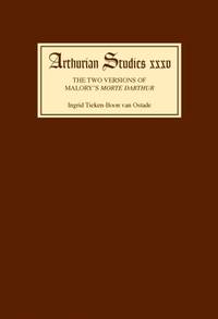
Van Ostade, Ingrid Tieken-Boon
The Two Versions of Malory's Morte Darthur: Multiple Negation and the Editing of the Text
Cambridge: D. S. Brewer. As New in As New dust jacket. 1995. First Edition Thus. First Printing. Hard Cover. 0859914372 . "Malory's Morte Darthur survives in two versions: the Winchester manuscript which has been dated 1469-70 and the edition Caxton published in 1485. These versions were thought to be collaterally related through a common source to an original lost manuscript until in 1977 new evidence suggested a linear descent. Dr Tieken-Boon van Ostade's study supports this argument first through a detailed refutation of Vinaver's arguments for collateral descent then through an analysis of the incidence of multiple negation in both versions of the Morte Darthur and the conclusions to be drawn from it. A reconstruction of the events leading to Caxton's publication of the text at a politically hazardous time completes the volume.". The volume is in perfect pristine condition unmarked tight square and clean. AS NEW. Arthurian Studies Series. Vol. 35. 8vo 8" - 9" tall. x 169 2 pp . D. S. Brewer hardcover
Referentie van de boekhandelaar : 8006 ISBN : 0859914372 9780859914376
|
|
|
Van Pul, Paul
In Flanders Flooded Fields: Before Ypres There Was Yser
Barnsley: Pen & Sword Military. First edition. Hard cover in dust jacket. Published: Barnsley: Pen & Sword Military 2006 first printing. 8vo. xxii266pp. illus. b/w photos maps. Black cloth with gilt titles. Very fine in very fine dust jacket. . Very Fine. Hard. 1st. 2006. Pen & Sword Military unknown
Referentie van de boekhandelaar : 010687 ISBN : 1844154920 9781844154920
|
|
|
VAN ROOSBROECK R.
Revolutie over Europa
Antwerpen, Volksuniversiteit "Herman van den Reeck" 1935, 32pp.
|
|
|
VAN SCHAIK Ton
Abdijen in West-Europa en hun bewoners
144pp.rijkelijk geïll., gecart.band, 28cm., mooie staat
|
|
|
VAN TIEGHEM, Paul.
COMPENDIO DE HISTORIA LITERARIA DE EUROPA. DESDE EL RENACIMIENTO.
20,5x15,5. 283p. Trad. J. M. Quiroga Pla. Primera Edición. Lomo algo deteriorado.

|
|
|
VAN TIEGHEM, Paul.
LE ROMANTISME DANS LA LITTERATURE EUROPÉENNE. L'ére romantique.
fort vol. in-8, 560 pp., broché. Bel exemplaire, en partie non coupé. [SO-4]
|
|
|
Van Voris, Jacqueline
CONSTANCE DE MARKIEVICZ - IN THE CAUSE OF IRELAND
Amherst:: Univ. Massachusetts Pr. VG unmarked Hardback; printer's ink smudge on 6 pp. not. 1967. ISBN: affecting text; no DJ. 384 pp. Catalogs: HISTORY - IRELAND. Keywords: HISTORY - IRELAND IRELAND. Univ. Massachusetts Pr. hardcover
Referentie van de boekhandelaar : BOOKS023904I
|
|
|
VAN WAUWE Ludo
België Europa: regionale of unitaire economie ?
Antwerpen/ Utrecht, Standaard Wetenschappelijke Uitgeverij, 1973, 168pp.
|
|
|
VANAGAITE, RUTA; Zuroff, Efraim
Our People: Discovering Lithuania's Hidden Holocaust
Lanham MD: Rowman & Littlefield 2016. Hardcover with unclipped dust jacket in very good condition. Jacket edges are creased and nicked. Board spine ends are bumped. Minimal ink marginalia on a few of the pages which are otherwise clear and binding is sound. LW. Hardcover. Very Good/Very Good. Used. Rowman & Littlefield Hardcover
Referentie van de boekhandelaar : 617048 ISBN : 1538133032 9781538133033

|
|
|
Vanberg, Bent
Of Norwegian Ways
Minneapolis: Dillon Press 1971 WYSIWYG pricing--no added shipping charge for standard shipping within USA. Teal cloth red titles on spine and device on front board 227 pp 17 illustrations including title page and one full-page illustration for each chapter. DJ spine slightly browned else fine; in Brodart archival cover. From the DJ: "Of Norwegian Ways is a light-hearted and somewhat irreverent history and description of Norway--and of Norwegians and their Norwegian-American cousins." Shipping weight 2 lbs. 3rd ptg. . Fine/Near Fine. Illus. by Henning Jensen. 23 X 15 cm. Dillon Press Hardcover
Referentie van de boekhandelaar : ETNW00026
|
|
|
Vance William L.
Americas Rome: Volume One. Classical Rome
Yale Univ Pr 1989. Hardcover. Very Good/Very Good. gift inscription front endpaper. <br/> <br/> Yale Univ Pr hardcover
Referentie van de boekhandelaar : 353582 ISBN : 0300036701 9780300036701
|
|
|
Vance, Ethel
Reprisal
London: Collins 1943 Book. Near Fine. Hard Cover with Dust Jacket. 1st Edition. Near Fine/VG. 1st Edition. Drama of events following the murder of a German Officer in Occupied France. BOOK:- Gift inscription on FFEP. Dog-ear crease to top right corner of front endpapers. JACKET: - Intact but no price may be export jacket. Edgewear on spine head/heel and flap hinge corners. Two small tears 2mm &4mm at top edge of rear panel. A full condition report for this book is availabl e on request. London: Collins, 1943 Hardcover
Referentie van de boekhandelaar : 002976
|
|
|
Vance, William L.
America's Rome: Volume One Classical Rome
New Haven CT: Yale University Press. Very Good in Very Good dust jacket. 1989. First Printing. Hardcover. 0300036701 . Inscribed by the author on the half title page. Maroon cloth. xxviii 414pp. Acknowledgments black and white and color photos notes bibliography and index. A discussion of the impact of Rome on American artists and writers from the earliest days of the new republic. Volume I focuses on the influence of classical Rome. From the front jacket flap. ; 8vo 8" - 9" tall . Yale University Press hardcover
Referentie van de boekhandelaar : 54886 ISBN : 0300036701 9780300036701

|
|
|
Vance, William L.
America's Rome: Volume Two. Catholic and Contemporary Rome
Yale Univ Pr 1989. Hardcover. Very Good/Very Good. gift inscription front endpaper. <br/> <br/> Yale Univ Pr hardcover
Referentie van de boekhandelaar : 353583 ISBN : 0300044534 9780300044539
|
|
|
VANCE,Norman
Irish Literature: a Social History
Hbk 315pp prev owner's stamp on title page dj slightly shelfworn now in protective sleeve internally a very good clean tight unmarked text.<br /> Blackwell, 1990, hardcover
Referentie van de boekhandelaar : LC338 ISBN : 0631156291 9780631156291
|
|
|
Vancsa, Max (Hg.):
Jahrbuch für Landeskunde von Niederösterreich. Neue Folge, 8. Jahrgang 1909.
372 Seiten. Orig.-Broschur (etwas angestaubt). *Enthält 6 Beiträge zur niederösterreichischen Landesgeschichte: Ältere Geschichte der Pfarre Krems. - Die Hanadwerksordnung Ferdinand I. - Berichte des Reichshofrates Dr. Georg Eder an die Herzöge Albrecht und Wilhelm von Bayern. - Denkschrift Melchior Khlesls über die Gegenreformation. - Geschichte der Straßen in das Wiener Becken. - Bibliographische Beiträge. Bücher de
|
|
|
Vancsa, Max (Hg.):
Jahrbuch für Landeskunde von Niederösterreich. Neue Folge, 12. Jahrgang 1913.
328 Seiten. Orig.-Broschur (Frontdeckel leicht fleckig). *Enthält 8 Beiträge zur niederösterreichischen Landesgeschichte, u.a.: Das Benediktinerstift Seitenstetten in den Jahren 1602-1648. - Ein Wiener Donaubrückenprojekt aus dem 16. Jh. - Die Abgeordneten Niederösterreichs bei der deutsche´n Nationalversammlung in Frankfurt am Main. - Der ständige Zentralausschuss in Österreich im April 1848. - Bibliographische Beiträge. Bücher de
|
|
|
Vandal, Albert
L' Avènement de Bonaparte. Zwei Bände, vollständig. Deux volumes. (I. 20. Édition, II. 14. Édition).
Paris, Plon-Nourrit, 1924. I. La Genèse du Consulat, Brumaire, La Constitution de l'an VIII. II. La République Consulaire 1800. I. IX, 600 SS.; II. 2 Bll., 540 SS. 8°, original Verlagsbroschuren. Couvertures souples originales.
Referentie van de boekhandelaar : 24243
|
|
|
VanDam \(Firm\)
Let's Go Map Guide: Paris Let's Go Map Guide
good. paperback cover and corner wear paperback
Referentie van de boekhandelaar : 060417B140N6611
|
|
|
Vandamme, J.
Employee Consultation and Information in Multinational Corporations
Croom Helm 1986. This is an ex-library book and may have the usual library/used-book markings inside.This book has hardback covers. Clean from markings. In poor condition suitable as a reading copy. No dust jacket. Please note the Image in this listing is a stock photo and may not match the covers of the actual item550grams ISBN:0709926243 Croom Helm hardcover
Referentie van de boekhandelaar : 9864919 ISBN : 0709926243 9780709926245
|
|
|
VANDEN ABEELE (dir.)
Le marché commun et le marché de l'art. Journée d'études organisée par l'Institut d'Etudes européennes, Bruxelles 1er mars 1982
119pp., br.orig., 24cm., bon état, S84613
|
|
|
Vanden Broeck, Ed
Numismatique bruxelloise. Recherches sur les jetons des receveurs de Bruxelles. Postérieurs à la charte de 1421.
Tournai:, Imprimerie Delcourt-Vasseur, 1903-1906. Gr.-8°. 90 S., zahlreiche Münzenabbildungen, Broschiert in Halbleinenmappe 8 Artikel in 8 Heften. (Mappe leicht angestaubt; sonst altersgemäss gut erhalten)
Referentie van de boekhandelaar : 9967AB

|
|
|
Vandenberg Philipp
Lo schiavo di Pompei (stampa 1987)
trad. di Luisa Coeta tela edit. con sovrac. ill., piccole rotture in sovrac.
|
|
|
Vandenberg, Philipp
Der Gladiator : [Roman].
Stuttgart [u.a.] : Dt. Bücherbund, 1983. 352 S. 8°. Lizenzausg. OPpbd. mit SU.
Referentie van de boekhandelaar : 25013
|
|
|
Vandenberg, Philipp
Nero : Kaiser und Gott, Künstler und Narr.
Bindlach : Gondrom, 1991. 348, [24] S. : Ill., Kt. 8°. Lizenzausg. Ill. OPpbd.
Referentie van de boekhandelaar : 17710
|
|
|
VANDER AA Pieter (1659 - 1733)
La Livonie Avec les frontieres de courlande et de Finlande
Carta geografica tratta dalla "Galerie Agréable" del Vander aa. Incisione in rame, in perfette condizioni. A map publisher from Leiden, Pieter van der Aa (1659–1733), published several atlases. In 1729 he issued Galerie Agréable du monde, the source of the present map.Copperplate in very good conditions.

|
|
|
VANDER AA Pieter (1659 - 1733)
Scandinavie Septentrionale ou Couronnes de Nord/Scandinvia Meridionale…
La carta è racchiusa in una cornice decorativa. Era parte della Galerie Agreable du Monde, il famoso atlante di Vander Aa, completato nel 1729 e consistente in più di 3000 mappe. The card is enclosed in a decorative frame. It was part of the Galerie agreable du Monde, the famous Atlas Vander Aa, completed in 1729 and comprising more than 3000 maps.

|
|
|
VANDER LINDEN Herman
Itinéraires de Marie de Bourgogne et de Maximilien d'Autriche (1477-1482)
xiv + 125pp., 31cm., reliure cart. d'éditeur intacte, imprimé sur papier de luxe, non coupé, quelques rousseurs aux tranches, le texte est frais et sans rousseurs, publication de l'Académie royale de Belgique, bon état, B99752
|
|
|
VANDER LINDEN, Herman.
L'Hegemonie Europeenne. Periode Italo-Espagnole (Histoire du Monde, Tome X).
in-8°, 470 pages, broche, couverture. Qq. pass. soul. sin. bel exemplaire, en partie non coupe, DEDICACE par l'auteur. [CA30-1]
|
|
|
VANDER VELPEN, J.
Les voilà qui arrivent. L'extrême droite et l'Europe.
in-8°, 232 pages, notes, index, broche, couverture illustree pelliculee. Bel exemplaire. [HI-3]
|
|
|
 De zoekresultaten per email ontvangen
 Zoekresultaten downloaden als PDF
 RSS feed


