|
BLASSELLE Bruno
Chemins de rencontre. L'Europe avant la lettre.
Reliure simili de l'éditeur (pas de jaquette), signet, 30X21 cm, 1992, 179 pages, nombreuses illustrations en noir et en couleurs, collection banque nationale de Paris éditions Hervas. Très bon état.
书商的参考编号 : 8159

|
|
|
BLATUS René
De La Vieille à La Nouvelle Europe
Paris Le Centurion 1953 Grand In 8 Collection " Le poids du Jour " . Préface du Président Robert Schuman . Service de Presse . Histoire Europe .- 144 p. , 350 gr.
书商的参考编号 : 019911

|
|
|
Blaize A.
Des Monts-de-piété et des banques de prêt sur gage en France et dans les divers états de l'Europe (Tome 1)
Pagnerre Relié 1856 In-8 (16,2 x 24,1 cm), reliure plein chagrin, dos à 4 nerfs, liseré doré sur les coupes, tranches jaspées, 508 pages, tome 1 seul ; nerfs, coiffes et coins frottés, bon état. Livraison a domicile (La Poste) ou en Mondial Relay sur simple demande.
书商的参考编号 : za738

|
|
|
BLADE Jean-François
Etudes sur l'origine des Basques
Paris, A. Franck 1869 iv + 549pp., Edition originale de 1869, br.orig. (peu tachée), 25cm., non coupé, peu de rousseurs, bon état, rare, G77290
书商的参考编号 : G77290
|
|
|
Blandford Edmund L
Fatal Decisions: Errors and Blunders in WWII
Airlife Publishing Ltd 1999 272 pages 16 69x23 19x2 82cm. 1999. Relié. 272 pages. Ce livre est une collection d'incidents certains célèbres et d'autres moins connus survenus pendant la Seconde Guerre mondiale qui illustrent comment les plans échouent souvent en temps de guerre. Il examine les erreurs et les mauvais calculs commis à tous les niveaux de commandement du plus haut au plus bas et montre comment ces erreurs peuvent coûter des vies ou avoir des conséquences désastreuses pour des nations entières
书商的参考编号 : 100155511 ???????? : 1840371048

|
|
|
BLANCHARD (Raoul).
Géographie de l'Europe.
Félix Alcan, 1936, gr. in-8°, viii-483 pp, 17 pl. de photos hors texte, 36 illustrations et cartes, broché, dos recollé, état correct
书商的参考编号 : 2946
|
|
|
BLAYNEY (Andrew Thomas)
L' Espagne en 1810. Souvenirs d'un prisonnier de guerre anglais. Pub. par A. Savine. Suivi de : Une captivité en France. Journal d'un prisonnier anglais (1811-1814)
Paris, Louis-Michaud, 1909 in-12, 188 pp. et 192 pp., ill., demi-basane verte, dos à nerfs, couv. cons. (reliure postérieure).
书商的参考编号 : 222465
|
|
|
Blanc André
L'Europe socialiste
Presses Universitaires de France Europe de demain Broché 1974 In-8 (17x24 cm), broché, 1er plat illustré, 263 pages, illustrations noir et blanc hors-texte ; coiffes, coins et coupes frottées, plats un peu jaunis, bon état. Livraison a domicile (La Poste) ou en Mondial Relay sur simple demande.
书商的参考编号 : gm1067

|
|
|
BLACAS D'AULPS (Duc de)
L.A.S. au duc de Lévis.
Rome, 17 juin 1816 in-4, 2 pp. 1/3
书商的参考编号 : 218211
|
|
|
BLAMEY Marjorie / GREY-WILSON Christopher
LA FLORE d'Europe occidentale : plus de 2400 planches décrites et illustrées en couleurs.
Arthaud 1991 Arthaud, 1991, 544 p., cartonnage éditeur sous jaquette, environ 27x18cm. Bon état.
书商的参考编号 : 119259

|
|
|
BLASQUEZ Adélaïde
LE NOIR ANIMAL
Couverture souple Belfond, 1988, in8 broché avec bordereau, 222pp Exemplaire légèrement défraichi . Langue: Français
书商的参考编号 : M17345
|
|
|
BLASZCZYKA (Wlodzimierza) [Ed.]
Poczatki i rozwoj starego miasta w poznaniu w swietle badan archeologicznych i urbanistyczno-architektonicznych.
Warszwa, Panstwowe Wydawnictwo Naukowe, 1977. In-8 broché sous jaquette ill., 479 pp., 8 planches de plans dépliants en noir, nbr. fig., cartes, plans et ill. photogr. en noir dans le texte. (Biblioteka fontes archaeologici posnanienses, T. 3).
书商的参考编号 : 510041
|
|
|
BLAZE DE BURY Henry
Souvenirs et Récits des Campagnes d'Autriche - Édition originale.
Par H. Blaze de Bury. Guerre d'Italie - Venise - Vérone - Guerre de Hongrie.Édition originale. Paris, Michel Lévy Frères - 1854 - 419 pages.Superbe reliure janséniste plein maroquin vert signée Selz-Niedrée. Dos à nerfs aux titre et auteur doré. Dentelle dorée bordant les contreplats. Tranches dorées. Rares rousseurs éparses. Très bon état. Format in-12°(18x12).
书商的参考编号 : 15751

|
|
|
Blanning","T. C. W.
The Rise and Fall of the French Revolution.
University of Chicago Press, 1996 22,86 x 15,88 x 2,54 cm., 512 pp, Broché
书商的参考编号 : 241847

|
|
|
Blaufarb (Rafe)
The French Army 1750-1820.
Manchester University Press, 2017 23,39 x 15,6 x 1,4 cm., 240 pp, Broché
书商的参考编号 : 241891

|
|
|
Blaeu (Joaen) ; Hoff (Bert van 't), éditeur scientifique
Toonneel der Steden van de Vereenighde Nederlanden met hare beschrijvingen. Met hare beschrijvingen uytgegeven by Joan Blaeu [Steden van Holland en Westfriesland /Utrecht Dutch City Maps).
Lausanne-Amsterdam, Sequoia, Elsevier 1966 In-folio 56,5 x 35 cm. Reliure éditeur fauve sous étui carton à l’identique, dos lisse orné de fers dorés, pièces de titre cuir rouge et noir, armoiries dorées sur le premier plat, non paginé 200 pp., 55 illustrations, soit 1 page de titre en couleur, 23 illustrations en couleurs en double page, 2 illustrations en noir et blanc et 29 autres illustrations en couleurs. Très bon exemplaire.
书商的参考编号 : 94012
|
|
|
Black Antony
Political thought in Europe 1250-1450.
pp. 211, cm 22x14, paperback edition.
|
|
|
Black, C B
BRITTANY AND TOURAINE; Their Monuments and Ancient Castles Ocean and Sea-Bathing Stations Places of Pilgrimage. the Loire from Orelans to the Ocean
London: Adam and Charles Black. 1914. Hardcover. Very Good. Boards with moderate wear to extremities. ; 12 maps in color and 14 plans. ; 16mo 6" - 7" tall; xxii 204 pages . Adam and Charles Black hardcover
书商的参考编号 : 20825

|
|
|
Black, C B
NORMANDY AND PICARDY; Their Relics Castles Churches and Footprints of William the Conqueror
London: Adam and Charles Black. 1899. Fifth Edition. Hardcover. Very Good. Boards with some minor edgewear. Front hinge a bit gapping but holding strong. Neat pencil notes on half-title page. ; 4 maps and 14 plans. Includes detailed descriptions about: Amiens Avranches Bayeux Beauvais Boulogne Chaen Calais Cherbourg Dieppe Dreux Etretat Eu Granville Lillebonne Lisieux Rouen Trouville Valognes and Vire among others. ; 16mo 6" - 7" tall; xvi 213 pages . Adam and Charles Black hardcover
书商的参考编号 : 20824
|
|
|
Black, C B
TOURAINE AND BRITTANY
London: A & C Black. 1909. Fourteenth Edition. Hardcover. Very Good. Light wear to extremities. Bookplate and partly erased owner's name to first blank page; With twelve maps and fourteen plans. Numerous b&w photographs. The maps are very detailed and pretty - many of them in colors; 16mo 6" - 7" tall; 204 pages . A & C Black hardcover
书商的参考编号 : 12206
|
|
|
Black, C B (Charles)
Touraine And Brittany : Their Celtic Monuments and Ancient Castles Ocean and Sea-Bathing Stations Places of Pilgrimage The Loire from Orleans to the Ocean : 12th Edition
London: Adam and Charles Black 1901. Illustrated by Twelve Coloured Maps and Fourteen Plans maps; All of these are listed on pages xx to xxii all in place and look nice three of them had an extra very small fold but were elsewise flat and clean like the others; all the maps most of which fold-out were tipped in on glossy paper and printed in two or three colors. In addition there is a two-page "Index and Railway Map of France" on the rear endpapers. Following the index from page 199 to 204 are four color pages of an advertisement/schedule for train and ferry service. Textblock is complete and clean except for foxing maps not foxed primarily in the margins; binding good with a minor cleft at page 112/113 but all pages safely sewn in --none are loose; front hinge secure; rear hinge is intact but endpapers split with visible gauze although the hinge is not loose at all. Blue cloth cover has minor rubbing minor soiling and minor cornerwear; although spine is browned gilt on spine still clearly legible; gilt on front still bold. . Twelfth Edition. Blue Cloth. Very Good. Illus. by Twelve Coloured Maps and Fourteen Plans. 12mo - over 6¾" 7¾" Tall. Hardcover. Adam and Charles Black Hardcover
书商的参考编号 : 03415

|
|
|
Black, C. B
Belgium with Part of Holland, North France, the Rhine and the Moselle.
London, Black, 1904. Kl.8°. XXXIX, 239 S. Mit 8 Karten und 15 Plänen. OLn. mit Deckel- und RVg. 5. Auflage.
书商的参考编号 : 7558A
|
|
|
Black, C. E. and E. C. Helmreich
Twentieth Century Europe. A history. [By C. E. Black and E. C. Helmreich].
New York: Alfred A. Knopf 1952. XXIII, (1), 910, XVIII Seiten. Mit zahlreichen photographischen Abbildungen. Gr. 8° (24,5 x 16 cm). Orig.-Leinenband mit goldgeprägtem Rückentitel. [Hardcover / fest gebunden].
书商的参考编号 : 68450

|
|
|
BLACK, David (editor), illustrated by Stephen Lee
Carl Linnaeus Travels
4to [25 x 20 cm]; 108 pp, frontis (port), illus, mainly in color, some full-page, glossary, bibliog, classification diagrams. endpaper facsimiles of Linnaeus' handwriting. original cloth, gilt spine title lettering, dj (price clipped), fine, clean, unmarked. A picture of this book is available upon request by email. Extracts from three major expeditions made in Sweden by one of the greatest and most influential naturalists. Beautifully illustrated in color.
|
|
|
BLACK, David (editor), illustrated by Stephen Lee
Carl Linnaeus Travels
sm 4to [25 x 20 cm]; 108 pp, frontis (port), illus, mainly in color, some full-page, glossary, bibliog, classification diagrams. ep facsimiles. original cloth, gilt lettering, dj (small crease), fine. A picture of this book is available upon request by email. Extracts from three major expeditions made in Sweden by one of the greatest and most influential naturalists.
|
|
|
Black, Jeremy
European Warfare 1815-2000
Hampshire: Palgrave. First edition. Softcover. Published Hampshire: Palgrave 2002 first printing. 8vo. wrappers 247pp. Near fine. . Near Fine. Soft cover. 1st. 2002. Palgrave paperback
书商的参考编号 : 010840 ???????? : 0333786688 9780333786680
|
|
|
Black, Jeremy
War and the World : Military Power and the Fate of the Continents 1450-2000
New Haven CT U.S.A.: Yale University Press 1998 First edition. Cloth binding 334 pp. Investigating both land and sea warfare Jeremy Black examines modern weaponry tactics strategy and resources as well as the political social and cultural impact of conflict in this illustrated global history of warfare in the modern era. He takes issue with established interpretations not least those that emphasize technology and directly challenges the view that European military and naval forces were dominant throughout the period. Black investigates the impact of for example Ottoman expansion Babur and the Mughals in 16th-century India and the Manchu conquest of China in the following century. New in new dustjacket. Yale University Press hardcover
书商的参考编号 : 007755 ???????? : 0300072023 9780300072020

|
|
|
Black, Jeremy
Die Kriege des 18. Jahrhunderts / aus d. Engl. von Klaus-Dieter Bosse.
[Rheda-Wiedenbrück u.a.] : RM-Buch-und-Medien-Vertrieb [u.a.], 2001. 224 S. : zahlr. Ill. 4°. Ungekürzte Lizenzausg. Geb. in ill. OPpbd.
书商的参考编号 : 9871
|
|
|
Black, Robert; Law, John E. (eds.)
The Medici: Citizens and Masters (Villa I Tatti Series, 32)
Paperback in very good condition. Light edgewear to covers and nick to spine foot. Minor marks and foxing to page block head. Pages are sound and internally clean throughout. TA Used
|
|
|
BLACKABY, FRANK.
Europe and Nato Expansion. Socialist Renewal. European Labour Forum. Pamphlet No. 9.
|
|
|
Blackburn, Henry
ARTISTIC TRAVEL; A Thousand Miles Towards the Sun; in Normandy Brittany Pyrenees Spain & Algeria
London: Sampson Low. 1892. Hardcover. Very Good. Boards with light rubbing to extremities. Front hinge started. ; Profusely illustrated. The British art critic's travel descriptions in Europe and Algeria. ; Lithograph; 8vo 8" - 9" tall; xiii320 pages . Sampson Low hardcover
书商的参考编号 : 487

|
|
|
Blackburn, Henry
ARTISTIC TRAVEL A Thousand Miles Towards the Sun; in Normandy, Brittany, Pyrenees, Spain & Algeria
Boards with light rubbing to extremities. Front hinge started. ; Profusely illustrated. ; Lithograph; 8vo; xiii,320 pages
|
|
|
BLADE Jean-François
Etudes sur l'origine des Basques
iv + 549pp., Edition originale de 1869, br.orig. (peu tachée), 25cm., non coupé, peu de rousseurs, bon état, rare, G77290
|
|
|
BLAEU Johannes (Alkmaar 1596 circa - Amsterdam 1663)
Avenio vulgo Avignon
Opera tratta dalla rara prima edizione del Theatrum Civitatum et Admirandorum Italiae ad aevi veteris & praesentis temporis faciem expressum à Ioanne Blaeu G. F., stampata ad Amsterdam nel 1663. Si tratta del primo, monumentale, libro interamente dedicato alla cartografia urbana della sola penisola, preceduto dal “tascabile” Italia Hodierna di Jodocus Hondius del 1627 e realizzato in probabile concorrenza con Johannes Janssonius che, nel 1657, aveva pubblicato il Theatrum praecipuarum urbium, contenente un volume dedicato all’Italia. Johannes Blaeu, durante la sua lunga attività editoriale pubblica tre volumi sulle città italiane. Nel 1663 i primi tre, suddivisi in Stato della Chiesa, Roma e Regno di Napoli e Sicilia. Alla sua morte i suoi eredi danno alla luce altri due volumi datati 1682 incentrati sulle città del Piemonte e della Savoia, poi ristampati da altri editori nel 1693 e 1697. Il francese Pierre Mortier pubblica una ristampa nel 1704/5, intitolata Nouveau Theatre de l’Italie. L’opera è in quattro volumi e comprende le lastre del Blaeu, ritoccate e modificate in piccola parte, integrate dall’aggiunta di numerose nuove mappe di proprio disegno, raffiguranti le città della parte settentrionale della penisola, racchiuse nel primo volume dell’opera. L’atlante del Mortier venne pubblicato con testo latino, francese ed olandese. Il grande successo dell’opera diede origine ad un’ulteriore ristampa, praticamente identica, curata da Alberts ed edita nel 1724/5. Esemplare con testo descrittivo la verso, della prima edizione del 1663. Bibliografia Koeman, Atlas Neerlandici, pp. 332/338; Cremonini pp. 49-52, 39. Map taken form the rare first edition of Theatrum Civitatum et Admirandorum Italiae ad aevi veteris & praesentis temporis faciem expressum à Ioanne Blaeu G. F., printed by Johannes Blaeu, Amsterdam, 1663. This is the first monumental town book entirely covering Italy, preceded by the "pocket-size" Italia Hodierna by Jodocus Hondius jr. (1627) and realized in likely competition with Johannes Janssonius who, in 1657, published the Theatrum praecipuarum urbium, containing a volume dedicated to Italy. Johannes Blaeu, during his long editorial activity published three volumes on Italian cities. In 1663 the first three, divided into the State of the Church, Rome and the Kingdom of Naples and Sicily. At his death his heirs gave birth to two more volumes dated 1682 focused on the cities of Piedmont and Savoy, then reprinted by other publishers in 1693 and 1697. Pierre Mortier publishes a reprint in 1704/5, entitled Nouveau Theatre de l'Italie. The work is in four volumes and includes the plates of Blaeu, retouched and modified in small part, supplemented by the addition of several new maps of his own design, depicting the cities of the northern part of the peninsula, enclosed in the first volume of the work. Mortier's atlas was published with Latin, French and Dutch texts. The great success of the work gave rise to a further reprint, virtually identical, edited by R. Alberts and published in 1724/5. Example of the first edition, showing descriptive text on the back of the map. Literature Koeman, Atlas Neerlandici, pp. 332/338; Cremonini pp. 49-52, 39.

|
|
|
BLAEU Johannes (Alkmaar 1596 circa - Amsterdam 1663)
Ducatus Chablasius et Lacus Lemanus cum Regionibus adjacentibus
Mappa della regione del Lago Lemano in Svizzera, dal libro di Blaeu sulla Savoia e il Piemonte "Theatrum Statuum Regiae Celsitudinis Sabaudiae Ducis, Pedemontii Principis".La carta deriva dall'opera di Tommaso Borgonio, ed è stata incisa da Joannes de Broen e pubblicata dagli eredi di Blaeu. Acquaforte su rame, finemente colorata a mano, in ottime condizioni. Map of the Lake Geneva region of Switzerland, from Blaeu's townbook of Savoy and Piedmont "Theatrum Statuum Regiae Celsitudinis Sabaudiae Ducis, Pedemontii Principis".The map is after Borgonio and was engraved by Joannes de Broen and published by Blaeu's heirs. Copperplate with fine later hand colour, very good condition.

|
|
|
BLAEU Johannes (Alkmaar 1596 circa - Amsterdam 1663)
Nova Zemla
La mappa mostra la Nowaja Semlja (Nova Zembla) nell'Oceano Artico, la penisola Jamal e l'Obbussen.La Novaya Zemlya, nota anche come Nova Zembla, è un arcipelago situato nell'Oceano Artico nel nord della Russia e nell'estremo nord-est dell'Europa, il punto più orientale d'Europa che si trova a Capo Flissingsky, sull'isola settentrionale. A ovest di Novaya Zemlya si trova il Mare di Barents e a est il Mare di Kara. Gli olandesi sono stati i più persistenti ricercatori del cosiddetto "passaggio a nord-est", sia a nord della Novaya Zemlya (la cui costa occidentale è mostrata in dettaglio) sia attraverso quello che a sud hanno chiamato Stretto di Nassau.I russi conoscevano la Novaya Zemlya fin dall'XI secolo, quando i cacciatori di Novgorod visitarono la zona. Per gli europei occidentali, la ricerca della rotta del Mare del Nord nel XVI secolo ha portato alla sua esplorazione. La prima visita di un europeo occidentale fu di Hugh Willoughby nel 1553. L'esploratore olandese Willem Barentsz raggiunse la costa occidentale della Novaya Zemlya nel 1594 e, in una successiva spedizione del 1596, arrotondò il capo settentrionale e svernò sulla costa nord-orientale. Barentsz morì durante la spedizione e potrebbe essere stato sepolto sull'isola di Severny. Durante un successivo viaggio di Fyodor Litke nel 1821? 1824, la costa occidentale fu mappata. Sul grande mappamondo Gerhards Mercator del 1597, è già chiamato Nova Zemla. Henry Hudson era un altro esploratore che passò attraverso Novaya Zemlya mentre cercava il Passaggio a Nord-Est.L'opera appare per la prima volta nell "Atlas Major" di Johannes Blaeu dle 1662. Questo esemplare non ha testo al verso ed è probabilmente pubblicato dai figli di Johannes, dopo la sua morte.Incisione in rame, coloritura coeva, in buono stato di conservazione. Map shows the russian Nowaja Semlja (Nova Zembla) in the Arctic ocean, the peninsula Jamal and the Obbussen, with two decorative cartouches.Novaya Zemlya also known as Nova Zembla is an archipelago in the Arctic Ocean in northern Russia and the extreme northeast of Europe, the easternmost point of Europe lying at Cape Flissingsky on the Northern island. West of Novaya Zemlya is the Barents Sea, and to the east is the Kara Sea. The Dutch were the most persistent searchers after the north-east Passage, whether to the north of Novaya Zemlya (whose west coast is shown in detail) or through what they called Nassau Straits to its south.The Russians knew of Novaya Zemlya from the 11th century, when hunters from Novgorod visited the area. For Western Europeans, the search for the Northern Sea Route in the 16th century led to its exploration. The first visit from a Western European was by Hugh Willoughby in 1553. Dutch explorer Willem Barentsz reached the west coast of Novaya Zemlya in 1594, and in a subsequent expedition of 1596, he rounded the northern cape and wintered on the northeastern coast. Barentsz died during the expedition, and may have been buried on Severny Island. During a later voyage by Fyodor Litke in 1821?1824, the western coast was mapped. On Gerhards Mercator large world map from 1597 , it is alredy named as Nova Zemla. Henry Hudson was another explorer who passed through Novaya Zemlya while searching for the Northeast Passage.The work appears for the first time in Johannes Blaeu's "Atlas Major", 1662. This exemple is without text on verso, and is probably published by Johannes's sons after his death.Copper engraving, iwith fine original colouring, very good condition. cfr. A. Berkhemer, 'De Spaanse Atlas Mayor van Blaeu: nieuwe gegevens', Caert-Thresoor 16 (1997) 3, pp.71-76, H. De la Fontaine Verwey, The 'Spanish Blaeu,' Quaerendo 11 (1981), pp.83-94.

|
|
|
BLAEU Johannes (Alkmaar 1596 circa - Amsterdam 1663)
Pars Borealior Iutiae Septentrionalis... / Pars Australior Iutiae Septentrionalis...
Carta in due fogli della Danimarca di Johannes Blaeu. La carta viene per la prima volta pubblicata nell’Atlas Major del 1662. Il presente esemplare è tratto dall’edizione con testo latino. Alla morte di Willem J. Blaeu, nell’ottobre del 1638, la tipografia venne rilevata dai figli Johannes o Joan (1596-1673) e Cornelis (circa 1610-1642) che subentrarono negli affari del padre. Nello stesso anno Joan Blaeu assunse anche la posizione di suo padre come cartografo ufficiale del V.O.C. Il titolo poneva la casa editrice Blaeu al centro della creazione di mappe ad Amsterdam, dando loro un potere e un’influenza senza precedenti. Alla morte di Cornelis, nel 1642, la casa editrice rimase esclusivamente nelle mani di Joan Blaeu, che nel 1648 fu il primo a pubblicare una mappa che raffigurava la teoria copernicana della Terra che ruota attorno al Sole, un concetto eretico secondo la Chiesa cattolica. Nel 1662 Blaeu completò il suo opus magnum: l’Atlas maior sive cosmographia Blaviana. Magnifca prova, impressa su carta vergata coeva, finemente colorata d’epoca, in ottimo stato di conservazione. Two-sheet map of Denmark by Johannes Blaeu. The map is first published in the Atlas Major of 1662. The present specimen is taken from the edition with Latin text. At the death of Willem J. Blaeu, in October 1638, the printing house was taken over by his sons Johannes or Joan (1596-1673) and Cornelis (about 1610-1642) who took over the business of their father. In the same year Joan Blaeu also took over his father's position as official cartographer of the V.O.C. The title placed Blaeu's publishing house at the center of map-making in Amsterdam, giving them unprecedented power and influence. Upon Cornelis' death in 1642, the publishing house remained solely in the hands of Joan Blaeu, who in 1648 was the first to publish a map depicting the Copernican theory of the Earth revolving around the Sun, a heretical concept according to the Catholic Church. In 1662 Blaeu completed his magnum opus: the Atlas maior sive cosmographia Blaviana. A fine example, printed on contemporary paper, finely original colouring, in good condition.

|
|
|
BLAEU Johannes (Alkmaar 1596 circa - Amsterdam 1663)
Transylvania Sibenburgen
Antica mappa della Transilvania, nell'edizione di Johannes Blaeu (1649-1655). Pubblicata per la prima volta da Willem Blaeu nel 1634 nel Theatrum Orbis Terrarum o Atlas Novus. Willem Janszoon Blaeu, avviò nel 1599 la sua attività di costruttore di globi e strumenti astronomici ad Amsterdam. Nel 1630, dopo aver comprato alcune lastre dell’atlante del Mercator da Jodocus Hondius II, fu in grado di pubblicare un volume di 60 mappe con il titolo di Atlantis Appendix. Cinque anni dopo, pubblicò i primi due volumi del suo atlante Atlas Novus o Theatrum Orbis Terrarum, in sei libri. Dopo la sua morte, Joan (Johannes) continuò l’opera paterna, completando l’intera serie di sei volume dell’Atlas Novus intorno al 1655. Fu inoltre autore di un Atlas Maior sive Cosmographia Blaviana, in 12 volumi pubblicati nel 1662 -72. Incisione su rame, finemente acquarellata, in ottimo stato di conservazione. Antique map of Transilvania by J. Blaeu, (1649-1655). First published by Willem Blaeu in 1634 in his "Theatrum Orbis Terrarum" or "Atlas Novus" The map shows the region of Transilvania, at the time part of Hungary, now Romania; the major city is Alba Iulia or Weissenburg.Decorative title cartouche surmounted by coat of arms. Willem Janszoon Blaeu, started in 1599 his business as a builder of globes and astronomical instruments in Amsterdam. In 1630, after buying some plates of the Mercator atlas from Jodocus Hondius II, he was able to publish a volume of 60 maps under the title Atlantis Appendix. Five years later, he published the first two volumes of his atlas Atlas Novus or Theatrum Orbis Terrarum, in six books. After his death, Joan (Johannes) continued his father's work, completing the entire six-volume Atlas Novus series around 1655. He was also the author of an Atlas Maior sive Cosmographia Blaviana, in 12 volumes published in 1662 -72. Copper engraving, finely hand-colured, in excellent condition. Latin text on verso Van der Krogt 2, 7700:2.

|
|
|
Blaeu, Joan; Peter van der Krogt (intro, texts)
Atlas Maior of 1665: Belgica Regia et Belgiaca Foederata De Lage Landen - Les Pays-Bas et la Belgique - The Netherlands and Belgium
Koln Germany: Taschen 2006. Book. Near Fine. Hardcover. First Thus. Elephant Folio - over 15" - 23" tall. White polished paper covered boards lettered in black with color device printed on front cover. Slightly bumped bottom corners otherwise as issued. 208 pp. fully illus. in color. Text in Dutch French and English. Color illus. dust jacket as issued now in mylar. Taschen Hardcover
书商的参考编号 : 040185 ???????? : 3822851035 9783822851036

|
|
|
Blaeu, Willem (Janszoon)
Europa recens descripta. Altkolorierte Kupferstichkarte aus:
Amsterdam, Blaeu, ca. 1635. Willem J. und Joan Blaeu, Novus Atlas, Das ist Weltbeschreibung. Ca. 41 cm x 55,5 cm.
书商的参考编号 : 19446
|
|
|
Blair, R Baxter; Harding, Samuel B
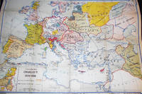
Europe at the Time of Charles V 1519-1556 Denoyer-Geppert New Social Science Map H9 by Samuel B. Harding; compiled and drawn by R. Baxter Blair
Chicago: Denoyer-Geppert Co 1956. Map. Very Good . 1 folded linen-backed color map 33 x 44 inches attached to a dark green cover 30 cm. with brown printed paper label. In Very Good Condition; edges are starting to fray; map is clean bright and intact. Denoyer-Geppert Co unknown
书商的参考编号 : 007266
|
|
|
Blake George.
THE HEART OF SCOTLAND.
(Codice VR/0714) In 8° XII-115 pp. + 32 pp. (catalogue). Colour frontispice, 112 plates, 13 drawings by Brian Cook. Original half cloth, no dust jacket. Very good. ~~~ SPEDIZIONE IN ITALIA SEMPRE TRACCIATA

|
|
|
BLAKE Willliam
LIBRI PROFETICI. Introduzione, traduzione e note di Roberto Sanesi.
In-8 (cm. 22), brossura editoriale illustrata, pp. 213, (5), con alcune illustrazioni in bianco e nero nel testo. In buono stato di conservazione (good copy).
|
|
|
Blakemore, Steven (ed.)
Burke and the French Revolution: Bicentennial Essays
Hardcover in good condition. Jacket is lightly marked and edge worn. Jacket spine head is nicked. Hardcover leading corners and spine ends are lightly bumped and worn. Pages are clean and text is clear throughout. HCW Used
|
|
|
BLANC, Albert
Discours prononcés par. Son Exc. le Baron Blanc Ministre des Affaires Étrangers dans la discussion du budget des affaires étrangères à la. Chambre des Députés les 3 et 5 mai 1894.
Rome. Imprimerie de Cabinet du Ministèere des affaires étrangèrss 1894. 28 pages. Original softcover. (A little used). Mit Stempel "Sammlung Markgrafen von Baden". 25x18 cm
书商的参考编号 : 140891
|
|
|
Blanc, Louis
Pages d'Histoire de la Révolution de Février 1848
Mm 115x180 Volume nella sua brossura originale, 331 pagine. Copia in buon ordine; spedizione in 24 ore dalla conferma dell'ordine.
|
|
|
Blanc, Louis.:
Révolution Francaise. Histoire de dix ans 1830-1840. 16 Bände, gebunden in 4.
Kl.-8°. Zus. ca. 2700 S. Leinwandbände d. Zt. mit Rückenvergoldung. *Stempel der Bibl. Fürstenberg auf Titelblättern. Bücher fr
|
|
|
Blanc, Ludwig Gottfried
Handbuch des Wissenswürdigsten aus der Natur und Geschichte der Erde und ihrer Bewohner. Hier Erster Theil.
Halle, Schwetschke, 1821. Halbleder
书商的参考编号 : 38135

|
|
|
Blanchard, W.O. a. S.S. Visher
Economic geography of Europe. 1st ed., 10th impr.
New York, McGraw-Hill, 1931. M. 1 mehrf. gef. Kte. u. zahlr. Ktn.-Skizzen u. Abb. VIII, 507 S. OLwd. m. Rsign. M. mehr. St.
书商的参考编号 : 412527
|
|
|
BLANCO ANGEL
GRANDE PESTE (LA) - UN FLAGELLO SULL'EUROPA DEL TRECENTO
Pagine: 96 . Illustrazioni: Molte illustrazioni nel testo . Formato: 16° . Rilegatura: Brossura lucida a colori . Stato: Buono . Caratteristiche: Breve, ma precisa analisi di un grande male che ha cambiato l'Europa . Collana: Piccola biblioteca di base .
|
|

 ?????????
 ?????PDF???
 RSS feed
 ??
??


