|
Hydrographer Of The Navy
Malacca Strait and West Coast of Sumatra Pilot : Malacca Strait and its Northern Approaches Singapore Strait and the West Coast of Sumatra and Including Cocos Islands : Sixth Edition 1987
Hydrographer of the Navy. Very Good. 1987. Hardcover. Sixth Edition 1987 . This book is in very good condition; some age spotting to edges. It does have some cover shelfwear. Inside pages have no writing. . Hydrographer of the Navy hardcover
Referentie van de boekhandelaar : 08GW22-253-159f
|
|
|
Hydrographic Office US Navy
Merchant Marine House Flags and Stack Insignia: H.O. Pub. No. 100
Hardcover. NEW/NEW. <br/> <br/> hardcover
Referentie van de boekhandelaar : Pazz191778 ISBN : 9798367675737 9798367675
|
|
|
Hydrographic Office. Us Navy
Merchant Marine House Flags and Stack Insignia. H. O. Pub. 100
GPO 1961. 1961. First edition. Ringbound. Very good. light shelf wear mild discoloration to the binder. GPO, 1961 unknown
Referentie van de boekhandelaar : Alibris.0076899
|
|
|
Hydrographic Office - US. Navy U. S.
Monthly Surface Temperature Charts of the North Atlantic Ocean
Washington D.C.: Hydrographic Office/United States Government Printing Office 1945. 1st. MAP . Near Fine/Near Fine. Large 51.5"" x 30"" map produced during WWII for the US Navy. Opens to 12 equal sections one for each month. No print dates but map was together with other WWII 1943/1944 charts. Small tears at 3 of the folds - would not be visible if map were mounted. One sided and neatly folded. Chart includes the whole of the Atlantic Ocean from the northern coast of South America all the way up past Newfoundland. Amazingly no markings and very little if any soiling. Hydrographic Office/United States Government Printing Office unknown
Referentie van de boekhandelaar : blb02843
|
|
|
Hydrographic Office under the authority of the Secretary of the Navy
Naval Air Pilot : Mexico - Corrected to May 1 1933 - Notice to Aviators No. 9 1933
Washington D. C.: Government Printing Office 1933. Very Good condition. Light edge wear. SEE PHOTOS. Square and tight. A few pages have dog-eared corners. NOT a library discard. NO owner's name or bookplate. Pages are clean and unmarked. NO underlining. NO highlighting. NO margin notes. Softcover. 5.75" wide by 9" tall. Illustrated with photos of landing fields and numerous maps in color a few folding. Detailed guide to air routes distances air traffic rules airstrips sea plane anchorages and landing fields in Mexico. Hydrographic Office Publication No. 193. Index. Bound in the original green wraps stamped in black. First printing of 1933 Revised Edition. Softcover. Very Good condition. v 95pp. Government Printing Office Paperback
Referentie van de boekhandelaar : 016961

|
|
|
Hydrographer of the Navy
New Zealand Pilot. Offshore and coastal waters around North and South Islands of New Zealand Stewart Island and adjacent islands Kermadec Chatham Bounty Antipodes Auckland and Campbell Islands
Hydrographer of the Navy 1987. Hardcover. Very Good. Fourteenth edition 1987. Minimal rub to hardcover. No marks or names inside. Because of size media mail in US only. No priority. <br/> <br/> Hydrographer of the Navy hardcover
Referentie van de boekhandelaar : 038044
|
|
|
Hydrographic Office US. Navy U. S.
No. 129 West Indies Pilot Volume II The Lesser Antilles And The Seacoast Of Venezuela
Government Printing Office . 1915. Hardback. Good. Both top corners and all pages between them have a one inch bump. The pages have a one inch crease. No dust wrapper. Owner's name and address in pencil. West Indies Pilot Vol. II. 16 x 10 inch fold-out map. Government Printing Office hardcover
Referentie van de boekhandelaar : 17036
|
|
|
Hydrographer of the Navy
North Sea Pilot. Vol. IV. The Eastern Shores of the North Sea From Nieuwpoort to Skagen. S. D. No. 55
Hydrographer of the Navy 1963-01-01. Hardcover. Very Good. in x in x in. on blue cloth Hydrographer of the Navy hardcover
Referentie van de boekhandelaar : mon0000090496
|
|
|
Hydrographer of the Navy
North Sea Pilot. Vol. II. Comprising The Northern and Eastern Coasts of Scotland From Cape Wrath to Berwick. S.D. No. 53
Great Britain: Hydrographer of the Navy. Very Good/No Jacket. 1959. 11th Edition. Cloth. 8vo - over 7¾" - 9¾" Tall Octavo Hardback Hardback. North Sea Pilot. Volume II. Slight foxing to edge. Blue cloth with yellow lettering. Included in Supplement No 7 - 1971. The North Sea Pilot. Volume II contains a description of the northern and eastern coast of Scotland from Cape Wrath to Berwick including the estuary of and the River Tay as far as Perth; also of the Firth of Forth and River Forth as far as Stirling. This the eleventh edition has been prepared by Commander W. B. Monk R.N. and contains the latest information received in the Hydrographic Department. 309 pp. We carry a wide selection of titles in The Arts Theology History Politics Social and Physical Sciences. academic and scholarly books and Modern First Editions Reference books and all types of Academic Literature. . Hydrographer of the Navy hardcover
Referentie van de boekhandelaar : 094834
|
|
|
Hydrographer of the Navy
North Sea Pilot. Vol. IV. The Eastern Shores of the North Sea From Nieuwpoort to Skagen. S. D. No. 55
Great Britain: Hydrographer of the Navy. Very Good/No Jacket. 1963. 11th Edition. Cloth. 8vo - over 7¾" - 9¾" Tall Octavo Hardback Hardback. North Sea Pilot. Vol. IV. Slight foxing to edge. Couple of slight marks to cloth. Slightly sunned spine. Blue cloth with yellow lettering. Included in Supplement No 6 - 1971. The North Sea Pilot Volume IV contains a description of the coasts of Belgium Holland Germany and Denmark from the French Boundary to Skagen and the off-lying shoals and banks. This the eleventh edition has been prepared by Captain W. S. Bardwell D.S.O. M.V.O. R.N. from the latest information received in the Hydrographic Department. 560 pp. We carry a wide selection of titles in The Arts Theology History Politics Social and Physical Sciences. academic and scholarly books and Modern First Editions Reference books and all types of Academic Literature. . Hydrographer of the Navy hardcover
Referentie van de boekhandelaar : 094835
|
|
|
Hydrographer of the Navy
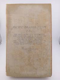
Pacific Islands Pilot Vol II - 7th Edition 1943
UK: Hydrographer of the Navy. Fair. Hardcover. 1943. 523 pages. cover worn & marked some damage to a couple of pages <br><p></p> . Hydrographer of the Navy hardcover
Referentie van de boekhandelaar : 5774ae
|
|
|
Hydrographer Of The Navy
Pacific Islands Pilot Vol II - 9th Edition 1969
UK: Hydrographer of the Navy. Good. Hardcover. 1969. spine cloth faded light/small discolouring to cloth cover<br><p></p> . Hydrographer of the Navy hardcover
Referentie van de boekhandelaar : 4240u

|
|
|
Hydrographer of the Navy
Pacific Islands pilot: Vol. III
Hydrographer of the Navy. Used - Good. Good condition. 9th edition. Volume 3. Supplement laid in. Pilot Guides Pacific Ocean Navigation A copy that has been read but remains intact. May contain markings such as bookplates stamps limited notes and highlighting or a few light stains. Bundled media such as CDs DVDs floppy disks or access codes may not be included. Hydrographer of the Navy unknown
Referentie van de boekhandelaar : I20OS-00986
|
|
|
Hydrographic Office - US. Navy U. S.
Pilot Chart of the Greenland and Barents Seas - November 1943
Washington D.C.: Hydrographic Office/United States Government Printing Office 1943. 1st. MAP . Near Fine/Near Fine. Large 37.5"" x 26"" double sided map produced during WWII for the US Navy. Stated ""Printed October 15th 1943"" this is a chart of the seas around the east coast of Greenland Iceland Svalbard Norway etc. for the month of December showing typical storm patterns currents etc. . Map also shows prior December storm tracks with red lines and each one listed with Roman numerals. Amazingly no markings or tears and very little if any soiling. Map is colored with hashed pink and light red to show areas where icebergs are problems. Reverse side shows ""Arctic Solar Illumination Diagram"" in a wave like diagram showing illumination based on months and degrees. States ""Restricted"" on both sides. Hydrographic Office/United States Government Printing Office unknown
Referentie van de boekhandelaar : blb02866
|
|
|
Hydrographic Office - US. Navy U. S.
Pilot Chart of the North Atlantic Ocean - April 1945
Washington D.C.: Hydrographic Office/United States Government Printing Office 1945. 1st thus. MAP . Near Fine/Near Fine. Large 38""x26"" two sided map produced during WWII for the US Navy. Stated ""Printed February 16th 1945"" this is a chart of the North Atlantic for the month of April showing typical storm patterns currents and ice flows. Also has an inset of the Mediterranean Sea. Reverse side has a complex and attractive illustration of ""Monthly Moonlight Diagrams"" for May 1945 with each box and row showing details for different lattitudes. Chart includes the whole of the Atlantic Ocean from the northern coast of South America all the way up past Newfoundland and shows prior April storm tracks with red lines and each one listed with Roman numerals. Amazingly no markings or tears and very little if any soiling.Really fantastic piece of history and a beautiful map. Moon side is equally interesting and attractive. Hydrographic Office/United States Government Printing Office unknown
Referentie van de boekhandelaar : blb02839
|
|
|
Hydrographic Office - US. Navy U. S.
Pilot Chart of the North Atlantic Ocean - November 1943
Washington D.C.: Hydrographic Office/United States Government Printing Office 1945. 1st. MAP . Near Fine/Fine. Large 38""x26"" two sided map produced during WWII for the US Navy. Stated ""Printed October 15th 1943"" this is a chart of the North Atlantic for the month of April showing typical storm patterns currents and ice flows. Also has an inset of the Mediterranean Sea. Reverse side has a complex and attractive illustration of ""Monthly Moonlight Diagrams"" for December 1943 with each box and row showing details for different lattitudes. Chart includes the whole of the Atlantic Ocean from the northern coast of South America all the way up past Newfoundland and shows prior November storm tracks with red lines and each one listed with Roman numerals. Amazingly no markings or tears and very little if any soiling. Really fantastic piece of history and a beautiful map. Moon side is equally interesting and attractive. Folded neatly. Hydrographic Office/United States Government Printing Office unknown
Referentie van de boekhandelaar : blb02842
|
|
|
Hydrographic Office - US. Navy U. S.
Pilot Chart of the North Atlantic Ocean - December 1943
Washington D.C.: Hydrographic Office/United States Government Printing Office 1945. 1st. MAP . Near Fine. Large 38""x26"" two sided map produced during WWII for the US Navy. Stated ""Printed November 20th 1943"" this is a chart of the North Atlantic for the month of April showing typical storm patterns currents and ice flows. Also has an inset of the Mediterranean Sea. Reverse side has a complex and attractive illustration of ""Monthly Moonlight Diagrams"" for January 1944 with each box and row showing details for different lattitudes. Chart includes the whole of the Atlantic Ocean from the northern coast of South America all the way up past Newfoundland and shows prior December storm tracks with red lines and each one listed with Roman numerals. Amazingly no markings or tears and very little if any soiling. Really fantastic piece of history and a beautiful map. Moon side is equally interesting and attractive. Hydrographic Office/United States Government Printing Office unknown
Referentie van de boekhandelaar : blb02841
|
|
|
Hydrographic Office - US. Navy U. S.
Pilot Chart of the North Pacific Ocean - November 1943
Washington D.C.: Hydrographic Office/United States Government Printing Office 1943. New Edition. MAP . Near Fine. Large 37.5"" x 26"" two sided map produced during WWII for the US Navy. Stated ""Printed September 25th 1943"" this is a chart of the North Pacific for the month of November showing typical storm patterns currents and ice flows. Also has an inset showing gales and their frequency and another for isotherms and isobars. Includes section ""Instructions regarding Minesweepers."" Reverse side is completely filled with illustrations and information on Waterspouts by Willis Edwin Hurd of the US Weather Bureau. Chart includes the majority of the Pacific Ocean from Hawaii up to Alaska and the Bering Sea. Map also shows prior November storm tracks with red lines and each one listed with Roman numerals. Amazingly no markings or tears and very little if any soiling. Really fantastic piece of history and a beautiful map. Hydrographic Office/United States Government Printing Office unknown
Referentie van de boekhandelaar : blb02860
|
|
|
Hydrographic Office - US. Navy U. S.
Pilot Chart of the Greenland and Barents Seas - December 1943
Washington D.C.: Hydrographic Office/United States Government Printing Office 1943. 1st. MAP . Near Fine. Large 37.5"" x 26"" single sided map produced during WWII for the US Navy. Stated ""Printed November 19th 1943"" this is a chart of the seas around the east coast of Greenland Iceland Svalbard Norway etc. for the month of December showing typical storm patterns currents etc. . Map also shows prior December storm tracks with red lines and each one listed with Roman numerals. Amazingly no markings or tears and very little if any soiling. Map is colored with hashed pink and light red to show areas where icebergs are problems. Hydrographic Office/United States Government Printing Office unknown
Referentie van de boekhandelaar : blb02863
|
|
|
Hydrographic Office - US. Navy U. S.
Pilot Chart of the Central American Waters - August 1943
Washington D.C.: Hydrographic Office/United States Government Printing Office 1943. 1st. MAP . Near Fine/Fine. Large 37.5"" x 26"" two sided map produced during WWII for the US Navy. Stated ""Printed July 14th 1943"" this is a chart of the Central America Waters for the month of August showing typical storm patterns currents etc. Reverse side is completely filled with illustrations information and maps on Cyclonic Storms Hurricanse assembled by the US Weather Bureau. Chart includes the majority of the Central American waters on Pacific and Caribbean side from the Northern coast of South America up through all of the islands and to Florida. Map also shows prior August storm tracks with red lines and each one listed with Roman numerals. Amazingly no markings or tears and very little if any soiling. Really fantastic piece of history and a beautiful map. Hydrographic Office/United States Government Printing Office unknown
Referentie van de boekhandelaar : blb02861
|
|
|
Hydrographic Office - US. Navy U. S.
Pilot Chart of the North Atlantic Ocean - March 1945
Washington D.C.: Hydrographic Office/United States Government Printing Office 1945. 1st. MAP . Near Fine. Large 38""x26"" two sided map produced during WWII for the US Navy. Stated ""Printed January 19th 1945"" this is a chart of the North Atlantic for the month of March showing typical storm patterns currents and ice flows. Also has an inset of the Mediterranean Sea. Reverse side has a complex and attractive illustration of ""Monthly Moonlight Diagrams"" for April 1945 with each box and row showing details for different lattitudes. Chart includes the whole of the Atlantic Ocean from the northern coast of South America all the way up past Newfoundland and shows prior March storm tracks with red lines and each one listed with Roman numerals. Amazingly no markings or tears and very little if any soiling. Really fantastic piece of history and a beautiful map. Moon side is equally interesting and attractive. Hydrographic Office/United States Government Printing Office unknown
Referentie van de boekhandelaar : blb02838
|
|
|
Hydrographic Office - US. Navy U. S.
Pilot Chart of the Central American Waters - December 1943
Washington D.C.: Hydrographic Office/United States Government Printing Office 1943. MAP . Near Fine. Large 37.5"" x 26"" two sided map produced during WWII for the US Navy. Stated ""Printed November 20th 1943"" this is a chart of the Central America Waters for the month of December showing typical storm patterns currents etc. Reverse side is ""Total Solar Eclipse January 25th 1944"" and is completely filled with illustrations information and a large map showing the path of the Eclipse assembled by Captain J. F. Hellweg U.S. Navy Superintendent at the U.S. Naval Observatory. Chart includes the majority of the Central American waters on Pacific and Caribbean side from the Northern coast of South America up through all of the islands and to Florida. Map also shows prior December storm tracks with red lines and each one listed with Roman numerals. Amazingly no markings or tears and very little if any soiling. Hydrographic Office/United States Government Printing Office unknown
Referentie van de boekhandelaar : blb02862
|
|
|
Hydrographic Office - US. Navy U. S.
Pilot Chart of the North Atlantic Ocean - January 1944
Washington D.C.: Hydrographic Office/United States Government Printing Office 1945. 4th. MAP . Near Fine. Large 38""x26"" two sided map produced during WWII for the US Navy. Stated ""Printed December 14th 1943"" this is a chart of the North Atlantic for the month of January showing typical storm patterns currents and ice flows. Also has an inset of the Mediterranean Sea. Reverse side has a complex and attractive illustration of ""Monthly Moonlight Diagrams"" for Feb. 1944 with each box and row showing details for different lattitudes. Chart includes the whole of the Atlantic Ocean from the northern coast of South America all the way up past Newfoundland and shows prior January storm tracks with red lines and each one listed with Roman numerals. Also information for ""Broadcast Signals for 500 KC.Time Signal Service"" including locations and codes. Amazingly no markings or tears and very little if any soiling. Really fantastic piece of history and a beautiful map. Moon side is equally interesting and attractive. Hydrographic Office/United States Government Printing Office unknown
Referentie van de boekhandelaar : blb02840
|
|
|
Hydrographic Office, United States Navy Department
Sailing Directions for the Southwest Coast of Africa From Cape Palmas to Cape of Good Hope.
Washington Government Printing Office 1932 paperback. Third edition 1932. -- H.O. No. 105. Stamped: "corrected through notice to mariners 30 Jul 28 '43." Issued under authority of the Secretary of the Navy. Errata tipped in to several pages. Includes fold-out maps index chart and routes. Perforated order forms for coming supplements are bound in. 442 pages. -- Fragile softcover. Good used condition cover tear at spine. Government Printing Office paperback
Referentie van de boekhandelaar : 27027
|
|
|
Hydrographic Office, United States Navy Department
Sailing Directions for New Guinea Including the Islands Eastward of Celebes and Timor
Washington Government Printing Office 1952 hardcover. Fourth edition 1952. H.O. No. 164. Published by the Hydrographic Office under the authority of the Secretary of the Navy. Includes folding map. 540 pages 8x10.5 inches. Hardcover board covers ex-library copy with spine label internal ownerships. Good used condition library marks; some pencil notes. Government Printing Office hardcover
Referentie van de boekhandelaar : 26088
|
|
|
HYDROGRAPHIC OFFICE, UNITED STATES NAVY DEPARTMENT
SAILING DIRECTIONS FOR THE MEDITERRANEAN VOLUME II: H. O. NO. 152 Third Edition 1941
WASHINGTON D.C.: GOVERNMENT PRINTING OFFICE. G. LIGHT BROWN CLOTH DARKENED ALONG SPINE. PAPER DARKENED. Pages: 644. . 1941. 3RD. HARDCOVER. NAVY STAMP ON FFEP. 12 BOUND-IN SUPPLEMENT COUPONS FOR THE 1942 TO THE 1953 SUPPLEMENTS. . GOVERNMENT PRINTING OFFICE hardcover
Referentie van de boekhandelaar : MASTER069606I
|
|
|
Hydrographic Office - US. Navy U. S.
Sea & Swell Chart - North Atlantic Ocean - April - Restricted
Washington D.C.: Hydrographic Office/United States Government Printing Office 1945. 1st. MAP . Near Fine/Near Fine. Large 36"" x 27"" map produced during WWII for the US Navy. No print dates but map was together with other WWII 1943/1944 charts. Shows direction and strength/size of seas and swells in different areas of the Atlantic for the month of April. One sided and neatly folded. Chart includes the whole of the Atlantic Ocean from the northern coast of South America all the way up past Newfoundland. States ""RESTRICTED"" at top of map. Amazingly no markings and very little if any soiling. Hydrographic Office/United States Government Printing Office unknown
Referentie van de boekhandelaar : blb02845
|
|
|
Hydrographic Office - US. Navy U. S.
Sea & Swell Chart - North Atlantic Ocean - May - Restricted
Washington D.C.: Hydrographic Office/United States Government Printing Office 1945. 1st. MAP . Near Fine. Large 36"" x 27"" map produced during WWII for the US Navy. No print dates but map was together with other WWII 1943/1944 charts. Shows direction and intensity/size of swells and seas in different areas of the Atlantic for the month of May. One sided and neatly folded. Chart includes the whole of the Atlantic Ocean from the northern coast of South America all the way up past Newfoundland. States ""RESTRICTED"" at top of map. Amazingly no markings and very little if any soiling. Hydrographic Office/United States Government Printing Office unknown
Referentie van de boekhandelaar : blb02844
|
|
|
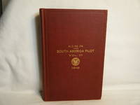
Hydrographic Office U. S. Navy
South America Pilot Volume III West Coast from Corcovado Gulf to Panama
Wash. DC: Government Printing Office. Very Good with no dust jacket. 1916. First Edition. Hardcover. Red cloth titled in gilt. Stated first edition. Corners/edges lightly bumped else sound and square; no marks noted. Foldout map. ; 8vo 8" - 9" tall; 510 pages . Government Printing Office hardcover
Referentie van de boekhandelaar : 28790
|
|
|
Hydrographic Office of the Royal New Zealand Navy. Defense Mapping Agency, Hydrographic/Topographic Center.
South Pacific Ocean New Zealand Including Norfolk and Campbell Is. 1:3500000 22o30` Depts. in Meters Heights in Meters Mercator Projection. DMA Stock No. WOPGN600. OMEGA INTERNATIONAL CHART SERIES
Washing D. C. : Defense Mapping Agency Hydrographic/Topographic Center. 1982. Hardcover. Very Good. Map: Very Good/ 1982 . Map: Very Good/ $55.77 South Pacific Ocean New Zealand Including Norfolk and Campbell Is. 1:3500000 22o30` Depts. in Meters Heights in Meters Mercator Projection. DMA Stock No. WOPGN600. OMEGA INTERNATIONAL CHART SERIES Hydrographic Office of the Royal New Zealand Navy. Defense Mapping Agency Hydrographic/Topographic Center. Washing D. C. 1982 Tall Wide Folding Map 30 Inches Wide X 43 Inches Tall S/c. Map Printed On Heavy Paper Folding Map: In Very Good/ Condition. No Binding. D/j: None. This Item Will Be Sent Wrapped In Plastic Taped Shut And In A = Padded Mailing Envelope = To Prevent Shipping Damage So That It Will Arrive In The Description Described Which Applies To This B00K Only. = No Odors No Writing No Names No Rippling Not Stuck Together No Book Plate Not X~Library No Other Marks. = Will Make It An Excellent Addition To Your Own Personal Library Collection Or As A Gift For The Discriminating Reader / Collector. = WORLD WIDE SHIPPING AVAILABLE <br/> <br/> Defense Mapping Agency, Hydrographic/Topographic Center. hardcover
Referentie van de boekhandelaar : 016998
|
|
|
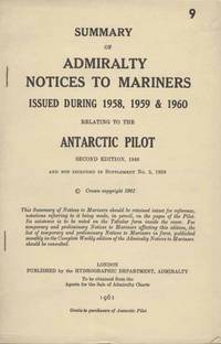
Hydrographer of the Navy
Summary of Admiralty Notices to Mariners Issued During 1958 1959 & 1960 Relating to the Antarctic Pilot Second Edition
London: Hydrographic Department Admiralty London 1961. Paperback. VG. 6 pages. Staplebound. Material not included in Supplement No. 5 1958. Includes two B&W maps. Hydrographic Department, Admiralty, London paperback
Referentie van de boekhandelaar : 18803
|
|
|
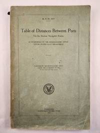
Hydrographic Office United States Navy Department
Table of Distances Between Ports Via the Shortest Navigable Routes H.O. No. 117
Washington: Government Printing Office 1918. Small 4to.; paper wraps softcover; 278 pages; soiled chipped and torn wraps that are partially detached and small water mark on some pages not effecting the text else good. <br/><br/> Washington: Government Printing Office, 1918 paperback
Referentie van de boekhandelaar : 48234
|
|
|
Hydrographer of the Navy.
The English and Bristol Channels - Pocket Tidal Stream Atlas
Hydrographer of the Navy 1961T. paperback. Very Good. PAPERBACK No stamps or inscriptions; Hydrographer of the Navy paperback
Referentie van de boekhandelaar : mon0000365832
|
|
|
Hydrographer of the Navy
West Coasts of England & Wales Pilot: West coasts of England and Wales and south coast of Scotland from Cape Cornwall to Mull of Galloway including Isle of Man
Hydrographer of the Navy 1974. Hardcover. Very Good/No Jacket. H/B 234 pages condition is very good. 11th edition 1974. <br/> <br/> Hydrographer of the Navy hardcover
Referentie van de boekhandelaar : 084658
|
|
|
Hydrographer of the Navy
West Coast of Scotland Pilot. Comprising the West Coast of Scotland From the Mull of Galloway to Cape Wrath Including the Inner and Outer Hebrides. S. D. No. 66
Great Britain: Hydrographer of the Navy. Very Good/No Jacket. 1958. 10th Edition. Cloth. 8vo - over 7¾" - 9¾" Tall Octavo Hardback Hardback. West Coast of Scotland Pilot. Browning to end inside covers. Blue cloth with yellow lettering Included in Supplement No 8 - 1971. This the tenth Edition has been prepared by Captain F. M. Hodgson R.N. and contains the latest information received in the Hydrographic Department. 687 pp. We carry a wide selection of titles in The Arts Theology History Politics Social and Physical Sciences. academic and scholarly books and Modern First Editions Reference books and all types of Academic Literature. . Hydrographer of the Navy hardcover
Referentie van de boekhandelaar : 094831
|
|
|
Hydrographer of the Navy
West Coast of England Pilot Comprising the Coast of Great Britain From the Scilly Isles to the Mull of Galloway Including The Isle of Man. S. D. No. 37
Great Britain: Hydrographer of the Navy. Very Good/No Jacket. 1960. 10th Edition. Cloth. 8vo - over 7¾" - 9¾" Tall Octavo Hardback Hardback. West Coast of England Pilot. Slight foxing to edge. Blue cloth with yellow lettering. Inlcluded in Supplement No. 7 - 1971. The West Coast of England Pilot contains a description of the coast of Great Britain from the Scilly Isles to the Mull of Galloway including the Isle of Man. This the tenth edition has been prepared by Commander H. P. L. Tennet R.N. and contains the latest information received in the Hydrographic Department. 509 pp. We carry a wide selection of titles in The Arts Theology History Politics Social and Physical Sciences. academic and scholarly books and Modern First Editions Reference books and all types of Academic Literature. . Hydrographer of the Navy hardcover
Referentie van de boekhandelaar : 094830
|
|
|
Hydrographic Office under the Authority of the Secretary of the Navy
West Indies Grand and Lesser Caymans
Washington DC: Secretary of the Navy 1933. 20th Ed. July 1933. 31 3/4 x 25 1/4 inches. Very good condition with folds bringing it down to 12 x 13 3/4 inches. Wall map of the Lesser Caymans Grand Caymans and an inset of George Town Anchorage. Original Vintage map printed on heavy paper. The map is stamped with a notice thet it had been corrected with "Notice to Mariners" updating it through Nov. 26 1960. Unconfirmed information given to me when I bought this map many years ogo was that this map was part of a collection of maps used by South Floridians to manage the Bay of Pigs invasion. Regardless of its pedigree it ia a beautiful artifact of the mapmakers art of the islands so prominent in Christopher Columbus sightings on May 10 1503. This is a rarity which is the classic image often reproduced. This is the real item! Not a reproduction!!! Secretary of the Navy unknown
Referentie van de boekhandelaar : 107
|
|
|
Hydrographer of the Navy
WEST INDIES PILOT VOL III : Comprising Bermuda the Bahamas Florida Strait and Cays and the Islands of Hispaniola Cuba and Jamaica
Hydrographer of the Navy 1957. Fifth Edition. Hardcover. Acceptable. Volume III only! Library binding. Ex-library with typical markings. Interior clean binding tight moderate wear to covers. Supplement No. 1 - 1960 bound in at rear. Hydrographer of the Navy hardcover
Referentie van de boekhandelaar : B000KEXWJWasin
|
|
|
Hydrographic Office, U.S. Navy Department.
AZIMUTHS OF CELESTIAL BODIES Whose Declinations Range from 24 to 70 degrees for latitudes Extending to 7 degrees from the Equator - No 120. 7th edition.
(Codice NW/0446) In 8° (27,5 cm) 288 pp. Legatura tutta tela editoriale, titolo oro. Ordinati appunti (in italiano) alla sguardia. Firme. Ottimo stato. ~~~ SPEDIZIONE IN ITALIA SEMPRE TRACCIATA

|
|
|
Hyland A. (cur.); Roberts C. (cur.)
Gatti d'autore
ill., br. "Quale dono più grande dell'amore di un gatto?" chiedeva Dickens. Forse è proprio perché l'amore di un gatto è così difficile da conquistare che queste ammalianti creature ci affascinano tanto. Si dice che i gatti si siano addomesticati da soli. Quando gli uomini da nomadi divennero stanziali, non tardarono a prendere possesso del territorio. Del resto, è proprio il contesto domestico quello in cui i gatti sono più frequentemente ritratti nell'arte: la casa è il terreno comune di umani e felini. Questi curiosi animali sono le uniche creature domestiche che vanno e vengono a loro piacimento e che conducono segretamente una seconda vita di cui non sappiamo nulla, facendo ritorno a casa solo in cerca di cibo, riparo e (se siete dei veri privilegiati) il grembo confortevole di un umano su cui accoccolarsi. Questo comportamento all'apparenza mercenario è la chiave per spiegare il rapporto tutto speciale tra gatti e umani. Laddove, infatti, la maggior parte degli animali domestici dipende interamente dagli uomini, questo non vale per i gatti, e certe persone (invariabilmente non amanti dei gatti) faticano ad accettarlo. I gatti sono animali intelligenti e, come le eroine di Jane Austen, non è facile conquistarli. Sembra che queste creature adorino tenerci appesi a un filo, e ciò non fa che aumentarne il fascino. Come sintetizza efficacemente Hazel Nicholson, "Un gatto è un rompicapo senza possibilità di soluzione". Accompagnata da una serie di proverbi e citazioni sui gatti firmate da autori del calibro di Colette, Hemingway e Dickens, questa galleria di gatti nell'arte - sdraiati al sole, accoccolati, arruffati o sornioni - raccoglie illustrazioni e dipinti firmati da artisti di tutto il mondo, tra cui Lucian Freud, Francisco Goya, Franz Marc, Paul Klee, Andy Warhol, ma anche Edouard Manet e Leonardo da Vinci. Tra un'immagine e l'altra, brevi testi raccontano aneddoti sugli autori e forniscono informazioni sul più sfuggente degli animali domestici, mostrandone tutta la bellezza, l'eleganza e l'alterigia.

|
|
|
Hyland Angus; Wilson Kendra
Cani d'autore. Ediz. illustrata
ill., br. Da Goya a Casorati, da Hockney a Degas, una rassegna di dipinti e illustrazioni sui migliori amici dell'uomo. Chi ama attribuire qualità umane agli animali trova senza dubbio terreno fertile con i cani. Li agghindiamo con maglioncini, annientiamo il loro fascino ferino immortalandoli davanti a leziose carte da parati, cambiamo il colore del loro manto. Ecco come ritraiamo i nostri migliori amici. L'imperituro amore dei cani è ripagato in Cani d'autore, perché il rapporto è chiaramente di mutua dipendenza. Noi abbiamo bisogno di loro perché ci aiutano a sbloccare determinati canali emotivi. Nell'arte, come nella vita, proiettiamo sui cani ansie, ambizioni e trionfi, e loro non sembrano mai averne abbastanza. Nelle loro tante razze (deerhound, barzoi, saluki), i levrieri aggiungono un tocco di eleganza a dipinti già carichi di simboli di opulenza e prestigio. Anche i whippet di Lucian Freud, intrecciati ai corpi umani, elevano il tono delle composizioni. Tra i personaggi più teatrali, poi, sono piuttosto popolari i bassotti: compagni di Pablo Picasso e Andy Warhol, sono inevitabilmente stati trasposti su carta e su tela. Cani d'autore esplora l'alternativa alla vita selvaggia: quella a fianco degli umani. Questa galleria di cani nell'arte - grandi, piccoli, graziosi, divertenti - raccoglie illustrazioni e dipinti firmati da artisti di tutto il mondo. Tra un'immagine e l'altra, brevi testi raccontano divertenti aneddoti sugli autori e forniscono informazioni sulle razze.

|
|
|
Hylke Vinkeles Melchers et Marina Vinkeles Melchers
When Planets Become Stars: How to Set Up Operate and Position an NGO in a World of Shifting Perceptions
like new. unknown
Referentie van de boekhandelaar : 41453621 ISBN : 1838595333 9781838595333

|
|
|
Hylke Vinkeles Melchers et Marina Vinkeles Melchers
When Planets Become Stars: How to Set Up Operate and Position an NGO in a World of Shifting Perceptions
new. unknown
Referentie van de boekhandelaar : 41453621-n ISBN : 1838595333 9781838595333
|
|
|
Hylke Vinkeles Melchers et Marina Vinkeles Melchers
When Planets Become Stars: How to Set Up Operate and Position an NGO in a World of Shifting Perceptions
Matador 2020. Paperback. Very Good. Edition 2020. Ammareal gives back up to 15% of this item's net price to charity organizations. Matador paperback
Referentie van de boekhandelaar : E-303-040 ISBN : 1838595333 9781838595333
|
|
|
Hylke Vinkeles Melchers/ Marina Vinkeles Melchers
When Planets Become Stars: How to Set Up Operate and Position an NGO in a World of Shifting Perceptions
Matador 2020. Paperback. New. 256 pages. 9.13x6.14x1.14 inches. Matador paperback
Referentie van de boekhandelaar : x-1838595333 ISBN : 1838595333 9781838595333
|
|
|
HYNES Samuel
Flights of Passage. Reflections of a World War II Aviator. NEAR FINE COPY IN UNCLIPPED DUSTWRAPPER
8vo., First Edition; red cloth, gilt back, a near fine copy in unclipped dustwrapper.

|
|
|
Hyrtl, J.
Zur vergleichenden Anatomie der Trommelhöhle. 1. Ueber einen neuen Muskel in der Trommelhöhle bei Phoca vitilina.
1850 9 p., 1 lithographed plate, folio (text 27 x 38, plate 30 x 43 cm), disbound (no covers).
Referentie van de boekhandelaar : VM10366
|
|
|
HYTHE Viscount
The Naval Annual 1913
ARCO PUBLISHING COMPANY. 1970. In-8. Broché. Bon état, Couv. convenable, Dos satisfaisant, Intérieur frais. 520 pages. Nombreux schémas, dessins et photos en noir et blanc, dans le texte et en planches hors-texte. Ouvrage en anglais.. . . . Classification Dewey : 386-Marine
Referentie van de boekhandelaar : RO80049177

|
|
|
Hythe, Viscount
The Naval Annual 1913. REPRINT !
David and Charles, 1970.
Referentie van de boekhandelaar : 251502

|
|
|
Hägg, Erik
Under Segel. En Skildring Fran Segelflottornas Tid. Med illustrationer efter malningar och teckningar av J. Hägg.
Stockholm, Lindfors Bokförlag, 1943. 137 S. Mit zahlreichen teils farbigen Abbildungen. 4°, OHLdr. mit goldgepr. Rückentitel und Rücken- und Deckelgoldfileten, Kopfgoldschnitt.
Referentie van de boekhandelaar : 130375
|
|
 De zoekresultaten per email ontvangen
 Zoekresultaten downloaden als PDF
 RSS feed


