|
|
|
CHIHA (Michel)
Variations sur la Méditerranée.
Beyrouth, Editions du Trident, 1973. In-8 broché, 247 pp.
Referenz des Buchhändlers : 604742
|
|
|
Chiara Silvi Antonini, Giorgio Stacul
The Proto-Historic Graveyards of Swat (Pakistan). Part 1: Description of Graves and Finds. Text + Plates (2 volumi)
Collana “Reports and Memories”, VII, 1. 2 volumi, XVI-536 pagine complessive, brossura editoriale. Dimensioni: 24x34 cm. Minime tracce del tempo alla brossura, per il resto ottime condizioni. Volume 1 (Text): numerose figure in b/n nel testo, alcune tavole su foglio ripiegato in b/n fuori testo. Volume 2 (Plates): 1 tavola a colori, CCLXII tavole in b/n e una cartina geografica su foglio più volte ripiegato fuori testo. In lingua inglese. Nonostante la dicitura “Part 1” faccia presupporre altri volumi, questa risulta essere l’unica pubblicata. (N.B. Per peso e dimensioni saranno necessarie spese di spedizione aggiuntive. Additional shipping costs are requested for international shipping of this book. You will be notified by email, or you may email us before you order for a shipping quote).
|
|
|
Chibwe, E C
Afro-Arab Relations in the New World Order
1978. Hardcover. Good. Publisher: St. Martin's Press 1978 Good HB ISBN: 0-312-01063-X hardcover
Referenz des Buchhändlers : 008543 ISBN : 031201063X 9780312010638

|
|
|
CHIERICI Maurizio -
Dayan.
Novara, De Agostini, 1976, 8vo legatura editoriale cartonato telato con titoli dorati al piatto anteriore e al dorso e sovraccopertina illustrata a colori (piccoli strappi) pp. 190 completamente illustrato da fotografie e tavole fotografiche in nero e a colori (I condottieri) .

|
|
|
CHIESA BRUNO - COLOMBO VALENTINA - CRESPI GABRIELE - GARBINI GIOVANNI - NOJA SERGIO - PIOTROVSKI MICHAIL B.
PRIMI (I) ARABI
A Cura: Noja Sergio . Prefazione: Gabrieli Francesco . Pagine: 272 . Illustrazioni: Disegni in bianco e nero nel testo e tavole a colori fuori testo . Formato: 4° . Rilegatura: Cartonato telato con sovracoperta originale . Stato: Buono . Caratteristiche: In buonissimo stato. . Collana: Corpus arabicum .
|
|
|
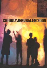
Chihuly
CHIHULY JERUSALEM 2000
2000. 2000 Chihuly CHIHULY JERUSALEM 2000 Seattle WA: Portland Press c2000 First edition 234pp illustrated in color 4to As new hardcover copy with as new dust jacket. unknown
Referenz des Buchhändlers : 69928 ISBN : 157684014X 9781576840146
|
|
|
CHOMSKY Noam, ACHCAR Gilbert
La poudrière du Moyen-Orient
Fayard, 2007, 391 pp., broché, pli de lecture sur le dos, légères traces de mouillure sur la tranche latérale, état correct.
|
|
|
Chronographus, Philo.
Arca Temporum Mundi Reserata, Oder: Der Welt eröffnete Zeit- und Geschicht-Beschreibung. Begreiffend: Perspeculatum [...]. Augsburg, Jakob Koppmayer for Jakob Enderlin, 1693.
Folio (305 x 190 mm). 2 parts in 1 volume. (4), 31, (1), 64 pp. With 12 (instead of 16) plates containing 24 copper engravings. Modern boards. Fascinating, little-received chronographical study focusing on the history of the Eastern Mediterranean and Asia Minor, then under Ottoman rule. The anonymous late 17th-century German author hides behind the name of "Philo Chronographus" and is evidently identical with the "Philo Cosmographus" who produced the similarly themed geographical work, "Trinum Marinum", which is announced on the title page and was often issued together with this, though produced by a different publisher and catalogued separately. The first part of the work contains a general introduction which relates the 24 hours of the day to the time from Creation to the year 1800 (which is conceived of as the end of the world, leaving another mere 107 years of history to come!). The second part features a chronicle of the "Rule of the Ottoman Porte", from Sultan Osman to Suleyman II. - Numerous pages of plates (each page containing two copper engravings) depict costumes, animals and plants, maps and views of towns (Sultan Osman, the Ottoman Residence and a view of Constantinople, dolphins and cranes, Turkish ladies in their various garments, a cypress and a mastix tree, etc.). - The number of plates, and indeed even the arrangement of engravings on a single page, varies from copy to copy, but this wants 4 plates as compared to the table of plates. Well-preserved. VD 17, 12:645730N. Weller, Pseud. 439.

|
|
|
Chrysanthos, Metropolitan of Durazzo, Brusa, and Smyrna.
[Proskynetarion tes hagias poleos Hierousalem kai pases Palaistines]. Vienna, Johanna Schrämbl, 1807.
Folio (215 x 328 mm). (4), 104 pp. With engraved frontispiece and 51 leaves of plates (8 double-page-sized or folded). Near-contemporary red half morocco with gilt rules and marbled covers, spine richly gilt (loss of label). Marbled endpapers. All edges gilt. Rare description of the Holy City of Jerusalem and of the whole of Palestine; a reissue (with changed title) of the edition published by Josef Baumeister in Vienna in 1787. Previous editions had appeared in Venice in 1728, then in 1749 and 1781, while the 1787 edition boasted "a new text and different iconography" (Staikos). This latter edition is here reproduced largely unchanged save for bringing the name of the Patriarch of Jerusalem up to date (from Abraham to Anthimus), as well as that of the editor, Apostolas Boras, on the title page. "The engraving of the Patriarch on his throne is unchanged except for the name; it is signed (in Greek): 'engraved by Schindelmayer in Vienna' [...] A large-sized, impressive book" (Staikos). "A portrait of the Patriarch [Anthimus] forms the frontispiece; also, there is an illustration of the Palace of David, and a plan of the Church of the Holy Sepulchre, though the view of its cross-section is quite haphazard [...] The author expands on Jerusalem, Bethlehem, Hebron, and the sacred sites of Galilee. The text is apparently more or less that of the Venice 1728 edition; apart from that, it is generously interspersed with highly appealing illustrations in the true taste of modern Greece" (cf. Tobler 135). The Viennese publisher and printer Franz Anton Schrämbl, whose company was continued by his widow Johanna after his death in 1804, specialised in reprints (often of large sets), maps, and books in Greek. Their production was one of the strongest in Vienna (cf. Frank/Frimmel, Buchwesen in Wien, p. 175f.). - Extremeties bumped; spine-ends chipped. Still a beautiful volume from the library of King George III of the United Kingdom (1738-1820) with his royal cypher on the spine. Staikos no. 28 (note p. 94). OCLC 41651327. Cf. Röhricht 1362, 1515. Tobler 124f., 135. Legrand (XVIII) 1208.
|
|
|
Churchill, Awnsham & John.
A Collection of Voyages and Travels, Some Now First Printed from Original Manuscripts. London, Henry Lintot & John Osborne, by assignment from Messrs. Churchill, 1744-1746.
Folio (245 x 362 mm). 6 vols. (12), LXXII, (4), 668, (1) pp. (4), 743, (1) pp. 793, (1) pp. (2), IV, 5-780 pp. (4), 708 pp. 824, (104) pp. Title printed in red and black. With 187 engraved plates (many folding) and 9 engravings in the text (showing maps, plans, views, costumes, flora, fauna, scenes, portraits etc., including 2 bound as frontispieces), as well as numerous woodcuts in the text (showing arms, seals, devices, coastal views, details, machinery etc.). Uniform full calf with red labels to spine (gilding oxydized). Third and best edition of this important and profusely illustrated collection of travel reports, compiled by the brothers Awnsham and John Churchill, based on Hakluyt and Purchas. It includes the accounts of Martin Baumgarten (Egypt, Arabia, Palestine, Syria), Thomas Roe, Philipp Balde and Johan Nieuhoff (East Indies, including a detailed account of the north-eastern coast of Arabia, with a description of pearl fishing in Bahrain and mentioning Julfar, Qatar, Sir Bani Yas, Dubai, Sharjah, Ajman, Ras al-Khaimah, Amalgavine, and other places of interest along the coastline), J. Gemelli Careri (Turkey, Persia, India), Nicholas Rolamb (Constantinople), John Barbot (West Africa, with a chapter on "Mahomet and his Alcoran"), as well as of Yemen and various journeys to China, Korea, Greenland, Iceland, Africa, North and South America (including Columbus). - "This is a very valuable collection, both for its range of coverage and for the fact that it gives the original accounts [...] The third edition is considered to be best because of its greater inclusiveness and its copious index" (Hill). Two further volumes were issued separately in 1745, republished in 1752. - The count of the illustrations is notoriously complicated: the "List of the Copper Plates" counts 305 illustrations and maps, of which as many as four are placed on a single plate, and some are placed within the text. Compared to this list, the present set lacks 52 illustrations, or ca. 20 plates, whereas the first volume contains 5 additional plates not called for in the List. Three of the maps (Africa, Asia, America) which the List announces for the first volume are in fact bound in volumes IV-VI. The introduction, a "History of Navigation from its Original to this time", is likely one of the final works of the philosopher John Locke, whose publisher and financial manager Awnsham Churchill had been (while the attribution has been called into question, the text was included in Locke's Complete Works). - Provenance: Byrdie McNeill, Mt. Edgecumbe, Alaska (her stamps). Bindings professionally repaired. Some browning; some edge defects, tears and paper flaws, but generally well-preserved. Cox, I, 10. Hill 295. Sabin 13017. Shirley G.CHUR-1d. Alden/L. 744/62. Borba de Moraes I, 158. Landwehr, VOC 260 (note). Cf. National Maritime Museum Cat. I, 33.
|
|
|
Churi, Joseph H.
Sea Nile, the Desert, and Nigritia. Travels in Company with Captain Peel, R.N. 1851-1852. [...] With Thirteen Arabic Songs, as Sung by the Egyptian Sailors on the Nile. London, published by the author, 1853.
Large 8vo. XII, 331, (1) pp. With wood-engraved frontispiece of the Homra tree. Original publisher's brown boards with title in gilt to spine. First edition. - The Lebanese Maronite Churi trained at the Congregation of Propaganda in Rome from 1842 to 1849. He later left Rome and made his way to London, where he gave lessons in Arabic, Latin, Italian, and Hebrew. Captain W. Peel was amongst his pupils and persuaded him to accompany him on a tour of the Middle East between October 1850 and February 1851. The present work is an account of a second journey the pair undertook to Egypt and the Sudan between August 1851 and February 1852. - Some wear to spine and boards. Mild occasional foxing, otherwise in very good condition. Nice original, unblemished yellow endpapers. Rare. Ibrahim-Hilmy I, 135 (erroneously s. v. "Chusi"). OCLC 4709982. Not in Gay.

|
|
|
Chwolson, Daniel.
Über die Überreste der altbabylonischen Literatur in arabischen Uebersetzungen. St. Petersburg, impr. de l'Académie des sciences, 1859.
Small folio. 196 pp. Contemporary half calf. Marbled endpapers. First edition of this study of ancient Babylonian sources in Arabic translations. The Russian orientalist Daniel Abramovich Chwolson (1819-1911) was appointed extraordinary professor of Oriental languages in St Petersburg in 1855. In 1856 the Imperial Academy issued, at its own expense, Chwolson's first work, which established its author an an authority in the field of oriental research, the two-volume "Die Ssabier und der Ssabismus"; three years later Chwolson published the present "Über die Überreste der Altbabylonischen Literatur in arabischen Uebersetzungen" (also in Russian, in "The Russian Messenger", as "Novootkrytie Pamyatniki"). This work made a great sensation among scholars by the importance of its discoveries and by Chwolson's theories concerning the old Babylonian monuments. (= Sur les débris de l'ancienne littérature babylonienne, conservés dans des traductions arabes. Mémoires présentés à l'Académie impériale des sciences de Saint-Pétersbourg par divers savants, 6e série, VIII). From the library of the Ducs de Luynes at the Château de Dampierre: their bookplate reproducing the arms of Charles Marie d'Albert de Luynes (1783-1839), 7th Duc de Luynes, on pastedown. OCLC 457694735.

|
|
|
Chérif, Ahmed.
Le Pélerinage de la Mecque. Essai d'histoire, de psychologie et d'hygiène sur le voyage sacré de l'Islam. Beirut, Angelil, 1930.
8vo. (4), VI, 71 pp., final blank page. With folding map in colour and 10 black-and-white photo illustrations and maps on plates. Original illustrated wrappers printed in red and black. Only edition, rare. - Report on the Islamic pilgrimage to Mecca, with spectacular views of the holy city and the Kaaba, as well as the Beirut quarantine hospital. The French-trained Lebanese physican and medical historian Ahmed Chérif discusses not only the history and rituals of the Hajj, but also focuses on aspects of health and hygiene during the week-long mass gathering. - Occasional foxing to margins. Two temporary block-stitches to gutter; a few pages and plates loose. Untrimmed copy much in the original condition as issued, awaiting its first proper binding. Macro 16. OCLC 936820237.
|
|
|
CIARLANTINI Franco
Viaggio nell'Oriente mediterraneo
in 16°, pp. 10 nn., 166, bross. edit. Collana: Tempo nostro; i luoghi più suggestivi del Mediterraneo come sono immaginati e come sono realmente, con numerose foto d'epoca f.t.; firme al front. 239/34

|
|
|
CIPOLLA Arnaldo.
Su gli altipiani dell'Iran.
In-8°, legatura in brossura editoriale, pp. 285, con illustrazioni fuori testo. Marginali tracce d'uso e vecchia firma di appartenenza all'occhietto.
|
|
|
Cipolla Arnaldo.
Sulle orme di Alessandro Magno. (Dal Granico al Caspio).
Brossura edit. illustrata, qualche modesta traccia del tempo. Con 12 tavv. f.t. Sc. A.
|
|
|
Claude-Joseph POMEL - Michel Ange LANCRET
DESCRIPTION DE L'EGYPTE. Thèbes. Karnak. Plan et détail du plafond de la porte du sud. (ANTIQUITES, volume III, planche 50)
Imprimerie Impériale | Paris 1809-1829 | 71 x 54 cm | une feuille
Referenz des Buchhändlers : 23387
|
|
|
Clark, Wesley K
Winning Modern Wars: Iraq Terrorism and the American Empire
New York New York U.S.A.: BBS Public Affairs 2003. 2d . Hardcover. As New/As New. 2d Large book black spine black boards very bright gilt lettering on spine 218 lightly browned pages. DJ glossy black beneath mylar map of Iraq with unit insignias at center front color photo of General Clark on back. Signed by General Clark. DJ and book both As New. <br/> <br/> BBS Public Affairs hardcover
Referenz des Buchhändlers : 35807 ISBN : 1586482181 9781586482183

|
|
|
Clark, Wesley K
Winning Modern Wars: Iraq Terrorism and the American Empire
New York New York U.S.A.: Public Affairs 2003. First Edition . Hardcover. Fine/Near Very Fine. 1st 1st Larger book smooth black spine army green boards bright gilt lettering on spine 218 pages Signed by General Clark on title page. DJ glossy dark green beneath mylar with color-illustration of map with unit patches silver and gold lettering color photo of Clark on back. DJ has two tiny light dents at front spine indentation. Near Very Fine DJ/Very Fine book. <br/> <br/> Public Affairs hardcover
Referenz des Buchhändlers : 38854 ISBN : 1586482181 9781586482183
|
|
|
Claude Deffarge -
Yemen 62-69 -
1969. Soft Cover. Good. PB/pub.1969/Gd. condition/302 pages - This Text is in French only. AH24225z paperback
Referenz des Buchhändlers : 4225z
|
|
|
CLEMENT-GRANDCOURT Général
Au Levant - Histoires de brigands - Histoires vraies - avec 15 illustrations
hors-texte - Préface du général Ed. Brémond,Paris, Victor Attinger 1936, 192 pp., 1 vol. in 8 br. couverture fatiguée, dos cassé, intérieur bon état (qq. rouss.)
Referenz des Buchhändlers : 10984
|
|
|
CLERMONT-GANNEAU, Ch.:
Les antiquités sémitiques. Leçon d’ouverture faite au collège de France pour l’inauguration de la chaire d’épigraphie et antiquités sémitiques le 21 mai 1890.
Paris, Ernest Leroux, 1890, pt. in-8vo, 62 p., brochure originale.
Referenz des Buchhändlers : 119991aaf
|
|
|
Cleveland, Ray L
The Middle East and South Asia 1984: The World Today Series
1984. Hardcover. Good. Publisher: Stryker-Post Publications 1984 Good HB ISBN: 0-943448-14-X Volume 3 XLIB with usual markings. hardcover
Referenz des Buchhändlers : 006596 ISBN : 094344814X 9780943448145
|
|
|
Clive, Robert.
A Series of Lithographic Drawings from Sketches by Robert Clive, comprising the undermentioned subjects, lying principally between the Persian Gulf & the Black Sea [...]. London, Dickinson & Co., [1852].
Large folio (456 x 592 mm). Modern half morocco over marbled covers, spine gilt around raised bands with gilt spine title. 9 tinted lithographs on 8 plates (2 on 1 leaf) after Robert Clive. 3 leaves (1 repeat) of letterpress printed on rectos only. First edition of this rare lithographic plate book of Mesopotamian antiquities and views. The first instalment of a total of three, containing nine lithographs: 1. Sculptures at Nimroud-Lions; 2. Moosul; 3. Hît; 4. Distant view of Mount Ararat; 5. Arab encampment near the Birs Nimroud (on one sheet); 6. Sheikh Adi; 7. Baghdad; 8. Roman ruin on the way to Palmyra; 9. Sculptures in the Mount at Nimroud. The Victoria and Albert Museum ascribes this work to the artist Robert Charles Clive (1827-1902). - Original torn and somewhat defective front wrapper laid down on heavy paper and bound into a modern half calf binding; plates and binding fine. The two-page list of plates with descriptions is also laid on heavy paper. OCLC 785146909. Not recorded in Atabey, Blackmer, Tooley, Röhricht or Tobler.
|
|
|
CLOT (André)
Haroun al-Rachid et le temps des Mille et Une Nuits
Fayard "Grandes biographies" 1986, in-8 relié demi-basane rouge, couvertures conservées, 375 p. (très bon exemplaire, bien relié) Chronologie, bibliographie et index. Biographie de celui qui symbolisa le mieux l'Orient fabuleux, calife le plus célèbre de la dynastie abbasside, au temps de Charlemagne.
Referenz des Buchhändlers : 51847
|
|
|
CLOAREC Vincent - LAURENS Henry
Le Moyen-Orient au 20e siècle
Armand Colin Armand Colin, 2002. Grand In-8 broché de 255 pages; Bon état
Referenz des Buchhändlers : 193969

|
|
|
Clénard, Nicolaus.
Peregrinationum, ac de rebus Machometicis epistolae elegantissimae. Accessere autem supra priorem editionem aliquot epistolae ut amoenae ita salsae, sed citra gentis alicuius offensionem. Leuven, (Reyner Velpius for) Martin Rotarius, 1551.
8vo. (166) pp., final blank f. With several Arabic interspersions in the text. Modern half calf with marbled covers, spine gilt with red label. All edges sprinkled in red. Second, significantly expanded edition of 24 travel letters by the Dutch educator and enthusiast of Arabic Nicolaes Cleynaerts (Clénard, 1493-1542), who visited Spain, Portugal and Morocco during the last years of his life, sending Latin letters "dated variously from 1535 to 1541" (Weber) to friends in his native Belgium: "He moved from Louvain to Salamanca and then to Fez (in 1540), so as to expand his knowledge of the Arabic language. In Granada he undertook a translation of the Qur'an. His letters to Latomus (1510-96) date from this time, when he was preoccupied with Qur'anic studies" (cf. Göllner I, p. 416); "his missives give a narrative of his journey to Morocco and provide critical commentaries on Islam" (cf. Göllner II, p. 18). Latomus's first collection, published in 1550, had comprised no more than 14 letters (while a "fragmentary publication" of Clénard's letters "concerned with the teaching of Latin" had appeared as early as 1546). "Notably the letters to Latomus of July 1539 and of April 1541 contain quotations in Arabic in a barely readable version of the original script" (Smitskamp, PO 248). Clénard had become acquainted with Islamic theology in Granada, learning Arabic from a local Moor, and endeavoured to familiarize Christianity and Islam with each other more closely. In Morocco he was welcomed by the Sultan, but his opposition to the slave trade, in which the Portuguese consul in Fez was involved, resulted in a cabal that forced him to flee back to Spain, and he died in the Alhambra soon after. His letters bear witness to the Spanish, Portuguese, and Moroccan history of his age and preserve his thoughts about the common ground between the Muslim and Christian faiths. - Some insignificant browning; an appealing copy. Rare: in 1999 the Burrell copy, the only copy in auction records, commanded £1,400 in spite of poor condition. Adams C 2160. BM-STC Dutch 54. Göllner 903. Weber II, 142. Pettegree/Walsby, Netherlandish Books 8448. Riant 3531. Chauvin (Clénard), p. 170f. Cf. Brunet II, 99 (other eds.).
|
|
|
COLLECTIF - Collection dirigée par Albert Champdor
Description de l'Egypte publiée par ordre de Napoléon Bonaparte - Tome deuxième / deuxième album de la Description de l'Egypte
1968 Albert Guillot Editeur - 1968 - 1 vol grand in-4 - Broché - Feuillets volants - Sans pagination - Doubles gravures en noir et blanc et en couleurs
Referenz des Buchhändlers : 107620
|
|
|
Collectif
F. de Saulcy (1807-1880) et la Terre Sainte. Musée du Louvre archives et monuments d'une mission archéologique.
Paris: Editions de la Réunion des musées nationaux, 1982 in-8, 238 pages, illustrations, bibliographie. Broché, couv. lég. défr., sinon bon état. Sommaire: La vie et l'oeuvre de Félix de Saulcy. Bibliographie de Saulcy. Livres ayant appartenu à Saulcy. Documents biographiques et iconographiques. Livres de la donation Robien de Bry. Photographies de la Terres Sainte par Auguste Salzmann. Antiquités rapportées au Louvre par Saulcy. (Notes et documents des musées de France 5).
Referenz des Buchhändlers : 13971366
|
|
|
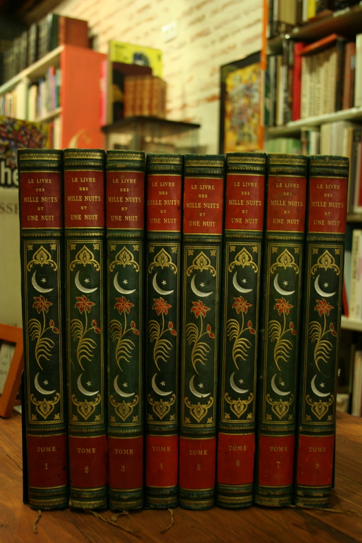
Collectif.
Le Livre des Mille nuits et Une nuit (8vol), illustré de 156 miniatures persanes.
à Paris, éditions Fasquelle, sd.
Referenz des Buchhändlers : 1230
|
|
|
COLLECTIF
Le monde arabe Tradition et renouveau
Vilo ; Les Trois Continents ; Edita Lazarus ; Sud Editions Tunis 1977 In-4 reliure éditeur sous jaquette, 250 pp. illustrations en noir & couleurs
Referenz des Buchhändlers : 2658
|
|
|
COLLECTIF
Le problème égyptien par un groupe d'Egyptiens à Paris
Edition 'Orient-Paris' | Paris 1935 | 16 x 24.50 cm | agrafé
Referenz des Buchhändlers : 15199
|
|
|
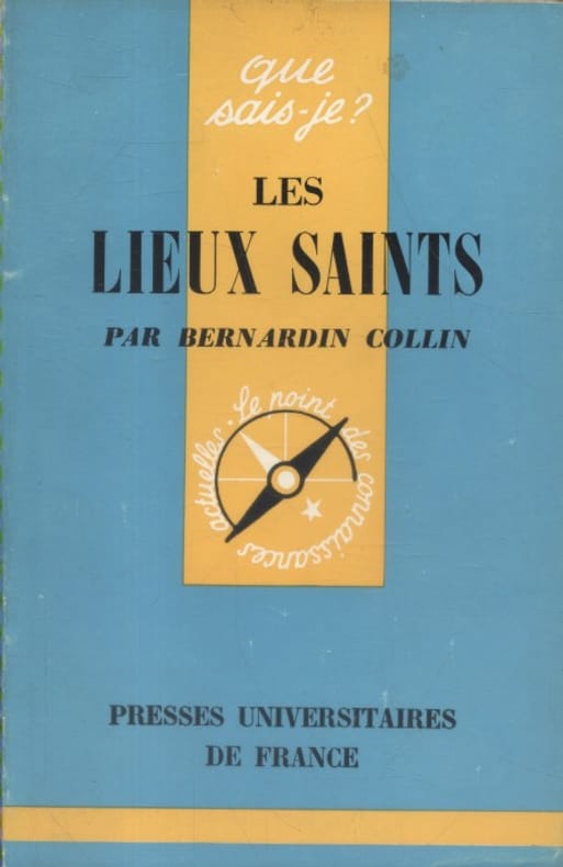
COLLIN Bernardin
Les lieux saints.
Couverture souple. Broché. 128 pages.
Referenz des Buchhändlers : 132559
|
|
|
COLLIN Bernardin
Les lieux saints.
Couverture souple. Broché. 128 pages.
Referenz des Buchhändlers : 132560
|
|
|
COLLECTIF
Notice sur l'Institut Pasteur d'Algérie. Recherches scientifiques, enseignement et missions, applications pratiques. 1900-1934 & 1935-1949
S. n. | Alger 1934-1955 | 13.50 x 18.50 cm | 2 volumes brochés
Referenz des Buchhändlers : 40708
|
|
|
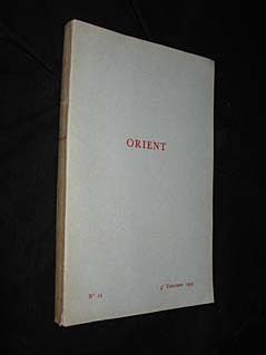
Collectif
Orient, n°12, 4e trimestre 1959
Orient Broché 1959 In-8, (15.5x24.5 cm), broché, 247 pages, revue trimestrielle ; plats légèrement jaunis, bon état. Livraison a domicile (La Poste) ou en Mondial Relay sur simple demande.
Referenz des Buchhändlers : jj5429
|
|
|
Collectif
Orient (n° 1 à 4)
Orient Revue 1957 Quatre volumes in-8 (15,6 x 24,3 cm), brochés, n° 1 à 4 de la revue trimestrielle Orient ; pliures sur les dos, traces d'humidité et marques d'usure sur les plats, dos et plats brunis, état moyen. Livraison a domicile (La Poste) ou en Mondial Relay sur simple demande.
Referenz des Buchhändlers : dl1144
|
|
|
COLLECTIF
Projet de Code Civil
Imprimerie Mourès & Cie | Alexandrie 1871 | in-4 | relié
Referenz des Buchhändlers : 76693
|
|
|
COLITTO Tarco -
Assetto politico ed economico della Palestina nel dopo guerra.
Subiaco, 1927, 8vo br. pp. 194. Intonso.

|
|
|
COLLECTIVE.
Hz. Mevlana'dan Yunus Emre'ye Evrensel Sevgi ve Kültürlerin Kardesligi Projesi: Karaman Ulusal Kültür ve Inanç Turizmi Sempozyumu. 23-24-25 Mart 2012.
As New English Paperback. Pbo. Mint. 4to. (29 x 21 cm). In Turkish. B/w ills. 300, [1] p. Symposium papers of tourism of beliefs and culture. Hz. Mevlana'dan Yunus Emre'ye Evrensel Sevgi ve Kültürlerin Kardesligi Projesi: Karaman Ulusal Kültür ve Inanç Turizmi Sempozyumu. 23-24-25 Mart 2012.
|
|
|
Collective.
The First International Congress on Islamic Archaeology. Programme & participants list. Istanbul 8-10 April 2005 Yildiz Sarayi Çit Kasri.
Very Good English The first international congress on Islamic Archaeology. Programme & Participants List = Istanbul 8 - 10 April 2005 Yildiz Sarayi Cit Kasri, Private edition, Ist., 2005. Paperback. Pbo. Fine. In English and Turkish. 26 p. Roy. 8vo. (23 x 16 cm).
|
|
|
Collingwood, William, R.I.N. surveyor (fl. 1840s-1860s).
Collection of watercolours showing Indian Navy ships in the Arabian Gulf. Includes Collingwood's original surveying telescope. [Mostly Arabian Gulf], 1856-1858.
Three hand-drawn watercolours showing the "Coromandel" (148 x 225 mm), the "Tigris" (178 x 240 mm), and the "Georgiana" (142 x 240 mm), mounted on backing paper, separately matted. With a presentation leather-cased 1½-inch three-draw leather-covered surveying telescope and compass compendium by Andrew Ross, London, contained in 29 cm leather carry case with lid enclosing a lacquered-brass compass, collapsed length 25 cm, expands to 71 cm. A striking collection of original watercolours drawn by Lieutenant William Collingwood, civil engineer in the Royal Indian Navy, during his surveying mission to the Middle East in the mid-1850s. The three ships, all built for the "Honourable [East India] Company", are the H.C. Screw Troop Ship "Coromandel" ("1112 Tons. Commander C. D. Campbell I.N. London to Madras Aug. to Nov. 1856"), the H.C. Brigantine "Tigris" ("Persian Gulf. Entering "Cheroo" Bay. August 1857"), and the H.C. Schooner "Georgiana" ("Lieut. Collingwood Comd. off 'Karack', Feb. 1858"). While the exact location of the "Coromandel" at the time of sketching is not identified (though Collingwood was undoubtedly in the Arabian area at the time), the other two ships are clearly sailing the Arabian Gulf. The "Tigris" is shown entering Cheroo Bay (Chiruyeh, Bandar-e Chiru), on the south coast of Persia, opposite Inderabi Island; the bay was popular with navigators in the region for offering safe shelter from western and northwestern winds, with regular soundings of up to ten fathoms quite near the shore. The "Georgiana" is pictured farther north off Kharg Island, 16 miles from the coast of Bushehr province. Kharg is mentioned in the 10th-century "Hudud al-'alam" as a good source for pearls and was visited by Jean de Thévenot in 1665, who recorded trade with Isfahan and Basra. After the Dutch Empire established both a trading post and a fort on the island in 1753, the Dutch fort was captured in 1766 by Mir Mahanna, the governor of Bandar Rig. The island was briefly occupied in 1838 by the British to block the 1838 Siege of Herat but was soon returned. - Slight loss to upper left corner of all three sheets; some brownstaining and traces of folds, but well-preserved on the whole. The ensemble is neatly complemented by Collingwood's presentation surveying telescope and compass compendium, the telescope being signed and inscribed: "From Comr. Selby, Surveyor in Mesopotamia, to Lieut. W. Collingwood, Asst. Surveyor, in kind remembrance of Services together in Babylonia & Irak Arabia". Commander W. B. Selby, who dedicated this fine telescope-cum-compass set, began his distinguished surveying career in 1837 when, as a midshipman, he embarked on the expedition first to lay navigation buoys in the mouths of the Indus River and then to chart some coastal areas in the "Horn of Africa". By 1846 he was back working off the mouths of the Indus, having made his reputation in Mesopotamia (in 1840-41), and thereafter achieved considerable acclaim for his numerous other surveys, including those during the military expedition to Persia in 1856, before returning to England at the end of 1862. He was succeeded as Surveyor of Mesopotamia by his protégé, Lt. William Collingwood (a distant cousin of the Admiral), who had already done much valuable work in the region, including the large-scale, though surreptitious, mapping of Baghdad in 1855, described by him as follows: "The survey of the city of Baghdad was completed entirely by myself and under very unpleasant restrictions [...] The Turkish Government were not to know anything about it [...] and I was left to survey the town as best I could, and under such difficulties that at times I had to note bearings and paces all over my white shirt, where best I could get the pencil at the time [...]". During this same expedition, Collingwood also surveyed the Shatt-ul-Arab, the city of Bussorah (also by stealth) and much of the country between the Tigris and Euphrates Rivers, and was undoubtedly one of the most gifted and productive R.I.N. surveyors of his day.
|
|
|
Collingwood, William, R.I.N. surveyor (fl. 1840s-1860s).
Journal of a voyage from London to Bombay. On board the "Oriental", 1846.
8vo. English ms. in blue ink on paper. 69 pp., interleaved with pink blotting paper. With several coloured ink sketches. Bound in red morocco with inscribed cover "Journal of the proceedings on board the ship Oriental from London to Bombay". Marbled endpapers, inscribed "W. Collingwood. Journal Book". A passage journal kept aboard the ship "Oriental" from London around Africa to Bombay between 6 January and 30 May 1846, written in a neat and clear hand with occasional coloured ink sketches. The varied content includes weather observations, poetry, and day-to-day commentary: "March 31st 1846 Tuesday: A large shoal of porpoises playing about the bows the mate went out on the dolphin striker to harpoon one but was unsuccessful [...]", "May 11th 1846 Monday: This morning we sighted Coëtivy, it is a low rocky shore sprinkled with Cocoa nut trees etc., before 12 it was out of sight [...]" (includes a panoramic sketch of the coastline). - Lieutenant William Collingwood, a distant cousin of the Admiral, was an R.I.N. surveyor who did much valuable work in Iraq, including the large-scale, though surreptitious, mapping of Baghdad in 1855. During this same expedition, Collingwood also surveyed the Shatt-ul-Arab, the city of Bussorah (also by stealth) and much of the country between the Tigris and Euphrates Rivers, and he was undoubtedly one of the most gifted and productive R.I.N. surveyors of his day. - Binding slightly rubbed at extremeties; in good condition altogether.

|
|
|
Collingwood, William.
Trigonometrical Survey of a part of Mesopotamia. From Hillah to the Ruins of Niffer with the rivers Euphrates and Tigris. London, J. & C. Walker, 1862.
101 x 71 cm. Constant ratio linear horizontal scale, ca. 1:150,000. Signed by Collingwood. Impressive, early, large-scale map of central Iraq, showing the area between Al Hillah (100 km south of Baghdad) to the ruins of the ancient Sumerian city of Nippur. Indicates sand hills, canals, old river beds, tracks, cultivated areas. Includes inset plans and views of Tel Ibrahim, Zibbleyeh, Nejmi, Niffer, and the Niffer Mounds. - Some paper defects and edge damage restored. Rare; copies are known in no more than two public collections (Bodleian; British Library). Personal copy of the cartographer William Collingwood, signed by himself as well as by Cdr. W. B. Selby, R.I.N. - Selby began his distinguished surveying career in 1837 when, as a midshipman, he embarked on the expedition first to lay navigation buoys in the mouths of the Indus River and then to chart some coastal areas in the Horn of Africa. By 1846 he was back working off the mouth of the Indus, having made his reputation in Mesopotamia (in 1840-41), and thereafter achieved considerable acclaim for his numerous other surveys, including those during the military expedition to Persia in 1856, before returning to England at the end of 1862. He was succeeded as Surveyor of Mesopotamia by his protégé, Lt. William Collingwood (a distant cousin of the Admiral), who had already done much valuable work in the region, including the large-scale, though surreptitious, mapping of Baghdad in 1855, described by him as follows: "The survey of the city of Baghdad was completed entirely by myself and under very unpleasant restrictions [...] The Turkish Government were not to know anything about it [...] and I was left to survey the town as best I could, and under such difficulties that at times I had to note bearings and paces all over my white shirt, where best I could get the pencil at the time [...]". During this same expedition, Collingwood also surveyed the Shatt-ul-Arab, the city of Bussorah (also by stealth) and much of the country between the Tigris and Euphrates Rivers, and he was undoubtedly one of the most gifted and productive R.I.N. surveyors of his day. OCLC 863254646.

|
|
|
Colom, Jacob Aertsz.
[Description de la mer méditerranée]. [Amsterdam, ca. 1670].
Folio (290 x 450 mm). 9 double-page engraved charts only, each sheet approx. 440 x 550 mm, each mounted on stiff paper with maps back-to-back, with thick red and black ink borderlines. Of the 9 maps, 8 are by Colom, numbered in the plates from "2" to "9"; plate 1 replaced with Johannes de Ram's map of the Mediterranean, "Paskaart vande Middelandsche Zee In twee deelen vertoont". Contemporary stiff paper covers (worn with losses); manuscript label to lower cover pasted upside down: "Carta Marinaresca del Mar Mediterraneo". Unusual working copy of Colom's rare pilot, owned by an Ottoman Turkish mariner with his Osmanli inscriptions transliterating the location names throughout. Colom's charts cover the Straits of Gibraltar, the Barbary Coast, Mallorca, the coastline around Barcelona, Nice, Corsica, Sardinia, Southern Italy, Sicily, and Croatia. Koeman highlights the rarity of all of Colom's pilot books and notes that despite "thousands of copies [having been] circulated [...], only a score have survived". - Significant spotting and browning throughout, some cockling and losses to sheets, old repaired tears, creases and signs of heavy use. A highly uncommon survival. Cf. Phillips III, 53 ff. Koeman IV, 120.
|
|
|
Colomb, Philip Howard.
Slave-catching in the Indian Ocean. A record of naval experiences. London, Longmans, Green & Co. (colophon: printed by Spottiswoode & Co.), 1873.
8vo. VIII, (4), 503, (1) pp. With 8 steel-engraved plates including the frontispiece (the 5 signed ones engraved by Pearson) and a folding map of the Indian Ocean, Red Sea and the Gulf, hand-coloured in outline (lithographed by Edward Weller). Red cloth. First edition (only edition until a 1968 facsimile) of a very detailed and well-illustrated account of a British naval campaign to suppress the East African slave trade in the years 1868 to 1870, published only eight years after the end of the United States' Civil War and the abolition of slavery there. Slavery was not outlawed in the Ottoman Empire (which at the time of publication included Egypt and what is now Iraq) until 1882, and in Iran and most of the Gulf States not until the 20th century. The author, Captain Philip Howard Colomb (1831-99), was Commander of the HMS Dryad from 1868 to 1870 and led the campaign. He operated primarily in and around the Gulf, Oman and Zanzibar and captured seven slave ships during those two years. The illustrations show the Dryad and some of the slave ships, individual and group portraits of slaves encountered during the campaign, and views of ports where slave trading occurred. One of the group portraits was engraved after a photograph made by one of the Dryad's officers and other illustrations after drawings by other officers. The map ("The slave trading waters of the Indian Ocean") shows the Indian Ocean, Arabian Sea, Red Sea and the Gulf, including Madagascar and the other islands. The first chapter relates Colomb's voyage to Aden, where he took command of the Dryad, and the next two chapters provide extensive background information to place the account of the campaign in context. Colomb's account of his own campaign includes chapters on individual regions (Bombay, Muscat and Oman, the Gulf, Madagascar, Zanzibar, etc.) and on various topics (slaves on board ship, the slave market, etc.). Colomb was promoted to Admiral after his retirement from active duty. The book is sometimes mistakenly ascribed to his younger brother, John Charles Ready Colomb. - Bookplate "HW". Spine sunned; insignificant foxing in the folding map, but otherwise in fine condition. Garrick, "Indian Ocean, post-exploration", in: Speake, Literature of travel and exploration (2003), pp. 608-610. WorldCat (4 copies). Zeitschrift für Ethnologie 5 (1873), p. 117.

|
|
|
COLOMBO FURIO.
Per Israele.
In 8°, br. edit. ill., pp. 267,(5); prima ed., lievemente brunito il bordo ed il taglio sup. delle pp. ma copia molto buona. (x068/d) (spedizione standard SEMPRE tracciata con raccomandata-piego di libri, eventuale FATTURA da richiedere all'ordine)
|
|
|
Colton, Joseph Hutchins.
Africa. North Eastern Sheet. New York, 1859.
Hand-coloured engraved map. Interesting map of Northeast Africa, extending from Tripoli and Egypt to Mt. Kenya, Somalia, etc. and including all of Saudi Arabia. Nice detail in the interior, including Nubia, Sennar, Abyssinia, etc. Shows the Sahara and some details in the interior. Inset map showing the Nile region. Unusually detailed for the period. Decorative border. A terrific regional map, from Colton, one of the most prolific American mapmakers of the mid-19th Century. Not in Tibbets, Al Ankary or Al-Qasimi.
|
|
|
Colton, Joseph Hutchins.
Persia Arabia &c. New York, 1858.
Hand-coloured engraved map (435 x 375 mm). Striking map of Saudi Arabia, Iran, Iraq, and Afghanistan, showing fine detail. Colton was one of the pre-eminent American map publishing firms in the mid-19th Century. Not in Tibbets, Al Ankary or Al-Qasimi.
|
|
|
Comité d'études Moyen-Orient
Antisionisme et antisémitisme - De l'antisémitisme confessionnel à l'antisémistisme politique
Joseph Lewkowicz. Non daté. In-12. Broché. Bon état, Couv. convenable, Dos satisfaisant, Intérieur frais. 22 pages agrafées. Non daté.. . . . Classification Dewey : 320-Science politique
Referenz des Buchhändlers : R240147309

|
|
|

 Per e-mail erhalten
 Als pdf-Dokument herunterladen
 RSS feed
 Permanenter link


