Site indépendant de libraires professionnels

‎Cartes‎

Main

Nombre de résultats : 11 998 (240 Page(s))

Première page Page précédente 1 ... 212 213 214 [215] 216 217 218 ... 221 224 227 230 233 236 239 ... 240 Page suivante Dernière page

‎STANFORD (Edward).‎

‎[ÎLES IONIENNES & MALTE] Map of the Ionian Islands and Malta.‎

‎London, Edward Stanford, [1896]. 630 x 540 mm.‎

‎Belle carte figurant les Îles Ioniennes de Corfou, Paxos, Sainte-Maure (actuelle Leucade), Itha que, Céphalonie, et Zante ou Zakynthos. En carton, les îles de Malte et de Gozo, l'île ionienne de Cythère ou Cerigo, et une carte de la Méditerranée montrant les principales routes à partir de Londres vers Bombay. La carte est issue du London Atlas of universal geography de Edward Stanford. Bel exemplaire en coloris de l'époque.‎

Référence libraire : LBW-2869

Livre Rare Book

Librairie Le Bail
Paris France Francia França France
[Livres de Librairie Le Bail]

150,00 € Acheter

‎STANFORD (Edward).‎

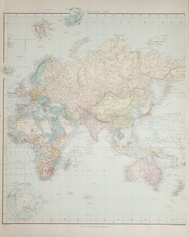
‎A Chart of the World on Mercator's projection.‎

‎London, Edward Stanford, [1896]. En deux feuilles non jointes pouvant former une carte de 0,66 x 1,07 m.‎

‎Belle mappemonde à projection plane dite de Mercator, montrant les itinéraires des transports maritimes et les lignes de télécommunications sous-marines, et illustrée de deux petites cartes de l'Arctique et de l'Antarctique. La carte est issue du London Atlas of universal geography de Edward Stanford. Bel exemplaire en coloris de l'époque.‎

Référence libraire : LBW-2686

Livre Rare Book

Librairie Le Bail
Paris France Francia França France
[Livres de Librairie Le Bail]

500,00 € Acheter

‎STANFORD (Edward).‎

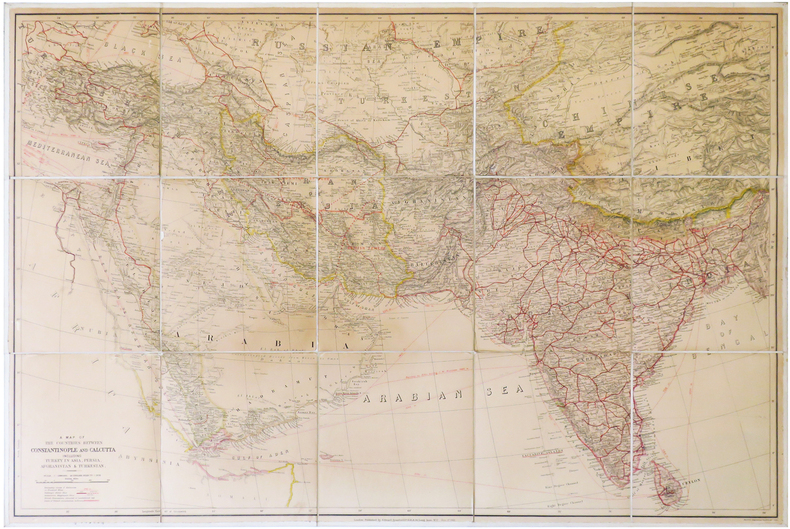
‎A Map of the countries between Constantinople and Calcutta including Turkey in Asia, Persia, Afghanistan & Turkestan.‎

‎London, Edward Stanford, 1912. En 15 sections montées sur toile et pliées, formant une carte de 0,68 x 1,02 m.‎

‎Grande carte dressée par Edward Stanford, figurant la région comprise entre Constantinople, capitale de l'Empire ottoman, et l'Inde britannique, avec la Turquie, la Perse, l'Afghanistan et le Turkestan. Les possessions britanniques sont coloriées ou soulignées en rouge, et comprennent l'Inde britannique, Chypre, le protectorat d'Aden (actuel Yémen), l'île de Socotra (Yémen), ainsi que quelques villes situées le long du littoral de la Corne de l'Afrique. À l'est du Bhoutan figure un territoire dont il n'a pas été fait de levé géographique, et habité par des tribus indigènes. La carte montre également les sphères d'influence russe et britannique en Iran. Les lignes de chemin de fer et les câbles télégraphiques sous-marins sont également indiqués. Les routes et distances des bateaux sont notées en miles. Bon exemplaire. Deux petits manques aux sections 7 et 8.‎

Référence libraire : LBW-6838

Livre Rare Book

Librairie Le Bail
Paris France Francia França France
[Livres de Librairie Le Bail]

400,00 € Acheter

‎STANFORD (Edward).‎

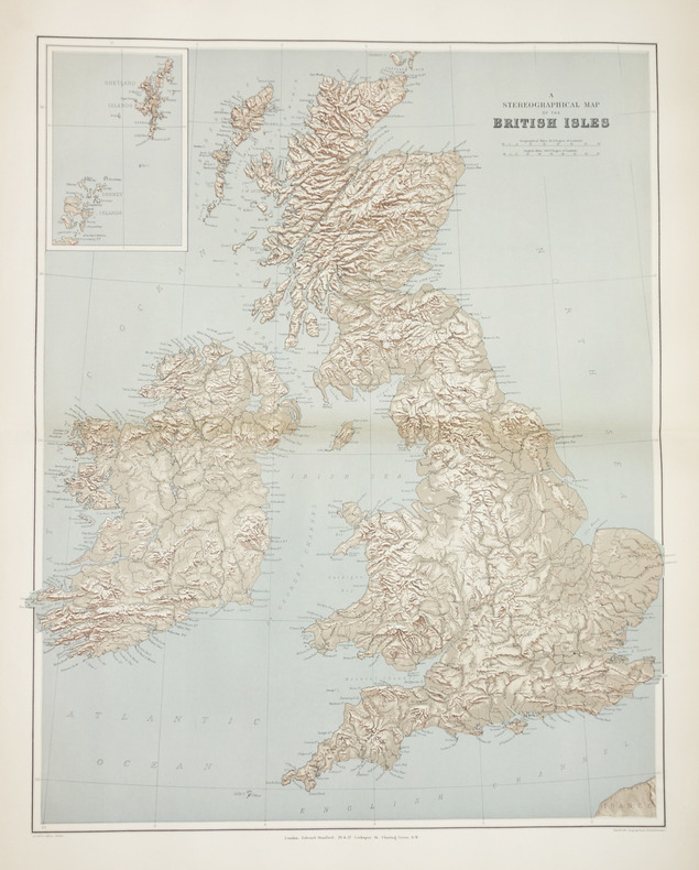
‎A stereographical map of the British Isles.‎

‎London, Edward Stanford, [1896]. 605 x 478 mm.‎

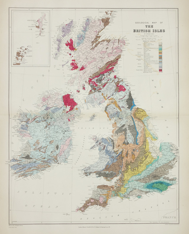
‎Carte issue du London Atlas of universal geography de Edward Stanford. En carton, les Shetland et les Orcades. Bel exemplaire en coloris de l'époque.‎

Référence libraire : LBW-2864

Livre Rare Book

Librairie Le Bail
Paris France Francia França France
[Livres de Librairie Le Bail]

100,00 € Acheter

‎STANLEY Henri M.‎

‎A travers le Continent mystérieux‎

‎découverte des sources méridionales du Nil, circumnavigation du lac Victoria et du lac Tanganika, descente du fleuve Livingstone ou Congo jusqu’à l’atlantique.Durée de l’expédition 990 jours,distance parcourue 11571 km.Traduit de l’anglais avec l’autorisation de l’auteur.Deux tomes en deux volumes in 8 demi-chagrin rouge d’époque,titre,roulette,filets,dorés.Tome1:faux-titre,frontispice portait de STANLEY,titre,6 pages,IV,Une carte en couleurs Stanley 1874-1877.490 pages,nombreuses illustrations gravées sur bois dans et hors-texte.Six cartes en couleurs dont une très grande dépliante(78x87cm) en fin de volume.Tome 2:Faux-titre,frontispice,titre,544 pages,nombreuses illustrations dans et hors-texte. 3 cartes dont une très grande dépliante, en couleurs(70x87 cm),en fin de volume.Hachette & Cie 1879 édition originale de la traduction française. Quelques petites rousseurs en début et fin de volume,sinon très bon état.‎

Référence libraire : 5674

Livre Rare Book

Charbonnel
Bar le Duc France Francia França France
[Livres de Charbonnel]

340,00 € Acheter

‎STANLEY Henri Morton:‎

‎A travers le continent mystérieux. Découverte des sources méridionales du Nil. Circumnavigation du lac Victoria et du lac Tanganika. Descente du fleuve Livingstone ou Congo jusqu'à l'Atlantique.‎

‎Paris, Librairie Hachette et Cie, 1879. 2 volumes in-4 de [12]-496-[2] et [6]-544 pages, demi-chagrin brun, dos à nerfs.‎

‎Illustré de 150 gravures dont 80 en pleine page et 9 cartes en couleurs, dont 3 dépliantes et une volante, très grande (89 x 71 cm). "Carte de la moitié oriental de l'Afrique Équatoriale et des explorations par terre et par eau de Henry M. Stanley 1874-1877". Bon exemplaire de ce fameux voyage qui dura 999 jours et qui s'étendit sur 11'517 kilomètres: "explorations de l'Afrique équatoriale, qu'il traverse d'est en ouest en partant de Zanzibar en 1874. L’expédition, financée par le Daily Telegraph et le New York Herald, mobilise plus de 230 personnes, porteurs et soldats, et même un bateau de treize mètres en pièces détachées, le Lady Alice. Stanley part de Zanzibar le 17 novembre 1874. Il doit recruter d’autres compagnons en cours de route. Il gagne le lac Victoria par l'itinéraire de John Hanning Speke, et effectue la circumnavigation du lac. Il visite le Buganda, passe par le lac Albert découvert en 1864 par Samuel White Baker et Florence Baker, et explore la totalité des rives du lac Tanganyika du 11 juin au 31 juillet.Stanley rencontre Tippo Tip à Kasongo. Ensemble, ils montent une expédition forte de 400 hommes pour explorer l'Ouest. Ils quittent Nyangwe, le 5 novembre, et pénètrent dans la forêt équatoriale. Après cinquante jours, Tippo Tip renonce, mais Stanley continue vers l'ouest. Pour traverser ces régions, comme le bassin du Congo, où les échanges sont organisés selon les règles strictes du commerce par relais, Stanley doit forcer le passage à plusieurs reprises. Le 20 décembre, 150 personnes réparties sur 23 bateaux entament la descente du fleuve. Le 6 janvier 1877, ils sont bloqués par les chutes Boyoma, qu'ils mettent vingt jours à éviter. Le 1er février, au confluent avec l'Aruwimi, ils combattent contre les Basoko. Le 14 février, ils affrontent les Bangalas. Le 9 mars, ils atteignent le confluent avec le Kasaï, et Ntamo le 12 mars, future implantation de Léopoldville (Kinshasa).Les chutes Livingstone constituent le plus redoutable des obstacles : cinq mois sont nécessaires pour couvrir les quelques centaines de kilomètres qui les séparent de Boma, Alexandre Delcommune recueillant finalement une expédition décimée. Stanley est le dernier des quatre Européens encore vivants, et des 356 compagnons africains seulement 115 parviennent à la côte atlantique en août 1877.Malgré les difficultés, l'exploit est historique. Stanley décrit ce voyage extraordinaire dans un ouvrage publié en 1878, “À travers le continent mystérieux”. " (merci wiki). Dos légèrement passé, une coupe frottée; réparation ancienne à la grande carte sans manque.‎

Référence libraire : 20578

Livre Rare Book

ILLIBRAIRIE | Bombadil SA
Genève Switzerland Suiza Suíça Suisse
[Livres de ILLIBRAIRIE | Bombadil SA]

286,70 € Acheter

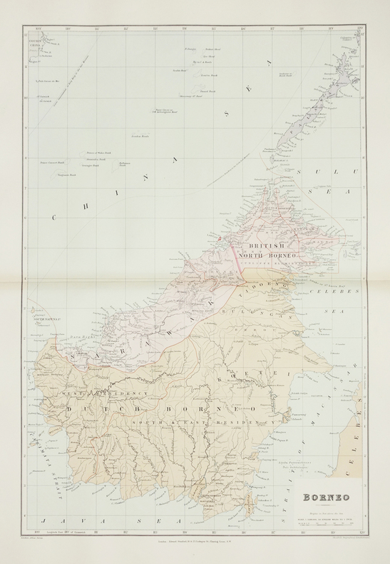
‎STANFORD (Edward).‎

‎Borneo.‎

‎London, Edward Stanford, [1896]. 610 x 406 mm.‎

‎Belle carte figurant l'île indonésienne de Bornéo, avec la partie britannique coloriée en rose. Au nord on peut voir l'île de Palawan. La carte est issue du London Atlas of universal geography de Edward Stanford. Bel exemplaire en coloris de l'époque.‎

Référence libraire : LBW-2874

Livre Rare Book

Librairie Le Bail
Paris France Francia França France
[Livres de Librairie Le Bail]

250,00 € Acheter

‎STANLEY Henry Morton:‎

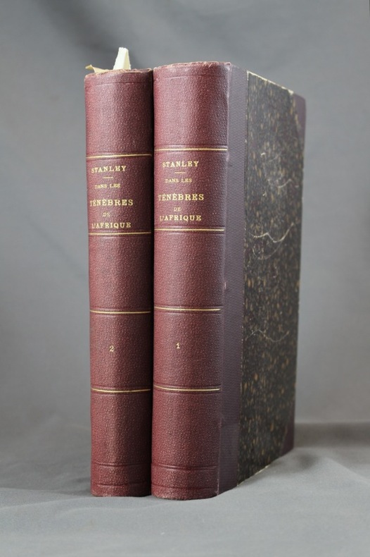
‎Dans les ténèbres de l'Afrique. Recherche, délivrance et retraite d'Emin Pacha. Tomes I & II.‎

‎Paris, Hachette, 1890. 2 volumes grand in-8 de [8]-518 et [8]-482-[4] pages, demi-percaline aubergine à coins, dos ornés de filets, titre et tomaison dorés. Inscription de possesseur sur garde des 2 vol., plats griffés avec quelques salissures, rousseurs; la carte dépliante à la fin du premier volume est déchirée sur une bonne partie du pli central, proprement et sans perte.‎

‎Illustré de 150 gravures in-texte d'après les dessins de A. Forestier, Sydney Hall, Montbard et Riou, ainsi que de trois grandes cartes dépliantes en couleurs. Avec un tableau dépliant de "vocabulaire comparatif de la forêt et du pays aux herbes". Il s'agit bien de l'auteur, quelques années plus tôt, du fameux "Docteur Livingstone, I presume ?".‎

Référence libraire : 6971

Livre Rare Book

ILLIBRAIRIE | Bombadil SA
Genève Switzerland Suiza Suíça Suisse
[Livres de ILLIBRAIRIE | Bombadil SA]

191,14 € Acheter

‎Stati Sardi in terraferma‎

‎Gran Carta degli Stati Sardi in terraferma.N° 63 Sampeyre.‎

‎1870 portfolio toile noire éditeur. carte toilée 55 x 74 cm. Torino G. B. Maggi 1870‎

Référence libraire : 16226

Livre Rare Book

Librairie ancienne Georges de Lucenay
Charolles France Francia França France
[Livres de Librairie ancienne Georges de Lucenay]

50,00 € Acheter

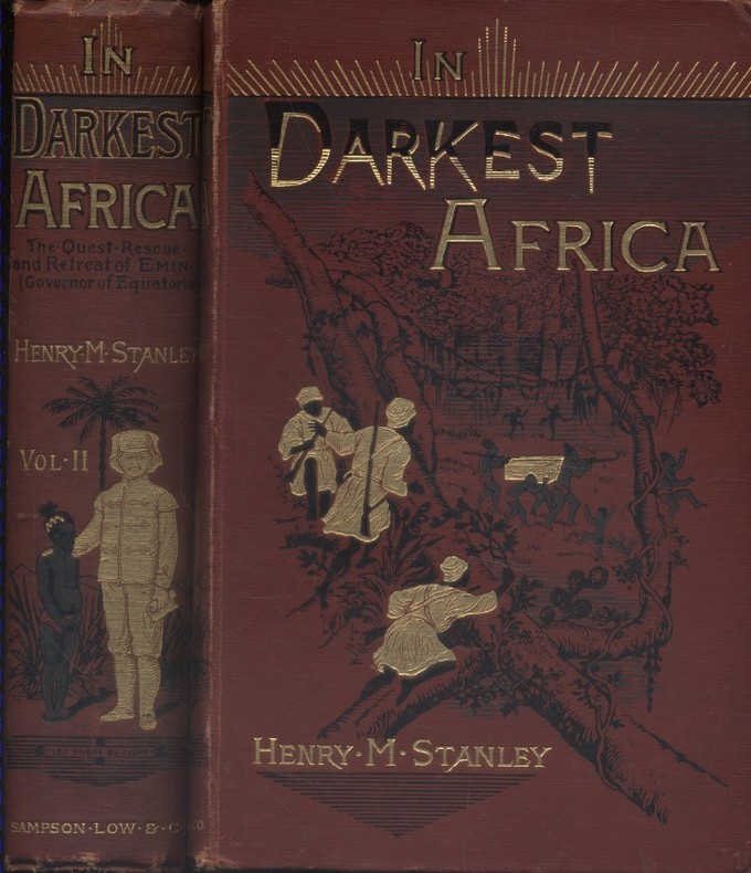
‎STANLEY Henry M. 150 woodcut illustrations and maps. Decorative cloth bound by Leighton Son & Hodge.‎

‎In darkest Africa, or the quest, rescue, and retreat of Emin Governor of Equatoria. Two volumes in good condition.‎

‎Couverture rigide. Reliures toile rouge illustrées. 530 + 472 pages. Quelques rousseurs.‎

‎Livre en anglais. Two coloured fold out maps, some repaired. 150 woodcut illustrations and maps. Decorative cloth bound by Leighton Son & Hodge. Sampson Low, Marston Low, Searle and Rivington, London, 1890.‎

Référence libraire : 128712

Livre Rare Book

Librairie et Cætera
Belin-Beliet France Francia França France
[Livres de Librairie et Cætera]

252,00 € Acheter

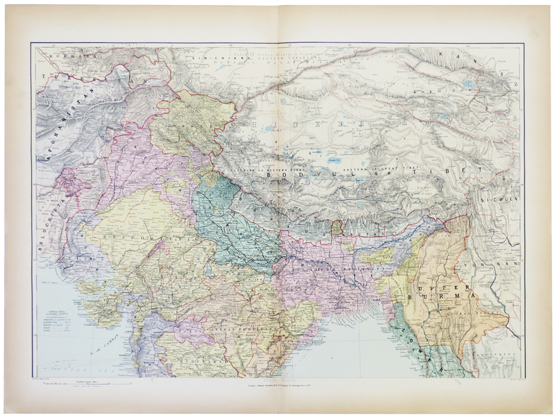
‎STANFORD (Edward).‎

‎India and the adjacent parts of Beluchistan, Afghanistan, Turkestan, the Chinese empire, and Siam.‎

‎London, Edward Stanford, [1896]. En deux feuilles non jointes pouvant former une carte de 801 x 676 mm.‎

‎Belle carte de l'Inde et des régions voisines, issue du London Atlas of universal geography de Edward Stanford. Bel exemplaire en coloris de l'époque.‎

Référence libraire : LBW-5383

Livre Rare Book

Librairie Le Bail
Paris France Francia França France
[Livres de Librairie Le Bail]

150,00 € Acheter

‎STAYMAN Samuel M.‎

‎Le système Stayman de bridge-contrat.‎

‎Paris, Grasset, 1956 14 x 21, 269 pp., broché, bon état‎

Référence libraire : 3316

Livre Rare Book

Librairie Ausone
Bruxelles Belgium Bélgica Bélgica Belgique
[Livres de Librairie Ausone]

12,00 € Acheter

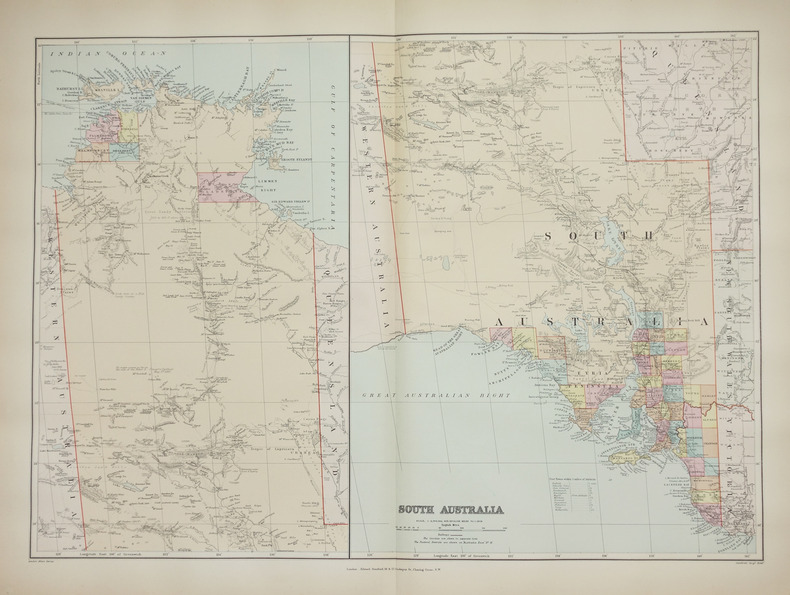
‎STANFORD (Edward).‎

‎South Australia.‎

‎London, Edward Stanford, [1896]. 482 x 659 mm.‎

‎Belle carte figurant la partie est de l'Australie, correspondant aux états du Territoire du Nord, de l'Australie méridionale, du Queensland, de la Nouvelle Galles du Sud et de Victoria. Elle est issue du London Atlas of universal geography de Edward Stanford. Bel exemplaire en coloris de l'époque.‎

Référence libraire : LBW-2687

Livre Rare Book

Librairie Le Bail
Paris France Francia França France
[Livres de Librairie Le Bail]

250,00 € Acheter

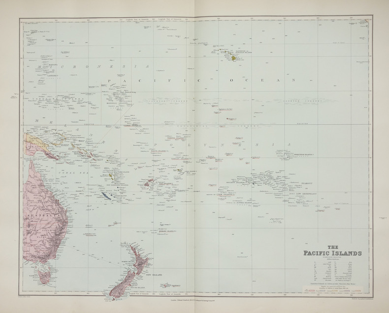
‎STANFORD (Edward).‎

‎The Pacific islands on Mercator's projection.‎

‎London, Edward Stanford, [1896]. 480 x 603 mm.‎

‎Très belle carte du Pacifique, dressée sur la projection dite de Mercator, indiquant les atolls, les volcans en activité, les récifs coralliens émergés, les îles et atolls volcaniques, etc, avec un système de couleurs permettant de distinguer les possessions britanniques, françaises, allemandes, espagnoles et hollandaises. Elle est issue du London Atlas of universal geography de Edward Stanford. Bel exemplaire en coloris de l'époque.‎

Référence libraire : LBW-2658

Livre Rare Book

Librairie Le Bail
Paris France Francia França France
[Livres de Librairie Le Bail]

250,00 € Acheter

‎STANFORD (Edward).‎

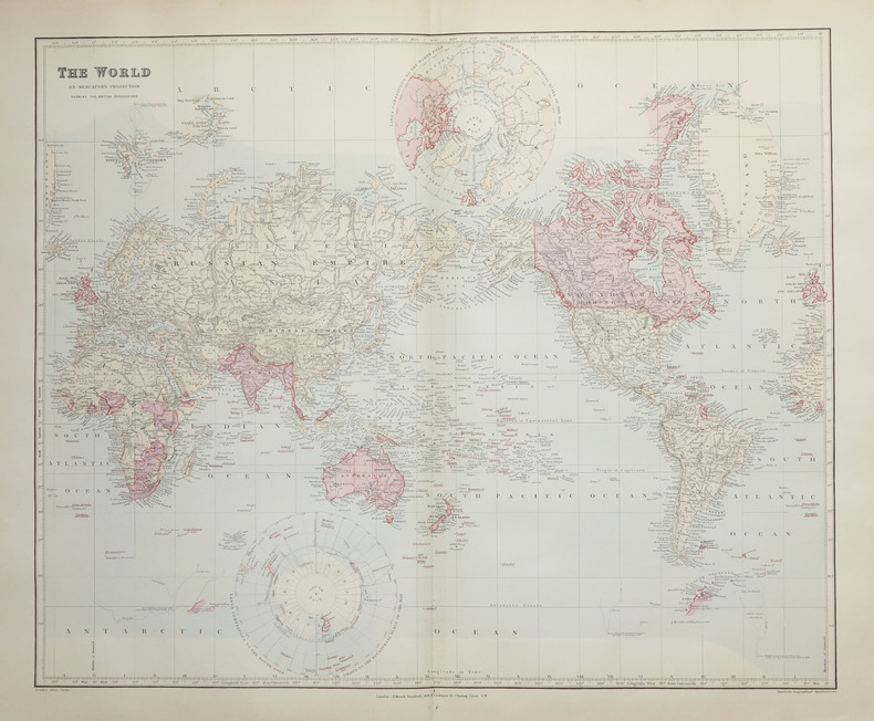
‎The World on Mercator's projection showing the British possessions.‎

‎London, Edward Stanford, [1896]. 496 x 603 mm.‎

‎Belle mappemonde à projection plane dite de Mercator, montrant toutes les possessions britanniques aquarellées en rose. La carte est issue du London Atlas of universal geography de Edward Stanford. Bel exemplaire en coloris de l'époque.‎

Référence libraire : LBW-2662

Livre Rare Book

Librairie Le Bail
Paris France Francia França France
[Livres de Librairie Le Bail]

300,00 € Acheter

‎STANFORD (Edward);‎

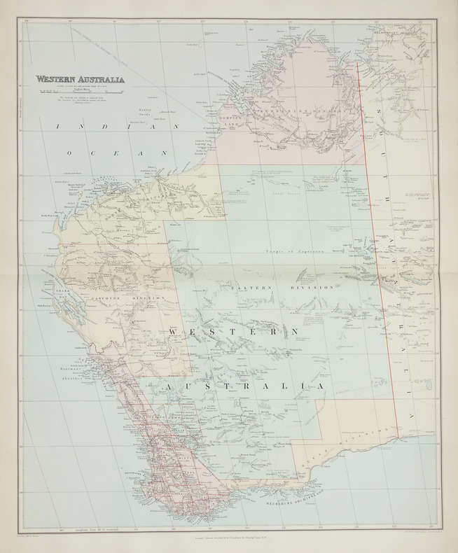
‎Western Australia.‎

‎London, Edward Stanford, [1896]. 508 x 628 mm.‎

‎Belle carte figurant la partie ouest de l'Australie, correspondant à l'état de l'Australie-Occidentale ou Western Australia, issue du London Atlas of universal geography de Edward Stanford. Bel exemplaire en coloris de l'époque.‎

Référence libraire : LBW-2708

Livre Rare Book

Librairie Le Bail
Paris France Francia França France
[Livres de Librairie Le Bail]

200,00 € Acheter

‎Stacey, Col CP; GWL Nicholson; CCJ Bond (Illust & Maps); C P G W L C C J‎

‎Official History of the Canadian Army in the Second World War Complete in Three Volumes‎

‎Ottawa Ontario Canada: Pubished by the Authority of the Minister of National Defence Roger Duhamel Queen's Printer and Controller of Stationery 1956-1960. Hardcover. pp. xiii 629; xv 807; xiii 770. Thick Royal 8vo's. Uniformly bound in bright red cloth over boards gilt lettering to the spines and armorial device embossed to the centre of the front boards; map endpapers. Replete with many black-and-white and colour maps including many fold-out photographs illustrations portraits et al. Excepting some light bumping to the spine ends the extremities remain remarkably well-preserved with no additional detectable flaws contents remain equally and uniformly without blemish with bright clean and unmarked pages and tight sound bindings; about fine with each housed in light shelfworn dustjackets now in protective mylar covers. Overall very good to near fine. <br/><br/> Pubished by the Authority of the Minister of National Defence | Roger Duhamel, Queen's Printer and Controller of Stationery hardcover‎

Référence libraire : 7943

‎Staff‎

‎Bulletin of the Pan American Union Volume 43‎

‎Vol. XLIII , July - December 1916, Nos. 274 - 279, 816 pages, with a great many b&w photos throughout. Includes trade, travel, industrial, agricultural, export, census, building data, etc. for the Latin and South American countries: Argentina, Bolivia, Brazil, Central America, Chile, Columbia, Costa Rica, Cuba, Ecuador, Dominican Republic, Guatemala Haiti, Honduras, Mexico, Nicaragua, Panama, Paraguay, etc.‎

‎Staff‎

‎Edwards Lithoprinted Facsimiles: Series A Document of the American Revolution Parts 1,2,3,4,5,6‎

‎Six folders each with hard plastic protective folders within, containing 5 - 20 loose leaf documents each reproducing original documents of the American revolution. Parts 1 - 6, each a separate folder, contain documents of Lexington & Concord, The tragedy of the playwright general, 20,000 pounds for West Point! the plot that failed, Amenities of Yorktown, American vs. the British, Women of the revolution. Letters, maps, edicts, etc.‎

‎Staff‎

‎Kelly's Post Office Directory Map of London‎

‎Red folder with some shelf wear, a few small stains, small tear at lower spine with four maps of London for the North Western Section, South Western Section, North Eastern Section and South Eastern Section. Each map is 38 x 31" (96cm X 80cm) and all are in excellent condition, showing little to no wear. Street maps are printed in half mile squares with postal districts outlined in orange. No date.‎

‎Staff of Franklin Maps‎

‎Metro Street Atlas of Chester County in Pennsylvania by Staff of Franklin Maps‎

‎Franklin Maps. Very Good. Franklin Maps; King of Prussia 1998. Softcover. A Very Good some handling/scuff marks to covers crease bottom rear cover corners binding solid and sturdy trace edge/corner wear a nice clean and unmarked copy in Oversize stapled Wraps. 4toquarto or approx. 9.5 x 12 inches approx. 151pp. 71 large scale maps 10300 streets indexed with zip codes and 1150 cultural features indexed with telephone numbers. We pack securely and ship daily with delivery confirmation on every book. The picture on the listing page is of the actual book for sale. Additional Scans are available for any item please inquire. Franklin Maps paperback‎

Référence libraire : SKU1023409

Biblio.com

Lavendier Books
United States Estados Unidos Estados Unidos États-Unis
[Livres de Lavendier Books]

42,31 € Acheter

‎Staff of Heligan Gardens Ltd‎

‎The Lost Gardens of Heligan Handbook‎

‎No marks or inscriptions. Small crease to upper corner of rear cover. A very clean very tight copy with bright unmarked boards and no bumping to corners. 73pp. The essential guide to the Gardens & wider estate near St Austell in Cornwall.‎

MareMagnum

Godley Books
Hyde, GB
[Livres de Godley Books]

5,40 € Acheter

‎Staff; Office of Technology Assessment‎

‎Effects of Nuclear War, The‎

‎Book is in excellent condition with very bright red covers, gilt print at spine. Binding is solid and square, covers have sharp corners, exterior shows no blemishes, text/interior is clean and free of marking of any kind. Dust jacket has one 1/2" tear, a little edge wear. Previous owner's name at front endpaper. Contents include: A nuclear weapon over Detroit or Leningrad: a tutorial on the effets of nuclear weapons, Civil defense, Three attack cases, Other long-term effects, with six apendices. Lots of great graphics: maps of Detriot and Leningrad with bomb graphics over them showing PSI ratings, for instance, surface burst, air burst, casualty counts, terrorist weapon senario, radioactive graphics over Lake Erie, fireball, breakaway, shock front, Mach front, fallout, thermonuclear ground burst, lots of great stuff we can thank the Pentagon for: making us safer!‎

‎Stanford's Library & Commercial Maps‎

‎A Map of the Countries Between Constantinople and Calcutta Including Turkey in Asia Persia Afghanistan and Turkestan‎

‎Edward Stanford. Good. . This is a large folding coloured linen backed map. Map is clean with minimal wear. No copyright date is given. Edward Stanford unknown‎

Référence libraire : mon0003321896

Biblio.com

Schwabe Books
United States Estados Unidos Estados Unidos États-Unis
[Livres de Schwabe Books]

355,36 € Acheter

‎Stanford's Library Maps‎

‎LONDON ATLAS MAP OF CAPE OF GOOD HOPE & THE ORANGE FREE STATE‎

‎London: Edward Stanford. Hard Cover. Very Good binding. Engraved on Copper Plates in the Finest Style of the Art; "Property of M.I.D. G-2" stamped in atlas. No markings on fold-out map. Red cloth covers with beige title label. Light edgewear to head and tail of spine.Hardcover with Fold-out Map. Very Good binding. Edward Stanford unknown books‎

Référence libraire : 228477

ABAA

Black Swan Books, Inc.
United States Estados Unidos Estados Unidos États-Unis
[Livres de Black Swan Books, Inc.]

105,76 € Acheter

‎STANFORD'S MAP OF EAST DEVON‎

‎Stanford's Map of East Devon. [Scale One Inch to One Statute Mile.] FINE COPY AND A RARE SURVIVAL‎

‎8vo., folding coloured map on cloth measuring 28 x 34 inches (approx. 71 x 86 cms) folding in 32 panels to 7 x 4.5 inches (approx. 18 x 12 cms); strongly bound in burgundy cloth, upper board lettered in gilt, marbled endpapers, a near fine copy. VERY SCARCE IN THIS CONDITION.‎

‎Staniland, L. N.‎

‎THE PRINCIPLES OF LINE ILLUSTRATION. With Emphasis on the Requirements of Biological and other Scientific Workers.‎

‎pp. frontis, xii, 212. Nearly two hundred line illustrations. 8vo. Original full cloth binding. Original dust jacket. Chipped. ART 1‎

‎Stanley, Arthur Penrhyn.‎

‎LECTURES ON THE HISTORY OF THE JEWISH CHURCH. Part I. Abraham to Samuel. With Maps and Plans.‎

‎pp. xl, 572 + Plus two folding maps and two plans. Bookplate of Rev. L(uther) A. Gotwald, theological educator and author. Quarto. Original full cloth binding, gold lettered spine. Head of spine chipped with loss. Hardbound. First Series. JUDAICA BOX 1‎

‎Stanley, Arthur Penrhyn.‎

‎SINAI AND PALESTINE IN CONNECTION WITH THEIR HISTORY. Tenth Thousand. With Maps and Plans.‎

‎pp. lviii, 560, 32 [Publisher's catalogue] + Seven colored folding maps and five woodcut maps. Foxed. Offsetting from folding maps. Frontis folding map slightly torn at margin. Slight damp staining last signature. Bookplate of John D. Zimmerman. Large 8vo. 9 x 5 1/2 inches. Original full dark blue publisher's cloth binding. Gilt lettered spine. Bottom corner of front and rear boards damp stained. Hardbound. Arthur Penrhyn Stanley (1815-1881) was an English churchman, Dean of Westminster. He was a 'Broad Churchman' and was the author of various works on Church History. **PRICE JUST REDUCED! JUDAICA BOX 1‎

‎Stanley, Henry Morton (1841-1904).‎

‎IN DARKEST AFRICA. Or The Quest, Rescue, And Retreat Of Emin Governor Of Equatoria. With Two Steel Engravings, And One Hundred And Fifty Illustrations And Maps. In Two Volumes.‎

‎Two Volumes + Plus portrait frontis. Illustrated with steel engravings. Lacks pocket maps. Damp stained. XLib. Original marble boards repaired with black tape. Worn. AFRICA/5‎

‎Stannard, Dorothy (editor)‎

‎Tunisia Insight Guide‎

‎No marks or inscriptions. No creasing to covers or to spine. A very clean very tight copy with bright unmarked lightly indented boards and no bumping to corners. 344pp. With descriptions of the culture, history and tourism of the North African country this travel book takes the reader into some of its lesser known delights as well as the sand and sea tourist spots.‎

MareMagnum

Godley Books
Hyde, GB
[Livres de Godley Books]

5,63 € Acheter

‎Stark, James H.; Maps, Engravings, Photo-Prints (Illustrator)‎

‎Stark's Illustrated Bermuda Guide; Containing a Description of Everything on or About These Places of Which the Visitor or Resident May Desire Information‎

‎Boston / London: James H. Stark Publisher 1902. Hardcover. Very Good. 12mo 6.75 - 7.75'' tall. Hardcover. Book Condition: Very Good. James H. Stark Publisher Boston / London 1902. Ads 158 pages. Nice Firm Clean copy ! Light general wear. With a lovely folding map! Size: 12mo 6.75 - 7.75'' tall. Travel::Antique History::Localities Maps 6272 6272 James H. Stark Publisher hardcover‎

Référence libraire : 127907

Biblio.com

BookScene
United States Estados Unidos Estados Unidos États-Unis
[Livres de BookScene]

71,92 € Acheter

‎STEFAN André‎

‎Carte Postale Ancienne (CPA), portrait original en couleurs, d'une femme coiffée du Poitou.‎

‎***. Année 1940. In-12. Broché. Bon état, Couv. convenable, Dos satisfaisant, Intérieur frais. Carte postale en couleurs de 10 / 15 cm, sous verre,. . . . Classification : 240-Cartes Postales Anciennes Humoristiques‎

‎Classification : 240-Cartes Postales Anciennes Humoristiques‎

Référence libraire : RO80078933

Livre Rare Book

Le-livre.fr / Le Village du Livre
Sablons France Francia França France
[Livres de Le-livre.fr / Le Village du Livre]

49,50 € Acheter

‎Sterne René:‎

‎Ex-libris Adler.‎

‎Zarg-bulle. Ex-libris couleurs, au format 20 x 26 cm. Microscopiques frottements en coins.‎

‎Tirage limité à 99 exemplaires, celui-ci numéro 41. Signé par Sterne. Suite à un accident immobilisant votre libraire pour quelques semaines, le traitement des commandes est bien assuré, mais momentanément ralenti. Merci de votre patience et de votre compréhension.‎

Référence libraire : 24395

Livre Rare Book

La Bergerie
Le Locle Switzerland Suiza Suíça Suisse
[Livres de La Bergerie]

23,89 € Acheter

‎STEINMANN P / CANDIR R‎

‎HANSI A TRAVERS SES CARTES POSTALES 1895 - 1951‎

‎1996 Ed du Rhin , 1996 , in4° cartonnage ill éditeur , 191 pp . Près de 400 reproductions !‎

Référence libraire : M16027

Livre Rare Book

Nord - Sud
Kervignac France Francia França France
[Livres de Nord - Sud]

20,00 € Acheter

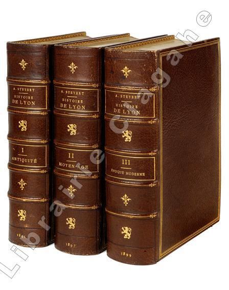
‎Steyert (André) :‎

‎Nouvelle histoire de Lyon et des provinces de Lyonnais - Forez - Beaujolais - Franc-Lyonnais et Dombes.‎

‎Lyon, Bernoux et Cumin, 1895-1899 ; 3 tomes fort in 8, maroquin bordeaux, dos à nerfs décoré et doré du fer au lion debout, titre et tomaison dorés, encadrement d’un triple filet doré, double filet doré sur les coupes, large dentelle intérieure, tête dorée, non rogné (L. Guétant) ; 614; 668 ; 666 pp., 26 planches hors-texte, certaines sur page double, [2] pp. d’Index de ces planches ; XXIV pp. Liste des souscripteurs.‎

‎Edition originale, un des très rares exemplaires de tête sur Japon Impérial nominatif, celui-ci au nom de Monsieur Charles Aynard. Cette excellente histoire de Lyon a été complétée d’un quatrième tome en 1939, intéressant surtout pour son errata et Index général. Cet ouvrage, à l’iconographie fort riche et bien choisie, fait toujours référence. Charles Aynard est un des membres de cette famille nombreuse, déjà fort connue et rendue célèbre par son cousin Edouard Aynard (1837-1913) qui associe la soierie et la banque. Solide partisan du libéralisme économique, il incarne l’archétype du bourgeois lyonnais qui s’investit également dans le social (Hospices civils, Société d’Instruction primaire, Société d’enseignement professionnel du Rhône, Société de logements économiques, etc.) et l’action économique et politique, conseiller municipal puis député. Très bel exemplaire, fort rare sur ce beau papier du Japon.‎

Référence libraire : 19909

Livre Rare Book

Librairie Ancienne Clagahé
Saint Symphorien d’Ozon France Francia França France
[Livres de Librairie Ancienne Clagahé]

1 600,00 € Acheter

‎STERN-VEYRIN Olivier 6 photographies, 2 cartes et 33 dessins de l'auteur.‎

‎Solitaire ou pas. L'Atlantique par deux fois.‎

‎Couverture souple. Broché. 272 pages.‎

‎Livre. 6 photographies, 2 cartes et 33 dessins de l'auteur. Editions Arthaud (Collection : Mer), 1968.‎

Référence libraire : 147122

Livre Rare Book

Librairie et Cætera
Belin-Beliet France Francia França France
[Livres de Librairie et Cætera]

9,00 € Acheter

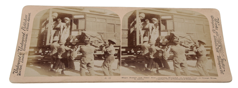
‎STEROSCOPE CARDS -‎

‎South African War through the Stereoscope. Vol. I-II.‎

‎Washington, Underwood & Underwood, 1900 - 1901. 72 stereoscope card (177 x 90 mm) housed in the original book-like slipcase. Slipcase with wear. Cards fine and clean.‎

‎Fine collection of 72 stereoscope cards depicting primarily war scenes from the South African War (Anglo-Boer war). Most of the images deal with the action on the north-eastern frontier of the Cape between November 1899 and February 1900 including scenes from Hanover, Naauwpoort, Dordrecht or Arundel and Rensburg (South of Colesburg). U & U photographers were also present on the march to Kimberley, at the surrender of General Cronje at Paardeberg, at the occupation of Bloemfontein, on the march through the Free State towards Johannesburg and the triumphant entry into Pretoria. Images of the Natal campaign (siege of Ladysmith), battlegrounds of Colenso and Spioenkop are also included. “War correspondents and news photographers descended upon South Africa at the start of the Anglo-Boer war, among them the photographers of Underwood & Underwood. These photographers were not news photographers after sensational, gory war images, nor were they part of any pro-British or anti-Boer propaganda campaign. They stayed away from conflict zones but still captured other military related activity with their primary market, namely the American middle class in mind. Underwood and Underwood produced sets of images in boxes made to look like a single, or a pair of books entitled: “The South African War through the Stereoscope”. These boxes were then filled with Anglo-Boer war stereo photographs pasted onto curved cardboard. More titles were added as the war progressed. Later described as the leaders in armchair travel photography, Underwood & Underwood was founded by two brothers in 1881 in Ottawa, Kansas. The brothers were Elmer Underwood (born Fulton County, Illinois 1859 - died St. Petersburg, Florida during 1947) and Bert Elias Underwood (born in Oxford, Illinois 1862 - died Tucson, Arizona during 1943). The company moved its main office from Ottawa, Kansas to New York City 10 years later. During the late 19th and early 20th century, Underwood and Underwood (To be referred to as U & U from this point onwards) responded to the increasing demand of their primary market, namely the middle-class American’s visual curiosity on the expanding world. The Underwoods hired their own photographers, some of whom were Americans. Unfortunately, none of their names have been recorded on the Anglo-Boer war stereo cards or on the photographs themselves. It is thought that some photographs may also have been bought from South African based photographers by U & U. This would however have been an absolute exception and not the rule. The Anglo-Boer war images sold door to door in America would have formed but a small fraction of the wide variety of images and themes on offer by U & U.” (Carol Hardijzer, Anglo-Boer War - Stereo Photographs produced by Underwood & Underwood).‎

Référence libraire : 59848

Livre Rare Book

Herman H. J. Lynge & Son
Copenhagen Denmark Dinamarca Dinamarca Danemark
[Livres de Herman H. J. Lynge & Son]

738,65 € Acheter

‎STE MAURE‎

‎Carte couleurs au 1/100 000?. Feuille XIII-20.‎

‎Une feuille 57x45 cm.‎

‎Steele, Matthew Forney.‎

‎AMERICAN CAMPAIGN. In Two Volumes. Volume I - Text. Volume II - Maps.‎

‎Two volumes. Volume I text and Volume II maps. A few maps in Volume II torn. Both Volumes XLib. Given by the estate of William G. Price, Jr. Lieutenant General Commander of the Pennsylvania National Guard to PMC Lt. William J. Wolfgram Memorial Library. Sm. 4to. Original quarter leather over cloth covered boards. Spine on volume II very worn. Boards very fragile. Hardbound set. SHELF W21‎

‎Stembridge, Jasper H.‎

‎North America and Asia‎

‎12mo, approximately 310 pages, illustrated with many maps and plates. Former School Library copy. Edges are browned. eng‎

MareMagnum

Gravity Books
Bridlington, GB
[Livres de Gravity Books]

5,34 € Acheter

‎STEROSCOPE CARDS -‎

‎South African War through the Stereoscope. Vol. I-II.‎

‎Washington, Underwood & Underwood, 1900 - 1901. 72 stereoscope card (177 x 90 mm) housed in the original book-like slipcase. Slipcase with wear. Cards fine and clean.‎

‎Steury, Donald P.; Cirillo, Roger (editor)‎

‎The Intelligence War (World War II Chronicles Series)‎

‎128 pages including index. Black and white illustrations throughout. From signals intelligence and code-cracking breakthroughs to the daring exploits of agents in the field, this work vividly chronicles the covert activities that comprised the secret war of 1939 through 1945. Written by intelligence expert Donald P. Steury, illustrated with full-color maps and period photographs, and featuring an introduction by series editor and respected WWII historian Lt. Col. Roger Cirillo, United States Army, Retired, this evocative history provides an insightful account of the significance of intelligence during World War II. Clean, bright and unmarked. Very light wear. Excellent copy. Book‎

‎Steve Smith‎

‎Manchester Real Ale Pub Guide‎

‎No marks or inscriptions. No creasing to covers or to spine. A very clean very tight copy with bright unmarked boards and no bumping to corners. 72pp. A real ale pub guide to supping in the city of Manchester and beyond. Very scarce.‎

MareMagnum

Godley Books
Hyde, GB
[Livres de Godley Books]

8,53 € Acheter

‎Steven Cartes, Julia Sokol‎

‎Ces hommes qui ont peur d'aimer‎

‎Used - Good. Pages intact with minimal writing/highlighting. The binding may be loose and creased. Dust jackets/supplements are not included. Stock photo provided. Product includes identifying sticker. Better World Books: Buy Books. Do Good. unknown‎

Référence libraire : 3869516-6 ISBN : 2894300026 9782894300022

Biblio.com

Better World Books
United States Estados Unidos Estados Unidos États-Unis
[Livres de Better World Books]

75,20 € Acheter

‎Stewart, Robert Walter [Roberto Gualtiero]‎

‎The Tent and the Khan: A Journey to Sinai and Palestine.‎

‎RARE illustrated account of a travel from Cairo to Damascus undertaken by a Scottish traveler and pastor Robert Walter Stewart (also called Roberto Gualtiero, 1812-1887), who was an important figure in Italian Protestantism and author of several books, among them "On the present condition and future prospects of the Waldensian Church, in Lectures on Foreing Churches delivered in Edinburgh and Glasgow" (Edinburgh, 1845), and "An Italian campaing, or Evangelical movement in Italy, 1845-1887" (London, 1890). The book features a frontispiece, additional 15 b&w illustrations and a large fold-out map of the Sinai peninsula. 220x150mm. XVI+528 pages (+ 8 advertisement pages). Quarter-cloth rebound Hardcover. Spine dirty. Spine edges slightly bumped. Ex libris sticker on front end-paper upper corner. Previous owner's name written in ink on title page upper corner/edge. Map inner edge bear binding slightly torn. Title page and page III/IV coming loose. Page XIII/XIV detached from binding (but present). Pages yellowing and slightly wavy. [SUMMARY]: Save for some light wear, this rare and beautifully illustrated travel account is in good condition.‎

MareMagnum

The Book Gallery
United States Estados Unidos Estados Unidos États-Unis
[Livres de The Book Gallery]

129,81 € Acheter

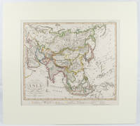
‎STIELER, ADOLF; STUPNAGEL, FREDERIC VON AND BERGHAUS HERMANN‎

‎Asia.‎

‎Gotha.: Perthes Justus. Circa1855. Engraved map 44.1 x 36.3 cm sheet size 35.8 x 29.7cm map size plate mark map with original hand colouring and hand coloured key noting Islamic "Mohammedanische" Buddhist "Buddhaistische" and European territories by country. Unusual map in an early issue. It was included as map 39 in Stieler's "Hand-Atlas uber alle Theile der Erde und uber das Weltgebaude by Frederic von Stulpnagel" revised by Hermann Berghaus in 1855. The issue is noted to the top right: Ausg. in 63BI. no XIV. Fine outline hand colouring denotes territories by religion and Chinese ports open to European trade and Japanese ports open to American trade. . Perthes, Justus. unknown‎

Référence libraire : 173439

Biblio.com

Asia Bookroom
Australia Australia Austrália Australie
[Livres de Asia Bookroom]

230,68 € Acheter

‎Stieler, Ad[olf]‎

‎Die bekannteren Höhen über der Meeresfläche in transparenten Profilen. Nach der geograph. Lage geordnet, mit Andeutung des Zusammenhanges u. der Entfernung vom Auge. Ein Versuch v. Ad. Stieler 1822. Handkolorierter Kupferstich‎

‎Neu berichtigte Auflage von Herm. Berhaus 1854. Bildausschnitt: 29x36 cm, Blattgrösse: 36,5x45 cm, gefaltet, in den Faltungen etw. rissig, Unterkante m. kl. Einriss, fingerfleck.‎

Référence libraire : KART0141

‎STIELER, Adolf.‎

‎Adolf Stieler's Handatlas über alle Theile der Erde und über das Weltgebäude.‎

‎Gotha, Justus Perthes, s.a. (1902). Gran Folio; 4 h. con portada e Índice, 95 mapas a doble página en color, y 201 pp. de Índice alfabético de nombres. Encuadernación de época en media piel con puntas.‎

‎Stier, Hans Erich (ed); Aner, Ekkehard (ed.); Georg Westermann Verlag‎

‎Westermanns Grosser Atlas zur Weltgeschichte Vorzeit, Altertum, Mittelalter, Neuzeit‎

‎Folio in light blue cloth with gilt-stamped titles; xx, 170, 80 pages maps (chefly color) 30 cm In German. Maps beautifully printed in many colors. / Historical geography -- Maps. Historical geography. Atlas Weltgeschichte Maps. Maps. Cartes gÈographiques.Cartography / **A large book. Extra shipping charges may apply for international & expedited orders. Please inquire.**‎

Nombre de résultats : 11 998 (240 Page(s))

Première page Page précédente 1 ... 212 213 214 [215] 216 217 218 ... 221 224 227 230 233 236 239 ... 240 Page suivante Dernière page