|
|
|
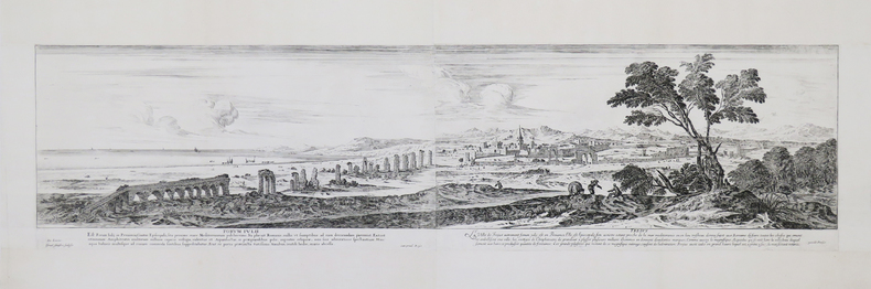
SILVESTRE (Israël).
[FRÉJUS] Forum Iulii – Frejus. De Lincler. Israel Silvestre sculpsit. Cum privil. Regis. excudit Parisiis.
[circa 1650]. En deux feuilles jointes de 215 x 820 mm.
Referentie van de boekhandelaar : LBW-4405
|
|
|
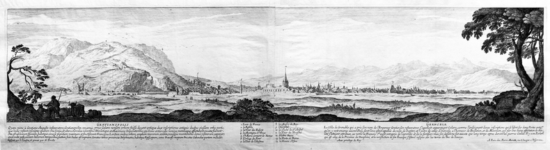
SILVESTRE (Israël).
[GRENOBLE] Gratianopolis – Grenoble. Dessignée par I. Silvestre, et gravée par N. Perelle. Avec privilège du roy. A Paris chez Pierre Mariette, rue S. Jacques à l’Espérance.
[circa 1650]. En deux feuilles jointes de 200 x 780 mm.
Referentie van de boekhandelaar : LBW-4398
|
|
|
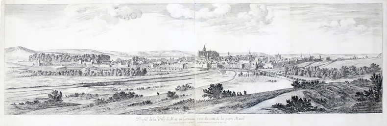
SILVESTRE (Israël).
[METZ] Profil de la ville de Metz en Lorraine veue du costé de la porte Mazel.
Paris, Israel Silvestre, 1667. En deux feuilles jointes de 400 x 1286 mm.
Referentie van de boekhandelaar : LBW-4500
|
|
|
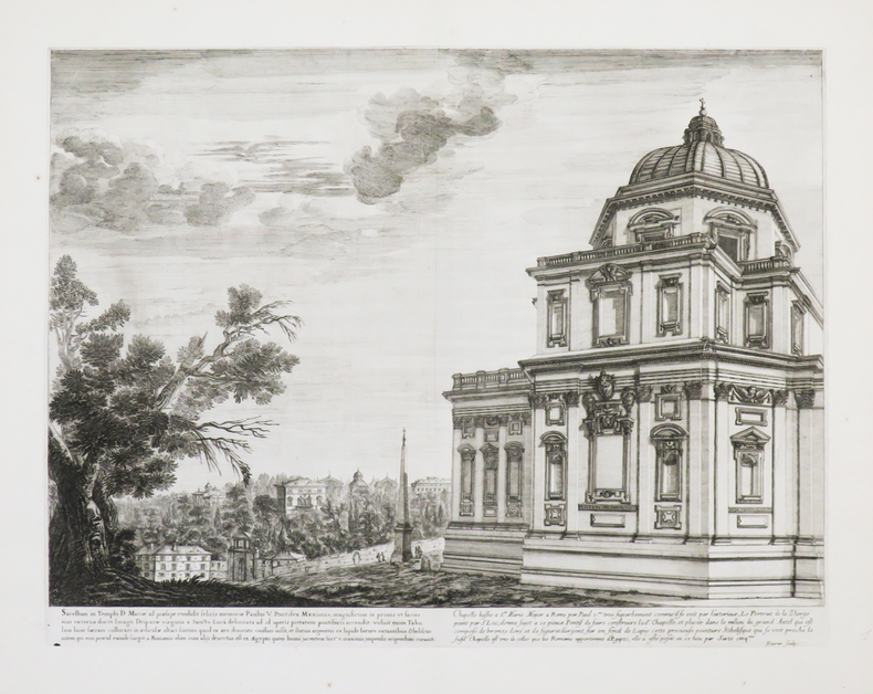
SILVESTRE (Israël).
[ROME] Chapelle bastie à Ste Marie Major à Rome par Paul Vme très-superbement comme il se voit par l’extérieur. Goyran sculp.
[circa 1650]. 335 x 450 mm.
Referentie van de boekhandelaar : LBW-4407
|
|
|
SILVAIN Gérard
Deux destins en diaspora, 1897-1947 - 50 ans de mémoires juives à travers un millier de cartes postales
1984, Albin Michel, in-4 pleine toile marron de 239+239 pages, jaquette illustrée, plus de 1000 illustrations et documents, préface de Pierre Bourget. Moi, Myriam Attias, juive sépharade, moi Yosef Lewski, juif ashkénaze. | Etat : Bon état général (Ref.: G3809)
Referentie van de boekhandelaar : 33268
|
|
|
SILIOTTI Alberto
EGYPTE, TERRE DES PHARAONS
PARIS, Librairie Gründ, 1994In folio, cartonnage bleu, titre frappé or au dos de l'ouvrage, sous jaquette pelliculée illustrée en couleurs du célèbre masque funéraire en or de Toutankhamon, titre imprimé au dosTraduction française de Marie-Paule DUVERNEL'ouvrage est illustré de superbes planches photographiques en couleurs dans et en pleine page et in plano de Luca ROSSI. Les cartes et dessins en noir dans et hors le texte sont de Monica FALCONE et Cristina FRANCO,In fine, un glossaire illustré, une table des provinces de l'Egypte ancienne, une bibliographie et un indexOuvrage d'une grande qualité, superbe état de fraîcheur, proche du neuf
Referentie van de boekhandelaar : 2050
|
|
|
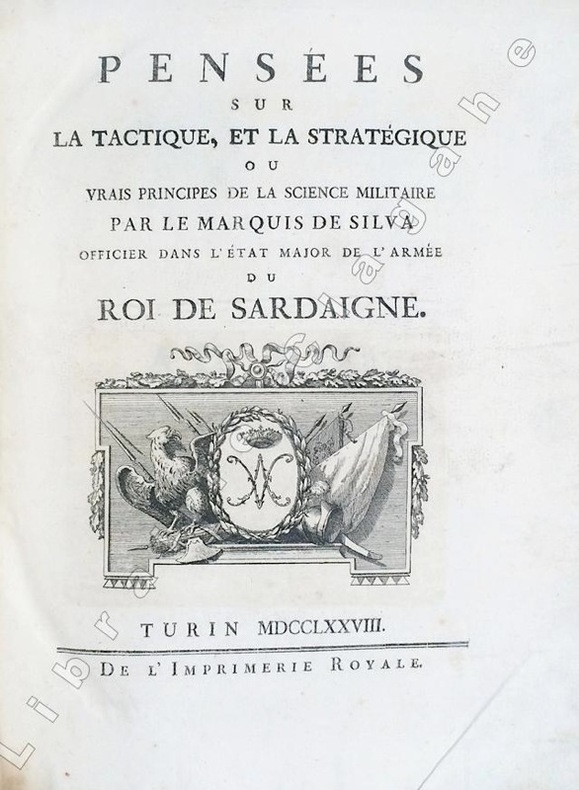
Silva, Marquis de :
Pensées sur la tactique et la stratégie ou vrais principes de la science militaire.
Turin, Imprimerie Royale, 1778 ; in-4 ; demi-veau glacé havane, dos à faux-nerfs dorés et palettes décoratives, pièce de titre vert-pistache, tranches mouchetées de bleu (reliure de l'époque) ; (14), 359, (1 bl.) ; (4), 55, (1) pp. et 30 planches gravées dépliantes.SUIVI DE : "CONSIDERATIONS SUR LA GUERRE DE 1769 ENTRE LES RUSSES ET LES TURCS. Nouvelle édition corrigée et augmentée de plusieurs notes historiques."
Referentie van de boekhandelaar : 6494
|
|
|
SILVESTRE Israel (Nancy, 1621 - Parigi, 1691).
(Panorama di Roma)
Acquaforte, 1645/50 circa, firmata in lastra in basso a destra..Inusuale veduta panoramica della città, con vista su vari monumenti, descritti in basso in un legenda di 9 punti, riportata in basso in italiano e francese e che comprende: 1. Vestigij del Tempio della Pace . 2. Chiesa di S.ta Francesca Romana . 3. Vigna Fanesia . 4. Vestigij del Palazzo Maggiore. 5. Vestigij della Casa di Cicerone. 6. St. Maria liberatrice . 7. St. Pietro Montorio. 8. Frontespitio dell'Acqua Paula. 9. Colonne restate del Tempio di Giove Statore. La Basilica, in primo piano, è disegnata con grande dettaglio, come pure il panorama della città, dove sono riconoscibili numerose opere architettoniche. Come per il panorama generale di Roma, anche questa veduta generale venne probabilmente incisa "da un disegno eseguito ad vivum da L. de Lincher, un disegnatore francese poco noto che fu attivo in quegli anni a Roma e fornì i sui disegni a diversi incisori fra i quali anche il conterraneo Francois Collignon" (cfr. Barbara Jatta in "Roma Veduta" p. 164),Il Silvestre, incisore e disegnatore, nasce a Nancy nel 1621. Tra il 1638 e il 1641 viaggiò in Italia; si hanno notizie della sua presenza nella Penisola ancora nel 1643 e nel 1653. Il suo stile fu, all’inizio, piuttosto sciolto, ma dal 1643 in poi divenne più raffinato e delicato, acquisendo accuratezza e precisione senza essere asciutto, risultando a volte simile a quello di Jacques Callot o di Stefano della Bella, con i quali ebbe rapporti di amicizia. Accanto alle testimonianze per la Roma antica mostrò ben presto un grandissimo interesse per la città "moderna", divenendo uno dei precursori del vedutismo - non solo nel campo incisorio - anticipando artisti come Lievin Cruyl e Gaspar van Wittel. Bellissima prova, con ampli margini, pieghe verticali dovute alla conservazione - più volte ripiegata e conservata il album - in ottimo stato di conservazione. Rara. Etching, circa 1645/50, signed on the lower right-hand plate. Unusual panoramic view of the city, with a view of various monuments, described in a 9-point legend at the bottom in Italian and French, including: 1. Vestigij del Tempio della Pace . 2. Chiesa di S.ta Francesca Romana . 3. Vigna Fanesia . 4. Vestigij del Palazzo Maggiore. 5. Vestigij della Casa di Cicerone. 6. St. Maria liberatrice . 7. St. Pietro Montorio. 8. Frontespitio dell'Acqua Paula. 9. Colonne restate del Tempio di Giove Statore. The Basilica, in the foreground, is drawn in great detail, as is the panorama of the city, where numerous architectural works are recognisable. As with the general view of Rome, this panorama was probably engraved "from a drawing made ad vivum by L. de Lincher, a little-known French draughtsman who was active in Rome in those years and supplied his drawings to various engravers, including his fellow countryman Francois Collignon" (cf. Barbara Jatta in "Roma Veduta" p. 164). Silvestre, engraver and draughtsman, was born in Nancy in 1621. Between 1638 and 1641 he travelled in Italy; there are records of his presence in the Peninsula again in 1643 and 1653. His style was rather loose at first, but from 1643 onwards it became more refined and delicate, acquiring accuracy and precision without being dry, sometimes resembling that of Jacques Callot or Stefano della Bella, with whom he was friends. Alongside the evidence for ancient Rome, he soon showed great interest in the "modern" city, becoming one of the forerunners of vedutism - not only in the field of engraving - anticipating artists such as Lievin Cruyl and Gaspar van Wittel. Beautiful proof, with wide margins, vertical folds due to storage - folded several times and stored in the album - in excellent condition. Rare.

|
|
|
SILVESTRE Israel (Nancy, 1621 - Parigi, 1691).
Panorama di Roma da Monte Mario
Acquaforte, 1642, firmata in lastra in basso.Bellissima prova, impressa su carta vergata coeva, con ampi margini, in perfetto stato di conservazione.Inusuale veduta panoramica della città, presa dalle pendici di Monte Mario. La Basilica, in primo piano, è disegnata con grande dettaglio, come pure il panorama della città, dove sono riconoscibili numerose opere architettoniche. "L'incisione è la prima grande veduta di Roma realizzata da Israel Silvestre pochi anni dopo il suo arrivo in città. Questa è ripresa dalle pendici di Monte Mario e il panorama spazia dalla Porta del Popolo al complesso del Vaticano. Il formato oblungo e la scelta del punto di vista verrà largamente ripreso dagli artisti successivi. La veduta venne incisa da un disegno eseguito ad vivum da L. de Lincher, un disegnatore francese poco noto che fu attivo in quegli anni a Roma e fornì i sui disegni a diversi incisori fra i quali anche il conterraneo Francois Collignon" (cfr. Barbara Jatta in "Roma Veduta" p. 164),Il Silvestre, incisore e disegnatore, nasce a Nancy nel 1621. Tra il 1638 e il 1641 viaggiò in Italia; si hanno notizie della sua presenza nella Penisola ancora nel 1643 e nel 1653. Il suo stile fu, all’inizio, piuttosto sciolto, ma dal 1643 in poi divenne più raffinato e delicato, acquisendo accuratezza e precisione senza essere asciutto, risultando a volte simile a quello di Jacques Callot o di Stefano della Bella, con i quali ebbe rapporti di amicizia. Accanto alle testimonianze per la Roma antica mostrò ben presto un grandissimo interesse per la città "moderna", divenendo uno dei precursori del vedutismo - non solo nel campo incisorio - anticipando artisti come Lievin Cruyl e Gaspar van Wittel.Primo, in ordine cronologico, dei quattro panorami dedicati dall’artista francese alla città. Molto rara. Bibliografia Le Blanc III, p. 508, 224; Roma Veduta, pp. 164-165, n. 24; Faucheaux, Catalogue raisonné de l’oeuvre d’Israel Silvestre, 28 II/II. Etching, 1642, signed on lower plate.Beautiful work, printed on contemporary laid paper, wide margins, in very good condition. First, in chronological order, of the four panoramas dedicated by the French artist to the city. The engraving is the first large view of Rome made by Israel Silvestre a few years after his arrival in the city. This is taken from the slopes of Monte Mario and the panorama ranges from the Porta del Popolo to the Vatican complex. The oblong format and the choice of the viewpoint will be largely taken up by the artists who followed. The view was engraved from a drawing made ad vivum by L. de Lincher, a little-known French artist who was active in Rome in those years and supplied his drawings to various engravers, including his fellow countryman Francois Collignon (cf. Barbara Jatta in "Roma Veduta" p. 164) Silvestre, engraver and draftsman, was born in Nancy in 1621. Between 1638 and 1641 he travelled in Italy; we have news of his presence in the Peninsula still in 1643 and 1653. His style was, at the beginning, rather loose, but from 1643 onwards he became more refined and delicate, acquiring accuracy and precision without being dry, sometimes similar to that of Jacques Callot or Stefano della Bella, with whom he had friendly relations. Alongside the evidence for ancient Rome, he soon showed great interest in the 'modern' city, becoming one of the precursors of vedutism - not only in the field of engraving - anticipating artists such as Lievin Vruyl and Gaspar van Wittel. Literature Le Blanc III, p. 508, 224; Roma Veduta, pp. 164-165, n. 24; Faucheaux, Catalogue raisonné de l’oeuvre d’Israel Silvestre, 28 II/II.

|
|
|
SILVESTRE Israel (Nancy, 1621 - Parigi, 1691).
Veduta del Campo Vaccino, e duna parte delle Città, di Roma….
Acquaforte, 1652 circa, priva di firma in lastra dove troviamo la sola indicazione del privilegio. Bellissima prova, impressa su carta vergata coeva, con margini, in perfetto stato di conservazione. Veduta panoramica di Roma raffigurante presa dagli Orti Farnesiani, con il Foro Romano in primo piano. LO stemma araldico di Luigi XIV, con le armi di Francia e Navarra, è inciso al centro con la scritta Dédié au Roy. “L’impianto di questa veduta di Campo Vaccino, dedicata a Luigi XIV, che spazia dal Campidoglio alla Basilica di Massenzio, appartiene alla seconda fase della sua produzione, contraddistinta dall’estrema precisione nella rappresentazione degli edifici. È probabile che l’artista abbia scelto come punto di vista gli Horti Farnesiani sul Palatino che gli permettevano una visione dall’alto della città. Oltre alla raffigurazione dei monumenti antichi, la veduta è caratterizzata, seppure in secondo piano, dalla presenza di numerose architetture moderne della zona nord-orientale di Roma, tra le quali la chiesa di S. Maria di Loreto, Villa Medici, il Quirinale e il palazzo del cardinale Mazzarino alle Quattro Fontane” (cfr. Barbara Jatta in "Roma Veduta" p. 167). Il Silvestre, incisore e disegnatore, nasce a Nancy nel 1621. Tra il 1638 e il 1641 viaggiò in Italia; si hanno notizie della sua presenza nella Penisola ancora nel 1643 e nel 1653. Il suo stile fu, all’inizio, piuttosto sciolto, ma dal 1643 in poi divenne più raffinato e delicato, acquisendo accuratezza e precisione senza essere asciutto, risultando a volte simile a quello di Jacques Callot o di Stefano della Bella, con i quali ebbe rapporti di amicizia. Accanto alle testimonianze per la Roma antica mostrò ben presto un grandissimo interesse per la città "moderna", divenendo uno dei precursori del vedutismo - non solo nel campo incisorio - anticipando artisti come Lievin Cruyl e Gaspar van Wittel. Bibliografia Le Blanc III, p. 508, 228; Roma Veduta (2000), p. 167, n. 26; Faucheaux, Catalogue raisonné de l’oeuvre d’Israel Silvestre, 32.1; C. Marigliani, Le Piante di Roma delle collezioni private, tav. 122 Etching, about 1652, without signature on the plate where we find only the indication of the privilege. Beautiful proof, printed on contemporary laid paper, later hand colour, with margins, in perfect condition. Panoramic view of Rome taken from the Orti Farnesiani, with the Roman Forum in the foreground. The heraldic coat of arms of Louis XIV, with the arms of France and Navarre, is engraved in the center with the inscription Dédié au Roy. The layout of this view of Campo Vaccino, dedicated to Louis XIV, ranging from the Capitol to the Basilica of Maxentius, belongs to the second phase of his production, marked by extreme precision in the representation of the buildings. It is likely that the artist chose as a point of view the Horti Farnesiani on the Palatine, which allowed him a view of the city from above. In addition to the depiction of ancient monuments, the view is characterized, albeit in the background, by the presence of numerous modern buildings in the north-eastern area of Rome, including the church of S. Maria di Loreto, Villa Medici, the Quirinale and the palace of Cardinal Mazzarino at the Quattro Fontane (see Barbara Jatta in "Roma Veduta" p. 167). Silvestre, engraver and draftsman, was born in Nancy in 1621. Between 1638 and 1641 he traveled in Italy; we have news of his presence in the Peninsula again in 1643 and 1653. His style was, at the beginning, rather loose, but from 1643 onwards became more refined and delicate, acquiring accuracy and precision without being dry, resulting sometimes similar to that of Jacques Callot or Stefano della Bella, with whom he had relationships of friendship. Alongside the evidence for ancient Rome soon showed a great interest in the city "modern", becoming one of the precursors of vedutismo - not only in the field of engraving - anticipating artists such as Lievin Cruyl and Gaspar van Wittel. Literature Le Blanc III, p. 508, 228; Roma Veduta, p. 167, n. 26; Faucheaux, Catalogue raisonné de l'oeuvre d'Israel Silvestre, 32.1; C. Marigliani, "Le Piante di Roma delle collezioni private", n. 122.

|
|
|
SILVESTRE Israel (Nancy, 1621 - Parigi, 1691).
Vedute della Chiesa di S.to Pietro in Vaticano, et del Palazzo Papale, ed altri luoghi, disegnate in Roma fuori della porta
Acquaforte, 1652, firmata e datata in lastra in basso a sinistra Israel SIlvestre delineavit et sculpt. l'anne 1652 in Parigi. Bellissima prova, impressa su carta vergata coeva, con ampi margini, in perfetto stato di conservazione. Inusuale veduta panoramica della città, presa dalle pendici colle Vaticano - fuori da Porta Cavalleggeri come indicato nel titolo - con un magnifico e accurato dettaglio della Basilica Vaticana prima del colonnato del Bernini (1665). In alto al centro, in un cartiglio con lo stemma araldico di Louis Hesselin troviamo la dedica di Jean Vivot: Illustrissimo Nobillissimoque Domino. D. Hesselin Regi il Secretioribus Consilijs, Palatij, et Camerae denariorum Magistro Observantissimus Seruus J. Viuot Dicat. È probabile che Vivot, un comune gentiluomo della camera del Re, nominato nel 1670 custode dell'antiquariato, abbia commissionato al Silvestre questa veduta per dedicarla a Louis Hesselin, Seigneur de Condé aristocratico francese, funzionario del governo, mecenate e collezionista. Il Silvestre, incisore e disegnatore, nasce a Nancy nel 1621. Tra il 1638 e il 1641 viaggiò in Italia; si hanno notizie della sua presenza nella Penisola ancora nel 1643 e nel 1653. Il suo stile fu, all’inizio, piuttosto sciolto, ma dal 1643 in poi divenne più raffinato e delicato, acquisendo accuratezza e precisione senza essere asciutto, risultando a volte simile a quello di Jacques Callot o di Stefano della Bella, con i quali ebbe rapporti di amicizia. Accanto alle testimonianze per la Roma antica mostrò ben presto un grandissimo interesse per la città "moderna", divenendo uno dei precursori del vedutismo - non solo nel campo incisorio - anticipando artisti come Lievin Cruyl e Gaspar van Wittel. Bibliografia L. E. Faucheux, Catalogue raisonné de toutes les estampes qui forment l'oeuvre d'Israel Silvestre: précédé d'une notice sur sa vie (1857), n. 31.1; F. Baré, Israël Silvestre et sa famille, suivi du catalogue de son oeuvre (1885), n. 768. Etching, 1652, signed and dated on the plate at lower left Israel SIlvestre delineavit et sculpt. l'anne 1652 in Parigi. Beautiful proof, printed on contemporary laid paper, with wide margins, in perfect condition. Unusual panoramic view of the city, taken from the slopes of the Vatican hill - outside Porta Cavallegeri as indicated in the title - with a magnificent and accurate detail of the Vatican Basilica before Bernini's colonnade (1665). In the upper center, in a cartouche with the heraldic coat of arms of Louis Hesselin we find the dedication of Jean Vivot: Illustrissimo Nobillissimoque Domino. D. Hesselin Regi the Secretioribus Consilijs, Palatij, et Camerae denariorum Magistro Observantissimus Seruus J. Viuot Dicat. It is likely that Vivot, a common gentleman of the King's chamber, appointed in 1670 as keeper of antiques, commissioned Silvestre this view to dedicate it to Louis Hesselin, Seigneur de Condé French aristocrat, government official, patron and collector. Silvestre, engraver and draftsman, was born in Nancy in 1621. Between 1638 and 1641 he traveled in Italy; we have news of his presence in the Peninsula again in 1643 and 1653. His style was, at the beginning, rather loose, but from 1643 onwards became more refined and delicate, acquiring accuracy and precision without being dry, resulting sometimes similar to that of Jacques Callot or Stefano della Bella, with whom he had relationships of friendship. Alongside the evidence for ancient Rome soon showed a great interest in the city "modern", becoming one of the precursors of vedutismo - not only in the field of engraving - anticipating artists such as Lievin Cruyl and Gaspar van Wittel. Literature L. E. Faucheux, Catalogue raisonné de toutes les estampes qui forment l'oeuvre d'Israel Silvestre: précédé d'une notice sur sa vie (1857), n. 31.1; F. Baré, Israël Silvestre et sa famille, suivi du catalogue de son oeuvre (1885), n. 768.

|
|
|
SILVESTRE Israel (Nancy, 1621 - Parigi, 1691).
Vue de Rome et du derrière de l'Eglise St Pierre prise sur les hauteurs du mont Vatican hors la ville
Acquaforte, 1646 circa, firmata in lastra in basso a sinistra. Bellissima prova, impressa su carta vergata coeva, con ampi margini, in perfetto stato di conservazione. Inusuale veduta panoramica della città, presa dal colle Vaticano. La Basilica, in primo piano, è disegnata con grande dettaglio, come pure il panorama della città, dove sono riconoscibili numerose opere architettoniche. “È insolita la scelta del punto di vista di questa veduta romano, presa dal colle Vaticano, dietro la Basilica di San Pietro. Anche in quest’opera, sempre molto particolareggiata secondo lo stile tipico dell’artista, è forte l’influsso delle incisioni di Callot, sia nel linguaggio che nella costruzione della veduta, come ci conferma la quinta in primo piano con le mura vaticane"(cfr. Barbara Jatta in "Roma Veduta" p. 168). Il Silvestre, incisore e disegnatore, nasce a Nancy nel 1621. Tra il 1638 e il 1641 viaggiò in Italia; si hanno notizie della sua presenza nella Penisola ancora nel 1643 e nel 1653. Il suo stile fu, all’inizio, piuttosto sciolto, ma dal 1643 in poi divenne più raffinato e delicato, acquisendo accuratezza e precisione senza essere asciutto, risultando a volte simile a quello di Jacques Callot o di Stefano della Bella, con i quali ebbe rapporti di amicizia. Accanto alle testimonianze per la Roma antica mostrò ben presto un grandissimo interesse per la città "moderna", divenendo uno dei precursori del vedutismo - non solo nel campo incisorio - anticipando artisti come Lievin Cruyl e Gaspar van Wittel. Bibliografia Le Blanc III, p. 508, 225; Roma Veduta, pp. 168-169, n. 27; L. E. Faucheux, Catalogue raisonné de toutes les estampes qui forment l'oeuvre d'Israel Silvestre: précédé d'une notice sur sa vie (1857), n. 29.1; F. Baré, Israël Silvestre et sa famille, suivi du catalogue de son oeuvre (1885), n. 766. Etching, circa 1646, signed in plate at lower left. Beautiful proof, printed on contemporary laid paper, with wide margins, in perfect condition. Unusual panoramic view of the city, taken from the Vatican Hill. The Basilica, in the foreground, is drawn with great detail, as well as the panorama of the city, where many architectural works are recognizable. The choice of the point of view of this Roman view, taken from the Vatican Hill, behind St. Peter's Basilica, is unusual. Also in this work, always very detailed according to the typical style of the artist, the influence of Callot's engravings is strong, both in the language and in the construction of the view, as confirmed by the foreground with the Vatican walls (see Barbara Jatta in "Roma Veduta" p. 168). Silvestre, engraver and draftsman, was born in Nancy in 1621. Between 1638 and 1641 he traveled in Italy; we have news of his presence in the Peninsula again in 1643 and 1653. His style was, at the beginning, rather loose, but from 1643 onwards became more refined and delicate, acquiring accuracy and precision without being dry, resulting sometimes similar to that of Jacques Callot or Stefano della Bella, with whom he had relationships of friendship. Alongside the evidence for ancient Rome soon showed a great interest in the city "modern", becoming one of the precursors of vedutismo - not only in the field of engraving - anticipating artists such as Lievin Cruyl and Gaspar van Wittel. Literature Le Blanc III, p. 508, 225; Roma Veduta, pp. 168-169, n. 27; L. E. Faucheux, Catalogue raisonné de toutes les estampes qui forment l'oeuvre d'Israel Silvestre: précédé d'une notice sur sa vie (1857), n. 29.1; F. Baré, Israël Silvestre et sa famille, suivi du catalogue de son oeuvre (1885), n. 766.

|
|
|
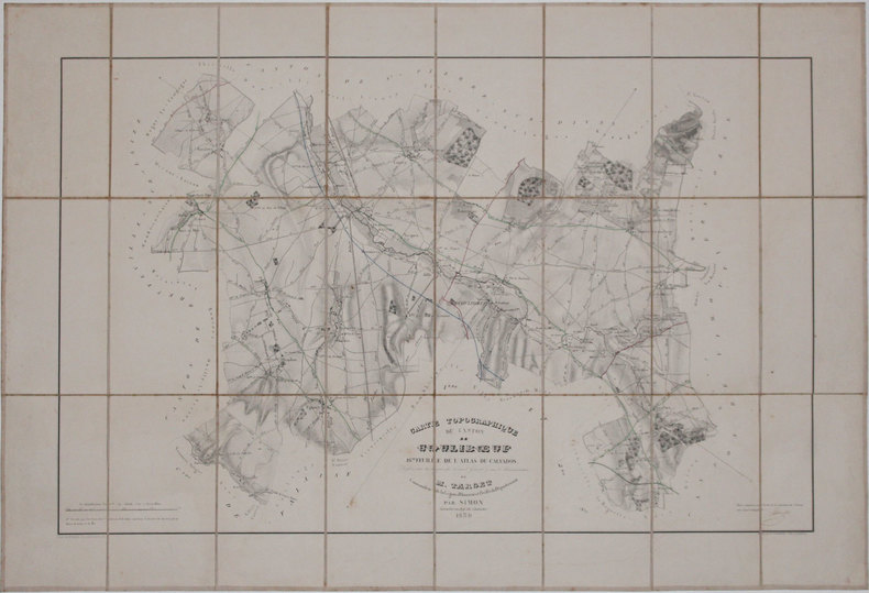
SIMON.
[NORMANDIE/COULIBŒUF] Carte topographique du canton de Coulibœuf.
1839. En 18 sections montées sur toile et pliées, formant une carte de 0,70 x 1,03 m ; étiquette au dos de l'éditeur E. Andriveau-Goujon.
Referentie van de boekhandelaar : LBW-3269
|
|
|
SIMON (Jean). REMBIELINSKI ( Eugène).
Atlas du Calvados. 35 Cartes topographiques des cantons, dressées sous les auspices du Conseil général et sous l'administration de M. Target, Commandeur de la Légion D'Honneur et Préfet du Département, par SIMON, Géomètre en chef du Cadastre. Bayeux - Beny-Bocage (Le) - Blangy-Le-Château Bourguebus - Bretteville-Sur-Laize Caen Cambremer - Caumont-L'Eventé - Condé-Sur-Noireau Couliboeuf Creully - Douvres-La-Délivrande Dozulé Evrecy Falaise Harcourt Honfleur - Isigny-Sur-Mer - Lisieux Livarot - Mézidon-Canon Orbec - Pont-L'Evêque Ryes - Saint-Pierre-Sur-Dives - Saint-Sever-Calvados - Tilly-Sur-Seulles Trevieres Vassy - Vire.
Paris, Atelier de lithographie de N. Gratia, 1839 - 1842. In-plano (53,5 x 74 cm), un feuillet de légendes indiquant les Routes royales, Routes départementales et les Chemins de grandes communications, 34 cartes topographiques des cantons gravées sur pierre par Eugène Rembielinski, un tableau d'assemblage des feuilles et une deuxième carte de Caen "Statistique générale" de 1836 (nommée 7ème feuille de l'atlas, avec les détails statistiques), ces deux derniers sont gravés par Bouffard. Quelques cartes aux contours rehaussés de bleu. Exemplaire très frais, monté sur onglets. Demi-basane havane, dos lisse orné de filets dorés et fleurons à froid. Eraflures, coiffe inférieure usée. Reliure de l'époque.
Referentie van de boekhandelaar : 17218

|
|
|
SIMON E. et R. LEMAIRE
Catalogue des cartes postales. L'aéronautique (avant 1914).
Chez les Auteurs, 1985 (3e édition). 2 volumes in-4, 485pp., reproductions de cartes postales, br.
Referentie van de boekhandelaar : AVIA51

|
|
|
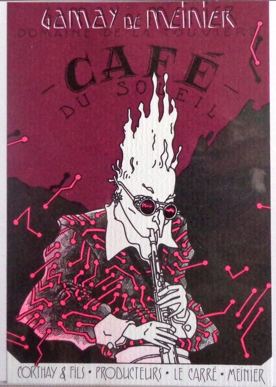
Simon:
Etiquette de vin Café du Soleil.
Referentie van de boekhandelaar : 1903
|
|
|
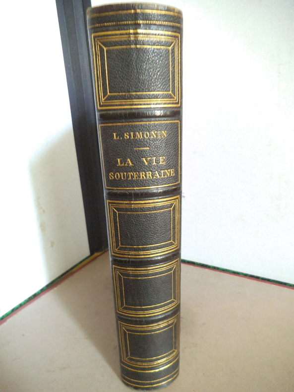
SIMONIN Louis
La vie souterraine
La vie souterraine ou les mines et les mineurs. Ouvrage illustré de 100 gravures sur bois hors texte et dans le texte 30 cartes tirées en couleurs et de 10 planches imprimées en chromolithographie dont le frontispice. In 8 demi chagrin vert titre, filets caissons dorés, plats percaline chagrinée verte, filets à froid en encadrement. 190x270mm, poids 2n2kg. Faux titre, frontispice, titre ; 604 pages ; tranches dorées, rousseurs éparses plus fortes en en début et fin de volume. Paris librairie hachette & Cie 1867. Bon exemplaire.
Referentie van de boekhandelaar : 14505
|
|
|
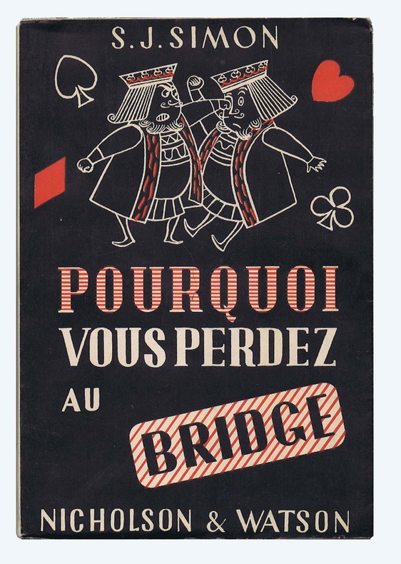
SIMON S.J. Illustrations de J.-P. Jacques
POURQUOI VOUS PERDEZ AU BRIDGE
Broché sous jaquette illustrée. 18,5 x 12,5 cm, 198 pages. Très bel exemplaire avec sa jaquette. Envoi rapide sous emballage bien protecteur.
Referentie van de boekhandelaar : VBA-104
|
|
|
SIMON Luc
Souvenirs d'Angers. La vie en 1900. Images d'hier et d'avant-hier. Texte agrémenté par la reproduction de cartes postales anciennes. Préface d'André Sarazin, archiviste.
Nantes: Editions L. N. G., 1985 in-8, 320 pages, nombreuses illustrations. Rel. d'éd. skivertex décorée, très bon état.
Referentie van de boekhandelaar : 13979981
|
|
|
SIMON E. & LEMAIRE R.
L'AERONAUTIQUE (AVANT 1914). CATALOGUE DES CARTES POSTALES. 3ième édition.Deux volumes
P., sans nom d'éditeur, 1985. Deux volumes in-4 brochés, 458 pages en numérotation continue. Quelques illustrations en noir et blanc.Couvertures très légèrement défraichies.
|
|
|
Simon Kirwan
Discover the Peak District (Discovery Guides)
Appears unread. No marks or inscriptions to contents. No creasing to covers or to spine. A very clean very tight copy with bright boards, trace of label removal to front and no bumping to corners. 33pp. A journey through Derbyshire's Peak District in well-captioned colour photographs.
|
|
|
Simons, J.
Jerusalem in the Old Testament: Research and Theories. [SERIES]: Studia Francisci Scholten Memoriae Dicata - Volumen Primum.
RARE comprehensive synthesis of all literary and archaeological data concerning biblical Jerusalem. Includes many b&w illustrations (33 plates and 64 figures, among them also fold-out plans/maps). 300x230mm. XVI+517 pages. Dark-blue cloth Hardcover with gilt front cover and spine. Cover slightly curved. Cover and spine dirty/slightly stained. Cover corners and spine edges bumped and rubbed. Cover edges and spine hinges rubbed. Pages slightly yellowing and slightly wavy. [SUMMARY]: This extremely rare monograph on biblical Jerusalem, covering all available ancient and modern literary sources and archaeological data published until the 1950s, is in good condition. PLEASE NOTE: This item is overweight. We may ask for extra shipping costs.
|
|
|
Simpkins, Mary Ann
Canada: Trav Bugs Travel Guides
359 pages including index. A world of exhilarating experiences lies in store for the traveler within these pages. Stunning colour photography reveals silent blue lakes, the majestic white peaks of the Rockies towering over green forests, the rugged coastline of Nova Scotia, the cafe life of Montreal, and much more. Includes hundreds of full-colour photos, accurate maps, trip-planning details, and fascinating text. Unmarked. Light wear. A nice copy of this attractive volume. Book
|
|
|
SINCLAIR, Iain With an Introduction by Michael Moorcock and Maps by Dave McKean
Lud Heat and Suicide Bridge.
Granta Books London. 1998. Granta Books London. 1998. Paperback. Illustrated. Covers slightly worn to extremities. Page edges foxed and pages browned o/w clean and sound. SCARCE. paperback
Referentie van de boekhandelaar : 109297
|
|
|
Sinclair, A.J.; Wynne-Edwards, H.R.; Brown, A. Sutherland
An Analysis of Distribution of Mineral Occurrences in British Columbia: Bulletin No. 68
125 pages including bibliography and appendices. "Distribution of mineral occurrences in British Columbia recorded in an extensive computerized file." - from page 5. Contents include mineral commodity occurrence maps, quantitative approach to regional analysis of data, and discussion (mineral resource potential, metallogeny). Usual library markings. Moderate wear. Sound binding. A solid working copy. Book

|
|
|
Singleton, David
The North West : Land for Leisure
Ex-library book with usual marks and stamps. A clean tight copy with no bumping to corners. Dust jacket not price clipped or torn or creased with slightly faded spine. 96pp. How our growing leisure time is changing the landscape of the region. Focus on England's North West

|
|
|
SITUATIONNISTES].
Misère de la révolution et révolution de la misère.
Strasbourg Sans nom, 12 décembre 1968 1968 1 vol. broché 1 feuillet dactylographié recto-verso. Tract strasbourgeois signé "Les Enragés" dénonçant la tiédeur de la dernière assemblée générale à la Faculté des Lettres.
Referentie van de boekhandelaar : 90689
|
|
|
SITUATIONNISTES].
Misère de la révolution et révolution de la misère.
Strasbourg Sans nom, 12 décembre 1968 1968 1 vol. broché 1 feuillet dactylographié recto-verso. Tract strasbourgeois signé "Les Enragés" dénonçant la tiédeur de la dernière assemblée générale à la Faculté des Lettres.
Referentie van de boekhandelaar : 90689
|
|
|
SITUATIONNISTES].
On se fout de nous et ce n'est qu'un début...
Strasbourg sans nom 1968 1 vol. broché 1 feuillet dactylographié recto-verso, daté du 3 décembre 1968, non signé. Tract strasbourgeois en réaction à la loi Faure du 12 novembre.
Referentie van de boekhandelaar : 90688
|
|
|
SITUATIONNISTES].
On se fout de nous et ce n'est qu'un début...
Strasbourg sans nom 1968 1 vol. broché 1 feuillet dactylographié recto-verso, daté du 3 décembre 1968, non signé. Tract strasbourgeois en réaction à la loi Faure du 12 novembre.
Referentie van de boekhandelaar : 90688
|
|
|
SJOBERG, Axel.
Fotografier ofver Trollhattan.
Hardcover oblong de 18x11cm, 10 cartes sur carton depliant, cartonnage decor original + fermoir dore.-- 10 Blat, illustriertes mit goldgepragtem Deckel dieser Band enthält einen Leporello mit 10 Fotografien von Trollhättan auf Karton. Excellent état (cartonnage impeccable, dorures tres fraiches) - Very Good ++++. [BU-11]
|
|
|
SJÆLLAND - (PONTOPPIDAN, ERIC).
Generalem et prorsus Novam Siælandiæ....officiosissime inscribit E.P. (Eric Pontoppidan).
(Kiøbenhavn, Godiche, 1767). 46,5 x 55,5 cm. Kobberstukket kort over Sjælland med stor fin rokokkokartouche. Lidt tæt beskåret, et par små revner ved venstre margin repareret.
Referentie van de boekhandelaar : 43464
|
|
|
SJÆLLAND & MØN - WESSEL, CASPAR & H. SKANKE.
Kort over Siælland og Møen med tilgrænsende Kyster af Skaane, Falster, Laaland, Langeland, Thorsinge, Fyen, Samsöe og Jylland under det Kongl. Videnskabernes Selskabs Direction ved rigtig Landmaaling optaget og ved trigonometriske samt astronomiske Op...
(København), 1777. 62x68 cm. Kobberstukket kort opdelt i 24 sektioner og opsat på lærred, foldet i en samtidig kassette.
Referentie van de boekhandelaar : 31610
|
|
|
SJÆLLAND & MØN - WESSEL, CASPAR & H. SKANKE.
Kort over Siælland og Møen med tilgrænsende Kyster af Skaane, Falster, Laaland, Langeland, Thorsinge, Fyen, Samsöe og Jylland under det Kongl. Videnskabernes Selskabs Direction ved rigtig Landmaaling optaget og ved trigonometriske samt astronomiske Op...
(København), 1777. 62x68 cm. Kobberstukket kort opdelt i 24 sektioner og opsat på lærred, foldet i en samtidig kassette.
|
|
|
SJÆLLAND - (PONTOPPIDAN, ERIC).
Generalem et prorsus Novam Siælandiæ....officiosissime inscribit E.P. (Eric Pontoppidan).
(Kiøbenhavn, Godiche, 1767). 46,5 x 55,5 cm. Kobberstukket kort over Sjælland med stor fin rokokkokartouche. Lidt tæt beskåret, et par små revner ved venstre margin repareret.
|
|
|
SKELTON, Raleig A. - MARSTON, Thomas H. - PAINTER, George D.
The Vinland Map and the Tartar Relation. For the Yale University Library with a Foreword by Alexander O.Vietor.
London, New Haven and London Yale University Press 1963, 295x240mm, 289pages, editor's binding with jacket. Book in good condition.
Referentie van de boekhandelaar : 12085
|
|
|
Skelton, R. A.
Decorative Printed Map of the 15th to 18th Centuries
Ex-library book with usual (minimal) marks and stamps. Light foxing to last few pages. No other marks or inscriptions. No creasing to covers or to spine. A very clean very tight copy in a library binding with very slightly marked boards, bumping to lower edge and minor rubbing to corners. All maps in excellent condition. 84 plates of maps plus text on 80pp. This book serves as a resource of specimens of maps and as an elementary guide to the study of maps printed from wood blocks or copper plates between the 15th and the 18th centuries.

|
|
|
Skelton, R.A
Decorative Printed Maps of the 15th to 18th Centuries
London Spring Books 1967. 4° 80 S + 83 taf. m. Kart. OPp. m. O.Umsch. Umsch. minim. berieb. sonst Buch sehr gut. Zust. Sprache: englisch
Referentie van de boekhandelaar : 1426BB
|
|
|
Skelton, R.A.
Decorative Printed Maps of the 15th to 18th Centuries
80 pages plus 84 plates. "A revised edition of 'Old Decorative Maps and Charts' by A.L. Humphreys with 84 reproductions and a new text by R. A. Skelton" - from title page. "Provides a survey of maps printed from copper plates or wood-blocks between the 15th and 18th centuries." - from dust jacket. Contents clean and unmarked. Binding sound. Moderate wear to blue cloth-covered boards. Closed tears to dust jacket now in mylar. Nice working copy of this wondrous reference. Book

|
|
|
SKELTON, Raleigh A., MARSTON, Thomas E. y PAINTER, George D.
The Vinland Map and the Tartar Relation. With a foreword by Alexander O. Vietor.
New Haven-London, Yale University Press, 1965. Folio; XII-291 pp., con 24 reproducciones de mapas entre el texto y en láminas aparte, algunas de ellas plegadas. Encuadernación original en media tela. Un estudio fundamental sobre los orígenes de la debatida cartografía referente a Vinlandia y las expediciones a las costas americanas en el medievo.

|
|
|
SKINNER, John.
Voyages au Pérou, faits dans les années 1791 à 1794, par les pp. Manuel Sobreviela, et Narcisso y Barcelo; précédés d'un tableau de l'état actuel de ce pays, sous les rapports de la géographie, de la topographie, de la minéralogie, du commerce, de la littérature et des arts, des mœurs et coutumes de ses habitans de toutes les classes
Paris, J.G. Dentu, 1809. 3 volumes TEXTE, 2 vol. in-8°,[2]-xii-385, [2]-427 pp. , brochage d’attente orange, étiquette avec titre au dos, quelques frottement. ATLAS, 1 vol. in-4° (290x225),12 planches sous serpente en couleurs et une carte de Lapie, reliure d’attente, titre sur le plat, dos manquant, coutures apparentes, la carte est volante et datée de 1829, elle provient d’un autre ouvrage
Referentie van de boekhandelaar : PHO-1737

|
|
|
Skinner, Annabel
Tanzania & Zanzibar
No marks or inscriptions. No creasing to covers or to spine. A very clean very tight copy with bright unmarked boards and no bumping to corners. 437pp. Travel guide to east African countries.

|
|
|
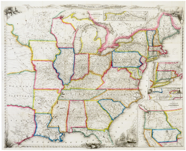
SMITH (John Calvin).
A new map for travelers through the United States of America showing the railroads, canals & stage roads, with the distances.
New York, Sherman & Smith, 1852. 550 x 685 mm, sur papier fin.
Referentie van de boekhandelaar : LBW-6388
|
|
|
Smith Jack H.
Old New York in the Picture Poscards 1900-1945
Vestal Press 1999 In-4 broché 27,5 cm sur 20,5. Livre en anglais. 207 pages. Très bon état d’occasion.
Referentie van de boekhandelaar : 104692
|
|
|
SMITH WILLIAM
Voyages autour du Monde et dans les contrées les plus curieuses du Globe.
Depuis Christophe Colomb jusqu’à nos jours par les plus célèbres navigateurs, mis en ordre par WILLIAM SMITH.11 tomes sur 12 en 11 volumes sur 12. In 8 demi cuir vert à nerfs,titre,filets dorés,tranches jaspées,nombreuses gravures sur acier sous serpentes 9 cartes dépliantes. Au bureau de la publication sans date Tome I.363 pages.Introduction.Notice sur la vie de George Anson.Voyage autour du monde par Anson.Voyage autour du monde par le Commodore Byron.Voyage autour du monde par Bougainville.Frontispice,titre illustré et gravé,8 planches.Tome II.393 pages.Notice sur la vie du Capitaine Cook.Voyages du Capitaine Cook.9 Planches.Tome III.403 pages.Suite des Voyages du Capitaine Cook.Voyage au Pôle Austral et autour du monde.8 planches.2 cartes dépliantes Tome IV.396 pages.Suite des Voyages du Capitaine Cook. Troisième Voyage.8 planches plus 2 planches signalées dans le tome V par **.Tome V.396 pages.Suite des Voyages du Capitaine Cook.9 planches. Tome VI.388 pages.Notice sur la vie de La Pérouse.Voyage autour du monde par La Pérouse. Voyage de découvertes aux Terres Australes exécuté par le Capitaine Baudin. Voyage autour du monde de la Corvette L’uranie,commandé par M. Louis de Freycinet.Voyage autour du monde de la Corvette La Coquille commandé par M. Duperrey. Voyage de la Corvette Lastrolabe commandée par M. Dumont d’Urville. Expédition de Lastrolabe et de La Zélée par M. Dumont d’Urville.8 planches.(Il manque 1 planche en regard de la page 27).Tome VIII.441 pages.Précis historique.Voyages en Afrique par F.Le Vaillant.Second voyage de Le Vaillant en Afrique.8 planches.Tome IX.438 pages.Voyage dans l’intérieur de l’Afrique par Mungo-Park. Second voyage de Mungo-Park dans l’intérieur de l’Afrique. Voyage à Temboctou et à Jenné dans l’Afrique Centrale par René Caillé.Voyage en Afrique effectué dans le but d’explorer le cours et l’embouchure du Niger par Richard et John Lander.8 planches.Tome X.439 pages Voyage en Perse par Chardin.Voyage aux Indes Orientales d’après Miss Graham, Heber Skinner,etc.8 Planches.Tome XI.412 pages.Voyage en Chine et en Tartarie par Lord Macartney,Ambassadeur du Roi d’Angleterre.Voyage au Mont Caucase par Klaproth.Voyage en Egypte et en Arabie par Niéburth suivi dune description de l’Arabie d’après les voyages modernes de Burckardt,Rupell et Léon de Laborde.Voyage de Saint Peters Bourg Tauris par Kotzbue.8 planches.Et 2 cartes dépliantes Tome XII.400 pages. Notice sur la vie de Christophe Colomb.Voyages de Christophe Colomb.Conquête du Mexique par Fernand Cortez. Conquête du Pérou par Pizzare.Voyage aux Etats-Unis de l’Amérique Septentrionale d’après Basil-Hall,Levasseur et Georges De Beaumont.Voyage dans l’Amérique Septentrionale et particulièrement dans les territoires de la Floride,du Ouisconsin et au Canada par le Comte de Castelnau.Voyage au Pôle Nord et aux Régions Artiques par le Capitaine Ross. Voyage en Grèce et à Constantinople par F.C.H.Pouqueville. 8 planches.2 cartes dépliantes.Rousseurs éparses habituelles Assez bon état d’ensemble
Referentie van de boekhandelaar : 4650
|
|
|
SMITH John Spencer
Whist, traité méthodique des règles, maximes et calculs de ce jeu, tirés des meilleures autorités anglaises, tant de la vieille école de Hoyle que de la nouvelle de Mathews. Suivi d'observations sur le nouveau jeu de Petit-Whist. Troisième édition
Caen Hardel 1838 in-18 br., couv. impr
Referentie van de boekhandelaar : 11254
|
|
|
SMITH John Spencer
Whist. Traité méthodique des règles, maximes et calculs de ce jeu, tirés des meilleures autorités anglaises, tant de la vieille école de Hoyle que de la nouvelle de Mathews. Suivi d'observations sur le nouveau jeu de petit-whist, compilé et traduit de l'anglais. Troisième édition
Caen A. Hardel 1838 in-18 demi-basane bouteille, dos lisse orné de filets et fleurons dorés, tranches mouchetées [Rel. de l'époque]
Referentie van de boekhandelaar : 24869
|
|
|
Smith, Dan
The State of the World Atlas
No marks or inscriptions. No creasing to covers or to spine. A very clean very tight copy with bright unmarked boards and no bumping to corners. 144pp. The state of the world country by country very well presented pictorially and in text.

|
|
|
Smith, George Adam.
THE HISTORICAL GEOGRAPHY OF THE HOLY LAND. Especially In Relation To The History Of Israel And Of The Early Church. With Six Maps. Fifteenth Edition.
pp. xxvii, 713 + Four color folding maps and one full page monochrome map. The 'General Map of Palestine' usually in a rear pocket does not seem to be present here. Stamped ownership of Nelson R. Sulouff, Scotland, on title page. Small 4to. Original full green cloth binding. Spine repaired with clear tape. Fifteenth edition. Maps in nice condition. Hardbound. Good. **PRICE JUST REDUCED! RELIGION BOX 4
|
|
|
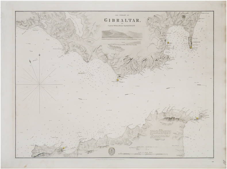
SMYTH (William Henry).
[DÉTROIT de GIBRALTAR] The strait of Gibraltar.
London, Hydrographical Office of the Admiralty, 1833. 445 x 592 mm.
Referentie van de boekhandelaar : LBW-8936
|
|
|

 De zoekresultaten per email ontvangen
 Zoekresultaten downloaden als PDF
 RSS feed
 Permanente link


