|
LACROIX (E.).
[CHARENTE-MARITIME] France communale & cantonale. Dép.t de la Charente-Inférieure. Arrondissement de Saintes. Atlas du canton de Burie.
Paris, Imprimerie Lithographique P. Dupont, 1853. In-folio ; titre imprimé sur le premier plat (cartonnage de l'éditeur).
Referentie van de boekhandelaar : LBW-8702

|
|
|
LACROIX (E.).
[CHARENTE-MARITIME] France communale & cantonale. Dép.t de la Charente-Inférieure. Arrondissement de Saintes. Atlas du canton de Pons.
Paris, Imprimerie Lithographique P. Dupont, 1854. In-folio ; titre imprimé sur le premier plat (cartonnage de l'éditeur).
Referentie van de boekhandelaar : LBW-8683

|
|
|
LACROIX Louis
les écraseurs de crabes sur les derniers voiliers caboteurs.
Préface du capitaine A. MARCHAANDEAU. In 8 broché, couverture illustrée, faux-titre, titre, 348 pages, annexe XXXVI- illustrations photos hors-texte, 2 cartes dépliantes en fin de volume. Aux portes du large- Nantes 1947. Edition originale, envoi manuscrit autographe de l’auteur.
Referentie van de boekhandelaar : 11770

|
|
|
LACROIX Louis; MARCHANDEAU Capitaine A. (préf.):
Les écraseurs de crabes sur les Derniers Voiliers Caboteurs.
Nantes, Aux portes du large, 1947. In-8 broché de 348-XXXVI pages, couverture illustrée. Belle condition.
Referentie van de boekhandelaar : 2380

|
|
|
LACROIX Paul, Conservateur de la Bibliothèque National de l'Arsenal - (Pseudonyme "Bibliophile Jacob") .
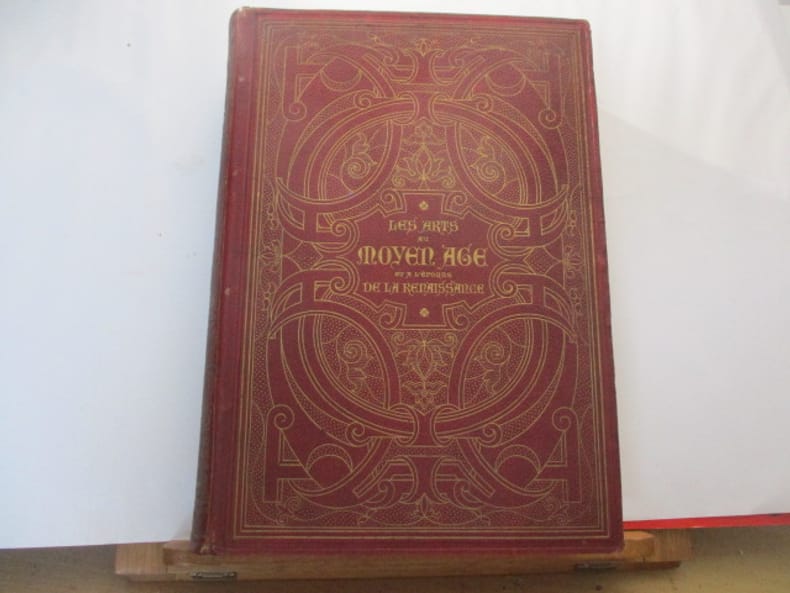
LES ARTS AU MOYEN-AGE ET A L'EPOQUE DE LA RENAISSANCE
PARIS, Firmin-Didot Frères, Fils & Cie - 1869 - Grand In-4° - Reliure polychrome ornée de l'éditeur -(frottée) Dos lisse orné de caissons ornés - Toutes tranches dorées - Ouvrage illustré de 19 planches chromolithographiques exécutées par F. KELLERHOVEN et de 400 gravures sur bois - légères rousseurs - 548 pages - bon exemplaire.
Referentie van de boekhandelaar : 669
|
|
|
LACROIX Paul, Conservateur de la Bibliothèque National de l'Arsenal - (Pseudonyme "Bibliophile Jacob") .
LES ARTS AU MOYEN-AGE ET A L'EPOQUE DE LA RENAISSANCE
PARIS, Firmin-Didot Frères, Fils & Cie - 1869 - Grand In-4° - Reliure polychrome ornée de l'éditeur -(frottée) Dos lisse orné de caissons ornés - Toutes tranches dorées - Ouvrage illustré de 19 planches chromolithographiques exécutées par F. KELLERHOVEN et de 400 gravures sur bois - légères rousseurs - 548 pages - bon exemplaire.
|
|
|
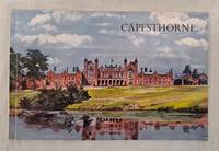
Lady Bromley Davenport; edited Charles H Wood; front cover painting by Patrick Horsbrugh; maps by C H Brown
Capesthorne An Illustrated Survey of the Cheshire Home of the Bromley-Davenport Family History and description of contents
Designed and Produced by English Life Publications; printed by Wood Mitchell & Co. Ltd Hanley Derby 1959. Early Edition. Softcover. Very Good Condition. Illustrated covers plain white spine. 32 pages. Crisp clean covers sound binding clean pages and inside covers. Contains many black and white illustrations. Undated by publisher. Dated by reference to COPAC/Library Hub Discover. Quantity Available: 1. Shipped Weight: under 1 kg. Pictures of this item not already displayed here available upon request. Inventory No: 51222041198. All our books music and maps are sent by a tracked mail service. Designed and Produced by English Life Publications; printed by Wood Mitchell & Co. Ltd, Hanley paperback
Referentie van de boekhandelaar : 51222041198
|
|
|
LAFFON Caroline & Martine
Dessiner le monde : histoires de géographie.
Le Grand Livre du Mois, sans date, 187 p., cartonnage sous jaquette oblong, environ 26x30cm, bon état.
Referentie van de boekhandelaar : 105325
|
|
|
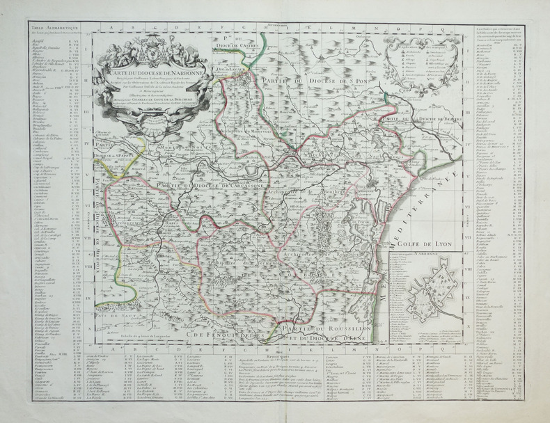
LAFONT (Guillaume) & L'ISLE (Guillaume de).
[NARBONNE] Carte du diocèse de Narbonne.
Paris, G. de l'Isle, 1704. 460 x 602 mm.
Referentie van de boekhandelaar : LBW-1897
|
|
|
LAFRERI Antonio (Orgelet 1512 - Roma 1577)
Rome, Ville tres fameuse…
Rarissima ristampa della lastra anonima - attribuita ad Antonio Lafreri e databile al 1555/60. Esemplare nel terzo stato di quattro descritto e illustrato in Bifolco-Ronca, pagina 2377.In alto a sinistra l’iscrizione Urbis Rome totius olim orbis domitricis, situs: cum adhuc extantibus, sacrosancte vetustatis monumentis PIRRHO LIGORIO NEAP. INVENTOR. Orientazione nei quattro lati al centro con il nome dei punti cardinali SEPTENTRIO, MERIDIES, ORIENS, OCCIDENS, il nord a sinistra.Anonima pianta prospettica della città, basata sulla pianta di Pirro Ligorio, edita da Michele Tramezzini nel 1552. La pianta è inserita in alcuni esemplari dello Speculum Romanae Magnificentiae di Antonio Lafreri, al quale pertanto viene attribuita. Il grande interesse storico di questa pianta non è dato dall’opera stessa, una semplice copia del lavoro del Ligorio, ma è rappresentato dalle tirature successive di questa lastra. Il secondo stato, databile alla seconda metà del XVII secolo, è completamente emendato ed arricchito da toponomastica in lingua francese. Viene inserita anche una lunga descrizione della città, sempre in lingua francese. E’ noto che, alla morte di Antonio Lafreri (1577), i due terzi delle lastre furono divisi tra i nipoti Stefano e Claudio Duchetti. Il restante terzo venne suddiviso tra più editori. Questa lastra quindi potrebbe avere preso la via di Parigi, dove venne ristampata circa un secolo dopo. In alternativa la carta potrebbe essere stampata Roma ed emendata in lingua francese. Tale edizione viene descritta da Hülsen (1915), che la annovera tra le “Copie e ristampe”, come "Incisa nel sec. XVII ex.ovvero XVIII. Ne vidi una copia presso il sig. Lang nel 1914" (la libreria antiquaria Lang di Roma). Un altro esemplare, che tuttavia potrebbe essere lo stesso citato da Hülsen, è descritto nella biblioteca della British School of Rome, appartenuto alla celebre collezione di Thomas Ashby (1874-1931), direttore dell’accademia dal 1906 al 1925. Sempre Hülsen cataloga lo stato finale dell’opera, con l’indirizzo dell’editore francese Francois Jollain. Acquaforte e bulino, stampata su carta vergata coeva, in ottimo stato di conservazione. Bibliografia Bifolco-Ronca, Cartografia e topografia italiana del XVI secolo (2018): pp. 2376-77, tav. 1123, III/IV; Frutaz (1962): n. XVI e tav. 25; Hülsen (1915): II, p. 42, n. 11 e p. 43, nn. 13-14; Karrow (1993): n. 51/1.1; Marigliani (2007): n. 36; Marigliani (2016): n. XI.5. A very rare map of the city, published in Paris in the mid-seventeenth century using the plate made in Rome by Antonio Lafreri.Example of the third state of four.The map is based on that of Pirro Ligorio, 1552, edited by Michele Tramezini in Rome, and its subsequent and numerous variants.The only example known today of this map is in the library of the British School of Rome, belonged to the famous collection of Thomas Ashby (1874-1931), director of the British School at Rome from 1906 to 1925.For the stile of type this work can be attributed to the French publisher Francois Jollain. The plate appears to be yet more ancient, even '500, to which were added numerous inscriptions in French, starting from the extensive description in the bottom right corner.Copper engraving, perfect condition. An extremely rare work.LiteratureBifolco-Ronca, Cartografia e topografia italiana del XVI secolo (2018): pp. 2376-77, tav. 1123, III/IV;Frutaz (1962): n. XVI e tav. 25; Hülsen (1915): II, p. 42, n. 11 e p. 43, nn. 13-14; Karrow (1993): n. 51/1.1; Marigliani (2007): n. 36; Marigliani (2016): n. XI.5. Frutaz (1962): n. XVI e tav. 25; Hülsen (1915): II, p. 42, n. 11 e p. 43, nn. 13-14; Karrow (1993): n. 51/1.1; Marigliani (2007): n. 36; Marigliani (2016): n. XI.5. DI ROMA DAL 1551 AL 1748, (1915) 43e.

|
|
|
LAFRERI Antonio (Orgelet 1512 - Roma 1577)
Urbis Rome, totius olim orbis dominitricis, situs: cum adhuit extantibus, sacrosancte…
Rarissima ristampa della lastra anonima - attribuita ad Antonio Lafreri, databile al 1555/60. Esemplare nel quarto stato di quattro descritto in Bifolco-Ronca, pagina 2377, con l'indirizzo di Jollain. In alto a sinistra l’iscrizione Urbis Rome totius olim orbis domitricis, situs: cum adhuc extantibus, sacrosancte vetustatis monumentis PIRRHO LIGORIO NEAP. INVENTOR. Orientazione nei quattro lati al centro con il nome dei punti cardinali SEPTENTRIO, MERIDIES, ORIENS, OCCIDENS, il nord a sinistra. Anonima pianta prospettica della città, basata sulla pianta di Pirro Ligorio, edita da Michele Tramezzini nel 1552. La pianta è inserita in alcuni esemplari dello Speculum Romanae Magnificentiae di Antonio Lafreri, al quale, pertanto, viene attribuita. Il grande interesse storico di questa pianta non è dato dall’opera stessa, una semplice copia del lavoro del Ligorio, ma è rappresentato dalle tirature successive di questa lastra. Il secondo stato, databile alla seconda metà del XVII secolo, è completamente emendato ed arricchito da toponomastica in lingua francese. Viene inserita anche una lunga descrizione della città, sempre in lingua francese. Alla morte di Antonio Lafreri (1577), i due terzi delle lastre furono divisi tra i nipoti Stefano e Claudio Duchetti. Il restante terzo venne suddiviso tra più editori. Questa lastra, quindi, potrebbe avere preso la via di Parigi, dove venne ristampata circa un secolo dopo. In alternativa, la carta potrebbe essere stampata Roma ed emendata in lingua francese. Tale edizione viene descritta da Hülsen (1915), che la annovera tra le “Copie e ristampe”, come "Incisa nel sec. XVII ex.ovvero XVIII. Ne vidi una copia presso il sig. Lang nel 1914" (la libreria antiquaria Lang di Roma). Un altro esemplare, che tuttavia potrebbe essere lo stesso citato da Hülsen, è descritto nella biblioteca della British School of Rome, appartenuto alla celebre collezione di Thomas Ashby (1874-1931), direttore dell’accademia dal 1906 al 1925. Sempre Hülsen cataloga lo stato finale dell’opera, con l’indirizzo dell’editore francese Francois Jollain. L’opera appartiene allo Speculum Romanae Magnificentiae, la prima iconografia della Roma antica. Lo Speculum ebbe origine nelle attività editoriali di Antonio Salamanca e Antonio Lafreri (Lafrery). Durante la loro carriera editoriale romana, i due editori - che hanno lavorato insieme tra il 1553 e il 1563 - hanno avviato la produzione di stampe di architettura, statuaria e vedutistica della città legate alla Roma antica e moderna. Le stampe potevano essere acquistate individualmente da turisti e collezionisti, ma venivano anche acquistate in gruppi più grandi che erano spesso legati insieme in un album. Nel 1573, Lafreri commissionò a questo scopo un frontespizio, dove compare per la prima volta il titolo Speculum Romanae Magnificentiae. Alla morte di Lafreri, due terzi delle lastre di rame esistenti andarono alla famiglia Duchetti (Claudio e Stefano), mentre un altro terzo fu distribuito tra diversi editori. Claudio Duchetti continuò l’attività editoriale, implementando le lastre dello Speculum con copie di quelle “perdute” nella divisione ereditaria, che fece incidere al milanese Amborgio Brambilla. Alla morte di Claudio (1585) le lastre furono cedute – dopo un breve periodo di pubblicazione degli eredi, in particolare nella figura di Giacomo Gherardi - a Giovanni Orlandi, che nel 1614 vendette la sua tipografia al fiammingo Hendrick van Schoel. Stefano Duchetti, al contrario, cedette le proprie matrici all’editore Paolo Graziani, che si associò con Pietro de Nobili; il fondo confluì nella tipografia De Rossi passando per le mani di editori come Marcello Clodio, Claudio Arbotti e Giovan Battista de Cavalleris. Il restante terzo di matrici della divisione Lafreri fu suddiviso e scisso tra diversi editori, in parte anche francesi: curioso vedere come alcune tavole vengano ristampate a Parigi da Francois Jollain alla m... A very rare map of the city, published in Paris in the mid-seventeenth century using the plate made in Rome by Antonio Lafreri. Example of the fourth state of four, with the Jollain's imprint. The map is based on that of Pirro Ligorio, 1552, edited by Michele Tramezini in Rome, and its subsequent and numerous variants. In the upper left the inscription Urbis Rome totius olim orbis domitricis, situs: cum adhuc extantibus, sacrosancte vetustatis monumentis PIRRHO LIGORIO NEAP. INVENTOR. Orientation in the four sides to the center with the name of the cardinal points SEPTENTRIO, MERIDIES, ORIENS, OCCIDENS, the north on the left. Anonymous map of the city, based on the work byPirro Ligorio, published by Michele Tramezzini in 1552. The ma is inserted in some of the Speculum Romanae Magnificentiae of Antonio Lafreri, to which therefore it is attributed. The great historical interest of this map is not given by the work itself, a simple copy of Ligorio's work, but is represented by the subsequent issues of this plate. The second state, datable to the second half of the seventeenth century, is completely amended and enriched by toponymy in French. A long description of the city is also included, again in French. It is known that, at the death of Antonio Lafreri (1577), two thirds of the plates were divided between his nephews Stefano and Claudio Duchetti. The remaining third was divided among several publishers. This plate therefore may have taken the road to Paris, where it was reprinted about a century later. This edition is described by Hülsen (1915), who lists it among the "Copies and reprints", as "Engraved in the seventeenth century ex.ovvero XVIII. According with Bifolco-Ronca this is the final state of the work, with the address of the French publisher Francois Jollain. The work belongs to the Speculum Romanae Magnificentiae, the earliest iconography of ancient Rome. The Speculum originated in the publishing activities of Antonio Salamanca and Antonio Lafreri (Lafrery). During their Roman publishing careers, the two editors-who worked together between 1553 and 1563-started the production of prints of architecture, statuary, and city views related to ancient and modern Rome. The prints could be purchased individually by tourists and collectors, but they were also purchased in larger groups that were often bound together in an album. In 1573, Lafreri commissioned a frontispiece for this purpose, where the title Speculum Romanae Magnificentiae appears for the first time. Upon Lafreri's death, two-thirds of the existing copperplates went to the Duchetti family (Claudio and Stefano), while another third was distributed among several publishers. Claudio Duchetti continued the publishing activity, implementing the Speculum plates with copies of those "lost" in the hereditary division, which he had engraved by the Milanese Amborgio Brambilla. Upon Claudio's death (1585) the plates were sold - after a brief period of publication by the heirs, particularly in the figure of Giacomo Gherardi - to Giovanni Orlandi, who in 1614 sold his printing house to the Flemish publisher Hendrick van Schoel. Stefano Duchetti, on the other hand, sold his own plates to the publisher Paolo Graziani, who partnered with Pietro de Nobili; the stock flowed into the De Rossi typography passing through the hands of publishers such as Marcello Clodio, Claudio Arbotti and Giovan Battista de Cavalleris. The remaining third of plates in the Lafreri division was divided and split among different publishers, some of them French: curious to see how some plates were reprinted in Paris by Francois Jollain in the mid-17th century. Different way had some plates printed by Antonio Salamanca in his early period; through his son Francesco, they goes to Nicolas van Aelst's. Other editors who contributed to the Speculum were the brothers Michele and Francesco Tramezzino (authors of numerous plates that flowed in part to the Lafreri printing house), Tommaso Barlacchi,...

|
|
|
LAGIER-FORNERY
Plan de la Ville & du Territoire d'Avignon avec les Sections cadastrales, Clos, Quartiers, Campagnes, chemins de fer, gares, cours d'eau et pays environnants dressé par Lagier-Fornery lithographe.
Avignon Lagier-Fornery 1879 540 x 710 mm 1 feuille
Referentie van de boekhandelaar : 17343
|
|
|
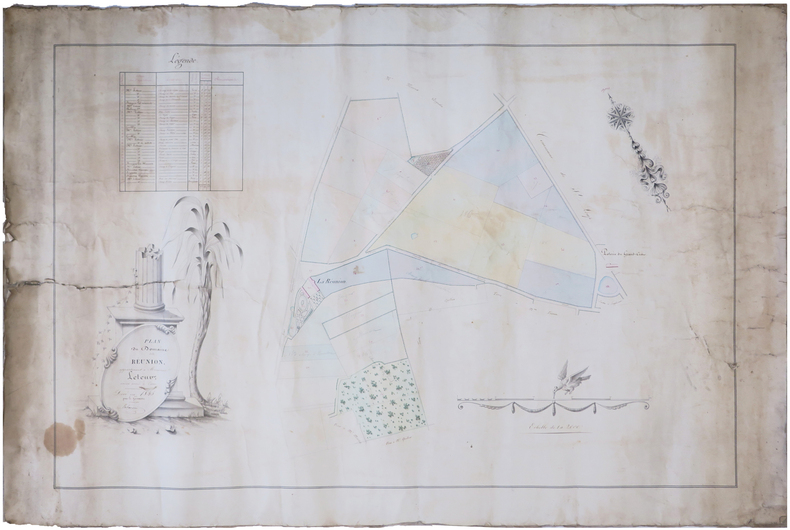
LAHAUSSOIS.
[NIÈVRE] Plan du domaine de la Réunion, appartenant à Monsieur Leteur, ancien avoué à Cosne.
1845. 57,5 x 89 cm, montée sur toile.
Referentie van de boekhandelaar : LBW-7477
|
|
|
LAHURE Charles
le whist à trois ou mort
in 12 pleine toile bleue d’éditeur,titre en noir au dos, en long et sur le premier plat avec un triple filet noir en encadrement.Faux-titre,titre en noir et rouge 76 pages avec illustrations dans le texte et hors-texte,à la suite 10 problèmes avec leurs solutions,1 feuillet de table,204 pages au total.A.Lahure éditeur 1886
Referentie van de boekhandelaar : 6762
|
|
|
LAIGLE
Carte couleurs au 1/100 000?me. Feuille XIII-13.
Une feuille 57x45 cm.
|
|
|
Laishley, A. L.
The City of York
Name to top of title page. No other marks or inscriptions. No creasing to covers. A very clean very tight booklet with bright unmarked boards, minor traces of storage and no bumping to corners. 32pp. Illustrated guide to York. Tucked in are two copies of a town plan and things to do leaflet. Undated ca 1960s.

|
|
|
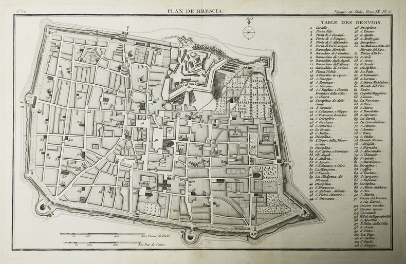
LALANDE (Joseph-Jérome Le François de).
[BRESCIA] Plan de Brescia.
[Paris, 1786]. 227 x 359 mm.
Referentie van de boekhandelaar : LBW-3486
|
|
|
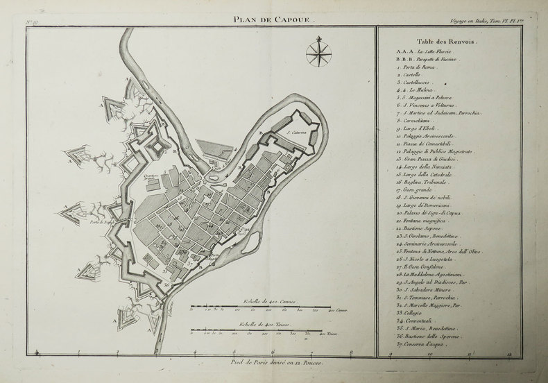
LALANDE (Joseph-Jérome Le François de).
[CAPOUE] Plan de Capoue.
[Paris, 1786]. 236 x 338 mm.
Referentie van de boekhandelaar : LBW-3481
|
|
|
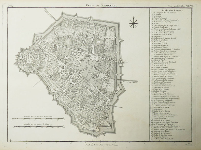
LALANDE (Joseph-Jérome Le François de).
[FERRARE] Plan de Ferrare.
[Paris, 1786]. 259 x 333 mm.
Referentie van de boekhandelaar : LBW-3483
|
|
|
LALICKI, TOM with original maps by CAIN, DAVID
GRIERSON'S RAID - A DARING CAVALRY STRIKE THROUGH THE HEART OF THE CONFEDERACY
Farrar Straus Giroux New York 2004. 200 pp including index b&w photographic and line illustrations surface damage to paste-downs else very good copy in fine illustrated d/j. Farrar Straus Giroux, New York, 2004 unknown
Referentie van de boekhandelaar : 196541
|
|
|
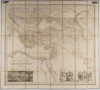
LALLEMAND, ADRIEN TOUSSAINT.
Carte du Théâtre de La Guerre dans L'Empire Ottoman donnant une grande partie des Empires de Russie d.Autriche et de Perse; des Provinces et des Mers ou passent les operations Militaires.
Paris.: Ministère d'Etampes et de Géographies. 1853. Engraved map with outline hand colour 67.2 x 75.1 cm sectioned and linen-backed two large vignettes: a view of Constantinople; and costumed Turks and European soldiers facing off across a stream the linen browned with some loss but not affecting the map with the fine nineteenth century label of Charles Delarue & Hivert on the verso. Fine map with beautiful vignettes by Adrien Toussaint Lallemand 1793 - c.1856 geographer and engraver at the Depôt de la Guerre. Lallemand was appointed at a precociously young age and later set up in business on his own the quality of his work assuring him of the continued business of the Depôt. <br> <br>Highly attractive map of the Ottoman Empire published at the outset time of the Crimean War 1853-1856. <br> <br>This item is held off-site. Please note there may be a few days delay while it is brought into our shop for viewing or mailing to you. Thank you for your understanding. . Ministère d'Etampes et de Géographies unknown
Referentie van de boekhandelaar : 176118
|
|
|
Lalobbe, E. de :
Cours de topographie élémentaire à l'usage des officiers de l'Armée.
Paris, J.Dumaine, (Versailles, Beau jeune), 1856 ; in-12, broché ; XVIII, 285, (1) pp., (1) f. d'errata ; 8 planches lithographiées dépliantes hors-texte.
Referentie van de boekhandelaar : 6966
|
|
|
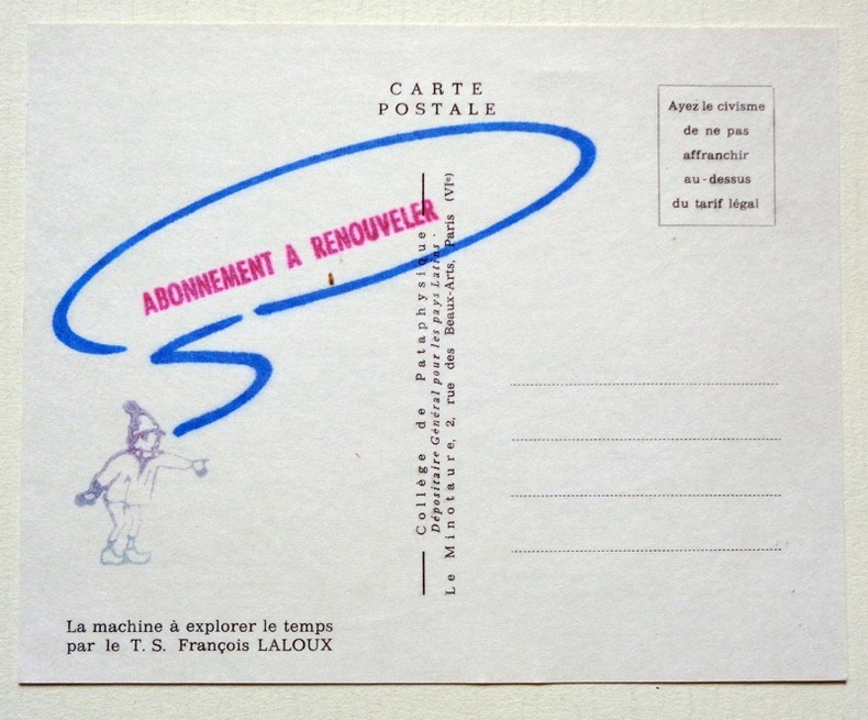
Laloux François:
La machine à explorer le temps.
Collège de Pataphysique. 1989. Carte postale au format 15 x 12 cm., au recto la composition de Laloux, au verso, un tampon appelant au renouvellement de l'abonnement.
Referentie van de boekhandelaar : 4912
|
|
|
LAMANDÉ (François Laurent).
[LE HAVRE] Plan du Havre avec le projet des ouvrages pour l'amélioration du port et l'agrandissement de la ville proposé par les ingénieurs des Ponts et Chaussées et approuvé le 2 février 1787. Ce projet est celui qu'on exécute.
1787. 565 x 843 mm ; contrecollé sur carton fin.
Referentie van de boekhandelaar : LBW-8608

|
|
|
Lamb, Harold & Maps On End Papers
The March of Muscovy Ivan the Terrible and the Growth of the Russian Empire 1400-1648
Doubleday. Good with no dust jacket. 1948. Hardcover. 309 pages; Copyright page does not state edition or printing. Likely 1st edition judging from date. Foxing heavy to the exterior edge of pages only. Yellowing to pages. Otherwise in good condition. No writing or major blemishes. ; - We're committed to your satisfaction. We offer free returns and respond promptly to all inquiries. Your item will be carefully wrapped in bubble wrap and securely boxed. All orders ship on the same or next business day. Buy with confidence. . Doubleday hardcover
Referentie van de boekhandelaar : TOB217-32701-A-0.50
|
|
|
LAMBERT J. (Ingénieur des Ponts-et-Chaussées)
CARTE ROUTIERE ET VELOCIPEDIQUE DU DEPARTEMENT DES ARDENNES ET PLANS DE VILLES DE MEZIERES, SEDAN ET RETHEL
Reims Matot-Braine - Henri Matot et Fils Successeur 1899 -in-12 carte papier en couleurs (map in paper in colours) coupée en 2 - repliée sous une chemise rouge imprimée - éditeur in-octavo (folding under editor jacket), dimensions (size in Inches) : 49 centimètres de largeur (width : 19,29) sur 60 de hauteur (height : 23,62), petites déchirures aux plis (small tears with the folds), dressée par Lambert, 1899 à Reims Matot-Braine - Henri Matot et Fils Successeur Imprimeurs Libraires Editeurs,
Referentie van de boekhandelaar : 1686
|
|
|
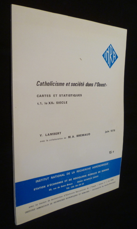
Lambert Yves
Catholicisme et société dans l'Ouest: cartes et statistiques (t.1, le XXe siècle)
INRA Revue en brochure d'éditeur 1979 In-4 (21 x 30 cm.), revue brochée, 51 pages, cartes et figures en noir in-texte ; menus incidents aux plats, bon état. Livraison a domicile (La Poste) ou en Mondial Relay sur simple demande.
Referentie van de boekhandelaar : cg81
|
|
|
LAMORLETTE L. (Dir.) Nombreuses cartes et illustrations.
L'Europe. Géographie en 2 volumes.
Couverture rigide. 2 volumes, reliure de l'éditeur. 856 pages. 25 x 32 cm.
Referentie van de boekhandelaar : 48584
|
|
|
LAMORLETTE L. (Dir.) Nombreuses cartes et illustrations.
La France. Géographie en 2 volumes.
Couverture rigide. 2 volumes, reliure de l'éditeur. 855 pages. 25 x 32 cm.
Referentie van de boekhandelaar : 48583
|
|
|
LAMOTHE. MANUSCRIT.
Profil du bastion royal de Péronne par Lamothe de Lamyre mousquetairedu roy commis par S.M. à la conduitte et direction des fortifications de Picardie et de Haynault.
[circa 1660]. En deux feuilles jointes de 390 x 586 mm.
Referentie van de boekhandelaar : LBW-4146

|
|
|
Lamoureux Sophie
Comment parler de l'Europe aux enfants
Le baron perché Editions 2013 13 4x1x21 8cm. 2013. Broché.
Referentie van de boekhandelaar : 500059367

|
|
|
Lamoureux Sophie
Comment parler de l'Europe aux enfants
Le baron perché Editions 2013 13 4x1x21 8cm. 2013. Broché.
Referentie van de boekhandelaar : 500077119

|
|
|
Lamoureux Sophie
Comment parler de l'Europe aux enfants
Le baron perché Editions 2013 13 4x1x21 8cm. 2013. Broché.
Referentie van de boekhandelaar : 500072454

|
|
|
Lamoureux Sophie
Comment parler de l'Europe aux enfants
Le baron perché Editions 2013 13 4x1x21 8cm. 2013. Broché.
Referentie van de boekhandelaar : 500072485

|
|
|
Lamoureux Sophie
Comment parler de l'Europe aux enfants
Le baron perché Editions 2013 13 4x1x21 8cm. 2013. Broché.
Referentie van de boekhandelaar : 500072622

|
|
|
Lamoureux Sophie
Comment parler de l'Europe aux enfants
Le baron perché Editions 2013 13 4x1x21 8cm. 2013. Broché.
Referentie van de boekhandelaar : 500075463

|
|
|
Lamoureux Sophie
Comment parler de l'Europe aux enfants
Le baron perché Editions 2013 13 4x1x21 8cm. 2013. Broché.
Referentie van de boekhandelaar : 500094707

|
|
|
Lamoureux Sophie
Comment parler de l'Europe aux enfants
Le baron perché Editions 2013 13 4x1x21 8cm. 2013. Broché.
Referentie van de boekhandelaar : 500096904

|
|
|
LAN Louis
PLAN TOPOGRAPHIQUE DE LA COMMUNE DE MARSEILLE et des Communes environnantes. Echelle en mètres 1 à 20000.
Paris Erhard sans date vers 1879. TRES GRAND ET BEAU PLAN en couleurs entoilé mesurant 1 mètre 48 et demi en hauteur et 1 mètre 68 et demi de largeur, divisé en 4 segments se rejoignant parfaitement et se pliant plusieurs fois; ensemble sous étui cartonné spécial avec une pièce de titre rouge sur le dos (18,5cm en hauteur sur 13,5cm de largeur). Un liséré noir indique les limites des communes dépendant de l'arrondissement de Marseille; un autre, de couleur verte, indique la limite des communes dépendant d'Aix-en-Provence; les chiffres rapportés sur le plan signalent les hauteurs au-dessus du niveau de la mer. Bordures de l'étui fendues et manques sur la pièce de titre sans perte de lettres. Schéma de montage de la carte sur le dos toilé, écrit à l'époque au crayon bleu "ville sud", ville nord", Allauch-Aubagne", "Cassis-La Ciotat". PLAN FRAIS COMPLET ET EN TRES BON ETAT.
Referentie van de boekhandelaar : GITk554

|
|
|
Landeshut (Schlesien):
Landeshut. Schlesien. "Plan der Action welche d. 23. Juny 1760 zwischen einem Corps der Kayserlich Königlich Ungarischen und einem Corps der Königlich Preussischen Armee bei Landeshutte in Schlesien vorgefallen". Schlachtenplan von Landshut/Schlesien. Kupferstich mit farbigen Truppenaufstellungen aus "Neues Kriegs-Theater ...", No. 28.
Format: 18 x 29,5 cm. *Leicht gebräunt, insgesamt gut erhalten. Landkarten de
|
|
|
Lands, Neil
Visitor's Guide to the Dordogne
Book appears unread in virtually mint condition. 160pp. Travel guide to the Dordogne region of France.

|
|
|
Landshut (Schlesien):
"Plan der Action welche d. 23. Juny 1760 zwischen den Kayserl. Königl. General Feld Zeugmeister Freyherr von Laudon und den Königl. Preussischen General von Fouquet. Schlachtplan, teilkolorierter Kupferstich.
Format: 17,5 x 30,5 cm. *Ränder gebräunt, insgesamt gut erhalten. Landkarten de
|
|
|
LANGDON-DAVIES, John:
The Armada. A collection of contemporary documents. Jackdaw N° 5.
London, Jonathan Cape, 1964, in-4to, 10 loosely inserted documents (maps, portraits, engravings, broadsheets), orig. illustr. portfolio
Referentie van de boekhandelaar : 94064aaf

|
|
|
LANGLOIS (Achille).
[SAÔNE-et-LOIRE] Nouvelle carte commerciale du département de Saône et Loire dressée d'après les cartes du Dépôt de la Guerre.
Paris, A. Logerot, et Chalon sur Saône, L. Boyer, [1856]. En 32 sections montées sur toile et repliées, formant une carte de 0,87 x 1,07 m ; étiquette au dos de l'Atelier de Collage de Cartes Géographiques, Tableaux etc d'Auguste Logerot à Paris.
Referentie van de boekhandelaar : LBW-9018

|
|
|
LANGLOIS (Nicolas).
[POSTES] Carte générale de toute les poste et traverse de France.
Paris, N. Langlois, [circa 1670]. 400 x 528 mm.
Referentie van de boekhandelaar : LBW-7365

|
|
|
LANGRES
Carte au 1/200 000e. Sans date.
Une feuille 32x50 cm.
|
|
|
LANIER L.
L'Europe ( Sans La France ) : Choix De Lectures De Géographie
Paris Belin Frères 1888 In-12 Fort VIII+992 pp, (.) accompagnées de résumés, d'analyses, de notes explicatives et bibliographiques et ornées de 44 vignettes, de 10 cartes tirées en couleur et de 53 cartes intercalées dans le texte ( dont certaines dépliantes ). 4ème édition, revue, corrigée et augmentée. Doubles filets et roulettes dorés au dos, reliure et cachets de bibliothèque. Fines épidermures sur les coiffes.
Referentie van de boekhandelaar : 14087
|
|
|
Lanier, Sidney]. Armes, Ethel. Maps and Line Drawings by Catherine Claiborne Armes
Stratford on the Potomac; and Address on Robert E. Lee by Sidney Lanier
Greenwich CT: William Alexander Jr. Chapter United Daughters of the Confederacy 1928. Stapled Wraps. Fair/No Jacket Paperback. Stapled in stiff card wrappers 40 pp. illus. Externally Fair only with extremities bumped wear at spine and edges wrappers stained mounted illustration missing from front cover. Interior clean and unmarked. Size: 8vo <br/> <br/> William Alexander, Jr. Chapter, United Daughters of the Confederacy paperback
Referentie van de boekhandelaar : 10859
|
|
|
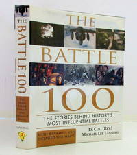
Lanning, Lt. Col. Michael Lee. Maps By Rosenburgh, Bob
The Battle 100: The Stories Behind History's Most Influential Battles
Naperville. Illinois: Sourcebooks Inc 2003. First Edition. Hardcover. Very Good/Fine. 8vo - over 7 - 9" tall. Sourcebooks Inc. 2003. First Edition. Hardcover Book in Very Good Condition. Fine Dust Jacket. With Rankings and Detailed Site Maps. Battle maps throughout. Black paper over boards with gilt titles to spine very clean slightly rubbed on lower edge else fine. Sewn binding tight and solid and square. Internals as new. Lanning ranks these battles according to their influence both immediate and long-term. Thought-provoking and controversial his rankings take us to the heart of the battles and their true greatness. For example: See why the battle of Leipzig was actually more important than Napoleon's defeat at Waterloo; Compare the influence of Antietam to the battles of Gettysburg and Vicksburg. 355 pages with Index and Bibliography. 9.5 x 87.25 inches. 2003 Sourcebooks Inc. Sourcebooks, Inc hardcover
Referentie van de boekhandelaar : 028920 ISBN : 1570717990 9781570717994
|
|
|
Lanzas, Pedro Torres
Relacion descriptiva de los Mapas, Planos, etc. De las antiguas audencias de Panama, Santa Fe y Quito.
Madrid, Revista de Arch. Bibl., y Museas 1904. In Spanisch.
Referentie van de boekhandelaar : BIBG0062
|
|
 De zoekresultaten per email ontvangen
 Zoekresultaten downloaden als PDF
 RSS feed


