|
TRACT]
La Voie inique.
Paris, le 8 février 1963, un feuillet in-4 (22 x 28 cm), imprimé au recto en noir sur papier jaune. Protestation bilingue contre les tractations menées par les ministres de l'Intérieur français et espagnol à propos du sort des membres de l'O.A.S. et des républicains espagnols en exil. "Il y a un précédent à ce marchandage dans l'histoire de ce pays, ce précédent s'appelle Pétain". Signatures de : Robert Benayoun, André Breton, Edouard Jaguer, André Pieyre de Mandiargues, José Pierre, Jean Schuster, etc.
书商的参考编号 : 38471
|
|
|
Tract
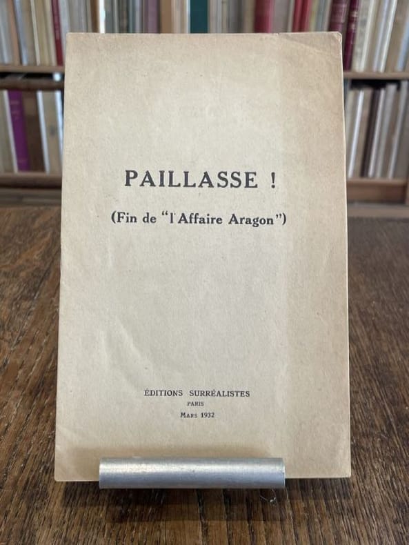
Paillasse ! (Fin de "l'Affaire Aragon").
Paris Editions surréalistes 1932 1 vol. broché plaquette in-8, agrafée, 11 pp. Édition originale. Contributions de René Char, René Crevel, Salvado Dali, Paul Eluard, Max Ernst, Benjamin Péret, Yves Tanguy, André Thirion et Tristan Tzara. Exemplaire provenant de la bibliothèque de Georges Bataille avec tampon à l'encre noire sur le premier feuillet "Bibliothèque de Georges Bataille". Légère marque d'insolation à la couverture.
书商的参考编号 : 104016
|
|
|
Tract
Paillasse ! (Fin de "l'Affaire Aragon").
Paris Editions surréalistes 1932 1 vol. broché plaquette in-8, agrafée, 11 pp. Édition originale. Contributions de René Char, René Crevel, Salvado Dali, Paul Eluard, Max Ernst, Benjamin Péret, Yves Tanguy, André Thirion et Tristan Tzara. Exemplaire provenant de la bibliothèque de Georges Bataille avec tampon à l'encre noire sur le premier feuillet "Bibliothèque de Georges Bataille". Légère marque d'insolation à la couverture.
书商的参考编号 : 104016
|
|
|
TRANCHANT Maurice
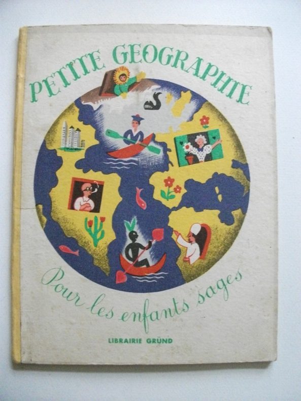
petite géographie pour tous les enfants sages
petit in 8 cartonné,dos pincé jaune,couverture illustrée en couleurs,titre illustré en couleurs 24 pages,20 charmantes illustrations en couleurs pleine page,ainsi qu’une double page de Maurice TRANCHANT Gründ éditeur 1947 Bon exemplaire,coloris frais
书商的参考编号 : 6237
|
|
|
Tract
Préallégation.
S.l.n.d. [1960] 1 vol. broché 1 feuillet in-4 imprimé en rose sur papier crème. Tract en marge de l'attribution du Prix des poètes, avec des textes par Désiré Nisard, Saint-John Perse, Rose P. Connolly. Document provenant de la bibliothèque de Georges Bataille avec tampon à l'encre noire sur le premier feuillet "Bibliothèque de Georges Bataille".
书商的参考编号 : 103932
|
|
|
Tract
Préallégation.
S.l.n.d. [1960] 1 vol. broché 1 feuillet in-4 imprimé en rose sur papier crème. Tract en marge de l'attribution du Prix des poètes, avec des textes par Désiré Nisard, Saint-John Perse, Rose P. Connolly. Document provenant de la bibliothèque de Georges Bataille avec tampon à l'encre noire sur le premier feuillet "Bibliothèque de Georges Bataille".
书商的参考编号 : 103932
|
|
|
TRACOL, Michel-André
Quand le Rhône... était un fleuve - Album de cartes postales, de photographies et de gravures composé et légendé par l'auteur
1980 Editions Michel-André Tracol - 1980 - In-4 à l'italienne, broché, sous jaquette illustrée - 142 pages - nombreuse iconographie
书商的参考编号 : 50107
|
|
|
Traduite en Francois, Avec des Notes Et des Cartes
Histoire Generale d'Espagne du P. Jean de Mariana de la Compagnie de Jesus Vol. 3
paperback. Good. Access codes and supplements are not guaranteed with used items. May be an ex-library book. paperback
书商的参考编号 : 0365078743.G ???????? : 0365078743 9780365078746
|
|
|
Traill, H. D.
ENGLAND, EGYPT, AND THE SUDAN.
242p + Plus three full page maps and a large folding map of the Nile Valley. Inked presentation to I. S. Beecher from Weston Fuller, Feb. 22nd, 1901. Foxed. Damp stained. 8vo. Original full red cloth binding, gold lettered. Top and bottom of spine chipped. Front cover slightly marred with white paint. First American Edition? AFRICA/6.
|
|
|
Trails Illustrated - National Geographic Maps
Mammoth Hots Springs - Yellowstone National Park NW Trails Illustrated Topographic Map #303
map. Good. Access codes and supplements are not guaranteed with used items. May be an ex-library book. unknown
书商的参考编号 : 1566953049.G ???????? : 1566953049 9781566953047
|
|
|
Trakker Maps Inc [Editor]
Union/Hudson/Essex Counties Atlas
Hagstrom Map Co 2000-01-28. paperback. New. In shrink wrap. Looks like an interesting title! Hagstrom Map Co paperback
书商的参考编号 : Q-0880976403 ???????? : 0880976403 9780880976404
|
|
|
TRAMEZINO o TRAMEZINI Francesco & Michele
Anteiquae Urbis Imago Accuratissime ex Vetusteis Monumenteis Formata
Pianta archeologica a proiezione verticale, con rappresentazione in alzato degli edifici antichi. Disegnata ed ideata da Pirro Ligorio, viene incisa da Jacob Bos per l’editore Tramezzino. Si tratta della grande pianta archeologica del Ligorio, frutto della sua valente esperienza di archeologo, che ebbe una grande influenza sulla produzione topografica della città per oltre due secoli. Per elaborare questa pianta, si avvalse della sua profonda conoscenza archeologica delle rovine di Roma, delle fonti classiche e di una vasta documentazione costituita da iscrizioni, bassorilievi e monete antiche. Per la parte topografica il Ligorio si basa sulla pianta del Bufalini del 1551.Roma entro le mura appare come un fantasioso insieme di edifici, alcuni noti e ancora presenti e altri che, sebbene localizzati con una certa esattezza, indubbiamente sono frutto di ricostruzioni abbastanza fantasiose. Non mancano gli errori di localizzazione, come ad esempio il Foro Romano, erroneamente collocato tra il Campidoglio ed il Palatino. Il primo stato della carta è noto solo attraverso gli esemplari conservati al British Museum e alla Philadelphia Library Company. La carta ebbe una ristampa inalterata, circa un secolo dopo per mano di Gian Battista de Rossi. Dopo un altro secolo circa (1773) anche Carlo Losi ne realizza una ristampa dalle lastre originali, che poi furono acquisite da Giovanni Scudellari e ristampate verso il 1820/30.In alto, lungo il bordo superiore, è impresso il titolo: ANTEIQUAE URBIS IMAGO ACCURATISSIME EX VETUSTEIS MONUMENTEIS FORMATA. Nel cartiglio all’angolo superiore sinistro si legge: EFFIGIES ANTIQUAE ROMAE EXVESTIGIIS AEDIFICIORUM RUINIS TESTIMONIO VETERUM AUCTORUM FIDE NUMISMATUM MONUMENTIS AENEIS PLUMBAEIS SAXEIS TIGLINISQUE COLLECTA ATQUE IN HANC TABELLAM REDACTA ATQUE DESCRIPTA A PYRRHO LIGORIO ROMANO PER XIIII REGIONES IN QUAS URBEM DIVISIT IMP CAESAR. AUG. PIOQUE IIII PONT MAX DICATA EXCUDERUNT ROMAE MICHAEL ET FRANCISCUS TRAMEZZINI M.D.LXI. Seguono l’indicazione del privilegio e la firma dell’incisore: Cum privilegio Sum[m]i Pont[ificis] et Senat[us] Venet[iani]. Iacobus Bossius belga incidebat. Orientazione fornita dal punto cardinale SEPTENTRIONE, indicazione collocata nell’angolo in alto a sinistra; il nord-est è in alto. Nella tavola alcuni monumenti e luoghi sono evidenziati attraverso il toponimo.Bulino, stampato su dodici fogli, applicati su tela e più volte ripiegati. Esemplare nel quarto stato finale, della tiratura Scudellari, finemente colorato a mano.Bibliografia:Bifolco - Ronca, Cartografia e Topografia italiana del XVI secolo (2018), pp. 2341-2342, tav. 1207, IV/IV; Destombes (1970): n. 94; Bevilacqua-Fagiolo (2012): p. 25; Caldana (2013): p. 22 e n. I.7; Frutaz (1962): n. XVIIa-b e tavv. 671-684; Hülsen (1915): VIII, pp. 52-53, nn. 31-35; Hülsen (1933): pp. 105-106, VIII; Karrow (1993): n. 51/11 e 51/11.4-51/11.7; Mandowsky-Mitchell (1963): tavv. 75-76; Scaccia Scarafoni (1939: nn. 11-13. Archaeological map with vertical projection, with representation in elevation of ancient buildings. Designed and conceived by Pirro Ligorio, it is engraved by Jacob Bos for the publisher Tramezzino. It is the great archaeological plant of Ligorio, the result of his valuable experience as an archaeologist, which had a great influence on the topographic production of the city for over two centuries. In order to elaborate this plan, he used his deep archaeological knowledge of the ruins of Rome, classical sources and a vast documentation consisting of inscriptions, bas-reliefs and ancient coins. For the topographic part Ligorio is based on the map by Bufalini of 1551.Rome within the walls appears as a fanciful set of buildings, some of them known and still present and others that, although located with a certain accuracy, are undoubtedly the result of quite fanciful reconstructions. There is no lack of localization errors, such as the Roman Forum, erroneously located between the Capitol and the Palatine Hill. The first state of the map is known only through the examples preserved at the British Museum and the Philadelphia Library Company. The ma was reprinted unchanged, about a century later by Gian Battista de Rossi. After another century or so (1773) Carlo Losi also made a reprint from the original plates, which were then acquired by Giovanni Scudellari and reprinted around 1820/30.At the top, along the upper edge, is engraved the title: ANTEIQUAE URBIS IMAGO ACCURATISSIME EX VETUSTEIS MONUMENTEIS FORMATA. In the cartouche in the upper left: EFFIGIES ANTIQUAE ROMAE EXVESTIGIIS AEDIFICIORUM RUINIS TESTIMONIO VETERUM AUCTORUM FIDE NUMISMATUM MONUMENTS AENEIS PLUMBAEIS SAXEIS TIGLINISQUE COLLECTA ATQUE IN HANC TABELLAM REDACTA ATQUE DESCRIPTA A PYRRHO LIGORIO ROMANO PER XIIII REGIONES IN QUAS URBEM DIVISIT IMP CAESAR. AUG. PIOQUE IIII PONT MAX DICATA EXCUDERUNT ROMAE MICHAEL ET FRANCISCUS TRAMEZZINI M.D.LXI. Follow the indication of the privilege and the signature of the engraver: Cum privilegio Sum[m]i Pont[ificis] et Senat[us] Venet[iani]. Iacobus Bossius Belgian incidebat. Orientation provided by the cardinal point SEPTENTRION, indication located in the upper left corner; the northeast is at the top. Engraving, printed on twelve sheets, applied on canvas and folded several times. Exemple in the fourth final state, of the edition by Scudellari. Literature:Bifolco - Ronca, Cartografia e Topografia italiana del XVI secolo (2018), pp. 2341-2342, tav. 1207, IV/IV; Destombes (1970): n. 94; Bevilacqua-Fagiolo (2012): p. 25; Caldana (2013): p. 22 e n. I.7; Frutaz (1962): n. XVIIa-b e tavv. 671-684; Hülsen (1915): VIII, pp. 52-53, nn. 31-35; Hülsen (1933): pp. 105-106, VIII; Karrow (1993): n. 51/11 e 51/11.4-51/11.7; Mandowsky-Mitchell (1963): tavv. 75-76; Scaccia Scarafoni (1939: nn. 11-13. Bifolco - Ronca, Cartografia e Topografia italiana del XVI secolo (2018), pp. 2341-2342, tav. 1207, IV/IV.

|
|
|
Travel & Maps
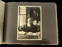
Japan Travel Photography Western Tourist Album Showing Temples Theater and Imperial Circuits Including Korea 1930s
1930. Japan travel photograph album. 1930s. This album documents Western travel through Japan during a period of expanding imperial influence and managed international tourism recording temple architecture theatrical performance and curated cultural sites alongside limited family portraiture. The photographs provide primary visual evidence of how foreign visitors encountered Japan through established travel circuits that emphasized religious monuments scenic landscapes and staged cultural forms while also including a labeled image from Korea that situates the journey within the geography of Japanese colonial rule.<br /> <br /> Album containing 22 silver gelatin photographs each mounted one per page with white ink captions identifying locations including "Nikko" "Kyoto" "Shochiku-za" "Koya San" "Akashi" "Takao" and "Korea." Three photographs depict members of a Western family posed in studio and outdoor settings including portraits in front of temple gates and residential entrances. The remaining images focus on architectural and cultural sites including temple facades with detailed ornamentation mountain and waterfall landscapes and a staged theatrical performance at the Shochiku-za theatre in Osaka showing performers in elaborate costume and makeup. One photograph labeled "Korea" depicts seated women wearing hanbok indicating travel beyond the Japanese home islands. The photographs are consistently sized at approximately 5 x 7 inches and mounted in an album measuring approximately 8.5 x 12 inches bound in cloth boards with decorative striping and cord binding.<br /> <br /> The album was produced during a decade when Japan promoted domestic and imperial sites as destinations for foreign travelers integrating religious landmarks urban infrastructure and colonial territories into a coherent tourist experience. Sites such as Nikko and Koya San were presented as emblematic of national heritage while theatrical venues and scenic locations formed part of structured itineraries. The inclusion of Korea reflects the extension of these travel routes into occupied regions where colonial subjects and landscapes were incorporated into representations of the empire. Photographs remain clear with strong contrast; minor wear to album consistent with handling; overall very good. A focused visual record of Western travel in 1930s Japan documenting how cultural sites and imperial geography were presented to foreign visitors. unknown
书商的参考编号 : 22302
|
|
|
TREMP Ernst:
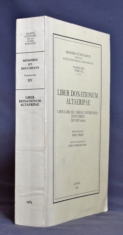
Liber donationum altaeripae. Cartulaire de l’abbaye cistercienne d’Hauterive (XIIe - XIIIe siècles).
Lausanne, Société d’histoire de la Suisse romande, 1984. In-8 broché de XII-433 pages, couverture imprimée.
书商的参考编号 : 1149
|
|
|
TREMAINE Jon
Tours de cartes. Collection : Image par image.
Paris, Solar, 1995. 24 x 27, 125 pp., très nombreuses illustrations en couleurs, cartonnage d'édition imprimé, bon état.
书商的参考编号 : 37107
|
|
|
Trench, Richard, with a foreword by Wilfred Thesiger, last of the great Arabia; Endpaper maps, color illustrations and black/whi
Arabian Travellers The European discovery of Arabia
MacMillan 1986-01-01. Hardcover. New. New. In shrink wrap. Looks like an interesting title! MacMillan hardcover
书商的参考编号 : Q-0333428897 ???????? : 0333428897 9780333428894
|
|
|
Trent, Christopher
Motoring on Regional Byways : Midland England : 50 Miles from Birmingham
Ex-library copy with usual (mininal) marks and stamps - to front end paper and reverse of title page only. Mainly clean tight pages with bright unmarked tape-free boards, dusty page edges and no bumping to corners. Dust jacket not price clipped or marked or torn or creased with minor traces of handling. 144pp. Many places deserving of exploration within fifty miles motoring of Birmingham.

|
|
|
Trevelyan, Raleigh & B/W Illus; Maps & Cartoons
Rome '44 the Battle for the Eternal City
Easton Press. Very Good with no dust jacket. 1990. Hardcover. Leather-bound hard cover published by Easton Press in 1990. No dust jacket. Black leather covers with gilt decorations and lettering. Corners are slightly bumped. Spine has three raised bands. Page edges are gilt-covered. Silk moire endpapers. Gray satin bookmark ribbon is attached to headband. Included are an unused and unattached bookplate from Easton Press and the Collector's Notes from Easton Press. Book is in very good plus condition. Large 8vo 366 pages 2.2 lb. ; Large 8vo 9" - 10" tall; 366 pages . Easton Press hardcover
书商的参考编号 : MST13651
|
|
|
TRINQUIER (Jean).
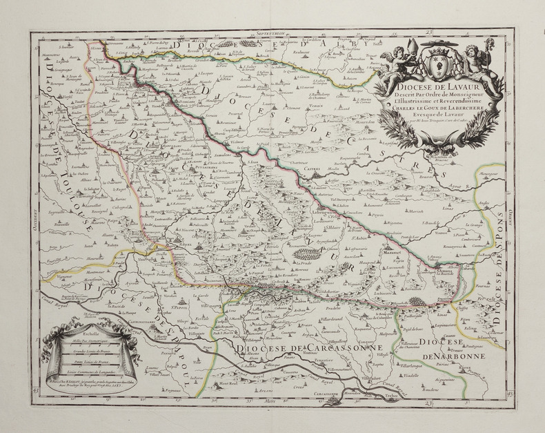
[LAVAUR] Diocèse de Lavaur.
Paris, H. Jaillot, 1683. 351 x 451 mm.
书商的参考编号 : LBW-2754
|
|
|
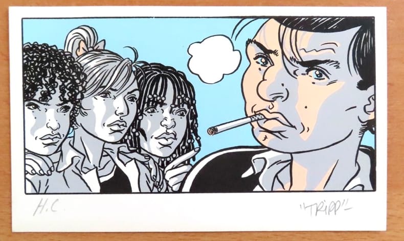
Tripp:
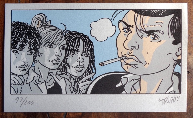
Petite sérigaphie couleurs.
2012 Sérigraphie au format 20 x 12.
书商的参考编号 : 984
|
|
|
Tripp:
Petite sérigaphie couleurs.
Sérigraphie au format 20 x 12.
书商的参考编号 : 26117
|
|
|
Trigiani, Elaine
Top 10 Sicily (revised edition)
No marks or inscriptions. No creasing to covers or to spine. A lovely clean crisp very tight copy with bright covers and no bumping to corners. 160pp. The self-wraps open up to present a map of the island (front) and a map of Central Palermo (rear). This is the revised edition of the guide to the 10 best of everything in Sicily, eg, beaches, resorts, sights, restaurants, etc.

|
|
|
Tring Urban District Council
Tring Urban District : The Official Guide
No marks or inscriptions. Minor creasing to covers adjacent to spine. A very clean very tight booklet with bright unmarked boards and no bumping to corners. Large fold-out street plan and map on rear in excellent condition. 40pp. Official guide the the Hertfordshire town of Tring with history, Local Authority information and photographs of the town in the early 1970s. Extremely scarce.

|
|
|
TROUVE (Claude-Joseph, baron).
ESSAI HISTORIQUE SUR LES ETATS-GENERAUX DE LA PROVINCE DE LANGUEDOC, avec cartes et gravures. [&] DESCRIPTION GENERALE ET STATISTIQUE DU DEPARTEMENT DE L'AUDE. Avec cartes et gravures. 2 volumes
1818 A Paris, Firmin Didot, 1818. Deux volumes in-quarto (215 X 269) broché TOME I : XIX (dont faux-titre et titre), 584 pages, frontispice " Armoiries des Etats de Languedoc " (relié entre les pages 328 et 329), 2 cartes, 2 plans et un tableau dépliants ; TOME II : frontispice (Blasons), VIII (dont faux-titre et titre), carte dépliante gravée couleurs de l'Aude, 679 pages (" errata " au verso du dernier feuillet), 3 vues et 2 plans. EDITION ORIGINALE de ce remarquable ouvrage complet en deux volumes, qui comprend notamment une CARTE en couleurs gravée et TROIS GRANDES PLANCHES dépliantes représentant la grande vue de Carcassonne avec le plan de la Cité, la vue générale de Castelnaudary et celle de Narbonne. Le premier volume contient une étude historique depuis la conquête romaine, la description des différents diocèses du Languedoc et enfin l'histoire des ouvrages publics et des canaux. Le second volume donne une étude très détaillée de l'Aude comprenant la topographie, géologie, description des villes et villages, population, moeurs, agriculture, industrie, commerce, pêche, etc. Claude-Joseph, baron TROUVE (1768-1860), fut le deuxième préfet de l'Aude, succédant à Barante. Très soucieux de sa mission administrative, il organise en 1807 un recensement démographique et agricole détaillé, fait exécuter plusieurs enquêtes sur l'industrie et l'école, crée un réseau de correspondants qui alimentent peu à peu sa future " Description générale et statistique du département de l'Aude " (Les Audois, Dictionnaire biographique sous la direction de R. CAZALS & D. FABRE, 328).
书商的参考编号 : 1806
|
|
|
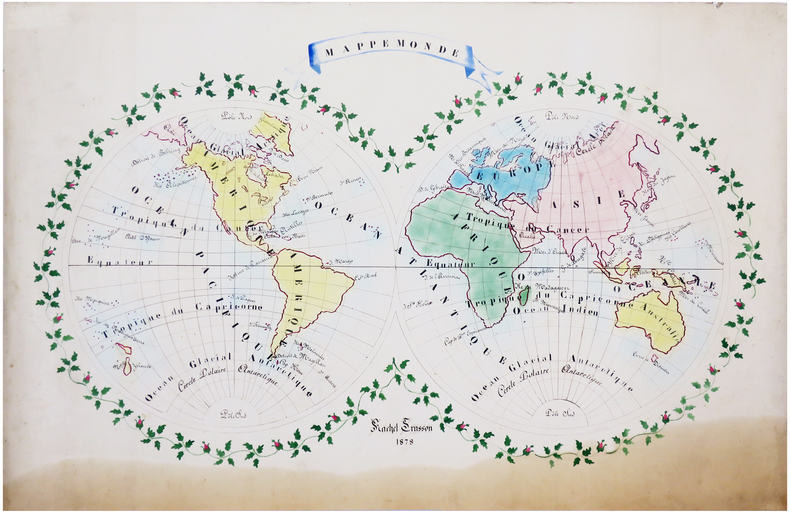
TRUSSON (Rachel).
Mappemonde.
1878. 61 x 90 cm.
书商的参考编号 : LBW-6628
|
|
|
TRULLEN, Pablo [Comisario].
La Cartografía de Aragón. Primera Muestra de Documentación Histórica Aragonesa.
Zaragoza, 1988. Folio; 79 pp., 4 hs. Con 24 láminas. Cubiertas originales.

|
|
|
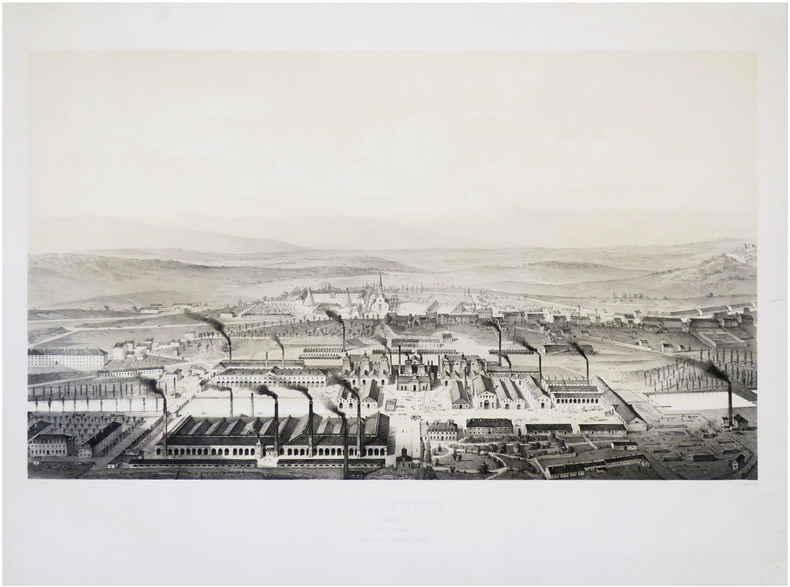
TRÉMAUX (Pierre).
[LE CREUSOT] Le Creusot. (1847). Saône et Loire. Vue prise du nord au sud.
Paris, Lemercier, 1847. 480 x 708 mm.
书商的参考编号 : LBW-8626
|
|
|
TSCHUDI, Iwan von:
Der Tourist in der Schweiz nebst Grenzgebieten. Reisetaschenbuch. 36., neu bearb. Auflage v. C. Täuber. In 3 Bden.
Zürich, Orell Füssli, 1921, 21, 22, kl. in-8°, Frontispiz Porträt Iwan v. Tschudie & ca. 600 S., mit Karten und Panoramen ill., grüner Original-Leinenband.
书商的参考编号 : 56401aaf
|
|
|
TSCHUDI, Iwan von:
Der Tourist in der Schweiz nebst Grenzgebieten. Reisetaschenbuch. 34., neu bearb. Auflage. In 3 Bde.
Zürich, Orell Füssli, 1899, kl. in-8°, 534 S., mit vielen Karten, Gebirgsprofilen und Stadtplänen, roter Original-Leinenband, Schuber.
书商的参考编号 : 90011aaf
|
|
|
TSCHUDI, Iwan von:
Der Tourist in der Schweiz und Grenzgebieten. Reisetaschenbuch. 35., neu bearb. Auflage v. C. Täuber. In 3 Bden.
Zürich, Orell Füssli, 1918, kl. in-8°, ca. 600 S., mit vielen Karten, Gebirgsprofilen und Stadtplänen illustriert, Original-Leinenbde
书商的参考编号 : 119935aaf
|
|
|
TSCHUDI, Iwan von:
Der Tourist in der Schweiz und Grenzgebieten. Reisetaschenbuch. 36., neu bearb. Auflage v. C. Täuber. In 3 Bden.
Zürich, Orell Füssli, 1921, kl. in-8°, ca. 600 S., mit vielen Karten, Gebirgsprofilen und Stadtplänen illustriert, Original-Leinenbde.
书商的参考编号 : 119936aaf
|
|
|
TSCHUDI, Iwan von:
Der Turist in der Schweiz und den Grenzrayons. Reisetaschenbuch. 33., neu bearb. Auflage.
Zürich, Orell Füssli, 1895, kl. in-8°, 6 gelbe Blätter (Werbung & Index) + XXXIV + 534 S. + 9 gefalt. Panoramas + 6 gefalt. Stadtplänen + 11 Karten, und als Vorsatz hinten 1 Doppelblattgrosses Routekärtchen der Schweiz + 1 gef. Touristenkarte der Schweiz am Schlusse des Buches, roter Original-Leinenband, Schönes Exemplar.
书商的参考编号 : 137129aaf
|
|
|
TT Maps & Publications Ltd
Himachal Pradesh: With trekking routes TTK discover India series
paperback. Good. Access codes and supplements are not guaranteed with used items. May be an ex-library book. paperback
书商的参考编号 : 8170530660.G ???????? : 8170530660 9788170530664

|
|
|
Tt Maps & Publications Ltd
Kerala Discover India Series
paperback. Good. Access codes and supplements are not guaranteed with used items. May be an ex-library book. paperback
书商的参考编号 : 8170530164.G ???????? : 8170530164 9788170530169
|
|
|
TT Maps & Publications Ltd
Odisha Road Guide
paperback. Good. Access codes and supplements are not guaranteed with used items. May be an ex-library book. paperback
书商的参考编号 : 8170530857.G ???????? : 8170530857 9788170530855
|
|
|
TT Maps & Publications Ltd
Sikkim Discover India series / TT. Maps
paperback. Good. Access codes and supplements are not guaranteed with used items. May be an ex-library book. paperback
书商的参考编号 : 8170530962.G ???????? : 8170530962 9788170530961
|
|
|
Tucazinsky, Nissan Aharon
The Borders of the Holy Land: Jerusalem in Pictures [IN HEBREW] Supplement to the Book "The Holy City & Temple"
In Hebrew. 180X250 mm. 43+4+12 + 55 Plates. Gilt Hard cover with dust jacket. Dust Jacket slightly torn on the upper edge. Cover and spine slightly worn. Yellow pages. Name of previous owner written on the first white page and on title page. Else in good condition. Includes Maps, Photos and Illustrations.
|
|
|
Tucker Glenn; maps by Dorothy Thomas Tucker
Dawn Like Thunder: The Barbary Wars and the Birth of the U.S. Navy
Indianapolis: Bobbs-Merrill 1963. 1st. Hardcover. Book fine Dust jacket fine. The dust jacket is price clipped and has minor chips and closed tears to the extremities. <br/><br/> Bobbs-Merrill hardcover books
书商的参考编号 : 9010503
|
|
|
Tucker Glenn; Tucker Maps WT. W. T.
Poltroons and Patriots: A Popular Account of the War of 1812 Two volumes
Bobbs-Merrill 1954. Very Good. Tucker Glenn. Poltroons and Patriots: A Popular Account of the War of 1812 Two volumes. Tucker Maps W.T. Indianapolis: Bobbs-Merrill 1954. 812pp. Indexed. Illustrated. 8vo. Cloth with gilt lettering. Book condition: Very good with lightly bumped and yellowed spines. Slipcase is very good with light rubbing and yellowing. Includes monthly bulletin of American History Publication Society. Bobbs-Merrill hardcover books
书商的参考编号 : UTUCPOL00JMJ
|
|
|
Tufte, Edward R.
Envisioning Information
A clean, unmarked book with a tight binding. 126 pages. Slight edge wear and marks to dust jacket. "Revealed here are design strategies for enhancing the dimensionality and density of portrayals of information -- techniques exemplified in maps, the manuscripts of Galileo, timetables, notation describing dance movements, aerial photographs, the Vietnam Veterans Memorial, electrocardiograms, drawings of Caler and Klee, computer visualizations, and a textbook of Euclid's geometry." Later printing.

|
|
|
TUNBRIDGE WELLS.
Barnett's Official Street Plan of Tunbridge Wells. With Road Map of Kent, Plans of Tonbridge, London Boroughs & Postale Districts. Also Map of the M2 Motorway. BRIGHT, CLEAN COPY
Folding street plan in red and black on paper, measuring 25.0 x 20.0 ins (approx. 63.5 x 51.0 cms) folding in 16 panels to 9.0 x 5.5 ins (approx. 23.0 x 14.0 cms); original printed wrappers in orange and black, yapped edges, covers very lightly age-soiled else a very good, bright, clean copy. With numerous trade advertisements.

|
|
|
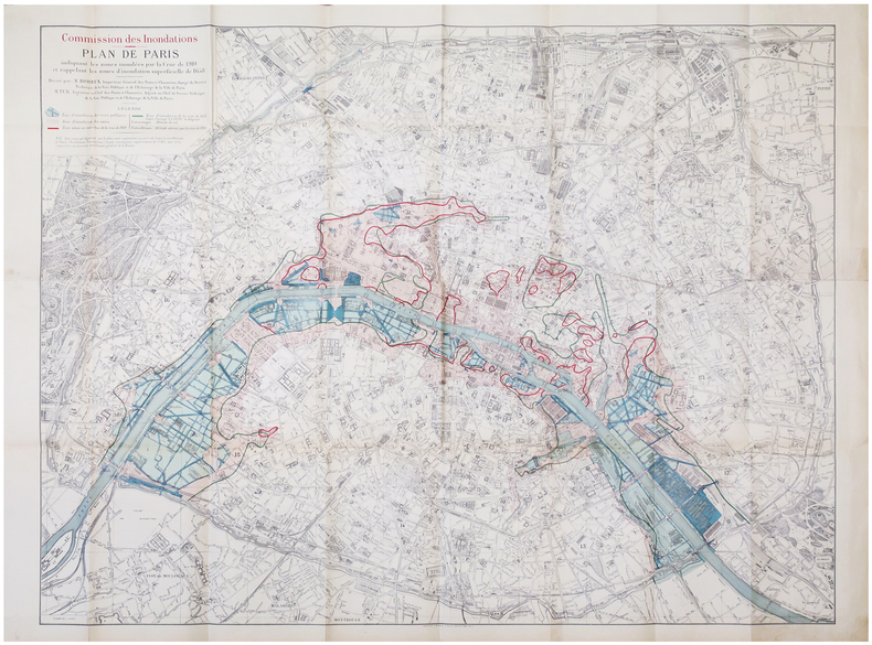
TUR (Paul Henri) & BOREUX (Léon Claude).
[INONDATIONS de 1910] Commission des Inondations. Plan de Paris indiquant les zones inondées par la crue de 1910 et rappelant les zones d'inondation superficielle de 1658.
Paris, Librairie Chaix, 1910. 0,93 x 1,18 m.
书商的参考编号 : LBW-6846
|
|
|
Turin Jeanne
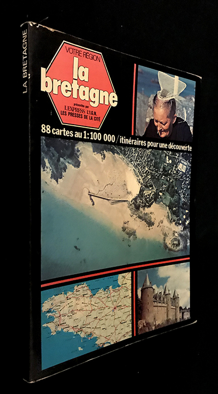
Votre région : La Bretagne (avec 88 cartes au 1:100 000 / itinéraires pour une découverte)
L'express, Les Presses de la cité, l'I.G.N Votre région Broché 1977 In-4 (20.5 x 28 cm), broché avec rabats, couverture illustrée en couleurs, 126 pages, préface d'Olivier Philip, présentation d'Henri Queffélec, textes de Jeanne Turin, avec 88 cartes en couleurs au 1:100 000 / itinéraires pour une découverte et photographies en couleurs in et hors-texte ; coiffes et bords frottés, pliures et marques d'usage à la couverture, notes manuscrites à la dernière garde, assez bon état. Livraison a domicile (La Poste) ou en Mondial Relay sur simple demande.
书商的参考编号 : fm651
|
|
|
Turner, Colonel A. G. (editor)
Trans-African Highways
No marks or inscriptions to contents. No creasing to covers or to spine. A clean very tight copy with very slightly marked boards, dusty page edges and bumping to some corners. A small piece of a fair number of the lower edges of adjacent pages has been clipped away/pierced - with no effect on any of the maps or text. 548pp. A fascinating trip around Africa with great detail giving mile-by-mile information and all the place names for all of the major road routes.

|
|
|
Turner, Reverend Mr
A VIEW OF THE EARTH: Being a Short But Comprehensive System of Modern Geography
London: Printed for S. Crowder 1766. Book. Very Good. Hardcover. The Second Edition. Folio 21 x 32cm. The second edition with additions and improvements; pp. iv 45 iii publisher's adverts; engraved frontispiece map of the world five further engraved plates of maps and one engraved plate of globes ten engraved figures and diagrams within the text. Contemporary half textured calf binding with marbled paper boards expertly restored with a new spine in matching style re-corned. contents clean and tight a few small marks/reading wear; frontispiece plate with a couple of short edge-tears expertly and inconspicuously repaired a few corners re-tipped. A very good well-presented copy. Scarce. Printed for S. Crowder Hardcover
书商的参考编号 : 016077

|
|
|
Turner, Robert D.
Pacific Empresses: An Illustrated History of Canadian Pacific Railways Empress Liners on the Pacific Ocean
290 pages. "The dramatic story of the Canadian Pacific's Empresses on the trans-Pacific service, from record-breaking runs and multi-million-dollar silk cargoes to typhoons and war service." - from dust jacket. Contains over 400 illustrations, photographs, maps, timetables and scale drawings, together with detailed text, fleet lists, bibliography and index. Map endpapers. Colour frontis. Book clean, bright and unmarked with minimal wear. Light wear to dust jacket which bears closed two-inch tear at bottom of back panel and is now preserved in a glossy new archival-grade Brodart cover. Very nice copy of this handsome reference. Book

|
|
|
Tutte, W. T
Graph Theory.
Cambridge, Cambridge University Press (Cambridge Mathematical Library), 2001. Foreword by Crispin St. J. A. Nash-Williams) XXI, 333 S. (24 cm) Broschierte Ausgabe
书商的参考编号 : 74064
|
|
|
TWYFORD
Road Map of Twyford and District. Presented with the Compliments of Pike & Smith of Twyford. BRIGHT, CLEAN COPY
Large folding road map printed in green on paper measuring 16.0 x 19.0 ins (approx. 40.5 x 48.0 cms) folding in 12 panels to 8.5 x 3.5 ins (approx. 21.5 x 9.0 cms); original printed wrappers, folded as issued, yapped edges, covers very lightly dust-soiled else a very good, bright, clean copy.

|
|
|
Tyler Maps
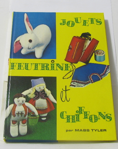
Jouets feutrine et chiffons
La farandole 1975 130 pages in8. 1975. Relié. 130 pages.
书商的参考编号 : 278005
|
|
|
TYROL
Carte du Tyrol et du Trento N° 5.
1800 18 sections montées sur toile et pliées formant une carte de 600 x 890 située à l'angle inférieur gauche d'une carte non déterminée. s.n. ca 1800
书商的参考编号 : 16327
|
|

 ?????????
 ?????PDF???
 RSS feed
 ??
??


