|
Mathioulakis,Christos Z
Crete : Tourist Guide to Crete (With Tourist Map , Scale 1:300,000)
Locally produced guidebook to Crete, ,including good street maps of Heraklion and other towns. Pbk. 96p.illus + coloured plates, Maps Crisp tight unmarked copy copy, but fold-out map is missing [3 copies of this edition found in WorldCat Book
|
|
|
Matkin, Robert B.
Map Reading
Name/date to front end paper. No other marks or inscriptions. No creasing to covers. A very clean very tight copy with bright unmarked boards and no bumping to corners. 32pp. A guide to understanding maps and map reading. Illustrated.

|
|
|
Matthews, Brian R.[Signed]
A History of Pointe Claire
324 pages. Index. Bibliography. Black and white illustrations. Author's signature upon front free endpaper. "Traces the development of the town of Pointe Claire from its beginnings as a stretch of lonely farms to its present as a major municipality. Covers three hundred years of Canadian history as it affected the people of the West Island community. Old maps, photos and the words of contemporary observers take the reader into a past where the pioneer farmers struggled to defeat Indians, the land, the climate and foreign invaders... This is the only complete history of the town." - from dust jacket. Gift greetings atop title page else book clean, bright and unmarked with negligible wear. Very light wear to dust jacket which has touches of yellowing to flaps, and is now preserved in a glossy new Brodart cover. A premium copy. Book

|
|
|
Matthiae, Karl / Thiel, Winfried
Biblische Zeittafeln Geschichtliche Abrisse, chronologische Übersichten, Überblickstafeln und Landkarten zur alt- und neutestamentlichen Zeit
8' in a worn yellow hard slipcase and in a white soft slipcase. softocover booklet and numerous tables and maps. else in good condition.
|
|
|
MAUGENDRE (Adolphe).
[JOINVILLE] Chemins de fer de l'Est. Joinville. Vue prise du pont sur la Marne.
Paris, Auguste Bry, [1857]. 280 x 380 mm.
Référence libraire : LBW-9008

|
|
|
MAUGENDRE (Adolphe).
[LUNÉVILLE] Chemins de fer de l'Est. Lunéville, vue prise du canton des Novions.
Paris, Auguste Bry, [1857]. 275 x 375 mm.
Référence libraire : LBW-9013

|
|
|
MAUGENDRE (Adolphe).
[LÉROUVILLE] Chemins de fer de l'Est. Lérouville, vue prise de la Prairie.
Paris, Auguste Bry, [1857]. 272 x 380 mm.
Référence libraire : LBW-9012

|
|
|
MAUGENDRE (Adolphe).
[PONT-à-MOUSSON] Chemins de fer de l'Est. Pont-à-Mousson. Vue prise des hauteurs de Peuvenelle.
Paris, Auguste Bry, [1857]. 279 x 381 mm.
Référence libraire : LBW-9009

|
|
|
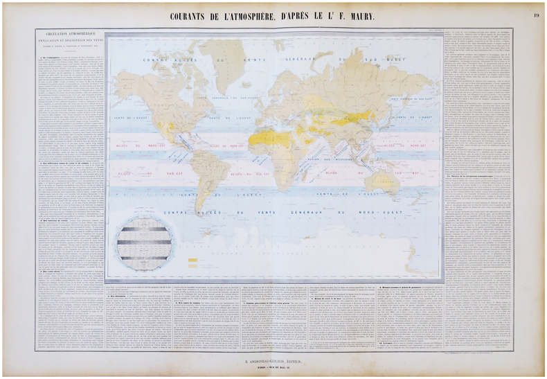
MAURY (Matthew Fontaine) & ANDRIVEAU-GOUJON (Eugène).
Courants de l'atmosphère, d'après le L.t F. Maury.
Paris, E. Andriveau-Goujon, 1864. En deux feuilles jointes de 665 x 887 mm.
Référence libraire : LBW-6843
|
|
|
MAURITANIE par Odette de PUIGAUDEAU.
La grande foire des dattes. Adrar mauritanien. Illustré (héliogravures, cartes).
Paris, éd. Plon 1937. Bon exemplaire broché, couverture décorée d'éd., in-8, 281 pages + planches.
Référence libraire : AUB-4024
|
|
|
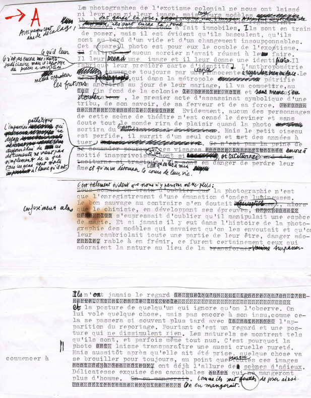
Maurel, Christian (1931-2011, écrivain et journaliste)
Tapuscrit de L'Exotisme colonial
1980 Ensemble comprenant : 1) Le tapuscrit de premier jet avec de nombreuses corrections autographes : environ 16 ff. in-4 assemblés ; 2) Le tapuscrit définitif, y compris tables, crédits photographiques, 4e de couverture... : 29 ff. in-4 souvent reconstitués ; 3) Instructions pour les retouches de photos : 3 pp. tapuscrites in-4 avec corrections autographes, 2 pp. manuscrites in-12.
Référence libraire : 2665
|
|
|
MAURIAC
Carte d'?tat-major ? l'?chelle 1/80 000?.
1 feuille entoil?e (repli?e). 60x84 cm. Mouillure en marge.
|
|
|
Maurice Colbeck
Village Yorkshire
No marks or inscriptions. A very clean very tight copy with bright unmarked boards and no bumping to corners. Dust jacket price clipped but not marked or torn or creased with minor traces of storage. 160pp. A tour around scores of Yorkshire villages. Well illustrated.

|
|
|
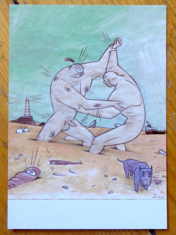
Max:
Argos and Cyclops playing on the beach.
Chez l'auteur, 1997. Avis de changement d'adresse du dessinateur, au format carte postale.
Référence libraire : 9047
|
|
|
Max:
Buen rollito 2000 !
Carte de voeux en triptyque par le dessinateur espagnol.
Référence libraire : 23826

|
|
|
Maxwell A. Kreindler, With Assistance Of Alexis Lichine And Frank Schoonmaker, Etc. Maps By Charles E. Skaggs
Jack & Charlie's 21 Wine List
New York Ny: Jack And Charlie's "Twenty-One" / "21 1954. 1st Edition . Hardcover. Near Fine. 71 Pp. Red Cloth Gilt And Stamped In Blind. #343 Of A Limited Edition Of 1000 Copies. Lightly Used No Fraying Or Stains Gilt Brilliant. Ownership Stamp Of Fred Herrington 1898-1971 A California Lawyer Whose Collection Of Menus Is Held At Uc Davis. <br/> <br/> Jack And Charlie's "Twenty-One" / "21 hardcover
Référence libraire : 058667
|
|
|
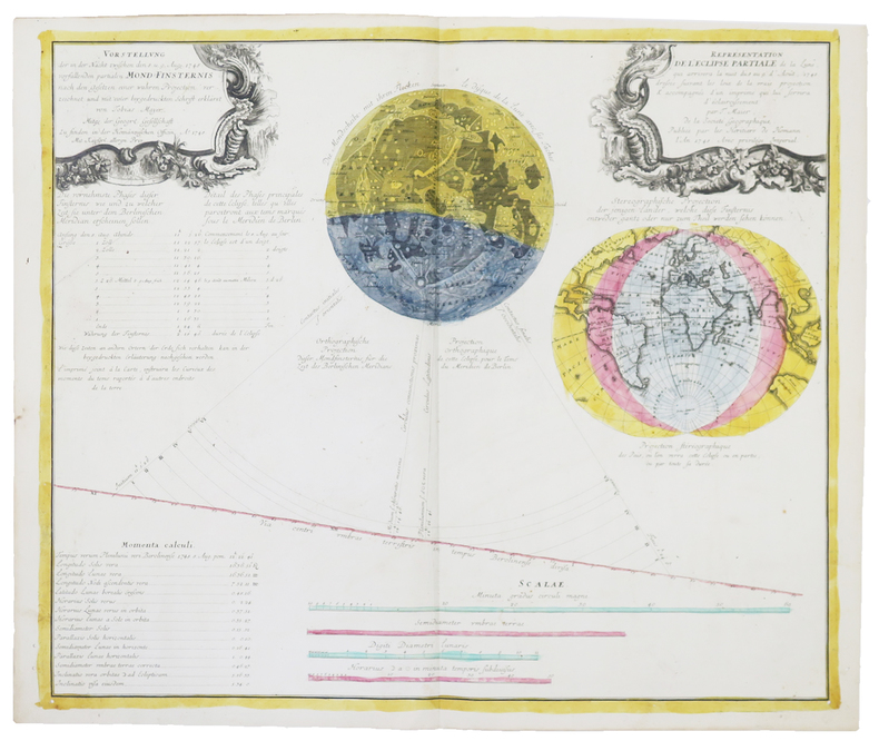
MAYER (Tobias).
[ÉCLIPSES] Représentation de l'éclipse partiale de la Lune, qui arrivera dans la nuit du 8 au 9 d'août 1748.
Nuremberg, Héritiers de Homann, 1748. 485 x 570 mm.
Référence libraire : LBW-4858
|
|
|
MAY Helmut - MILLER Henry
Hans Reichel. 1892-1958. Ein eutscher maler in Paris
Köln Wallraf-Richartz-Museum 1960 plaquette in-8 Agrafé, couverture illustrée
Référence libraire : 014320
|
|
|
MAYER, TOBIAS & HOMANN - POLAND.
Mappa Geographica Regni Poloniae ex novissimis quotquot sunt mappis specialibus composita at ad LL stereographica projectionis revocata a Tob. Mayero...
Nürnberg, Homannianos Heredes, 1773. 48,5x53,5 cm. Engraved and original hancoloured map of Poland and neighbouring areas. A tear in upper margin just touching the coloured image area. A very small hole in lower part of map in the folding.
Référence libraire : 32941
|
|
|
May, Dr Jacques M.
Thailand, Around the World Program; American Geographical Society
No marks or inscriptions. Tiny crease to lower corner of rear cover. A very clean very tight copy with very slightly dusty boards, rusty staples and no bumping to corners. All twenty-five coloured stickers present and attached. 64pp. An introduction to Thailand in the 1960s and earlier. Very well illustrated. We do not use stock photos, the picture displayed is of the actual book for sale. Every one of our books is in stock in the UK ready for immediate delivery.

|
|
|
May, Jutta
The Visitor's Guide to Corsica
Ex library book with usual marks and stamps. Clean tight pages with bright unmarked tape-free red cloth boards and no bumping to corners. Dust jacket not price clipped or marked or torn with creasing. 231pp. An ideal detailed guide for the independent motoring traveller in Corsica.

|
|
|
MAYER, TOBIAS & HOMANN - POLAND.
Mappa Geographica Regni Poloniae ex novissimis quotquot sunt mappis specialibus composita at ad LL stereographica projectionis revocata a Tob. Mayero...
Nürnberg, Homannianos Heredes, 1773. 48,5x53,5 cm. Engraved and original hancoloured map of Poland and neighbouring areas. A tear in upper margin just touching the coloured image area. A very small hole in lower part of map in the folding.
|
|
|
Mayo, Lida (maps by Arthur S. Hardyman)
Bloody Buna
Australian National University Press Canberra 1975. Hardcover octavo; green boards with gilt spine titling; 222pp. monochrome plates and maps. Tape marks and some scattered spotting on endpapers; browned text block edges. Green illustrated dustwrapper with slightly faded spine. Very good with wrapper now professionally protected by superior non-adhesive polypropylene film. Postage quoted is for a standard format octavo book. Final charges may vary depending on size and weight. In 1942 the Australian 16th and 25th AIF Brigades supported by militiamen of the 3rd Battalion forced the Japanese back over the Kokoda Trail and into a narrow strip in the Buna-Gona-Sanananda area along the northern New Guinea coast. It was decided the Australians would clear the Gona-Sanananda area; the Americans would attack Buna. The inexperienced 32nd U.S. Infantry Division gathered south of Buna and on 19 November 1942 the confident main American assault began. The veteran Japanese jungle fighters recently reinforced were ready. They had constructed an elaborate defensive system of dirt covered coconut-log bunkers; swamps; flooded rivers rain mud and the kunai hampered the Americans; thickly-foliaged trees made air strikes nearly impossible and faulty intelligence reports gave a totally inaccurate assessment of the Japanese strength. By December the attack on Buna had halted. Poorly trained and equipped discipline gone hungry dirty and ill the Americans were reluctant to move. Lieutenant-General Eichelberger sent in by the impatient Supreme Commander General MacArthur ordered a major reorganisation and new attacks were mounted. But the bloody Buna battle again ground to a stalemate. Australia's 18th Brigade and other troops equipped with long overdue tanks and artillery joined in whilst other Australian forces pressed on with their task at Gona-Sanananda. The Japanese fought with fanatical resolve but the weight of the Australian-American attacks finally told and on 2 January 1943 the Americans took Buna government station to end one of the most desperate campaigns of the entire Pacific war. In Bloody Buna senior U.S. Army historian Lida Mayo describes the affair in authentic and gripping detail. Her narrative is sharpened with interviews and private accounts and she leaves no doubts about the crushing mental pressures physical ordeals brutalities and macabre horrors of the struggle. Nor does she fail to analyse the problems created by the remoteness of higher command from the scene of action. Australian National University Press, Canberra, 1975. hardcover
Référence libraire : 97347

|
|
|
MAYO, LIDA & HARDYMAN, ARTHUR S. (Illus maps)
Bloody Buna
Doubleday & Company 1974. First edition octavo hardcover VG in d/w VG; all our specials have minimal description to keep listing them viable. They are at least reading copies complete and in reasonable condition but usually secondhand; frequently they are superior examples. Ordering more than one book will reduce your overall postage costs Doubleday & Company 1974 hardcover
Référence libraire : 220380
|
|
|
MAZIERS, Micel.
Rhode-Saint-Genèse en cartes postales anciennes.- Sint-Genesius-Rode in oude prentkaarten.
Petit in-8 oblong, 76 cartes en n&b., reliure cartonnage editeur illustrée.- RARE Bel exemplaire. [BU-11]
|
|
|
Mb Maps
Geography Coloring Book: Maps of World Regions Continents World Projections USA and Canada
Paperback / softback. New. paperback
Référence libraire : A9798573521909 ISBN : 9798573521908 9798573521

|
|
|
Mb Maps
Geography Coloring Book: Maps of World Regions Continents World Projections USA and Canada
Paperback / softback. New. paperback
Référence libraire : B9798573521909 ISBN : 9798573521908 9798573521
|
|
|
McCarta, Robertson
Cyprus Nelles guides
Munchen Germany: Nelles Verlag 1993 Ex-Library. Very Good. Laminated Softcover. First Edition. Clean neat copy comprehensive travel guide to Cyprus. 256p. illus col index. Neat and complete with one library "sold" stamp P . Nelles Verlag paperback
Référence libraire : 040525 ISBN : 3886183866 9783886183869

|
|
|
McCarta, Robertson
Cyprus (Nelles guides)
Clean neat copy, comprehensive travel guide to Cyprus. 256p. illus (col) index. Neat and complete, with one library "sold" stamp P Ex-Library
|
|
|
McClellan, George B.
REPORT ON THE ORGANIZATION AND CAMPAIGNS OF THE ARMY OF THE POTOMAC: To Which Is Added An Account Of The Campaign In Western Virginia, With Plans Of Battle-Fields.
pp. 465, (14) [Publisher's catalogue] + Frontis folding map of Antietam battle field, old tape repair at top fold, and full page plans of battle fields. Age stained. Inked ownership of H. R. Pratt, 1935. Large 12mo. Original full cloth binding, lacks spine. Hardbound. SHELF W29
|
|
|
McCorquodale, Anna (editor)
Debrett's Cities of the World : London
No marks or inscriptions. No creasing to covers or to spine. A very clean very tight copy with bright unmarked boards and no bumping to corners. 303pp. The volume which is distributed to peers and baronets, chairmen, managing directors, Members of Parliament, and Members of the European Parliament and others selected from Debretts (of Debrett's Peerage Ltd fame) - primarily those living within a 150 mile radius of London. A limited number is circulated among London's top hotels. A heavy book.

|
|
|
McCoy, Alfred W.; Read, Cathleen R.; Adams, Leonard P.
The Politics of Heroin in Southeast Asia
464 pages including notes, index, black and white photographic plates and illustrations. "In spite of recent well-publicized seizures of massive shipments of heroin from Southeast Asia, heroin continues to flood the country, spreading into every level of this society and shredding the fabric of everyday life. U.S. government estimates of the number of addicts has leaped from 315,000 in 1969 to over 560,000 in 1972. This book puts all the pieces of this ghastly puzzle together, and then maps the possible avenues out of the horror, suggesting that America may have to choose between our commitments in Southeast Asia and getting heroin out of our high schools." - from dust jacket. Moderate wear. Book clean and unmarked. Small closed tear to dust jacket. Nice copy. Book
|
|
|
McCrossan, Moira & Taylor, Hugh
Jordan Globetrotter Travel Guide
United Kingdom: New Holland Publishers 2009 Book. As New. Pictorial Cover. Pocket sized tourist guide with useful information tips and recommendations accompanied by colour photographs charts and maps for the first-time traveller who wants to experience the major highlights that Jordan has to offer. In plastic sleeve and including a nice fold-out map of Jordan. New Holland Publishers hardcover
Référence libraire : 045154 ISBN : 1847734944 9781847734945

|
|
|
McDonnell Patrick:
Triptyque Earl & Mooch.
Les Humanoïdes Associés. Ravissant triptyque de présentation, à l'état de neuf.
Référence libraire : 5406

|
|
|
McDermott, John W.; Illustrated by B&w maps. [Illustrator]
How to Get Lost and Found in Fiji
Waikiki 1978-01-01. Paperback. New. In shrink wrap. Waikiki paperback
Référence libraire : COD-00178
|
|
|
McDougall, Duncan
Victoria : The Garden City
Inscription inside front cover and light indenting to front cover. No other marks, light creasing to covers and spine. A clean very tight copy with lightly rubbed covers and no bumping to corners. 72pp. With coloured photographs and black & white line drawings of this Canadian city with a little text.

|
|
|
McDowell, Jim
Uncharted Waters the Explorations of Jose Narvaez (1768 - 1840)
Ex-library book with the usual stamps, stickers, etc. Binding is solid and text/interior is clean and free of marking of any kind. Barely used; interior is perfect, covers show no wear, maps, b&w illustrations throughout.
|
|
|
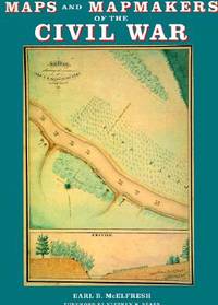
McElfresh, Earl B
Maps and Mapmakers of the Civil War
Boston Massachusetts U.S.A.: Harry N Abrams Inc 1999. 272pp/180 illustrations including 150 plates in full color. The largest most comprehensive & most beautifully illustrated collection of Civil War maps ever published. Still shrink wrapped. First Edition. Hard Cover. New/New. 4to - over 9¾" - 12" tall. Harry N Abrams Inc hardcover
Référence libraire : 007290 ISBN : 0810934302 9780810934306
|
|
|
McElfresh, Earl B.
MAPS AND MAPMAKERS OF THE CIVIL WAR
New York: Abrams Image 1999. Paper-covered Boards. Very Fine/Very Fine. Large 4to. 272pp. Biblio & index. 180 illustrations including 150 color plates. History Book Cub edition. <br/> <br/> Abrams Image hardcover
Référence libraire : 16280 ISBN : 0810934302 9780810934306
|
|
|
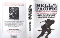
McEnery, Jim, 1919-2012 ; Bill Sloan. design, Ruth Lee-Mui, maps, Paul Pugliese; jacket Tom McKeveny, photo, Soctt Applewhite
Hell in the Pacific : a Marine rifleman's journey from Guadalcanal to Peleliu A nice day for a boat ride -- Always a Marine at heart -- Disaster at sea slaughter ashore -- Bushido takes a beating -- Japan's offensive hits a wall -- "We've got the bastards licked" -- Red mud red blood green hell -- The crab and coconut wars -- Peleliu "A terrible mistake" -- The worst nightmare yet -- Going back to the real world.
New York : Simon & Schuster 2012. 2012. 1st Edition 1st Printing. Hardcover. Fine/Fine. First Simon & Schuster hardcover edition. ; 1st printing ; ix 305 pages : illustrations ; 25 cm ; ISBN 9781451659139 9781451659146 9781451659153 145165913X 1451659148 1451659156 ; OCLC 759912915 ; LCCN ; black cloth in photographic dustjacket ; In what may be the last memoir to be published by a living veteran of the pivotal invasion of Guadalcanal which occurred almost seventy years ago Marine Jim McEnery has teamed up with author Bill Sloan to create an unforgettable chronicle of heroism and horror. McErery's Rifle Company-the legendary K/3/5 of the First Marine Division made famous by the HBO miniseries The Pacific-fought in some of the most ferocious battles of the war. In searing detail the author takes us back to Guadalcanal where American forces first turned the tide against the Japanese; Cape Gloucester where 1300 Marines were killed or wounded; and bloody Peleliu where McEnery assumed command of the company and helped hasten the final defeat of the Japanese garrison after weeks of torturous cave-to-cave fighting. McEnery's story is a no-holds-barred grunt's-eye view of the sacrifices suffering and raw courage of the men in the foxholes locked in mortal combat with an implacable enemy sworn to fight to the death. From bayonet charges and hand-to-hand combat to midnight banzai attacks and the loss of close buddies the rifle squad leader spares no details chronicling his odyssey from boot camp through twenty-eight months of hellish combat until his eventual return home. He has given us an unforgettable portrait of men at war. ; Jim McEnery served in the 1st Marine Division's famed K-3-5 rifle company in World War II and fought in three major campaigns against the Japanese. After the war he moved to New Jersey and worked at Rutgers University until retirement. He passed away in September 2012.; Bill Sloan is a respected military historian and author of more than a dozen books including Brotherhood of Heroes: The Ultimate Battle. He lives in Dallas Texas.; ents: A nice day for a boat ride -- Always a Marine at heart -- Disaster at sea slaughter ashore -- Bushido takes a beating -- Japan's offensive hits a wall -- "We've got the bastards licked" -- Red mud red blood green hell -- The crab and coconut wars -- Peleliu "A terrible mistake" -- The worst nightmare yet -- Going back to the real world. ; ConFINE/FINE <br/> <br/> New York : Simon & Schuster, 2012. hardcover
Référence libraire : 008573 ISBN : 145165913x 9781451659139
|
|
|
McEvedy, Colin
The Penguin Atlas of Medieval History & The Penguin Atlas of Modern History (to 1815)
Penguin Books, (Middlesex) 1972. 2x96 S., 18cm Karton 0
Référence libraire : 74807

|
|
|
McGonagle, Declan & Badger, Gerry
Troubled Land : The Social Landscape of Northern Ireland
Previous owner's bookplate to front end paper. No marks or inscriptions. Extremely faint crease to front cover, none to rear or to spine. A lovely clean very tight copy with bright unmarked boards and no bumping to corners. 80pp. This work of full-page colour photographs by Paul Graham deals with the small but insistent signs of deep political division within the landscape of Northern Ireland in the 1980s. 'The foreword by Declan McGonagle contrasts the work against the melodramatic imagery of the North and places the Troubles in a broader framework of the marginalisation and denial of power that has been the hallmark of British cononialism for centuries. The main text by Gerry Badger examines the genre of reportage photography and positions this work within a new generation of intelligent documentary photography that represents ideas rather than furnishing simple visual records or illustrating words.'

|
|
|
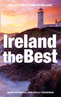
McKenna John McKenna Sally Collins Maps
Ireland the Best: the Insider's Guide to Ireland
HarperCollins Publishers Limited. Used - Very Good. Ships from the UK. Former library book; may include library markings. Used book that is in excellent condition. May show signs of wear or have minor defects. HarperCollins Publishers Limited unknown
Référence libraire : 19115939-20 ISBN : 0008248818 9780008248819
|
|
|
McKenna, John, McKenna, Sally, Collins Maps
Ireland the Best: the Insider's Guide to Ireland
HarperCollins Publishers Limited. Used - Very Good. Former library book; may include library markings. Used book that is in excellent condition. May show signs of wear or have minor defects. HarperCollins Publishers Limited unknown
Référence libraire : 19115939-20 ISBN : 0008248818 9780008248819
|
|
|
McLean, Allan Campbell
Explore the Highlands and Islands
No marks or inscriptions. Faint creasing to covers. A very clean very tight copy with bright unmarked boards, traces of foxing to page edges and no bumping to corners. 63pp. Publicity brochure for parts of Scotland.

|
|
|
McMinnies, W. G.
Signpost : An Intimate and Independent Guide to Pleasant Ports of Call 1959
No marks or inscriptions. A very clean very tight copy with bright unmarked boards and no bumping to corners. Dust jacket not price clipped or marked or torn or creased with minor traces of rubbing and handling. 400pp. A guide to places to visit and stay in Britain, the Channel Isles, Orkney and Scilly

|
|
|
McNally, Rand
Northeastern U.S. Road Atlas and Travel Guide
Boston u.a., Rand McNally & Company, 1990. Broschur, mit farbigem Deckelphoto, Metall-Spiralbindung, ca. DinA 4, 198 Seiten, durchgehend farbige Kartenskizzen, 2 auffaltbare lose Kartenskizzen liegen bei, Einband mit Gebrauchsspuren, Knickspuren, altes Preisschild (lässt sich MÖGLICHERWEISE nicht lösen) am oberen Vorderdeckel, zum Rücken unten minimal eingerissen, Seiten minimal randbeschabt, insgesamt gut erhalten / insgesamt guter Zustand [5 Warenabbildungen]
Référence libraire : 30687ge

|
|
|
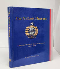
MCNORGAN, Michael R.; JOHNSON, Christopher (maps & drawings)
The Gallant Hussars: A History of the 1st Hussars Regiment 1856-2004
<p>The 1st Hussars Cavalry Fund 2004. Hardcover. ex library-good. 359 p. 29 cm. B&w and colour illustrations. Ex library with ink stamps on top and bottom edges. Scuffed front free endpaper. A few dents and scratches to outside. <br /><br /></p> The 1st Hussars Cavalry Fund hardcover
Référence libraire : 156762 ISBN : 0969465912 9780969465911
|
|
|
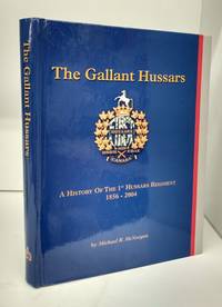
MCNORGAN, Michael R.; JOHNSON, Christopher (maps & drawings)
The Gallant Hussars: A History of the 1st Hussars Regiment 1856-2004
The 1st Hussars Cavalry Fund 2004. Hardcover. Near fine. 359 p. 29 cm. B&w and colour illustrations. Light wear. States this book is the property of the a uthor. <br/><br/> The 1st Hussars Cavalry Fund hardcover
Référence libraire : 154390 ISBN : 0969465912 9780969465911
|
|
|
McReynolds, Don ( 1990 Maps By.)
Hydrologic Atlas for Floyd County Texas
Lubbock Texas: Higfh Plains Underground Water Conserv. Dist. 1990 Eight page explanatory booklet accompannied by four large folded hydrologic maps. Depicting the depth of land surface to water at any point in Floyd County Texas and by extension. a resource for well water waer tables land management and agricultural concerns.Mapping by D.D. Smith geologist. Fine In original envelope. Higfh Plains Underground Water Conserv. Dist. unknown
Référence libraire : 121520

|
|
 Recevoir par e-mail
 Télécharger en PDF
 Flux RSS


