|
MARTIN (Philippe).
Carte de voeux illustrée d'une gravure originale signée.
Paris Société des peintres-graveurs français 2001 1 vol. Broché Carte de voeux dépliante sur Arches illustrée d'une alugraphie en couleurs (16 x 22 cm) signée par Philippe Martin. En parfait état.
Référence libraire : 109099
|
|
|
MARTIN (Prosper).
[ÎLE-aux-MOINES] Isle-aux-Moines. Golfe du Morbihan. Superficie 310ha 32a 09ca.
Vannes, I.O.V., [vers 1955]. 585 x 428 mm ; sur papier fort.
Référence libraire : LBW-8243

|
|
|
Martin Cartes, Juan Antonio
Prevención de Adherencias postquirúrgicas con Prótesis Intraperitoneal: Estudio Experimental Spanish Edition
paperback. Good. Access codes and supplements are not guaranteed with used items. May be an ex-library book. paperback
Référence libraire : 3844349561.G ISBN : 3844349561 9783844349566

|
|
|
MARTINEAU, G. D. & O'DRISCOLL, Capt. P. D. (Maps)
A History of the Royal Sussex Regiment: A History of the Old Belfast Regiment of Sussex 1701-1953
Chichester Moore & Tillyer n/d circa 1955. Octavo blue buckram boards gilt lettering to read leather title plate to spine gilt military insignia to front board top page edges stained blue 324pp illus/maps VG light bruising to board extrems light sun fading to spine light soiling to boards light to moderate tanning & foxing to page edges & eps light cracking to front gutter Chichester Moore & Tillyer n/d (circa 1955) hardcover
Référence libraire : 278970
|
|
|
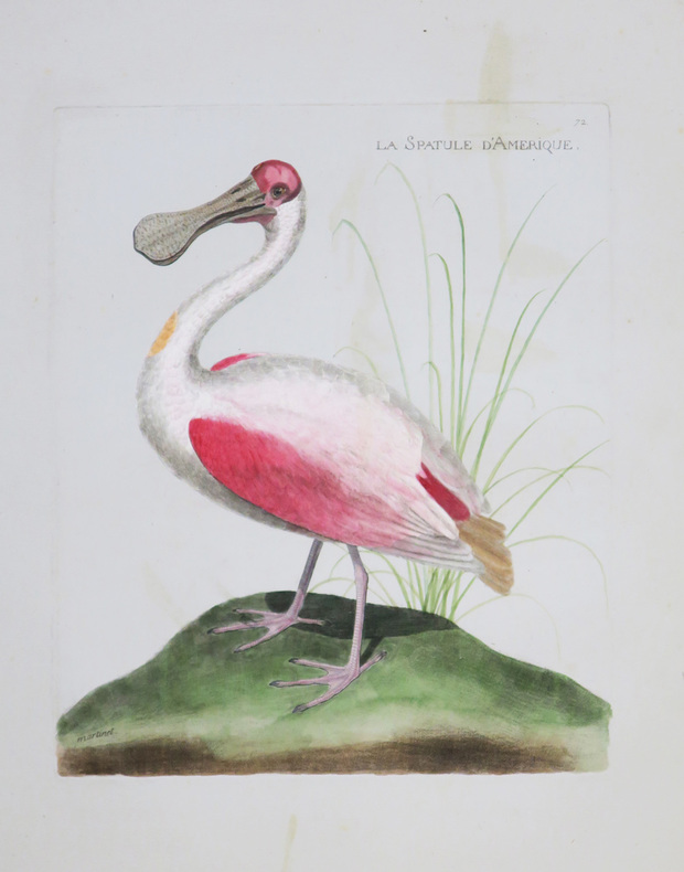
MARTINET (Alexandre).
La Spatule d'Amérique.
[Paris, circa 1795]. 228 x 201 mm.
Référence libraire : LBW-4361
|
|
|
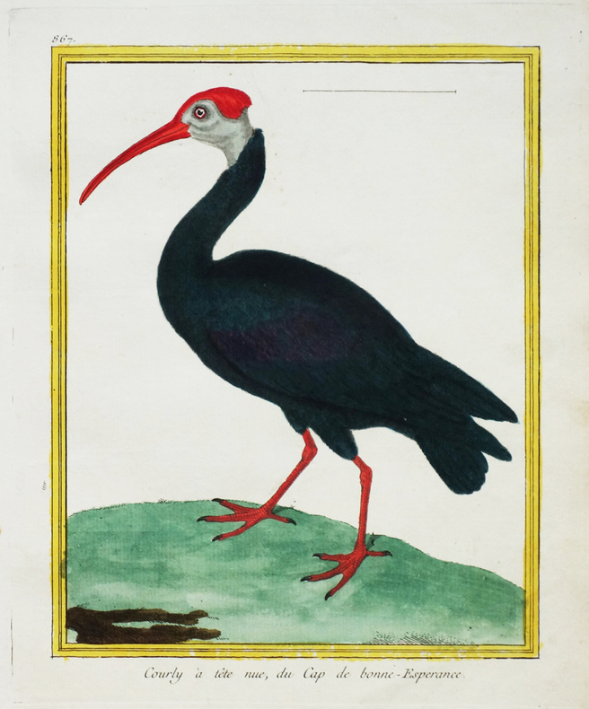
MARTINET (François-Nicolas) & BUFFON (George-Louis Leclerc de).
[AFRIQUE du SUD] Courly à tête nue, du Cap de Bonne-Espérance.
[Paris, 1771-1786]. 224 x 176 mm.
Référence libraire : LBW-2673
|
|
|
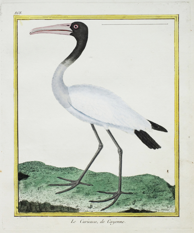
MARTINET (François-Nicolas) & BUFFON (George-Louis Leclerc de).
[CAYENNE] Le Curicaca de Cayenne.
[Paris, 1771-1786]. 228 x 178 mm.
Référence libraire : LBW-2676
|
|
|
MARTINET (François-Nicolas) & BUFFON (George-Louis Leclerc de).
[INDE] Le Bec ouvert, de Pondichéry.
[Paris, 1771-1786]. 225 x 175 mm.
Référence libraire : LBW-2772

|
|
|
MARTINET (François-Nicolas) & BUFFON (George-Louis Leclerc de).
[JAVA] Sarcelle, de Java.
[Paris, 1771-1786]. 219 x 172 mm.
Référence libraire : LBW-2766

|
|
|
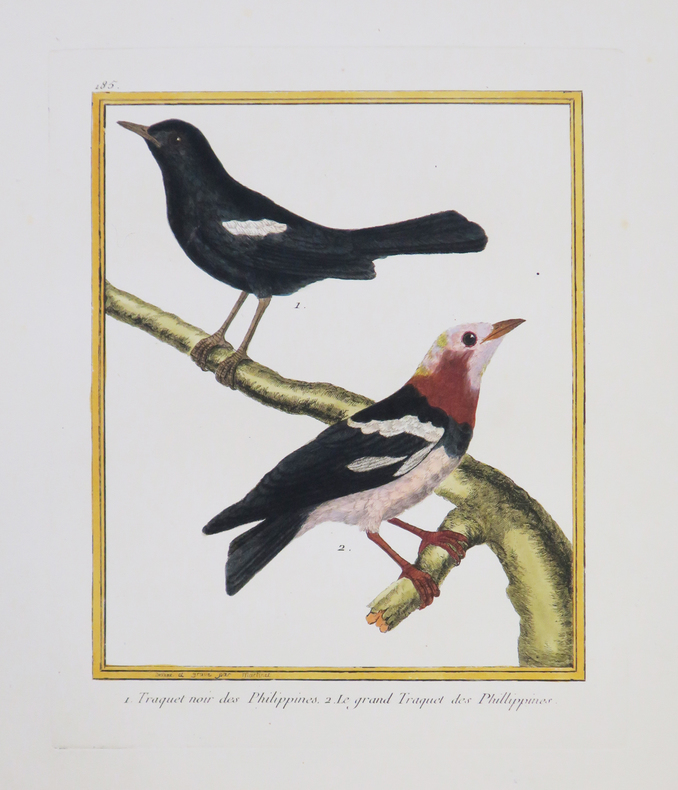
MARTINET (François-Nicolas) & BUFFON (George-Louis Leclerc de).
[PHILIPPINES] Traquet noir des Philippines - Le grand Traquet des Phillippines.
[Paris, 1771-1786]. 226 x 180 mm.
Référence libraire : LBW-4329
|
|
|
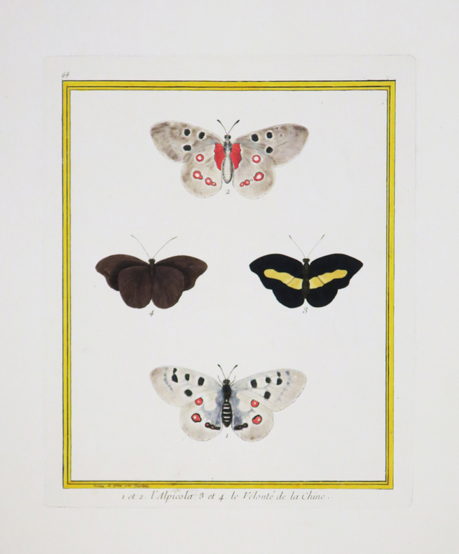
MARTINET (François-Nicolas) & BUFFON (Georges Louis Leclerc, comte de).
1 et 2. L'Alpicola. 3 et 4. Le Velouté de la Chine.
[Paris, 1771-1786]. 240 x 185 mm.
Référence libraire : LBW-4392
|
|
|
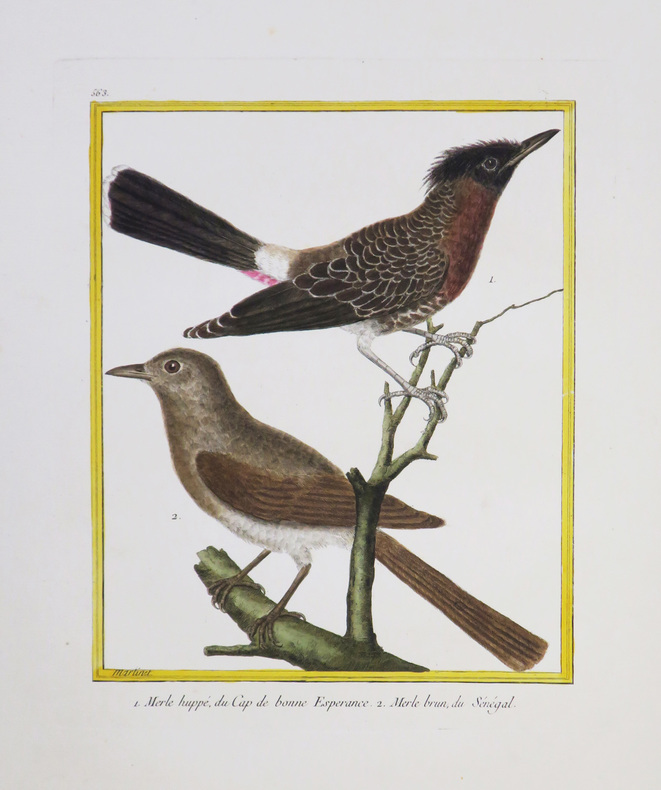
MARTINET (François-Nicolas) & BUFFON (Georges Louis Leclerc, comte de).
[AFRIQUE du SUD/SÉNÉGAL] Merle huppé, du Cap de Bonne Espérance - Merle brun, du Sénégal.
[Paris, 1771-1786]. 231 x 180 mm.
Référence libraire : LBW-4338
|
|
|
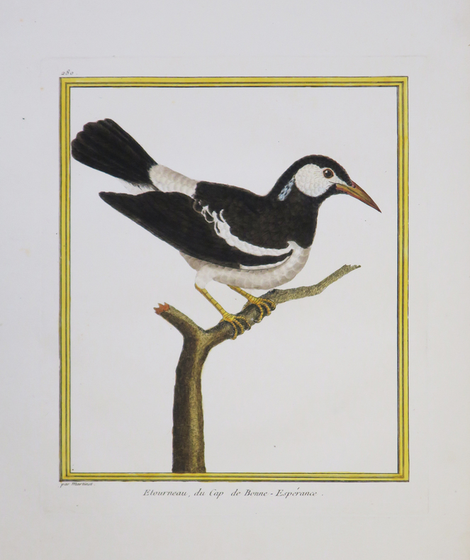
MARTINET (François-Nicolas) & BUFFON (Georges Louis Leclerc, comte de).
[AFRIQUE du SUD] Etourneau, du Cap de Bonne-Espérance.
[Paris, 1771-1786]. 236 x 190 mm.
Référence libraire : LBW-4340
|
|
|
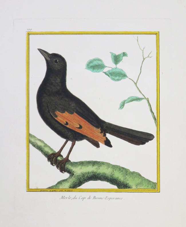
MARTINET (François-Nicolas) & BUFFON (Georges Louis Leclerc, comte de).
[AFRIQUE du SUD] Merle, du Cap de Bonne-Espérance.
[Paris, 1771-1786]. 222 x 177 mm.
Référence libraire : LBW-4343
|
|
|
MARTINET (François-Nicolas) & BUFFON (Georges Louis Leclerc, comte de).
[CAYENNE] Choucas chauve, de Cayenne.
[Paris, 1771-1786]. 241 x 189 mm.
Référence libraire : LBW-4347

|
|
|
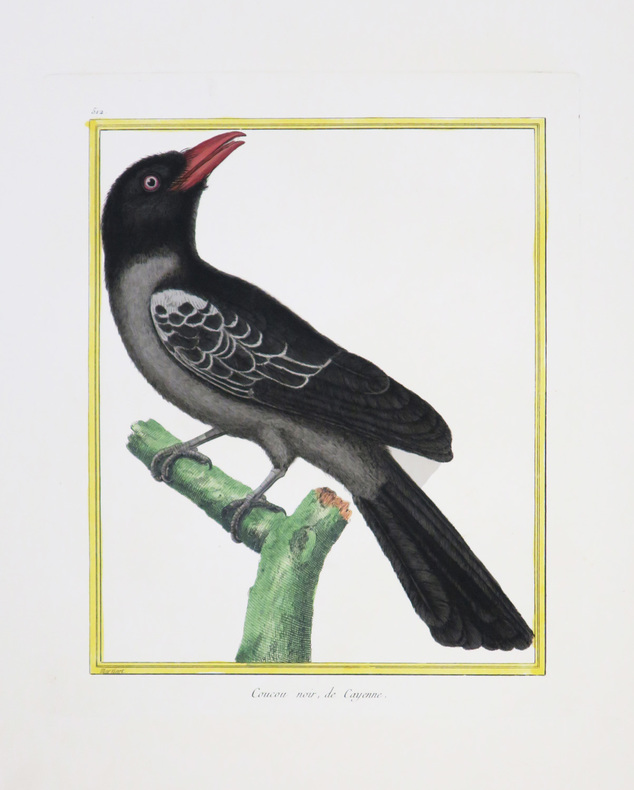
MARTINET (François-Nicolas) & BUFFON (Georges Louis Leclerc, comte de).
[CAYENNE] Coucou noir, de Cayenne.
[Paris, 1771-1786]. 231 x 180 mm.
Référence libraire : LBW-4352
|
|
|
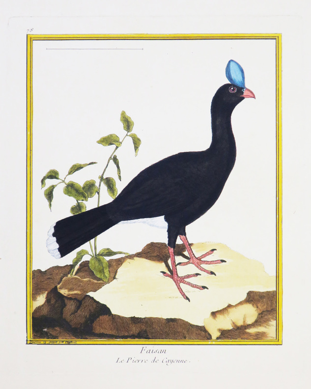
MARTINET (François-Nicolas) & BUFFON (Georges Louis Leclerc, comte de).
[CAYENNE] Faisan. Le pierre de Cayenne.
[Paris, 1771-1786]. 234 x 180 mm.
Référence libraire : LBW-4334
|
|
|
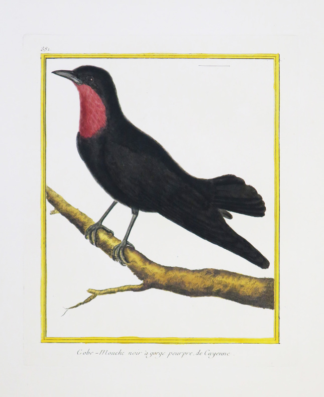
MARTINET (François-Nicolas) & BUFFON (Georges Louis Leclerc, comte de).
[CAYENNE] Gobe-mouche noir à gorge pourpre de Cayenne.
[Paris, 1771-1786]. 237 x 182 mm.
Référence libraire : LBW-4335
|
|
|
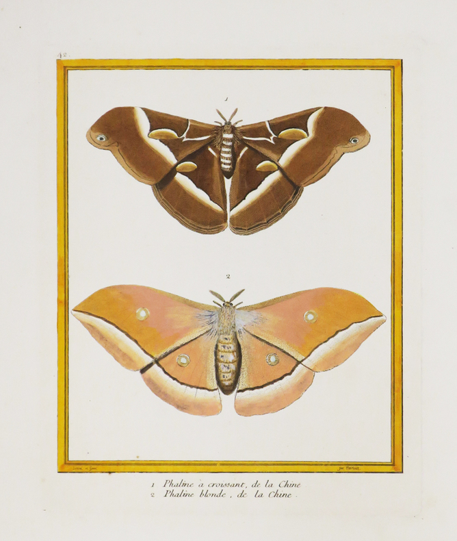
MARTINET (François-Nicolas) & BUFFON (Georges Louis Leclerc, comte de).
[CHINE] 1. Phaline à croissant, de la Chine. 2. Phaline blonde, de la Chine.
[Paris, 1771-1786]. 228 x 183 mm.
Référence libraire : LBW-4389
|
|
|
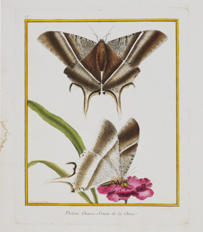
MARTINET (François-Nicolas) & BUFFON (Georges Louis Leclerc, comte de).
[CHINE] Phalène chauve-souris de la Chine.
[Paris, 1771-1786]. 242 x 189 mm.
Référence libraire : LBW-4390
|
|
|
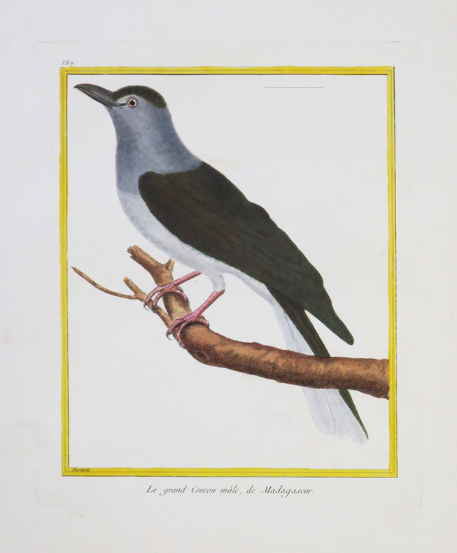
MARTINET (François-Nicolas) & BUFFON (Georges Louis Leclerc, comte de).
[MADAGASCAR] Le grand Coucou mâle, de Madagascar.
[Paris, 1771-1786]. 234 x 181 mm.
Référence libraire : LBW-4331
|
|
|
MARTINET (François-Nicolas) & BUFFON (Georges Louis Leclerc, comte de).
[MOLUQUES] Calao des Moluques.
[Paris, 1771-1786]. 233 x 180 mm.
Référence libraire : LBW-4342

|
|
|
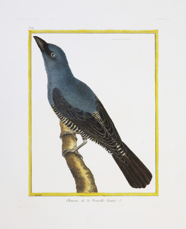
MARTINET (François-Nicolas) & BUFFON (Georges Louis Leclerc, comte de).
[NOUVELLE-GUINÉE] Choucas, de la Nouvelle Guinée.
[Paris, 1771-1786]. 230 x 175 mm.
Référence libraire : LBW-4346
|
|
|
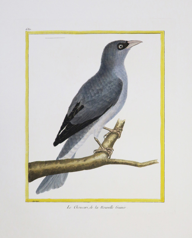
MARTINET (François-Nicolas) & BUFFON (Georges Louis Leclerc, comte de).
[NOUVELLE-GUINÉE] Le Choucari, de la Nouvelle Guinée.
[Paris, 1771-1786]. 231 x 177 mm.
Référence libraire : LBW-4344
|
|
|
MARTINET (François-Nicolas) & BUFFON (Georges Louis Leclerc, comte de).
[SAINT-DOMINGUE] 1. Le Rocou, de St. Domingue. 2 et 3. Le Nacré, de St. Domingue. 3. Le Quinteraye, de St. Domingue.
[Paris, 1771-1786]. 237 x 179 mm.
Référence libraire : LBW-4391

|
|
|
MARTINET (François-Nicolas) & BUFFON (Georges Louis Leclerc, comte de).
[SURINAM] 1 et 2. Le Parasol de Surinam. 3 et 4. Le Guidon de Surinam.
[Paris, 1771-1786]. 233 x 182 mm.
Référence libraire : LBW-4388

|
|
|
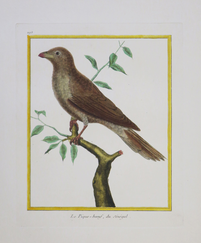
MARTINET (François-Nicolas) & BUFFON (Georges Louis Leclerc, comte de).
[SÉNÉGAL] Le Pique-bœuf, du Sénégal.
[Paris, 1771-1786]. 229 x 180 mm.
Référence libraire : LBW-4345
|
|
|
MARTINET Fils.
[LE HAVRE] I.RE Vue de la ville du Havre de Grâce.
[Paris, 1786]. 340 x 596 mm.
Référence libraire : LBW-6804

|
|
|
MARTINY DE RIEZ G. Portraits et cartes coloriées.
Histoire illustrée de la guerre de 1870-1871 et de la guerre civile à Paris. Réflexions morales et politiques.
Couverture rigide. Reliure demi-basane rouge à nerfs. 406 pages. Nombreuses rousseurs.
Référence libraire : 147610

|
|
|
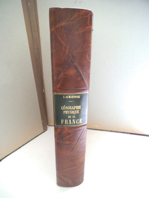
MARTONE A de
Géographie physique de la France.
In 4 demi- cuir marron raciné, pièce de titre cuir vert, filets à froid. Faux-titre, titre, 463 pages, nombreuses illustrations 167 cartes, figures, dans le texte144 photographies et une carte en couleurs hors-texte ; Librairie Armand Colin 1942. Très bon état
Référence libraire : 13333
|
|
|
Martres, Laurent
Photographing the Soutwest : Volume 1 - A Guide to the Natural Landmarks of Southern Utah
No marks or inscriptions. No creasing to covers or to spine. A very clean very tight copy with bright unmarked boards and no bumping to corners. 320pp. A travel guide to the natural landmarks of Southern Utah including Grand Circle, Red Rock Country and Dinosaur National Monument with emphasis on the opportunities for spectacular photography and with over 240 full-color photographs.
|
|
|
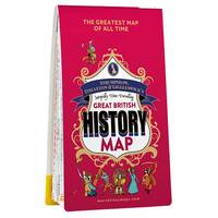
Marvellous Maps
Great British History Map Historical Map & Guide Marvellous Maps History Gifts Adventure Trivia
Marvellous Maps 06/21/2021. 1st. Map. Used; Very Good. WE SHIP WITHIN 24 HRS FROM LONDON UK 98% OF OUR ORDERS ARE RECEIVED WITHIN 7-10 DAYS. We believe you will be completely satisfied with our quick and reliable service. All orders are dispatched as swiftly as possible! Buy with confidence! Greener Books. Marvellous Maps unknown
Référence libraire : 4810280 ISBN : 1913447081 9781913447083
|
|
|
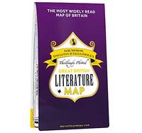
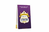
Marvellous Maps
Great British Literature Map Literary Map & Guide Marvellous Maps Book Gifts Holiday Planning British Geography
Paperback. Like New. paperback
Référence libraire : GOR011974547 ISBN : 1913447014 9781913447014
|
|
|
Marvellous Maps
Great British History Map Historical Map & Guide Marvellous Maps History Gifts Adventure Trivia
Paperback. Very Good. paperback
Référence libraire : GOR011755720 ISBN : 1913447081 9781913447083
|
|
|
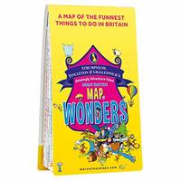
Marvellous Maps
Great British Map of Wonders Adventure Map & Guide Marvellous Maps Days Out Holiday Planning British Geography
Paperback. Good. paperback
Référence libraire : GOR011445872 ISBN : 1913447030 9781913447038

|
|
|
Marvellous Maps
Great British Map of Wonders Adventure Map & Guide Marvellous Maps Days Out Holiday Planning British Geography
Paperback. Very Good. paperback
Référence libraire : GOR011044919 ISBN : 1913447030 9781913447038
|
|
|
Marvellous Maps
Great British Literature Map Literary Map & Guide Marvellous Maps Book Gifts Holiday Planning British Geography
Paperback. Very Good. paperback
Référence libraire : GOR011065435 ISBN : 1913447014 9781913447014
|
|
|
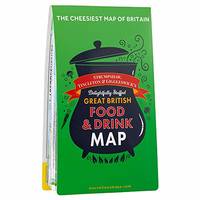
Marvellous Maps
Great British Food & Drink Map Food Map & Guide Marvellous Maps Food & Drink Gifts Holiday Planning British Geography
Paperback. Acceptable. paperback
Référence libraire : GOR010686755 ISBN : 1999784561 9781999784560
|
|
|
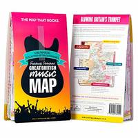
Marvellous Maps
Great British Music Map Music Map & Guide Marvellous Maps Music Gifts Holiday Planning British Geography S T & G's Great British Music Map
Paperback. Very Good. paperback
Référence libraire : GOR009662677 ISBN : 1999784529 9781999784522
|
|
|
Marvellous Maps
ST&G's Joyously Busy Great British Adventure Map
Marvellous Maps 2022. Paperback. New. 1 pages. 8.94x5.20x1.22 inches. Marvellous Maps paperback
Référence libraire : 2-191344712X ISBN : 191344712X 9781913447120
|
|
|
Marvellous Maps
St&g's Solid Gold Great British Bucket List Map
Used - Very Good. Ships from the UK. Former library book; may include library markings. Used book that is in excellent condition. May show signs of wear or have minor defects. unknown
Référence libraire : 54939542-20 ISBN : 1913447146 9781913447144
|
|
|
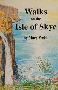
Mary Welsh, illus Margaret Clarke and David Macaulay, maps by Don Clarke
Walks on the Isle of Skye
Westmorland Gazette 1990 37 walks in all parts of the island. Name to title page otherwise VG. Westmorland Gazette paperback
Référence libraire : 13226 ISBN : 0902272837 9780902272835
|
|
|
Marygrace Dansereau Maps
Journey to Emmaus
Paperback. New. paperback
Référence libraire : B9781530407422 ISBN : 1530407427 9781530407422

|
|
|
MARZOLLA Benedetto (Brindisi, 1801 - Napoli, 1858)
Impero di Alessandro
Carta storica raffigurante i territori dell'Impero di Alessandro Magno intorno al 323 a.C. Tratta dall’ Atlante geografico. Corredato di notizie relative alla geografia fisica politica, ed in generale alla statistica delle varie regioni del Globo. Compilato ed eseguito in litografia per cura e sotto la direzione di Benedetto Marzolla edito a Napoli nel 1858. Marzolla, autore di importanti atlanti sulle provincie del Regno di Napoli, è anche autore di diverse carte sulle Circoscrizioni Ecclesiastiche nel Regno delle Due Sicilie, pubblicate postume, nello stesso anno della morte (1858) a Napoli nello Stabilimento Geografico diretto da Luigi Manzella. Benedetto Marzolla fu disegnatore topografo e litografo; geografo e cartografo; membro della Commissione di statistica presso il Ministero dell'Interno. Personaggio di grandissimo rilievo nella cartografia napoletana ed italiana del XIX secolo, Marzolla ottenne in vita pubblici riconoscimenti ed attestati per la produzione cartografica di altissima qualità. La sua notorietà si è lentamente dissolta dopo la morte; va tuttavia osservato che solo la mancanza di uno spiccato coinvolgimento politico in senso risorgimentale e di una valenza letteraria nella sua opera non lo hanno reso famoso come i contemporanei Francesco Costantino Marmocchi (1805-1858) e Attilio Zuccagni-Orlandini (1783-1872), con i quali può certamente confrontarsi. I progetti culturali didattici e editoriali di Marzolla furono e rimangono di straordinaria modernità; egli inventò, è il caso di dire, un nuovo modo di intendere e di disegnare la carta geografica, fornendo una visione assolutamente originale della comunicazione dei dati geografici attraverso la combinazione di testo e immagine. Con tale operazione, egli riuscì a fondere in un'unica opera, storia, geografia, economia, statistica e cartografia, raggiungendo un equilibrio grafico di rara efficacia (cfr. V. Valerio, Benedetto Marzolla Brindisino, Geografo e Cartografo dell'800 Europeo, Brindisi 2008). Bell’esemplare con coloritura coeva dei contorni, in ottimo stato di conservazione. Bibliografia V. Valerio, Benedetto Marzolla Brindisino, Geografo e Cartografo dell’800 Europeo (2008). Historical map depicting the territories of Alexander the Great's empire, around 323 BC. Taken from the Atlante geografico. Corredato di notizie relative alla geografia fisica politica, ed in generale alla statistica delle varie regioni del Globo. Compilato ed eseguito in litografia per cura e sotto la direzione di Benedetto Marzolla published in Naples in 1858. Marzolla, author of important atlases on the provinces of the Kingdom of Naples, is also the author of several maps on the Ecclesiastical Circumscriptions in the Kingdom of the Two Sicilies, published posthumously in the same year of his death (1858) in Naples in the Stabilimento Geografico directed by Luigi Manzella. Benedetto Marzolla was draftsman topographer and lithographer, geographer and cartographer. Character of great importance in the Neapolitan and Italian cartography of the nineteenth century, Marzolla obtained during his life public recognition and certificates for the production of high quality cartography. His notoriety slowly faded after his death; it should be noted, however, that only the lack of a strong political involvement in the sense of the Risorgimento and of a literary value in his work did not make him as famous as his contemporaries Francesco Costantino Marmocchi (1805-1858) and Attilio Zuccagni-Orlandini (1783-1872), with whom he can certainly compare himself. Marzolla's cultural, didactic and editorial projects were, and remain, extraordinarily modern; he invented a new way of understanding and drawing maps, providing an absolutely original vision of the communication of geographical data through the combination of text and image. With this operation, he was able to merge in a single work, history, geography, economics, statistics and cartography, achieving a graphic balance of rare effectiveness. Benedetto Marzolla is famous for being among the most important cartographers of the XIX century, for being the one to print geographic maps using high quality lithographies.His Atlante Geografico, made of 58 maps, presents finely sketched works. Six maps depict North America, among them famous map of gold diggers in California, deriving from Hippolite Ferry. Extremely relevant are also the maps of Antarctic, South Africa with the plan of Cape Town and those about Australia.Though the maps are dated between 1843 and 1856, this 1858 edition, printed in Naples at the Stabilimento Geografico Strada San Carlo (founded by Marzolla himself), represents the final version of his atlas, the last one before his death. A posthumous edition will be published in 1865.The atlas is pretty rare, is not actually listed in Phillips, British Library e OCLC. Beautiful specimen with contemporary coloring of the contours, in excellent condition. Bibliografia V. Valerio, Benedetto Marzolla Brindisino, Geografo e Cartografo dell’800 Europeo (2008).

|
|
|
Masao Tamai / Written by Historical Maps
my chikuho story
Not Available 1980. Soft Cover. Fine. The book is in fine condition. Not Available paperback
Référence libraire : 2090502113713456
|
|
|
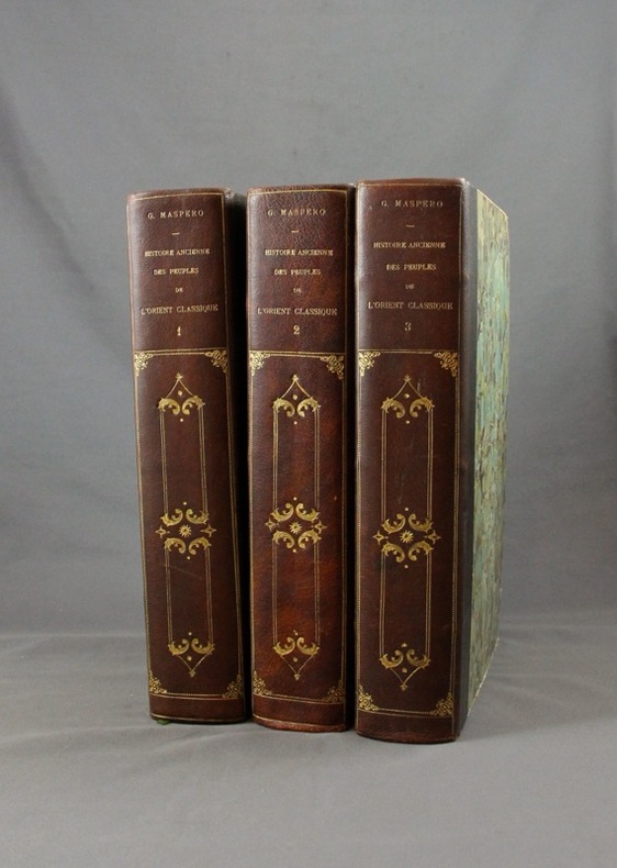
MASPERO G:
Histoire ancienne des peuples de l’Orient classique.
Paris, Lib. Hachette, 1895-1899. 3 vol. in-4 de 804 + 798 + 826 pp. demi-maroquin noir, dos lisse orné de fers d’inspiration romantiques, couv. d’origine cons. Bel état.
Référence libraire : 1570
|
|
|
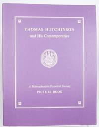
Massachusetts Historial Society; Photographs & Maps [Illustrator]
Thomas Hutchinson and His Contemporaries
Boston: Massachusetts Historial Society 1974 2021-06-24. First Edition. Paperback. Fine . Profusely ills. Bright sharp copy with no ownership markings. Well packaged in a box ships with tracking. Massachusetts Historial Society paperback
Référence libraire : 210624005
|
|
|
MASSIP Catherine - Emmanuel Le Roy Ladurie (préface) - Avec la participation des Départements ds Cartes et Plans, des Estampes, des Livres imprimés, des Manuscrits occidentaux et orientaux, des Médailles, et de la Musique de la Bibliothèque Nationale
Le chant d'Euterpe, l'aventure de la musique
1991 Hervas, collection Banque Nationale de Paris - 1991 - In-4 couverture cartonnée noire décorée - 188 pages - nombreuses reproductions photographiques
Référence libraire : 98357
|
|
|
Masters Journal 1992 McDermott, John R. Ed; Glossy Color Photos, MAPS [Illustrator]
Masters Journal 1992
Events Pub; Golf Digest 1992-01-01. Unknown Binding. Like New. Oversize. Appears unused with no marks or inscriptions. Light general shelf wear. Events Pub; Golf Digest unknown
Référence libraire : 004105
|
|
|
Mathews, W.H. (compiler); et al
Geology of the Cordilleran Orogen in Canada - Geology of North America, Volume G-2/Geology of Canada No. 4
Large slipcase contains the following maps: 1701A - Physiographic Map of the Canadian Cordillera; 17.1 Structural cross-sections of the Canadian Cordillera; 1714A Metamorphic Map of the Canadian Cordillera; 15.1 Distribution of Proterozoic to Miocene plutonic suites; 19.1A to I; 1713A Terrane Map of the Canadian Cordillera (sheets 1 and 2); Correlation chart for Canadian Cordillera (3 sheets). Minor reference markings to slipcase and each map. Please note: we are offering the map set only. Book not included. Book

|
|
 Recevoir par e-mail
 Télécharger en PDF
 Flux RSS


