|
NORTHUMBERLAND
Engraved County map of Northumberland. BRIGHT COPY WITH GOOD CONTEMPORARY COLOURING
Engraved map on paper measuring 9.0 x 7.0 ins (approx. 23 x 18 cms), COLOURED BY HAND IN FRAME AND OUTLINE, small loss at bottom (blank) left-hand corner else a very good, bright, clean copy.

|
|
|
NORVEGE
Carte de poche au 1/1 500 000e.
1 feuille repli?e. 55x75 cm.
|
|
|
Not Cited
PHILIPS JUNIOR HISTORICAL ATLAS Prepared Under the Direction of the Historical Association
London: George Philip & Son Limited 1929. Book. Very Good. Paperback. Fifth Edition. 4to. 40 colour maps. Cloth backed card covers good with some general wear a little grubby. Contents tight some general reading wear and finger marks title page somewhat marked with a small scuff mark. A good to very good copy. George Philip & Son Limited Paperback
书商的参考编号 : 006602
|
|
|
NOTEBOOK, maps
Minsk Belarus Notebook: City Map Notebook for Travelers Diary Writing Subject Memo Book Planner with Lined Paper 6x9 Inches College Ruled 120 Lined Pages
Independently published 2020. Paperback. New. 120 pages. 9.00x6.00x0.30 inches. Independently published paperback
书商的参考编号 : 2-1658556216 ???????? : 1658556216 9781658556217
|
|
|
NOTEBOOK, Maps
Tashkent Uzbekistan Notebook: City Map Notebook for Travelers Diary Writing Subject Memo Book Planner with Lined Paper 6x9 Inches College Ruled 120 Lined Pages
Independently published 2020. Paperback. New. 120 pages. 9.00x6.00x0.30 inches. Independently published paperback
书商的参考编号 : 2-1658562143 ???????? : 1658562143 9781658562140
|
|
|
NOUVEL Jean
"Horizons" Quartier île Seguin-rives de Seine Boulogne-Billancourt
Paris Ateliers Jean Nouvel - Hines - Gecina 2006 In-4 carré Cartonnage toilé illustré et étui éditeur Signé par l'illustrateur
书商的参考编号 : 012552
|
|
|
NOUVELLE CHRONOLOGIE
des Rois de France, depuis Pharamond jusqu’à Napoléon 1er.
A Paris, Delion rue Greneta n°6 près celle Martin, A Paris, Delion rue Greneta n°6 près celle Martins. d. (1810) ; grande planche gravée sur vergé fort, à toutes marges, pliée sous un cartonnage in-8 rose, avec étiquette de titre gravée sur le premier plat., 63 x 51 cm.Planche portant 25 vignettes (6,5 x 10,5 cm.) style cartes de jeux instructifs, avec les portraits des rois (3 par carte) depuis Pharamond, le fondateur de la monarchie, jusqu’à Napoléon et ses frères (Jérôme, Joachim, Eugène, Louis et Joseph). “Napoléon Ier Empereur des français, ce monarque surnommé le Grand, est admiré de toutes les Puissances pour son Courage, sa Clémence et se Générosité. Son Génie Pacificateur l’a conduit à la victoire et l’illustre alliance qu’il vient de faire avec Marie-Louise archiduchesse d’Autriche, donnant à la france l’espérance de voir Naitre des fils dignes d’un père vertueux met le comble au Bonheur e son Peuple...” Louis XVI est flanqué d’une sorte d’épitaphe : “Son cœur ne sut qu’aimer, pardonner et mourir. Il aurait su régner s’il avait su punir”.Etiquette de la maison Delion qui “fabrique un assortiment d’images, jeux instructifs et amusans à l’usage de la Jeunesse, et jeux de société” D’Allemagne. Les cartes à jouer I, p. 431.Les encadrements sont coloriés en jaune. Exemplaire à toutes marges. Fente marginale sans manque à une pliure.
书商的参考编号 : 46405159
|
|
|
NSW. GOVERNMENT TOURIST BUREAU & NATIONAL ROADS AND MOTORISTS ASSOCIATION with maps drawn by H. E. C. Robinson Ltd N. S.
MOTOR ROAD GUIDE TO SOUTHERN AND NEAR WESTERN N.S.W. - With Through Routes to and from Melbourne
The Australian Guide Book Co. Sydney c. 1927. 333 pp 208 maps 'key map' at front advertisements cloth spine faded and worn chips to board edges and corners else very good copy in illustrated papered boards. The Australian Guide Book Co., Sydney, c. 1927 hardcover
书商的参考编号 : 232038
|
|
|
NUSRET.
[ATLAS OF ROUTES OF VESSELS / NAVIGATION] Martin'in manevra levhasiyla Batenberg'in rota müs'irinin sûret-i istimaline mahsûs talimat. [i.e. Martin's maneuvering plate and Batenberg's instruction for the use of the route master].
Fine Turkish, Ottoman (1500-1928) Modern light brown cloth bdg. gilt lettering on the front board. [1], 99 p., 36 numbered maps printed in black and red ink, 5 numbered folded plates. A fine copy. First and only edition of this extremely rare atlas in user guide form including the instructions and descriptions of the routes of vessels by an advisor of the British naval officer and German prince related to the British royal family, Prince Louis Alexander of Battenberg (1854-1921), who was the first Marquess of Milford Haven, commanded the Atlantic Fleet from 1908 to 1910 and became first sea lord in 1912. This book was translated by Nusret, who was a lieutenant in the Ottoman Naval Forces in its period and prepared only for use of Turkish naval officers. The plates include the maneuver plate of an officer named "Martin", who is not able to be recognized. Every map and plate depending on the current position of the ship has its own descriptive text. Özege 12270.; Not in OCLC and Library Hub.
|
|
|
NUSSBAUM, Fritz.
Les Pyrénées dans l'ancien cartographie selon la Collection de Cartes de la Bibliothèque de la Ville de Berne, Suisse.
Zaragoza, 1952 [Separata de "Actas del Primer Congreso Internacional del Pirineo"]. 4to. mayor; 26 pp., con 14 reproducciones entre el texto y 8 láminas fotográficas aparte. Edición limitada de 500 ejemplares. Cubiertas originales.

|
|
|
O'Hara, Lucy Hudgins) James, Katie O'Hara (editor)b/w Photos; maps on end Papers
Yorktown As I Remember Yorktown Virginia
Verona VA: McClure Printing Co 1981. 1st . Hardcover. Near Fine/Near Fine. 8vo. b/w Photos; maps on end Papers. 1st printing; dj in mylar; blue c w/gilt decorations/titles; 78 clean unmarked pages/index <br/> <br/> McClure Printing Co hardcover
书商的参考编号 : 115414
|
|
|
O. Akbulatova (ed.) N. Vernova
Peterhof (Treasures of Russia)
No marks or inscriptions. Crease to lower corner of rear cover. A very clean very tight copy with bright unmarked boards and no bumping to corners. 82pp. A guide to the sumptuous Palace and gardens of Peterhof in St. Petersburg, Russia. Very scarce in the UK.

|
|
|
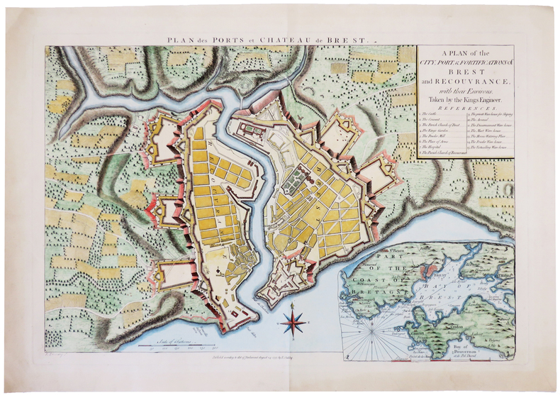
OAKLEY (Edward).
[BREST] Plan des ports et château de Brest. A plan of the city, port, & fortifications of Brest and Recouvrance, with their environs, taken by the Kings engineer.
1757. 345 x 506 mm.
书商的参考编号 : LBW-4984
|
|
|
OCCIDENT ROMAIN par Louis HARMAND.
L'occident romain. Gaule ; Espagne ; Bretagne ; Afrique du Nord (31 av. J.-C. à 235 ap. J.-C.). Racines celtiques et structures romaines d'une communauté ... Contient 15 cartes de l'auteur.
Ed. Payot 1960. Bel exemplaire broché, fort in-8, 494 pages avec tables.
书商的参考编号 : AUB-6182
|
|
|
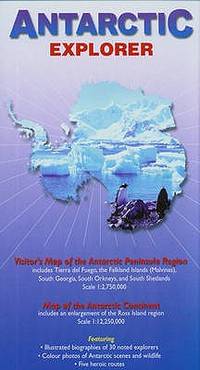
Ocean Explorer Maps
Antarctic Explorer Map; Ocean Explorer Maps
map. Good. Access codes and supplements are not guaranteed with used items. May be an ex-library book. unknown
书商的参考编号 : 0954371763.G ???????? : 0954371763 9780954371760
|
|
|
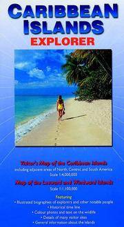
Ocean Explorer Maps
Caribbean Islands explorer map Ocean Explorer Maps
map. Good. Access codes and supplements are not guaranteed with used items. May be an ex-library book. unknown
书商的参考编号 : 0954371704.G ???????? : 0954371704 9780954371708
|
|
|
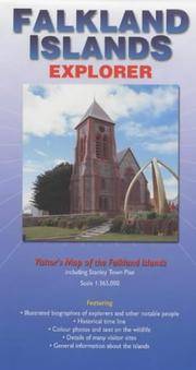
Ocean Explorer Maps
Falkland Islands Explorer Map
map. Good. Access codes and supplements are not guaranteed with used items. May be an ex-library book. unknown
书商的参考编号 : 0953861880.G ???????? : 0953861880 9780953861880
|
|
|
Ocean Explorer maps
Falkland Islands Explorer Map
map. Good. Access codes and supplements are not guaranteed with used items. May be an ex-library book. unknown
书商的参考编号 : 0954371747.G ???????? : 0954371747 9780954371746
|
|
|
Ocean Explorer maps
Falkland Islands Explorer Map
Ocean Explorer Maps 2007-02-22. map. New. 3.70x0.12x8.66. Buy with confidence. Excellent Customer Service & Return policy. Ocean Explorer Maps unknown
书商的参考编号 : DADAX0954371747 ???????? : 0954371747 9780954371746
|
|
|
Ocean Explorer Maps
Galapagos Islands : Explorer Ocean Explorer Maps
map. Good. Access codes and supplements are not guaranteed with used items. May be an ex-library book. unknown
书商的参考编号 : 0954371771.G ???????? : 0954371771 9780954371777

|
|
|
Ocean Explorer Maps
Mediterranean Explorer Ocean Explorer Maps
map. Good. Access codes and supplements are not guaranteed with used items. May be an ex-library book. unknown
书商的参考编号 : 0954371739.G ???????? : 0954371739 9780954371739
|
|
|
Ocean Explorer Maps
South Georgia : Explorer Ocean Explorer Maps
map. Good. Access codes and supplements are not guaranteed with used items. May be an ex-library book. unknown
书商的参考编号 : 0957002807.G ???????? : 0957002807 9780957002807
|
|
|
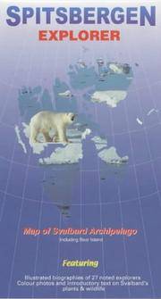
Ocean Explorer Maps
Spitsbergen Explorer Map by Ocean Explorer Maps
map. Good. Access codes and supplements are not guaranteed with used items. May be an ex-library book. unknown
书商的参考编号 : 0953861813.G ???????? : 0953861813 9780953861811
|
|
|
OCEAN PACIFIQUE
Oc?an pacifique et ses principaux archipels. Carte couleur.
1 feuille 80 x 67 cm.
|
|
|
Odgers, Sally Farrell; Hinch, Jennifer (maps).
Tasmania - A Guide.
Sydney Kenthurst: Kangaroo Press 1991. Reprint ed. Paperback trade very good condition black & white text-photos maps minor edgewear. 224 pp. This comprehensive book looks at places of historic and scenic interest and includes a number of tourist attractions specifically designed for young travellers. Sally Farrell Odgers a Tasmanian herself has travelled most of the routes and explored many of the places she writes about here. Kangaroo Press paperback
书商的参考编号 : 28527 ???????? : 0864172362 9780864172365
|
|
|
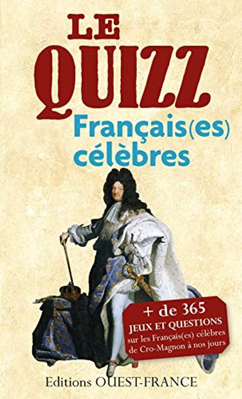
Odile LOZACHMEUR
QUIZZ DES FRANCAIS(ES) CELEBRES: De Cro-Magnon à nos jours
OUEST-FRANCE 2014 200 pages 10 8x2 2x17 6cm. 2014. Broché. 200 pages.
书商的参考编号 : 500034956
|
|
|
Oehser P. ed. and b & w Photos Maps
National Geographic Society Research Reports: 1964 Projects
Hardcover. Very Good. National Geographic Society 1969 hardcover. 1964 Projects volume. Cover contents binding like-new. Dust jacket shows minor wear. hardcover
书商的参考编号 : C4-MJNY-G1GB
|
|
|
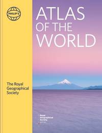
Of British Geographers, Institute (Author)/ Philip's Maps (Author)/ Chabluk, Stefan (Illustrator)/ Donohoe, William (Illustrator
Philip's RGS Atlas of the World: 2024 edition Philip's World Atlas
Philip's 2024. Hardcover. New. 448 pages. 11.26x1.50x14.49 inches. Philip's hardcover
书商的参考编号 : __1849077002 ???????? : 1849077002 9781849077002
|
|
|
ohne Autor
(Ekuador) Guia general del Ecuador.
Guayaquil, Publicistas, 1959. Mehrfach gefaltete Farbkarte.
书商的参考编号 : 4624
|
|
|
ohne Autor
(Mexiko) Las Carreteras de Mexico. Road Map of/Carta de Caminos Mexico.
ohne Ort, Rand McNally (ohne Jahr). Mehrfach gefaltete Straßenkarte.
书商的参考编号 : 4647
|
|
|
Olami, Ya'aqov ; Sender, Shlomo ; Oren, Eldad
Archaeological Survey of Israel: Map of Yagur (27)
Contains a map. 24x17 cm. 102+72 pages. Softcover. In good condition.
|
|
|
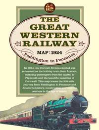
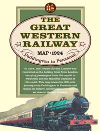
Old House Books & Maps
Great Western Railway Map 1924
map. Good. Access codes and supplements are not guaranteed with used items. May be an ex-library book. unknown
书商的参考编号 : 190840230X.G ???????? : 190840230X 9781908402301
|
|
|
Old House Books & Maps
Great Western Railway Map 1924
Paperback. Very Good. paperback
书商的参考编号 : GOR006296571 ???????? : 190840230X 9781908402301
|
|
|
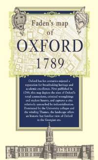
Old House Books & Maps
Map of Oxford 1789
Paperback. Very Good. paperback
书商的参考编号 : GOR005421721 ???????? : 1908402202 9781908402202
|
|
|
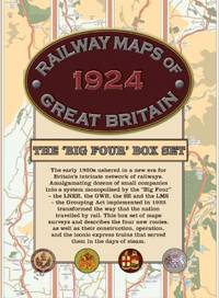
Old House Books & Maps
Railway Maps of Great Britain 1924: The âBig Fourâ Box-set
Paperback. Very Good. paperback
书商的参考编号 : GOR006268288 ???????? : 1908402318 9781908402318
|
|
|
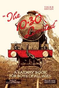
Old House Books & Maps
The 10.30 Limited: A Railway Book for Boys of All Ages
hardcover. Good. Access codes and supplements are not guaranteed with used items. May be an ex-library book. hardcover
书商的参考编号 : 1908402172.G ???????? : 1908402172 9781908402172

|
|
|
Old House Books & Maps
The 10.30 Limited: A Railway Book for Boys of All Ages
2012-04-01. hardcover. Used: Good. 7.99x10.00x1.85. Buy with confidence. Excellent Customer Service & Return policy. hardcover
书商的参考编号 : SONG1908402172 ???????? : 1908402172 9781908402172
|
|
|
Old House Books & Maps
The 10.30 Limited: A Railway Book for Boys of All Ages
Paperback. Very Good. paperback
书商的参考编号 : GOR004122453 ???????? : 1908402172 9781908402172
|
|
|
OLD MAPS
Alte Karten aus Meisterhand. Sammelmappe mit 24 ausgewählten Reproduktionen. Begleittext in deutsch englisch und französisch von W. Horn. Zusammenstellung und Redaktion: H. Täubert.
Gotha : Hermann Haack Geographisch-Kartographische Anstalt 1987. HARDCOVER . 24 mostly col. reproductions 30x41 cm. 24 p. text in English German and French. Hlf cloth portfolio with col old map on front. VERY GOOD hardcover
书商的参考编号 : 4154
|
|
|
OLD MAPS & GLOBES
Oude kaarten & globes uit het bezit van de Universiteitsbibliotheek het Universiteitsmuseum en het Geografisch Instituut der Rijksuniversiteit te Utrecht
1965. SOFTCOVER . 29 p. ills. maps Orig. pictorial wrappers edges slightly discol else AS NEW Interesting exposition catalogue. paperback
书商的参考编号 : 3863
|
|
|
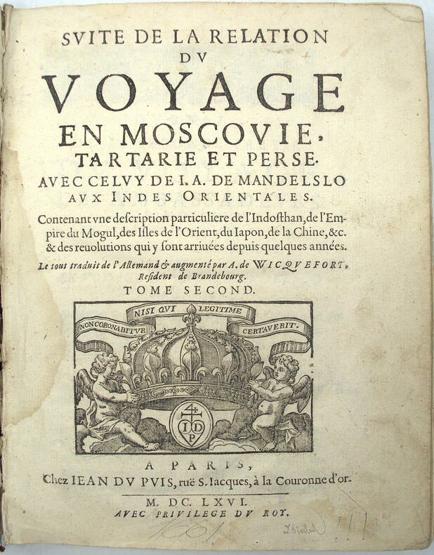
OLEARIUS (Adam) , MANDELSO (J.A. de) , WICQUEFORT (A. de , traducteur)
Relation du voyage d'Adam Olearius en Moscovie, Tartarie et Perse , augmentée en cette nouvelle édition... d'une seconde partie contenant le voyage de Jean Albert de Mandelslo aux Indes Orientales, traduit de l'allemand par A. de Wicquefort
Paris, Dezallier, 1679, 2 volumes in-4 ,28ff.-686pp., 22ff-648pp , relié plein cuir époque, dos à nerfs orné avec pièce de titre et tomaison, tranches mouchetées rouge, réparations aux dos, pièces de titre et tomaison récentes au tome, illustré de 6 cartes dépliantes (7), ex-libris manuscrit en page de garde et au titre, traces de réparation aux cartes.
书商的参考编号 : PHO-1772

|
|
|
OLEARIUS (Adam), MANDELSO (J.A. de), WICQUEFORT (A. de, traducteur)
Suitte du voyage en Moscovie. Tartarie et Perse, avec celuy de J. A. de Mandelslo aux Indes orientales, contenant une description... de l'Indosthan, de l'empire du Mogul, des isles de l'Orient, du Japon, de la Chine….
Paris, Jean du Puis, 1666, 1 volume (2) in-4 (24x18cm), 23ff.-648pp., veau époque, dos à nerfs, manque important au dos, frottements, coiffes arasées, fentes, mouillure, manque les cartes.
书商的参考编号 : PHO-2151
|
|
|
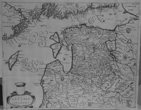
OLEARIUS (Adam).
[LETTONIE] La Livonie ou Liflande.
[1659]. 279 x 361 mm.
书商的参考编号 : LBW02521
|
|
|
Olearius, Adam
La Livonie ou Liflande. Original-Kupferstichkarte, unkoloriert.
[Paris, A. Dezailler, 1679]. 28,5 x 36,5. Unter Passepartout.
书商的参考编号 : 78821

|
|
|
Olearius, Adam (1599-1671)
Vera delineatio provinciae fertilissimae Kilan olim Hyrcaniae ad mare Caspium sitae. [Kaspisches Meer]. Per Ad. Olearium.
O. O. (Paris), (Jean Dupuis), ( 1659). Kupferstich. Darstellung ca. 28 x 33 cm, Blattmaß 31 x 42 cm. Feinkartonpassepartout.
书商的参考编号 : 78800

|
|
|
OLIVIERI Bernardino (Roma, 1770 - ?)
Circoli per formare La Sfera Armillare
Foglio contenente delle sezioni di globo - in dodici segmenti - e altri elementi atti a costruire una sfera armillare. Il globo terrestre centrale è in 12 segmenti e avrebbe un diametro di circa 5,5 cm se costruito. La sfera armillare complessiva avrebbe un diametro di 28 cm. I vari anelli della sfera armillare comprendono l'equatore, il Tropico del Cancro, il Tropico del Capricorno, le zone e i cerchi polari e antartici. Tavola edita dalla Calcografia Camerale, Roma 1795 e tratta dal Nuovo Atlante Geografico Universale delineato sulle ultime osservazioni, edito a Roma dal 1792 fino al 1801, opera che la Calcografia Camerale commissionò al Cassini al fine di sostituire l’ormai obsoleto Mercurio Geografico della tipografia De Rossi. Bernardino Olivieri fu cartografo incisore presso la Calcografia Camerale di Roma sitauta nel Collegio di Propaganda Fide Incisione in rame, finemente colorata a mano, in ottime condizioni. Rara. This matching set of sheets contain the pieces to construct an armillary sphere. The central terrestrial globe is in 12 segments and would have a diameter of approximately 5.5 cm if constructed. The overall armillary sphere would have a diameter of 28 cm. The various rings of the armillary sphere include the equator, the Tropic of Cancer, the Tropic of Capricorn, the zones, and the Polar and Antarctic circles. Uncommon maps, published in the Nuovo Atlante Geografico Universale, that was commissioned to Cassini by the Calcografia Camerale, in order to replace the obsolete De Rossi's Mercurio Geografico. Bernardino Olivieri was a cartographer and engraver at the Calcografia Camerale di Roma located in the Collegio di Propaganda Fide. Copper engraving, finely hand colored, in very good condition. Rare.

|
|
|
ONE OF THE LARGEST ENGRAVED FUNERAL PROCESSIONS - ERIK DAHLBERG.
Exequiae Serenissimi ac Potentiss: Principis ac Dni. Domini Caroli Gustavi Suecorum Gothorum et Wandalorum Regis d. 3. Nouemb. 1660 Holmiæ Celebratæ. Accuraté delineauit E.I. Dahlbergh. (The funeral procession of King Carl X Gustav of Sweden).
(Nürnberg, 1696). The large engraving of the procession through Stockholm being composed of 13 engraved plates joined together, measuring 30x450 cm. (Plates numb. 1-13). Some mostly marginal dampstains, some marginal tears, some brownspots mainly marginal. Upper margin of plate 3 partly gone. Margins strenghtened at verso with brown paper. Some variation to paperquality, but in general in good strong impressions.
书商的参考编号 : 32611

|
|
|
ONE OF THE LARGEST ENGRAVED FUNERAL PROCESSIONS - ERIK DAHLBERG.
Exequiae Serenissimi ac Potentiss: Principis ac Dni. Domini Caroli Gustavi Suecorum Gothorum et Wandalorum Regis d. 3. Nouemb. 1660 Holmiæ Celebratæ. Accuraté delineauit E.I. Dahlbergh. (The funeral procession of King Carl X Gustav of Sweden).
(Nürnberg, 1696). The large engraving of the procession through Stockholm being composed of 13 engraved plates joined together, measuring 30x450 cm. (Plates numb. 1-13). Some mostly marginal dampstains, some marginal tears, some brownspots mainly marginal. Upper margin of plate 3 partly gone. Margins strenghtened at verso with brown paper. Some variation to paperquality, but in general in good strong impressions.
|
|
|
Ontario Ministry of Natural Resources; Ontario Ministry of Natural Resources; Photos/ Maps [Illustrator]
Canoe Route of Ontario A Comprehensive Guide to More Than 100 Canoe Routes Throughout the Province
The Canadian Publishers 1992-01-01. Paperback. Acceptable. 8x0x11. The Canadian Publishers paperback
书商的参考编号 : 0771060688-4-24991959 ???????? : 0771060688 9780771060687
|
|
|
OOShea, Richard [David, Greenspan (maps)]
Battle Maps of the American Civil War
Stroud: Sutton 1994. 1st edition. Nice Copy. quarto. dust jacket 176pp. frontis. colour & b/w plates maps appends. bibliog. index Comprehensive many fine colour illusts of uniforms. Also accounts of tactics & weaponry. Light tape-marks to end papers o/w a nice copy Sutton unknown
书商的参考编号 : 76637
|
|
 ?????????
 ?????PDF???
 RSS feed


