|
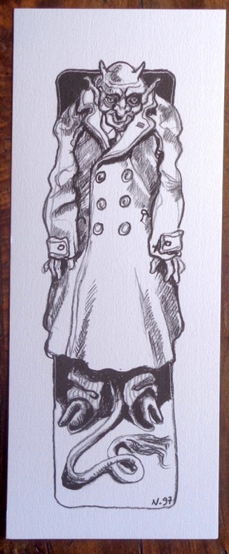
Nicollet Jean-Michel::
Petite sérigraphie en noir.
1997. Sérigraphie au format 10 x 25 cm., à l'état de neuf. Non signée.
Bookseller reference : 2007
|
|
|
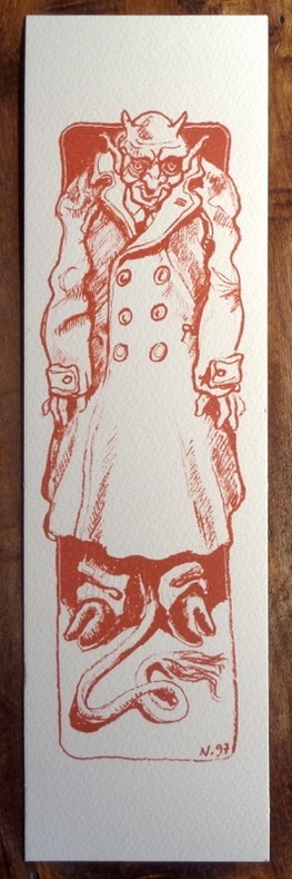
Nicollet Jean-Michel::
Petite sérigraphie sépia.
1997. Sérigraphie au format 8 x 28 cm., à l'état de neuf. Non signée.
Bookseller reference : 2008
|
|
|
Nicolson maps
Bridge of Weir Street Guide Nicolson Street Guides
Paperback. Very Good. paperback
Bookseller reference : GOR013059784 ISBN : 1874288909 9781874288909
|
|
|
Nicolson Maps Staff
Edinburgh City Atlas
Nicolson Maps. Used - Very Good. Ships from the UK. Used book that is in excellent condition. May show signs of wear or have minor defects. Nicolson Maps unknown
Bookseller reference : 54607895-20 ISBN : 1860970826 9781860970825
|
|
|
Nicolson maps
Edinburgh City Map Atlas
Largs: Nicolson Maps. As new. . Fine. Soft cover. 2000. Nicolson Maps paperback
Bookseller reference : 028523 ISBN : 1860970826 9781860970825

|
|
|
Nicolson Maps
Falkirk Stirling & District Street Atlas
Used - Good. Ships from the UK. Used book that is in clean average condition without any missing pages. unknown
Bookseller reference : 54617963-20 ISBN : 1860972993 9781860972997
|
|
|
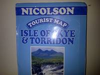
Nicolson maps
Isle of Skye and Torridon Tourist Map
Paperback. Very Good. paperback
Bookseller reference : GOR002040338 ISBN : 1860970559 9781860970559
|
|
|
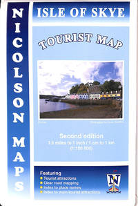
Nicolson Maps
Nicolson Isle of Skye Tourist Map
Nicolson Maps 2013-08-16. map. Good. 19 to 25 cm tall Octavo 8vo. . Posted within 1 working day. 1st class tracked post to the UK Airmail tracked worldwide. Robust recyclable packaging. Nicolson Maps unknown
Bookseller reference : 279206 ISBN : 1860973663 9781860973666
|
|
|
Nicolson maps
Oban and Mull Tourist Map
map. Good. Access codes and supplements are not guaranteed with used items. May be an ex-library book. unknown
Bookseller reference : 1860970567.G ISBN : 1860970567 9781860970566
|
|
|
Nicolson maps
Oban and Mull Tourist Map Nicholson Maps
Nicolson Maps. Map. Used; Good. Simply Brit welcome to our online used book store where affordability meets great quality. Dive into a world of captivating reads without breaking the bank. We take pride in offering a wide selection of used books from classics to hidden gems ensuring theres something for every literary palate. All orders are shipped within 24 hours and our lightning fast-delivery within 48 hours coupled with our prompt customer service ensures a smooth journey from ordering to delivery. Discover the joy of reading with us your trusted source for affordable books that do not compromise on quality. 05/01/1999 Nicolson Maps unknown
Bookseller reference : 1654109 ISBN : 1860970567 9781860970566
|
|
|
Nicolson maps
Oban and Mull Tourist Map Nicholson Maps
Nicolson Maps 05/01/1999. Map. Used; Very Good. WE SHIP WITHIN 24 HRS FROM LONDON UK 98% OF OUR ORDERS ARE RECEIVED WITHIN 7-10 DAYS. We believe you will be completely satisfied with our quick and reliable service. All orders are dispatched as swiftly as possible! Buy with confidence! Greener Books. Nicolson Maps unknown
Bookseller reference : 2729527 ISBN : 1860970567 9781860970566
|
|
|
Nicolson Maps
Oban and Mull Tourist Map
Paperback. Very Good. paperback
Bookseller reference : GOR002406817 ISBN : 1860972195 9781860972195

|
|
|
Nicolson maps
Oban and Mull Tourist Map
Paperback. Very Good. paperback
Bookseller reference : GOR002497832 ISBN : 1860970567 9781860970566

|
|
|
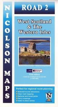
Nicolson Maps
Road 2: West Scotland & The Western Isles
Paperback. Very Good. paperback
Bookseller reference : GOR006735234 ISBN : 1860973353 9781860973352
|
|
|
Nicolson Maps
Scotland Tourist Map
Paperback. Very Good. paperback
Bookseller reference : GOR002351469 ISBN : 1860972047 9781860972041

|
|
|
Nicolson Maps Staff
Scottish Borders Third Series 1st Editio
Used - Good. Ships from the UK. Used book that is in clean average condition without any missing pages. unknown
Bookseller reference : 52983607-20 ISBN : 1860972276 9781860972270
|
|
|
Niehaus, T.; color plates, drawings, maps [Illustrator]
A Field Guide to Southwestern and Texas Wildflowers Peterson Field Guide Series
Houghton Mifflin Company 1984-01-01. paperback. Good. 1x4x7. Houghton Mifflin Company paperback
Bookseller reference : 0395366402-3-31543487 ISBN : 0395366402 9780395366400

|
|
|
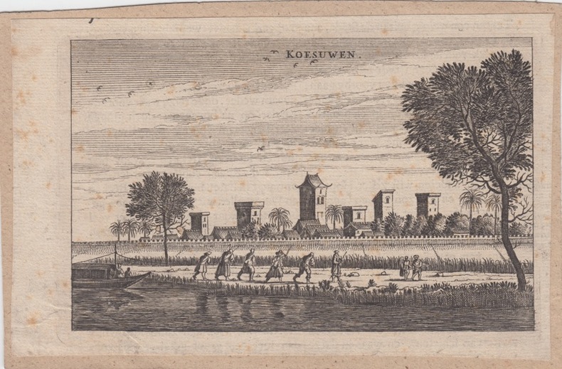
NIEUHOF, Joan.
View on Koesuwen.Antique Print-KOESUWEN-CHINA-Nieuhof-
1699 Amsterdam, 1699. original copper-engraving, 10 x 16 cm, taken from Joan Nieuhof: Het Gezandtschap der Neêrlandtsche Oost-Indische Compagnie, aan den grooten Tartarischen Cham, den tegenwoordigen Keizer van China, Amsterdam, 1666-99
Bookseller reference : 26061
|
|
|
Nihat Bey, Mehmet.
[The Ottoman Empire and the Balkan Wars]. Istanbul, [1924 and] 1928.
Folio (ca. 410 x 570 to 570 x 820 mm). 22 folded original military maps, 8 of which in colour (scales 1:20,000 - 1:420,000). - Includes 56 ff. of Ottoman Turkish manuscript notes on military history, loosely stored. A rare and substantial set of military maps of the Balkan Wars, issued as rear-pocket matter to accompany the three-volume work "1328-29 Balkan Harbi, Trakya Seferi" (1924-28) by the topographer and military historian Nihat Bey. Never seen at auction; merely three copies could be traced in libraries worldwide (Istanbul, Princeton, and Washington). The maps show the Ottoman military campaigns on the Balkan peninsula against Bulgaria, Serbia, Greece, and Montenegro in 1912 and 1913, wars which resulted in the Ottoman Empire losing the bulk of its European territory. - Nihad Bey (1886-1928) of Bursa held the rank of Lieutenant Colonel but is remembered as a scholar rather than a soldier. The first and foremost military historian of the Turkish Republic, he published no fewer than 39 books in which he meticulously evaluated operational mistakes and emphasized lessons to be learned from past wars. - Includes a set of manuscript notes in pencil, presumably taken by one of Nihat Bey's students at the military academy in the course of lectures on early 20th century Ottoman military history. Bey probably incorporated the maps in his lectures, as is suggested by marks and notes found on several map sheets, mostly in blue or red crayon, corresponding to the colours and patterns used in printing eight of the maps. - Small tears and holes to several maps, mostly along the folds. The manuscript notes show traces of stapling. An unusual and important specimen of Turkish military history.
|
|
|
Nilson, A. & J. Hornung; Photos, Maps, Fold-out Charts [Illustrator]
PRACTICAL RADIO COMMUNICATION. PRINCIPLES - SYSTEMS- EQUIPMENT - OPERATION
McGraw-Hill Book Co. Inc 1943-01-01. Paperback. Good. Good condition softcover with torn and tattered cover and spine. McGraw-Hill Book Co., Inc paperback
Bookseller reference : 90-24204
|
|
|
No Author
Chin Coulee, Alberta, West of Fourth Meridian, Scale 1:50,000
36" x 25.5". Indicates 25 foot contours, water bodies, roads, rail lines, structures, etc. Average soiling and wear. Book

|
|
|
No Author
Dial Map of Greater Vancouver, British Columbia - Street Cars, Buses / Map of Burnaby - New Westminster and Parts of Adjacent Municipalities (including Surrey) Circa 1950
25 inches wide by 19 inches high. Vancouver map indicates parks and water in shades of green, transit routes in red. Shows route of the B.C. Electric Railway, Lulu Island Interurban, Fourth (4th) Ave. Trolley, Granville-Marpole Trolley, Cambie Trolley Coach, Powell Trolley, and various bus routes. Original price $0.35. Four-digit phone numbers. Advertisement suggests printing date circa 1950. Average wear and soiling overall with moderate sunning/tanning along some creases. Above-average soiling to front panel. A worthy copy of this rare vintage map. Book

|
|
|
No Author
Handy Map & Guide to London with index to Streets Cruchley's Handy Map of London
<p>Gall & Inglis' 1870's-1880's. Paperback. Very good. VGC.Gall & Inglis'.No date given but probably 1870's to 1880's prior to London Tower Bridge build which is not included on the map.Green hardbacksmall dentsnicks and light shelf wear on the cover with folded map in VGC.The map is in VGC but with small stain marks and foxing marks on the edgessmall tear on the edge of the map.The map is hand coloured and includes:RailwaysRailway StationsSteamer RoutesOmnibus and Tramway RoutesParks.The size of the map is: 30x20 inch.The scale of the map is: 3 3/4 to 1 mile.The map covers: From Hyde Parkincluding parts of Kensington Palace to Blackwall and from Mildmay Park to South Lambeth.The map is in VGC for its age. A collectable and scarce map.</p> Gall & Inglis' paperback
Bookseller reference : 5388

|
|
|
No Author
Map of Grassy Lake, Alberta, West of Fourth Meridian, Scale 1:50,000
36" x 25.5". Indicates 25 foot contours, water bodies, roads, rail lines, structures, etc. Light wear. Unmarked. Book

|
|
|
No Author
Map of Hays Alberta, West of Fourth Meridian, Scale 1:50,000
36" x 25.5". Indicates 25 foot contours, water bodies, roads, rail lines, structures, etc. Light wear. Unmarked. Book

|
|
|
No Author
Map of Raymond, Alberta, West of Fourth Meridian, Scale 1:50,000
36" x 25.5". Indicates 25 foot contours, water bodies, roads, rail lines, structures, etc. Light wear. Unmarked. Book

|
|
|
No Author
Map of Township of Guelph, Ontario
25.5" x 16 3/8". Grey colouring. Includes owners' names for most acreages outside the city of Guelph. Map of Village of Hartfield (where Fergus Road meets Woolwich Road) in upper left corner, Date lightly handwritten in pencil (twice). 5" opening near left side of bottom edge is barely visible. A wonderful historical and genealogical reference ideally suited to framing and displaying in home or office. Please note that our photo shows only the left half of the map. Book

|
|
|
No Author
Map of Warner County, Alberta, West of Fourth Meridian, Scale 1:50,000
36" x 25.5". Indicates 25 foot contours, water bodies, roads, rail lines, structures, etc. Light wear. Unmarked. Book

|
|
|
No Author
Mapas Turisticos Provinciales - Islas Canarias: Aprobados Por El Consejo Superior Geographico
Text in Spanish. One-sided color map of the Islas Canarias. 69 x 45cm. Clean and unmarked with moderate wear. Includes tourist information. A quality vintage copy. Book

|
|
|
No author
Newnes Motorists Touring Maps and Gazetteer
15th edition 2nd impression. 4to, 64 pages, maps, maps on front and back endpapers. Poor condition hardback gilt writing on spine and front cover, hinge loose, some damage to bottom of spine some loss at head of spine. Edges of pages browning. 39096. eng
|
|
|
No Author
Picture Butte, Lethbridge County, Alberta, West of Fourth Meridian, Scale 1:50,000
36" x 25.5". Indicates 25 foot contours, water bodies, roads, rail lines, structures, etc. Light wear. Book

|
|
|
No Author
Road Map scale: 3 Miles to 1 inch for Motoring Cycling and Hiking: Section LL Exeter Torquay Plymouth Dartmoor Barnstaple Etc.
W. & A. K. Johnston Ltd 1949. Book. Very Good. Paperback. code 12/49 presumed to be December 1949. Large colour printed map folding down into pictorial card covers printed in red and green. Covers very good with light wear only. Map clean and bright no annotations or inscriptions a single 1cm split at central folding otherwise very light wear. A very good copy. W. & A. K. Johnston Ltd Paperback
Bookseller reference : 029337

|
|
|
No Author
Rochester Guidebook
Ex-library book with the usual stamps, stickers, etc. Binding is solid and text/interior is clean and free of marking of any kind. 128 pages in small format. Rochester, New York's first guide book, an alphabetical listing of sites, businesses, educational facilities, government, pastimes, clubs, philanthropies "and other interests." Fold-out city map at front with a few small tears at attachment points to book, b&w photos, a few ads at back. Binding is worn and appears to be the library's with paperback covers adhered to hardback boards.

|
|
|
No Author
Skiff, Alberta, West of Fourth Meridian, Scale 1:50,000
36" x 25.5". Indicates 25 foot contours, water bodies, roads, rail lines, structures, etc. Light wear. Book

|
|
|
No Author
SOUTH AMERICA From the Best Authorities Inc. Falkland Islands ORIGINAL ANTIQUE MAP
T. Tegg Map. Very Good. Unframed. No date but circa 1840. An original copper engraved map entitled SOUTH AMERICA From the Best Authorities; the Falklands islands are also depicted. Plate measures 21.2 x 24.5cm. Originally from an atlas with a central fold. Very good condition with slight dust marking. T. Tegg unknown
Bookseller reference : 020932

|
|
|
No Author
THE ISLAND OF SUMATRA ORIGINAL COLOUR MAP
London: Edward Stanford Map. Very Good. Unframed. No date but circa 1910. A fine coloured map of the island of Sumatra measuing 19. x 32.5cm. Originally from an atlas with 3 fold lines. Very good condition. Edward Stanford unknown
Bookseller reference : 020930

|
|
|
No Author
Travers, Alberta - West of Fourth Meridian, Scale 1:50,000
36" x 25.5". Indicates 25 foot contours, water bodies, roads, rail lines, structures, etc. Light wear. Book

|
|
|
Noble, Isabella; Noble, John; Quintero, Josephine; Sainsbury, Brendan
Andalucia : Lonely Planet Guide
Appears unused. No marks or inscriptions. No creasing to covers or to spine. A very clean very tight copy with bright unmarked boards and no bumping to corners. 391pp. Lonely Planet guide to the Andalucia region of Spain including Seville and Gibraltar.

|
|
|
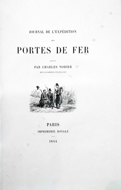
Nodier (Charles) :
Journal de l'Expédition des Portes de Fer.
Paris, Imprimerie Royale, 1844 ; grand in-8 ; cartonnage à la bradel de l'éditeur ; [4], XVI, 329 pp., [1] f. blanc, 40 planches hors-textes tirées sur chine contrecollées, protégées par des serpentes légendées et une carte dépliante en fin d'ouvrage et 200 vignettes gravées sur bois dans le texte.
Bookseller reference : 13368
|
|
|
NOEL (Joseph).
Harper's ferry en 1865.
Paris, [circa 1860]. 129 x 166 mm.
Bookseller reference : LBW-1254

|
|
|
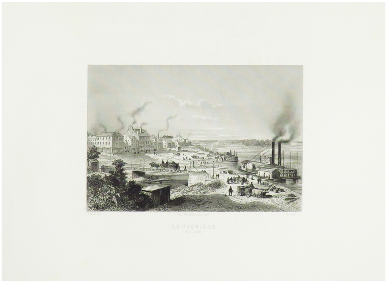
NOEL (Joseph).
Louisville (Kentucky).
Paris, [circa 1860]. 128 x 162 mm.
Bookseller reference : LBW-1253
|
|
|
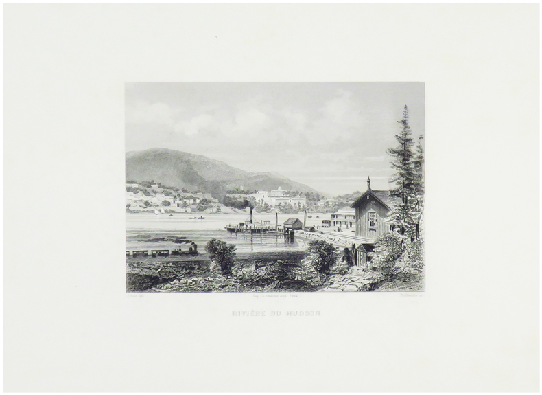
NOEL (Joseph).
Rivière du Hudson.
Paris, [circa 1860]. 124 x 159 mm.
Bookseller reference : LBW-1251
|
|
|
NOEL M
Carte routière de la France à l'usage des voyageurs
BassetM. Paris ,Chez Basset, 1829. Grande carte dépliante de 92*63 cm, repliée sous cartonnage. Carte en noir avec en bord, des suppléments pour : Madrid et Lisbonne. Turin, Florence, Milan, Rome et Naples. Vienne et Constantinople. Dresde, Berlin, Varsovie, Moscou et Saint Petersbourg. Copenhague et Stockholm. Amsterdam. Indiquant exactement les différentes espèces de routes et les distances intermédiaires des villes, bourgs, villages en lieues de poste de 2000 toises. Quelques déchirures aux pliures.
Bookseller reference : 188514

|
|
|
NOELLAT (Jean-Baptiste).
[RHÔNE] Nouvelle carte topographique et statistique du département du Rhône réduite d'après la grande carte de Cassini.
Lyon et Villefranche, 1827. 821 x 593 mm.
Bookseller reference : LBW-5138

|
|
|
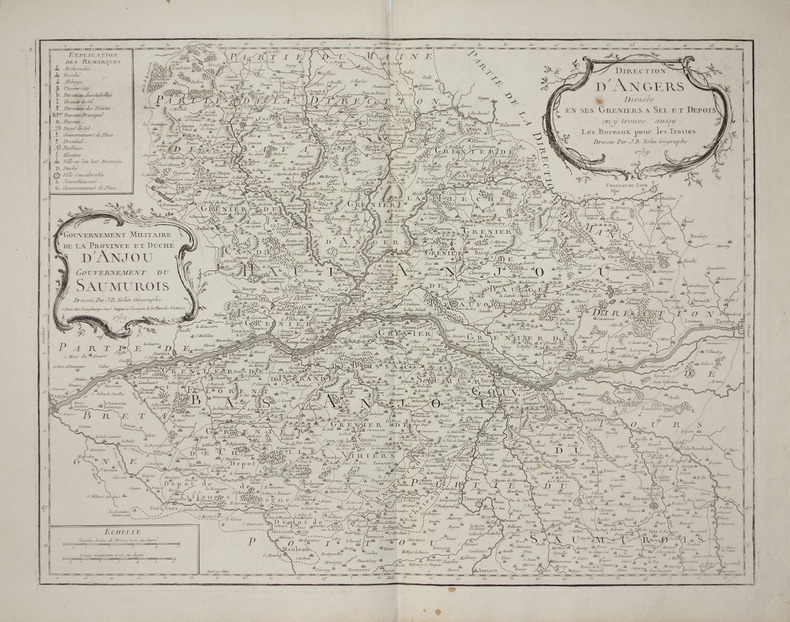
NOLIN (Jean-Baptiste).
[ANJOU/GRENIERS à SEL] Direction d'Angers divisée en ses greniers à sel et dépôts, on y trouve aussy les bureaux pour les traites - Gouvernement militaire de la province et duché d'Anjou, gouvernement du Saumurois.
Paris, Longchamps, 1759. 474 x 613 mm.
Bookseller reference : LBW-2797
|
|
|
NOLIN (Jean-Baptiste).
[ANJOU/GRENIERS à SEL] Gouvernement militaire de la province et Duché d'Anjou. Gouvernement du Saumurois - Direction d'Angers divisée en ses greniers à sel et dépôts, on y trouve aussy les bureaux pour les traites.
Paris, Mondhare et Jean. 1787 472 x 614 mm ; repliée sous couverture cartonnée recouverte de papier bleu de l'époque (200 x 127mm) ; étiquette sur le premier plat portant le titre manuscrit à l'encre.
Bookseller reference : LBW-8429

|
|
|
NOLIN (Jean-Baptiste).
[GUYENNE & GASCOGNE] Le gouvernement général de Guienne et Gascogne dédié à Sa Majesté, divisé en deux lieutenances générales de Haute et Basse Guienne et en une lieutenance de roy particulier.
Paris, Mondhare et Jean, 1787. 462 x 618 mm ; repliée sous couverture cartonnée recouverte de papier bleu de l'époque (200 x 128mm) ; étiquette sur le premier plat portant le titre manuscrit à l'encre.
Bookseller reference : LBW-8443

|
|
|
NOLIN (Jean-Baptiste).
[GUYENNE] Carte de la Guyenne, du Bourdelois, partie du Périgord et pays voisins.
À Bourdeaux, à la Bourse et au grand Bureau, 1776. 522 x 680 mm ; repliée sous couverture cartonnée recouverte de papier bleu de l'époque (200 x 128mm) ; étiquette sur le premier plat portant le titre manuscrit à l'encre.
Bookseller reference : LBW-8458

|
|
|
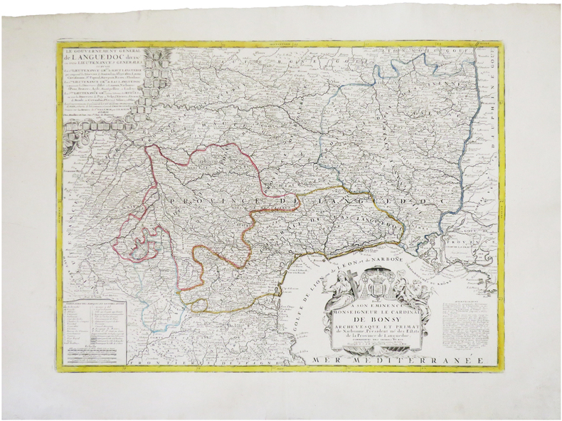
NOLIN (Jean-Baptiste).
[LANGUEDOC] Le gouvernement général de Languedoc divisé en trois lieutenances générales.
Paris, Mondhare et Jean, 1787. 450 x 610 mm.
Bookseller reference : LBW-7845
|
|
|
NOLIN (Jean-Baptiste).
[LYONNAIS] Le gouvernement général et militaire du Lyonnois comprenant les provinces du Lyonnois, du Forez, et du Beaujolois.
Paris, Mondhare et Jean, [circa 1780]. En deux feuilles pouvant être jointes pour former une carte de 779 x 616 mm ; repliée sous couverture cartonnée recouverte de papier bleu de l'époque (199 x 128mm) ; étiquette sur le premier plat portant le titre manuscrit à l'encre.
Bookseller reference : LBW-8422

|
|
 Receive by email
 Download as PDF document
 RSS feed


