|
|
|
ORTELIUS Abraham (1528 - 1598)
Aevi Veteris Typus Geographicus
Splendida carta del Mondo Antico pubblicata nel Parergon, l'atlante di Ortelius dedicato alla geografia antica.La mappa presenta i territori conosciuti fino al 1492, all'interno di una proiezione ovale in cui sono rappresentate le fasce climatiche canonizzate da Tolomeo. Ortelius, inoltre, nella realizzazione del planisfero tiene conto del passo di Strabone (II, 5,6) nel quale sostiene che la terra abitata occupi meno della metà dell'emisfero boreale. Pur con queste premesse, il disegno dell'ecumene è moderno, come mostrano i profili del golfo di Guinea, del Madagascar e della penisola indocinese.Il planisfero è circondato da una ricca cornice decorativa nei cui angoli sono contenute le mappe, di formato circolare, dei quattro continenti. Tratta dal Parergon, il primo atlante storico mai pubblicato. Fu inizialmente concepito da Ortelius come appendice del suo Theatrum Orbis Terrarum ma visto il notevole successo di queste carte storiche divenne in seguito un lavoro indipendente e rimase la fonte principale di tutti i lavori simili per tutto il XVII secolo. Come sottolinea Koeman “il Parergon deve essere considerato come lavoro personale di Ortelius. Per quest'opera, infatti, diversamente dal Theatrum, non copiò le mappe di altri cartografi, ma ne disegnò lui stesso di nuove ed originali…prese luoghi, regioni e territori delle civiltà classiche illustrandone e spiegandone la storia, una materia molto vicina al suo cuore. Le mappe e le lastre del Parergon devono essere valutate come le più importanti incisioni che rappresentano il diffuso interesse per la geografia classica nel XVI secolo”. Il Theatrum Orbis Terrarum e che è considerato il primo vero “atlante” moderno. L’opera fu pubblicata in 7 lingue e 36 edizioni, per il quale – nel 1570 - Ortelius ottenne il privilegio, ovvero una sorta di diritto d'autore che impediva ad altri cartografi di pubblicare i propri lavori. Il Theatrum rappresentava il lavoro più avanzato del lavoro della descrizione cartografica. L’Ortelius vi raccolse il sapere geografico e cartografico del suo tempo, proponendo in 147 spettacolari tavole incise l’immagine più fedele del mondo allora conosciuto e, in alcune straordinarie “carte storiche”, regioni e itinerari tratti dalla letteratura, dalla mitologia, dalla tradizione. Incisione su rame, finemente acquarellata, in ottimo stato di conservazione. Esemplare dall'edizione tedesca pubblicata nel 1602. This interesting map presents the regions of the earth that were known in classic times within a large oval projection showing the relative size of the now-known world. The map extends into Asia as far east as Sumatra and south to Madagascar and the Mountains of the Moon in Africa. The climate zones are shown as Zona frigida, temperata, and torrida, with the Zona frigida noted as being uninhabitable. An ornate border surrounds the map and incorporates four small insets: Europe, Asia, Africa and America representing the "modern" world. Map taken from the Parergon, the first historical atlas ever published. It was initially conceived by Ortelius as an appendix to his Theatrum Orbis Terrarum, but given the considerable success of these historical maps it later became an independent work and remained the main source of all similar works throughout the seventeenth century. Koeman wrote: "This atlas of ancient geography must be regarded as a personal work of Ortelius. For this work he did not, as in the Theatrum, copy other people's maps but drew the originals himself... He took many places and regions from the lands of classical civilization to illustrate and clarify their history, a subject very close to his heart... The maps and plates of the Parergon have to be evaluated as the most outstanding engravings depicting the wide-spread interest in classical geography in the 16th century." The Theatrum Orbis Terrarum, which is considered the first true modern "Atlas". The work was published in 7 languages and 36 editions, for which - in 1570 - Ortelius obtained the privilege, a kind of copyright that prevented other cartographers from publishing his works. The Theatrum represented the most advanced work of cartographic description. Ortelius collected in it the geographical and cartographic knowledge of his time, proposing in 147 spectacular engraved plates the most faithful image of the world then known and, in some extraordinary "historical maps", regions and routes taken from literature, mythology, tradition. From the 1602 German edition of the Parergon. Copperplate, with fine colouring, good conditions. Shirley #176; Van den Broecke #186.

|
|
|
ORTELIUS Abraham (1528 - 1598)
Creta Iouis magni, medio iacet insula ponto. Ex conatibus geographicis Abrahami Ortely.
Carta proveniente dall'edizione latina del Parergon sive veteris geographiae aliquot tabulae di Ortelius, raccolta di carte antiche pubblicata per la prima volta nel 1578 come supplemento al Theatrum Orbis Terrarum. Esso era seguito anche da un Nomenclator Ptolemaicus, elenco di tutti i nomi geografici che comparivano nella Geographia di Tolomeo. Questa tavola rappresenta, diversamente orientate ad Est o a Nord, Creta e altre isole dello Ionio, Sardegna e Corsica, ciascuna con margine graduato, longitudine e latitudine, inserite in riquadri in cui è riportato anche un elenco di luoghi dalla posizione sconosciuta. Il retro del foglio, riporta la descrizione in latino delle isole rappresentate. Tratta dal Parergon, il primo atlante storico mai pubblicato. Fu inizialmente concepito da Ortelius come appendice del suo Theatrum Orbis Terrarum ma visto il notevole successo di queste carte storiche divenne in seguito un lavoro indipendente e rimase la fonte principale di tutti i lavori simili per tutto il XVII secolo. Come sottolinea Koeman “il Parergon deve essere considerato come lavoro personale di Ortelius. Per quest'opera, infatti, diversamente dal Theatrum, non copiò le mappe di altri cartografi, ma ne disegnò lui stesso di nuove ed originali…prese luoghi, regioni e territori delle civiltà classiche illustrandone e spiegandone la storia, una materia molto vicina al suo cuore. Le mappe e le lastre del Parergon devono essere valutate come le più importanti incisioni che rappresentano il diffuso interesse per la geografia classica nel XVI secolo”. Il Theatrum Orbis Terrarum e che è considerato il primo vero “atlante” moderno. L’opera fu pubblicata in 7 lingue e 36 edizioni, per il quale – nel 1570 - Ortelius ottenne il privilegio, ovvero una sorta di diritto d'autore che impediva ad altri cartografi di pubblicare i propri lavori. Il Theatrum rappresentava il lavoro più avanzato del lavoro della descrizione cartografica. L’Ortelius vi raccolse il sapere geografico e cartografico del suo tempo, proponendo in 147 spettacolari tavole incise l’immagine più fedele del mondo allora conosciuto e, in alcune straordinarie “carte storiche”, regioni e itinerari tratti dalla letteratura, dalla mitologia, dalla tradizione. Incisione in rame, fine coloritura, in ottimo stato di conservazione. Map of islands of the Mediterranean taken from Ortelius' Parergon; a large map of Crete is at the bottom half of the sheet, with smaller maps of Corsica, the Greek Islands and Sardinia. The Parergon is the first historical atlas ever published. It was initially conceived by Ortelius as an appendix to his Theatrum Orbis Terrarum, but given the considerable success of these historical maps it later became an independent work and remained the main source of all similar works throughout the seventeenth century. Koeman wrote: "This atlas of ancient geography must be regarded as a personal work of Ortelius. For this work he did not, as in the Theatrum, copy other people's maps but drew the originals himself... He took many places and regions from the lands of classical civilization to illustrate and clarify their history, a subject very close to his heart... The maps and plates of the Parergon have to be evaluated as the most outstanding engravings depicting the wide-spread interest in classical geography in the 16th century." The Theatrum Orbis Terrarum, which is considered the first true modern "Atlas". The work was published in 7 languages and 36 editions, for which - in 1570 - Ortelius obtained the privilege, a kind of copyright that prevented other cartographers from publishing his works. The Theatrum represented the most advanced work of cartographic description. Ortelius collected in it the geographical and cartographic knowledge of his time, proposing in 147 spectacular engraved plates the most faithful image of the world then known and, in some extraordinary "historical maps", regions and routes taken from literature, mythology, tradition. Copper engraving, contemporary coloring, in good condition. Van den Broecke 217; Zacharakis, Greece 1621.

|
|
|
ORTELIUS Abraham (1528 - 1598)
Gallia Vetus, Ad Iulij Caesaris commentaria . . . 1590
Bella carta dell'antica regione della Gallia, tratta dal Parergon, il primo atlante storico mai pubblicato. Fu inizialmente concepito da Ortelius come appendice del suo Theatrum Orbis Terrarum ma visto il notevole successo di queste carte storiche divenne in seguito un lavoro indipendente e rimase la fonte principale di tutti i lavori simili per tutto il XVII secolo. Come sottolinea Koeman “il Parergon deve essere considerato come lavoro personale di Ortelius. Per quest'opera, infatti, diversamente dal Theatrum, non copiò le mappe di altri cartografi, ma ne disegnò lui stesso di nuove ed originali…prese luoghi, regioni e territori delle civiltà classiche illustrandone e spiegandone la storia, una materia molto vicina al suo cuore. Le mappe e le lastre del Parergon devono essere valutate come le più importanti incisioni che rappresentano il diffuso interesse per la geografia classica nel XVI secolo”. Il Theatrum Orbis Terrarum e che è considerato il primo vero “atlante” moderno. L’opera fu pubblicata in 7 lingue e 36 edizioni, per il quale – nel 1570 - Ortelius ottenne il privilegio, ovvero una sorta di diritto d'autore che impediva ad altri cartografi di pubblicare i propri lavori. Il Theatrum rappresentava il lavoro più avanzato del lavoro della descrizione cartografica. L’Ortelius vi raccolse il sapere geografico e cartografico del suo tempo, proponendo in 147 spettacolari tavole incise l’immagine più fedele del mondo allora conosciuto e, in alcune straordinarie “carte storiche”, regioni e itinerari tratti dalla letteratura, dalla mitologia, dalla tradizione. Incisione in rame, finemente colorata a mano in epoca, in buono stato di conservazione. First state of this map of ancient France, which Ortelius compiled from military information in Caesar's "De Bello Gallico". The map contains less geographical detail than the similar map "Galliae Veteris Typus". Large strapwork title, dedication and scale of miles cartouches, a elaborately engraved border and panels at sides with the names of famous people. Map taken from the Parergon, the first historical atlas ever published. It was initially conceived by Ortelius as an appendix to his Theatrum Orbis Terrarum, but given the considerable success of these historical maps it later became an independent work and remained the main source of all similar works throughout the seventeenth century. Koeman wrote: "This atlas of ancient geography must be regarded as a personal work of Ortelius. For this work he did not, as in the Theatrum, copy other people's maps but drew the originals himself... He took many places and regions from the lands of classical civilization to illustrate and clarify their history, a subject very close to his heart... The maps and plates of the Parergon have to be evaluated as the most outstanding engravings depicting the wide-spread interest in classical geography in the 16th century." The Theatrum Orbis Terrarum, which is considered the first true modern "Atlas". The work was published in 7 languages and 36 editions, for which - in 1570 - Ortelius obtained the privilege, a kind of copyright that prevented other cartographers from publishing his works. The Theatrum represented the most advanced work of cartographic description. Ortelius collected in it the geographical and cartographic knowledge of his time, proposing in 147 spectacular engraved plates the most faithful image of the world then known and, in some extraordinary "historical maps", regions and routes taken from literature, mythology, tradition. Copperplate with fine original hand colouring, very good condition. Van den Broecke 195.

|
|
|
ORTELIUS Abraham (1528 - 1598)
Latium
Bell'esemplare della mappa di Ortelius del Lazio, tratta dal Parergon di Ortelius, un atlante che rappresenta il mondo antico. Il Parergon fu generalmente pubblicato come appendice all'opera magna di Ortelius, il Theatrum Orbis Terrarum, che è considerato il primo atlante moderno. Tuttavia, il Parergon fu anche pubblicato come atlante separato in alcune occasioni, tra cui nel 1595 e nel 1624. Orientata verso nord, questa mappa si estende dal Mar Tirreno (Maris Tyrrheni) a sud fino alla regione dell'Umbria a nord, mostrando l'intera regione del Lazio così come parti delle regioni Toscana (Tusciae pars) e Campania (Campaniae pars). Le città sono rappresentate da edifici disegnati individualmente, nel tipico stile ortelico. Tre bellissimi cartigli adornano la mappa. Nell'angolo nord-est, il cartiglio del titolo è particolarmente ornato. Un cartiglio più semplice in Toscana dedica la mappa allo storico e patrizio Marcus Velser Augustanus. Il terzo cartiglio contiene un inserto della mappa del Monte Circeo (Mons Circaeus), e una nota indica che questa rappresentazione è stata fatta da Angelo Breventanus. Questo cartiglio contiene anche una semplice rosa dei venti, poiché il suo orientamento è diverso da quello della mappa più grande. Alcuni dettagli in questa mappa enfatizzano la storia e la mitologia associate a questa regione. Nel Mar Tirreno (Maris Tyrrheni), una nave naviga completa di rematori, soldati e due armi d'artiglieria, ricordando allo spettatore la potenza militare dell'Impero Romano. L'antica casa della maga Circe, che appare molto nell'Odissea di Omero, è nota a Circaeium. C'è anche una piccola descrizione al Lago Fucino (Fucinus Lacus), che indica che il lago contiene pesci con otto pinne, secondo Plinio. Il Parergon fu un progetto di interesse personale e l'opera che Ortelius stesso considerava il suo più grande risultato. Aveva un profondo interesse per l'antichità classica che lo spinse a creare le mappe del Parergon, e la quantità di tempo e di dettagli che mise in ogni mappa è chiaramente evidente. Ortelius disegnò a mano ogni mappa del Parergon, il che richiese una notevole abilità e conoscenza della storia e della geografia dell'area. È considerato il primo atlante storico. Acquaforte, finemente colorata a mano, buono stato di conservazione. Bibliografia Marcel P. Van den Broecke, Ortelius, n. 209. Fine example of Ortelius' map of the region of Latium from Ortelius' Parergon, an atlas depicting the ancient world. The Parergon was generally published as an appendix to Ortelius’ magnum opus, the Theatrum Orbis Terrarum, which is considered the first modern atlas. However, the Parergon was also published as a separate atlas on a few occasions, including in 1595 and 1624. Oriented northward, this map extends from the Tyrrhenian Sea (Maris Tyrrheni) in the south to the region of Umbria in the north, showing the entire region of Latium as well as parts of the regions of Tuscany (Tusciae pars) and Campania (Campaniae pars). Cities are depicted by individually drawn buildings, in typical Ortelian style. The natural features of the map are also neatly rendered. Mountain ranges and winding rivers cross the territory and trees dot the map at various points. The Fucine Lake (Fucinus Lacus) as well as the sea to the south of the Italian coast are filled in with careful stippling. Along the southern coast of Latium and Campania, Ortelius has added marshlands to give the viewer a better sense of the area’s geography. Three beautiful cartouches adorn the map. In the northeast corner, the title cartouche is particularly ornate. A simpler cartouche in Tuscany dedicates the map to the historian and patrician Marcus Velser Augustanus. The third cartouche contains an inset map of Mount Circeo (Mons Circaeus), and a note indicates that this depiction was done by Angelo Breventanus. This cartouche also contains a simple compass rose, as its orientation is different from the larger map. The strapwork cartouches employ texture and shading which give them a vivid appearance. Certain details in this map emphasize the history and mythology associated with this region. In the Tyrrhenian Sea (Maris Tyrrheni), a ship sails complete with oarsmen, soldiers, and two artillery weapons, reminding the viewer of the Roman Empire’s military might. The ancient home of the sorceress Circe, who features heavily in Homer’s Odyssey, is noted at Circaeium. There is also a small description at the Fucine Lake (Fucinus Lacus), indicating that the lake contains eight-finned fish, according to Pliny. Both myths and real historical figures are well represented, which makes this map particularly interesting among some of the others in the Parergon. Although best known for his world atlas, the Theatrum Orbis Terrarum, the Parergon was a project of personal interest and the work that Ortelius himself considered his greatest achievement. He had a deep interest in classical antiquity which spurred him to create the Parergon maps, and the amount of time and detail he put into each map is clearly evident. Ortelius hand drew each map of the Parergon, which required considerable skill and knowledge of the area’s history and geography. It is considered the first historical atlas. Copperplate with fine later hand colour, very good condition. Reference Marcel P. Van den Broecke, Ortelius, n. 209.

|
|
|
ORTELIUS Abraham (1528 - 1598)
Romani Imperii Imago
Splendida carta storico-geografica dell'Impero Romano, per la prima volta edita nel 1579, ed inserita nel Parergon di Ortelius, il suo celebre atlante storico. La mappa è riccamente decorata: nei due medaglioni in alto sono raffigurati Romolo e Remo; in basso a destra, entro cartiglio, è l'albero genealogico degli imperatori romani, mentre nel pannello di sinistra è una notazione storica sull'Impero. La citazione in alto, sulla destra, è da Vitruvio. Come sottolinea Koeman "... il Parergon deve essere considerato come lavoro personale di Ortelius. Per quest'opera, infatti, diversamente dal Theatrum, non copiò le mappe di altri cartografi, ma ne disegnò lui stesso di nuove ed originali…prese luoghi, regioni e territori delle civiltà classiche illustrandone e spiegandone la storia, una materia molto vicina al suo cuore… Le mappe e le lastre del Parergon devono essere valutate come le più importanti incisioni che rappresentano il diffuso interesse per la geografia classica nel XVI secolo". Incisione in rame con magnifica coloritura coeva. Esemplare montato su antico supporto di collezione, con alcune abrasioni, in discreto stato di conservazione. Bibliografia Van den Broecke, Ortelius atlas maps, 188. Beautiful map of the Roman Empire centered on the Mediterranean and covering most of Europe, Northern Africa, and the Near and Middle East, published in the Parergon, the historical atlas by by Ortelius. The map is richly decorated with several strapwork cartouches, two containing portraits. The medallion portraits are of Romulus and Remus -the genealogical 'tree' describes the lineage of the Roman emperors while the strap work bordered panels explain the history of the Empire. With a quote in large lettering of four lines by Vitrivius at the top right. Map taken from the Parergon; the first historical atlas ever published. It was initially conceived by Ortelius as an appendix to his Theatrum Orbis Terrarum but given the considerable success of these historical maps it later became an independent work and remained the main source of all similar works throughout the seventeenth century. Koeman wrote: "This atlas of ancient geography must be regarded as a personal work of Ortelius. For this work he did not, as in the Theatrum, copy other people's maps but drew the originals himself... He took many places and regions from the lands of classical civilization to illustrate and clarify their history, a subject very close to his heart... The maps and plates of the Parergon have to be evaluated as the most outstanding engravings depicting the wide-spread interest in classical geography in the 16th century." The Theatrum Orbis Terrarum, which is considered the first true modern "Atlas". The work was published in 7 languages and 36 editions, for which - in 1570 - Ortelius obtained the privilege, a kind of copyright that prevented other cartographers from publishing his works. The Theatrum represented the most advanced work of cartographic description. Ortelius collected in it the geographical and cartographic knowledge of his time, proposing in 147 spectacular engraved plates the most faithful image of the world then known and, in some extraordinary "historical maps", regions and routes taken from literature, mythology, tradition. Copper engraving with contemporary coloring. Mounted example on antique collection mount, with some abrasions, in fair condition. Bibliografia Van den Broecke, Ortelius atlas maps, 188.

|
|
|
ORTELIUS Abraham (1528 - 1598)
Thraciae Veteris Typus..
Carta della Tracia antica, che si estende da Bisanzio (Istanbul) e dallo stretto del Bosforo alla Macedonia, pubblicata da Abraham Ortleius.La regione comprende l'attuale Grecia nordorientale, la Bulgaria meridionale e la Turchia nord-occidentale.La mappa si basa sulla mappa di Gastaldi dell'Europa sudorientale e sulle informazioni di numerose fonti antiche, in particolare Erodoto, Plinio, Strabo, Appiano, Virgilio, Plutarco e Sidone. Opera tratta dal Parergon, il primo atlante storico mai pubblicato. Fu inizialmente concepito da Ortelius come appendice del suo Theatrum Orbis Terrarum ma visto il notevole successo di queste carte storiche divenne in seguito un lavoro indipendente e rimase la fonte principale di tutti i lavori simili per tutto il XVII secolo. Come sottolinea Koeman “il Parergon deve essere considerato come lavoro personale di Ortelius. Per quest'opera, infatti, diversamente dal Theatrum, non copiò le mappe di altri cartografi, ma ne disegnò lui stesso di nuove ed originali…prese luoghi, regioni e territori delle civiltà classiche illustrandone e spiegandone la storia, una materia molto vicina al suo cuore. Le mappe e le lastre del Parergon devono essere valutate come le più importanti incisioni che rappresentano il diffuso interesse per la geografia classica nel XVI secolo”. Il Theatrum Orbis Terrarum e che è considerato il primo vero “atlante” moderno. L’opera fu pubblicata in 7 lingue e 36 edizioni, per il quale – nel 1570 - Ortelius ottenne il privilegio, ovvero una sorta di diritto d'autore che impediva ad altri cartografi di pubblicare i propri lavori. Il Theatrum rappresentava il lavoro più avanzato del lavoro della descrizione cartografica. L’Ortelius vi raccolse il sapere geografico e cartografico del suo tempo, proponendo in 147 spettacolari tavole incise l’immagine più fedele del mondo allora conosciuto e, in alcune straordinarie “carte storiche”, regioni e itinerari tratti dalla letteratura, dalla mitologia, dalla tradizione. Incisione in rame, fine coloritura, in ottimo stato di conservazione. Fine map of ancient Thrace, extending from Byzantium (Istanbul) and the Bosphorus Straits to Macedonia, published by Abraham Ortleius. This finely engraved map shows Thrace, present-day north eastern Greece, southern Bulgaria, and northwest Turkey, and identifies main settlements with their original latinised names. The map is based on Gastaldi's 1560 map of South East Europe, and on information from numerous ancient sources, specifically Herodotus, Plinius, Strabo, Appianus, Virgilius, Plutarchus, and Sidonius. Portions of the Black Sea, Sea of Marmara, and Thrakikon Pelagos, all stipple engraved and fully colored, make this a very handsome map. Map taken from the Parergon, the first historical atlas ever published. It was initially conceived by Ortelius as an appendix to his Theatrum Orbis Terrarum, but given the considerable success of these historical maps it later became an independent work and remained the main source of all similar works throughout the seventeenth century. Koeman wrote: "This atlas of ancient geography must be regarded as a personal work of Ortelius. For this work he did not, as in the Theatrum, copy other people's maps but drew the originals himself... He took many places and regions from the lands of classical civilization to illustrate and clarify their history, a subject very close to his heart... The maps and plates of the Parergon have to be evaluated as the most outstanding engravings depicting the wide-spread interest in classical geography in the 16th century." The Theatrum Orbis Terrarum, which is considered the first true modern "Atlas". The work was published in 7 languages and 36 editions, for which - in 1570 - Ortelius obtained the privilege, a kind of copyright that prevented other cartographers from publishing his works. The Theatrum represented the most advanced work of cartographic description. Ortelius collected in it the geographical and cartographic knowledge of his time, proposing in 147 spectacular engraved plates the most faithful image of the world then known and, in some extraordinary "historical maps", regions and routes taken from literature, mythology, tradition. Copper engraving, contemporary coloring, in good condition. Van den Broecke #214.

|
|
|
Ortelius, Abraham
Descriptio Germaniae Inferioris. [Altkolorierter Kupferstich / colored copper engraving].
o.J. Abraham Ortelius, geboren 1527 in Antwerpen; gestorben 28. Juni 1598 ebenda.
书商的参考编号 : 53248BB

|
|
|
OS and Moore, Dr Gareth
The Ordnance Survey Puzzle Tour of Britain
Book in unread as new condition. 239pp. Over 300 fiendish puzzles to crack, with the challenges provided from Ordnance Survey's maps.

|
|
|
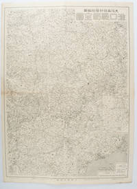
OSAKA MAINICHI SHINBUNSHA. EDITED BY. .
漢口戦局全図. Kanko senkyoku zenzu. Hankow/Hankou War Situation Map.
大阪. Osaka.: 大阪毎日新聞社. Osaka Mainichi Shinbunsha. 昭和 13 1938. Black and white map folded showing Hankow one of the three cities which merged to become Wuhan 54.5 x 49cm scale 1:2000000. Some light browning tiny closed tear upper margin neatly repaired with conservation standard tape. Good copy. This Hankow/Hankou War Situation Map is a supplement map of Osaka Mainichi Newspaper on 25 August 1938. The two inset maps show the region around Nanjing and Hong Kong. It gives detailed place names of Hankow area. . 大阪毎日新聞社. [Osaka Mainichi Shinbunsha]. unknown
书商的参考编号 : 172829
|
|
|
Osborne, Albert E.
The Stereograph and the Stereoscope: With Special Maps and Books Forming a Travel System - What They Mean for Individual development, What They Promise for the Spread of Civilization
288 pages including index. Illustrated with line drawings. Chapters include: Introductory; Different Ends for Which Pictures Have Been Used; The Different Kinds of Pictures; Stereographs and the Stereoscope; Experiences of Travel with Stereographs; The Importance of Environment; The Limitations of Language; The Wide Environment The Stereograph Travel System Gives. Part II includes the following chapters: What are the Necessities of Life; Life is the Purpose of Our Existence; What is the Life We Are Here to Develop?; Happiness vs. Pleasure; The Different Needs of Our Life; The Fundamental Conditions for the Development of the Intellect; The Fundamental Conditions for the Development of the Aesthetic Nature; Fundamental Conditions for the Development of the Moral Nature; Fundamental Conditions for the Development of the Religious Life; Summary and Conclusion. Small dab of liquid paper upon front endpaper. Minimal markings to text. Some pencil markings have been erased. Lettering worn from spine. Above average wear to boards. Hinges intact. Minor lean to spine. Average soiling. Moderate yellowing to contents. Book
|
|
|
Osmont (Anne) :
Clartés sur l'Occultisme.
Paris, Dervy, 1947 ; in-8, broché ; 196, [4] pp.
书商的参考编号 : 20089

|
|
|
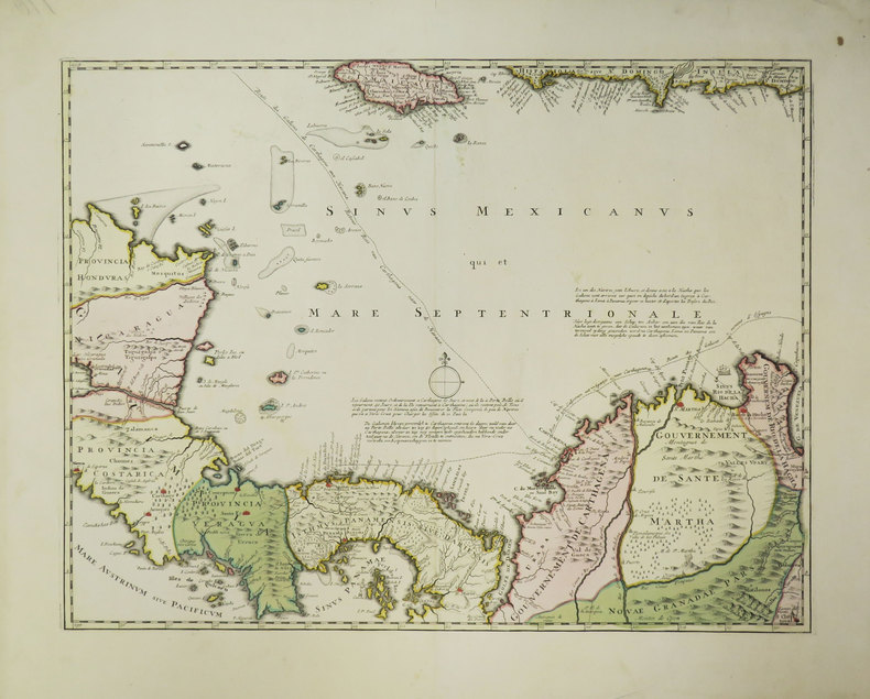
OTTENS (Reinier & Josua).
[AMERIQUE CENTRALE] [Nova Isthmi Americani, qui et Panamiensis item Dariensis, Tabula in qua Urbes Porto Bello, Panama et Carthagena].
[circa 1740]. 410 x 538 mm.
书商的参考编号 : LBW-3454
|
|
|
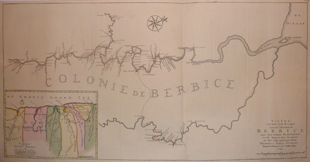
OTTENS (Reinier & Josua);
[GUYANE BRITANNIQUE] Nieuwe gemeten kaart van de colonie de Berbice met der zelver plantagien en de namen der bezitters in het ligt gebragt.
Amsterdam Reinier & Josua Ottens 1740 En deux feuilles jointes de 488 x 959 mm.
书商的参考编号 : LBW03935
|
|
|
OTTOMAN EMPIRE BALKANS & DANUBIA.
Turkey in Europe and Hungary.
Philadelphia.: Carey Mathew and Warner Benjamin. 1816. Engraved map 19 x 22.3 cm original folds some offsetting to the map marginal browning and staining small archival repairs to the outer margin but in good condition. Fine map Plate 19 prepared for Carey and Benjamin's "General Atlas.". . (Carey, Mathew and Warner, Benjamin). unknown
书商的参考编号 : 175252
|
|
|
OUDIETTE (Charles).
Carte des environs de Paris, divisés en départemens, arrondissemens et cantons.
Paris, J. Goujon, 1820. En 18 sections montées sur toile et repliées, formant une carte de 567 x 693 mm ; étiquette au dos de l'Atelier de Collage de Cartes Géographiques, Tableaux etc d'Auguste Logerot à Paris.
书商的参考编号 : LBW-8967

|
|
|
OUDIETTE (Charles)
Dictionnaire topographique des environs de Paris.
1817 À Paris, chez l’Auteur, 1817.
书商的参考编号 : 446

|
|
|
OUELLETTE, William
CARTES FANTASQUES
Paris Henri Veyrier 1975 in 4 oblong (30 X24) 1 volume broché, 87 pages, avec plus de 250 reproductions en couleurs et en noir et blanc de cartes postales de la belle époque. Bel exemplaire ( Photographies sur demande / We can send pictures of this book on simple request )
书商的参考编号 : 16913
|
|
|
Ouellette William
Cartes fantasques
Henri Veyrier Dos carré collé 1975 In-4 (30 x 24 cm), format italien, dos carré collé, 61 pages, illustrations en couleur et noir et blanc ; coiffes et bords des plats frottés, pliure sur le quatrième plat, état moyen. Livraison a domicile (La Poste) ou en Mondial Relay sur simple demande.
书商的参考编号 : dz668
|
|
|
OURSEL Raymond:
L'Art populaire baroque en Savoie.
Annecy, Gardet, coll. Ars Sabaudiae, 1955. Plaquette in-8 de 21-[3] pages, suivie des planches volantes, le tout sous chemise imprimée en deux tons.
书商的参考编号 : 13645

|
|
|
OUTHIER (Réginald, abbé).
Carte topographique du diocèse de Sens divisé en ses cinq archidiaconés et ses douze doyennés.
Sens, André Jannot, et Paris, Ve Mazieres et J. Bap.te Garnier, 1741. En deux feuilles jointes de 725 x 870 mm.
书商的参考编号 : LBW-426

|
|
|
OUTHIER [Abbé Réginald]:
Journal d'un voyage au Nord, en 1736 & 1737.
Paris, Piget; Durand, 1744. In-4 de [8]-238-[2] pages, plein veau marbré brun, dos à nerfs orné de filets et fleurons dorés, pièce de titre brune, tranches rouges.
书商的参考编号 : 8781

|
|
|
Outdoor Books & Maps
Arapaho & Roosevelt National Forest Recreation Guide
paperback. Good. Access codes and supplements are not guaranteed with used items. May be an ex-library book. paperback
书商的参考编号 : 093065708X.G ???????? : 093065708X 9780930657086

|
|
|
Outdoor Books & Maps
Best of Northern Colorado Hiking Trails
paperback. Good. Access codes and supplements are not guaranteed with used items. May be an ex-library book. paperback
书商的参考编号 : 0930657187.G ???????? : 0930657187 9780930657185
|
|
|
Outdoor Books & Maps
Best of Northern Colorado Hiking Trails: 78 Hiking Trails to Scenic & Historical Sites
Outdoor Books and Maps 1995. Paperback. Good. Pages can have notes/highlighting. Spine may show signs of wear. ~ ThriftBooks: Read More Spend Less.Dust jacket quality is not guaranteed. Outdoor Books and Maps paperback
书商的参考编号 : G0930657187I3N00 ???????? : 0930657187 9780930657185

|
|
|
Outdoor Books & Maps
Best of Rocky Mountain National Park Hiking Trails
paperback. Good. Access codes and supplements are not guaranteed with used items. May be an ex-library book. paperback
书商的参考编号 : 093065739X.G ???????? : 093065739X 9780930657390
|
|
|
Outdoor Books and Maps
Best of Western Colorado Hiking Trails
Adler Publishing Company 1998. Paperback. Good. Pages can have notes/highlighting. Spine may show signs of wear. ~ ThriftBooks: Read More Spend Less.Dust jacket quality is not guaranteed. Adler Publishing Company paperback
书商的参考编号 : G0930657179I3N00 ???????? : 0930657179 9780930657178
|
|
|
Outdoor Books & Maps
Best of Western Colorado Hiking Trails
paperback. Good. Access codes and supplements are not guaranteed with used items. May be an ex-library book. paperback
书商的参考编号 : 0930657179.G ???????? : 0930657179 9780930657178
|
|
|
Outdoor Books & Maps
Colorado 4-Wheel Drive Roads Revised Edition
Adler Publishing 2007. Softcover. Very Good. 8x0x10. A majority of Coloradoâs open access 4-wheel roads are located within its National Forests. These roads travel to scenic and historic areas in the backcountry of the Rocky Mountains. The 165 forest roads included in this guide lead to historic mining areas abandoned town sites mountain passes remote valleys and views of majestic mountain ranges. All the 4-wheel drive roads described are rated for difficulty and length. Those roads rated most difficult are for the expert driver other roads are rated down to easy for those seeking a relaxing drive in the backcountry. Accompanying the text for each forest road is a detailed map which depicts connecting roads hiking trails campgrounds towns physical features and historic sites. The maps and descriptions will guide you to your destination. All of Coloradoâs National Forests are included in this guide the information was compiled from Forest Service data and maps. Adler Publishing paperback
书商的参考编号 : SKU2020027359 ???????? : 0930657403 9780930657406

|
|
|
Outdoor Books & Maps
Colorado 4-Wheel Drive Roads Revised Edition
UsedGood. The book may have minor cosmetic wear i.e. creased spine/cover scratches curled corners folded pages minor sunburn minor water damage minor bent. The book may have some highlights/notes/underlined pages - Accessories such as CD codes toys may not be included - Safe and Secure Mailer - No Hassle Return unknown
书商的参考编号 : 521YH00013P1 ???????? : 0930657403 9780930657406
|
|
|
Outdoor Books & Maps
Colorado 4-Wheel Drive Roads
Outdoor Books and Maps 2007. Paperback. Acceptable. Readable copy. Pages may have considerable notes/highlighting. ~ ThriftBooks: Read More Spend Less.Dust jacket quality is not guaranteed. Outdoor Books and Maps paperback
书商的参考编号 : G0930657403I5N00 ???????? : 0930657403 9780930657406

|
|
|
Outdoor Books & Maps
Colorado 4-Wheel Drive Roads Revised Edition
Outdoor Books & Maps 2007-05-15. Paperback. New. In shrink wrap. Looks like an interesting title! Outdoor Books & Maps paperback
书商的参考编号 : Q-0930657403 ???????? : 0930657403 9780930657406
|
|
|
Outdoor Books & Maps
Colorado 4-Wheel Drive Roads Revised Edition
paperback. Good. Access codes and supplements are not guaranteed with used items. May be an ex-library book. paperback
书商的参考编号 : 0930657403.G ???????? : 0930657403 9780930657406
|
|
|
Outdoor Books & Maps
Colorado 4-Wheel Drive Roads
Outdoor Books and Maps 2007. Paperback. Good. Pages can have notes/highlighting. Spine may show signs of wear. ~ ThriftBooks: Read More Spend Less.Dust jacket quality is not guaranteed. Outdoor Books and Maps paperback
书商的参考编号 : G0930657403I3N00 ???????? : 0930657403 9780930657406

|
|
|
Outdoor Books & Maps
Colorado 4-Wheel Drive Roads Revised Edition
Brand: Outdoor Books n Maps 2007-05-15. Revised. paperback. New. 8.25x0.50x10.75. Buy with confidence. Excellent Customer Service & Return policy. Brand: Outdoor Books n Maps paperback
书商的参考编号 : DADAX0930657403 ???????? : 0930657403 9780930657406
|
|
|
Outdoor Books & Maps
Colorado 4-Wheel Drive Roads Revised Edition
Brand: Outdoor Books n Maps 2007-05-15. Revised. paperback. Used: Good. 8.25x0.50x10.75. Buy with confidence. Excellent Customer Service & Return policy. Brand: Outdoor Books n Maps paperback
书商的参考编号 : SONG0930657403 ???????? : 0930657403 9780930657406
|
|
|
Outdoor Books and Maps
Colorado Biking Trails
Adler Publishing Company. Used - Good. Former library book; may include library markings. Used book that is in clean average condition without any missing pages. Adler Publishing Company unknown
书商的参考编号 : 4914670-75 ???????? : 0930657284 9780930657284

|
|
|
Outdoor Books & Maps
Colorado Biking Trails
Outdoor Books & Maps 2007-05-31. Paperback. New. In shrink wrap. Looks like an interesting title! Outdoor Books & Maps paperback
书商的参考编号 : Q-0930657284 ???????? : 0930657284 9780930657284
|
|
|
Outdoor Books & Maps
Colorado Biking Trails
paperback. Good. Access codes and supplements are not guaranteed with used items. May be an ex-library book. paperback
书商的参考编号 : 0930657284.G ???????? : 0930657284 9780930657284
|
|
|
Outdoor Books & Maps
Colorado Campgrounds
Adler Publishing 2010-07-19. Perfect Paperback. Good. 0.9000 10.6000 8.0000. Moderate shelfwear and/or minor creases. Pages clean and intact. Adler Publishing paperback
书商的参考编号 : mon0002665376 ???????? : 0930657551 9780930657550
|
|
|
Outdoor Books & Maps
Colorado Campgrounds
perfect. Good. Access codes and supplements are not guaranteed with used items. May be an ex-library book. unknown
书商的参考编号 : 0930657551.G ???????? : 0930657551 9780930657550
|
|
|
Outdoor Books & Maps
Colorado Campgrounds
Adler Publishing Company 2010. Perfect Paperback. Very Good. Disclaimer:A copy that has been read but remains in excellent condition. Pages are intact and are not marred by notes or highlighting but may contain a neat previous owner name. The spine remains undamaged. At ThriftBooks our motto is: Read More Spend Less.Dust jacket quality is not guaranteed. Adler Publishing Company paperback
书商的参考编号 : G0930657551I4N00 ???????? : 0930657551 9780930657550
|
|
|
Outdoor Books & Maps
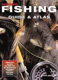
Colorado Fishing Guide & Atlas
Adler Pub Co 2000-06-22. paperback. Very Good. 8x0x10. VERY GOOD Contains one or two pages of minor writing or highlights and Underlines. Legible and in good shape. Minor to slightly heavy wears on cover from warehouse shelves. Used so may not contain codes/CDs/Inserts that is included with the book. Adler Pub Co paperback
书商的参考编号 : VB680305956 ???????? : 0930657411 9780930657413
|
|
|
Outdoor Books & Maps
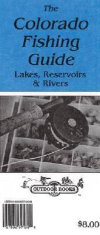
Colorado Fishing Guide to Stocked Lakes Reservoirs & Rivers Map
Outdoor Books and Maps 1999. Paperback. Very Good. May have limited writing in cover pages. Pages are unmarked. ~ ThriftBooks: Read More Spend Less.Dust jacket quality is not guaranteed. Outdoor Books and Maps paperback
书商的参考编号 : G0930657306I4N00 ???????? : 0930657306 9780930657307
|
|
|
Outdoor Books & Maps
Colorado Fishing
Outdoor Books and Maps 2011. Paperback. Good. Pages can have notes/highlighting. Spine may show signs of wear. ~ ThriftBooks: Read More Spend Less.Dust jacket quality is not guaranteed. Outdoor Books and Maps paperback
书商的参考编号 : G0930657586I3N00 ???????? : 0930657586 9780930657581

|
|
|
Outdoor Books & Maps
Colorado Fishing Guide & Atlas
paperback. Good. Access codes and supplements are not guaranteed with used items. May be an ex-library book. paperback
书商的参考编号 : 0930657411.G ???????? : 0930657411 9780930657413
|
|
|
Outdoor Books & Maps
Colorado Fishing
perfect. Good. Access codes and supplements are not guaranteed with used items. May be an ex-library book. unknown
书商的参考编号 : 0930657586.G ???????? : 0930657586 9780930657581
|
|
|
Outdoor Books & Maps
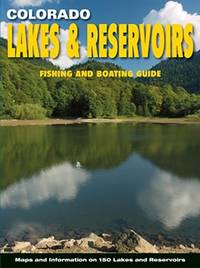
Colorado Lakes & Reservoirs: Fishing and Boating Guide
NEW. unknown
书商的参考编号 : BIB-NOV-15-2025-61195 ???????? : 0930657543 9780930657543
|
|
|
Outdoor Books & Maps
Colorado Lakes & Reservoirs: Fishing and Boating Guide
Outdoor Books & Maps. 9th. Good. It's a preowned item in good condition and includes all the pages. It may have some general signs of wear and tear such as markings highlighting slight damage to the cover minimal wear to the binding etc. but they will not affect the overall reading experience. Outdoor Books & Maps unknown
书商的参考编号 : 0930657543-11-1 ???????? : 0930657543 9780930657543
|
|
|
Outdoor Books & Maps
Colorado Lakes & Reservoirs: Fishing & Boating Guide
Outdoor Books and Maps 2013. Paperback. Like New. Pages are clean and are not marred by notes or folds of any kind. ~ ThriftBooks: Read More Spend Less.Dust jacket quality is not guaranteed. Outdoor Books and Maps paperback
书商的参考编号 : G0930657543I2N00 ???????? : 0930657543 9780930657543
|
|
|
Outdoor Books & Maps
Colorado Lakes & Reservoirs: Fishing and Boating Guide
Adler Pub Co 2008. Paperback. New. 9th edition. 216 pages. 10.75x8.00x0.50 inches. Adler Pub Co paperback
书商的参考编号 : 1-0930657543 ???????? : 0930657543 9780930657543
|
|
|
 ?????????
 ?????PDF???
 RSS feed


