|
PAUSANIAS; GEDOYN Abbé:
Pausanias, ou voyage historique de la Grèce, traduit en français avec des remarques par M. l'abbé Gedoyn.
Paris, F. G. Quillau, 1731. 2 volumes grand in-4 de [2]-VIII-XXIV-478-[4] et [2]-VI-524 pages, pleine basane brune, dos à nerfs épidermés, manque la coiffe inf. du second volume. Rousseurs et brunissures.
Référence libraire : 8782

|
|
|
PAYER J.; GOURDAULT Jules (trad.):
L’expédition de Tegetthoff. Voyage et découvertes aux 80°-83° degrés de latitude nord.
Paris, Librairie Hachette et Cie, 1878. In-8 de 381 pages, demi-chagrin rouge, dos à nerfs orné, plats de percaline, tranches dorées, gardes moirées blanches.
Référence libraire : 2104

|
|
|
PAZZINI CARLI Vincenzo (Siena ? - 1769)
Mappa-Mondo tagliato sul piano di un meridiano Emisfero Orientle - Mappa Mondo tagliato sul piano di un meridiano Emisfero O
Carta tratta dalla rara raccolta di carte geografiche denominata Atlante Geografico, prima stesura delle opera dell’abate Bartolomeo Borghi, pubblicata in Siena dal Pazzini Carli. Molte delle carte, datate tra il 1788 ed il 1800, sono incise da Agostino Costa e poi successivamente inserite nell’opera Atlante generale dell'ab. Bartolommeo Borghi, pubblicato a Firenze nel 1819.Bartolomeo Borghi, che Vermiglioli (Biografia degli scrittori perugini, 1829) definisce "uno dei migliori geografi dell'Europa", nacque nel 1750 a Monte del Lago, piccola frazione del comune di Magione, in provincia di Perugia, sulle rive del Trasimeno. Ordinato sacerdote nel 1774, trascorse i primi anni del suo mandato nel paese natale, poi a Magione e quindi a Sorbello (Cortona).Appassionato studioso di geografia, applicò dapprima le sue conoscenze all'analisi delle terre a lui più familiari: nel 1770 scrisse Descrizione geografica, fisica e naturale del Lago Trasimeno (che sarà tuttavia data alle stampe per la prima volta solo nel 1821), e nel 1791 pubblicò negli atti dell'Accademia etrusca di Cortona una Dissertazione sopra l'antica geografia dell'Etruria, Umbria e Piceno, arricchendo entrambe le opere di una carta delle regioni descritte. Intanto la sua fama di cartografo, oltre che di geografo, cresceva, tanto da fargli ottenere le nomine a membro delle Accademie Cortonese e Reale di Firenze, e procurargli l'incarico, da parte di Pietro Leopoldo, di delineare la carta del catasto pubblico di Cortona e del contado di Castiglione.Nello stesso tempo gli orizzonti geografici della sua attività si allargavano sensibilmente, e se nell'Atlante Novissimo, illustrato ed accresciuto sulle osservazioni, e scoperte fatte dai più celebri e più recenti cartografi di Antonio Zatta (Venezia 1779-1785) il suo contributo fu ancora legato all'area toscana, nell'Atlante geografico che si pubblicò a Siena da Pazzini Carli tra il 1798 ed il 1800 il Borghi tracciò la maggior parte delle carte e spaziò dalle province del Sud-Est dell'Inghilterra, al Regno di Danimarca, alla Romania. Una sorta di prova generale, quest'ultima, della sua opera più importante, quell'Atlante generale dell'ab. Bartolommeo Borghi, pubblicato a Firenze nel 1819. L'Atlante, corredato da brevi descrizioni storiche, politiche, civili e naturali che introducono le carte relative ai territori afferenti a ciascun Impero o Regno illustrato, rispecchia il nuovo assetto geo-politico attuato dal Congresso di Vienna. Incisione in rame, in buone condizioni. Due fogli da 330x250mm. Map taken form the very rare Atlante Geografico, the first draft of the abbot Bartolomeo Borghi, published in Siena by Pazzini Carli. Many of the mapss, dated between 1788 and 1800, are engraved by Agostino Costa and then later incorporated in the Atlante Generale di Bartolomeo Borghi, published in Florence in 1819.Bartolomeo Borghi, who Vermiglioli (Biography of writers Perugini, 1829) calls "one of the best geographers of Europe", was born in 1750 in Monte del Lago, a small fraction of the town of Mansfield, in the province of Perugia, on the shores of Lake Trasimeno. Ordained in 1774, spent the first years of his term in his hometown, then to Mansfield and then Sorbello (Cortona).A passionate student of geography, first applied his knowledge to the analysis of land more familiar to him: Cortona and Tuscany. Meanwhile, his fame as a cartographer, as well as a geographer, was growing, so that he get the nomination as a member of the Royal Academies of Florence and Cortona, and give him the job, by Pietro Leopoldo, to outline the map's of the public land Cortona and the county of Castiglione.At the same time the geographical horizons of its activities widened considerably, and if in the Atlas Novissimo, illustrated and amplified the observations and discoveries made by the most recent and most famous cartographer Antonio Zatta (Venice 1779-1785) his contribution was still related area of Tuscany, in the Atlas geographic monthly published in Siena by Pazzini Carli between 1798 and 1800 the villages drew most of the maps and spaced from the provinces of South-East of England, the Kingdom of Denmark, Romania.A sort of dress rehearsal, the latter, his most important work, the Atlante General of AB. Bartolomeo Borghi, published in Florence in 1819. The Atlas, accompanied by brief descriptions of historical, political, civil and natural to introduce the papers relating to the territories belonging to each United Empire or illustrated, reflects the new geo-political structure implemented by the Congress of Vienna.Two sheets of 330x250mm.

|
|
|
Peace, D. B.
A Historic Buildings Map of the Peak District and Sherwood Forest
Folded map. No marks or inscriptions. No creasing to covers. A very clean very tight copy, bright unmarked, not torn and no bumping to corners. 1pp. Some 450 historic buildings, including 228 churches, are illustrated on the map from sketches and with Heraldic Emblems. On the reverse side is a comprehensive guide arranged alphabetically to the places of interest in towns and villages from Abney to Youlgreave. The map covers parts of Yorkshire West Riding, Cheshire, Staffordshire, Derbyshire and Nottinghamshire. Both map sides are held open to photograph with laid-on metal supports.

|
|
|
Pearsons, Howard
B.C. (British Columbia) Gem Trails - With Maps
30 pages. Undated. Appears to be circa 1970s. Suggests 30 gem-hunting areas in B.C. Two stickers on front cover. Doodling on back cover. Somewhat above-average wear. A sound copy. Book

|
|
|
PEAUX-ROUGES par Jean PICTET.
L'épopée des Peaux-Rouges. Documenté (héliogravures, table des tribus, cartes ... index).
Lausanne, éd. Favre S.A. 1988. Bel exemplaire broché, couverture ornée d'éd., fort in-8, 826 pages + planches.
Référence libraire : AUB-7853
|
|
|
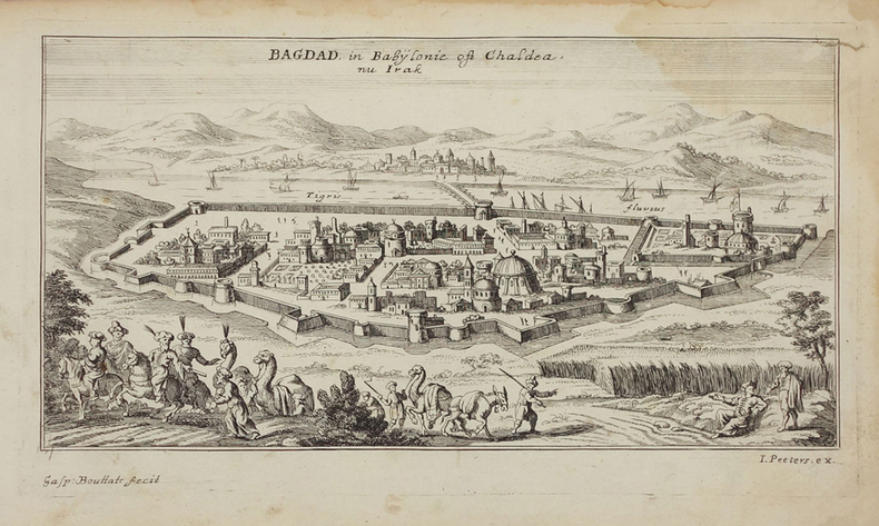
PEETERS (Jan).
[IRAK] Bagdad in Babylonie oft Chaldea nu Irak.
[circa 1690]. 121 x 231 mm.
Référence libraire : LBW02507
|
|
|
PEETERS (Jan).
[MONTENEGRO] Budova.
[circa 1690]. 150 x 210 mm.
Référence libraire : LBW045d9

|
|
|
PEETERS (Jan).
[MONTENEGRO] Dulcigno.
[circa 1690]. 132 x 209 mm.
Référence libraire : LBW045f8

|
|
|
PEETERS (Jan);
[ATHENES] Ville d'Athènes.
circa 1690 128 x 200 mm.
Référence libraire : LBW045fd

|
|
|
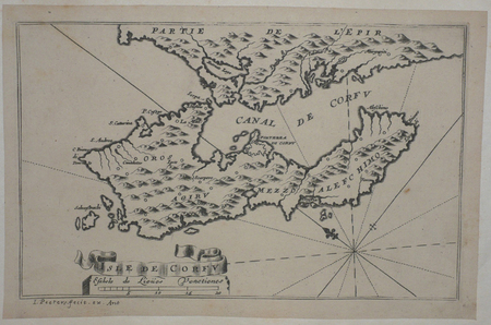
PEETERS (Jan);
[CORFOU] Isle de Corfu.
circa 1690 130 x 206 mm.
Référence libraire : LBW045df
|
|
|
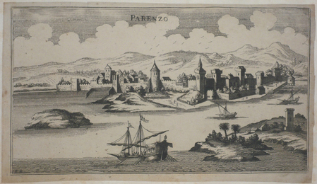
PEETERS (Jan);
[CROATIE] Parenzo.
circa 1690 133 x 238 mm.
Référence libraire : LBW045ec
|
|
|
PEETERS (Jan);
[DARDANELLES] Gli Dardanelli.
circa 1690 104 x 263 mm.
Référence libraire : LBW02e6c
|
|
|
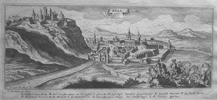
PEETERS (Jan);
[EGER] Erla.
circa 1690 100 x 247 mm.
Référence libraire : LBW0279c
|
|
|
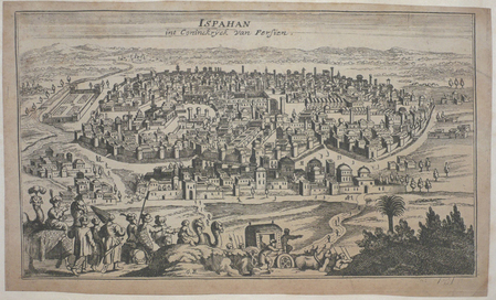
PEETERS (Jan);
[IRAN] Ispahan int Coninckryck van Persien.
circa 1690 139 x 234 mm.
Référence libraire : LBW045ed
|
|
|
PEETERS (Jan);
[IRAN] Kaschan int koningryck van Persien.
circa 1690 127 x 236 mm.
Référence libraire : LBW02508

|
|
|
PEETERS (Jan);
[MONT DES OLIVIERS] Den Bergh van Oliveten.
circa 1690 115 x 259 mm.
Référence libraire : LBW024dd
|
|
|
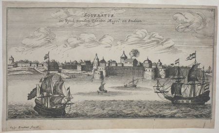
PEETERS (Jan);
[SURAT] Sourratte int Ryck vanden Grooten Mogol en Indien.
circa 1690 129 x 236 mm.
Référence libraire : LBW045f2
|
|
|
PEETERS (Jan);
[SZARVAS] St. Servaes.
circa 1690 96 x 244 mm.
Référence libraire : LBW02799

|
|
|
PEETERS (Jan);
[SZIGETVAR] Ziget.
circa 1690 101 x 270 mm.
Référence libraire : LBW0279e

|
|
|
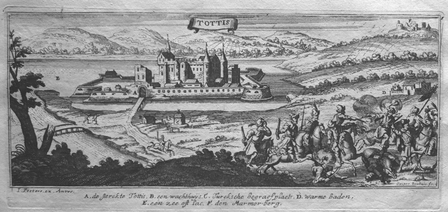
PEETERS (Jan);
[TATA] Tottis.
circa 1690 101 x 248 mm.
Référence libraire : LBW027a0
|
|
|
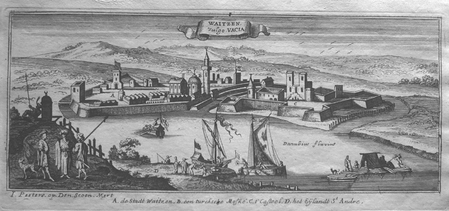
PEETERS (Jan);
[VAC] Waitzen vulgo Vacia.
circa 1690 105 x 256 mm.
Référence libraire : LBW0279a
|
|
|
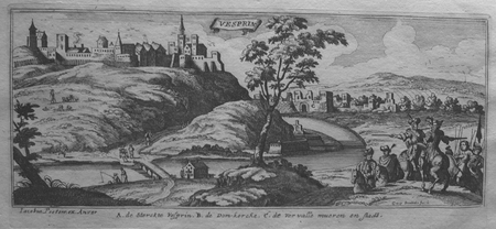
PEETERS (Jan);
[VESZPREM] Vesprin.
circa 1690 101 x 245 mm.
Référence libraire : LBW0279f
|
|
|
PEETERS (Jan);
[VISEGRAD] Vicegrad.
circa 1690 103 x 265 mm.
Référence libraire : LBW0279b

|
|
|
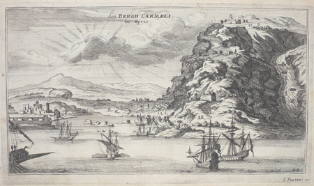
PEETERS (Jan);
Den Bergh Carmeli in Syrien.
circa 1690 133 x 239 mm.
Référence libraire : LBW02509
|
|
|
PEETERS (Jan);
Jerusalem.
circa 1690 115 x 258 mm.
Référence libraire : LBW024dc

|
|
|
PEETERS (Jan);
Ramma in Arabia.
circa 1690 115 x 256 mm.
Référence libraire : LBW024de
|
|
|
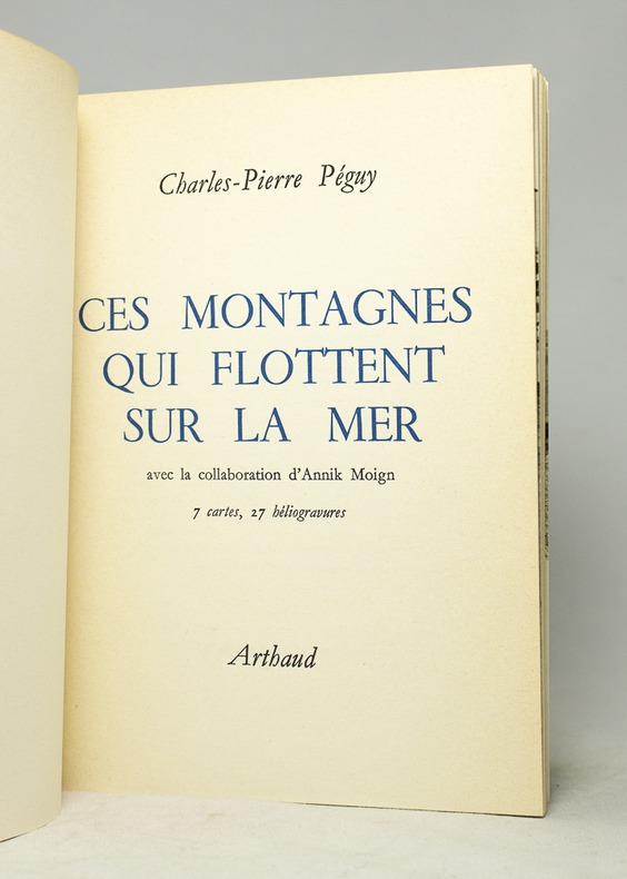
PEGUY Charles-Pierre:
Ces montagnes qui flottent sur la mer.
B. Arthaud, 1969. In-8 broché de 318-[4] pages, couverture imprimée en deux tons, dos passé.
Référence libraire : 16671
|
|
|
Peigné-Delacourt - Delisle ( Léopold )
Monasticon Gallicanum Collection de 168 Planches de vues Topographiques représentant Les Monastères de l'Ordre de Saint-Benoit Congrégation de Saint Maur Avec Deux Cartes des établissements Bénédictins en France
P., Les Humanistes du XXe siècle, 1983., Etat : Bon. Petit in-folio rel., pleine toile grise d'édition (sans jaq.), titre doré au 1er plat, 68 pp, 168 gravures (vues topograhiques) et 2 cartes doubles mobiles de la France. Très bonne condition. Réimpression anastasique de l'édition de Paris, parue chez Victor Palmé en 1871.
Référence libraire : 17053

|
|
|
PEIGNÉ-DELACOURT ; GERMAIN, Michel Dom.
Monasticon Gallicanum. Collection de 168 planches de vues topographiques des Monastères Bénédictins de la Congrégation de Saint-Maur. Avec deux cartes des établissements de l'Ordre de Saint-Benoît. COMPLET.
Paris, Librairie de Féchoz & Letouzey, 1882. 306 x 232 mm, (1) f. blanc, L-16 pp., 1 carte et 169 planches dont 1 carte : pl. N° 3. Reliure cartonnée restaurée, décharge et rousseurs sur premier et dernier feuillet blanc, pl. 89 : claires rousseurs dans les marges, claires rousseurs sur page de faux-titre, très bel état. COMPLET des 168 vues et 2 cartes. Bel exemplaire.
Référence libraire : 7917

|
|
|
PELET (Lt. général)
Carte des environs d'Oran et de Mers-el-kébir dressée au Dépôt général de la Guerre par ordre de M. le Maréchal duc de Dalmatie.
1834 21 sections montées sur toile et pliées formant une carte de 630 x 940 mm. P. 1834
Référence libraire : 16320
|
|
|
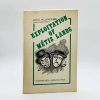
Pelletier, Emile; Real Bedard (Cover Illust. & Maps), et al.
Exploitation of Metis Lands
Winnipeg Manitoba: Manitobas Metis Federation Press 1975. First Edition First Printing. Softcover. pp. vii 328. 8vo. Illustrated stiff card covers. Richly illustrated with many black-and-white photographs portraits charts maps tables illustrations et al. Bright clean and unmarked with firm sound binding; as new. Rare in commerce. See OCLC #184852975. <br/><br/>"Exploitation of Metis Lands is the third phase of a study undertaken by the Manitoba Metis Federation to determine the statutory and aboriginal rights of the Metis people of this province. It is a detailed investitation of the 1400000 acres of land reserved for the Metis children born before the 15th of July 1870 date of entry of Manitoba as a province into Confederation of Canada. Manitobas Metis Federation Press paperback
Référence libraire : 6912
|
|
|
Pellos René:
Banque des Pieds Nickelés - Billet de 127 francs.
Editions Vent d'Ouest. Faux billet de banque, publié à l'occasion de l'intégrale chez Vent d'Ouest.
Référence libraire : 8571

|
|
|
Pennsylvania Turnpike.
THE PENNSYLVANIA TURNPIKE.
13p. Pagination includes wraps. Illustrated with photographs, drawings and maps. Tall thin 8vo. Original pictorial wraps. Lists Interchanges, tunnels and service stations. PA PAMPH 20_1 BX7 x 3c.
|
|
|
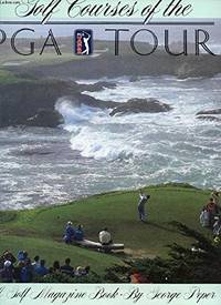
Peper, George; photographs by Brian D. Morgan, James Moriarty and Anthony Roberts. Maps by Elizabeth Peper
The Courses of the PGA Tour
New York: Harry N. Abrams 1988. Updated Edition. . Hardcover. Fine/Fine. 304pp index. 100s of colour photos. Almost as new gift condition. Size: Large 4to <br/> <br/> Harry N. Abrams hardcover
Référence libraire : 30628 ISBN : 0810909944 9780810909946
|
|
|
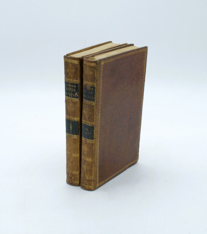
PERCIVAL, Robert.
Voyage à l'île de Ceylan fait dans les années 1797 à 1800; contenant l'histoire, la géographie et la description des moeurs des habitants, ainsi que celle des productions naturelles du pays...
Paris, Dentu, an XI (1803). 2 volumes in-8 (191 x 124 mm). 4 cartes et plans repliés hors texte : une carte de l'île de Ceylan par Arrowsmith et de la pêche des perles et les plans des ports de Trinquemale et Colombo, basane mouchetée de l'époque, dos lisses ornés avec pièces de titre et tomaison, dentelles dorées sur les plats, frottements et vieille épidermure au tome 2.
Référence libraire : PHO-1636
|
|
|
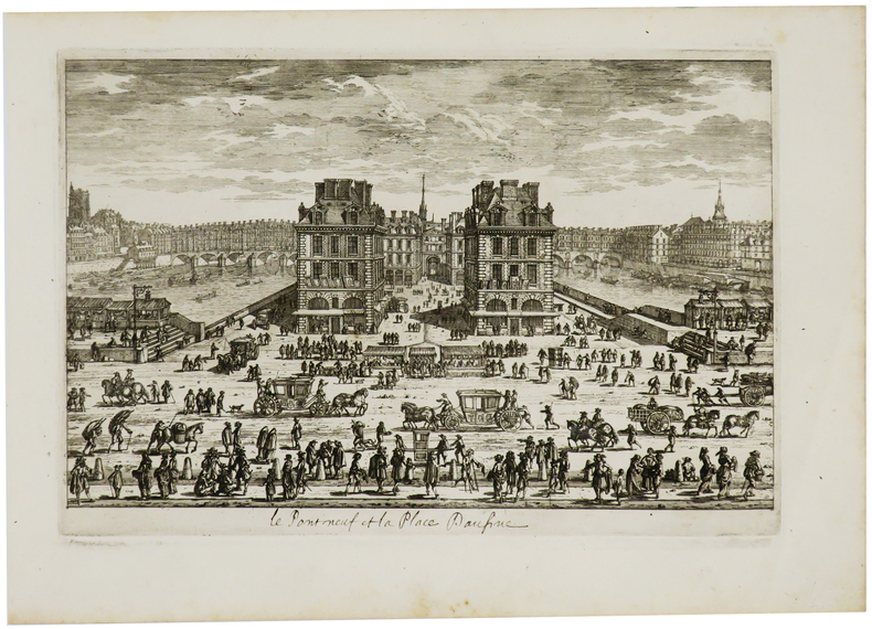
PERELLE (Gabriel).
[Le Pont Neuf et la place Daufine].
[Paris, circa 1690]. 183 x 274 mm.
Référence libraire : LBW-730
|
|
|
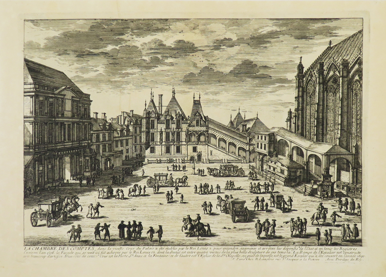
PERELLE (Gabriel).
[PALAIS DE JUSTICE] La Chambre des Comptes.
Paris, N. Langlois, [circa 1680]. 212 x 298 mm.
Référence libraire : LBW-4942
|
|
|
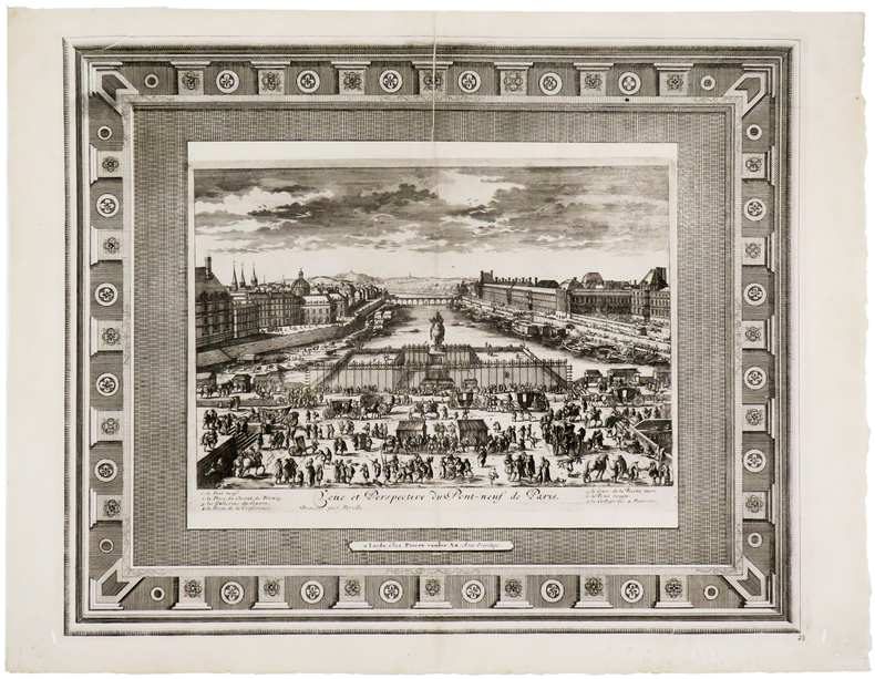
PERELLE (Gabriel).
Veüe et perspective du Pont-Neuf de Paris.
Leyde, Pierre Vander Aa, [circa 1710]. 336 x 412 mm.
Référence libraire : LBW-5724
|
|
|
Perignan
Prospect von dem inneren Theil der Stadt Zürch und des Zürcher Sees (...) Vue interieure de la ville du fond du lac de Zürch (...)
O. O., ca. 1770. Kolorierter Kupferstich von Balthasar Frederic Leizel nach Perignan. Bildgrösse: 38 x 25 cm. Blattgrösse: 39,5 x 28 cm. + Wichtig: Für unsere Kunden in der EU erfolgt der Versand alle 14 Tage verzollt ab Deutschland / Postbank-Konto in Deutschland vorhanden +, 278BG
Référence libraire : 278BG

|
|
|
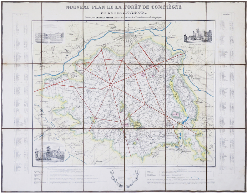
PERINT (Charles).
[FORÊT de COMPIÈGNE] Nouveau plan de la forêt de Compiègne et de ses environs.
Compiègne, Dubois, [circa 1845]. En 18 sections montées sur toile et repliées, formant une carte de 532 x 687 mm.
Référence libraire : LBW-7850
|
|
|
PERREIN (Paul)
Images d'autrefois de Bordeaux et de la Gironde - 506 cartes postales anciennes
Périgueux, Pierre Fanlac, 1984. Grand in-8 broché jaune, ill. sur plats, couv. à rabats, 310 p. Très nombreuses photos en noir. Préface de Jacques Chaban-Delmas. Très bon état. Prix du Livre cartophile 1981.
Référence libraire : 10048
|
|
|
PERREIN (Paul)
Images d'autrefois de la Gironde, de L'Amélie-sur-Mer à Virelade - Tome II, 552 cartes postales anciennes
Périgueux, Pierre Fanlac, 1982. Grand in-8 broché, couverture ill. "carte postale Pessac" à rabats, 334 p. Préface de Roger Galy. 552 cartes postales anciennes. Très bon état : couverture discrètement roussie.
Référence libraire : 6942
|
|
|
PERRIN (Maurice).
[ALGER] Plan d'Alger.
Paris, [1890]. 227 x 155 mm.
Référence libraire : LBW-8653

|
|
|
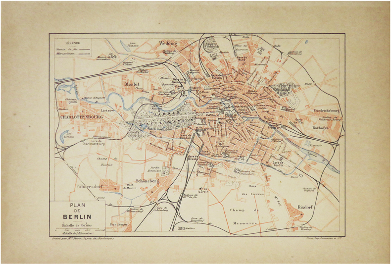
PERRIN (Maurice).
[BERLIN] Plan de Berlin.
Paris, [1890]. 157 x 226 mm.
Référence libraire : LBW-8600
|
|
|
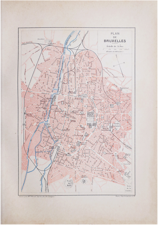
PERRIN (Maurice).
[BRUXELLES] Plan de Bruxelles.
Paris, [1890]. 228 x 156 mm.
Référence libraire : LBW-8612
|
|
|
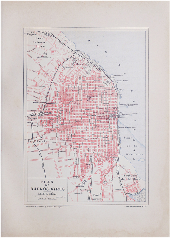
PERRIN (Maurice).
[BUENOS-AIRES] Plan de Buenos-Ayres.
Paris, [1890]. 229 x 156 mm.
Référence libraire : LBW-8637
|
|
|
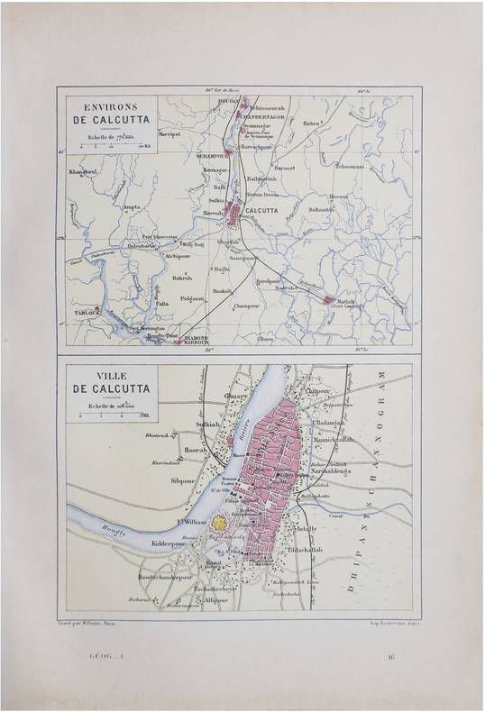
PERRIN (Maurice).
[CALCUTTA] Environs de Calcutta - Ville de Calcutta.
Paris, [1890]. 228 x 158 mm.
Référence libraire : LBW-8640
|
|
|
PERRIN (Maurice).
[INDOCHINE] Tonkin, Annam, Cochinchine et Cambodge.
[1890]. 239 x 158 mm.
Référence libraire : LBW-7248

|
|
|
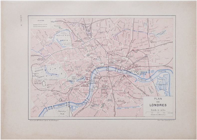
PERRIN (Maurice).
[LONDRES] Plan de Londres.
Paris, [1890]. 160 x 226 mm.
Référence libraire : LBW-8641
|
|
 Recevoir par e-mail
 Télécharger en PDF
 Flux RSS


