|
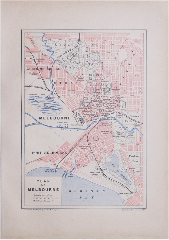
PERRIN (Maurice).
[MELBOURNE] Plan de Melbourne.
Paris, [1890]. 229 x 156 mm.
书商的参考编号 : LBW-8601
|
|
|
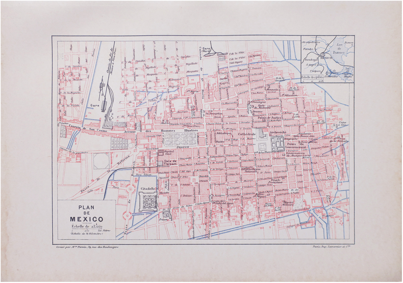
PERRIN (Maurice).
[MEXICO] Plan de Mexico.
Paris, [1890]. 159 x 226 mm.
书商的参考编号 : LBW-8625
|
|
|
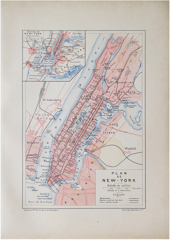
PERRIN (Maurice).
[NEW YORK] Plan de New-York.
Paris, [1890]. 227 x 155 mm.
书商的参考编号 : LBW-8610
|
|
|
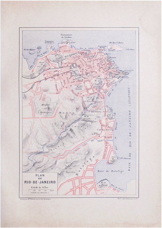
PERRIN (Maurice).
[RIO de JANEIRO] Plan de Rio-de-Janeiro.
Paris, [1890]. 228 x 156 mm.
书商的参考编号 : LBW-8639
|
|
|
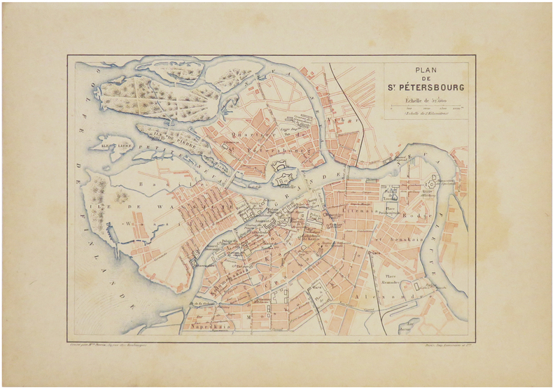
PERRIN (Maurice).
[SAINT-PÉTERSBOURG] Plan de Saint-Pétersbourg.
[1890]. 160 x 224 mm.
书商的参考编号 : LBW-7240
|
|
|
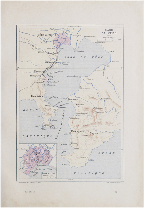
PERRIN (Maurice).
[TOKYO] Rade de Yédo.
Paris, [1890]. 229 x 156 mm.
书商的参考编号 : LBW-8644
|
|
|
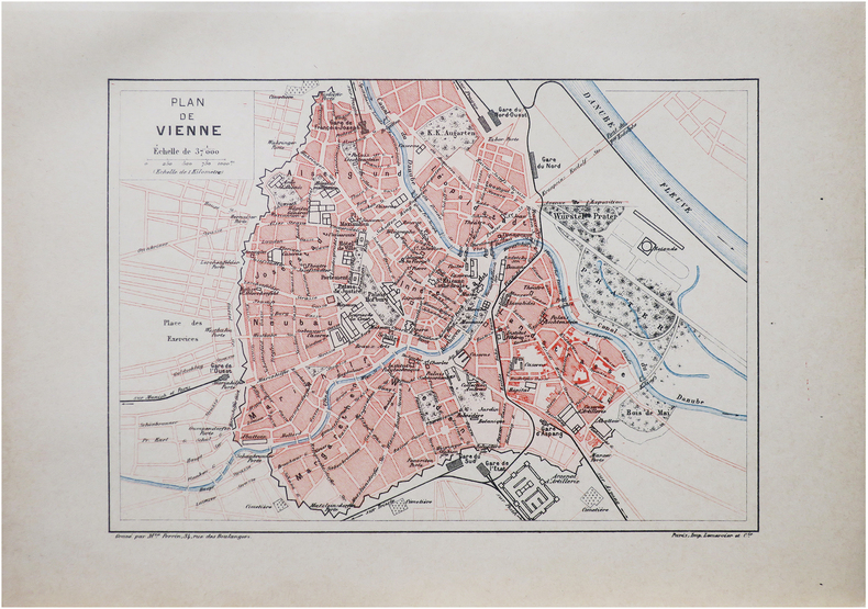
PERRIN (Maurice).
[VIENNE] Plan de Vienne.
Paris, [1890]. 159 x 225 mm.
书商的参考编号 : LBW-8618
|
|
|
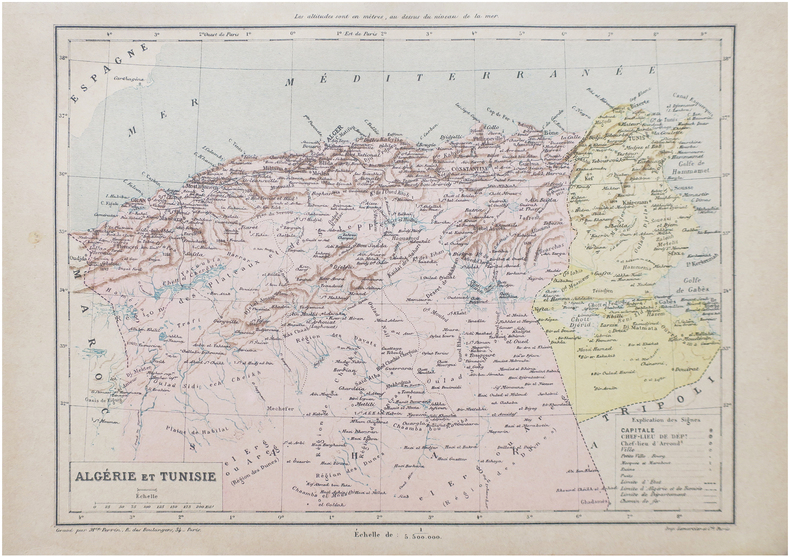
PERRIN (Maurice).
Algérie et Tunisie.
Paris, [1890]. 198 x 258 mm.
书商的参考编号 : LBW-8652
|
|
|
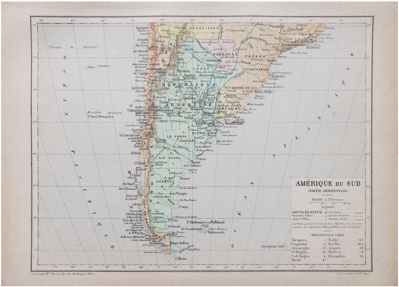
PERRIN (Maurice).
Amérique du Sud (Partie méridionale).
Paris, [1890]. 192 x 258 mm.
书商的参考编号 : LBW-8656
|
|
|
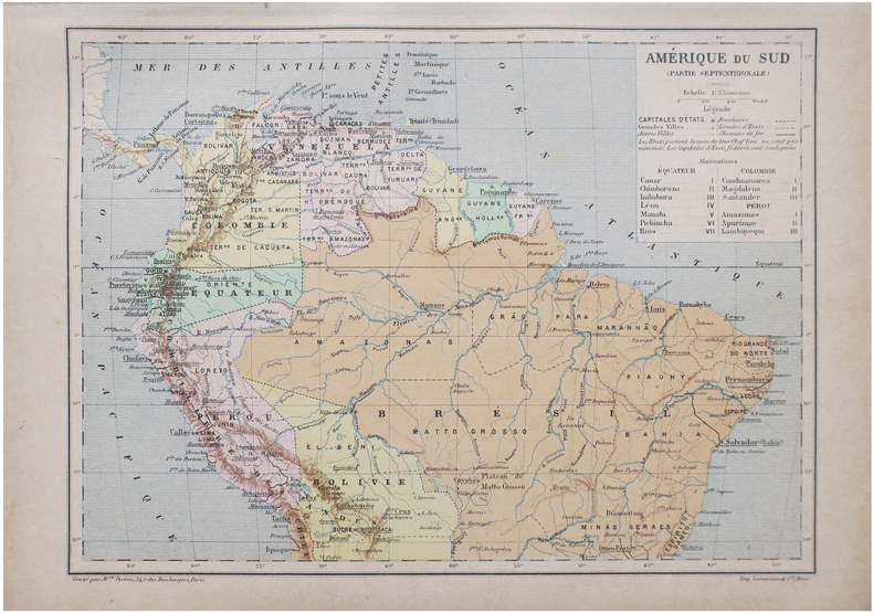
PERRIN (Maurice).
Amérique du Sud (Partie septentrionale).
Paris, [1890]. 192 x 258 mm.
书商的参考编号 : LBW-8655
|
|
|
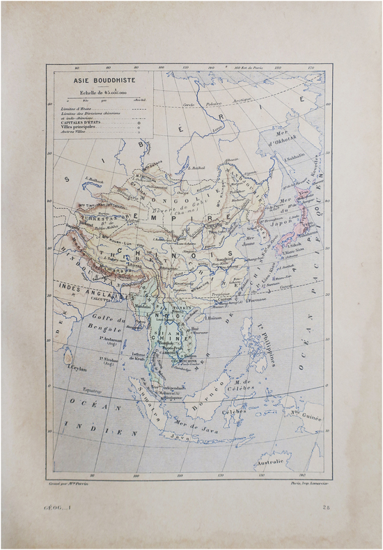
PERRIN (Maurice).
Asie bouddhiste.
Paris, [1890]. 230 x 158 mm.
书商的参考编号 : LBW-8646
|
|
|
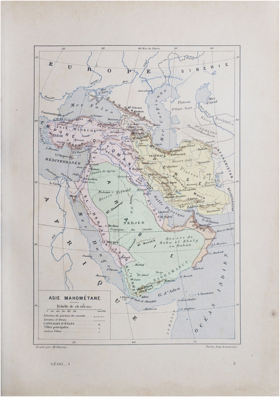
PERRIN (Maurice).
Asie mahométane.
Paris, [1890]. 230 x 157 mm.
书商的参考编号 : LBW-8645
|
|
|
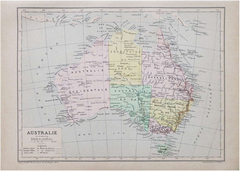
PERRIN (Maurice).
Australie.
Paris, [1890]. 193 x 260 mm.
书商的参考编号 : LBW-8647
|
|
|
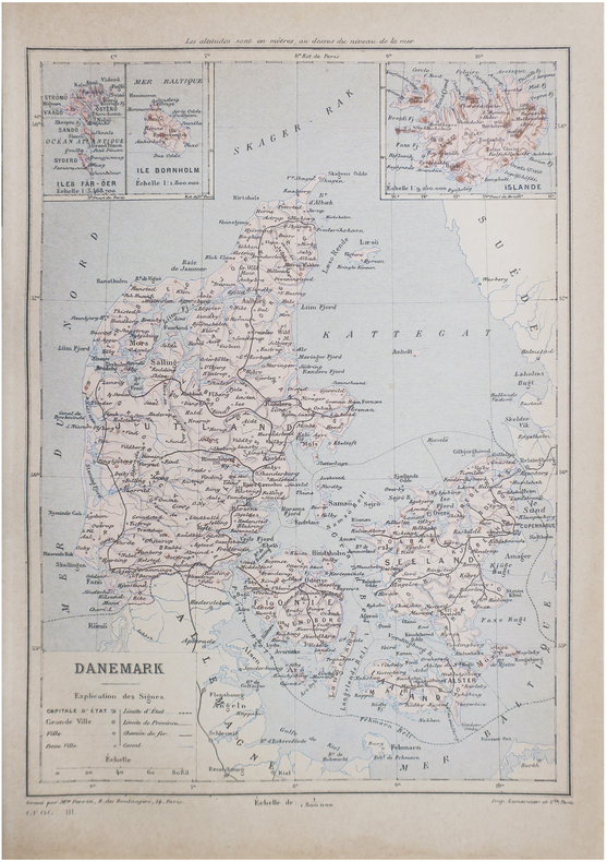
PERRIN (Maurice).
Danemark.
Paris, [1890]. 267 x 190 mm.
书商的参考编号 : LBW-8648
|
|
|
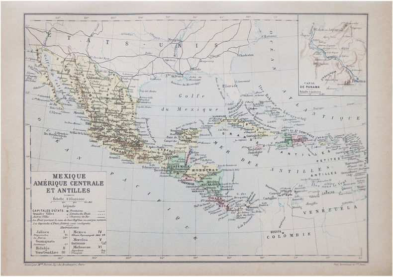
PERRIN (Maurice).
Mexique, Amérique centrale et Antilles.
Paris, [1890]. 192 x 265 mm.
书商的参考编号 : LBW-8649
|
|
|
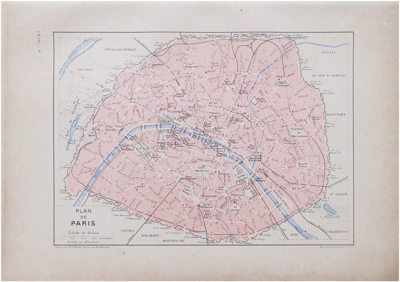
PERRIN (Maurice).
Plan de Paris.
Paris, [1890]. 163 x 225 mm.
书商的参考编号 : LBW-8638
|
|
|
PERROT (A.M.).
Carte pittoresque et maritime de la France. Revue et augmentée par A. Vuillemin.
Paris, Bulla Frères et François Delarue, s.d.(1860). Grande carte entoilée de 82 cm x 112 cm) formée de 32 panneaux , gravée et rehaussée en couleurs à l'aquarelle. Rempliée sous percaline brune ornée à froid de l'époque, marque du libraire Auguste Fontaine (Passage des panoramas) et titre doré au premier plat "Carte routière". Très bon état.
书商的参考编号 : 16163
|
|
|
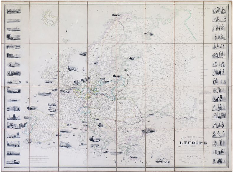
PERROT (Aristide Michel) & VUILLEMIN (Alexandre).
Carte pittoresque & maritime de l'Europe.
Paris, Fatout, 1861. 612 x 842 mm.
书商的参考编号 : LBW-7914
|
|
|
PERROT (Aristide Michel).
[MÉTÉOROLOGIE] Tableau de météorologie représentant les divers phénomènes de l'athmosphère, tels que le tonnerre, l'aurore boréale, aréolythes, l'arc-en-ciel, les trombes, le feu S.t Elme, les étoiles filantes et aréolythes, le halo, les parhélies, le mirage, les marées &.a &.a.
Paris, Langlois et Leclercq, Maison Basset, 1856. 491 x 627 mm.
书商的参考编号 : LBW-8423

|
|
|
PERROT (Aristide Michel).
[TOPOGRAPHIE] Topographie. Tableau des teintes et signes conventionnels, adoptés par le Ministère de la Guerre. Guide réel des ingénieurs civils et militaires, officiers d'État-major, &c.
Paris, Bouasse-Lebel, Édit. Imp., et Anc.ne M.on Basset réunies, [1863]. 497 x 613 mm.
书商的参考编号 : LBW-8426

|
|
|
PERROT (Aristide Michel).
Carte pour servir de tableau d'assemblage aux colonies françaises occidentales.
I. Duprat-Duverger, 1826. 296 x 293 mm.
书商的参考编号 : LBW-4800

|
|
|
PERROT (Aristide Michel).
Tableau des animaux et des végétaux existans avant le Déluge, rédigé d'après Cuvier, Buckland, de Humboldt, &.c ; par Perrot, Ingén.r-Géographe. Dessiné d'après les végétaux et les fossiles existants dans les divers cabinets de l'Europe.
Paris, Langlois et Leclercq, Maison Basset, [1842]. 491 x 627 mm.
书商的参考编号 : LBW-8431

|
|
|
PERROT (Aristide Michel).
Tableau pittoresque des merveilles de la nature. Encyclopédie Bouasse-Lebel.
Paris, Maison Bouasse Lebel, et ancienne Maison Basset réunies, [1863]. 440 x 585 mm.
书商的参考编号 : LBW-8843

|
|
|
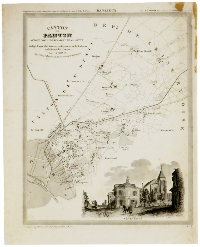
PERROT (Aristide-Michel) & MONIN (Charles V.).
[PANTIN] Canton de Pantin, arrond.t de St Denis, dép.t de la Seine.
[1834]. 305 x 240 mm, sur papier fin.
书商的参考编号 : LBW-5373
|
|
|
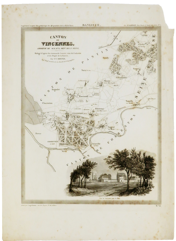
PERROT (Aristide-Michel) & MONIN (Charles V.).
[VINCENNES] Canton de Vincennes, arrond.t de Sceaux, dép.t de la Seine.
[1834]. 305 x 241 mm, sur papier fin.
书商的参考编号 : LBW-5374
|
|
|
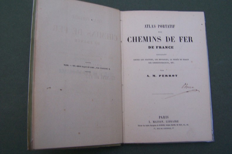
PERROT A.M.
Atlas portatif des Chemins de Fer de France.
P., Maison, s.d. In-12, carte des environs de Paris en frontispice, 37 pages de cartes, cartonnage.
书商的参考编号 : CF343
|
|
|
PERROT J-.M.
CARTE PITTORESQUE ET MARITIME DE LA FRANCE
1841 carte entoilée, pliée in-8, qq. coupures aux plis, gravée / acier par bénard, ornée de chaque côtés par des lith. représentant villes et monuments / 1 col., fatout éditeur, 1841,
书商的参考编号 : 702
|
|
|
PERROT.
CAEN (Calvados).
Paris, Benard, [circa 1850]. 212 x 285 mm.
书商的参考编号 : LBW03d71
|
|
|
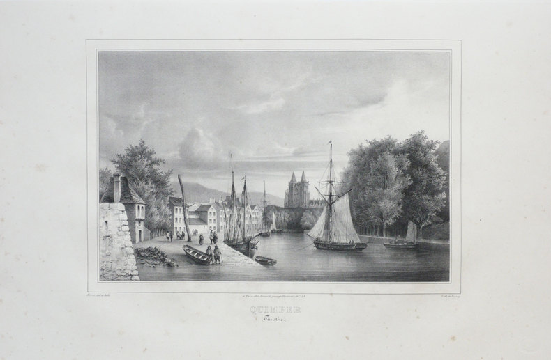
PERROT.
QUIMPER (Finistère).
Paris, Benard, [circa 1850]. 225 x 297 mm.
书商的参考编号 : LBW03d69
|
|
|
Pershing, John J.
My Experiences in the World War - Volume I
400 pages including 69 black and white reproductions from photographs and numerous maps. Gilt-edged top. Former owner's rubber stamp upon verso of half title page and upon front side of black and white photographic frontis of General Pershing. Small bookseller's sticker inside back board. "My primary purpose in writing this story of the American Expeditionary Forces in France is to render what I conceive to be an important service to my country. In that adventure there were many lessons useful to the American People, should they ever again be called to arms, and I felt it a duty to record them as I saw them." - from the Foreward. Book
|
|
|
Pestman, P. W
A Guide to the Zenon Archive (P.L. Bat. 21) Compiled by P. W. Pestman. (= Papyrologica Lugduno-Batava, vol. 21a and 21b). Volume 1: Lists and Surveys; Volume 2: Indexes and Maps. 2 volumes complete.
Leiden: E. J. Brill 1981. XX, 466; 467-748 Seiten. With two maps. 4° (28 x 22 cm) Orig.-Broschuren. [Softcover / Paperback].
书商的参考编号 : 2140746

|
|
|
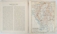
PETERMANN, AUGUST HEINRICH AND SCHMIDT, CARL (CARTOGRAPHER).
Burma map Britisch-Birma nach den neuesten Grenzbestimungen auf Grund amtlicher Quellen. from Petermann's Geographische Mitteilungen
Gotha: Justus Perthes. 1903. Map printed in colour 24.7 x19.4cm and leaf of descriptive text in German 26.5 x 22.5cm slight toning and edges of the map worn with two small tears no loss. Geopolitical map of Burma with railways and railways under construction highlighted. The accompanying text is by the German Tibetologist linguist and orientalist Dr Emil Schlagintweit. . Justus Perthes unknown
书商的参考编号 : 173709
|
|
|
PETERMANN, A. (HRSG.).
Mittheilugen aus Justus Perthe's Geographischer Anstalt über wichtige neue Erforschungen auf dem Gebiete der Geographie. 1860 (= Bd. 6 der Reihe). (+) 3 Ergänzungshefte. (1. A. Vibe: Küsten und Meer Norwegens. 24 pp., 1 chromolithographed plate (with ...
Gotha, Julius Perthes, 1860. 4to. Contemp, hcalf. Gilt spine. A small stamp to titlepage. X,490 pp. and 19, partly folded, lithographed maps and plans. Internally clean. + Ergänzungshäfte.
|
|
|
PETERMANN, A. (HRSG.).
Mittheilugen aus Justus Perthe's Geographischer Anstalt über wichtige neue Erforschungen auf dem Gebiete der Geographie. 1861 (= Bd. 7 der Reihe). (+) 3 Ergänzungshefte. (1. G. Lejean: Ethnographie de la Turque D'Europe. Ethnographie der Europäisch...
Gotha, Julius Perthes, 1861. 4to. Contemp, hcalf. Gilt spine. A small stamp to titlepage. VIII,482 pp. and 16, partly folded, lithographed maps and plans. Internally clean. + Ergänzungshäfte.
|
|
|
PETERMANN, A. (HRSG.).
Mittheilugen aus Justus Perthe's Geographischer Anstalt über wichtige neue Erforschungen auf dem Gebiete der Geographie. 1858 (= Bd. 4 der Reihe).
Gotha, Julius Perthes, 1858. 4to. Contemp, hcalf. Gilt spine. A small stamp to titlepage. VIII,596 pp. and 20, partly folded, lithographed maps and plans. Text as well as maps fine and clean.
|
|
|
PETERMANN, A. (HRSG.).
Mittheilugen aus Justus Perthe's Geographischer Anstalt über wichtige neue Erforschungen auf dem Gebiete der Geographie. 1867 (= Bd. 13 der Reihe).
Gotha, Julius Perthes, 1867. 4to. Contemp, hcalf. Gilt spine. Spine somewhat rubbed. A small stamp to titlepage. VI,470 pp. and 19, partly folded, lithographed maps and plans. Textleaves with some browning and scattered brownspots. Maps clean.
|
|
|
PETERMANN, A. (HRSG.).
Mittheilugen aus Justus Perthe's Geographischer Anstalt über wichtige neue Erforschungen auf dem Gebiete der Geographie. 23. Bd.
Gotha, Julius Perthes, 1877. 4to. Later hcloth. Spine gilt. XII,476 pp. and 23, partly folded, lithographed maps and plans. Internally clean.
|
|
|
PETERMANN, A. (HRSG.).
Mittheilugen aus Justus Perthe's Geographischer Anstalt über wichtige neue Erforschungen auf dem Gebiete der Geographie. 1858 (= Bd. 4 der Reihe).
Gotha, Julius Perthes, 1858. 4to. Contemp, hcalf. Gilt spine. A small stamp to titlepage. VIII,596 pp. and 20, partly folded, lithographed maps and plans. Text as well as maps fine and clean.
书商的参考编号 : 46631
|
|
|
PETERMANN, A. (HRSG.).
Mittheilugen aus Justus Perthe's Geographischer Anstalt über wichtige neue Erforschungen auf dem Gebiete der Geographie. 1867 (= Bd. 13 der Reihe).
Gotha, Julius Perthes, 1867. 4to. Contemp, hcalf. Gilt spine. Spine somewhat rubbed. A small stamp to titlepage. VI,470 pp. and 19, partly folded, lithographed maps and plans. Textleaves with some browning and scattered brownspots. Maps clean.
书商的参考编号 : 46634
|
|
|
PETERMANN, A. (HRSG.).
Mittheilugen aus Justus Perthe's Geographischer Anstalt über wichtige neue Erforschungen auf dem Gebiete der Geographie. 23. Bd.
Gotha, Julius Perthes, 1877. 4to. Later hcloth. Spine gilt. XII,476 pp. and 23, partly folded, lithographed maps and plans. Internally clean.
书商的参考编号 : 46640

|
|
|
PETERMANN, A. (HRSG.).
Mittheilugen aus Justus Perthe's Geographischer Anstalt über wichtige neue Erforschungen auf dem Gebiete der Geographie. 1860 (= Bd. 6 der Reihe). (+) 3 Ergänzungshefte. (1. A. Vibe: Küsten und Meer Norwegens. 24 pp., 1 chromolithographed plate (with ...
Gotha, Julius Perthes, 1860. 4to. Contemp, hcalf. Gilt spine. A small stamp to titlepage. X,490 pp. and 19, partly folded, lithographed maps and plans. Internally clean. + Ergänzungshäfte.
书商的参考编号 : 46641
|
|
|
PETERMANN, A. (HRSG.).
Mittheilugen aus Justus Perthe's Geographischer Anstalt über wichtige neue Erforschungen auf dem Gebiete der Geographie. 1861 (= Bd. 7 der Reihe). (+) 3 Ergänzungshefte. (1. G. Lejean: Ethnographie de la Turque D'Europe. Ethnographie der Europäisch...
Gotha, Julius Perthes, 1861. 4to. Contemp, hcalf. Gilt spine. A small stamp to titlepage. VIII,482 pp. and 16, partly folded, lithographed maps and plans. Internally clean. + Ergänzungshäfte.
书商的参考编号 : 46642
|
|
|
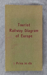
Peters, Al.
Tourist Railway Diagram of Europe Showing the Fares-Times-Distances Between Principal Cities Usually Visited By Americans
Berlin: Hobbing & Co. 1910. Hardcover. Good/no jacket. Green cloth over flexible card with red title 7.5 in tall folded map of Europe affixed to inside of rear cover. No date of publication given the map configuration showing Bohemia as part of Austria indicates a pre-World War I date. The map 22x23 in. shows the railway fares times and distances between cities. Also transatlantic steamer ports are underlined in red giving the name of steamship lines calling there. More detailed fare information for each country on reverse side. A clean map with 3 short tears at fold lines. Covers with brown tone at edges. Hobbing & Co. hardcover
书商的参考编号 : 002299
|
|
|
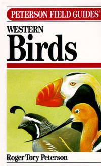
Peterson, Roger Tory - Text And Illustrations. Maps By Peterson, Virginia Marie
A Field Guide To Western Birds - Peterson Field Guide Third Edition Completely Revised and Enlarged
Boston: Houghton Mifflin Company. Vg In Wraps. Lightly Worn. A Completely New Guide To Field Marks Of All Speices Found In North America West Of The 100th Meridian & North Of Mexico. Pages: 432. 1990. Trade Paperback. Houghton Mifflin Company paperback
书商的参考编号 : MASTER259778I ???????? : 039551424X 9780395514245
|
|
|
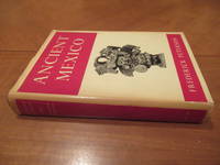
Peterson, Frederick, Jos Luis Franco (Maps and Illustrations)
Ancient Mexico: An Introduction to the Pre-Hispanic Cultures
New York NY: G.P. Putnam's Sons 1959. 1st U.S.A. Hardcover. Very Good/Good. 313 pages. Hardcover. B/w illustrations throughout. Cover boards bound in red cloth gilt title on spine. Dust jacket unclipped has some tanning covered in protective plastic no rips. Some tanning from age to pages and edges doesn't affect text or illustrations. In very good shape for its age. Books presents a coherent picture of ancient Mexico from the days of the early elephant hunters to the Spanish Conquest and deals with all the major groups: Aztecs Maya Totonacs Olmecs Toltecs Tarascans Mixtecs and Zapotecs. Record # 32162 G.P. Putnam's Sons hardcover
书商的参考编号 : 32162

|
|
|
Peterson, Frederick; Maps And Drawings By Jose Luis Franco
Ancient Mexico: An Introduction to the Pre-Hispanic Cultures
New York: G. P. Putnam's Sons 1959. First Edition . Red Cloth. Near Fine/Near Fine DJ. Plates and Drawings. 313 Pp. Red Cloth Spine Gilt. First American Edition. Near Fine In Near Fine Dust Jacket: A Bright Clean Example No Names Or Marks Just A Trace Of Wear. Dj Complete Not Price-Clipped A Few Short Tears At Corners Aging At Spine And Edges But With Almost No Wear. <br/> <br/> G. P. Putnam's Sons hardcover
书商的参考编号 : 019977
|
|
|
PETIT (Victor).
[CANNES] Vue de la ville de Cannes, publiée par les soins de la Société de l'Avenir de Cannes, d'après le projet de M.r F. Mouton.
Cannes, Société de l'Avenir de Cannes, [1865]. 310 x 925 mm ; lithographie sur Chine monté.
书商的参考编号 : LBW-7695

|
|
|
PETIT (Victor);
Palais de l'Exposition Universelle à Paris.
Paris Ch. Boivin 1855 235 x 411 mm.
书商的参考编号 : LBW-671
|
|
|
PETIT ATLAS NATIONAL
Carte d?partementale (noir) : Haute Sa?ne. Milieu XIXe.
Gravure 18x24 cm. Rousseurs.
|
|
|
PETIT ATLAS NATIONAL
Carte d?partementale (noir) : Loir et Cher. Milieu XIXe.
Gravure 18x24 cm. Rousseurs.
|
|
 ?????????
 ?????PDF???
 RSS feed


