|
|
|
Rothenburg, R. von.
Uebersichts-Karte aller in Deutschland und den angrenzenden Ländern seit dem Jahre 113 n. Ch. bis 1830 vorgefallenen Schlachten, Belagerungen und Gefechte. Berlin, Hampe, 1830.
1020 x 850 mm. Kupferstichkarte in 24 Segmenten, auf Leinen aufgezogen und gefaltet. In Schuber. Zeigt das Gebiet zwischen Amsterdam, Kopenhagen, Königsberg, Warschau, Peterwardein, Triest, Lyon und Paris, jeweils mit der Jahreszahl der militärischen Auseinandersetzung neben dem Ort.
|
|
|
ROUBY, édouard
La cartographie au dépôt de la guerre : notice historique et descriptive sur les publications du dépôt de la guerre
Paris, Librairie militaire J. Dumaine 1876 In-8 21 x 19 cm. Reliure demi-toile verte, VI-86 pp. Ex-libris autographe de l’auteur. Exemplaire en très bon état.
Referenz des Buchhändlers : 140205

|
|
|
ROUCOULES (Louis).
[PYRÉNÉES-ORIENTALES] Carte du département des Pyrénées Orientales.
1861. 538x 663 mm ; montée dans une reliure de percaline prune de l'époque (345 x 285 mm).
Referenz des Buchhändlers : LBW-7706

|
|
|
ROUEN
Carte d'?tat major au 1/80 000?, revis?e en 1903.
Une feuille 60x85 cm.
|
|
|
ROUEN. . .
Carte au 1/80 000e des manoeuvres du 3e Corps d'arm?e en 1888.
Une feuille 63x90 cm.
|
|
|
ROUGEOT (André).
[CAMARGUE] Camargue. Terre sauvage et de tradition.
Édition Mireille, [circa 1970]. 459 x 610 mm ; sur papier fort.
Referenz des Buchhändlers : LBW-8188

|
|
|
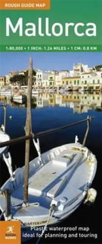
Rough Guides Maps
Rough Guide Map Mallorca
Rough Guides. 2. Map. Used; Very Good. Simply Brit welcome to our online used book store where affordability meets great quality. Dive into a world of captivating reads without breaking the bank. We take pride in offering a wide selection of used books from classics to hidden gems ensuring theres something for every literary palate. All orders are shipped within 24 hours and our lightning fast-delivery within 48 hours coupled with our prompt customer service ensures a smooth journey from ordering to delivery. Discover the joy of reading with us your trusted source for affordable books that do not compromise on quality. 01/02/2009 Rough Guides unknown
Referenz des Buchhändlers : 4092512 ISBN : 1848361866 9781848361867
|
|
|
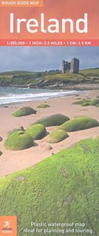
Rough Guides Maps
Rough Guide Map Ireland
Rough Guides. 2. Map. Used; Very Good. Simply Brit welcome to our online used book store where affordability meets great quality. Dive into a world of captivating reads without breaking the bank. We take pride in offering a wide selection of used books from classics to hidden gems ensuring theres something for every literary palate. All orders are shipped within 24 hours and our lightning fast-delivery within 48 hours coupled with our prompt customer service ensures a smooth journey from ordering to delivery. Discover the joy of reading with us your trusted source for affordable books that do not compromise on quality. 01/02/2009 Rough Guides unknown
Referenz des Buchhändlers : 3910788 ISBN : 1848361661 9781848361669
|
|
|
Rouillard, Carré, Labelle, Chartier:
Carte d'Albertville.
Paris, Librairie Plon / Plon, Nourrit et Cie. Carte au 1/80'000, entoilée, au format ouvert de 87 x 59 cm., vignette de la Librairie plon contrecollée au premier plat. Tampons de bureau technique, importantes déchirures sans manques à certains plis.
Referenz des Buchhändlers : 18274

|
|
|
ROULET Alain
Oullins ou la mélancolie d'un temps passé, 1900-1920.
1988, 208 p., broché, avec un envoi de l'auteur, des pliures sur les plats, bords de la couverture frottés, intérieur propre.
Referenz des Buchhändlers : 87282
|
|
|
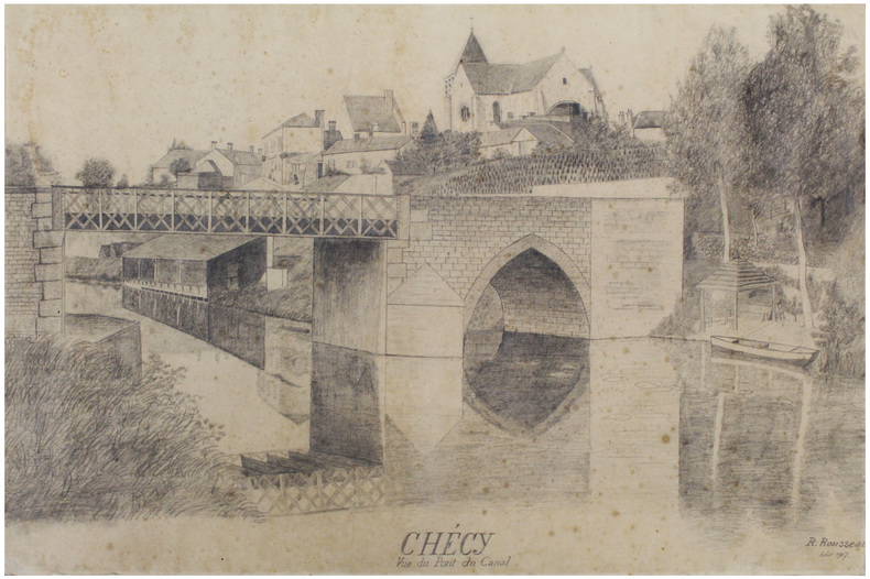
ROUSSEAU (R.).
Chécy. Vue du Pont du Canal.
Août 1907. 71,7 x 105 cm.
Referenz des Buchhändlers : LBW-6619
|
|
|
ROUSSEAU, M.
1939-1940 : L'Armee Francaise (pendant la drole de guerre) en images.
Hardcover in-4, 156 pages illustrees en n&b, cartonnage illustre de l"editeur. Tres bel exemplaire (dos leg. insole). [P-38]
|
|
|
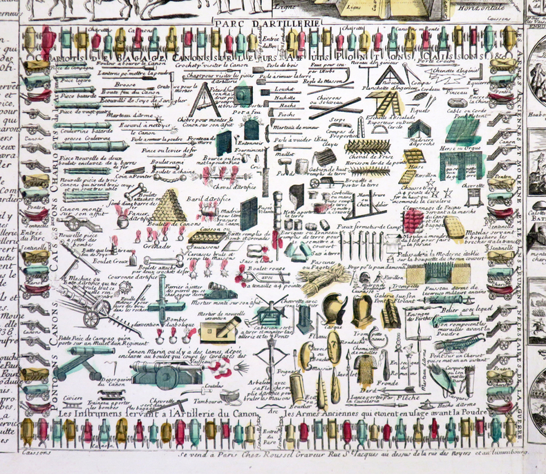
ROUSSEL (Claude).
[ART MILITAIRE] Les Elémens de l'art militaire où se voient la fortification, la marine, l'artillerie, les marches, et, campemens d'une armée. Avec l'explication des charges de tous ceux qui composent les armées de terre et de mer.
Paris, Roussel, [circa 1720]. 485 x 720 mm.
Referenz des Buchhändlers : LBW-4315
|
|
|
Roussel A.
Un Evêque assermenté (1790-1802) : Le Coz, Evêque d'Ille-et-Vilaine.
P.Lethielleux. Non daté. In-8. Cartonnage d'éditeurs. Bon état, Couv. convenable, Dos satisfaisant, Intérieur frais. 565 pages. Contre-plats jaspés. Signet conservé. Deux fac-similés dépliants en noir et blanc en fin d'ouvrage.Frontispice en noir et blanc.. . . . Classification : 270-Cartes Postales Illustrateurs
Referenz des Buchhändlers : RO20219031
|
|
|
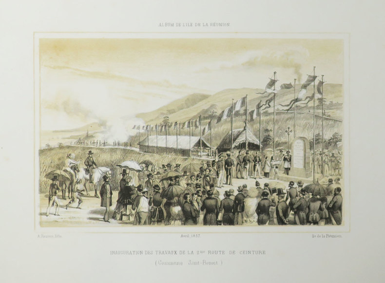
ROUSSIN (Louis-Antoine).
[REUNION] Album de l'Île de La Réunion. Inauguration des travaux de la 2ème route de ceinture (Commune Saint-Benoît). Avril 1857.
[Saint-Denis, Île de la Réunion], 1857. 175 x 228 mm.
Referenz des Buchhändlers : LBW-3509
|
|
|
ROUSSIN (Louis-Antoine).
[REUNION] Souvenir de l'Île de La Réunion. Charles Murray Hay major-général, commandant les forces de Sa Majesté britannique à l'Île Maurice. Dédié à Mr. Hubert Delisle gouverneur de l'Île de La Réunion. Août 1855.
[Saint-Denis, Île de la Réunion], 1855. 268 x 161 mm.
Referenz des Buchhändlers : LBW-3501

|
|
|
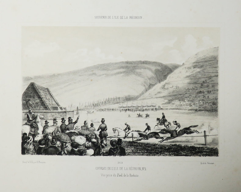
ROUSSIN (Louis-Antoine).
[REUNION] Souvenir de l'Île de La Réunion. Courses de l'Île de La Réunion, N°2. Vue prise du pied de la Redoute. 1853.
[Saint-Denis, Île de la Réunion], 1853. 168 x 207 mm.
Referenz des Buchhändlers : LBW-3513
|
|
|
ROUSSIN (Louis-Antoine).
[REUNION] Souvenir de l'Île de La Réunion. Eglise du quartier Saint-Benoît. Juillet 1856.
[Saint-Denis, Île de la Réunion], 1856. 162 x 217 mm.
Referenz des Buchhändlers : LBW-3507

|
|
|
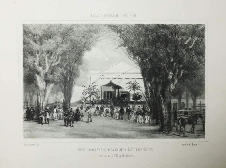
ROUSSIN (Louis-Antoine).
[REUNION] Souvenir de l'Île de La Réunion. Exposition des produits de l'agriculture et de l'industrie au Jardin de l'Etat, Octobre 1853.
[Saint-Denis, Île de la Réunion], 1853. 168 x 223 mm.
Referenz des Buchhändlers : LBW-3514
|
|
|
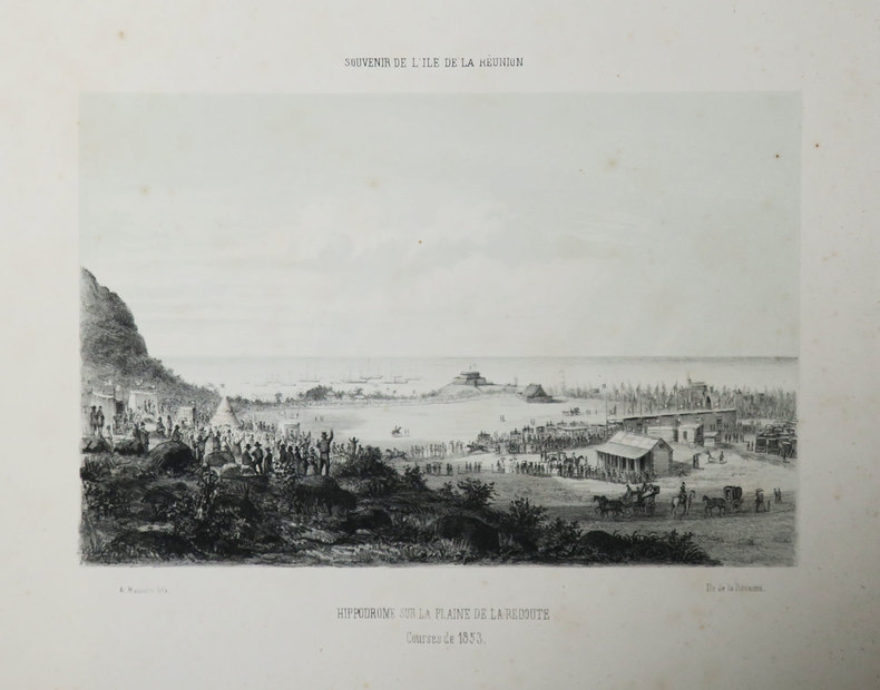
ROUSSIN (Louis-Antoine).
[REUNION] Souvenir de l'Île de La Réunion. Hippodrome sur la plaine de la Redoute. Courses de 1853.
[Saint-Denis, Île de la Réunion], 1853. 168 x 206 mm.
Referenz des Buchhändlers : LBW-3512
|
|
|
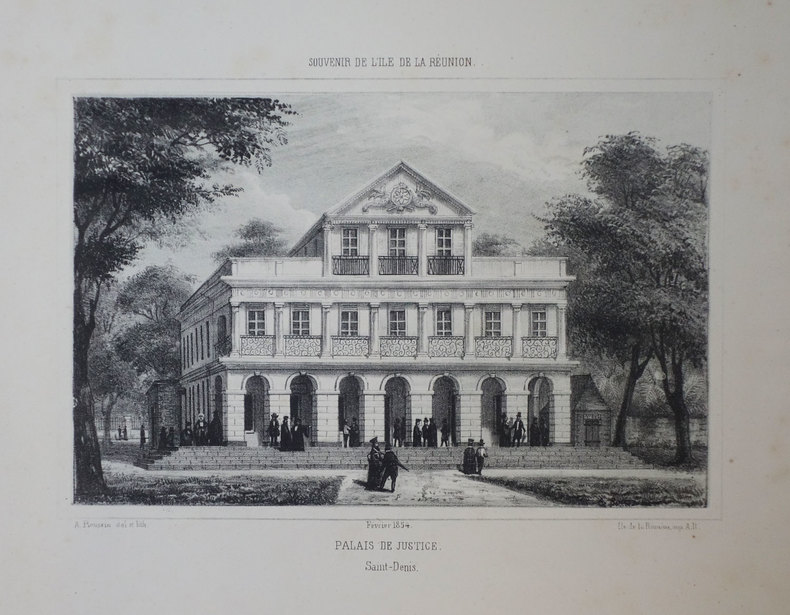
ROUSSIN (Louis-Antoine).
[REUNION] Souvenir de l'Île de La Réunion. Palais de Justice. Saint-Denis. Février 1854.
[Saint-Denis, Île de la Réunion], 1854. 168 x 217 mm.
Referenz des Buchhändlers : LBW-3412
|
|
|
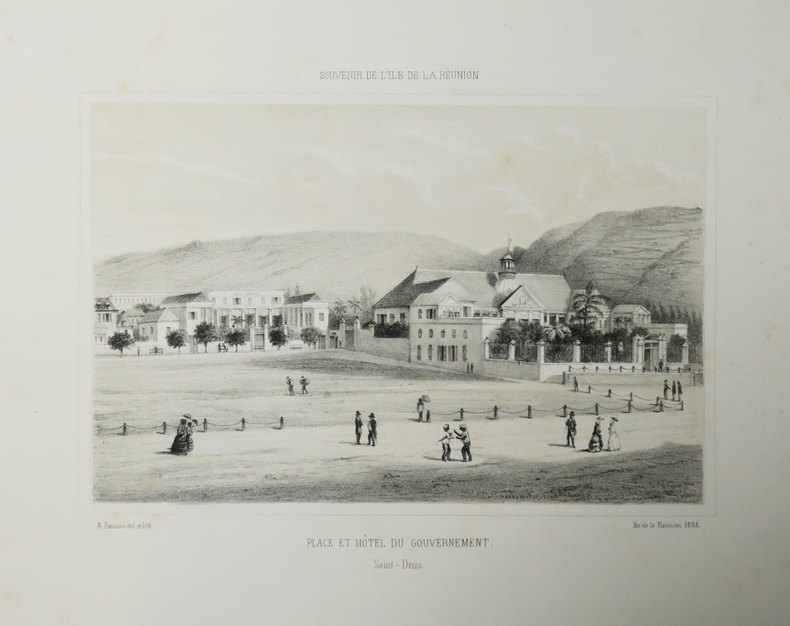
ROUSSIN (Louis-Antoine).
[REUNION] Souvenir de l'Île de La Réunion. Place et hôtel du Gouvernement. Saint-Denis.
[Saint-Denis, Île de la Réunion], 1853. 168 x 215 mm.
Referenz des Buchhändlers : LBW-3415
|
|
|
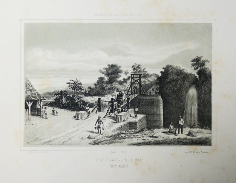
ROUSSIN (Louis-Antoine).
[REUNION] Souvenir de l'Île de La Réunion. Pont de la rivière du Mât. Saint-André. Avril 1855.
[Saint-Denis, Île de la Réunion], 1855. 170 x 217 mm.
Referenz des Buchhändlers : LBW-3438
|
|
|
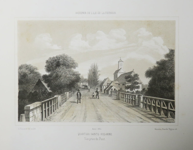
ROUSSIN (Louis-Antoine).
[REUNION] Souvenir de l'Île de La Réunion. Quartier Sainte-Suzanne. Vue prise du pont. Avril 1856.
[Saint-Denis, Île de la Réunion], 1856. 170 x 216 mm.
Referenz des Buchhändlers : LBW-3510
|
|
|
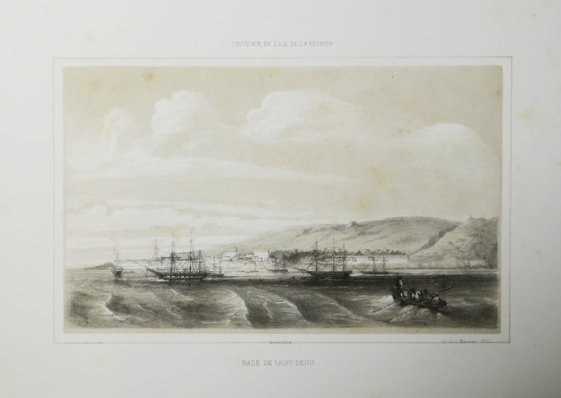
ROUSSIN (Louis-Antoine).
[REUNION] Souvenir de l'Île de La Réunion. Rade de Saint-Denis.
[Saint-Denis, Île de la Réunion], 1855. 161 x 225 mm.
Referenz des Buchhändlers : LBW-3443
|
|
|
ROUSSIN (Louis-Antoine).
[REUNION] Souvenir de l'Île de La Réunion. Rampes de l'hôpital. Saint-Denis.
[Saint-Denis, Île de la Réunion], 1855. 168 x 207 mm.
Referenz des Buchhändlers : LBW-3503

|
|
|
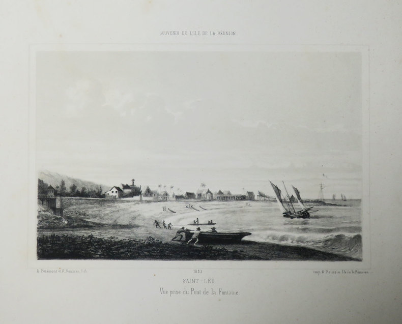
ROUSSIN (Louis-Antoine).
[REUNION] Souvenir de l'Île de La Réunion. Saint-Leu. Vue prise du Pont de la Fontaine. 1853.
[Saint-Denis, Île de la Réunion], 1853. 168 x 219 mm.
Referenz des Buchhändlers : LBW-3409
|
|
|
ROUSSIN (Louis-Antoine).
[REUNION] Souvenir de l'Île de La Réunion. Saint-Paul. Vue prise de la rade. Décembre 1855.
[Saint-Denis, Île de la Réunion], 1855. 175 x 219 mm.
Referenz des Buchhändlers : LBW-3421

|
|
|
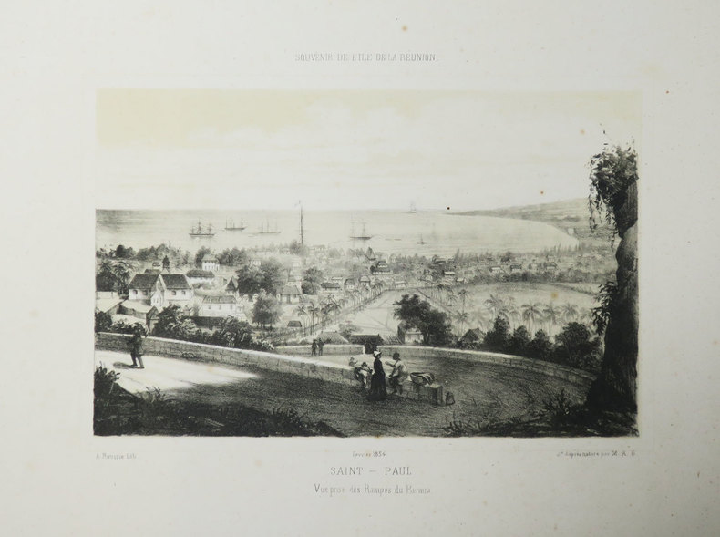
ROUSSIN (Louis-Antoine).
[REUNION] Souvenir de l'Île de La Réunion. Saint-Paul. Vue prise des Rampes du Bernica. Février 1854.
[Saint-Denis, Île de la Réunion], 1854. 168 x 218 mm.
Referenz des Buchhändlers : LBW-3506
|
|
|
ROUVILLE Paul de
Carte géologique et minéralogique du département de l'Hérault. ARRONDISSEMENT DE SAINT PONS
Imprimerie Lemercier & Cie 1876 73x95 1 grande carte en couleurs entoilée et pliée de l'époque. Cette carte géologique et minéralogique du département de l'Hérault: ARRONDISSEMENT DE SAINT PONS. Carte dressée conformément au voeu du Conseil Général, sous l'Administration de MM. Piétri, Garnier, Bergognié, Lisbonne et Limbourg, Préfets par M. Paul de Rouville en collaboration avec Emilien Dumas, de Sommières, en 1876. Chromolithographie par L. Wuhrer. Etiquette ex-libris du Docteur Louis Planchon. Louis Planchon, 1858-1915, docteur en médecine, licencié ès sciences naturelles, pharmacologue et spécialiste d'herboristerie médicale, professeur de botanique à l'Université de Montpellier. Rare. Bel exemplaire
Referenz des Buchhändlers : 49541
|
|
|
ROUVILLE Paul de
Carte géologique et minéralogique du département de l'Hérault. ARRONDISSEMENT DE LODÈVE
Imprimerie Lemercier & Cie 1876 73x95 1 grande carte en couleurs entoilée et pliée de l'époque. Cette carte géologique et minéralogique du département de l'Hérault: ARRONDISSEMENT DE LODÈVE, avec un tableau d'indication des terrains et un tableau des signes. Carte dressée conformément au voeu du Conseil Général, sous l'Administration de MM. Piétri, Garnier, Bergognié, Lisbonne et Limbourg, Préfets par M. Paul de Rouville en collaboration avec Emilien Dumas, de Sommières, en 1876. Chromolithographie par L. Wuhrer. Etiquette ex-libris du Docteur Louis Planchon. Louis Planchon, 1858-1915, docteur en médecine, licencié ès sciences naturelles, pharmacologue et spécialiste d'herboristerie médicale, professeur de botanique à l'Université de Montpellier. Rare. Bel exemplaire
Referenz des Buchhändlers : 49542
|
|
|
ROUX (Joseph).
[GOLFE du LION] Carte du Golfe de Lyon contenant les costes du Roussillon, Languedoc et Provence, depuis Rose jusqu'à La Ciotat.
Marseille, Joseph Roux, 1771. 574 x 801 mm.
Referenz des Buchhändlers : LBW-7183

|
|
|
Rowland Kenney; JF. Horrabin (maps) J. F.
The Northern Tangle: Scandinavia and the Post-War World
London: J.M. Dent 1946. Hard bound in red cloth 1st edition bright gilt titles to spine illustrated with maps xii Pp255. Includes index. A fine copy but without a dust jacket. 430 grams. London: J.M. Dent, 1946 hardcover
Referenz des Buchhändlers : 5303
|
|
|
Roy Woodcock; John McIlwain; AA Publishing. Maps [Editor]
Tour Guide Britain
Automobile Association 1991-03-29. Paperback. Very Good. 11x6x1. Appears to have hardly been read. Same day dispatch Mon- Fri from the UK if ordered by 1pm. Automobile Association paperback
Referenz des Buchhändlers : FR312220718031 ISBN : 0749501812 9780749501815
|
|
|
Roy, Pierre-Georges
Rapport de l'Archiviste de la Province de Québec pour 1924-1925
Ls.-A. Proulx Couverture souple Québec 1925
Referenz des Buchhändlers : 41987
|
|
|
Royal Automobile Club
R.A.C. Map : Midlands
Second series. One folded map, 3 miles to 1 inch. Including town maps, of Leicester, Coventry, Nottingham, Birmingham, Oxford. Also, primary routes and motorways, motorway junction numbers, other routes and place of interest. Near VG condition. 23549. eng
|
|
|
Royal Observatory Greenwich & Collins Maps
Collins Stars and Planets Royal Observatory Greenwich
Collins 08/15/2013. First edition. Hardcover. Used; Very Good. WE SHIP WITHIN 24 HRS FROM LONDON UK 98% OF OUR ORDERS ARE RECEIVED WITHIN 7-10 DAYS. We believe you will be completely satisfied with our quick and reliable service. All orders are dispatched as swiftly as possible! Buy with confidence! Greener Books. Collins hardcover
Referenz des Buchhändlers : 2909605 ISBN : 0007532261 9780007532261

|
|
|
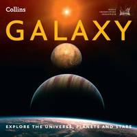
Royal Observatory Greenwich Collins Maps
Galaxy : Explore the Universe Planets and Stars
HarperCollins Publishers Limited. Used - Good. Ships from the UK. Former library book; may include library markings. Used book that is in clean average condition without any missing pages. HarperCollins Publishers Limited unknown
Referenz des Buchhändlers : GRP84744826 ISBN : 0007501242 9780007501243
|
|
|
RUFFIN Daniel
LES EVENTAILS DE CARTES
1980 plaquette in-octavo, couverture rouge illustrée sur le recto - un léger manque de papier sur le verso, illustrations photographiques in-texte par Serge Bourdin, bas de la page 23-24 légèrement abîmé, 24 pages, les années 70 Paris Revue de lAssociation Française des Artistes Prestidigitateurs Ordre des Illusionnistes,
Referenz des Buchhändlers : 5318
|
|
|
RUMEBE, B.
Plan de la Ville de Toulon indiquant les Agrandissements au Nord et à l'Ouest
1 carte dépliante format 64 x 48 cm, B. Rumèbe, Toulon, s.d. (seconde partie XIXe siècle)
Referenz des Buchhändlers : 55569

|
|
|
RUMEBE, B.
Plan de la Ville de Toulon indiquant les Agrandissements au Nord et à l'Ouest
1 carte dépliante format 64 x 48 cm, B. Rumèbe, Toulon, s.d. (seconde partie XIXe siècle) Bon exemplaire Français

|
|
|
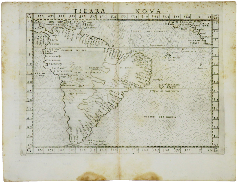
RUSCELLI (Girolamo) & PTOLÉMÉE (Claude).
Tierra nova.
[Venise, 1561]. 184 x 245 mm.
Referenz des Buchhändlers : LBW-5048
|
|
|
RUSCELLI Girolamo (Viterbo 1504 – Venezia 1566)
Carta Marina Nuova Tavola
La mappa di Ruscelli è molto interessante per la sua rappresentazione dei cinque continenti conosciuti, legati tra loro come una superficie continua. Questa mappa presenta una vista della superficie terrestre già piuttosto obsoleta ai tempi della sua pubblicazione. Già in precedenza, altri cartografi, partendo da Matrin Waldseemuller nel 1507, avevano messo in dubbio l’affermazione di Colombo secondo cui Asia e America fossero un unico continente. I viaggi di Magellano e altri esploratori, che permisero di conoscere definitivamente la reale estensione dell’oceano Pacifico, diedero ulteriore sostegno a tali dubbi, sebbene lasciassero aperta la possibilità di una connessione amer-asiatica a settentrione. Intorno alla metà del XVI secolo, tuttavia, anche questa ultima ipotesi venne completamente screditata, per essere rimpiazzata dall’idea di un ipotetico “stretto di Anian”. Altra interessante caratteristica di questa mappa è l’intreccio di “linee dei sestanti” radianti da 16 punti focali intorno alla mappa. Le linee dei sestanti erano strumenti di navigazione che aiutavano a mantenere la medesima posizione della bussola per raggiungere un qualsiasi punto di una linea da un altro punto della medesima. Queste sono semplicemente ornamentali e illustrative, in quanto la mappa è troppo piccola per essere funzionale. Carta tratta dalla "Geographia di Claudio Tolomeo", a cura del Ruscelli, pubblicata in Venezia in pù edizioni tra il 1561 ed il 1598. La carta è basata sulla "Geografia" di Giacomo Gastaldi, che probabilmente disegnò personalmente anche queste mappe, che vennero incise dai fratelli Sanuto. La peculiarità di queste mappe è che sono incise due per lastra e successivamente tagliate; questo il motivo per cui il segno del rame appare solo in tre lati della mappa. Il testo del Ruscelli e le sue carte sono considerate come il miglior atlante moderno fino alla prima versione del Thatrum di Ortelius, 1570. Solo la loro enorme diffusione ne impedisce una valutazione sostenuta nel mercato antiquario. L'opera infatti ebbe una prima stesura nel 1561, stampata da Vincenzo Valgrisi che ne curò anche la ristampa del 1562. Tre sono le edizioni firmate da Giordano Ziletti (due nel 1564 e una del 1574), mentre nel 1597 viene edita dai fratelli Calignani. Tutte queste edizioni contengono 64 tavole. Nel 1598 e 1599 vengono alla luce le due edizioni curate da Giuseppe Rosaccio e stampate dagli Eredi di Melchior Sessa. Queste ultime due edizioni comprendono 69 tavole; sono infatti aggiunte la carta del planisfero e dei continenti del Rosaccio. Nice example of Ruscelli’s Carta Marina, based upon Gastaldi’s map of 1548. Gastaldi's Carta Marina includes the earliest obtainable depictions of the California peninsula, is the earliest obtainable copperplate world map for collectors. Includes Gastaldi's belief in a continuous northern landmass, the isthmus reported by Verrazano in 1524, which closes the northern continents into as unbroken ring. The Asia-America connection was a standard concept, and one of which Gastaldi actively advocated. The joining of North America and Europe is unusual, resulting from two errors. In the east, Gastaldi depicts Greenland as an outgrowth of Scandinavia, based upon Waldseemuller. In the west, Gastaldi follows Verrazano’s model of North America. On the Atlantic coast by Gastaldi notes a green mountain and a large, unnamed cape pointing upwards. This cape, based upon Ramusio’s' map of 1534, first appeared in Ribero’s manuscript chart of 1529, as well as later works, such as Jode’s North America. The cape is believed to be Cape Cod, as both the Ribero and Ramusio maps reflect the reconnaissance along the New England coast by Estavao Gomes, who is believed to have coasted the region. The writing’s of Marco Polo are evident in Asia, with modern corrections.Map, taken from Ruscelli edition of Ptolemy's "Geographia", printed in Venice from 1561 to 1598. Ruscelli's Atlas is an expanded edition of Gastaldi's "Geografia" of 1548, which has been called the most comprehensive atlas produced between Martin Waldseemüller's Geographiae of 1513, and the Abraham Ortelius Theatrum of 1570. Ruscelli and Gastaldi's maps were beautifully engraved on copper, marking a turning point in the history of cartography. From that point forward, the majority of cartographic works used this medium. As it was a harder material than wood it gave the engraver the ability to render more detail. Gastaldi sought the most up-to-date geographical information available, making the modern maps in Ruscelli's Geographia among the best modern maps of the period. The maps are engraved by the Sanuto borthers.Only their enormous diffusion prevents a sustained evaluation in the antique market. The work in fact had a first issue in 1561, printed by Vincenzo Valgrisi who also edited the reprint of 1562. There are three editions signed by Giordano Ziletti (two in 1564 and one in 1574), while in 1597 it was edited by the Calignani brothers. All these editions contain 64 engraved maps. In 1598 and 1599 the two editions edited by Giuseppe Rosaccio and printed by the heirs of Melchior Sessa come to light. These last two editions include 69 plates; in fact the map of the planisphere and of the continents of Rosaccio are added. R. W. Shirley, "The Mapping of the world", 111

|
|
|
RUSCELLI Girolamo (Viterbo 1504 – Venezia 1566)
Carta Marina Nuova Tavola
Acquaforte e bulino, circa 1561. Magnifica prova, impressa su carta vergata coeva, con margini, in perfetto stato di conservazione. Esemplare in meravigliosa coloritura coeva.La mappa di Ruscelli è molto interessante per la sua rappresentazione dei cinque continenti conosciuti, legati tra loro come una superficie continua. Questa mappa presenta una proiezione della superficie terrestre già piuttosto obsoleta ai tempi della sua pubblicazione. Già in precedenza, altri cartografi, partendo da Matrin Waldseemuller nel 1507, avevano messo in dubbio l’affermazione di Colombo secondo cui Asia e America formassero un unico continente. I viaggi di Magellano e di altri esploratori, che permisero di conoscere definitivamente la reale estensione dell’oceano Pacifico, diedero ulteriore sostegno a tali dubbi, sebbene lasciassero aperta la possibilità di una connessione America-Asia a settentrione. Intorno alla metà del XVI secolo, tuttavia, anche questa ultima ipotesi venne completamente screditata, per essere rimpiazzata dall’idea di un ipotetico “stretto di Anian”. Altra interessante caratteristica di questa mappa è l’intreccio di “linee dei sestanti” radianti da 16 punti focali. Il sestante era uno strumento indispensabile per misurare e tracciare, la rotta di navigazione. In questo caso, le linee tracciate sulla mappa sono esclusivamente ornamentali e illustrative, in quanto la carta è troppo piccola per poter essere funzionale. Carta tratta dalla "Geographia di Claudio Tolomeo", a cura del Ruscelli, pubblicata in Venezia in pù edizioni tra il 1561 ed il 1598. La carta è basata sulla "Geografia" di Giacomo Gastaldi, che probabilmente disegnò personalmente anche queste mappe, che vennero incise dai fratelli Sanuto. La peculiarità di queste mappe è che sono incise due per lastra e successivamente tagliate; questo il motivo per cui il segno del rame appare solo in tre lati della mappa. Il testo del Ruscelli e le sue carte sono considerate come il miglior atlante moderno fino alla prima versione del Thatrum di Ortelius, 1570. Solo la loro enorme diffusione ne impedisce una valutazione sostenuta nel mercato antiquario. L'opera infatti ebbe una prima stesura nel 1561, stampata da Vincenzo Valgrisi che ne curò anche la ristampa del 1562. Tre sono le edizioni firmate da Giordano Ziletti (due nel 1564 e una del 1574), mentre nel 1597 viene edita dai fratelli Calignani. Tutte queste edizioni contengono 64 tavole. Nel 1598 e 1599 vengono alla luce le due edizioni curate da Giuseppe Rosaccio e stampate dagli Eredi di Melchior Sessa. Queste ultime due edizioni comprendono 69 tavole; sono infatti aggiunte la carta del planisfero e dei continenti del Rosaccio.Gli esemplari delle carte del Ruscelli in coloritura coeva sono assolutamente rarissimi. - ORIGINAL COLOURING -Etching with engraving, about 1561. Magnificent proof, printed on contemporary laid paper, with margins, in perfect condition. Example in wonderful contemporary coloring.The map of Ruscelli is very interesting for its representation of the five known continents, linked together like a continuous surface. This map shows a projection of the Earth's surface rather obsolete already at the time of its publication. Previously, other cartographers, starting from Martin Waldseemuller in 1507, had questioned the assertion of Columbus that Asia and America form a single continent. The travels of Magellan and other explorers, which allowed him to finally know the true extent of the Pacific Ocean, gave further support to these concerns, although leave open the possibility of a free America-Asia to the north. Around the middle of the sixteenth century, however, this latter hypothesis was completely discredited, to be replaced by the idea of a hypothetical "Strait of Anian." Another interesting feature of this map is the plot of "lines of sextants" radiant 16 focal points. The sextant was an indispensable tool to measure and track, the navigation route. In this case, the lines drawn on the map are exclusively ornamental and illustrative, because the paper is too small to be functional. The map comes from Ptolemy's Geographia, edited by Ruscelli, published in Venice in multiple editions between 1561 and 1598. The map is based on the same work of Giacomo Gastaldi (1548), which probably also personally drew these maps, engraved by the brothers Livio and Giulio Sanuto. The peculiarity of these maps is that they are recorded two for plate and subsequently cut, consequently the sign of the copper appears only on three sides for each map. The text of Ruscelli and his maps are considered as the best modern atlas to the first version of the Theatrum Orbis Terrarum by Ortelius of 1570. Only their ubiquity prevents an assessment supported in the antique market.Girolamo Ruscelli (Viterbo 1504 - Venice 1566), scholar and polygraph native of Viterbo, was formed in Rome but soon moved in Veneto where he treated, for typography Valgrisi, numerous editions of Italian classics. Ruscelli was also the curator of the revised and expanded version of Ptolemy's Geographia, printed in Venice several times between 1561 and the end of the century. The maps are based on those by Giacomo Gastaldi for the Venetian edition of 1548, and engraved by the brothers Sanuto.Example of Ruscelli’s maps in contemporary coloring are absolutely rare. Shirley, The Mapping of the World, 111. Dimensioni 260x195.

|
|
|
RUSCELLI Girolamo (Viterbo 1504 – Venezia 1566)
Orbis descriptio
Acquaforte e bulino, circa 1561. Magnifica prova, impressa su carta vergata coeva, con margini, in perfetto stato di conservazione. Esemplare in meravigliosa coloritura coeva.Carta tratta dalla "Geographia di Claudio Tolomeo", a cura del Ruscelli, pubblicata in Venezia in pù edizioni tra il 1561 ed il 1598. La carta è basata sulla "Geografia" di Giacomo Gastaldi, che probabilmente disegnò personalmente anche queste mappe, che vennero incise dai fratelli Sanuto. La peculiarità di queste mappe è che sono incise due per lastra e successivamente tagliate; questo il motivo per cui il segno del rame appare solo in tre lati della mappa. Il testo del Ruscelli e le sue carte sono considerate come il miglior atlante moderno fino alla prima versione del Thatrum di Ortelius, 1570. Solo la loro enorme diffusione ne impedisce una valutazione sostenuta nel mercato antiquario. L'opera infatti ebbe una prima stesura nel 1561, stampata da Vincenzo Valgrisi che ne curò anche la ristampa del 1562. Tre sono le edizioni firmate da Giordano Ziletti (due nel 1564 e una del 1574), mentre nel 1597 viene edita dai fratelli Calignani. Tutte queste edizioni contengono 64 tavole. Nel 1598 e 1599 vengono alla luce le due edizioni curate da Giuseppe Rosaccio e stampate dagli Eredi di Melchior Sessa. Queste ultime due edizioni comprendono 69 tavole; sono infatti aggiunte la carta del planisfero e dei continenti del Rosaccio. ORIGINAL COLOURINGEtching with engraving, about 1561. Magnificent proof, printed on contemporary laid paper, with margins, in perfect condition. Example in wonderful contemporary coloring.Map, taken from Ruscelli edition of Ptolemy's "Geographia", printed in Venice from 1561 to 1598. Ruscelli's Atlas is an expanded edition of Gastaldi's "Geografia" of 1548, which has been called the most comprehensive atlas produced between Martin Waldseemüller's Geographiae of 1513, and the Abraham Ortelius Theatrum of 1570. Ruscelli and Gastaldi's maps were beautifully engraved on copper, marking a turning point in the history of cartography. From that point forward, the majority of cartographic works used this medium. As it was a harder material than wood it gave the engraver the ability to render more detail. Gastaldi sought the most up-to-date geographical information available, making the modern maps in Ruscelli's Geographia among the best modern maps of the period. The maps are engraved by the Sanuto borthers.Only their enormous diffusion prevents a sustained evaluation in the antique market. The work in fact had a first issue in 1561, printed by Vincenzo Valgrisi who also edited the reprint of 1562. There are three editions signed by Giordano Ziletti (two in 1564 and one in 1574), while in 1597 it was edited by the Calignani brothers. All these editions contain 64 engraved maps. In 1598 and 1599 the two editions edited by Giuseppe Rosaccio and printed by the heirs of Melchior Sessa come to light. These last two editions include 69 plates; in fact the map of the planisphere and of the continents of Rosaccio are added.Only their ubiquity prevents an assessment supported in the antique market.

|
|
|
RUSCELLI Girolamo (Viterbo 1504 – Venezia 1566)
Orbis Descriptio
Carta tratta dalla "Geographia di Claudio Tolomeo", a cura del Ruscelli, pubblicata in Venezia in pù edizioni tra il 1561 ed il 1598. La carta è basata sulla "Geografia" di Giacomo Gastaldi, che probabilmente disegnò personalmente anche queste mappe, che vennero incise dai fratelli Sanuto. La peculiarità di queste mappe è che sono incise due per lastra e successivamente tagliate; questo il motivo per cui il segno del rame appare solo in tre lati della mappa. Il testo del Ruscelli e le sue carte sono considerate come il miglior atlante moderno fino alla prima versione del Thatrum di Ortelius, 1570. Solo la loro enorme diffusione ne impedisce una valutazione sostenuta nel mercato antiquario. L'opera infatti ebbe una prima stesura nel 1561, stampata da Vincenzo Valgrisi che ne curò anche la ristampa del 1562. Tre sono le edizioni firmate da Giordano Ziletti (due nel 1564 e una del 1574), mentre nel 1597 viene edita dai fratelli Calignani. Tutte queste edizioni contengono 64 tavole. Nel 1598 e 1599 vengono alla luce le due edizioni curate da Giuseppe Rosaccio e stampate dagli Eredi di Melchior Sessa. Queste ultime due edizioni comprendono 69 tavole; sono infatti aggiunte la carta del planisfero e dei continenti del Rosaccio.Buon esemplare. A nice example of Ruscelli's map of the world from his Geografia, the first double hemisphere world map to appear in an Atlas. One of two modern world maps in Ruscelli's Geografia, based upon Gastaldi's world map of 1548. The map is a copper plate engraving by Sanuto. The map is adapted from the oval projection used in Gastaldi's larger world map and is presented on Roger Bacon's circular projection, also used by Tramezzino's large world map of 1554. No southern continent is shown. The map clearly shows the broad mass of land joining Asia and America as Terra Incognita and the coastline as Littus Incongmitum. Map, taken from Ruscelli edition of Ptolemy's "Geographia", printed in Venice from 1561 to 1598. Ruscelli's Atlas is an expanded edition of Gastaldi's "Geografia" of 1548, which has been called the most comprehensive atlas produced between Martin Waldseemüller's Geographiae of 1513, and the Abraham Ortelius Theatrum of 1570. Ruscelli and Gastaldi's maps were beautifully engraved on copper, marking a turning point in the history of cartography. From that point forward, the majority of cartographic works used this medium. As it was a harder material than wood it gave the engraver the ability to render more detail. Gastaldi sought the most up-to-date geographical information available, making the modern maps in Ruscelli's Geographia among the best modern maps of the period. The maps are engraved by the Sanuto borthers.Only their enormous diffusion prevents a sustained evaluation in the antique market. The work in fact had a first issue in 1561, printed by Vincenzo Valgrisi who also edited the reprint of 1562. There are three editions signed by Giordano Ziletti (two in 1564 and one in 1574), while in 1597 it was edited by the Calignani brothers. All these editions contain 64 engraved maps. In 1598 and 1599 the two editions edited by Giuseppe Rosaccio and printed by the heirs of Melchior Sessa come to light. These last two editions include 69 plates; in fact the map of the planisphere and of the continents of Rosaccio are added.Small repairs at the white margins, otherwise very good. R. W. Shirley, "The Mapping of the world", 110

|
|
|
RUSCELLI Girolamo (Viterbo 1504 – Venezia 1566)
Ptolemaei Typus
Carta tratta dalla "Geographia di Claudio Tolomeo", a cura del Ruscelli, pubblicata in Venezia in pù edizioni tra il 1561 ed il 1598. La carta è basata sulla "Geografia" di Giacomo Gastaldi, che probabilmente disegnò personalmente anche queste mappe, che vennero incise dai fratelli Sanuto. La peculiarità di queste mappe è che sono incise due per lastra e successivamente tagliate; questo il motivo per cui il segno del rame appare solo in tre lati della mappa. Il testo del Ruscelli e le sue carte sono considerate come il miglior atlante moderno fino alla prima versione del Thatrum di Ortelius, 1570. Solo la loro enorme diffusione ne impedisce una valutazione sostenuta nel mercato antiquario. L'opera infatti ebbe una prima stesura nel 1561, stampata da Vincenzo Valgrisi che ne curò anche la ristampa del 1562. Tre sono le edizioni firmate da Giordano Ziletti (due nel 1564 e una del 1574), mentre nel 1597 viene edita dai fratelli Calignani. Tutte queste edizioni contengono 64 tavole. Nel 1598 e 1599 vengono alla luce le due edizioni curate da Giuseppe Rosaccio e stampate dagli Eredi di Melchior Sessa. Queste ultime due edizioni comprendono 69 tavole; sono infatti aggiunte la carta del planisfero e dei continenti del Rosaccio. Map, taken from Ruscelli edition of Ptolemy's "Geographia", printed in Venice from 1561 to 1598. Ruscelli's Atlas is an expanded edition of Gastaldi's Atlas of 1548, which has been called the most comprehensive atlas produced between Martin Waldseemüller's Geographiae of 1513, and the Abraham Ortelius Theatrum of 1570.Ruscelli and Gastaldi's maps were beautifully engraved on copper, marking a turning point in the history of cartography. From that point forward, the majority of cartographic works used this medium. As it was a harder material than wood it gave the engraver the ability to render more detail. Gastaldi sought the most up-to-date geographical information available, making the modern maps in Ruscelli's Geographia among the best modern maps of the period. The maps are engraved by the Sanuto borthers.Copperplate, good condition.

|
|
|
Rusenberg Auguste
THE SUEZ CANAL MAP AND NOTES OF THE WORLD'S MOST IMPORTANT WATERWAY (in English, French, German and Italian) (1933)
Port-Saïd The Oriental Commercial Bureau August Rüsenberg 1933 in-8 broché une carte dépliante brochée in-octavo Editeur (10,5 x 24 cm), couverture illustrée en bleu marron et jaune de la statue de Ferdinand de Lesseps, avec explications des Sites intéressants au long du Canal de Suez, en Anglais, français et Allemand + une grande carte dépliante en couleur du canal, format déplié : 22,8 x 85 cm , sans date (1933) Port-Saïd The Oriental Commercial Bureau August Rüsenberg Editeur,
Referenz des Buchhändlers : 21187
|
|
|
RUSSELL, DICK; GIVEN, EBEN (maps)
Eye of the Whale: Epic Passage from Naja to Siberia
Simon & Schuster 2001. Ex-library. 8vo hardcover VG in d/w VG; all our specials have minimal description to keep listing them viable. They are at least reading copies complete and in reasonable condition but usually secondhand; frequently they are superior examples. Ordering more than one book will reduce your overall postage costs Simon & Schuster 2001 hardcover
Referenz des Buchhändlers : 337604
|
|
|
RUSSELL, J. C.
SOUTH AMERICA Inc. Falkland Islands ORIGINAL ANTIQUE MAP
Map. Very Good. Unframed. No date but circa 1840. A fine original copper engraved map entitled SOUTH AMERICA; the Falklands islands are also depicted. Plate mark measuing 22 x 27.5cm. Originally from an atlas - this is map 26. J. C. Russell del. et sculpt. Very good condition with slight dust marking. unknown
Referenz des Buchhändlers : 020931

|
|
|
 Per e-mail erhalten
 Als pdf-Dokument herunterladen
 RSS feed


