|
Alexis Donnet DONNET ,FREMIN et LEVASSEUR ou DONNET and MONIN
Carte du Département du NORD avec vue de Lille dréssée par Donnet
1841 1841 à paris ,chez DUSSILLON ,rue Lafitte ,gravure sur acier avec limites coloriées par les fréres Malo,Extr. de l'Atlas des Départemens de la France, par M. Donnet, Frémin et Levasseur.
書籍販売業者の参照番号
: 2788

|
|
|
Alexis Donnet DONNET ,FREMIN et LEVASSEUR ou DONNET and MONIN
Carte du Département du MAINE et LOIRE avec vue de Angers dréssée par Donnet
1841 1841 à paris ,chez DUSSILLON ,rue Lafitte ,gravure sur acier avec limites coloriées par les fréres Malo,Extr. de l'Atlas des Départemens de la France, par M. Donnet, Frémin et Levasseur.
書籍販売業者の参照番号
: 2789

|
|
|
Alexis Donnet DONNET ,FREMIN et LEVASSEUR ou DONNET and MONIN
Carte du Département de la MEUSE avec vue de Bar-le- DUC dréssée par Donnet
1841 1841 à paris ,chez DUSSILLON ,rue Lafitte ,gravure sur acier avec limites coloriées par les fréres Malo,Extr. de l'Atlas des Départemens de la France, par M. Donnet, Frémin et Levasseur.
書籍販売業者の参照番号
: 2791

|
|
|
Alexis Donnet DONNET ,FREMIN et LEVASSEUR ou DONNET and MONIN
Carte du Département de la MEURTHE avec vue de Nancy dréssée par Donnet
1841 1841 à paris ,chez DUSSILLON ,rue Lafitte ,gravure sur acier avec limites coloriées par les fréres MaloExtr. de l'Atlas des Départemens de la France, par M. Donnet, Frémin et Levasseur.
書籍販売業者の参照番号
: 2792

|
|
|
Alexis Donnet DONNET ,FREMIN et LEVASSEUR ou DONNET and MONIN
Carte du Département de la CREUSE avec vue de Guéret dréssée par Donnet
1841 1841 à paris ,chez DUSSILLON ,rue Lafitte ,gravure sur acier avec limites coloriées par les fréres Malo,Extr. de l'Atlas des Départemens de la France, par M. Donnet, Frémin et Levasseur.
書籍販売業者の参照番号
: 2793

|
|
|
Alexis Donnet DONNET ,FREMIN et LEVASSEUR ou DONNET and MONIN
Carte du Département INDRE et LOIRE avec vue de Tours dréssée par Donnet
1841 1841 à paris ,chez DUSSILLON ,rue Lafitte ,gravure sur acier avec limites coloriées par les fréres Malo,Extr. de l'Atlas des Départemens de la France, par M. Donnet, Frémin et Levasseur.
書籍販売業者の参照番号
: 2794

|
|
|
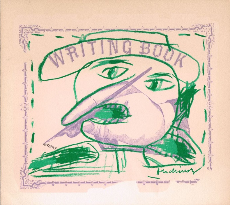
Alechinsky, Pierre
Writing book. Lithographie originale pour la carte de voeux de Aimé Maeght pour l'année 1981.
Paris Maeght 1980 aucune reliure 20 x 22,5 cm. 2ff. Lithographie originale en couleurs signée dans la planche. En page 2 la mention imprimée "Pierre Alechinsky, lithographie originale", en page 3 les voeux imprimés de Aimé Maeght et ses adresses à Paris, Zurich et Barcelone.
書籍販売業者の参照番号
: 3405
|
|
|
ALENCON S. E. - MORTAGNE S. O.
2 cartes au 1/80 000? type 1889. Entoil?es ensemble. R?vis?es en 1889 et 1894.
Une feuille 86x56 cm.
|
|
|
Alex Inkson McConnochie
Deeside: Aberdeenshire
Ex library book with usual marks and stamps. Very clean very tight pages with bright unmarked red cloth boards, rubbing to spine ends and lower edge and no bumping to corners. Dust jacket not price clipped or marked or torn or creased with slight sunning and a little rubbing to edges. Large fold-out map at the rear (35 x 14 inches) published by Lewis Smith of Aberdeen in excellent condition. 233pp. Originally publshed in 1900, this guide for tourists of the time gives history and legend, poetry and ballad and much description about the area of Deeside and is still of relevance to the present day tourist.

|
|
|
Alexander, Lynne; Fulton, Oliver
Staying Vegetarian
Name/date to front end paper. No other marks or inscriptions. No creasing to covers, creasing to spine. A very clean very tight copy with bright unmarked boards, tanning to page edges and no bumping to corners. 274pp. Guide to guesthouses and hotels for vegetarians, vegans and wholefooders.

|
|
|
ALFARO FOURNIER Félix
Los naipes, Museo Fournier : historia general desde su creacion a la epoca actual.
Heraclio Fournier Heraclio Fournier, 1982, 344 p., cartonnage éditeur, environ 29x22cm, bon état.
書籍販売業者の参照番号
: 100267

|
|
|
Alfons Van Gelder
Oud-Turnhout Arendonk in oude prentkaarten
, Europese Bibliotheek / Het Laatste Nieuws, 1974 Softcover, pagina's niet genummerd, 14 x 20 cm, NL. *Goede staat.
書籍販売業者の参照番号
: 69649
|
|
|
ALGERIE
CARTE DE L'ALGERIE DRESSEE AU DEPOT DE LA GUERRE 1876. REVUE EN 1889.
sans nom En 2 parties chacune de 52 centimètres X 68 centimètres, toilée. Couleur. Echelle 1/800 000ème. Parfait état.
書籍販売業者の参照番号
: 9994731
|
|
|
Algérie
CPA ALGER ILLUSTRATEUR CHAGNY. DIS CHERI TU VIENS PRENDRE LE CAOUA....
Non Renseigné. Non daté. In-12. Broché. Bon état, Couv. convenable, Dos satisfaisant, Intérieur frais. Carte tachée, assez bon état.. . . . Classification : 270-Cartes Postales Illustrateurs
書籍販売業者の参照番号
: R100038418
|
|
|
Algérie
CPA ALGER ILLUSTRATEUR CHAGNY. ...LA MOUKERE A TOUT SIMPLEMENT DE L'HYDROPISIE....
Non Renseigné. Non daté. In-12. Broché. Bon état, Couv. convenable, Dos satisfaisant, Intérieur frais. Bon état. . . . Classification : 270-Cartes Postales Illustrateurs
書籍販売業者の参照番号
: R100038419
|
|
|
Algérie
CPA ALGER ILLUSTRATEUR CHAGNY. ...LA MAMA ELLE, ELLE CRIE COMME UN CHAMEAU....
Non Renseigné. Non daté. In-12. Broché. Bon état, Couv. convenable, Dos satisfaisant, Intérieur frais. Un peu tachée, bon état. . . . Classification : 270-Cartes Postales Illustrateurs
書籍販売業者の参照番号
: R100038420
|
|
|
ALGERIE
CARTE DE L'ALGERIE DRESSEE AU DEPOT DE LA GUERRE 1876. REVUE EN 1889.
En 2 parties chacune de 52 centimètres X 68 centimètres, toilée. Couleur. Echelle 1/800 000ème. Parfait état.
|
|
|
Alhinho Marie
Marblegen - Un mystérieux adversaire (6): Avec 6 cartes collector exclusives
DRAGON D OR 2019 34 pages 19 4x21 8x0 6cm. 2019. Relié. 34 pages.
書籍販売業者の参照番号
: 500058031

|
|
|
Alhinho Marie
Marblegen - Un mystérieux adversaire (6): Avec 6 cartes collector exclusives
DRAGON D OR 2019 34 pages 19 4x21 8x0 6cm. 2019. Relié. 34 pages.
書籍販売業者の参照番号
: 500072738

|
|
|
Alhinho Marie
Marblegen - Un mystérieux adversaire (6): Avec 6 cartes collector exclusives
DRAGON D OR 2019 34 pages 19 4x21 8x0 6cm. 2019. Relié. 34 pages.
書籍販売業者の参照番号
: 500074454

|
|
|
Alhinho Marie
Marblegen - Un mystérieux adversaire (6): Avec 6 cartes collector exclusives
DRAGON D OR 2019 34 pages 19 4x21 8x0 6cm. 2019. Relié. 34 pages.
書籍販売業者の参照番号
: 500092689

|
|
|
Alhinho Marie
Marblegen - Un mystérieux adversaire (6): Avec 6 cartes collector exclusives
DRAGON D OR 2019 34 pages 19 4x21 8x0 6cm. 2019. Relié. 34 pages.
書籍販売業者の参照番号
: 500100509

|
|
|
Alhinho Marie
Marblegen - Un mystérieux adversaire (6): Avec 6 cartes collector exclusives
DRAGON D OR 2019 34 pages 19 4x21 8x0 6cm. 2019. Relié. 34 pages.
書籍販売業者の参照番号
: 500111212

|
|
|
Alhinho Marie
Marblegen - Un mystérieux adversaire (6): Avec 6 cartes collector exclusives
DRAGON D OR 2019 34 pages 19 4x21 8x0 6cm. 2019. Relié. 34 pages.
書籍販売業者の参照番号
: 500113231

|
|
|
ALLARD (Carel).
[ANDALOUSIE] Nieuwe en nauwkeurige kaart ... van Spanje genaamt Andalusie ... en de stadt van Cadix ... en haven van Gibraltar.
Amsterdam, R. et I. Ottens, [circa 1705]. 482 x 574 mm.
書籍販売業者の参照番号
: LBW-947
|
|
|
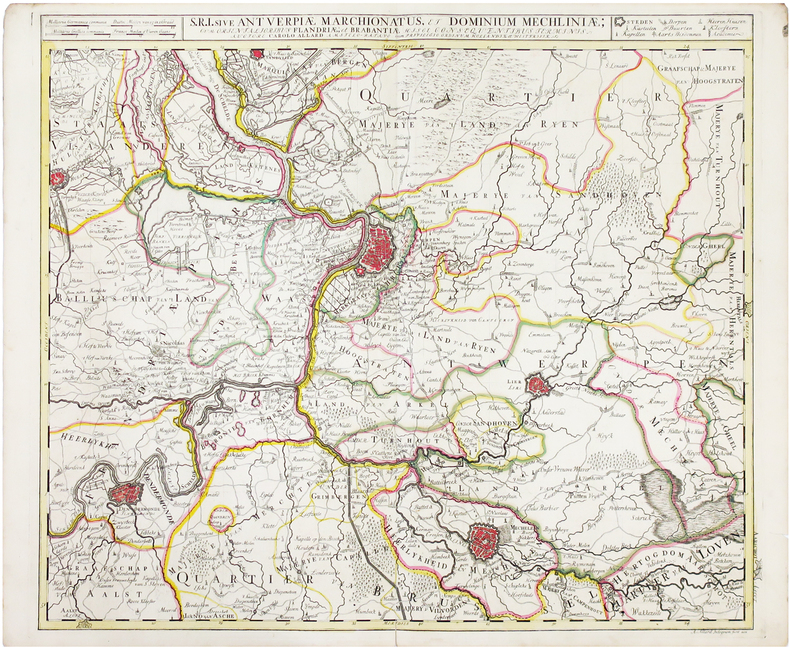
ALLARD (Carel).
[BELGIQUE/ANVERS] S.R.I. Antverpiae Marchionatus et dominium Mechliniae.
Amsterdam, [circa 1700]. 500 x 582 mm.
書籍販売業者の参照番号
: LBW0417b
|
|
|
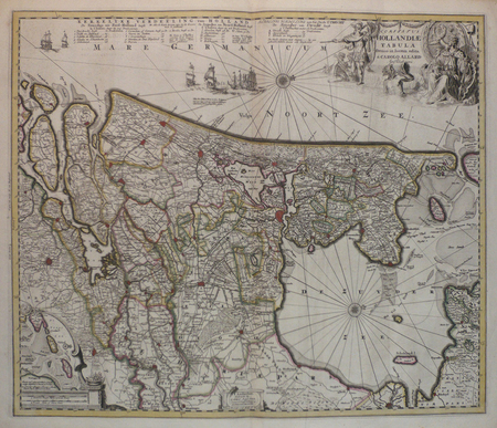
ALLARD (Carel);
[HOLLANDE] Comitatus Hollandiae tabula.
Amsterdam circa 1700 472 x 560 mm.
書籍販売業者の参照番号
: LBW0416c
|
|
|
ALLARD (Carel).
[ÎLES d'HYÈRES/FORT de BRÉGANÇON] Les isles d'Hyères et le Fort de Brégançon, et autres forces de Provence etc.
Amsterdam, [circa 1700]. 225 x 261 mm.
書籍販売業者の参照番号
: LBW-5518

|
|
|
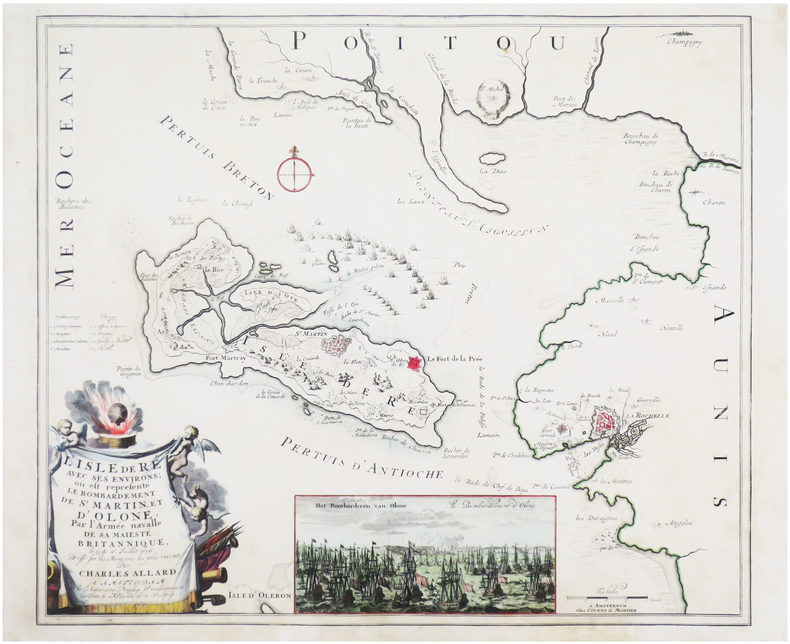
ALLARD (Carel).
[ÎLE DE RÉ] L'Isle de Ré avec ses environs ; où est représenté le bombardement de S.t Martin, et d'Olone, par l'armée navalle de Sa Majesté Britannique, le 15 & 16 juillet 1696.
Amsterdam, chez l'auteur, et chez Covens & Mortier, [circa 1700]. 496 x 579 mm.
書籍販売業者の参照番号
: LBW-7612
|
|
|
ALLAIN (Maurice)
Atlas Universel Quillet.
Physique – Économique – Politique. Dressé par Maurice ALLAIN. Préface du Président Édouard HERRIOT. 1: France et Union Française. 50 cartes en couleurs dépliantes avec au dos illustrations en noir et blanc. 2: L'Europe – L'Asie – L'Afrique – L'Amérique – L'Océanie. 80 cartes en couleurs dépliantes avec au dos illustrations en noir et blanc. Paris, Strasbourg – Bruxelles – Buenos Aires, Librairie Aristide Quillet, 1951-1951. 2 volumes in-folio (45,5x25,5cm) percaline noire foncé gaufré, dos cuirs et les légendes dorées, gardes ornées de motifs de fleurs. 90pp. + 175pp.
書籍販売業者の参照番号
: WOC-1721

|
|
|
ALLEMAGNE]
Carte d'Allemagne indiquant la division actuelle de cet empire, ainsi que les nouvelles possessions des princes qui composent le Corps Germanique, et comprenant la Batavie et l'Helvétie avec leurs nouvelles divisions, par E. Mentelle et P.G. Chanlaire.
Paris Vignon 1805 1 vol. en feuilles Grande carte entoilée en couleurs 96 x 130 cm. Quelques légères salissures sans gravité, sinon en bel état de conservation.
書籍販売業者の参照番号
: 52094
|
|
|
ALLEMAGNE]
Carte d'Allemagne indiquant la division actuelle de cet empire, ainsi que les nouvelles possessions des princes qui composent le Corps Germanique, et comprenant la Batavie et l'Helvétie avec leurs nouvelles divisions, par E. Mentelle et P.G. Chanlaire.
Paris Vignon 1805 1 vol. en feuilles Grande carte entoilée en couleurs 96 x 130 cm. Quelques légères salissures sans gravité, sinon en bel état de conservation.
書籍販売業者の参照番号
: 52094
|
|
|
Allary Robert
Rochefort en cartes postales anciennes
Bibliothèque européenne/S.F.L.. 1974. In-8. Cartonné. Etat passable, Coins frottés, Dos fané, Papier jauni. 76 pages illustrées en noir et blanc. Quelques rousseurs.. . . A l'italienne. Classification Dewey : 741.68-Illustrations des cartes postales
書籍販売業者の参照番号
: RO30364909
|
|
|
ALLEMAGNE
Allemagne et pays limitrophes. Carte automobile au 1/1 000 000e en couleurs.
Cartonn?e 126x92 cm. Repli?e.
|
|
|
Allen, Everett S and With Photographs & Maps
Arctic Odyssey the Life of Rear Admiral Donald B. MacMillan
Hardcover. Good. Jacket in Fair condition worn torn faded and foxed with significant tape repairs verso. Book has moderate wear some edge foxing; pages yellowed with an occasional minor blemish; binding firm; gift inscription to half-title. hardcover
書籍販売業者の参照番号
: G8N-H27-VU6
|
|
|
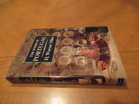
Allen, H Warner; Photographs By Percy Hennell; 2 Maps; Bookplate Of Robert Balzer
The Wines Of Portugal
New York: Mcgraw-Hill 1963. 1st Edition 1st Printing. Hardcover. Fine/Near Fine. 192 Pp White Spine Blue Cloth Covers Gilt. First Edition Indicated. Fine In Near Fine Dust Jacket Priced $10.00. Vine-Bordered Bookplate Of California Wine Expert Robert Lawrence Balzer. <br/> <br/> Mcgraw-Hill hardcover
書籍販売業者の参照番号
: 055361
|
|
|
Allen, William J. (editor-in-chief)
National Geographic December 2000
136 pages, illustrated, includes articles on the Blue Nile, polar bears, early American humans, the Fiordland national park, Lake Wobegon (Garrison Keillor) and Shipton's Arch. eng
|
|
|
Allied Operational Maps
Allied Operational Maps of Germany and France 1943-1944: A U.S. Soldier's Archive Used in the Liberation of Europe materially linking frontline navigation aerial bombardment liberation campaigns and the geopolitical reconfiguration of Europe under the expanding Soviet Bloc
1943. Archive of nine large original World War II maps used by a United States Army soldier in the European Theater of Operations during the Allied liberation of Western Europe. Lithographed military maps variously issued by U.S. Army and War Office agencies 1943-1944. Large formats ranging from approximately 19" x 24" to 42" x 34". These maps document the cartographic infrastructure of Allied ground and air operations in the climactic campaigns of 1944-1945. The German sheets-many designated for "Army/Air" or restricted War and Navy Department use-reflect the intensive aerial reconnaissance bombing coordination and mechanized advance into the industrial and administrative heartland of the Third Reich. Cities such as Berlin Magdeburg Kassel and Düsseldorf were central to armaments production rail networks and military command making accurate and rapidly updated mapping indispensable. The Paris map corresponds to the Allied advance culminating in the Liberation of Paris in August 1944 marking the symbolic reclamation of a major European capital from Nazi control. Several sheets note reliance on prewar German cartography 1938 editions supplemented by wartime intelligence underscoring how Allied forces repurposed and revised enemy geographic data for invasion and occupation planning.<br /> <br /> Crucially these maps also capture a political geography that was almost immediately transformed by postwar settlement and Soviet expansion into Central and Eastern Europe. Within two years of their issue Germany was divided into occupation zones and by 1949 into separate states aligned with Western and Soviet blocs. Cities such as Berlin Halle Saale Magdeburg and Wernigerode fell within the Soviet zone and subsequently the German Democratic Republic fundamentally altering administrative boundaries transportation networks and the ideological framing of space. Cartographic production in these regions shifted accordingly with new editions reflecting socialist state structures and restricted internal mapping policies characteristic of the emerging Eastern Bloc. Thus these 1943-1944 sheets preserve a transitional moment: Nazi Germany still territorially intact on paper yet already subjected to Allied military penetration and poised on the brink of partition. As artifacts carried by an American soldier they embody both the tactical prosecution of total war and the immediate redrawing of Europe into Cold War spheres of influence. The archive includes operational maps of Magdeburg Sheet M.53 1:250000 "First Edition" 1943 with manuscript annotation Kassel Sheet L52 "Emergency Road Map" First Edition color based on 1938 mapping with wartime intelligence updates Düsseldorf Sheet K52 similar issue with fading highlighting and manuscript marks Hanover Sheet L53 1943 Berlin Sheet N53 "Army/Air" 1943 Halle Saale Sheet M52 marked "War and Navy Department Agencies only. Not for sale or distribution" 1943 Wernigerode Sheet 4130 First Edition War Office 1944 Jülich G.S.G.S. No. 4507 War Office 1944 35" x 30" and a large U.S.-issued map of Paris 42" x 34" 1944. All were retained by the soldier following his service.<br /> <br /> Very good overall with expected wartime folds and handling; several sheets with manuscript annotations highlighting fading or moderate water exposure notably Wernigerode stiffened from dampness; no major losses observed. A substantial and research-rich archive of original Allied operational maps materially linking frontline navigation aerial bombardment liberation campaigns and the swift geopolitical reconfiguration of Germany and Europe under the expanding Soviet Eastern Bloc. unknown
書籍販売業者の参照番号
: 14434

|
|
|
Allied Operational Maps/ Eastern Bloc
Archive of 6 original Allied Operational Maps Document both the liberation of Central Europe by US Forces and the swift geopolitical transformation that consigned much of that terrain to the Soviet Eastern Bloc
1939. Archive of six large original World War II-era maps used by a United States Army soldier in the European Theater of Operations during the Allied liberation of Europe. Lithographed maps various issuers 1938-1939 wartime use 1944-1945.<br /> <br /> Beyond their immediate tactical utility these maps occupy a pivotal geopolitical moment. The Czech sheets document territories liberated by American forces in May 1945 particularly around Plzeň which marked the effective western limit of U.S. advance before demarcation lines were fixed with Soviet forces. Within months these same regions fell firmly within the Soviet sphere of influence formalized through postwar agreements and culminating in the 1948 Communist coup in Czechoslovakia. Cartographically borders administrative divisions and place names shifted to reflect the new socialist state while subsequent Eastern Bloc map production emphasized different political geographies aligned with Moscow. Thus these pre-Communist and German-printed sheets capture a fleeting interstice: cities momentarily under American military administration before incorporation into the Soviet Eastern Bloc. The 1938 promotional map of Czechoslovakia preserves the nation's pre-Munich territorial identity prior to its partition under Nazi pressure while the 1939 Hamburg map reflects the industrial heartland of the Third Reich before Allied devastation and Germany's eventual division into East and West. In this sense the archive charts not only wartime movement but the rapid redrawing of Europe's political landscape-where American operational cartography was almost immediately superseded by Cold War boundary-making. Sizes range from 19" x 24" to 34" x 22". The archive comprises detailed city and regional maps of western Czechoslovakia-Město Teplá 19" x 24" Plzeň Sheet 4151 24" x 19" black and white with green overlay Horšovský Týn Sheet 4150 24" x 19" and Kralovice Sheet 4051-together with a large 1938 promotional map of Czechoslovakia 34" x 22" and a 1939 German-printed map of Hamburg 28" x 24". All are original period printings retained by the soldier following his service. Good overall with expected wartime folds creasing and moderate wrinkling from field use and storage; no significant losses observed. A rare and materially resonant survival of Allied operational maps that document both the liberation of Central Europe and the swift geopolitical transformation that consigned much of that terrain to the Soviet Eastern Bloc rendering these sheets artifacts of a brief and transitional military presence. unknown
書籍販売業者の参照番号
: 14433
|
|
|
ALPHAND (Jean-Charles Adolphe) & FAUVE (L.).
[EAUX de PARIS] Eaux de Paris. Canalisation au 1er janvier 1889.
Paris, [1889]. 612 x 770 mm.
書籍販売業者の参照番号
: LBW-5916

|
|
|
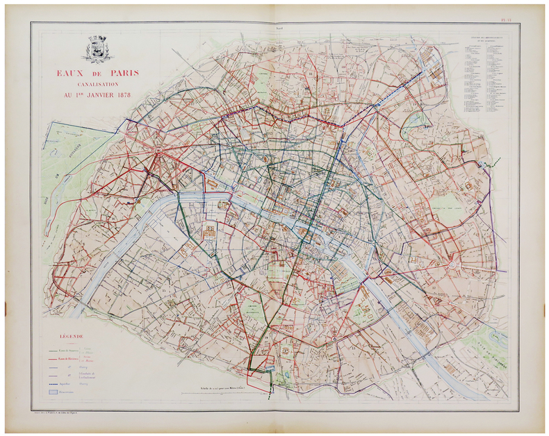
ALPHAND (Jean-Charles Adolphe) & FAUVE (L.).
[EAUX de PARIS] Eaux de Paris. Canalisation au 1er janvier 1878.
Paris, [1889]. 612 x 770 mm.
書籍販売業者の参照番号
: LBW-5971
|
|
|
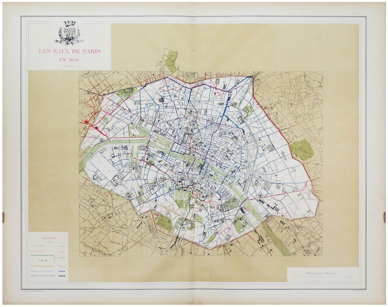
ALPHAND (Jean-Charles Adolphe) & FAUVE (L.).
[EAUX de PARIS] Les Eaux de Paris en 1854.
Paris, [1889]. 612 x 768 mm.
書籍販売業者の参照番号
: LBW-5996
|
|
|
ALPHAND (Jean-Charles Adolphe) & FAUVE (L.).
[EAUX de PARIS] Les Eaux de Paris en 1789.
[Paris, 1889]. 610 x 770 mm.
書籍販売業者の参照番号
: LBW-8860

|
|
|
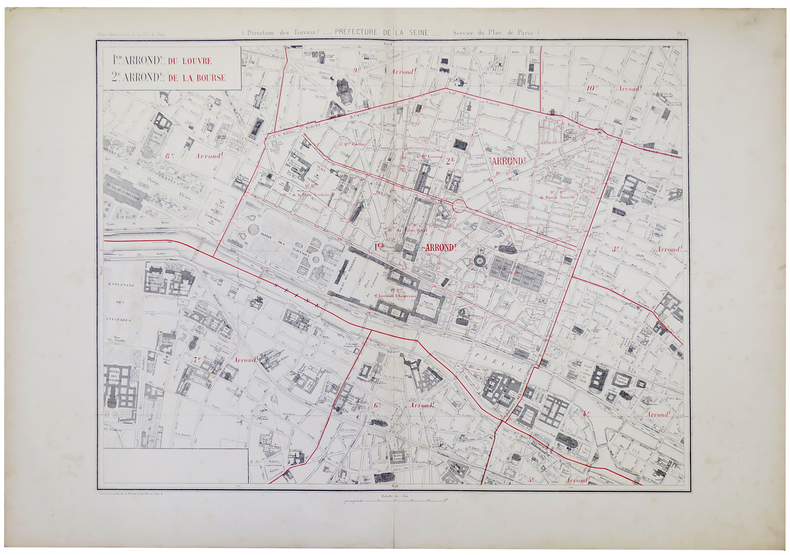
ALPHAND (Jean-Charles Adolphe).
[PARIS 1er et 2ème arrondissements] 1.er arrond.t du Louvre - 2.e arrond.t de la Bourse.
Paris, [1878]. 570 x 720 mm.
書籍販売業者の参照番号
: LBW-5323
|
|
|
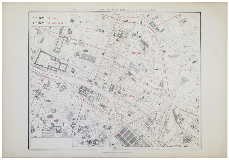
ALPHAND (Jean-Charles Adolphe).
[PARIS 3ème et 4ème arrondissements] 3.e arrond.t du Temple - 4.e arrond.t de l'Hôtel de Ville.
Paris, [1878]. 601 x 727 mm.
書籍販売業者の参照番号
: LBW-5324
|
|
|
ALPHAND (Jean-Charles Adolphe).
[PARIS 7ème arrondissement] 7.e arrond.t du Palais Bourbon.
Paris, [1878]. 605 x 784 mm.
書籍販売業者の参照番号
: LBW-5326

|
|
|
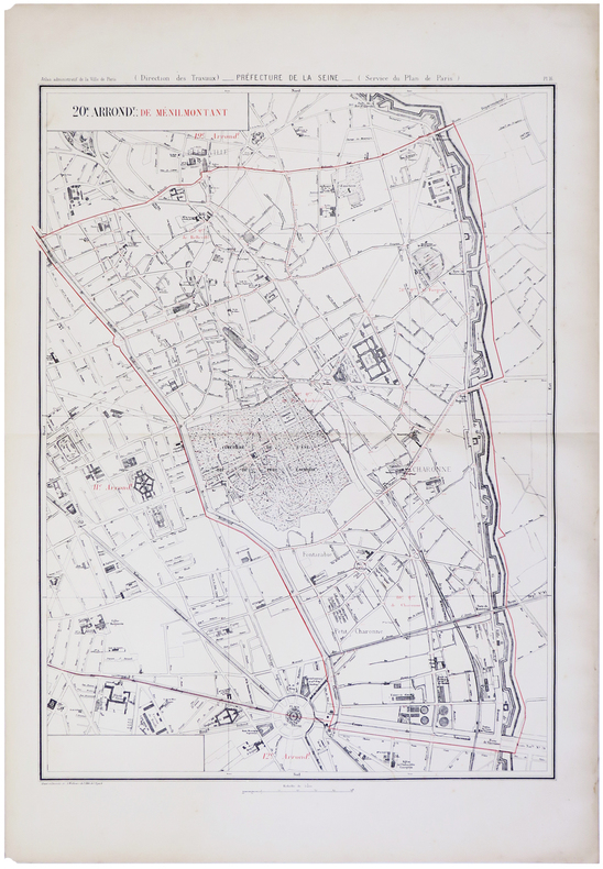
ALPHAND (Jean-Charles Adolphe) & FAUVE (L.).
[PARIS 20ème arrondissement] 20.e arrond.t de Ménilmontant.
Paris, [1878]. 790 x 571 mm.
書籍販売業者の参照番号
: LBW-5954
|
|
|
ALPHAND (Jean-Charles Adolphe) & FAUVE (L.).
[PARIS 13ème arrondissement] 13.e arrond.t des Gobelins.
Paris, [1878]. 620 x 786 mm.
書籍販売業者の参照番号
: LBW-5959

|
|
|
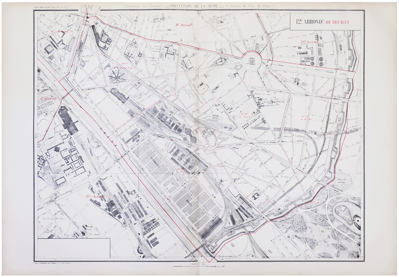
ALPHAND (Jean-Charles Adolphe) & FAUVE (L.).
[PARIS 12ème arrondissement] 12.e arrond.t de Reuilly.
Paris, [1878]. 630 x 798 mm.
書籍販売業者の参照番号
: LBW-5960
|
|
|
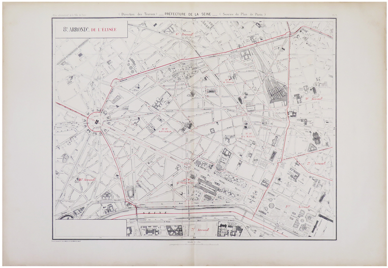
ALPHAND (Jean-Charles Adolphe) & FAUVE (L.).
[PARIS 8ème arrondissement] 8.e arrond.t de l'Élysée.
Paris, [1878]. 573 x 703 mm.
書籍販売業者の参照番号
: LBW-5963
|
|

 検索結果のメールを受信する
 PDFファイルの検索結果をダウンロード
 RSSフィード
 パーマネントリンク


