|
BUCHON (Jean Alexandre);
[COLOMBIE] Carte géographique, statistique et historique de la République Colombienne.
Paris 1825 441 x 602 mm.
Référence libraire : LBW0395a
|
|
|
BUCHON (Jean Alexandre);
Carte géographique, statistique et historique de l'Amérique méridionale.
Paris 1825 442 x 637 mm.
Référence libraire : LBW03959
|
|
|
BUCHOTTE
LES REGLES DU DESSIN ET DU LAVIS, POUR LES PLANS PARTICULIERS DES OUVRAGES ET DES BATIMENTS ET POUR LEURS COUPES, PROFILS, ELEVATIONS ET FACADES, TANT DE L'ARCHITECTURE MILITAIRE QUE CIVILE.
1754 1 volume, reliure de l'époque plein veau havane moucheté in-octavo (binding full calfskin in-octavo), dos à nerfs (spine with raised bands) décoré or (gilt decoration) filets et roulette or (fillets and gilt line) et filets à froid (blind-stamping line decoration) - entre-nerfs à fer spécial "Vase Antique" au fer plein (between the raised bands floweret with full blocking stamp) - titre frappé or (gilt title), pièce de titre sur fond bordeaux foncé (label of title) avec filet or (label of title with gilt line), coiffes manquantes (are missing the head and tail of the spine) Petit manque de cuir en coiffe et en queue sans gravité, plats légèrement épidermés (light scratches), charnière fendue (cracked joints) et coins écornés (corners dog-eared),tête lisse (top edge smooth), toutes tranches lisses (all smooth edges), orné de 24 planches dépliantes (folding plates) hors-texte (full page engraving) gravées sur bois (engraving wood) en noir, XV + 216 pages, 1754 Paris chez Charles Antoine Jombert Editeur,
Référence libraire : 13722
|
|
|
Buckham, A.F.
Nanaimo Coalfield (Coal Field) British Columbia (Map): Geological Survey Paper 47-22
38.5" x 26.75" map. Indicates sixty-seven coal mines and prospects. Extensive descriptive notes along right margin. Legend in left margin indicates the various formations shown on the map, including Gabriola, Northumberland, De Courcy, Cedar, Protection, Newcastle, Cranberry, Extension, Haslam and East Wellington, and Benson. Stored in original government-issued kraft envelope with some markings. Covers the area from Ladysmith Harbour north to Arbutus Point, south of Parksville. Includes most of Gabriola Island on the east and several miles inland from the coast on the west. Clean and unmarked with very light wear. A fascinating and highly-informative guide to the historic industry upon which Nanaimo was founded. An excellent vintage copy, most suitable for framing. Book

|
|
|
Buckley, J. A.
Geevor Mine
No marks or inscriptions. No creasing to covers. A very clean very tight copy with bright unmarked boards and no bumping to corners. 24pp. The story of Geevor Tin Mine in Cornwall. Glossary of mining terms at rear. Illustrated. We do not use stock photos, the picture displayed is of the actual book for sale. Every one of our books is in stock in the UK ready for immediate delivery.

|
|
|
Buffalo City Planning Association Inc.
City Facts
Ex-library book with the usual stamps, stickers, etc. Binding is solid and text/interior is clean and free of marking of any kind. Bound compilation of the City Facts publication from the Author dating from Oct. 1, 1922 to March, 1927. Issues include: Dec. 1926, Nov. 1924, Oct. '22, Mar. '23, Jan. '24, Apr. '24, Oct. '26, Jul. '26, May '26, Dec. '25, Sept. '25, Apr. '25, Dec. '24, Nov. '24, (#4) Nov. '24 (#5), Apr. '24, Jan. '24, (#1), Jan. '24 (#2), June '23, Apr. '23, Mar. '23, Jan. '23, Dec. '22 (#'s 1 & 2) in special binding that incorporates a box containing (5) color 21" x 31 1/2 " maps of Buffalo, New York, and one of the surrounding area that are laminated in a fashion that incorporates cloth on the back side and depicting existing and planned street layouts, building sites, etc. Map titles are: Plan of Buffalo, Showing General Development [(2) from 1922], (2) Comprehensive Plan of Niagara Frontier, Buffalo of Tomorrow (with features on the Circuit Traffic Way and reasons for Niagara Square) and City Plan of Buffalo (1921) with three sub-maps: Buffalo traffic accidents 1917, One Day's Traffic Counts & Major Street Plan. With Bulletin # 4 -- one page ephemera containing a resolution known as the Buffalo Plan (1922) in poor condition & a circular advertising a $100. cash prize for naming New Circuit Traffic Way. About 1/4 of the pages of the City Facts have 1" tear at a fold from the side about 2/3rds way down the page, maps are not pristine, but Very Good. Heavy library binding in excellent condition.

|
|
|
BUFFIER (R.P. Claude) s.j.
Géographie Universelle exposée dans les différentes Méthodes qui peuvent abréger l'étude & faciliter l'usage de cette science, avec le secours des Vers artificiels. Septième édition….
1758 basane marbrée, dos à n. in-12, XXIV-404pp., (2ff.), 18 cartes repl., P. P.-F. Giffart, 1758,
Référence libraire : 11644
|
|
|
BUFFON (Georges Louis Leclerc, comte de) & MARTINET (François-Nicolas).
1. Moineau franc, jeune. 2. Cardinal dominiquain.
[Paris, 1771-1786]. 230 x 187 mm.
Référence libraire : LBW-8273

|
|
|
BUFFON (Georges Louis Leclerc, comte de) & MARTINET (François-Nicolas).
[AFRIQUE du SUD] 1. Hirondelle brune à collier, du Cap de Bonne-Espérance. 2. Hirondelle brune à tête rousse, du Cap de Bonne-Espérance.
[Paris, 1771-1786]. 220 x 173 mm.
Référence libraire : LBW-8282

|
|
|
BUFFON (Georges Louis Leclerc, comte de) & MARTINET (François-Nicolas).
[GUYANE FRANÇAISE] 1. Carouge, de Cayenne. 2. Carouge, du Cap de Bonne Espérance.
[Paris, 1771-1786]. 235 x 179 mm.
Référence libraire : LBW-8280

|
|
|
BUFFON (Georges Louis Leclerc, comte de) & MARTINET (François-Nicolas).
[GUYANE FRANÇAISE] 1. Tangara pourpré, de Cayenne. 2. Femelle du Tangara pourpré, de Cayenne.
[Paris, 1771-1786]. 235 x 181 mm.
Référence libraire : LBW-8284

|
|
|
BUFFON (Georges Louis Leclerc, comte de) & MARTINET (François-Nicolas).
[GUYANE FRANÇAISE] Manakin à tête noire, de Cayenne. 2. Manakin verd hupé, de Cayenne.
[Paris, 1771-1786]. 240 x 179 mm.
Référence libraire : LBW-8278

|
|
|
BUFFON (Georges Louis Leclerc, comte de) & MARTINET (François-Nicolas).
[GUYANE FRANÇAISE] Manakin, du Brésil. 2. Manakin orangé de Cayenne.
[Paris, 1771-1786]. 235 x 182 mm.
Référence libraire : LBW-8277

|
|
|
BUFFON (Georges Louis Leclerc, comte de) & MARTINET (François-Nicolas).
[INDE] 1. Le Bengali. 2. Le Bengali brun. 3. Le Bengali piqueté.
[Paris, 1771-1786]. 235 x 182 mm.
Référence libraire : LBW-8291

|
|
|
BUFFON (Georges Louis Leclerc, comte de) & MARTINET (François-Nicolas).
[INDE] Perruche, de Gingi.
[Paris, 1771-1786]. 235 x 183 mm.
Référence libraire : LBW-8286

|
|
|
BUFFON (Georges Louis Leclerc, comte de) & MARTINET (François-Nicolas).
[INDONÉSIE/JAKARTA] Tourterelle, de Batavia.
[Paris, 1771-1786]. 225 x 175 mm.
Référence libraire : LBW-8289

|
|
|
BUFFON (Georges Louis Leclerc, comte de) & MARTINET (François-Nicolas).
[INDONÉSIE] Tourterelle, de Java.
[Paris, 1771-1786]. 235 x 178 mm.
Référence libraire : LBW-8288

|
|
|
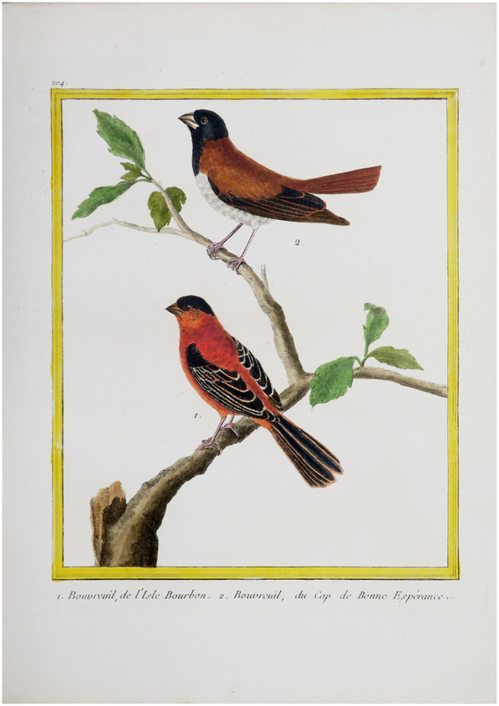
BUFFON (Georges Louis Leclerc, comte de) & MARTINET (François-Nicolas).
[LA RÉUNION] 1. Bouvreuil, de l'Isle Bourbon. 2. Bouvreuil, du Cap de Bonne Espérance.
[Paris, 1771-1786]. 235 x 185 mm.
Référence libraire : LBW-8276
|
|
|
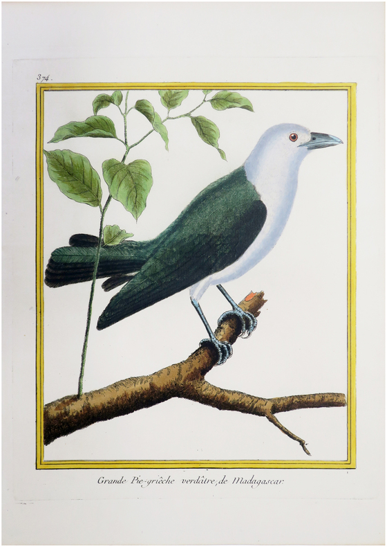
BUFFON (Georges Louis Leclerc, comte de) & MARTINET (François-Nicolas).
[MADAGASCAR] Grande Pie-griêche verdâtre, de Madagascar.
[Paris, 1771-1786]. 235 x 185 mm.
Référence libraire : LBW-8293
|
|
|
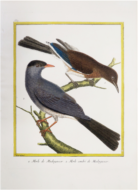
BUFFON (Georges Louis Leclerc, comte de) & MARTINET (François-Nicolas).
[MADAGASCAR] Merle de Madagascar. 2. Merle cendré de Madagascar.
[Paris, 1771-1786]. 232 x 179 mm.
Référence libraire : LBW-8279
|
|
|
BUFFON (Georges Louis Leclerc, comte de) & MARTINET (François-Nicolas).
[PROVENCE] 1. Le Gavoué de Provence. 2. Le Mitilêne de Provence.
[Paris, 1771-1786]. 230 x 182 mm.
Référence libraire : LBW-8270

|
|
|
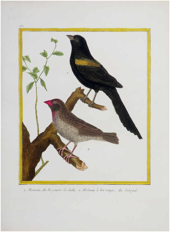
BUFFON (Georges Louis Leclerc, comte de) & MARTINET (François-Nicolas).
[SÉNÉGAL] 1. Moineau, du Royaume de Juda. 2. Moineau à bec rouge, du Sénégal.
[Paris, 1771-1786]. 230 x 178 mm.
Référence libraire : LBW-8275
|
|
|
Buffon, Georges Louis Leclerc, comte de (1707-1788) (Auteur) - (AMBROISE TARDIEU - GRAVEUR)
Carte des deux Régions Polaires jusqu'au 45-me Degré de Latitude. Tirée de : "Oeuvres complètes de Buffon, augmentées par M. F. Cuvier ", 1829 - 1832 Paris F. D. Pillot Editeur,
Paris L. Tenré 1829 - 1832 une carte ancienne gravée en noir et bordures en rose, bleu et jaune par Couché fils graveur et J. M. Hacq scripsit, Format : 24 x 31 cm, Tirée de : "Oeuvres complètes de Buffon, augmentées par M. F. Cuvier ", 1829 - 1832 Paris F. D. Pillot Editeur,
Référence libraire : 27141
|
|
|
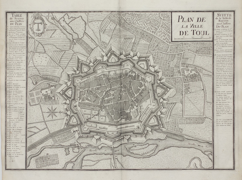
BUGNON (Didier).
Plan de la ville de Toul.
1745. 302 x 436 cm.
Référence libraire : LBW-2671
|
|
|
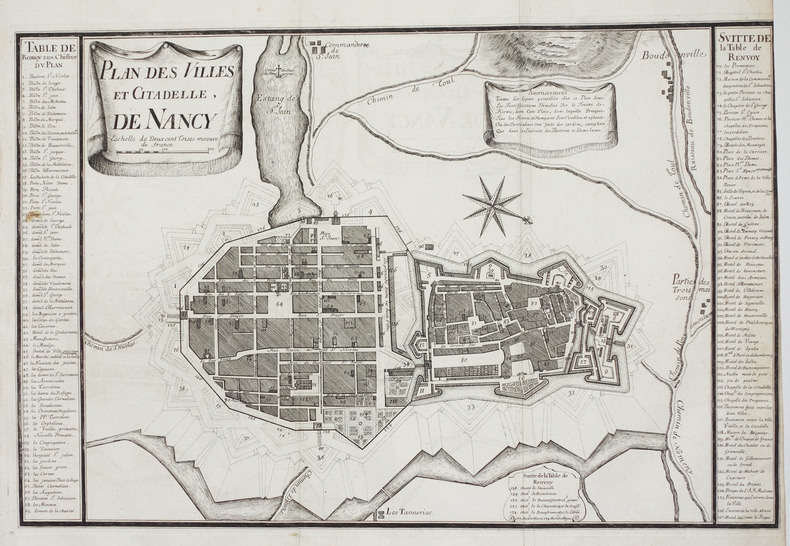
BUGNON (Didier).
Plan des villes et citadelle, de Nancy.
1745. 326 x 496 cm.
Référence libraire : LBW-2702
|
|
|
BUKACZ (Franz).
[CULTURE de la GIROFLE & de la MUSCADE] Clavero y mirística.
[Leipzig, Leipziger Schulbildverlag F.E. Wachsmuth, vers 1910]. 575 x 795 mm ; sur papier fort avec œillets d'origine.
Référence libraire : LBW-8810

|
|
|
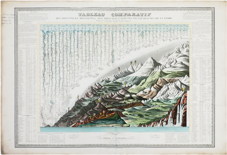
BULLA (François).
[MONTAGNES & FLEUVES du MONDE] Tableau comparatif des principales montagnes, des principaux fleuves et cataractes de la Terre. D'après les observations des plus savants voyageurs.
Paris, Bulla & Fontana, et chez Piquet, [1828]. 525 x 746 mm.
Référence libraire : LBW-7709
|
|
|
Bulletin de la Bibliothèque nationale de France
Bulletin de la Bibliothèque nationale de France - N° 1 de 1979Manuscrits de Gabriel Fauré au département de la musique - Le dernier registre d'écrou de la Bastille - Organisation et développement d'une collection - Jomard et le département des cartes et plans
In-4 - N° 1 de 1979
Référence libraire : 18144
|
|
|
Bulletin de la Société de Mythologie Française
Bulletin de la Société de Mythologie FrançaiseUn nom de commune déclaré "obscur". LOGRON en Eure et Loir (Abbé Villette) - Pierres. Roches et Monts à légende de Seine Maritime.14 cartes et illustrations (E. Ratier)
n° CVI - Juillet-septembre 1977 - Publication trimestrielle - revue illustrée - Siège social : Lycée Félix Faure. 60-Beauvais - in-4 broché - agrafée - ronéotype
Référence libraire : 52022
|
|
|
BUNTING Heinrich (1545 - 1606)
Tafel der Lender darin der Apostel Paulus geprediget hat
Carta storio-geografica che mostra le regioni toccate da San Paolo Apostolo durante la sua predicazione itinerante che interessò tutta l'area del Mediterraneo orientale: dalla Terra Santa all'Africa settentrionale , all'Asia Minore, alla Grecia, all'Italia meridionale e la Sicilia. Sulla mappa sono riportati i toponimi e i profili delle principali città, mentre nel mare - inciso con linee ondulate strette - sono raffigurati mostri marini.La mappa è inserita nell’ Itinerarium Sacrae Scriptura, per la prima volta edito nel 1581, e successivamente ristampato in ben dieci diverse edizioni. L’opera è corredata da diverse curiosità cartografiche decisamente insolite per l’epoca. Xilografia, testo tedesco al verso, piccole mancanze restaurate al margine inferiore bianco, per il resto in buone condizioni. Taken from the "Itinerarium Sacrae Scripturae", the map showing the Eastern Mediterranean with Southern Italy and Sicily, Greece, Cyprus, Asia Minor, the Holy Land and North Africa, with city profiles and sea monsters. Woodcut, very good condition.

|
|
|
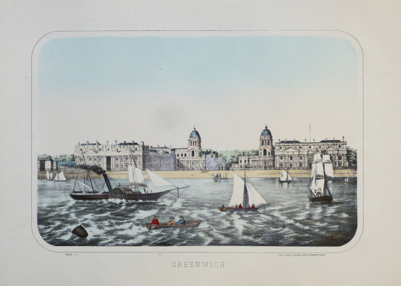
BURCKARDT (Charles);
Greenwich.
Wissembourg circa 1880 271 x 382 mm.
Référence libraire : LBW-1297
|
|
|
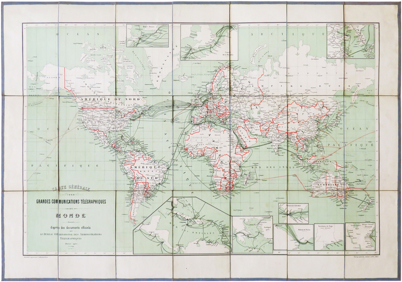
BUREAU INTERNATIONAL des ADMINISTRATIONS TÉLÉGRAPHIQUES.
[TÉLÉGRAPHE] Carte générale des grandes communications télégraphiques du Monde.
Berne, Kartographische Anstalt Lips, 1901. En 21 sections montées sur toile gris-bleu et pliées, formant une carte de 468 x 668 mm ; étiquette au dos portant le titre manuscrit.
Référence libraire : LBW-6826
|
|
|
BURGONDES par Odet PERRIN.
Les Burgondes, leur histoire des origines à la fin du premier Royaume (534). Contribution à l'histoire des invasions. Richement documenté (5 cartes dépliantes, notes.
Neuchâtel, éd. de la Baconnière 1968. Bel exemplaire relié, reliure avec titres dorés, et jaquette conservée, fort in-8, 590 pages avec annexes + cartes.
Référence libraire : AUB-6053
|
|
|
Burke, A.; Hart, B.H. Liddell; Maxwell, J.A.; Meyers, B.F.; Bethouart, H.; Long, F.A.; Stephens, R.A.; Geiger, G.J.; Grant, W.W.; Barnes, W.E.; Blandford, J.R.
Marine Corps Gazette - Professional Magazine for United States Marines, January (Jan.) 1961, Number 1, Volume 45 - Combat Helicopters in Algeria / Danger on the Flanks of NATO
70 pages. Features: Boeing-Vertol two-page ad for their 107 helicopter; NATO & Strateegic Mobility; The Soviet Threat - a CNO Appraisal; Danger on the Flanks of NATO - Capt B.H. Liddell Hart claims we are weak on the exposed flanks leading to control of the Atlantic and Middle East - major article with maps and photos; The LPH - Teamwork in Action; Battalion Air Mount Out - some ways to shorten load-out time; Combat Helicopters in Algeria - how they were used by a French commander - article with 4 maps; Embarkation via MSTS; Fast Amphibious Force - PHIBRON 10; Photos and details of Soviet helicopters; Money & Marines; You Can Speak in Public; Baseplate McGurk; Transfers and Promotions; Color back cover ad for McDonnell's F4H Phantom II fighter aircraft; and more. Average wear. Center page loose but present. Unmarked. A sound vintage copy. Magazine

|
|
|
Burke, James
Connections
The author's purpose was to acquaint the reader with some of the forces that have caused change in the past, looking in particular at eight innovations: the atomic bomb, the telephone, the computer, the production-line system of manufacture, the aircraft, plastics, the guided rocket and television. Black cloth covers. Gilt title on spine. Small, point impact dent on front cover; lower back cover corner a little bumped. This book is extra heavy, and may involve extra shipping charges to some countries
|
|
|
Burn, Richard
The Two Counties of Suffolk
Previous owner's name and date on front end paper. No other marks or inscriptions. A very clean very tight copy with bright unmarked boards and minor bumping to some corners. Price clipped dust jacket not marked or torn with traces of storage. 80pp. Captioned photographic study of old and new Suffolk - the two counties - plus seven page introduction.

|
|
|
Burn, Robert.
OLD ROME: A Handbook To The Ruins Of The City And The Campagna. Being an Epitome of His Larger Work `ROME AND THE CAMPAGNA'.
pp. xii, 266 + Twenty-two folding maps and plans. Numerous text drawings. Decorated title page. Unopened. XLib. 8vo. Original full cloth binding, gold lettered spine. Gilt pictorial vignette of Romulus and Remus nursing on the she-wolf on front cover. Binding slightly faded. Hardbound. Though XLib, still a very nice 1880 handbook about the then existing ruins and monuments of ancient Rome. **PRICE JUST REDUCED! TRAVEL/2
|
|
|
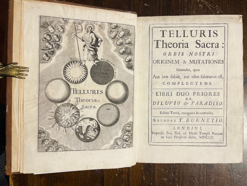
BURNETIO T. [ BURNET Thomas]:
Telluris Theoria Sacra: Orbis Nostri originem & Mutationes Generales, quas Aut jam sbitt, aut olim subiturus est, complectens. Libri duo priores de Diluvio & Paradiso. [et] Libri duo posteriores de Conflagratione Mundi, et de Futuro Rerum Statu. [et] Liber ultimus, de Novis Coelis & nova Terra, ac de Beato Seculo; sive De Mundo Renovato, et Rerum omnium Consummatione.
Londres, Benj. Took, 1702. In-8 de [16]-356p., plein veau brun, dos muet à nerfs, plats décorés de filets et fleurons à froid, roulette dorée sur les coupes.
Référence libraire : 6312
|
|
|
Burnham, Alan (editor); (vignettes), Over 150 b/w Photographs; Few b/w Maps
New York Landmarks A Study & Index of Architecturally Notable Structures in Greater New York
Wesleyan University Press. As New. 1963. Hardcover. FREE UPGRADE to Courier/Priority Shipping Upon Request - IN STOCK AND IMMEDIATELY AVAILABLE FOR SHIPMENT - AS NEW THE TEXT BLOCK IS PRISTINE CLEAN UNMARKED AND IN EXCELLENT CONDITION - - xiv 430 pp. 154 photos. bibliog. index 4to. -- with a bonus offer-- . Wesleyan University Press hardcover
Référence libraire : 80578
|
|
|
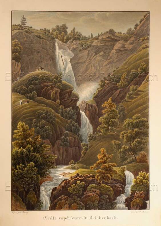
Burri, Johann Ulrich (1802-1870)
Chûte supérieure du Reichenbach.
O.O., um 1835. Altkolorierte Aquatinta von Rudolf Bodmer (1805-1841). Bildgrösse: 24,9 x 17,2 cm. Blattgrösse: 28,3 x 20,2 cm. + Wichtig: Für unsere Kunden in der EU erfolgt der Versand alle 14 Tage verzollt ab Deutschland / Postbank-Konto in Deutschland vorhanden +, Abb.
Référence libraire : 618DG

|
|
|
Burri, Johann Ulrich (1802-1870):
Chûte supérieure du Reichenbach.
O.O., um 1835. Altkolorierte Aquatinta von Rudolf Bodmer (1805-1841). Bildgrösse: 24,9 x 17,2 cm. Blattgrösse: 28,3 x 20,2 cm.
Référence libraire : 618DG
|
|
|
Burrowes, Thomas H.
STATE-BOOK OF PENNSYLVANIA, Containing an Account of the Geography, History, Government, Resources, and Noted Citizens of the State; With a Map of the State and of Each County.
pp. 314, 9 [Publisher's advertisments] + Map frontis. Map illustrations in text. First four pages contain recommendations for the book by Governor Shunk and others. Inked ownerships of Henry P. Shomo and Willie A. Shomo, Hamburg, Berks County on fly leaves. Penciled inscription of Harry P. Shomo "bought Saturday, Feb. 19th, 1876, Centennial Year." The Shomo family was very prominent in Berks County, PA. Slight dampstaining. 12mo. Original leather spine with pictorial paper front board and publisher's advertisement on rear board. Gilt lettered spine. Extremities worn with slight loss. Hardbound. Very good. Full Title: "STATE-BOOK OF PENNSYLVANIA, Containing an Account of the Geography, History, Government, Resources, and Noted Citizens of the State; With a Map of the State and of Each County. For the Use of Schools and Families." First Edition. **PRICE JUST REDUCED! PA 48
|
|
|
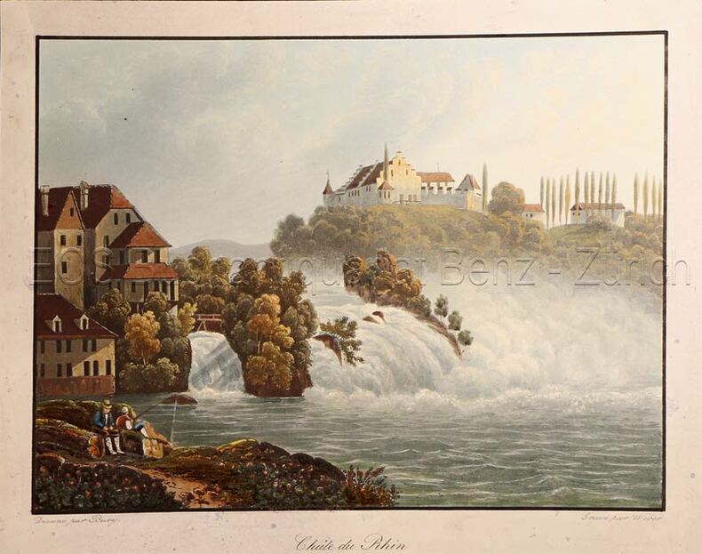
Bury
Chûte du Rhin (Rheinfall).
(Zürich, H.F. Leuthold), um 1850. Kolorierte Aquatinta von Weber. Bildgrösse: 13,2 x 17,4 cm. Blattgrösse: 15,4 x 19,4 cm. + Wichtig: Für unsere Kunden in der EU erfolgt der Versand alle 14 Tage verzollt ab Deutschland / Postbank-Konto in Deutschland vorhanden +, Abb.
Référence libraire : 616DG

|
|
|
Bury:
Chûte du Rhin (Rheinfall).
(Zürich, H.F. Leuthold), um 1850. Kolorierte Aquatinta von Weber. Bildgrösse: 13,2 x 17,4 cm. Blattgrösse: 15,4 x 19,4 cm.
Référence libraire : 616DG
|
|
|
Busche MAP
Manitoba / Saskatchewan- Maßstab 1: 2000 000
Dortmund, Busche, 1. Edition, o.J. Faltkarte, gefaltet ca.DINA 5, Maßstab: 1: 2000 000, zweiseitige farbige Karte, dazu Ortsverzeichnis, minimale Gebrauchsspuren, SEHR gut erhalten / SEHR guter Zustand [3 Warenabbildungen]
Référence libraire : 50562ge

|
|
|
BUSSA (Antoine).
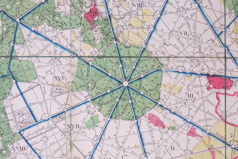
[FORÊT de COMPIÈGNE] Plan de la forêt de Compiègne et de ses environs.
1791. En 16 sections repliées, montées sur toile de couleur bleue-verte bordée d'une soie verte cousue et non collée, formant une carte de 615 x 808 mm.
Référence libraire : LBW-8991
|
|
|
BUY de MORNAS (Claude);
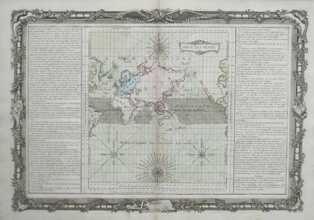
Pour les vents.
Paris Desnos 1761 355 x 520 mm.
Référence libraire : LBW0619a
|
|
|
BUY de MORNAS (Claude);
Pôles du monde, de l'éclyptique, et de l'horison. Points des équinoxes, et des solstices ; points cardinaux, et collatéraux.
[Paris, Desnos, 1761]. 360 x 525 mm.
Référence libraire : LBW061a0

|
|
|
BUY de MORNAS (Claude);
Suite de l'histoire de Carthage depuis l'an 3791 jusqu'à l'an 3860.
Paris Desnos 1761 355 x 523 mm.
Référence libraire : LBW0619c

|
|
|
BUY de MORNAS (Claude);
Suite de l'histoire sainte depuis l'an 3838 jusqu'à l'an 3856.
Paris Desnos 1761 352 x 520 mm.
Référence libraire : LBW0619d

|
|

 Recevoir par e-mail
 Télécharger en PDF
 Flux RSS
 Lien permanent


