|
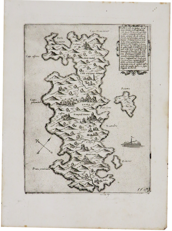
CAMOCIO (Giovanni Francesco).
[SAMOS] Samo nello arcipelago.
[Venise, 1572]. 205 x 154 mm.
Référence libraire : LBW-1435
|
|
|
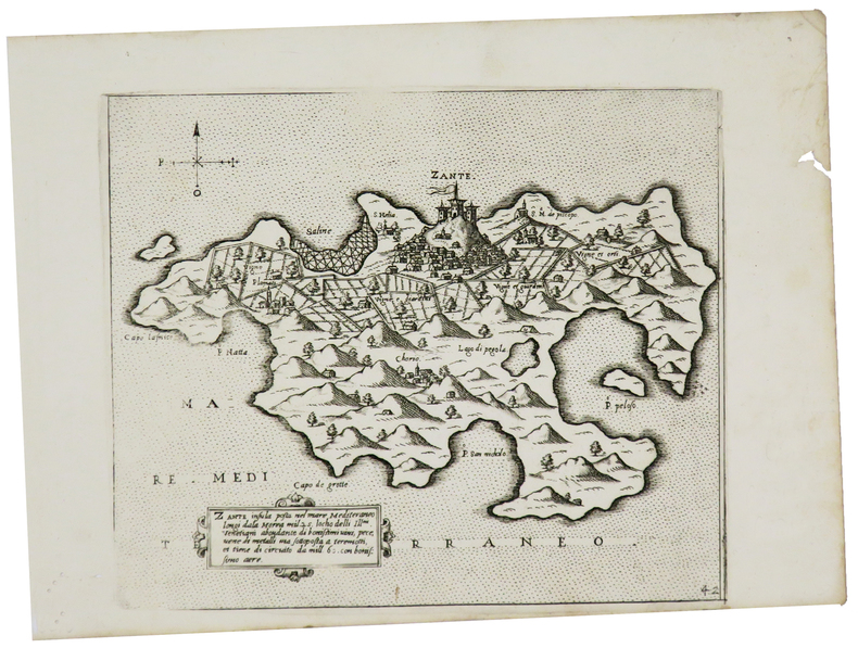
CAMOCIO (Giovanni Francesco).
[ZAKYNTHOS] Zante insula posta nel mare Mediteraneo.
[Venise, 1572]. 177 x 209 mm.
Référence libraire : LBW-1449
|
|
|
CAMOCIO Giovanni Francesco (Attivo a Venezia tra 1558 - 1575)
Il vero ordine et modo tenuto dalle armate Cristiana e Turchesca...
Nel cartiglio in basso a sinistra si legge: Il vero ordine et modo, tenuto dalle armate Cristiana et Turchesca, nella battaglia, che fu ali .7. Ottobrio .1571. il giorno di S.a Giustina, comincio lasalto a 4 hore et meza di giorno, et durò circa 4 hore; tra curzolari et cavo papa, loco poco discosto dal Golfo d[e] Lepa[n]to p[er] li havisi hauti dal Clar.mo Iustiniano venuto a Venetia, co[n] le nove de la vitoria, seguita in favor d[e] la Cristiana armata, con presa et rotta di galere 213, tra le quali erano 40 fano et 39 ne so[n] presi morti de nimici 40m in circa scihavi cristiani ricuperati, 18m in circa, turchi fatti schiavi 4m in circa. In basso, al centro della tavola, che è priva di orientazione, una bella vignetta allegorica mostra un drago con la mezzaluna sul capo - simbolo del nemico turco - assalito e sottomesso dal leone rampante di Venezia e dall’aquila asburgica. Opera molto rara, priva di indicazioni editoriali. Attribuita a Giovanni Francesco Camocio (cfr. Bifolco-Ronca, Cartografia e topografia italiana del XVI secolo, p. 1605). La presente tavola raffigura la Battaglia di Lepanto, la celebre battaglia navale del 1571 che si svolse di fronte a Lepanto, all’estremità occidentale del Golfo di Patrasso. Casus belli era stato l’attacco turco alla città di Famagosta, nel possedimento veneziano di Cipro, avvenuto l’anno precedente, il 22 agosto 1570. La vittoria cristiana contro le armate turche del 1571 ne fermò l’avanzata in Europa e verso Roma, segnando anche l’inizio della decadenza marittima ottomana. Vide coinvolte la flotta turca comandata da Mehmet Ali Pascià (un apostata di origini calabresi, convertitosi all’Islam) e quella della Lega Santa, creata il 20 maggio del 1571 da Papa Pio V: Stato Pontificio, Repubblica di Venezia, Repubblica di Genova, Ducato di Savoia, Granducato di Toscana, Ducato di Urbino, Ducato di Parma, Repubblica di Lucca, Ducato di Ferrara, Ducato di Mantova, Impero spagnolo (con il Regno di Napoli e di Sicilia) e Ordine di Malta, al comando del ventiseienne Don Giovanni d’Austria, figlio naturale di Carlo V e fratellastro del regnante Filippo II.La flotta cristiana era formata da circa 200 galere, di cui oltre la metà erano veneziane al comando del Capitano da Màr Sebastiano Venier, la flotta turca ne aveva circa 250. La prima linea della flotta cristiana era formata da galeazze mercantili veneziane (nell’incisione indicate come “galeaze” sul lato destro, sopra al cartiglio), trasformate per l’occasione, e in soli 100 giorni, in navi da guerra, impiegate per la prima volta proprio in questa battaglia, armate di cannoni non solo a prua, ma anche sui fianchi e a poppa, loro potenza di fuoco.La vittoria della flotta cristiana fu piuttosto rapida, anche perché i veneziani attaccarono e affondarono la galeotta del comandante in capo di tutta la potenza turca, Alì Pascià, uccidendolo. La flotta ottomana fu quasi completamente distrutta, con grandi perdite umane e un gran numero di prigionieri. Dieci giorni dopo, la galera di Onfré Zustinian, messaggero di Sebastiano Venier, entrava a Venezia trascinando nell’acqua le bandiere turche: la città sembrava impazzita dalla gioia. Lo stesso succederà poi in tutta Europa.Questo evento costituì un punto focale della storia europea sotto molteplici aspetti: politici, militari, religiosi e tecnologici. Solo poche battaglie sono state tanto celebrate e descritte come quella del 7 ottobre 1571, ed esercitò un poderoso effetto sui contemporanei, anche grazie al determinante contributo dato dagli artisti dell’epoca alla diffusione della sua rilevante e clamorosa importanza, in tempo quasi reale: fogli volanti nelle più diverse lingue diffusero in tutti i paesi d’Europa la notizia del grande avvenimento, sia con resoconti, sia con rappresentazioni di questa storica battaglia navale, ancor oggi considerata la più grande del Mediterraneo.Diverse sono le interpretazioni del soggetto che si ebbero a Venez... In the lower cartouche: Il vero ordine et modo, tenuto dalle armate Cristiana et Turchesca, nella battaglia, che fu ali .7. Ottobrio .1571. il giorno di S.a Giustina, comincio lasalto a 4 hore et meza di giorno, et durò circa 4 hore; tra curzolari et cavo papa, loco poco discosto dal Golfo d[e] Lepa[n]to p[er] li havisi hauti dal Clar.mo Iustiniano venuto a Venetia, co[n] le nove de la vitoria, seguita in favor d[e] la Cristiana armata, con presa et rotta di galere 213, tra le quali erano 40 fano et 39 ne so[n] presi morti de nimici 40m in circa scihavi cristiani ricuperati, 18m in circa, turchi fatti schiavi 4m in circa. At the bottom, in the center of the panel, a beautiful allegorical vignette shows a dragon with a crescent moon on his head - symbol of the Turkish enemy - attacked and subdued by the lion rampant of Venice and the Habsburg eagle. Very rare work, lacking editorial indications. Attributed to Giovanni Francesco Camocio (cfr. Bifolco-Ronca, Cartografia e topografia italiana del XVI secolo, p. 1605). The plate depicts the Battle of Lepanto, the naval engagement in the waters off southwestern Greece between the allied Christian forces of the Holy League and the Ottoman Turks during an Ottoman campaign to acquire the Venetian island of Cyprus, which took place on October 7, 1571.Early in 1570 the Ottoman sultan, Selim II, demanded that the Venetian hand over the island of Cyprus. When the Venetians refused to cede the island, invaded it in 1570.Pope Pius V persuaded Philip II of Spain to join with Venetians to defeat the Turkish attack on Cyprus. Genoa, Savoy, and the Knights of Saint John also agreed to send forces.The Holy League fleet consisted of 108 venetian galley, 81 Spanish galley, and 32 others provided by the pope and other allies. The Turkish fleet consisted of 270 galleys, which were faster and more maneuverable than the Christians'ship but were also smaller and less well protected. The Turkish commander was Uuuch Ali, a former Christian slave who had renounced his religion.The ability of the Christians to fire down onto the decks of the smaller Turkish ships placed the Turkish forces at a serious disadvantage. The two fleets made a magnificent sight as they closed. Each side hoped to overawe the other by its apperance and so gain a psychological advantage before the battle started. The galleys were richly decorated with gilded carvings and colorful banners, while the soldiers and naval officers wore striking uniforms and polished armor. After repulsing the first Turkish assault, the Christians gradually got the upper hand. When Müezzenzade Ali Pasha was shot and killed, Turkish resistance began to break. Seeing the collapse of the rest of theTurkish fleet, Uluch Ali broke off his fight against the Christian right flank and made good his escape with 47 galleys. The Turks lost over 200 ships, while 30.000 of their men was killed and 4000 taken prisoners. Christian losses included 12 galleys sunk, 7500 dead, and 8000 injured. In all, the battle had lasted just three hours.The victory against the Turkish army they stopped the advance in Europe, protecting Rome from invasion. The event at the time was really remarkable and sensational, even attracting the interest of many artists. There are different interpretations of the subject in Venice, due to all merchants, engravers and cartographers such as Nelli, Zenoi, Bertelli, Rota and Camocio same, which are known two more different depictions of the theme. Etching and engraving, impressed on contemporary paper and irregularly trimmed to the copperplate with partial loss of engraved portion; reconstructive restoration to lower margin, otherwise in good condition. Bibliografia Bifolco-Ronca, Cartografia e topografia italiana del XVI secolo, p. 1605, tav. 801; Gallo (1950): p. 99, n. 53; Zacharakis (2016): n. 813f.

|
|
|
CAMP DE MAILLY
Carte color?e au 1/20 000?.
Une feuille 74x100 cm.
|
|
|
CAMPBELL
CARTE GUIDE CAMPBELL N°13 PYRENEES BAYONNE
EDITIONS BLONDEL LA ROUGERIE - Carte dépliante en couleurs en 32 volets en couleurs au 1/320.000e. In-Plano toilé; etiquette,format IN12 repliée,la France en 15 regions; 86x68 cm.
Référence libraire : 20176
|
|
|
Campbell, Joseph
Historical Atlas of World Mythology Vol. II: The Way of the Seeded Earth, Part 1: The Sacrifice
A clean, unmarked book with a tight binding. Large format: 10 1/2"w x 13 7/8"h. 128 pages. Many color illustrations.

|
|
|
Canadian National Railways [CNR]
The Triangle Tour of British Columbia Canada - [Map] Supplement to the Canadian Rockies Folder
62 x 43.5 cm one-sided colour pictorial map reduces to 22.5 x 10 cm when folded inside original blue card cover lettered in black. Illustrates the route of the CNR's Triangle Tour of British Columbia which included "Jasper National Park, Mount Robson Park, the Canadian Rockies, and the scenic seas of the North Pacific coast." Without saying so, the right side of the map switches scales so as not to display Lake Louise, a prime tourist attraction of rival railway Canadian Pacific. Includes eight sepia-tone photos of sights of interest along the way. Clean and unmarked with light wear. A well-preserved copy of this excellent piece of vintage Western Canadian tourist ephemera. Reference: Cornell University Library, Persuasive Maps: PJ Mode Collection 1219.01. Book

|
|
|
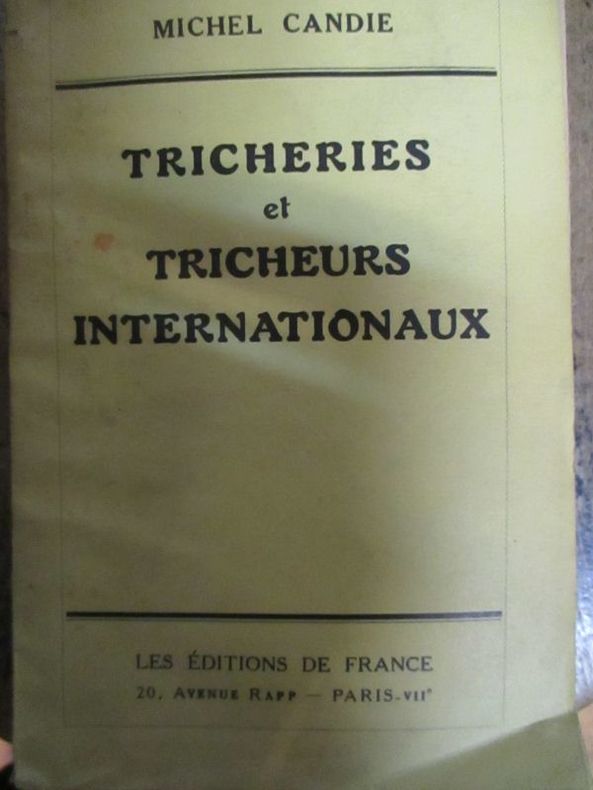
Candie (Michel)
Tricheries et tricheurs internationaux
1935 Paris les éditions de France sans date (1935) In12 broché 228 pages
Référence libraire : 5795
|
|
|
CAPITAINE (Louis) & CASSINI de THURY (César-François).
[MIREPOIX/ARIÈGE] Carte du diocèse de Mirepoix.
[Paris, 1781]. En deux feuilles pouvant être jointes pour former une carte de 823 x 630 mm.
Référence libraire : LBW-8196

|
|
|
CAPITAINE (Louis).
Carte de la France suivant sa nouvelle division en départements et districts. Dédiée à l'Assemblée Nationale par les directeurs et associés de la carte générale de la France.
1790. En 42 sections montées sur toile et pliées, formant une carte de 1,23 x 1,16 m, sous étui de papier bleu.
Référence libraire : LBW-4325

|
|
|
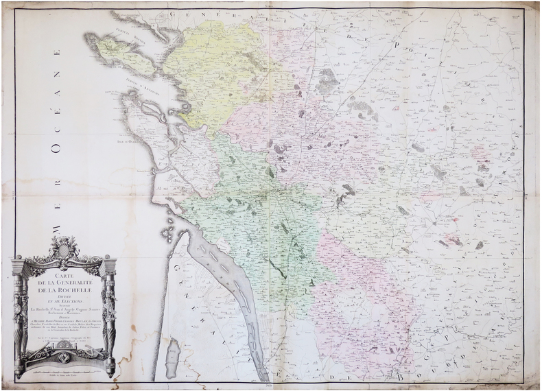
CAPITAINE (Louis).
Carte de la Généralité de La Rochelle, divisée en six élections, sçavoir La Rochelle, S.t Jean d'Angely, Cognac, Saintes, Barbezieux et Marennes.
Paris, 1781. En 4 feuilles jointes formant une carte de 0,87 x 1,14 m.
Référence libraire : LBW-7245
|
|
|
CAPITAINE (Louis);
Carte générale des Etats-Unis de l'Amérique septentrionale divisée en ses 17 provinces.
1799 395 x 452 mm.
Référence libraire : LBW061e4

|
|
|
CAPITAINE Louis, ingénieur Géographe
[EMBOUCHURE DE LA LOIRE DE TOURS A SAINT-NAZAIRE] CARTE N°8 DE LA CARTE GENERALE DE LA FRANCE, dédiée au Roi. Réduite sur léchelle dune ligne pour 400 toises, daprès les 180 feuilles de la grande Carte de la France levée géométriquement par ordre du Roi, sur léchelle dune ligne pour 100 toises. Cette réduction est luvre de Louis Capitaine
Paris 1790 carte d'époque entoilée sur une toile bleue repliée format 31,5 x 24,5 cm, format déplié : 61 x 93 cm, gravée en noir, [Paris] : [s.n.], 1790
Référence libraire : 21325
|
|
|
CAPITAINE Louis, ingénieur Géographe
[LA LOIRE D'AMBOISE A MOULINS - REGION CENTRE] CARTE N°9 DE LA CARTE GENERALE DE LA FRANCE, dédiée au Roi. Réduite sur léchelle dune ligne pour 400 toises, daprès les 180 feuilles de la grande Carte de la France levée géométriquement par ordre du Roi, sur léchelle dune ligne pour 100 toises. Cette réduction est luvre de Louis Capitaine
Paris 1789 carte d'époque entoilée sur une toile bleue repliée format 31,5 x 24,5 cm, format déplié : 61 x 93 cm, gravée en noir, [Paris] : [s.n.], 1789
Référence libraire : 21327
|
|
|
CAPON GEORGES (NE EN 1890).
LES EXPOSITIONS UNIVERSELLES DE JADIS ET DE NAGUERE. PARIS. HOFFMANN-LA ROCHE.
SANS DATE (VERS 1935). SERIE DE 5 CARTES POSTALES VERTICALES REPLIEES, FORMAT 10,5 X 15 CENTIMETRES ENVIRON, ILLUSTREES D'UNE COMPOSITION EN COULEURS. 1855. 1867. 1878 (LES SOUKS ALGERIENS DANS LES JARDINS DU TROCADERO). 1900. 1931 (EXPOSITION COLONIALE. LA PROMENADE A DOS DE CHAMEAU DANS L'ENCEINTE DU PAVILLON DE L'AEF). BON ETAT.
Référence libraire : 685
|
|
|
CARDOZE Edmond
BORDEAUX RETRO. LE PATRIMOINE BORDEALAIS EN 202 CARTES POSTALES
Editions librairie Pasteur. 1981. In-8. Broché. Etat d'usage, Couv. légèrement passée, Dos satisfaisant, Intérieur frais. 112 pages, 202 illustrations noir et blanc. . . . Classification Dewey : 741.68-Illustrations des cartes postales
Référence libraire : RO20065421
|
|
|
Carey Brian Todd; tactical maps illustrated by Joshua B. Allfree; regional maps illustrated by John Cairns
Hannibal's Last Battle: Zama and the Fall of Carthage
Yardley Pennsylvania: Westholme Publishing 2008. 1st. Hardcover. Book fine Dust jacket fine. <br/><br/> Westholme Publishing hardcover books
Référence libraire : 9009390 ISBN : 1594160759 9781594160752

|
|
|
Caribbean Maps: Norie J. W.
THE ISLAND OF ANTIGUA. Revised by J.W. Norie 1827
Antigua but actually Philadelphia: R.B. Eldridge & Co. 1860. Lithographic sheet map 20 1/2 x 26 1/2 inches. Backed with contemporary blue paper. Light foxing and toning. A few small tears in margins. Very good. An unusual lithographic edition of Norie's 1827 revision of this handsome chart lithographed by Wagner & McGuigan in Philadelphia. A statement in the cartouche reads: "Presented by R.B. Eldridge Antigua to Captain Andrew Tyler." The captain's name is accomplished in manuscript. R.B. Eldridge is not listed in Tooley's DICTIONARY OF MAPMAKERS and appears to be unrelated to publisher of charts George Eldridge. It seems most likely that he was rather an Antigua merchant who commissioned a reprint of the chart for complimentary distribution to sea captains. A handsome piece. R.B. Eldridge & Co. unknown books
Référence libraire : WRCAM48522

|
|
|
CARMICHAEL, Joel
Histoire illustrée de la Russie
1960 Editions NRF Gallimard, Collection "L'Oeil" - 1960 - In-4, cartonnage rouge illustré - 303 p. - Illustrations et reproductions photographiques en N&B in et hors-texte
Référence libraire : 109620
|
|
|
carnet de cartes postales
SAIL-SOUS-COUZAN.
Sail-sous-Couzan, Robert-Bonneton, s.d. (fin XIXème ou début Xxème), 1 br. carnet in-12 oblong de 10 cartes postales détachables, serpentes ;
Référence libraire : 15196
|
|
|
carnet de cartes postales
Souvenir d'une visite à Notre-Dame de Fourvière. Lyon.
Paris, Levy, s.d. (fin XIXème ou début XXème), 1 br., couverture illustrée. carnet in-12 oblong de 12 cartes postales détachables, 1 feuillet de texte, serpentes ;
Référence libraire : 15197
|
|
|
carnet de cartes postales.
Souvenir de Fourvière.
Lyon, Magasin de l'Oeuvre de Fourvière, s.d. (fin XIXème ou début XXème), 1 br., couverture illustrée. carnet oblong de 20 cartes postales, serpentes ;
Référence libraire : 15202
|
|
|
CARNEVALE-MAUZAN Mirande
Achille Mauzan. 1883-1952. L'oeuvre Complet (Catalogue raisonné).
2001 Fort in-4 Cartonnage et étui illustrés de l'éditeur
Référence libraire : 009577
|
|
|
Caro Ina; Cain maps David
Paris to the Past: Traveling Through French History by Train
W.W. Norton 2012. Fine. Caro Ina. Paris to the Past: Traveling Through French History by Train. Cain maps David. New York: W.W. Norton 2012. 381pp. Indexed. Bibliography. 8vo. Paperback. Book condition: Near fine. W.W. Norton paperback books
Référence libraire : UCARPAR00TM
|
|
|
Carole SEDILLOT et Chantal FRELAUT
B.A-BA : LE GRAND JEU DE MLLE LENORMAND
Un ouvrage de 126 pages, format 140 x 210 mm, illustré, broché couverture couleurs illustrée, publié en 2004, Editions Pardès (avec des surlignages dans le texte)
Référence libraire : LFA-126750284
|
|
|
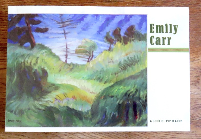
Carr Emily:
Emily Carr - A book of postcards.
Portland, Pomegranate, 2008. Livret composé de 30 cartes postales au format 18 x 12. Un carte détachée, les autres reliées encore mais détachables bien sûr, le book est complet des 30 cartes.
Référence libraire : 15602
|
|
|
Carr, John
A STRANGER IN IRELAND OR A TOUR IN THE SOUTHERN AND WESTERN PART OF THAT COUNTRY IN THE YEAR 1805
London: Printed for Richard Phillips Sold By Souter No. 1 Pater-noster-row. 1806. Book. Very Good. Hardcover. First Edition. Large 4to. A very good "large paper" copy with uncut edges leaf size approximately 285mm x 225mm with a few additional items bound in. Pp. xiv 2 530 ii ii. 16 hand-tinted aquatints of which several folding map plus an additional contemporary hand-coloured map of Ireland as frontispiece. Contents: frontispiece quarto format map - engraved for the Poem of Erin. The folding plate of Dublin shown as the frontispiece in the "Directions for Placing the Plates" has been bound in opposite the first page of text title page dedication prefacecontents errata directions for placing the engravings main body of the text additional page on St. Patrick from "Guide to Knowledge" bound in at rear before the Publisher's adverts cutting from the Times 1842 entitled "Robert Emmet and the Gaoler of Kilmainham" pasted to rear paste-down. Original paper-covered boards with recent pebbled cloth spine to match original with the original paper title-label applied to the spine binding in very good condition. Contents very good the uncut edges are a little worn in places and a couple of a small near-contemporary oval stamps of the "Baptist College Bristol" to the front end paper no other marks. Paper in very good condition without any obvious staining minimal foxing almost completly confined to the tissue guards maps and plates all very good clean and crisp short repaired tear to the edge of page 318 not nearly affecting the text. A very good to fine copy. Printed for Richard Phillips, Sold By Souter, No. 1, Pater-noster-row. Hardcover
Référence libraire : 009589

|
|
|
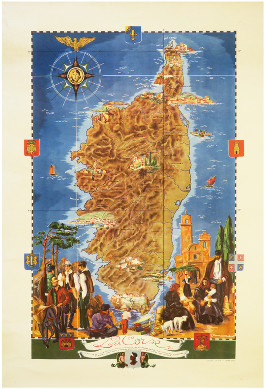
CARRIAT-ROLANT (Gabriel).
[CORSE] La Corse.
Casablanca, Éditions A.F.R.I.P., [circa 1950]. Lithographie en couleurs de 815 x 520 mm.
Référence libraire : LBW-8062
|
|
|
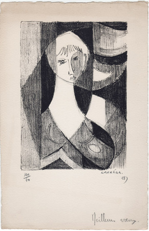
Carréga, Nicolas
Nicolas Carréga : carte de voeux pour 1958 et lithographie originale
1958 Carte de voeux de Nicolas Carréga pour 1958. 25 x 16,5 cm, une lithographie originale en noir (16,5 x 12 cm), numérotée 40/60, signée et datée à la mine de plomb. Avec un ajout autographe ("meilleurs voeux") en pied.
Référence libraire : 1058
|
|
|
CARTE BLONDEL
Carte couleurs : Bords de Loire au 1/320 000?. Sans date.
Une feuille 44x64 cm.
|
|
|
CARTE BLONDEL
Carte couleurs de la Vend?e au 1/200 000?. Sans date.
1feuille 75x56 cm.
|
|
|
CARTE DEPARTEMENTALE
D?partement de la Somme. Carte couleurs au 1/200 000e.
1 feuille 50x70 cm.
|
|
|
CARTE DEPARTEMENTALE
Is?re. Cartes couleurs au 1/200 000e. Sans date.
1 feuille repli?e sous chemise. 55x75 cm.
|
|
|
CARTE DEPARTEMENTALE
Savoie. Cartes couleurs au 1/200 000e. Sans date.
1 feuille repli?e sous chemise. 55x75 cm.
|
|
|
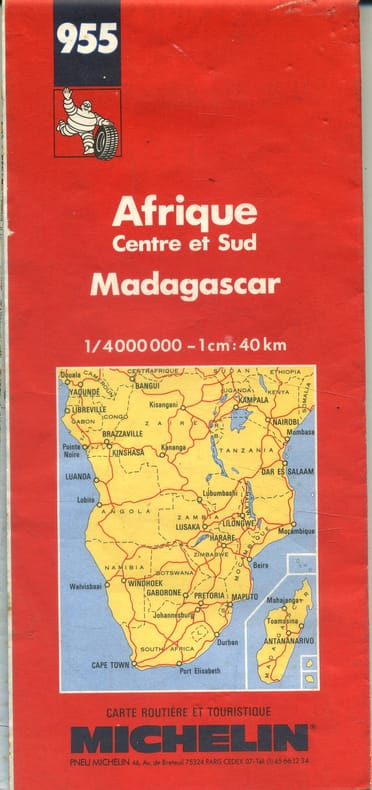
CARTE MICHELIN
Afrique Centre et Sud. Madagascar.
- Une feuille 100 x 121 cm, repliée sous couverture rouge.
Référence libraire : 143308
|
|
|
CARTE MICHELIN
Carte à l'échelle 1/4 000 000e. Afrique Nord et Ouest.
- Une feuille 98 x 120 cm repliée.
Référence libraire : 148129
|
|
|
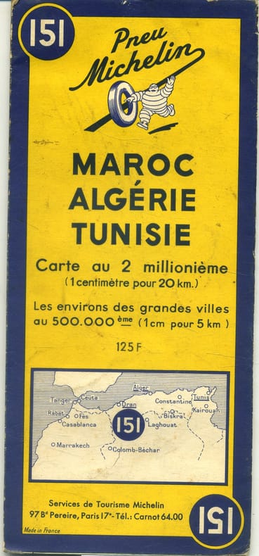
CARTE MICHELIN
Maroc, Algérie, Tunisie. Carte à l'échelle 1/2000 000e. Environs des grandes villes au 1/50 000e.
- Une feuille 110x50 cm, repliée sous couverture orange et bleue.
Référence libraire : 143306
|
|
|
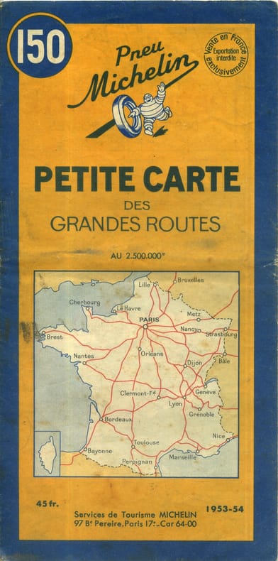
CARTE MICHELIN
Petite carte des grandes routes. Carte à l'échelle 1/2 500 000e.
- Une feuille 43 x 430 cm, repliée sous couverture orange et bleue.
Référence libraire : 143304
|
|
|
CARTE MICHELIN - 1-Belgique
Anvers-Rotterdam. Carte au 1/200 000e.
1 feuille repli?e 109,5 x 50 cm.
|
|
|
CARTE MICHELIN - 100
Sorties de Paris. Carte Michelin au 1/50 000e.
Feuille repli?e.
|
|
|
CARTE MICHELIN - 120
Carte cycliste. 50 km autour de Paris. L'?tat des routes, les c?tes, les curiosit?s, le pittoresque, les r?parateurs de v?los.
Couerture orange. R?par?e, traces de scotch.
|
|
|
CARTE MICHELIN - 163
Allemagne-Est. Carte Michelin au 1/1000 000e.
Feuille repli?e.
|
|
|
CARTE MICHELIN - 2-Belgique
Bruxelles-Ostende. Carte au 1200 000e.
1 feuille repli?e 109,5 x 50 cm.
|
|
|
CARTE MICHELIN - 205
Pays Rh?nans. Carte Michelin au 1/200 000e. Couverture orange et bleue. Edition provisoire avec limites de zones d'occupation.
Feuille repli?e.
|
|
|
CARTE MICHELIN - 206
Pays Rh?nans. Carte Michelin au 1/200 000e. Couverture orange et bleue. Edition avec limites de zones d'occupation.
Feuille repli?e.
|
|
|
CARTE MICHELIN - 21
Basel- St Gallen. Carte Michelin au 1/200 000e. Couverture orange et bleue.
Feuille repli?e.
|
|
|
CARTE MICHELIN - 23
Gen?ve-Berne. Carte Michelin au 1/200 000e. Couverture orange et bleue.
Feuille repli?e.
|
|
|
CARTE MICHELIN - 24
Andermatt-Bolzano. Carte Michelin au 1/200 000e. Couverture orange et bleue.
Feuille repli?e.
|
|
|
CARTE MICHELIN - 26
Martigny-Milan. Carte Michelin au 1/200 000e. Couverture orange et bleue.
Feuille repli?e.
|
|
|
CARTE MICHELIN - 3-Belgique
Bruxelles-Li?ge. Carte au 1/200 000e.
1 feuille repli?e 109,5 x 50 cm.
|
|

 Recevoir par e-mail
 Télécharger en PDF
 Flux RSS
 Lien permanent


