|
PARIS - PLAN DE TURGOT
Le plan de Louis Bretez dit Plan de Turgot. Planches (39x58 cm) des 20 quartiers de Paris. Le plus beau plan de Paris ? vol d'oiseau. Notice d'Andr? Rossel. Maquette et couverture de F. Doat.
20 planches et 20 feuilles de descriptions et notices. Couverture d?fraichie.
|
|
|
Paris -:
Stadtplan von Paris: "Westliche Hälfte von Paris." "Östliche Hälfte von Paris." Stahlstiche aus Meyers Handatlas, Karte 14 und 15. Von 2 Platten gedruckt und zu einem großen Plan zusammengesetzt.
Format (Bidbereich): 41 x 60,5 cm. Blattgröße: 48 x 69 cm. *"Enthaltend die Quartiere du Roule, des Champs Elysées, de la Place Vendóme, des Tuileries, St. Germain du Luxembourg, de la Sorbonne; des Marches, St. Martin des Champs; St. Avoye, de Popincourt, de`l Hotel du Ville, Jardin du Roi". Am Unterrand: "Profile der merkwürdigsten Gebäude". - Sauber und gut erhalten. Graphiken de
|
|
|
Parish, Steve
A Souvenir of Sydney : New South Wales Australia
No marks or inscriptions. No creasing to covers. A very clean very tight copy with bright unmarked boards, very minor traces of storage and no bumping to corners. 57pp. A mainly illustrated tribute to the beauty and diversity of the Australian city of Sydney.

|
|
|
Parker Robert M. author; Wong Jeanyee maps; Wormell Christopher drawings
BURGUNDY : A COMPREHENSIVE GUIDE TO THE PRODUCES APPELLATIONS AND WINES SIGNED
New York: Simon and Schuster 1990. Hardcover. Octavo; VG/VG-; Hardcover with DJ; DJ spine black with gold print; DJ has slight edgewear but is clean and bright; Boards quarter bound with red cloth to spine and grey paper to boards clean and strong; Text block clean and tight; Signed in ink by the author on front endpaper; 1052 pages illustrated 2-color. 1334823. FP New Rockville Stock. Simon and Schuster hardcover books
Riferimento per il libraio : 1334823 ISBN : 0671633783 9780671633783

|
|
|
Parker, Dave
First Water, Tigers! - A History of the Victoria Fire Department
234 pages including bibliography and index. "Tells the colourful story of the Victoria Fire Department through a well-researched absorbing text and in hundreds of eloquent photographs. Included also are maps, appendices of the department's apparatus over the years, and sections of aural history dating back to 1912, as well as numerous anecdotes. Many original archival sources and the official records of the Victoria Fire Department were used in research." - from dust jacket. Black and white illustrations throughout, plus several in colour. Book clean, bright and unmarked but for date written atop decorated front endpaper. Average wear but no tears to dust jacket. Very nice copy. Book
|
|
|
Parks, William A.
Report on the Building and Ornamental Stones of Canada - Volume III: Province of Quebec
304 pages. Index. Colour and black and white photographic plates. Maps. Foldouts. Chapters include: Limestones; Sandstones; Granites and Gneisses; The So-Called Black Granites and Related Rocks; Marbles; Serpenties and Serpentine Marbles; Slates; Glacial Drift; Rarer Decorative Materials; plus appendices. Average wear and soiling externally. Binding intact. Tears to top of spine. Solid copy of this authoritative reference. Book

|
|
|
Part 1, Books, Dramatic Compositions, Maps and Cha
Catalogue of Copyright Entries Vol. 1
paperback. Good. Access codes and supplements are not guaranteed with used items. May be an ex-library book. paperback
Riferimento per il libraio : 0266024866.G ISBN : 0266024866 9780266024866

|
|
|
Part 6; Maps; January-June, 1949
Catalog of Copyright Entries Vol. 3
paperback. Good. Access codes and supplements are not guaranteed with used items. May be an ex-library book. paperback
Riferimento per il libraio : 025907957X.G ISBN : 025907957X 9780259079576

|
|
|
Pascoe, John
New Zealand from the Air in Colour
Very slight marks to a few pages. No inscriptions. A very clean very tight copy with bright unmarked boards and no bumping to corners. Dust jacket not price clipped with very slight marking, creasing/rubbing to edges and small tears to spine ends. 111pp. New Zealand in 1968 in fifty-two full page colour plates with extensive detail and caption on opposite pages. A very scarce book.

|
|
|
PASTOUREAU Mireille , HOMET Jean-Marie , PICHARD Georges
Rivages & Terres De Provence : Cartographie d'une Province
Depuis la Gaule Romaine , les cartes n'ont cessé de préciser l'image de la Provence et des régions avoisinantes . Voici l'album des anciennes cartes et des premiers plans . Nombreuses illustrations de cartes en couleurs et noir et blanc . Très beau cadeau à faire . Cartes et plans . Voyages . - 176 p. , 1 kg 850 gr.

|
|
|
PATCH Joseph Dorst; Fitzhugh Turner ed.; Virgil Carrington Jones intro.; Marjorie Keen maps
The Battle of Ball's Bluff Limited Edition Inscribed
Leesburg VA: Potomac Press 1958. First Edition. Limited to an unspecified number of copies. Slim octavo 23.5cm.; original cloth in white pictorial dust jacket; 2123pp.; 4 leaves of illus. printed on rectos and versos text illus. throughout map endpapers additional bookplate of maps laid in. Jacket extremities chipped and worn spine crown pulled but present three small losses to spine one touching one letter without loss of meaning. Near Fine in Good or better jacket. Inscribed and signed to local historian and educator Garland Quarles on half title page: "For: Garland R. Quarles / With best wishes / Joseph Dorst Patch. Potomac Press unknown books
Riferimento per il libraio : 30952

|
|
|
PAUL KAHLE.
Piri Re'îs [sic. Pirî Reis] Bahrîje. Das türkische Segelhandbuch für das Mittellandische Meer vom Jahre 1521. Band II: Übersetzung. 1. Lieferung, Kapitel 1-28.
Very Good German Paperback. Small 4to. (26 x 18 cm). In German. [xLviii], 88 p., 4 numerous b/w plates (Tafeln). Piri Re'îs [sic. Pirî Reis] Bahrîje. Das türkische Segelhandbuch für das Mittellandische Meer vom Jahre 1521. Band II: Übersetzung. 1. Lieferung, Kapitel 1-28. First Edition.
|
|
|
PAZZINI CARLI Vincenzo (Siena ? - 1769)
Mappa-Mondo tagliato sul piano di un meridiano Emisfero Orientle - Mappa Mondo tagliato sul piano di un meridiano Emisfero O
Carta tratta dalla rara raccolta di carte geografiche denominata Atlante Geografico, prima stesura delle opera dell’abate Bartolomeo Borghi, pubblicata in Siena dal Pazzini Carli. Molte delle carte, datate tra il 1788 ed il 1800, sono incise da Agostino Costa e poi successivamente inserite nell’opera Atlante generale dell'ab. Bartolommeo Borghi, pubblicato a Firenze nel 1819.Bartolomeo Borghi, che Vermiglioli (Biografia degli scrittori perugini, 1829) definisce "uno dei migliori geografi dell'Europa", nacque nel 1750 a Monte del Lago, piccola frazione del comune di Magione, in provincia di Perugia, sulle rive del Trasimeno. Ordinato sacerdote nel 1774, trascorse i primi anni del suo mandato nel paese natale, poi a Magione e quindi a Sorbello (Cortona).Appassionato studioso di geografia, applicò dapprima le sue conoscenze all'analisi delle terre a lui più familiari: nel 1770 scrisse Descrizione geografica, fisica e naturale del Lago Trasimeno (che sarà tuttavia data alle stampe per la prima volta solo nel 1821), e nel 1791 pubblicò negli atti dell'Accademia etrusca di Cortona una Dissertazione sopra l'antica geografia dell'Etruria, Umbria e Piceno, arricchendo entrambe le opere di una carta delle regioni descritte. Intanto la sua fama di cartografo, oltre che di geografo, cresceva, tanto da fargli ottenere le nomine a membro delle Accademie Cortonese e Reale di Firenze, e procurargli l'incarico, da parte di Pietro Leopoldo, di delineare la carta del catasto pubblico di Cortona e del contado di Castiglione.Nello stesso tempo gli orizzonti geografici della sua attività si allargavano sensibilmente, e se nell'Atlante Novissimo, illustrato ed accresciuto sulle osservazioni, e scoperte fatte dai più celebri e più recenti cartografi di Antonio Zatta (Venezia 1779-1785) il suo contributo fu ancora legato all'area toscana, nell'Atlante geografico che si pubblicò a Siena da Pazzini Carli tra il 1798 ed il 1800 il Borghi tracciò la maggior parte delle carte e spaziò dalle province del Sud-Est dell'Inghilterra, al Regno di Danimarca, alla Romania. Una sorta di prova generale, quest'ultima, della sua opera più importante, quell'Atlante generale dell'ab. Bartolommeo Borghi, pubblicato a Firenze nel 1819. L'Atlante, corredato da brevi descrizioni storiche, politiche, civili e naturali che introducono le carte relative ai territori afferenti a ciascun Impero o Regno illustrato, rispecchia il nuovo assetto geo-politico attuato dal Congresso di Vienna. Incisione in rame, in buone condizioni. Due fogli da 330x250mm. Map taken form the very rare Atlante Geografico, the first draft of the abbot Bartolomeo Borghi, published in Siena by Pazzini Carli. Many of the mapss, dated between 1788 and 1800, are engraved by Agostino Costa and then later incorporated in the Atlante Generale di Bartolomeo Borghi, published in Florence in 1819.Bartolomeo Borghi, who Vermiglioli (Biography of writers Perugini, 1829) calls "one of the best geographers of Europe", was born in 1750 in Monte del Lago, a small fraction of the town of Mansfield, in the province of Perugia, on the shores of Lake Trasimeno. Ordained in 1774, spent the first years of his term in his hometown, then to Mansfield and then Sorbello (Cortona).A passionate student of geography, first applied his knowledge to the analysis of land more familiar to him: Cortona and Tuscany. Meanwhile, his fame as a cartographer, as well as a geographer, was growing, so that he get the nomination as a member of the Royal Academies of Florence and Cortona, and give him the job, by Pietro Leopoldo, to outline the map's of the public land Cortona and the county of Castiglione.At the same time the geographical horizons of its activities widened considerably, and if in the Atlas Novissimo, illustrated and amplified the observations and discoveries made by the most recent and most famous cartographer Antonio Zatta (Venice 1779-1785) his contribution was still related area of Tuscany, in the Atlas geographic monthly published in Siena by Pazzini Carli between 1798 and 1800 the villages drew most of the maps and spaced from the provinces of South-East of England, the Kingdom of Denmark, Romania.A sort of dress rehearsal, the latter, his most important work, the Atlante General of AB. Bartolomeo Borghi, published in Florence in 1819. The Atlas, accompanied by brief descriptions of historical, political, civil and natural to introduce the papers relating to the territories belonging to each United Empire or illustrated, reflects the new geo-political structure implemented by the Congress of Vienna.Two sheets of 330x250mm.

|
|
|
Peace, D. B.
A Historic Buildings Map of the Peak District and Sherwood Forest
Folded map. No marks or inscriptions. No creasing to covers. A very clean very tight copy, bright unmarked, not torn and no bumping to corners. 1pp. Some 450 historic buildings, including 228 churches, are illustrated on the map from sketches and with Heraldic Emblems. On the reverse side is a comprehensive guide arranged alphabetically to the places of interest in towns and villages from Abney to Youlgreave. The map covers parts of Yorkshire West Riding, Cheshire, Staffordshire, Derbyshire and Nottinghamshire. Both map sides are held open to photograph with laid-on metal supports.

|
|
|
Pearsons, Howard
B.C. (British Columbia) Gem Trails - With Maps
30 pages. Undated. Appears to be circa 1970s. Suggests 30 gem-hunting areas in B.C. Two stickers on front cover. Doodling on back cover. Somewhat above-average wear. A sound copy. Book

|
|
|
Pennsylvania Turnpike.
THE PENNSYLVANIA TURNPIKE.
13p. Pagination includes wraps. Illustrated with photographs, drawings and maps. Tall thin 8vo. Original pictorial wraps. Lists Interchanges, tunnels and service stations. PA PAMPH 20_1 BX7 x 3c.
|
|
|
Perignan
Prospect von dem inneren Theil der Stadt Zürch und des Zürcher Sees (...) Vue interieure de la ville du fond du lac de Zürch (...)
O. O., ca. 1770. Kolorierter Kupferstich von Balthasar Frederic Leizel nach Perignan. Bildgrösse: 38 x 25 cm. Blattgrösse: 39,5 x 28 cm. + Wichtig: Für unsere Kunden in der EU erfolgt der Versand alle 14 Tage verzollt ab Deutschland / Postbank-Konto in Deutschland vorhanden +, 278BG
Riferimento per il libraio : 278BG

|
|
|
Periodicals, Maps, Atlasses Etc; Published in Ger
Catalogue Of Books
paperback. Good. Access codes and supplements are not guaranteed with used items. May be an ex-library book. paperback
Riferimento per il libraio : 0366766228.G ISBN : 0366766228 9780366766222

|
|
|
Pershing, John J.
My Experiences in the World War - Volume I
400 pages including 69 black and white reproductions from photographs and numerous maps. Gilt-edged top. Former owner's rubber stamp upon verso of half title page and upon front side of black and white photographic frontis of General Pershing. Small bookseller's sticker inside back board. "My primary purpose in writing this story of the American Expeditionary Forces in France is to render what I conceive to be an important service to my country. In that adventure there were many lessons useful to the American People, should they ever again be called to arms, and I felt it a duty to record them as I saw them." - from the Foreward. Book
|
|
|
Pestman, P. W
A Guide to the Zenon Archive (P.L. Bat. 21) Compiled by P. W. Pestman. (= Papyrologica Lugduno-Batava, vol. 21a and 21b). Volume 1: Lists and Surveys; Volume 2: Indexes and Maps. 2 volumes complete.
Leiden: E. J. Brill 1981. XX, 466; 467-748 Seiten. With two maps. 4° (28 x 22 cm) Orig.-Broschuren. [Softcover / Paperback].
Riferimento per il libraio : 2140746

|
|
|
PETERMANN, AUGUST HEINRICH AND SCHMIDT, CARL (CARTOGRAPHER).
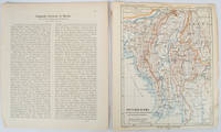
Burma map Britisch-Birma nach den neuesten Grenzbestimungen auf Grund amtlicher Quellen. from Petermann's Geographische Mitteilungen
Gotha: Justus Perthes. 1903. Map printed in colour 24.7 x19.4cm and leaf of descriptive text in German 26.5 x 22.5cm slight toning and edges of the map worn with two small tears no loss. Geopolitical map of Burma with railways and railways under construction highlighted. The accompanying text is by the German Tibetologist linguist and orientalist Dr Emil Schlagintweit. . Justus Perthes unknown
Riferimento per il libraio : 173709
|
|
|
PETERMANN, A. (HRSG.).
Mittheilugen aus Justus Perthe's Geographischer Anstalt über wichtige neue Erforschungen auf dem Gebiete der Geographie. 1860 (= Bd. 6 der Reihe). (+) 3 Ergänzungshefte. (1. A. Vibe: Küsten und Meer Norwegens. 24 pp., 1 chromolithographed plate (with ...
Gotha, Julius Perthes, 1860. 4to. Contemp, hcalf. Gilt spine. A small stamp to titlepage. X,490 pp. and 19, partly folded, lithographed maps and plans. Internally clean. + Ergänzungshäfte.
|
|
|
PETERMANN, A. (HRSG.).
Mittheilugen aus Justus Perthe's Geographischer Anstalt über wichtige neue Erforschungen auf dem Gebiete der Geographie. 1861 (= Bd. 7 der Reihe). (+) 3 Ergänzungshefte. (1. G. Lejean: Ethnographie de la Turque D'Europe. Ethnographie der Europäisch...
Gotha, Julius Perthes, 1861. 4to. Contemp, hcalf. Gilt spine. A small stamp to titlepage. VIII,482 pp. and 16, partly folded, lithographed maps and plans. Internally clean. + Ergänzungshäfte.
|
|
|
PETERMANN, A. (HRSG.).
Mittheilugen aus Justus Perthe's Geographischer Anstalt über wichtige neue Erforschungen auf dem Gebiete der Geographie. 1858 (= Bd. 4 der Reihe).
Gotha, Julius Perthes, 1858. 4to. Contemp, hcalf. Gilt spine. A small stamp to titlepage. VIII,596 pp. and 20, partly folded, lithographed maps and plans. Text as well as maps fine and clean.
|
|
|
PETERMANN, A. (HRSG.).
Mittheilugen aus Justus Perthe's Geographischer Anstalt über wichtige neue Erforschungen auf dem Gebiete der Geographie. 1867 (= Bd. 13 der Reihe).
Gotha, Julius Perthes, 1867. 4to. Contemp, hcalf. Gilt spine. Spine somewhat rubbed. A small stamp to titlepage. VI,470 pp. and 19, partly folded, lithographed maps and plans. Textleaves with some browning and scattered brownspots. Maps clean.
|
|
|
PETERMANN, A. (HRSG.).
Mittheilugen aus Justus Perthe's Geographischer Anstalt über wichtige neue Erforschungen auf dem Gebiete der Geographie. 23. Bd.
Gotha, Julius Perthes, 1877. 4to. Later hcloth. Spine gilt. XII,476 pp. and 23, partly folded, lithographed maps and plans. Internally clean.
|
|
|
PETIT ATLAS NATIONAL
Carte d?partementale (noir) : Haute Sa?ne. Milieu XIXe.
Gravure 18x24 cm. Rousseurs.
|
|
|
PETIT ATLAS NATIONAL
Carte d?partementale (noir) : Loir et Cher. Milieu XIXe.
Gravure 18x24 cm. Rousseurs.
|
|
|
PETIT ATLAS NATIONAL
Carte d?partementale (noir) : Loiret. Milieu XIXe.
Gravure 18x24 cm. Rousseurs.
|
|
|
PETIT ATLAS NATIONAL
Carte d?partementale (noir) : Ni?vre. Milieu XIXe.
Gravure 18x24 cm. Rousseurs.
|
|
|
PETIT ATLAS NATIONAL
Carte d?partementale (noir) : Sa?ne et Loire. Milieu XIXe.
Gravure 18x24 cm. Rousseurs.
|
|
|
PETIT ATLAS NATIONAL
Carte d?partementale (noir). Bouches du Rh?ne. Fin XIXe.
Gravure 18x24 cm. Rousseurs.
|
|
|
PETIT ATLAS NATIONAL
Carte d?partementale (noir). Hautes Garonne. Milieu XIXe.
Gravure 18x24 cm. Rousseurs.
|
|
|
PETIT ATLAS NATIONAL
Carte d?partementale (noir). Var. Fin XIXe.
Gravure 18x24 cm. Rousseurs.
|
|
|
PETIT ATLAS NATIONAL
Carte d?partementale (noir). Vaucluse. Fin XIXe.
Gravure 18x24 cm. Rousseurs.
|
|
|
PETIT ATLAS NATIONAL
Carte du d?partement de la Somme. Milieu XIX?.
1 feuille 24x18 cm. Rousseurs.
|
|
|
PETIT Claude
LE BRIDGE CONTRAT. Les annonces.
Editions du Dauphin 1947, In-12 broché de 108 pages.
|
|
|
Pfc Henry Parrott, Lt Max Gissen Maps By Pfc Arthur Hunker
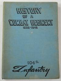
History of a Combat Regiment 1639-1945 - 104th Infantry
N.P.: 104th Infantry United States Army 1945. First edition undated late 1945 signed by Commanding Officer Ralph W. Palladino on the introductory page. History of this venerable US Army Regiment from its roots as a militia unit in the American Revolution up through the end of World War II the period on which this book focuses. Includes maps other black and white illustrations from photographs list those killed or missing in action battle statistics etc. Light blue cloth printed in black Route of Advance map on endpapers book about 7.5 inches tall 153 pages no dustjacket likely issued without. Some soil to covers good hinges sound text block age-browning to the war-era paper used for the pages no other names or markings. Signed by the Commanding Officer. First Edition. Hard Cover. Good. 16mo - over 5¾" - 6¾" tall. 104th Infantry, United States Army Hardcover
Riferimento per il libraio : 043919
|
|
|
PFEIFFER, Gustavo.
Mapa de España y Portugal. Panorama de la Península Ibérica. Topografía de M. Herrero. Grabado y publicado por...
Madrid, 1872. 4to., 22 cms; 89 x 65 cms., desplegado. Grabado en color, plegado. Montado sobre tela.. Escala 1:2.000.000. Encuadernación original en tela estampada.

|
|
|
Phair, Charles Illustrated By Ogden M Pleissner, Robert Nisbet and from Photographs, Drawings and Maps
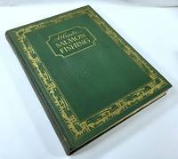
Atlantic Salmon Fishing
New York: The Derrydale Press 1937. One of 950 copies of the regular edition 1937. Well illustrated throughout in both color and in black and white. Hefty volume in green cloth lettered and decorated in gilt top edge gilt illustrated endpapers 193 pages plus plates folding map book 12.5 inches tall. Very good with very modest edge rubbing a little more rubbing to the spine ends a slightly dulled but readily legible spine good hinges sound text block clean pages with some very light foxing to the upper margins of a few pages personal bookplate on preliminary blank no other names or markings. Map appears to have never been unfolded. . First Limited Edition. Hard Cover. Very Good. Folio - 12" - 15" Tall. The Derrydale Press Hardcover
Riferimento per il libraio : 049296
|
|
|
Phelps, Gilbert
Latin America
109 pages, illustrated, maps, appendices, suggestions for further reading. eng
|
|
|
Phelps, Gilbert
Latin America
109 pages, illustrated, maps, appendices, suggestions for further reading. eng
|
|
|
Phenix, Penny; Murphy, Paul
Devon and Exmoor
No marks or inscriptions. No creasing to covers or to spine. A lovely clean very tight copy with bright unmarked boards and no bumping to corners. 128pp.

|
|
|
Philip's
Concise World Atlas
224 pages, maps, index. eng
|
|
|
Philip's Maps
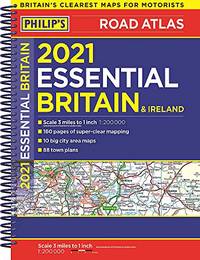
2021 Philip's Essential Road Atlas Britain and Ireland: A4 Spiral binding Philip's Road Atlases
Paperback. Acceptable. paperback
Riferimento per il libraio : GOR013594973 ISBN : 1849075220 9781849075220
|
|
|
Philip's Maps
2023 Philip's Big Road Atlas Europe: A3 Spiral binding
Philip's 2022-04-07. spiral_bound. Used: Good. 11.42x0.39x15.43. Buy with confidence. Excellent Customer Service & Return policy. Philip's unknown
Riferimento per il libraio : SONG1849075530 ISBN : 1849075530 9781849075534
|
|
|
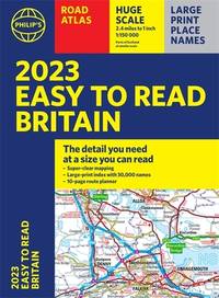
Philip's Maps
2023 Philip's Easy to Read Road Atlas Britain: A4 Paperback Philip's Road Atlases
new. unknown
Riferimento per il libraio : 43997735-n ISBN : 1849075956 9781849075954
|
|
|
Philip's Maps
2023 Philip's Big Road Atlas Europe: A3 Spiral binding
Philip's 2022-04-07. spiral_bound. New. 11.42x0.39x15.43. Buy with confidence. Excellent Customer Service & Return policy. Philip's unknown
Riferimento per il libraio : DADAX1849075530 ISBN : 1849075530 9781849075534
|
|
|
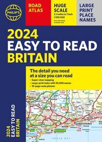
Philip's Maps
2024 Philip's Easy to Read Britain Road Atlas: A4 Paperback Philip's Road Atlases
new. unknown
Riferimento per il libraio : 45515646-n ISBN : 1849076200 9781849076203
|
|
|
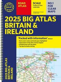
Philip's Maps
2025 Philip's Big Road Atlas of Britain & Ireland: A3 Spiral Binding Philip's Road Atlases
new. unknown
Riferimento per il libraio : 47330571-n ISBN : 1849076642 9781849076647
|
|

 Ricevere i risultati per e-mail
 Scaricare i risultati in PDF
 RSS feed
 Link
Link


