|
CAMP DE MAILLY
Carte color?e au 1/20 000?.
Une feuille 74x100 cm.
|
|
|
CAMPBELL
CARTE GUIDE CAMPBELL N°13 PYRENEES BAYONNE
EDITIONS BLONDEL LA ROUGERIE - Carte dépliante en couleurs en 32 volets en couleurs au 1/320.000e. In-Plano toilé; etiquette,format IN12 repliée,la France en 15 regions; 86x68 cm.
Riferimento per il libraio : 20176
|
|
|
Campbell, Joseph
Historical Atlas of World Mythology Vol. II: The Way of the Seeded Earth, Part 1: The Sacrifice
A clean, unmarked book with a tight binding. Large format: 10 1/2"w x 13 7/8"h. 128 pages. Many color illustrations.

|
|
|
Canadian National Railways [CNR]
The Triangle Tour of British Columbia Canada - [Map] Supplement to the Canadian Rockies Folder
62 x 43.5 cm one-sided colour pictorial map reduces to 22.5 x 10 cm when folded inside original blue card cover lettered in black. Illustrates the route of the CNR's Triangle Tour of British Columbia which included "Jasper National Park, Mount Robson Park, the Canadian Rockies, and the scenic seas of the North Pacific coast." Without saying so, the right side of the map switches scales so as not to display Lake Louise, a prime tourist attraction of rival railway Canadian Pacific. Includes eight sepia-tone photos of sights of interest along the way. Clean and unmarked with light wear. A well-preserved copy of this excellent piece of vintage Western Canadian tourist ephemera. Reference: Cornell University Library, Persuasive Maps: PJ Mode Collection 1219.01. Book

|
|
|
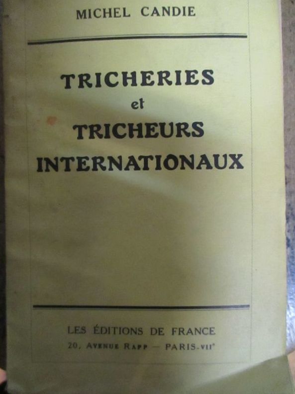
Candie (Michel)
Tricheries et tricheurs internationaux
1935 Paris les éditions de France sans date (1935) In12 broché 228 pages
Riferimento per il libraio : 5795
|
|
|
CAPITAINE (Louis) & CASSINI de THURY (César-François).
[MIREPOIX/ARIÈGE] Carte du diocèse de Mirepoix.
[Paris, 1781]. En deux feuilles pouvant être jointes pour former une carte de 823 x 630 mm.
Riferimento per il libraio : LBW-8196

|
|
|
CAPITAINE (Louis).
Carte de la France suivant sa nouvelle division en départements et districts. Dédiée à l'Assemblée Nationale par les directeurs et associés de la carte générale de la France.
1790. En 42 sections montées sur toile et pliées, formant une carte de 1,23 x 1,16 m, sous étui de papier bleu.
Riferimento per il libraio : LBW-4325

|
|
|
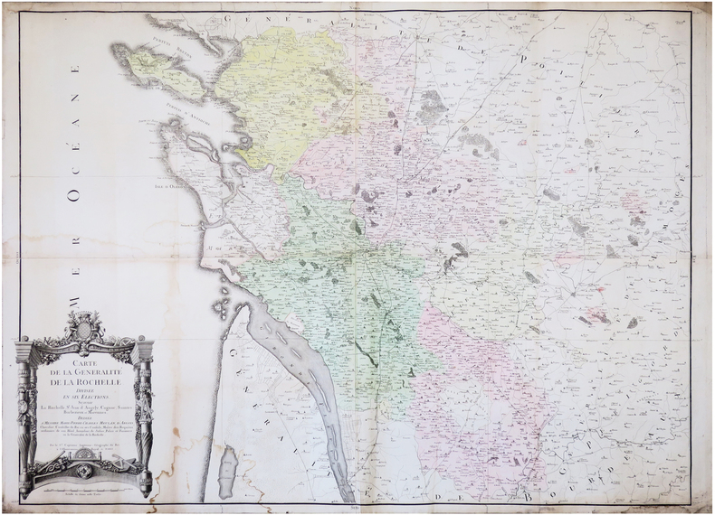
CAPITAINE (Louis).
Carte de la Généralité de La Rochelle, divisée en six élections, sçavoir La Rochelle, S.t Jean d'Angely, Cognac, Saintes, Barbezieux et Marennes.
Paris, 1781. En 4 feuilles jointes formant une carte de 0,87 x 1,14 m.
Riferimento per il libraio : LBW-7245
|
|
|
CAPITAINE (Louis);
Carte générale des Etats-Unis de l'Amérique septentrionale divisée en ses 17 provinces.
1799 395 x 452 mm.
Riferimento per il libraio : LBW061e4

|
|
|
CAPITAINE Louis, ingénieur Géographe
[EMBOUCHURE DE LA LOIRE DE TOURS A SAINT-NAZAIRE] CARTE N°8 DE LA CARTE GENERALE DE LA FRANCE, dédiée au Roi. Réduite sur léchelle dune ligne pour 400 toises, daprès les 180 feuilles de la grande Carte de la France levée géométriquement par ordre du Roi, sur léchelle dune ligne pour 100 toises. Cette réduction est luvre de Louis Capitaine
Paris 1790 carte d'époque entoilée sur une toile bleue repliée format 31,5 x 24,5 cm, format déplié : 61 x 93 cm, gravée en noir, [Paris] : [s.n.], 1790
Riferimento per il libraio : 21325
|
|
|
CAPITAINE Louis, ingénieur Géographe
[LA LOIRE D'AMBOISE A MOULINS - REGION CENTRE] CARTE N°9 DE LA CARTE GENERALE DE LA FRANCE, dédiée au Roi. Réduite sur léchelle dune ligne pour 400 toises, daprès les 180 feuilles de la grande Carte de la France levée géométriquement par ordre du Roi, sur léchelle dune ligne pour 100 toises. Cette réduction est luvre de Louis Capitaine
Paris 1789 carte d'époque entoilée sur une toile bleue repliée format 31,5 x 24,5 cm, format déplié : 61 x 93 cm, gravée en noir, [Paris] : [s.n.], 1789
Riferimento per il libraio : 21327
|
|
|
CAPON GEORGES (NE EN 1890).
LES EXPOSITIONS UNIVERSELLES DE JADIS ET DE NAGUERE. PARIS. HOFFMANN-LA ROCHE.
SANS DATE (VERS 1935). SERIE DE 5 CARTES POSTALES VERTICALES REPLIEES, FORMAT 10,5 X 15 CENTIMETRES ENVIRON, ILLUSTREES D'UNE COMPOSITION EN COULEURS. 1855. 1867. 1878 (LES SOUKS ALGERIENS DANS LES JARDINS DU TROCADERO). 1900. 1931 (EXPOSITION COLONIALE. LA PROMENADE A DOS DE CHAMEAU DANS L'ENCEINTE DU PAVILLON DE L'AEF). BON ETAT.
Riferimento per il libraio : 685
|
|
|
CARDOZE Edmond
BORDEAUX RETRO. LE PATRIMOINE BORDEALAIS EN 202 CARTES POSTALES
Editions librairie Pasteur. 1981. In-8. Broché. Etat d'usage, Couv. légèrement passée, Dos satisfaisant, Intérieur frais. 112 pages, 202 illustrations noir et blanc. . . . Classification Dewey : 741.68-Illustrations des cartes postales
Riferimento per il libraio : RO20065421
|
|
|
Carey Brian Todd; tactical maps illustrated by Joshua B. Allfree; regional maps illustrated by John Cairns
Hannibal's Last Battle: Zama and the Fall of Carthage
Yardley Pennsylvania: Westholme Publishing 2008. 1st. Hardcover. Book fine Dust jacket fine. <br/><br/> Westholme Publishing hardcover books
Riferimento per il libraio : 9009390 ISBN : 1594160759 9781594160752

|
|
|
Caribbean Maps: Norie J. W.
THE ISLAND OF ANTIGUA. Revised by J.W. Norie 1827
Antigua but actually Philadelphia: R.B. Eldridge & Co. 1860. Lithographic sheet map 20 1/2 x 26 1/2 inches. Backed with contemporary blue paper. Light foxing and toning. A few small tears in margins. Very good. An unusual lithographic edition of Norie's 1827 revision of this handsome chart lithographed by Wagner & McGuigan in Philadelphia. A statement in the cartouche reads: "Presented by R.B. Eldridge Antigua to Captain Andrew Tyler." The captain's name is accomplished in manuscript. R.B. Eldridge is not listed in Tooley's DICTIONARY OF MAPMAKERS and appears to be unrelated to publisher of charts George Eldridge. It seems most likely that he was rather an Antigua merchant who commissioned a reprint of the chart for complimentary distribution to sea captains. A handsome piece. R.B. Eldridge & Co. unknown books
Riferimento per il libraio : WRCAM48522

|
|
|
CARMICHAEL, Joel
Histoire illustrée de la Russie
1960 Editions NRF Gallimard, Collection "L'Oeil" - 1960 - In-4, cartonnage rouge illustré - 303 p. - Illustrations et reproductions photographiques en N&B in et hors-texte
Riferimento per il libraio : 109620
|
|
|
carnet de cartes postales
SAIL-SOUS-COUZAN.
Sail-sous-Couzan, Robert-Bonneton, s.d. (fin XIXème ou début Xxème), 1 br. carnet in-12 oblong de 10 cartes postales détachables, serpentes ;
Riferimento per il libraio : 15196
|
|
|
carnet de cartes postales
Souvenir d'une visite à Notre-Dame de Fourvière. Lyon.
Paris, Levy, s.d. (fin XIXème ou début XXème), 1 br., couverture illustrée. carnet in-12 oblong de 12 cartes postales détachables, 1 feuillet de texte, serpentes ;
Riferimento per il libraio : 15197
|
|
|
carnet de cartes postales.
Souvenir de Fourvière.
Lyon, Magasin de l'Oeuvre de Fourvière, s.d. (fin XIXème ou début XXème), 1 br., couverture illustrée. carnet oblong de 20 cartes postales, serpentes ;
Riferimento per il libraio : 15202
|
|
|
CARNEVALE-MAUZAN Mirande
Achille Mauzan. 1883-1952. L'oeuvre Complet (Catalogue raisonné).
2001 Fort in-4 Cartonnage et étui illustrés de l'éditeur
Riferimento per il libraio : 009577
|
|
|
Caro Ina; Cain maps David
Paris to the Past: Traveling Through French History by Train
W.W. Norton 2012. Fine. Caro Ina. Paris to the Past: Traveling Through French History by Train. Cain maps David. New York: W.W. Norton 2012. 381pp. Indexed. Bibliography. 8vo. Paperback. Book condition: Near fine. W.W. Norton paperback books
Riferimento per il libraio : UCARPAR00TM
|
|
|
Carole SEDILLOT et Chantal FRELAUT
B.A-BA : LE GRAND JEU DE MLLE LENORMAND
Un ouvrage de 126 pages, format 140 x 210 mm, illustré, broché couverture couleurs illustrée, publié en 2004, Editions Pardès (avec des surlignages dans le texte)
Riferimento per il libraio : LFA-126750284
|
|
|
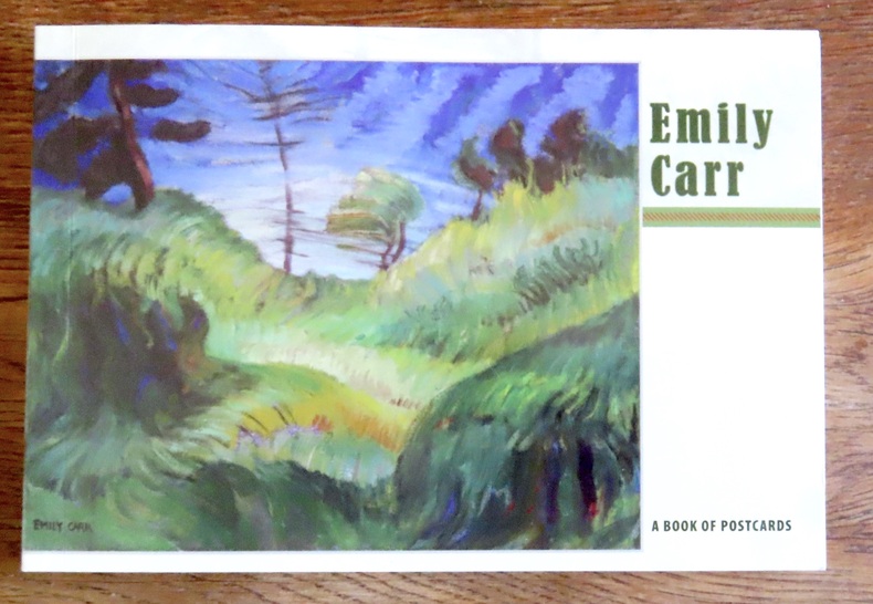
Carr Emily:
Emily Carr - A book of postcards.
Portland, Pomegranate, 2008. Livret composé de 30 cartes postales au format 18 x 12. Un carte détachée, les autres reliées encore mais détachables bien sûr, le book est complet des 30 cartes.
Riferimento per il libraio : 15602
|
|
|
Carr, John
A STRANGER IN IRELAND OR A TOUR IN THE SOUTHERN AND WESTERN PART OF THAT COUNTRY IN THE YEAR 1805
London: Printed for Richard Phillips Sold By Souter No. 1 Pater-noster-row. 1806. Book. Very Good. Hardcover. First Edition. Large 4to. A very good "large paper" copy with uncut edges leaf size approximately 285mm x 225mm with a few additional items bound in. Pp. xiv 2 530 ii ii. 16 hand-tinted aquatints of which several folding map plus an additional contemporary hand-coloured map of Ireland as frontispiece. Contents: frontispiece quarto format map - engraved for the Poem of Erin. The folding plate of Dublin shown as the frontispiece in the "Directions for Placing the Plates" has been bound in opposite the first page of text title page dedication prefacecontents errata directions for placing the engravings main body of the text additional page on St. Patrick from "Guide to Knowledge" bound in at rear before the Publisher's adverts cutting from the Times 1842 entitled "Robert Emmet and the Gaoler of Kilmainham" pasted to rear paste-down. Original paper-covered boards with recent pebbled cloth spine to match original with the original paper title-label applied to the spine binding in very good condition. Contents very good the uncut edges are a little worn in places and a couple of a small near-contemporary oval stamps of the "Baptist College Bristol" to the front end paper no other marks. Paper in very good condition without any obvious staining minimal foxing almost completly confined to the tissue guards maps and plates all very good clean and crisp short repaired tear to the edge of page 318 not nearly affecting the text. A very good to fine copy. Printed for Richard Phillips, Sold By Souter, No. 1, Pater-noster-row. Hardcover
Riferimento per il libraio : 009589

|
|
|
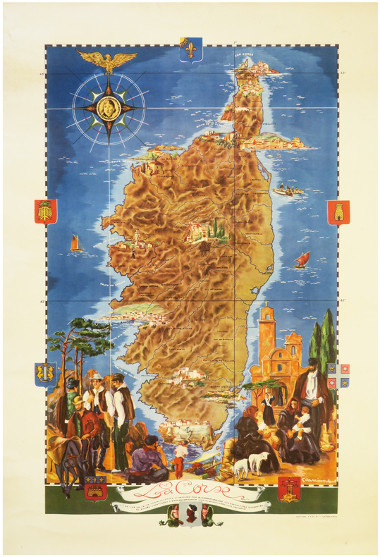
CARRIAT-ROLANT (Gabriel).
[CORSE] La Corse.
Casablanca, Éditions A.F.R.I.P., [circa 1950]. Lithographie en couleurs de 815 x 520 mm.
Riferimento per il libraio : LBW-8062
|
|
|
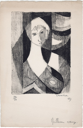
Carréga, Nicolas
Nicolas Carréga : carte de voeux pour 1958 et lithographie originale
1958 Carte de voeux de Nicolas Carréga pour 1958. 25 x 16,5 cm, une lithographie originale en noir (16,5 x 12 cm), numérotée 40/60, signée et datée à la mine de plomb. Avec un ajout autographe ("meilleurs voeux") en pied.
Riferimento per il libraio : 1058
|
|
|
CARTE BLONDEL
Carte couleurs : Bords de Loire au 1/320 000?. Sans date.
Une feuille 44x64 cm.
|
|
|
CARTE BLONDEL
Carte couleurs de la Vend?e au 1/200 000?. Sans date.
1feuille 75x56 cm.
|
|
|
CARTE DEPARTEMENTALE
D?partement de la Somme. Carte couleurs au 1/200 000e.
1 feuille 50x70 cm.
|
|
|
CARTE DEPARTEMENTALE
Is?re. Cartes couleurs au 1/200 000e. Sans date.
1 feuille repli?e sous chemise. 55x75 cm.
|
|
|
CARTE DEPARTEMENTALE
Savoie. Cartes couleurs au 1/200 000e. Sans date.
1 feuille repli?e sous chemise. 55x75 cm.
|
|
|
CARTE MICHELIN - 1-Belgique
Anvers-Rotterdam. Carte au 1/200 000e.
1 feuille repli?e 109,5 x 50 cm.
|
|
|
CARTE MICHELIN - 100
Sorties de Paris. Carte Michelin au 1/50 000e.
Feuille repli?e.
|
|
|
CARTE MICHELIN - 120
Carte cycliste. 50 km autour de Paris. L'?tat des routes, les c?tes, les curiosit?s, le pittoresque, les r?parateurs de v?los.
Couerture orange. R?par?e, traces de scotch.
|
|
|
CARTE MICHELIN - 163
Allemagne-Est. Carte Michelin au 1/1000 000e.
Feuille repli?e.
|
|
|
CARTE MICHELIN - 2-Belgique
Bruxelles-Ostende. Carte au 1200 000e.
1 feuille repli?e 109,5 x 50 cm.
|
|
|
CARTE MICHELIN - 205
Pays Rh?nans. Carte Michelin au 1/200 000e. Couverture orange et bleue. Edition provisoire avec limites de zones d'occupation.
Feuille repli?e.
|
|
|
CARTE MICHELIN - 206
Pays Rh?nans. Carte Michelin au 1/200 000e. Couverture orange et bleue. Edition avec limites de zones d'occupation.
Feuille repli?e.
|
|
|
CARTE MICHELIN - 21
Basel- St Gallen. Carte Michelin au 1/200 000e. Couverture orange et bleue.
Feuille repli?e.
|
|
|
CARTE MICHELIN - 23
Gen?ve-Berne. Carte Michelin au 1/200 000e. Couverture orange et bleue.
Feuille repli?e.
|
|
|
CARTE MICHELIN - 24
Andermatt-Bolzano. Carte Michelin au 1/200 000e. Couverture orange et bleue.
Feuille repli?e.
|
|
|
CARTE MICHELIN - 26
Martigny-Milan. Carte Michelin au 1/200 000e. Couverture orange et bleue.
Feuille repli?e.
|
|
|
CARTE MICHELIN - 3-Belgique
Bruxelles-Li?ge. Carte au 1/200 000e.
1 feuille repli?e 109,5 x 50 cm.
|
|
|
CARTE MICHELIN - 33
Grenoble-Torino. France en 48 feuilles au 1/200 000e.
Une feuille 42x100 cm. Sous couverture.
|
|
|
CARTE MICHELIN - 4-Belgique
Mons-Luxembourg. Carte au 1/200 000e. .
1 feuille repli?e 109,5 X 50 cm.
|
|
|
CARTE MICHELIN - 5-Hollande
Groningen-Alkmaar. carte au 1/200 000e. Bilingue fran?ais-hollandais.
1 feuille repli?e 98 x 49 cm.
|
|
|
CARTE MICHELIN - 51
Boulogne-Lille. Carte routi?re michelin au 1/200 000?me. Ponts ou bacs d?truits, localit?s gravement endommag?es.
Carte 100X50 cm. Repli?e.
|
|
|
CARTE MICHELIN - 52
Le Havre-Amiens. Carte Michelin au 1/200 000e. Couverture orange et bleue.
Feuille repli?e.
|
|
|
CARTE MICHELIN - 53
Arras-M?zi?res. Carte routi?re michelin au 1/200 000?me. Couverture orange. Indications des dommages de guerre.
Carte 100X50 cm. Repli?e.
|
|
|
CARTE MICHELIN - 57
Verdun - Wissembourg. Couverture orange.
|
|

 Ricevere i risultati per e-mail
 Scaricare i risultati in PDF
 RSS feed
 Link
Link


