|
|
|
REYNAL DE SAINT-MICHEL, Alain de
Carte géologique à l'échelle du 1/50.000. Feuilles de Basse-Terre et des Saintes [ Guadeloupe ]
2 cartes géologiques format 72 x 90 cm sous chemise commune, Carte géologique détaillée de la France, Département de la Guadeloupe, Ministère de l'Industrie, Paris, 1966 Belle carte géologique en deux feuilles de l'île de Basse-Terre (Guadeloupe). Bon état (accrocs et manques à la chemise avec cachet d'ex-libris, les cartes sont en parfait état) Français

|
|
|
Reynolds, Alta; Wright, Lynn
Cycles: a View of Planet Earth From Four Million BC to 15,000 AD
89 pages. Selected bibliography. Illustrated in colour. "Thirty-nine Earth Change maps spanning a vast period of time, from 4 million BC to 15,000 AD, come to light in a little village in South Africa. Their architect, Hans Luhdo, produced them in only 5 months. The pivotal maps are those drawn for the year 2000. The speed with which they were created suggests that he was a man driven, racing against time. A few weeks after the last map was completed, he died." - from back cover. Clean and unmarked with light wear. Nice copy. Book

|
|
|
Rhodos.:
"Description de l`isle de Rhodes". Map from: Bertius, Tabularum Geographicarum.
10 x 13,5 cm (full page: 12 x 19 cm). *Small map of Rhodes. View of the whole island. Surrounded by the sea, a sailing boat and a monster. Good condition. Landkarten de
|
|
|
Ribton-Turner, C J.
Warwick Castle and Town together with Guy’s Cliffe
Very slight marking to title page and crease to front cover. A very clean very tight copy with bright lightly marked covers. 72pp.

|
|
|
Rice, H.M.A.
Nelson Map-Area, East Half, British Columbia - Geological Survey Memoir 228
86 pages. Two black and white photographic plates. Based upon field work conducted in 1936 through 1938. Clean and unmarked. Yellowed at edges. Average wear. Unmarked. Large colour map in excellent condition stored in pocket inside back cover. Sound copy. Book

|
|
|
RICHARD KIEPERT, (1846-1915).
[KLEINASIEN MAP] [C2] [Afiun Karahisar and around].
Very Good German Original color map on cloth. Oblong atlas folio. (48 x 63 cm). In Latin, Greek and German. Toponyms are Turkish in Latin transcription script as well as their ancient names in Roman and Greek. Including Afiun Karahisar [Afyonkarahisar] and its south and southwest area. Ascanius Lavus, Djemal Bey Tschiftligi, Macropedium, Asi Karaaghatsch, Denizli, Cretopolis, Sozopolis, Isparta, Tabenerum Campus, Hynera (Cydrara), Anaua Lacus (Adji Tuz Gölü), Ishikli Eumenia, Panasium (Banas Ovasi i.e. Plain), etc. It's one of the 24 sheets of 'Karte von Kleinasien'. Rihard Kiepert was a German cartographer born in Weimar. He was the son of famed geographer Heinrich Kiepert. Richard Kiepert studied geography and history in Berlin and Heidelberg. In 1870, he traveled in Palestine and Asia Minor, returning to take part in the Franco-Prussian War. In 1874, he received his doctorate of philosophy at the University of Jena. From 1874 until 1878 he worked on the compilation of Ferdinand von Richthofen's atlas of China, and from 1875 to 1887, he was editor of the geographical periodical Globus. From 1902 until 1908 he worked on the Spezialkarte von Kleinasien, a map of Asia Minor that was created on a 1:400,000 scale. After his father's death in 1899, he continued the work on the elder Kiepert's classic Formae Orbis Antiqui.
|
|
|
Richards, T Addison; Fold Out Maps One with Short Tear But Complete [Illustrator]
Appleton's Companion Hand Book of Travel Containing a full description of the principal cities towns and places of interest together with hotels and routes of travel through the United States and the Canadas. With Colored Maps
D Appleton and Company 1862. Hardcover. Good. 1962 printing. Bound in publisher's cloth. Hardcover. Shelf wear. Spine ends chipped with loss. Some folded maps torn. D Appleton and Company hardcover
Riferimento per il libraio : 2109160014
|
|
|
Richardson, Olive
Canterbury
No marks or inscriptions. No creasing to covers or to spine. A very clean very tight booklet with bright unmarked boards and no bumping to corners. 20pp. Attractive little booklet with colour and black & white ptotographs of Canterbury with history and description. Undated ca 1975.

|
|
|
Richter, Klaus
Hamburg und der Süderelberaum 1577. REPRINTnach einer kolorierten Handzeichnung von Daniel Frese.
Braunschweig, Archiv-Verlag, [ca. 1985]. Mehrf. gefalt. farb. Karte über einem Panorama der Stadt, von der Elbseite gesehen (Blattgröße ca. 53 x 82 cm; Bildgröße ca. 45 x 81.
Riferimento per il libraio : 99383
|
|
|
Rickenbacker, Capt Edward V; Laurence la Tourette Driggs (fwd, maps)
Fighting the Flying Circus in scarce DJ
New York: Frederick A. Stokes Co. 1919. Book. Near Fine. Hardcover. 1st Edition. 12mo - over 6¾" - 7¾" tall. Blue cloth spine panel lettered in orange color front and back cover pastedown illus. Text block edges typically somewhat tanned with minor loss along top edge/corner of cover pastedown otherwise only slight wear. Color illus. dust jacket shows area of loss along top front edge minor loss to corners several closed tears and rubbed joints/folds now in mylar. xii371 pp. illus. Frederick A. Stokes Co. Hardcover
Riferimento per il libraio : 061262
|
|
|
RIETER & SENN.
Søndags=Dragt af en Siællandsk Bonde= Pige " tienende i Hovedstaden.
(København, 1805). Originalt håndkoloreret kobberstik. (21 x 14,5 cm.). Indrammet i ""sølvramme"" (29 x 21 cm.). Frisk eksemplar.
|
|
|
Ringger, Rudolf
Panorama vom Fürstlich Fürstenbergischen Schlosse Heiligenberg in Schwaben.
Zürich, H. Füessly & Comp. zur Meise, 1865. Stahlstich. Nach der Natur gezeichnet und gestochen von Rud. Ringger in Küsnach b/Zürich. Druck von D. Herter in Zürich. Bildgrösse: 10,2 cm x 302 cm. + Wichtig: Für unsere Kunden in der EU erfolgt der Versand alle 14 Tage verzollt ab Deutschland / Postbank-Konto in Deutschland vorhanden +, 37BG Orig.-Pappdeckel (Gelenke u. Kanten leicht berieben, Ecken minim bestossen) in Orig.-Papp-Schuber (berieben, Gelenke angeplatzt, etwas verblasst).
Riferimento per il libraio : 37BG

|
|
|
RINGGOLD, CADWALADER.
A Series of Charts with Sailing Directions, Embracing Surveys of the Farallones, entrance to the bay of San Francisco, bays of San Francisco and San Pablo, straits of Carquines and Suisun Bay, confluence and deltic branches of the Sacramento and San J... - [THE MOST ACCURATE CHARTS UP UNTIL THAT TIME OF THE SAN FRANCISCO BAY AREA]
Washington, Jno. T. Towers, 1851. 4to. In publishers original full pictoral green cloth. Front and back board with embossed title and ornamentation, showing an eagle holding a banner and anchor beneath whom Columbia sits holding the shield of California with a bear asleep at her feet. Front board in gold. Lower front board with gilt stamp. Stamp to front free end-paper and title-page. Light wear to extremities and internally with light occassional miscolouring. 44. pp. + 11 lithographic plates including frontispiece and 6 folding maps.
|
|
|
Rob Talbot; Robin Whiteman
The Yorkshire Moors and Dales (Country)
No marks or inscriptions. No creasing to covers or to spine. A very clean very tight copy with bright unmarked boards and no bumping to corners. 160pp. Some of England's finest examples of both natural and man-made scenery, photographed in colour by Rob Talbot and described from historical, geographical and natural perspectives by Robin Whiteman.

|
|
|
ROBBE, Jacques.
Méthode pour apprendre facilement la Géographie. Contenant un Abbrégé de la Sphère, la division de la Terre en ses Continens, Empires, Royaumes, États, Républiques, Provinces, &c. Avec les tables des villes les plus notables de chaque province. Tome Premier [sur deux].
À La Haye, chez Henri Van Bulderen, 1691. 8vo.; frontispicio grabado en cobre, 11 hojas, 575 pp., 8 hojas y 14 mapas plegados, dibujados por Nicholas de Fer (1646-1720) y grabados en cobre por De Winter. Encuadernación de época en piel, con lomera profusamente ornada. Este Tomo Primero contiene: Mapamundi, y los mapas de Europa, Francia, Imperio de Alemania, Países Bajos, Polonia, Rusia Blana, Suecia y Noruega, Dinamarca, Islas Británicas, España, Italia, Grecia (como la parte meridional de Turquía en Europa) y Hungría (como la parte septentrional de Turquía en Europa).

|
|
|
ROBERT ; [ VAUGONDY, Robert de ]
La Judée ou Terre Sainte divisée en ses douze Tribus. Par le Sr. Robert, Géographe du Roi, avec privilège, 1750 [Avec :] Carte de la Terre de Canaan ou Terre Promise à Abraham et à sa Postérité.
1 carte sous encadrement verre et bois au format 76 x 65 cm (format du cadre), le format apparent de la carte, sous marie-louise, est de 61 x 50,5 cm, frontières rehaussée en couleur, 1750 Bel état pour cette belle carte ancienne de Terre Sainte, déjà encadrée. A saisir. Français

|
|
|
ROBERT DE VAUGONDY, Didier
Archipel des Indes Orientales qui comprend les Isles de la Sonde, Moluques et Philippines, tirées des Cartes du Neptune Oriental
Carta geografica colorata a mano (53,5x71), con larghi margini, buone condizioni. Hand coloured map (53,5x71), large margins, good copy.
|
|
|
ROBERT DE VAUGONDY, Didier
Partie Orientale de l’Empire de la Russie en Asie...et le confins de la Tatarie Chinoise
Carta geografica colorata a mano (55x80), larghi margini, qualche macchia al margine inferiore. Geographic map, hand coloured, (55x80), some brownings at the lower margin.
|
|
|
Robert Fulford
Canada - A Celebration
Inscription opposite half-title page. No other marks. A very clean very tight copy with bright unmarked boards and no bumping to corners. Dust jacket price clipped but not marked or torn with crease to front dust flap. 240pp. The book follows the route of a traveller crossing Canada from East to West, exploring each of the provinces and territories in his path. It is a spectacular depiction of the land of Canada, its history and a verbal tribute to the country's people.

|
|
|
Robert Gambee
Nantucket Island (Signed By Author)
New book still in shrink wrap. Presumably signed before sealing. pp. A photographic album of Nantucket Island off Cape Cod, Massachusetts.

|
|
|
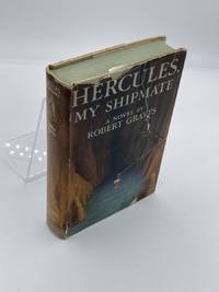
Robert Graves And Maps On End Papers
Hercules My Shipmate
Creative Age Press. Good in Good dust jacket. 1945. First Edition. Hardcover. Dust cover has noticeable tears. Yellowing to pages. Spill stain to edge of pages. - Good overall condition. General wear. No major blemishes. No writing. ; - We're committed to your satisfaction. We offer free returns and respond promptly to all inquiries. Your item will be carefully wrapped in bubble wrap and securely boxed. All orders ship on the same or next business day. Buy with confidence. . Creative Age Press hardcover
Riferimento per il libraio : HVD-23715-A-0
|
|
|
Robert, Gilles:
Partie septentrionale du Comte de Bourgogne ou Franche-Comte, ou sont les Bailliages de Vesoul, Gray, Besancon, Baume, le comte de Montbelliard, et parie des Bailliages de dole, Quingey et Ornans. Grenzkolorierter Kupferstich aus dem Atlas Universel von Robert und Vaugondy
Format (Darstellung): 46,5 x 56 cm. Blatt: 52 x 80 cm. Landkarten de
|
|
|
Roberts, Brian K.
Making of the English Village, The: A Study in Historical Geography
Book is in excellent condition. Binding is solid and square, covers have sharp corners, exterior shows no blemishes, text/interior is clean and free of marking of any kind. Contents include: Anatomy of the village, Row plans, Archaeology of villages, Composite village plans, Dominants and details, with a great many maps of all kinds. Book "shows how (Village) plans can be dissected, analysed and dated, demonstrates the presence of important regional contrasts, examines the processes creating, altering and destroying plays through time..." Copyright 2011 Pistil Books
|
|
|
Roberts, Tony & Elizabeth
See the Lleyn Peninsula
No marks or inscriptions. No creasing to covers or to spine. A very clean very tight copy with bright unmarked boards and no bumping to corners. 64pp.

|
|
|
ROBERTSON, William
Histoire de l’Amerique
Tre voll., in -8°, pp. XXXI, 487; 539; 513; pelle con fregi, tasselli e titoli al dorso. Completo delle cinque tavole ripiegate, di quattro carte e una tavola, “Table chronologique des Mexicains”. Complete of five folding plates, four geographic maps and a non folding plate: “Table chronologique des Mexicains”.
|
|
|
Robinson, W W, Illustrated With Maps, And Drawings By Irene Robinson
A Group Of 30 Individual Softcover Books On The History Of Southern California Localities Each Different Including 21 First Editions Written By W. W. Robinson. For Title Guaranty And Trust Beverly Hills Culver City Glendale Inglewood Land Titles In Long Beach Monrovia Pasadena Pomona San Fernando Valley San Pedro And Wilmington Santa Monica Whittier Santa Catalina The Forest And The People: The Story Of The Angeles National Forest Kern County Old Spanish & Mexican Ranchos Of Orange County 1958 Reprint The Story Of Riverside County The Story Of San Bernardino County The Story Of San Luis Obispo County The Story Of Tulare County And Visalia Ventura County
Los Angeles California: Title Guarantee And Trust / Title Insurance And Trust 1935 1936 1937 1938 1942 1946 1949 1951 1956 1957 1959 1961 1935. First Edition 1st Printing. Soft cover. Very Good/No Dust Jacket. 9 1/4" High. A Group Of 30 Different Booklets Including 19 Different First Printings 1935-1961 One With Second Issue Tipped In Slip 8Th Printing Of Old Spanish And Mexican Ranchos Of Orange County Six Are First Printings Of Later Revisions There Were Many Minor Revisions Usually Each Time They Were Re-Issued. Several Have Notations On Covers That They Were Gifts To Dr. George Hill Hastings From Arthur Mordan President Of Title Guaranty Who Employed Robinson. The Beverly Hills Book Has A Presentation Inscription From Mordan To Hastings The Island Of Santa Catalina Has A Long Notation By Hastings That It Was A Gift From Robinson Upon The Death Of Mordan A Dear Friend; Signed H. H. All Very Good To Near Fine Except Culver City Which Has Wear And Some Damp Spotting Centered On Spine And Extending Inwards Up To 1/4"; And The Forest And The People Is Only Good Worn And Some Small Light Water Spots. <br/> <br/> Title Guarantee And Trust / Title Insurance And Trust 1935 1936 1937 1938 1942 1946 1949 1951 1956 1957 1959 1961 paperback
Riferimento per il libraio : 036820
|
|
|
Robson, John
Captain Cook's World. Maps of the Life and Voyages of James Cook R.N.
New Zealand, Random House, 2000. 211 p. with 128 maps and a gazetteer. 30,5 x 25 cm, hardcover with original wrappers.
Riferimento per il libraio : 23956
|
|
|
Rochford, Noel
Landscapes of Corfu
No marks or inscriptions. Crease to lower corner of front cover, none to spine. A very clean very tight copy with bright unmarked boards and no bumping to corners. Large pull-out map in excellent condition. 128pp. Walking tours in Corfu plus car trips and picnic places.

|
|
|
Rochford, Noel
Landscapes of Lanzarote
No marks or inscriptions. No creasing to covers or to spine. A very clean very tight copy with bright unmarked boards, slight fading near spine and no bumping to corners. Large pull-out map in excellent condition. 70pp. Walking tours in Lanzarote plus car trips and picnic places.

|
|
|
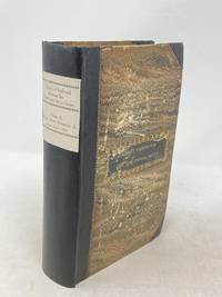
Rockwell, John A (Maps by Charles Preuss)
THIRTIETH CONGRESS - SECOND SESSION : REPORT NO. 145 HOUSE OF REPRESENTATIVES. CANAL OR RAILROAD BETWEEN THE ATLANTIC AND PACIFIC OCEANS FEBRUARY 20 1849; includes PREUSS MAPS
Washington D.C.: Government Printing Office 1849. Hardcover. Very Good. Octavo 9.2 in. x 6 in. pp. 678 1 index. Personal copy with gilt ownership plate to front board of DeWitt C. Lawrence Chief Clerk of the Patent Office. Illustrated with sixteen folding maps. Black half calf with decorative gilt chain rule over marbled boards. Rebacked spine. Gilt name on black ownership panel to front board. Black title on paper panel to spine. Marbled endpapers. Front free endpaper detached but present. Detailed pencil notes presumably from DeWitt Lawrence to preliminary pages index and rear endpapers and to occasional penciled comments on margins of main text providing reference and guidance. Fremont Preuss's maps #II-VIII in VG condition. Other maps in G condition with additional creases a few short closed tears at seams and light browning to several edges. <br /> <br /> ALL16 maps detached as they were removed for preservation and study. Maps I IX-XVI folded in archival pocket. The PREUSS Maps II-VIII "The Rockwell Maps" are laying flat preserved in archival sheath and will be mailed separately under cover. Includes additional copy of Rockwell's map of "Section III". The 16 folded maps include: #I. Map of the Country Between the Atlantic and Pacific Oceans. 1848. Rob Mills. Pencil notes on map. #II-VIII. Road from Missouri to Oregon in 7 Sections 1848. Charles Preuss. Includes two identical copies of Section #III map. All eight Preuss maps in VG condition #IX. Republica Mexicana Plano del Curso del Rio Coatzacoalcos. 1843 #X. Profils en Long et en Traviors du Canal. L'Isthme de Panama1841. Garella. #XI. Profile of That Section of the Country between Nicaragua and the South Sea 1838. Based on Thompson's Guatamala. #XII. Nicaragua Realejo Harbour Edward Belcher Harbour of San Juan de Nicaragua George Peacock 1832 #XIII. Chart of the Bay of Limon or Navy Bay 1829. J.A. Lloyd. #XIV. Republica Mexicana Pano de la Parte Austral del Istmo de Tehuantepec 1843. Jose de Garay. #XV. Panama Canal Longitudinal Section. J.A. Lloyd. Four inch closed tear with 1/2 inch chip to seam. #XVI. Carte Topographique de la Partie De L'Isthme de Panama comprise entre Panama Chagres. 1845. Garella. Uniquely annotated copy. <br /> <br /> The "first major government report devoted to interoceanic communication.Rockwell in addition to his prime focus on Central American canals compiled memorable documents on the suddenly urgent need for more directly binding California to the Union.Foremost.was the matchless seven-section map of the Oregon Trail made by Charles Preuss Fremont's gifted cartographer. Lieut. G.K. Warren in his 1859 memoir wrote that Preuss's 'skill in sketching topography in the field and in representing it on the map has probably never been surpassed in this country.' <br /> <br /> ".The Senate had issued this map separately in 1846; now the House was trying to make available to the Forty-0niners what was by far the best trail map of them all.this treasure was so deeply buried in this report that but few gold seekers found it and it is still so rare in both editions that Wheat lamented that it ' has been insufficiently appreciated by students of Western history.' ." Plains & Rockies 1800-1865: Supplemental volume to the series News of the Plains and Rockies; 2001 Arthur H. Clark Spokane. [Government Printing Office] hardcover
Riferimento per il libraio : 87523
|
|
|
Rocque John
A Plan of Rome… / La Topographia di Roma da G. B. Nolli… / Plan de Rome...
Pianta di Roma a proiezione verticale, orientata con il nord in alto.Incisa da R. Benning per il cartografo inglese John Rocque e basata sulla pianta di Giovan Battista Nolli del 1748."Come annunciato nel titolo (ripetuto anche in italiano e francese), si tratta di una diretta derivazione della pianta piccola del Nolli che l'autore ha voluto riportare nella scala in cui aveva già pubblicato la pianta della città di Londra. In basso a sinistra indice delle fabriche più ragguardevoli contenute nella pianta con 170 voci suddivise in sei colonne. In basso a destra dedica a Sir. Bouchier Wrey. Le emergenze architettoniche sono campite in nero ed il resto degli isolati a tratteggio diagonale. In basso a sinistra il nome dell'incisore R. Benning sc. La stessa pianta fu rstampata nel 1773 dal Sawyer" (cfr. Marigliani p. 274).Acquaforte, finemente colorata a mano, in buono stato di conservazione. Non comune. Vertical projection map of Rome, oriented with the north at the top.Published in 1750 by John Roque, from the earlier plan by Goivanni Battista Noli published in 1748 (These dates are printed on the map).As announced in the title (also repeated in Italian and French), this is a direct derivation of the small map of Nolli that the author wanted to bring back to the scale in which he had already published the map of the city of London. At the bottom left index of the most remarkable fabrications contained in the plan with 170 entries divided into six columns. Bottom right dedication to Sir. Bouchier Wrey. The architectural buildings are in black and the rest of the blocks are in diagonal hatching. Bottom left the name of the engraver R. Benning sc. The same plan was printed in 1773 by Sawyer (see Marigliani p. 274).Etching, finely colored by hand, in good condition. Not common. C. Marigliani, "Le Piante di Roma delle collezioni private", n. 192; Scaccia Scarafoni, "Le Piante di Roma", n. 230.

|
|
|
Roddy, H. J.
PHYSICAL & INDUSTRIAL GEOGRAPHY OF LANCASTER COUNTY, PENNSYLVANIA.
115 p. + Half tone photographic illustrations; + Folding Maps. Tall 8vo. Original cloth backed printed paper boards. Binding worn and slightly soiled. Scarce. PA 24 x2
|
|
|
Roderick MacFarquhar
The Forbidden City
No marks or inscriptions. A very clean very tight copy with bright unmarked boards and no bumping to corners. Dust jacket not price clipped or marked or torn or creased with very minor traces of storage. 172pp. With nearly 150 illustrations, many in colour, this account describes China's Forbidden City which only became accessible to all Chinese citizens after the 1911 revolution.

|
|
|
Rogers, A.C. (Fred) (Signed)
Hiking - Mountain Biking & Adventure Trails of the Nanaimo-Extension Mines, Alberni Valley and Other Vancouver Island East Districts
78 pages. Documents over 40 hiking trails in the mid-island area. A wonderful reference including detailed descriptions and maps. Former owner's notes on back page. Moderate wear and light soiling. Author's signature upon title page. Book
|
|
|
ROGISSART Alexandre de
Rome
Veduta tratta dal "Les delices de l'Italie, contenant une description exacte du Païs, des principales villes, de toutesa les Antiquitez" edito, per la prima volta, a Leida nel 1706 da Pieter Vander Aa e successivamente ristampato a Parigi da Guillaume Cavelier.La maggior parte delle copie della seconda edizione reca nel frontespizio l'indicazione Compagnie des libraires, associazione di librai stampatori la cui composizione è variata negli anni ma di cui Guillaume Cavelier faceva parte.La guida, che sappiamo da Barbier I, 872 essere opera di Rogissart e dell'abate Havard, è impreziosita da 152 tavole,Incisione in rame, in buono stato di conservazione. Bibliografia Marigliani (2007): p. 259, n. 169. Panorama of Rome taken from "Les delices de l'Italie, contenant une description exacte du Païs, des principales villes, de toutesa les Antiquitez"published for the first time in Leiden in 1706 by Pieter Vander Aa and later reprinted in Paris by Guillaume Cavelier. Most of the copies of the second edition have on the title page the indication Compagnie des libraires, an association of booksellers and printers whose composition has varied over the years but to which Guillaume Cavelier belonged. The guide, which we know from Barbier I, 872 to be the work of Rogissart and Abbot Havard, is embellished with 152 plates Copper engraving, in good condition. Literature Marigliani (2007): p. 259, n. 169.

|
|
|
Rolfe, William J.; Crockett, William D.
A SATCHEL GUIDE TO EUROPE. THE FORTY-EIGHTH ANNUAL EDITION. WITH MAPS.
pp. cvi, 596, (32)[Advertisements] + numerous large folding maps. Endpapers advertising Thos. Cook & Sons Travel Organization. Inked ownership of Helen M. Hafer, Hanover, PA. Paris bookseller's label. 12mo. Original full red cloth binding, lettered in gold. Original dust jacket, chipped with small loss. Hardbound. Nice copy. TOURISM; CLOTHING; VOYAGE; PASSPORTS; CYCLING; AIR LINES; RAILWAYS; FOLDING MAPS; HAFER; HANOVER TRAVEL/1
|
|
|
Rolfe, William J.; Crockett, William D.
A SATCHEL GUIDE TO EUROPE. THE FORTY-NINTH ANNUAL EDITION. WITH MAPS.
pp. cvi, 596, (24)[Advertisements] + numerous large folding maps. Endpapers advertising Thos. Cook & Sons Travel Organization. Discrete stamped ownership of Mrs. Alvin F. Fix, York, Pa. on title page and elsewhere. Mr. Fix was a PA Democrat. Delegate to Democratic National Convention from Pennsylvania, 1936. 12mo. Original full red cloth binding. Hardbound. Nice copy. TRAVEL/1
|
|
|
ROLMEDON, M.
Les Tours de Cartes les plus recreatifs et les plus surprenants.
in-12, 94 pp., figures, broche, couv. ill. Bel exemplaire, en grande partie non coupé. [CA26/4]
|
|
|
Ron Thornton
The River Tyne from Sea to Source
No marks or inscriptions. A very clean very tight copy with bright unmarked laminated boards, slight foxing to top of page edges and no bumping to corners. Dust jacket not price clipped or marked or torn with minor creasing to upper and lower edges. 160pp. A historical and background study of the River Tyne accompanied by the author's attractive paintings and illustrations. The direction of travel is from the harbour at Tynemouth upstream to both North and South Tyne sources. Beautifully illustrated.

|
|
|
Roomen Adrian van (Lovanio 1561 – Magonza 1615)
Roma
Pianta archeologica della città basata sul modello di Pirro Ligorio, pubblicata nel raro Parvum theatrum urbium sive urbium praecipuarum totius orbis brevis et methodica descriptio. Urbium praecipuarum totius orbis brevis et methodica descriptio [...]. di Adrian van Roomen, edita a Francoforte, Nicolaus Basse, 1595. Il Theatrum Urbium, stampato per la prima volta nel 1595 e quindi nel 1608, contiene 67 vedute silografiche di città. “Contains descriptions of Florida, New-France, New-Spain, Nova Galicia, Yucatan, Cuba, Brazil, Peru, etc." Also with views of Constantinople, Jerusalem, Genoa, London, Rostock, Rome, Vienna, Prague, Riga, Zurich, Genf, Bremen, Dresden, Geneva, Lubeck, Cologne, Leipzig, Mainz, Marburg, Munich, Nuremberg, Strasbourg, Trier, Ulm, Venice, Wittenberg and many others. (Sabin). Rara. Bibliografia Caldana, Roma Antica, Piante topografiche e vedute generali, p. 80, scheda I.11.Adams R 694. Bachmann 14. Muller 1376. Sabin 73000. Alden 595. Archaeological map of Rome based on the model of Pirro Ligorio (1561), published in the rare Parvum theatrum urbium sive urbium praecipuarum totius orbis brevis et methodica descriptio. Urbium praecipuarum totius orbis brevis et methodica descriptio [...]. by Adrian van Roomen, published in Frankfurt, Nicolaus Basse, 1595. The Theatrum Urbium, first printed in 1595 and again in 1608, contains 67 silographic views of cities. "Contains descriptions of Florida, New-France, New-Spain, Nova Galicia, Yucatan, Cuba, Brazil, Peru, etc." Also with views of Constantinople, Jerusalem, Genoa, London, Rostock, Rome, Vienna, Prague, Riga, Zurich, Genf, Bremen, Dresden, Geneva, Lubeck, Cologne, Leipzig, Mainz, Marburg, Munich, Nuremberg, Strasbourg, Trier, Ulm, Venice, Wittenberg and many others. (Sabin). Rare. Bibliography Caldana, Roma Antica, Piante topografiche e vedute generali, p. 80, scheda I.11.Adams R 694. Bachmann 14. Muller 1376. Sabin 73000. Alden 595.

|
|
|
Roost, I.B.:
Karte des Königreichs Bayern nach dem neusten Bestand, mit Angabe der Eisenbahnen und Dampfschiffahrten,,der Schiff und Floßbarkeit seiner Flüsse samt einem vergleichenden Höhen=Profile. 7. neu revidierte Ausgabe.
34 x 47 cm. Teilkolorierte Karte in 8 Segmenten, aufgezogen auf Leinen. In Orig.-Halbleinenumschlag, Der Einband berieben und beschabt. Landkarten de
|
|
|
Roquefeuil, Camille de
Voyage Around the World 1816-1819 (English and French Edition)
A clean, unmarked book with a tight binding. Maroon leatherette cover with gilt lettering. Tears on edge worn dust jacket. Map endpapers. 144 pages. 6 1/4"w x 9 1/4"h.

|
|
|
ROSACCIO Giuseppe Pordenone circa 1530 – Venezia 1621
Carte dei quattro continenti
Suite raffigurante i 4 continenti, finemente incisi ad acquaforte e bulino, databili al 1590/95 ca. La carta dell’Asia è firmata in lastra, in basso a sinistra. Magnifiche prove, ricche di toni, impresse su carta vergata coeva con filigrana “ancora in un cerchio sormontato da fiore” con relativa contromarca (Briquet 571, Woodward 178), ampi margini, in perfetto stato di conservazioneLe mappe, secondo Philip Burden e Richard Betz, sono databili al 1605 e derivano chiaramente da quelle pubblicate nella Universale Fabrica del Mondo di Giovanni Lorenzo Anania, Venezia 1582. Si differenziano principalmente per dimensione e per scala di gradazione. Tuttavia ci permettiamo di discordare dalla datazione attribuita da Burden e Betz, ritenendo queste opere del Rosaccio databili al periodo 1590/95. Le mappe erano infatti accompagnate dalla carta del mondo che Rodney Shirley include tra quelle aggiunte nella nuova ristampa di The Mapping of the World, elencandone un solo esemplare conosciuto, che si trova nella Biblioteca Municipale di Grenoble. Shirley data la mappa all’ultimo decennio del XVI secolo. A conclusione dello studio su questo inusuale gruppo cartografico, possiamo evidenziare che questo set rappresenta una prima stesura del Rosaccio per la realizzazione delle carte successivamente inserite nella sua Geografia ed anche nelle Relationi Universali del Botero. Le opere, probabilmente realizzate in pochissimi esemplari, non furono mai inserite in nessuna pubblicazione, e si presentano su fogli intonsi, a pieni margini, stampate su carta con filigrana che il Briquet indica fabbricata a Verona intorno al 1583, ed il Woodward riscontra in altre mappe del periodo 1580 e 1594. Diverse sono anche le dimensioni delle lastre, ma questo probabilmente perché gli studiosi si sono trovati ad esaminare esemplari rifilati all’interno del rame.Giuseppe Rosaccio, medico e geografo, è noto per alcune opere geografiche e cosmografiche, che, sebbene di non gran mole, gli procurarono qualche fama e furono più volte ristampate. Tra esse il Teatro del Cielo e della Terra (Venezia 1595), il Mondo e le sue parti, cioè Europa, Affrica, Asia et America (Verona 1596), il Microcosmo (Firenze 1600), il Mondo elementare e celeste (Treviso 1604), il Discorso sulla nobiltà ed eccellenza della Terra (Firenze, s. a.). Egli curò anche un'edizione della Geografia di Tolomeo, stampata a Venezia nel 1599, corredandola con alcuni Discorsi e 42 tavole nuove. Set omogeneo, di straordinaria rarità. - EARLY ISSUE, UNRECORDED - Suite depicting the 4 continents, finely etched with etching and engraving, dating to 1590/95 approx. The map of Asia is signed in the plate, lower left. Magnificent proofs, rich tones, printed on contemporary laid paper with watermark "still in a circle surmounted by flower" with the countermark (Briquet 571, 178 Woodward), wide margins, in perfect conditionThe maps, according to Philip Burden and Richard Betz, can be dated back to 1605 and are clearly derived from that published in the Universale Fabrica del Mondo by Giovanni Lorenzo Anania, Venice 1582. They differ mainly in size and scale of gradation. However, we would disagree on the dating attributed by Burden and Betz, considering these works of Rosaccio dating from the period 1590/95. The maps were in fact accompanied by a map of the world that includes Rodney Shirley among those added to the new reissue of The Mapping of the World, listing only known specimen, which is located in the Municipal Library of Grenoble. Shirley dated the map at the last decade of the sixteenth century. At the conclusion of the study of this unusual maps, we can that describe this set is a first issue of Rosaccio’s maps later incorporated in his "Geographia" and also in the Relationi Universali by Botero. The works, probably made in a few examples, were never included in any publication, and are on uncut sheets, with full margins, printed on paper with a watermark that indicates Briquet manufactured in Verona around 1583, and Woodward found in other maps of the period 1580 to 1594. There are also different sizes of plates, but this is probably because scholars have found to examine specimens trimmed in copper.Homogeneous set of extraordinary rarity. Burden, The Mapping of North America, 149; Shirley, The Mapping of the World, 174A, Betz, The Mapping of Africa, 51; Briquet, Les Filigranes, 571. Dimensioni circa 210x260 ognuna

|
|
|
ROSACCIO Luigi (attivo a Firenze 1600-1620 circa)
Universale Descrittione di Tutto il Mondo del Ecc.te Gioseppe Rosaccio
Rara carta del mondo pubblicata separatamente da Luigi Rosaccio. La carta deriva dal planisfero murale di suo padre, Giuseppe Rosaccio (1597, Bifolco-Ronca n. 31). Rodney Shirley nota che “This curiously elaborate world map is to be found in a speculative world geography by Giuseppe Rosaccio... The right-hand hemisphere is surrounded by bands denoting the climates; the left-hand one by lively windheads and celestial constellations. In the centre cusp is a dyspeptic portrait of the young Duke Cosimo II de Medici, and in the spandels are circular representations of the four elements. The lower part of the engraving consists of a neatly engraved Ptolemaic map of the world and a set of spherical diagrams showing the zones, meridians, and geographical features”. La mappa è molto rara; questo è un esempio del secondo stato, con una barba aggiunta al ritratto di Cosimo de Medici. Priva di datazione, la carta risulta stampata a Firenze, dove la famiglia Rosaccio si era trasferita dopo il periodo veneziano, il 28 novembre 1606, ottenendo il privilegio della stampa per le proprie opere - vedi Casali, Il 'Teatro "del mondo. GR (ca 1530-1620) tra Firenze e Bologna, in L'Europa divisa e i nuovi mondi. Per Adriano Prosperi, II, a cura di M. Donattini - G. Marcocci - S. Pastore, Pisa 2011, p. 56. Aloisio, Aluigio, Alovigi o probabilmente Luigi Rosaccio, figlio del cosmografo Giuseppe Rosaccio, si formò a Firenze, forse con Antonio Tempesta, alla corte dei Medici. Fin dai primi anni Novanta, Giuseppe Rosaccio si stabilì a Firenze, dove il 13 luglio 1594 entrò nella compagnia dell'"Arte dei medici e speziali" (Casali, 2011, p. 56 e n. 15 p. 62) come venditore di libri, ponendosi al servizio e sotto la protezione del Granduca dal suo 'banco' aperto sulla prestigiosa Piazza del Palazzo e dedicando alcune delle sue opere più significative a Ferdinando, Cosimo II e alla granduchessa Cristina. Sempre nella città dei Medici, il 28 novembre 1606 ottenne il privilegio di stampare per le proprie opere (Casali, 2011, pp. 56 s.). Luigi Rosaccio si cimentò nell'arte incisoria, traducendo in stampa le numerose opere del padre. Nel 1610 realizzò il ciclo di illustrazioni incluse nella descrizione delle "Esequie d'Arrigo Quarto cristianissimo re di francia e di Navarra celebrate in Firenze dal Serenissimo DON COSIMO II Gran Duca di Toscana". Descritto da Giuliano Giraldi pubblicato a Firenze da Bartolomeo Sermartelli, importante come testimonianza visiva del complesso delle decorazioni più che per le qualità stilistiche e tecniche, non particolarmente brillanti. Sempre al periodo fiorentino sono legate le tre splendide carte geografiche raffiguranti l'Italia, una grande carta che precede l'Italia Nova di Giovanni Antonio Magini, la Toscana (la cosiddetta "Carta del Cavallo"), e il Piemonte. Bibliografia Shirley, The Mapping of The World, #268. Rare separately published map of the World by Luigi Rosaccio, after the of the largest World Map of his father Giuseppe Rosaccio (1597, Bifolco-Ronca n. 31). Rodney Shirley notes: “This curiously elaborate world map is to be found in a speculative world geography by Giuseppe Rosaccio... The right-hand hemisphere is surrounded by bands denoting the climates; the left-hand one by lively windheads and celestial constellations. In the centre cusp is a dyspeptic portrait of the young Duke Cosimo II de Medici, and in the spandels are circular representations of the four elements. The lower part of the engraving consists of a neatly engraved Ptolemaic map of the world and a set of spherical diagrams showing the zones, meridians, and geographical features” The map was engraved by Giuseppe’s relative Alovisio Rosaccio and is very scarce. This is an example of the second state, with a beard added to the portrait of de Medici. Without the data, the map is printed in Florence, where the Rosaccio family was transferred after the Venetian period, on 28 November 1606, obtaining the privilege of printing for their works - see Casali, Il 'Teatro "del mondo. GR (ca 1530-1620) tra Firenze e Bologna, in L’Europa divisa e i nuovi mondi. Per Adriano Prosperi, II, a cura di M. Donattini - G. Marcocci - S. Pastore, Pisa 2011, p. 56. Aloisio, Aluigio, Alovigi or probably Luigi Rosaccio, son of the cosmographer Giuseppe Rosaccio, was trained in Florence, perhaps with Antonio Tempesta, at the Medici court. Since the early nineties, Giuseppe Rosaccio settled in Florence, where on 13 July 1594 joined the company of “Arte dei medici e speziali (Art of doctors and apothecaries)” (Casali, 2011, p. 56 and n. 15 p. 62) as a seller of books, placing himself at the service and under the protection of the Grand Duke from his 'bench' opened on the prestigious Piazza del Palazzo and dedicating some of his most significant works to Ferdinando, Cosimo II and the Grand Duchess Cristina.. Still in the city of the Medici, on 28 November 1606 he obtained the privilege of printing for his own works (Casali, 2011, pp. 56 s.). Luigi Rosaccio tried his hand at engraving art, translating his father's numerous works into a print. In 1610 he made the cycle of illustrations included in the description of the “Esequie d’Arrigo Quarto cristianissimo re di francia e di Navarra celebrate in Firenze dal Serenissimo DON COSIMO II Gran Duca di Toscana”. Described by Giuliano Giraldi published in Florence by Bartolomeo Sermartelli, important as visual testimony of the complex of the decorations rather than for the stylistic and technical qualities, not particularly brilliant. Always in the Florentine period are related to the three wonderful geographic maps depicting Italy, a great map preceding the Italia Nova of Giovanni Antonio Magini, Tuscany (the so-called “Carta del Cavallo”), and Piedmont. Bibliografia Shirley, The Mapping of The World, #268.

|
|
|
Ross, David
World Atlas
12mo, 64 pages, over 35 colour maps. eng
|
|
|
Ross, Zoe
Insight Guide : Amsterdam
Book in mint condition. 289pp. Everything you'll ever need in a guidebook which vividly conveys a sense of everyday life.

|
|
|
Rothenburg, R. von.
Uebersichts-Karte aller in Deutschland und den angrenzenden Ländern seit dem Jahre 113 n. Ch. bis 1830 vorgefallenen Schlachten, Belagerungen und Gefechte. Berlin, Hampe, 1830.
1020 x 850 mm. Kupferstichkarte in 24 Segmenten, auf Leinen aufgezogen und gefaltet. In Schuber. Zeigt das Gebiet zwischen Amsterdam, Kopenhagen, Königsberg, Warschau, Peterwardein, Triest, Lyon und Paris, jeweils mit der Jahreszahl der militärischen Auseinandersetzung neben dem Ort.
|
|
|
ROUEN
Carte d'?tat major au 1/80 000?, revis?e en 1903.
Une feuille 60x85 cm.
|
|
|
ROUEN. . .
Carte au 1/80 000e des manoeuvres du 3e Corps d'arm?e en 1888.
Une feuille 63x90 cm.
|
|
|
ROUSSEAU, M.
1939-1940 : L'Armee Francaise (pendant la drole de guerre) en images.
Hardcover in-4, 156 pages illustrees en n&b, cartonnage illustre de l"editeur. Tres bel exemplaire (dos leg. insole). [P-38]
|
|
|

 Ricevere i risultati per e-mail
 Scaricare i risultati in PDF
 RSS feed
 Link
Link


