|
Belleyme
CARTES DE PIERRE BELLEYME.
Cartes originales de Belleyme toilées.35 de 90cm/56. 16 1/2 de 45cm/59.Numéros: 3.8.9.10.14.15.22.24.28.29.30.31.Bon état.
Referentie van de boekhandelaar : 50736
|
|
|
BELLIN Jacques-Nicolas
Description géographique des débouquemens qui sont au Nord de l'Isle de SAINT DOMINGUE. Avec des Cartes et des Plans des Isles qui forment ces Passages, et des Dangers qui s'y trouvent. Pour le service des Vaisseaux du Roy. Par Ordre de M. Le Duc de PRASL
Imprimerie De Didot Paris 1768 In-4 carré ( 250 X 195 mm. ) de: [5] ff. ( Titre, Titre gravé, Table des chapitres, Table des cartes et plans ), 152 pages, pleine basane fauve marbrée, dos à nerfs orné de caissons, fleurons et roulettes dorés, pièce de titre de maroquin vieux-rouge, chaînette dorée sur les coupes, tranches brique. Joli bandeau allégorique signé Jean CHOFFARD et 34 cartes gravées dont 16 doubles ( 2 dépliantes ) par Nicolas BELLIN. Parmi les 34 cartes qui illustrent louvrage, une carte générale du Nord de St Domingue et de ses cinq débouquements, une du Canal de Bahama représentant le sud du Golfe du Mexique. Rare édition originale de ce routier des Antilles par le premier hydrographe de la Marine royale française, Jacques-Nicolas BELLIN ( 1703-1772 ). ( J. Polak 591 Sabbin, 4552 ). Reliure un peu frottée, 2 coins émoussés, mouillure claire et petite galerie de vers marginale à quelques feuillets, bon exemplaire à grandes marges.
Referentie van de boekhandelaar : 899943

|
|
|
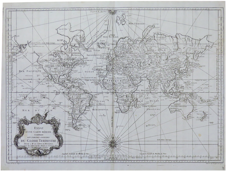
BELLIN (Jacques-Nicolas).
Essay d'une carte réduite, contenant les parties connues du globe terrestre.
1748 [1780]. 500 x 695 mm, replié, sur papier bleuté.
Referentie van de boekhandelaar : LBW-6808
|
|
|
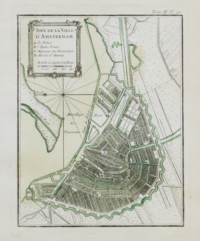
BELLIN (Jacques-Nicolas).
Idée de la ville d'Amsterdam.
[1764]. 217 x 170 mm.
Referentie van de boekhandelaar : LBW-707
|
|
|
BELLIN (Jacques-Nicolas);
L'Isle de Sardaigne.
1764 209 x 167 mm.
Referentie van de boekhandelaar : LBW-694
|
|
|
BELLIN (Jacques-Nicolas);
La Perse.
1764 243 x 354 mm.
Referentie van de boekhandelaar : LBW02517
|
|
|
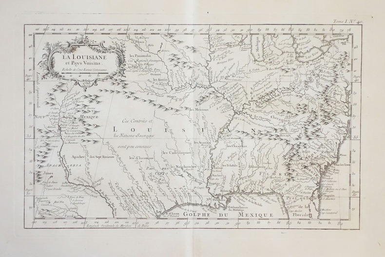
BELLIN (Jacques-Nicolas).
La Louisiane et pays voisins.
1764. 211 x 346 mm.
Referentie van de boekhandelaar : LBW-2387
|
|
|
BELLEFOREST (François de).
La ville, cité, université, & faux-bourgs de Paris.
[Paris, Nicolas Chesneau, 1575]. 422 x 551 mm.
Referentie van de boekhandelaar : LBW-8239

|
|
|
BELLEFOREST (François de).
Le Pourtraict de la Ville de Rouen.
Paris, Nicolas Chesneau, 1575. Gravure sur bois de 40 cm x 33 cm, légende avec lettres et numéros dans la marge inférieure désignant les rues et monuments, texte en français au verso. Très bon état. Sous verre dans un cadre moderne en chêne foncé, 53 x 47 cm.
Referentie van de boekhandelaar : 20642

|
|
|
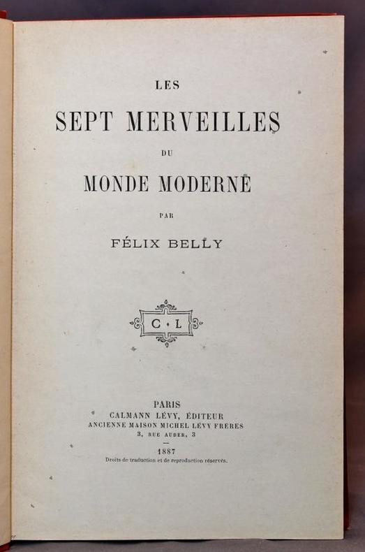
BELLY Félix:
Les sept merveilles du monde moderne.
Paris, Calmann Lévy, 1887. In-8 de VII-185-[3] pages, pleine percaline rouge richement décorée en noir et or.
Referentie van de boekhandelaar : 15670
|
|
|
BELLICAUD (Docteur).-
Nouveau traité de Bridge-Plafond. Edition nouvelle entièrement refondue et considérablement augmentée.
P., Stock, 1931, in 12 broché, 327pp. ; couverture fanée.
Referentie van de boekhandelaar : 30821
|
|
|
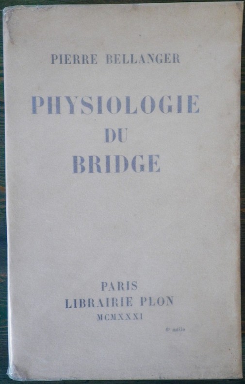
BELLANGER, Pierre
PHYSIOLOGIE DU BRIDGE
Paris Librairie Plon 1931 in 8 (22,5x14) 1 volume reliure demi basane marron à coins, couverture conservée, VIII et 491 pages (reliure signée: P. Ruffel, relieur). Bon exemplaire
Referentie van de boekhandelaar : 15532
|
|
|
BELLANGER (Pierre).
Physiologie du bridge.
P., Plon, 1931, 1 vol. in-8 br. de VIII - 491 pp.
Referentie van de boekhandelaar : 3734
|
|
|
BELLIN (Jacques-Nicolas).
Plan de la ville et port de St. Petersbourg.
[1764]. 212 x 168 mm.
Referentie van de boekhandelaar : LBW-406
|
|
|
BELLIN (Jacques-Nicolas);
Plan de la baye de Gayette.
1764 212 x 175 mm.
Referentie van de boekhandelaar : LBW-695
|
|
|
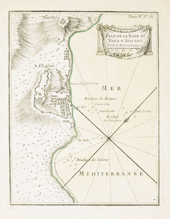
BELLIN (Jacques-Nicolas);
Plan de la rade et ville d'Alicant.
1764 227 x 176 mm.
Referentie van de boekhandelaar : LBW-699
|
|
|
BELLIN (Jacques-Nicolas);
Plan de la baye et port de La Corogne.
1764 212 x 165 mm.
Referentie van de boekhandelaar : LBW-703
|
|
|
BELLIN (Jacques-Nicolas);
Plan de St. Sebastien.
1764 222 x 178 mm.
Referentie van de boekhandelaar : LBW-704

|
|
|
BELLIN (Jacques Nicolas).
PLAN DE ROUEN ET DES ENVIRONS.
S. l., Croisey (graveur), sd. (1764). Plan gravé de 23,5 x 34,5 cm (cuvette), avec de belles marges et rehauts de couleurs.
Referentie van de boekhandelaar : 9372
|
|
|
BELLIN (Jacques Nicolas).
PLAN DE ROUEN ET DES ENVIRONS.
S. l., Croisey (graveur), sd. (1764). Plan gravé de 23,5 x 34,5 cm (cuvette), avec marges.
Referentie van de boekhandelaar : 9375
|
|
|
BELL D'ANTERMONY (Jean) , LANGE (Lorenz)
Voyages entre Saint-Pétersbourg et la Russie, dans divers pays d'Asie.
Paris, Robin, 1766. 3 volumes in-12, veau marbré, dos là nerfs orné (Reliure de l'époque) avec pièce de titre et tomaison , tranches rouges , ex-libris sur le contre-plat , défauts de reliure , coins et coiffes usés , début de fentes aux charnières , etc.
Referentie van de boekhandelaar : PHO-1265

|
|
|
Belen DOMINGUEZ
GRAN CANARIA : Tourist Guide
No marks or inscriptions. No creasing to covers or to spine. A very clean very tight copy with bright unmarked boards and no bumping to corners. 128pp. Very well colour illustrated guide to the Island of Gran Canaria. Very scarce.

|
|
|
Bell, Leonard M.; Kallman, Ronald J.
The Nanaimo River Estuary: Status of Environmental Knowledge to 1976 - Special Estuary Series No. 5
298 pages including index. Compiles all available references relevant to the environmental aspect of the Nanaimo River Estuary. Summarizes pertinent information and provides lists on plant and animal life, to provide readers with some idea of the ecological characteristics. Contents include topics such as: Geology; Economic Geology; Surficial Geology; Climatology; Hydrology; Oceanography; Invertebrate Biology; Invertebrate Fisheries Resource; Flora; Wildlife; Land and Water Use; Pollution; plus an extensive Bibliography. Includes a variety of maps. Report of the Estuary Working Group, Department of the Environment, Regional Pacific Region. Clean and unmarked with moderate wear. Binding sound. A wonderful reference. Book
|
|
|
Bell, Timothy: Editor
Bell's Mile By Mile Alaska Yukon and British Columbia Travel Guide
432 pages including index. All towns and highways described in detail mile-by-mile. Accommodations. Campgrounds. Emergency Services. Ferry Information. City maps. Alaska Railroad. Local History. What to see and do. Underlining and marginalia upon several pages. Very light wear. Attractive colour glossy covers. Please note: fold-out map not included. Book
|
|
|
Bella Terra Maps
Southeastern Lighthouses Map Pack - North Carolina South Carolina Georgia & Florida
NEW. unknown
Referentie van de boekhandelaar : BIB-NOV-15-2025-146694 ISBN : 1888216603 9781888216608
|
|
|
Bellah, James Warner. (Text) Pratt, Fletcher. (Foreword) Palacios, Rafael. (Maps)
THE VALIANT VIRGINIANS.
NY: BALLANTINE BOOKS. Near Fine in Very Good dust jacket. 1953. First Edition. Hardcover. Near fine in a Vg. dj. Barely discernable 2"-inch tear at upper seam of rear panel of dj. A few short edge tears & small chips as well as traces of shelfsoiling to dj. Novel of the Virginia Calvary in the Shenandoah Valley during the Civil War. LR . BALLANTINE BOOKS. hardcover
Referentie van de boekhandelaar : 309567
|
|
|
Bellamy, Joyce and Others
Hampstead Heath Flora : Habitat Handbook No 1
No marks or inscriptions to contents. Faint creasing to front cover. A very clean very tight copy with bright slightly indented front board and no bumping to corners. 60pp. With over 200 habitat maps of Hampstead Heath for different plant species, a detailed index and plant records. Includes seven other tucked-in A4 leaflets on the history and wildlife of Hampstead Heath.

|
|
|
BELLANGER Pierre
Physiologie du bridge
Plon 1931, In-8 broché, viii + 492 pages. Exemplaire non coupé. Petites salissures à la couverture sans gravité. Bon état.
|
|
|
BELLIN JACQUES NICOLAS. CARTOGRAPHER.
Carte De La Baye De Chin-Chew ou Chang-Chew.
Paris. circa1749. Black and white engraved map of Quanzhou and Zhangzhou 21.1 x 30 cm here spelled Chin-chew and Chang-chew and both final words with added superscript "ou" on watermarked laid paper 25.6 x 38 cm original folds a few marginal spots simplified compass rose and a decorative fleur de lis bottom right in very good condition. Attractive map including the estuary of Quanzhou River Xiamen Emowi and Kinmen or Quemoy Quemowi island. The map was designed by the eminent French cartographer Jacques-Nicolas Bellin and here published as plate No. 22 in the impressive 15 volume compilation of voyages "Histoire Generale des Voyages" by Antoine François Prévost. . unknown
Referentie van de boekhandelaar : 136795
|
|
|
BELLIN JACQUES NICHOLAS CARTOGRAPHER.
Carte de L'isle de Cheu-Chan ou Isle de Chusan de la Province de Che-Kiang Avec les Costes et Isles voisines.
Paris. circa1749. Black and white engraved map on watermarked laid paper 20.9 x 32.7cm showing coastal area of Zhejiang Province Province de Che-kiang including Zhoushan Archipelago Isle de Chusan Zhoushan Bay Bay de Chusan and Xiangshan County Siang-chan-luen a walled city outside of upper border Ningbo Ning-po prefecture under Qing administration title cartouche lower left original folds. This map is No. 3 Vol. 6 from the impressive 15-volume "Histoire Generale des Voyages" compiled by Antoine François Prévost. Even browning mainly to the sheet edges in very good condition. . unknown
Referentie van de boekhandelaar : 136826
|
|
|
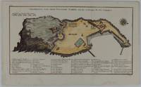
BELLIN JACQUES NICOLAS COMPAGNON PIERRE.
Grundriss von dem Eylande Goree nach den Zeichnungen des Hrn Compagnon.
Leipzig.: Schwabe Johann Joachim. 1748. Engraved map on laid paper 20.5 x 36 cm plate -mark inc. captions 24 x 39 cm sheet size original fold later hand-colouring slight marginal spotting but in very good condition. Fine 18th century ground plan of Gorée Island off the coast of Senegal infamous for its association with slavery. The map shows encampments and forts with a detailed key. Originally published in Abbe Prevost's "Histoire générale des voyages." 1746 -1789 with maps and plans by the great cartographer Jacques-Nicolas Bellin this was prepared for volume two of the the German edition "Allgemeine Historie der Reisen." published in 1748. . (Schwabe, Johann Joachim) unknown
Referentie van de boekhandelaar : 175859
|
|
|
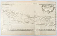
BELLIN, JACQUES-NICOLAS.
Idée de l'Isle de Java tirée des manuscripts Hollandois.
circa1750. Black and white copperplate engraving map of Java a little light even browning neat colour pencil highlighting of rivers and two settlements. Folded as issued. Good copy. 26 x 44cm. Issued in Prevost's Histoire Générale des Voyages ou nouvelle collection de toutes les relations de voyages par mer et par terre. . unknown
Referentie van de boekhandelaar : 136782
|
|
|
Bellin, Jacques-Nicolas
Deuxieme Carte des Isles de la Sonde. Sunda-Inseln; Java, Bali. Borneo... (1760). [Altkolorierter Kupferstich, gerahmt / handcoloured copper engraving, framed].
o.J. [3 Warenabbildungen] (Jacques-Nicolas Bellin, geb. 1703 in Paris, gest. 21. März 1772 in Versailles, französischer Kartograph, Ingenieur-Geog
Referentie van de boekhandelaar : 66108CB

|
|
|
Belling, Lawrence N.
Seychelles : Iles D'amour : Islands of Love (Signed By Chief Minister)
Inscribed on title page from the Chief Minister James R Mancham to Tom Pendry MP. No other marks or inscriptions to contents. No creasing to covers or to spine. A very clean very tight copy with bright cream boards, faint coloured mark to rear and no bumping to corners. 128pp. An account of the Islands of the Seychelles published for the visitor. Very well illustrated. Text in English and French.

|
|
|
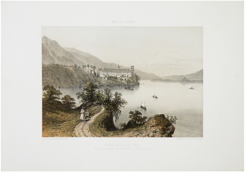
BENOIST (Félix).
[ABBAYE de HAUTECOMBE] Abbaye de Haute-Combe, sur le Lac du Bourget, près d'Aix-les-Bains. (Dép.t de la Savoie).
Nantes, Charpentier, [1864]. 257 x 327 mm.
Referentie van de boekhandelaar : LBW-7184
|
|
|
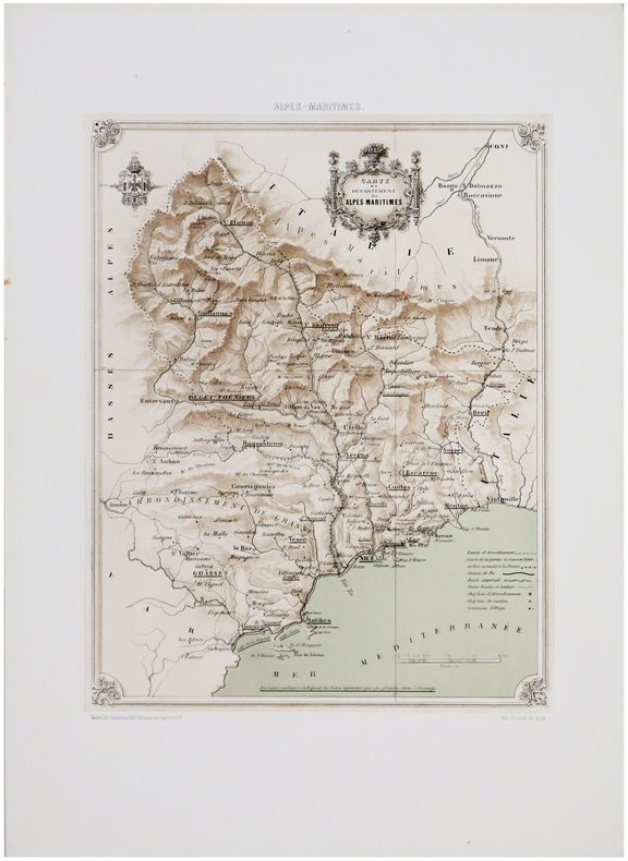
BENOIST (Félix).
[ALPES-MARITIMES] Carte du département des Alpes-Maritimes.
Nantes, Charpentier, [1863]. 350 x 262 mm.
Referentie van de boekhandelaar : LBW-7594
|
|
|
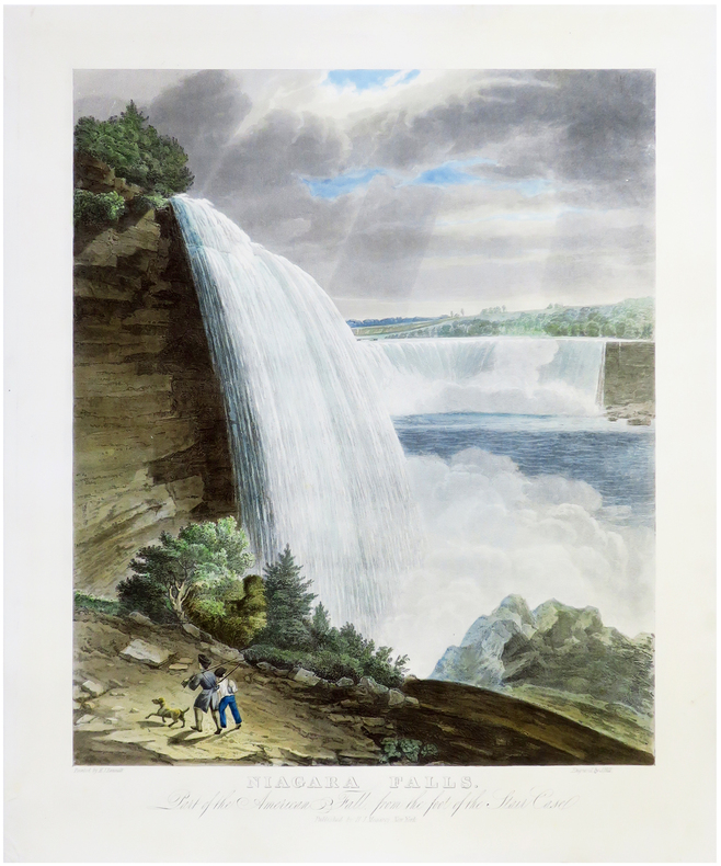
BENNETT (William James).
[CHUTES du NIAGARA] Niagara Falls. Part of the American Fall, from the foot of the Stair Case.
New York, H.I. Megarey, [1829]. 560 x 430 mm.
Referentie van de boekhandelaar : LBW-6825
|
|
|
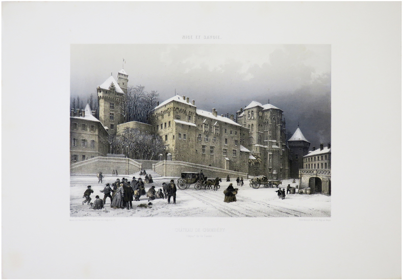
BENOIST (Félix).
[CHAMBÉRY] Château de Chambéry. (Dép.t de la Savoie).
Nantes, Charpentier, [1864]. 248 x 319 mm.
Referentie van de boekhandelaar : LBW-7232
|
|
|
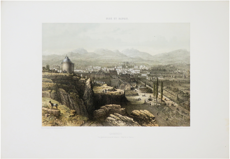
BENOIST (Félix).
[CHAMBÉRY] Chambéry. Vue générale prise de Lémenc. (Dép.t de la Savoie).
Nantes, Charpentier, [1864]. 259 x 313 mm.
Referentie van de boekhandelaar : LBW-7234
|
|
|
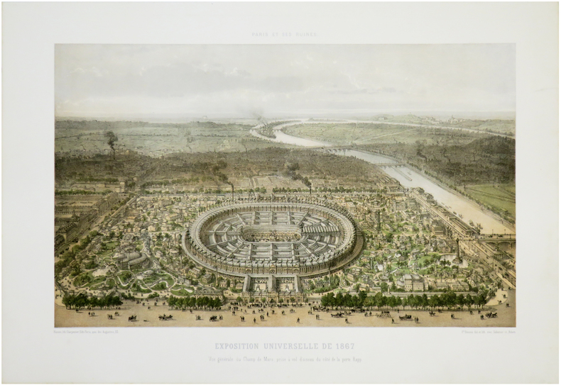
BENOIST (Philippe).
[EXPOSITION UNIVERSELLE] Paris et ses ruines. Exposition universelle de 1867. Vue générale du Champ de Mars, prise à vol d'oiseau du côté de la porte Rapp.
Nantes, Charpentier, [1872]. 287 x 403 mm.
Referentie van de boekhandelaar : LBW-7281
|
|
|
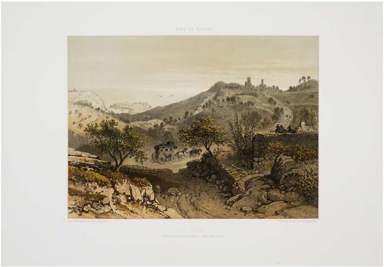
BENOIST (Félix).
[LA TURBIE & MONACO] La Turbie. Route de la Corniche et Monaco. (Alpes-Maritimes).
Nantes, Charpentier, [1863]. 260 x 316 mm.
Referentie van de boekhandelaar : LBW-7536
|
|
|
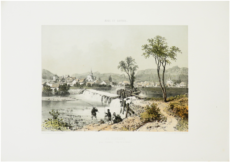
BENOIST (Félix).
[LES ÉCHELLES] Les Échelles, près Chambéry. (Dép.t de la Savoie).
Nantes, Charpentier, [1864]. 262 x 310 mm.
Referentie van de boekhandelaar : LBW-7175
|
|
|
BENOIST (Félix).
[MENTON] Menton (Dép.t des Alpes maritimes).
Nantes, Charpentier, [1863]. 262 x 316 mm.
Referentie van de boekhandelaar : LBW-7555
|
|
|
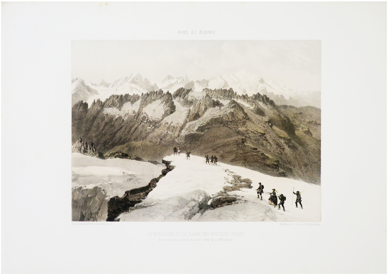
BENOIST (Félix).
[MONT-BLANC] Le Mont Blanc et la chaîne des Aiguilles Rouges. Vue prise du sommet du Buet. (Dép.t de la H.te Savoie).
Nantes, Charpentier, [1864]. 263 x 312 mm.
Referentie van de boekhandelaar : LBW-7182
|
|
|
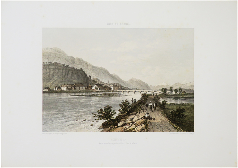
BENOIST (Félix).
[MONTMÉLIAN] Montmélian. Vue prise de la rive gauche de l'Isère. (Dép.t de la Savoie).
Nantes, Charpentier, [1864]. 249 x 312 mm.
Referentie van de boekhandelaar : LBW-7231
|
|
|
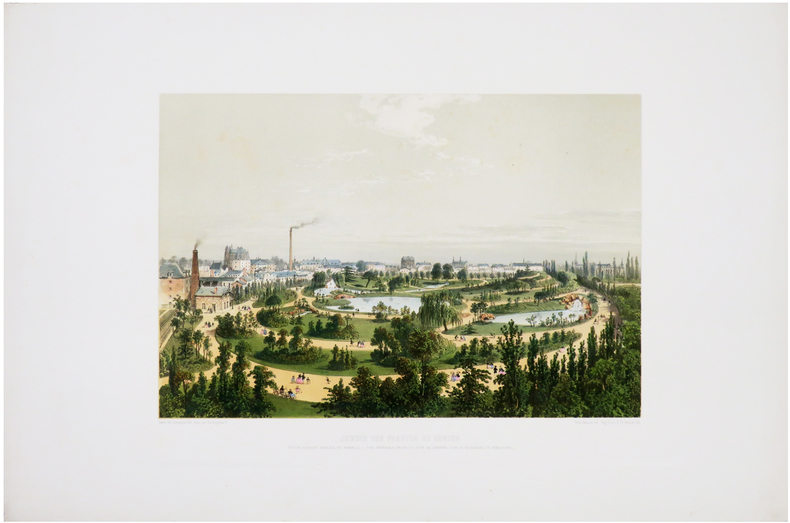
BENOIST (Félix).
[NANTES] Jardin des Plantes de Nantes nouvellement agrandi et embelli. Vue générale prise du côté de l'entrée, sur le boulevard de Sébastopol.
[1860]. 252 x 340 mm.
Referentie van de boekhandelaar : LBW-6518
|
|
|
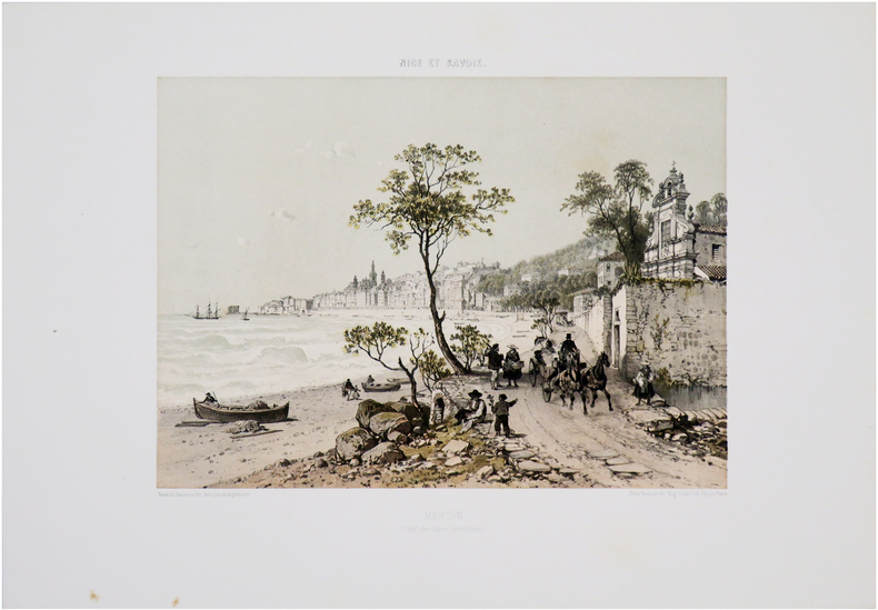
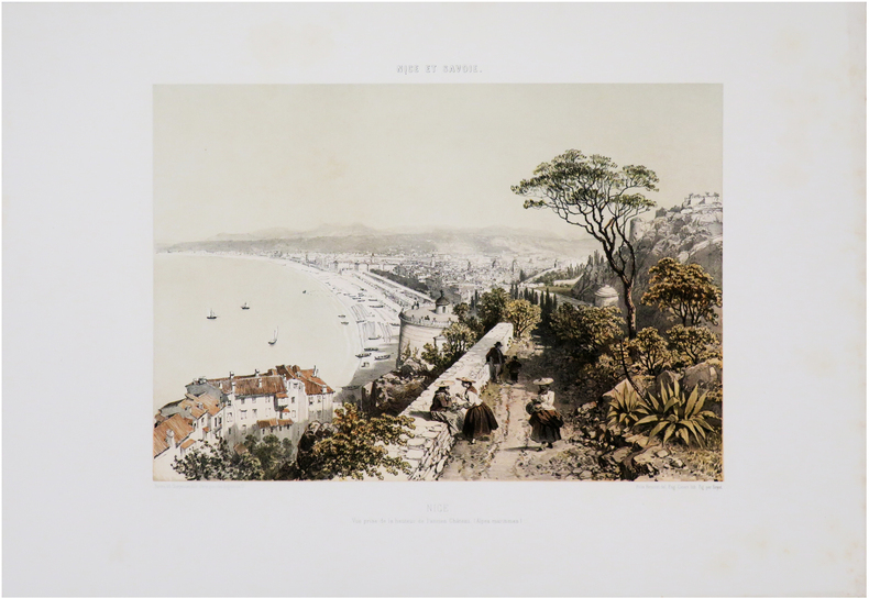
BENOIST (Félix).
[NICE] Nice. Vue prise de l'extrémité du Mont Boron (Dép.t des Alpes maritimes).
Nantes, Charpentier, [1863]. 270 x 321 mm.
Referentie van de boekhandelaar : LBW-7568

|
|
|
BENOIST (Félix).
[NICE] Nice. Vue prise de la hauteur de l'ancien château. (Alpes maritimes).
Nantes, Charpentier, [1863]. 260 x 320 mm.
Referentie van de boekhandelaar : LBW-7587
|
|
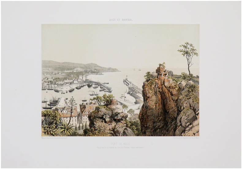
|
BENOIST (Félix).
[NICE] Port de Nice. Vue prise de la hauteur de l'ancien château. (Alpes maritimes).
Nantes, Charpentier, [1863]. 260 x 316 mm.
Referentie van de boekhandelaar : LBW-7591
|
|
|
BENOIST (Félix).
[NICE] Nice. Vue prise de la Villa Venanson (Dép.t des Alpes maritimes).
Nantes, Charpentier, [1863]. 255 x 313 mm.
Referentie van de boekhandelaar : LBW-7592

|
|
 De zoekresultaten per email ontvangen
 Zoekresultaten downloaden als PDF
 RSS feed


