|
Sporrong Ulf, Wennstrom Hans-Fedrik
Maps and Mapping. National Atlas of Sweden
34 cm, rilegatura editoriale, titolo in oro al piatto e al dorso, sovracopertina illustrata; p. 205, numerose illustrazioni e carte geografiche a colori, testo in inglese

|
|
|
SPRUNER, KARL AND MENKE,THEODOR
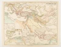
Die Länder des Islâm zur Zeit der Bûjiden 945-1055.
Gotha: Justus Perthes. 1877. Map with original colour and outline hand-colour 32.7 x 40.7 cm four inset maps text in German central fold slight marginal edge wear and spotting to the verso but in very good condition. A handsome map detailing the lands of Islam at the time of the Bujids 945-1055. The inset maps depict a western extension to the main map southern Arabia the lands of the Ghaznavid sultanate in Central Asia and lands of the Eastern Roman/Byzantine Empire issued for the "Hand-Atlas für die Geschichte des Mittelatters und die Neueren Zeit". . Justus Perthes unknown
Referenz des Buchhändlers : 174917
|
|
|
SPRUNER, KARL AND MENKE, THEODOR
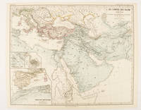
Die Länder des Islâm unter den Abbâsiden bis zur Einnahme von Baghdâd durch die Bûjiden 750 bis 945 n. Ch
Gotha: Justus Perthes. 1877. Map with original colour and outline hand-colour 32.2 x 40 cm three inset maps text in German central fold slight marginal toning in very good condition. A most handsome map detailing the lands of Islam under the Abbasids up to the capture of Baghdâd by the Bûjids from 750 to 945 AD. The inset maps depict Northern Iraq Baghdad and a western continuation of the main map issued for the "Hand-Atlas für die Geschichte des Mittelatters und die Neueren Zeit". . Justus Perthes unknown
Referenz des Buchhändlers : 174913
|
|
|
SPRUNER, KARL AND MENKE,THEODOR
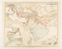
Die Länder des Islâm von der Hegra 622 n. Ch. bis zum Sturze der Umaijaden 750 n. Ch.
Gotha: Justus Perthes. 1877. Map with original colour and outline hand-colour 33.1 x 40.2 cm four inset maps text in German central fold slight marginal edge wear and spotting to the verso but in very good condition. A handsome map detailing the lands of Islam from Hegra in AD 622 to the fall of the Umayyads in AD 750. The inset maps depict a western extension to the main map and city plans for Damascus Jathrib & Medina and Mecca issued for the "Hand-Atlas für die Geschichte des Mittelatters und die Neueren Zeit". . Justus Perthes unknown
Referenz des Buchhändlers : 174916
|
|
|
SPRUNER, KARL AND MENKE, THEODOR
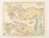
Lateinische Herrschaften im Orient 1210 bis 1311
Gotha: Justus Perthes. 1876. Map with original colour and outline hand-colour 32.2 x 40 cm seven inset maps text in German central fold slight marginal toning in very good condition. A most handsome and highly detailed map detailing provinces of the Latin Empire in the wake of the Crusades. The inset maps depict Achaia in Greece Divisions of the Empire and a city plan of Constantinople issued for the "Hand-Atlas für die Geschichte des Mittelatters und die Neueren Zeit" . Justus Perthes unknown
Referenz des Buchhändlers : 174910
|
|
|
SPRUNER, KARL AND MENKE,THEODOR
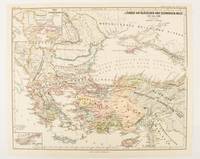
Länder am Ägäischen und Schwarzen Meer 1311 bis 1390.
Gotha: Justus Perthes. 1877. Map with original colour and outline hand-colour 32.2 x 40 cm two inset maps text in German central fold in very good condition. A most handsome map detailing countries on the Aegean and Black Seas 1311 to 1390. The inset maps depict the kingdom of Stephan Duschan Serbia and the land of the Crimean Goths issued for the "Hand-Atlas für die Geschichte des Mittelatters und die Neueren Zeit". . Justus Perthes unknown
Referenz des Buchhändlers : 174915
|
|
|
ST BRIEUC
Cartes d'Etat major type 1889 : St Brieuc - St Brieuc S-E
2 cartes 34x53 cm.
|
|
|
ST. PETERSBURG - COLLINS, WILLIAM.
St. Petersburg.
London, Glasgow & Edinburgh ca. 1870. Coloured lithograph showing a bird's eye view of the city. 22 x 28 cm. Framed and matted.
|
|
|
Stacey, Col CP; GWL Nicholson; CCJ Bond (Illust & Maps); C P G W L C C J
Official History of the Canadian Army in the Second World War Complete in Three Volumes
Ottawa Ontario Canada: Pubished by the Authority of the Minister of National Defence Roger Duhamel Queen's Printer and Controller of Stationery 1956-1960. Hardcover. pp. xiii 629; xv 807; xiii 770. Thick Royal 8vo's. Uniformly bound in bright red cloth over boards gilt lettering to the spines and armorial device embossed to the centre of the front boards; map endpapers. Replete with many black-and-white and colour maps including many fold-out photographs illustrations portraits et al. Excepting some light bumping to the spine ends the extremities remain remarkably well-preserved with no additional detectable flaws contents remain equally and uniformly without blemish with bright clean and unmarked pages and tight sound bindings; about fine with each housed in light shelfworn dustjackets now in protective mylar covers. Overall very good to near fine. <br/><br/> Pubished by the Authority of the Minister of National Defence | Roger Duhamel, Queen's Printer and Controller of Stationery hardcover
Referenz des Buchhändlers : 7943
|
|
|
Staff
Bulletin of the Pan American Union Volume 43
Vol. XLIII , July - December 1916, Nos. 274 - 279, 816 pages, with a great many b&w photos throughout. Includes trade, travel, industrial, agricultural, export, census, building data, etc. for the Latin and South American countries: Argentina, Bolivia, Brazil, Central America, Chile, Columbia, Costa Rica, Cuba, Ecuador, Dominican Republic, Guatemala Haiti, Honduras, Mexico, Nicaragua, Panama, Paraguay, etc.
|
|
|
Staff
Edwards Lithoprinted Facsimiles: Series A Document of the American Revolution Parts 1,2,3,4,5,6
Six folders each with hard plastic protective folders within, containing 5 - 20 loose leaf documents each reproducing original documents of the American revolution. Parts 1 - 6, each a separate folder, contain documents of Lexington & Concord, The tragedy of the playwright general, 20,000 pounds for West Point! the plot that failed, Amenities of Yorktown, American vs. the British, Women of the revolution. Letters, maps, edicts, etc.

|
|
|
Staff
Kelly's Post Office Directory Map of London
Red folder with some shelf wear, a few small stains, small tear at lower spine with four maps of London for the North Western Section, South Western Section, North Eastern Section and South Eastern Section. Each map is 38 x 31" (96cm X 80cm) and all are in excellent condition, showing little to no wear. Street maps are printed in half mile squares with postal districts outlined in orange. No date.

|
|
|
Staff of Franklin Maps
Metro Street Atlas of Chester County in Pennsylvania by Staff of Franklin Maps
Franklin Maps. Very Good. Franklin Maps; King of Prussia 1998. Softcover. A Very Good some handling/scuff marks to covers crease bottom rear cover corners binding solid and sturdy trace edge/corner wear a nice clean and unmarked copy in Oversize stapled Wraps. 4toquarto or approx. 9.5 x 12 inches approx. 151pp. 71 large scale maps 10300 streets indexed with zip codes and 1150 cultural features indexed with telephone numbers. We pack securely and ship daily with delivery confirmation on every book. The picture on the listing page is of the actual book for sale. Additional Scans are available for any item please inquire. Franklin Maps paperback
Referenz des Buchhändlers : SKU1023409

|
|
|
Staff of Heligan Gardens Ltd
The Lost Gardens of Heligan Handbook
No marks or inscriptions. Small crease to upper corner of rear cover. A very clean very tight copy with bright unmarked boards and no bumping to corners. 73pp. The essential guide to the Gardens & wider estate near St Austell in Cornwall.

|
|
|
Staff; Office of Technology Assessment
Effects of Nuclear War, The
Book is in excellent condition with very bright red covers, gilt print at spine. Binding is solid and square, covers have sharp corners, exterior shows no blemishes, text/interior is clean and free of marking of any kind. Dust jacket has one 1/2" tear, a little edge wear. Previous owner's name at front endpaper. Contents include: A nuclear weapon over Detroit or Leningrad: a tutorial on the effets of nuclear weapons, Civil defense, Three attack cases, Other long-term effects, with six apendices. Lots of great graphics: maps of Detriot and Leningrad with bomb graphics over them showing PSI ratings, for instance, surface burst, air burst, casualty counts, terrorist weapon senario, radioactive graphics over Lake Erie, fireball, breakaway, shock front, Mach front, fallout, thermonuclear ground burst, lots of great stuff we can thank the Pentagon for: making us safer!

|
|
|
Stanford's Library & Commercial Maps
A Map of the Countries Between Constantinople and Calcutta Including Turkey in Asia Persia Afghanistan and Turkestan
Edward Stanford. Good. . This is a large folding coloured linen backed map. Map is clean with minimal wear. No copyright date is given. Edward Stanford unknown
Referenz des Buchhändlers : mon0003321896
|
|
|
Stanford's Library Maps
LONDON ATLAS MAP OF CAPE OF GOOD HOPE & THE ORANGE FREE STATE
London: Edward Stanford. Hard Cover. Very Good binding. Engraved on Copper Plates in the Finest Style of the Art; "Property of M.I.D. G-2" stamped in atlas. No markings on fold-out map. Red cloth covers with beige title label. Light edgewear to head and tail of spine.Hardcover with Fold-out Map. Very Good binding. Edward Stanford unknown books
Referenz des Buchhändlers : 228477

|
|
|
STANFORD'S MAP OF EAST DEVON
Stanford's Map of East Devon. [Scale One Inch to One Statute Mile.] FINE COPY AND A RARE SURVIVAL
8vo., folding coloured map on cloth measuring 28 x 34 inches (approx. 71 x 86 cms) folding in 32 panels to 7 x 4.5 inches (approx. 18 x 12 cms); strongly bound in burgundy cloth, upper board lettered in gilt, marbled endpapers, a near fine copy. VERY SCARCE IN THIS CONDITION.
|
|
|
Staniland, L. N.
THE PRINCIPLES OF LINE ILLUSTRATION. With Emphasis on the Requirements of Biological and other Scientific Workers.
pp. frontis, xii, 212. Nearly two hundred line illustrations. 8vo. Original full cloth binding. Original dust jacket. Chipped. ART 1
|
|
|
Stanley, Arthur Penrhyn.
LECTURES ON THE HISTORY OF THE JEWISH CHURCH. Part I. Abraham to Samuel. With Maps and Plans.
pp. xl, 572 + Plus two folding maps and two plans. Bookplate of Rev. L(uther) A. Gotwald, theological educator and author. Quarto. Original full cloth binding, gold lettered spine. Head of spine chipped with loss. Hardbound. First Series. JUDAICA BOX 1
|
|
|
Stanley, Arthur Penrhyn.
SINAI AND PALESTINE IN CONNECTION WITH THEIR HISTORY. Tenth Thousand. With Maps and Plans.
pp. lviii, 560, 32 [Publisher's catalogue] + Seven colored folding maps and five woodcut maps. Foxed. Offsetting from folding maps. Frontis folding map slightly torn at margin. Slight damp staining last signature. Bookplate of John D. Zimmerman. Large 8vo. 9 x 5 1/2 inches. Original full dark blue publisher's cloth binding. Gilt lettered spine. Bottom corner of front and rear boards damp stained. Hardbound. Arthur Penrhyn Stanley (1815-1881) was an English churchman, Dean of Westminster. He was a 'Broad Churchman' and was the author of various works on Church History. **PRICE JUST REDUCED! JUDAICA BOX 1
|
|
|
Stanley, Henry Morton (1841-1904).
IN DARKEST AFRICA. Or The Quest, Rescue, And Retreat Of Emin Governor Of Equatoria. With Two Steel Engravings, And One Hundred And Fifty Illustrations And Maps. In Two Volumes.
Two Volumes + Plus portrait frontis. Illustrated with steel engravings. Lacks pocket maps. Damp stained. XLib. Original marble boards repaired with black tape. Worn. AFRICA/5
|
|
|
Stannard, Dorothy (editor)
Tunisia Insight Guide
No marks or inscriptions. No creasing to covers or to spine. A very clean very tight copy with bright unmarked lightly indented boards and no bumping to corners. 344pp. With descriptions of the culture, history and tourism of the North African country this travel book takes the reader into some of its lesser known delights as well as the sand and sea tourist spots.

|
|
|
Stark, James H.; Maps, Engravings, Photo-Prints (Illustrator)
Stark's Illustrated Bermuda Guide; Containing a Description of Everything on or About These Places of Which the Visitor or Resident May Desire Information
Boston / London: James H. Stark Publisher 1902. Hardcover. Very Good. 12mo 6.75 - 7.75'' tall. Hardcover. Book Condition: Very Good. James H. Stark Publisher Boston / London 1902. Ads 158 pages. Nice Firm Clean copy ! Light general wear. With a lovely folding map! Size: 12mo 6.75 - 7.75'' tall. Travel::Antique History::Localities Maps 6272 6272 James H. Stark Publisher hardcover
Referenz des Buchhändlers : 127907
|
|
|
STE MAURE
Carte couleurs au 1/100 000?. Feuille XIII-20.
Une feuille 57x45 cm.
|
|
|
Steele, Matthew Forney.
AMERICAN CAMPAIGN. In Two Volumes. Volume I - Text. Volume II - Maps.
Two volumes. Volume I text and Volume II maps. A few maps in Volume II torn. Both Volumes XLib. Given by the estate of William G. Price, Jr. Lieutenant General Commander of the Pennsylvania National Guard to PMC Lt. William J. Wolfgram Memorial Library. Sm. 4to. Original quarter leather over cloth covered boards. Spine on volume II very worn. Boards very fragile. Hardbound set. SHELF W21
|
|
|
Stembridge, Jasper H.
North America and Asia
12mo, approximately 310 pages, illustrated with many maps and plates. Former School Library copy. Edges are browned. eng
|
|
|
STEROSCOPE CARDS -
South African War through the Stereoscope. Vol. I-II.
Washington, Underwood & Underwood, 1900 - 1901. 72 stereoscope card (177 x 90 mm) housed in the original book-like slipcase. Slipcase with wear. Cards fine and clean.
|
|
|
Steury, Donald P.; Cirillo, Roger (editor)
The Intelligence War (World War II Chronicles Series)
128 pages including index. Black and white illustrations throughout. From signals intelligence and code-cracking breakthroughs to the daring exploits of agents in the field, this work vividly chronicles the covert activities that comprised the secret war of 1939 through 1945. Written by intelligence expert Donald P. Steury, illustrated with full-color maps and period photographs, and featuring an introduction by series editor and respected WWII historian Lt. Col. Roger Cirillo, United States Army, Retired, this evocative history provides an insightful account of the significance of intelligence during World War II. Clean, bright and unmarked. Very light wear. Excellent copy. Book
|
|
|
Steve Smith
Manchester Real Ale Pub Guide
No marks or inscriptions. No creasing to covers or to spine. A very clean very tight copy with bright unmarked boards and no bumping to corners. 72pp. A real ale pub guide to supping in the city of Manchester and beyond. Very scarce.

|
|
|
Steven Cartes, Julia Sokol
Ces hommes qui ont peur d'aimer
Used - Good. Pages intact with minimal writing/highlighting. The binding may be loose and creased. Dust jackets/supplements are not included. Stock photo provided. Product includes identifying sticker. Better World Books: Buy Books. Do Good. unknown
Referenz des Buchhändlers : 3869516-6 ISBN : 2894300026 9782894300022
|
|
|
Stewart, Robert Walter [Roberto Gualtiero]
The Tent and the Khan: A Journey to Sinai and Palestine.
RARE illustrated account of a travel from Cairo to Damascus undertaken by a Scottish traveler and pastor Robert Walter Stewart (also called Roberto Gualtiero, 1812-1887), who was an important figure in Italian Protestantism and author of several books, among them "On the present condition and future prospects of the Waldensian Church, in Lectures on Foreing Churches delivered in Edinburgh and Glasgow" (Edinburgh, 1845), and "An Italian campaing, or Evangelical movement in Italy, 1845-1887" (London, 1890). The book features a frontispiece, additional 15 b&w illustrations and a large fold-out map of the Sinai peninsula. 220x150mm. XVI+528 pages (+ 8 advertisement pages). Quarter-cloth rebound Hardcover. Spine dirty. Spine edges slightly bumped. Ex libris sticker on front end-paper upper corner. Previous owner's name written in ink on title page upper corner/edge. Map inner edge bear binding slightly torn. Title page and page III/IV coming loose. Page XIII/XIV detached from binding (but present). Pages yellowing and slightly wavy. [SUMMARY]: Save for some light wear, this rare and beautifully illustrated travel account is in good condition.
|
|
|
STIELER, ADOLF; STUPNAGEL, FREDERIC VON AND BERGHAUS HERMANN
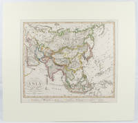
Asia.
Gotha.: Perthes Justus. Circa1855. Engraved map 44.1 x 36.3 cm sheet size 35.8 x 29.7cm map size plate mark map with original hand colouring and hand coloured key noting Islamic "Mohammedanische" Buddhist "Buddhaistische" and European territories by country. Unusual map in an early issue. It was included as map 39 in Stieler's "Hand-Atlas uber alle Theile der Erde und uber das Weltgebaude by Frederic von Stulpnagel" revised by Hermann Berghaus in 1855. The issue is noted to the top right: Ausg. in 63BI. no XIV. Fine outline hand colouring denotes territories by religion and Chinese ports open to European trade and Japanese ports open to American trade. . Perthes, Justus. unknown
Referenz des Buchhändlers : 173439
|
|
|
Stieler, Ad[olf]
Die bekannteren Höhen über der Meeresfläche in transparenten Profilen. Nach der geograph. Lage geordnet, mit Andeutung des Zusammenhanges u. der Entfernung vom Auge. Ein Versuch v. Ad. Stieler 1822. Handkolorierter Kupferstich
Neu berichtigte Auflage von Herm. Berhaus 1854. Bildausschnitt: 29x36 cm, Blattgrösse: 36,5x45 cm, gefaltet, in den Faltungen etw. rissig, Unterkante m. kl. Einriss, fingerfleck.
Referenz des Buchhändlers : KART0141
|
|
|
STIELER, Adolf.
Adolf Stieler's Handatlas über alle Theile der Erde und über das Weltgebäude.
Gotha, Justus Perthes, s.a. (1902). Gran Folio; 4 h. con portada e Índice, 95 mapas a doble página en color, y 201 pp. de Índice alfabético de nombres. Encuadernación de época en media piel con puntas.
|
|
|
Stier, Hans Erich (ed); Aner, Ekkehard (ed.); Georg Westermann Verlag
Westermanns Grosser Atlas zur Weltgeschichte Vorzeit, Altertum, Mittelalter, Neuzeit
Folio in light blue cloth with gilt-stamped titles; xx, 170, 80 pages maps (chefly color) 30 cm In German. Maps beautifully printed in many colors. / Historical geography -- Maps. Historical geography. Atlas Weltgeschichte Maps. Maps. Cartes gÈographiques.Cartography / **A large book. Extra shipping charges may apply for international & expedited orders. Please inquire.**
|
|
|
Stillman, Norman A .; Quentin Fiore, Endpaper Maps; Adrianne Onderdonk Dudden, Jacket Design [Illustrator]
The Jews of Arab lands: A history and source book
Jewish Publication Society of America 1979-01-01. Hardcover. New. In shrink wrap. Looks like an interesting title! Jewish Publication Society of America hardcover
Referenz des Buchhändlers : Q-0827601166 ISBN : 0827601166 9780827601161
|
|
|
Stiltz, Thomas
The Washington Collection: Twelve Lithographic Prints By Thomas Stiltz: Portfolio One
Twelve full-page colour prints in a rigid portfolio folder. Presentation plate to Tom Pendry (now Lord Pendry) inside front cover. No marks or inscriptions and no creasing to covers. Very clean prints in unmarked portfolio. 14pp. Photographic images of the USA Capital City including the White House, the Washington Monument, the Lincoln and Jefferson Memorials, the ceiling of the Capitol Rotunda, the Supreme Court building and the National Gallery of Art. Scarce in the UK.

|
|
|
STIRLING, Major J D P & OXLEY, Trooper S (Illus/Maps)
The First and the Last: The Story of the 4th/7th Royal Dragoon Guards: 1939-1945
Art & Educational Publishers 1946. Octavo black buckram boards gilt lettering to spine gilt military insignia to front board frontispiece xv 192pp illus/photos VG light bruising to extrems sl chafing to boards light tanning & foxing to page edges & eps occasional light soiling throughout Art & Educational Publishers 1946 hardcover
Referenz des Buchhändlers : 351255
|
|
|
STOCKHOLMS KARTOR (Maps of Stockholm).
6622
Jacket not in perfect condition but book is in pristine condition. unknown
Referenz des Buchhändlers : Landell, Nils-Erik
|
|
|
Stokes, Adrian
Venice : An Aspect of Art
Label removal mark inside rear board. No other marks or inscriptions to contents. No creasing to covers or to spine. Clean tight pages with dusty marked boards and page edges, sunned spine and bumping to front corners. 72pp. A history and description of Venice and its buildings with forty-eight black and white photographic plates.

|
|
|
Stovel Company Limited
Stovel's Map of Alberta
Wonderful 1922 colour map of Alberta "showing the complete railroad system in detail, and accurately locating all towns, post offices, railroad stations, etc. Provincial constituencies are outlined. Verso provides a detailed index of towns and post offices, some of which are indicated to lie along the CPR or CNR. 78 x 61cm. Folds down to 17 x 11.4 cm inside publisher's beige card covers. Unmarked with moderate wear. Few tiny openings to periphery of map and a 5cm opening along fold in upper left corner. A quality example of this fascinating representation of Alberta a century ago. Book

|
|
|
Strache, Dr Wolf
Die Eifel Mit Einer Einfuhrung
No inscriptions or marks. A very clean tight copy with bright unmarked boards, bumping to bottom of spine and no bumping to corners. Dust jacket not price clipped with small nicks to edges and signs of handling. 64pp. Black & white photographs with separate detailed captions in the text part of the book.

|
|
|
Straub, Georg (1805-1877)
La ChÛte de l'Aar à la Handeck.
O.O., um 1835. Aquatinata von Lukas Weber (1811-1860). Bildgrösse: 17,3 x 24,1 cm. Blattgrösse:22,2 x 18,8 cm. + Wichtig: Für unsere Kunden in der EU erfolgt der Versand alle 14 Tage verzollt ab Deutschland / Postbank-Konto in Deutschland vorhanden +, Abb.
Referenz des Buchhändlers : 626DG

|
|
|
Straub, Georg (1805-1877)
Les Bains de Rosenlaui au pied du Glacier de même nom.
O.O., um 1835. Aquatinata von Lukas Weber (1811-1860). Bildgrösse: 13,1 x 17,4 cm. Blattgrösse:17,5 x 22,9 cm. + Wichtig: Für unsere Kunden in der EU erfolgt der Versand alle 14 Tage verzollt ab Deutschland / Postbank-Konto in Deutschland vorhanden +, Abb.
Referenz des Buchhändlers : 623DG

|
|
|
Straub, Georg (1805-1877)
Staubbach dans la vallée de Lauterbrounen.
O.O., um 1835. Aquatinata von Lukas Weber (1811-1860). Bildgrösse: 13,1 x 17,3 cm. Blattgrösse:17,3 x 22,1 cm. + Wichtig: Für unsere Kunden in der EU erfolgt der Versand alle 14 Tage verzollt ab Deutschland / Postbank-Konto in Deutschland vorhanden +, Abb.
Referenz des Buchhändlers : 625DG

|
|
|
Streetwise Maps
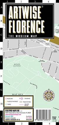
Artwise Florence Museum Map - Laminated Museum Map of Florence Italy
Streetwise Maps 2004-03-01. Map. Good. 0.1300 in x 8.3000 in x 4.0400 in. Streetwise Maps unknown
Referenz des Buchhändlers : mon0000832965 ISBN : 0935039376 9780935039375
|
|
|
Streetwise Maps
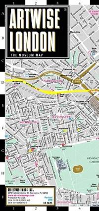
Artwise London Museum Map - Laminated Museum Map of London England
Streetwise Maps. Used - Very Good. Very Good condition. Laminated map. A copy that may have a few cosmetic defects. May also contain light spine creasing or a few markings such as an owner’s name short gifter’s inscription or light stamp. Streetwise Maps unknown
Referenz des Buchhändlers : D10P-00951 ISBN : 0935039406 9780935039405
|
|
|
Streetwise Maps
Artwise Manhattan Museum Map - Laminated Museum Map of Manhattan NY
map. Good. Access codes and supplements are not guaranteed with used items. May be an ex-library book. unknown
Referenz des Buchhändlers : 0935039236.G ISBN : 0935039236 9780935039238

|
|
|
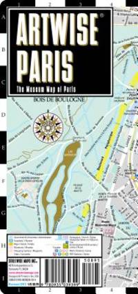
Streetwise Maps
Artwise Paris Museum Map - Laminated Museum Map of Paris FR
StreetWise 2007-12-27. map. New. 4.00x0.25x8.75. Buy with confidence. Excellent Customer Service & Return policy. StreetWise unknown
Referenz des Buchhändlers : DADAX0935039392 ISBN : 0935039392 9780935039399
|
|

 Per e-mail erhalten
 Als pdf-Dokument herunterladen
 RSS feed
 Permanenter link


