|
|
|
Dard, Antoine
Chez les ennemis d'Israël. Amorrheéns - Philistins. Hors texte, Cartes et Illustrations.
Paris, Victor Lecoffre 1906. (6) 331 (2) Seiten, mit mehreren Abbildungen auf Tafeln, Kl. 8° (17,5 x 12 cm), Priv.-Halbleineneinband.
書籍販売業者の参照番号
: 40636

|
|
|
Dardanellen.
Hellespont ou Detroit des Dardanelles pour servir de renseignement a la Carte des Limites des trois Empires ou Théatre de la Guerre presente 1788. [Paris], o. Dr., 1788.
Gest., alt ankolorierte Karte, Plattenmaß 645:295 mm (Blattmaß 666:340 mm). Unter Passepartout (800:455 mm). Zeigt die 65 Kilometer lange Meerenge der Dardanellen zwichen Ägäis und Marmarameer. Vier zusätzliche kleine Pläne (je 75:54 mm) zeigen "Les Forts des Dardanelles armes in Guerre", nämlich den "nouveau chateau d'Asie construit en 1658", den "nouveau chateau d'Europe construit en 1658", den "vieux chateau des Dardanelles en Asie" sowie den "vieux chateau d'Europe ou Dardanelle". 1788 trat Österreich in den Russisch-Türkischen Krieg ein. - Mit zeitgenössischem grünem Grenzkolorit. BM Cat. Maps 43980 (4).

|
|
|
Darlington, William.
FLORA CESTRICA. An Herborizing Companion for the Young Botanists of Chester County. Third Edition.
pp. 598 + Colored Map. XLib. (withdrawn). Some foxing and damp stain. Original full leather binding. Front board and spine almost detached. Early ownership of J.G. Getchell. William Darlington (1782-1863) was a Chester County physician and botanist, and a member of the U.S. House of Representatives from PA. He became a botanist at an early age, studied medicine, and graduated from the medical department of the University of Pennsylvania at Philadelphia in 1804. He went to the East Indies as ship's surgeon in 1806. He returned to West Chester in 1807 and was a practicing physician there for a number of years. He raised a company of volunteers at the beginning of the War of 1812 and was major of a volunteer regiment. Darlington was elected as a Democratic-Republican to the Fourteenth Congress; the Sixteenth; and the Seventeenth Congresses. He was appointed canal commissioner in 1825, and served as president of the West Chester Railroad. He established a natural history society in West Chester in 1826 and published several significant works on botany and natural history. Sabin 18596. The best edition. PA22
|
|
|
Darvill, Fred T; b/w Maps [Illustrator]
North Cascades Highway Guide
Reliance Printers 1973-01-01. Paperback. Good. Good condition with some wear to cover. Reliance Printers paperback
書籍販売業者の参照番号
: 20-28357
|
|
|
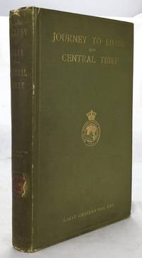
Das, Sarat Chandra (edited By WW Rockhill; Frontispiece Photo of Author, 2 Large Folding Maps, 4 Folding Color Plans [Illustrato
Journey to Lhasa and Central Tibet
John Murray 1/1/1902. Stated 2nd Edition revised. Hardcover. Good. Bound in publisher's green cloth. Gilt lettered and stamp of the Royal Geographical Society on front cover. Library stamps and markings. 285 pages. 34 illustrations and maps 6 of which are folding. Large color map of Tibet at rear. Many of the plates are stamped with library stamps on blank side. <br> Sarat Chandra Das 1849-1917 was a Bengali scholar of Tibet. Das has been described as "a traveler explorer.linguist a lexicographer an ethnographer and an eminent Tibetologist." Das was also a British spy. Born in Chittagong Das trained as an engineer in Calcutta. He became headmaster of the Bhutia Boarding School in Darjeeling. Bhutia was a school for Sikkimese and Tibetan boys many of who would be trained to fill a special place in the British colonial regime the role of a Pundit. Das became a "pundit" and an instructor at the school for British intelligence. Pundits acted as a network of British-trained operatives who were tasked to make inroads in the foreboding inner regions of Asia where white embassies could not gain entry. Tibet and other inland areas were increasingly gaining attention from competing British Russian and Chinese economic and strategic interests. Derek Waller speculates that the character of Huree Chunder Mookerjee in Kipling's Kim was based on Das p.193. As a teacher Das learned Tibetan to speak with his students. He read the limited books on the region available notably of Bogle 1773-5 and Manning's travels 1811 to Tibet. Manning and Bogle were the last successful British explorations of Tibet a nation who steadfastly resisted western intrusion. Das's language ability secured him entry with his colleague Lama Ugyen Gyasto to Tashilhunpo monastery in 1879 as the Prime Minister wished to learn Hindi from him. In 1881 Das returned to Tashilhunpo and made his way to Lhasa Sakya and the Tsangpo River. There he met with Thupten Gyatso the 13th Dalai Lama d. 1933 and returned to Darjeeling with a Yak loaded with over 200 Tibetan manuscripts. After Das was revealed to be a British agent Tibetan authorities increased restrictions on travelers and the Minister who had sponsored his entry was put to death. What makes Das's expedition so interesting is that he successfully brought back a wealth of information on an unknown land to the larger world. The Tibet that Das glimpsed is now gone with the passage of history and the destructive forces of modernity and Chinese domination. This book compiles the story of Das's journey his reports photographs diagrams ethnographic observations etc of a lost Tibet. Das went on to become an important Tibetan scholar and author an extensive multi-volume dictionary. The British would not successfully return to Tibet until 1903-4 with Colonel Francis Edward Younghusband's exhibition invasion and massacre of ~5000 Tibetans. Significantly Younghusband was the President of the Royal Geographical Society which notably published the 1902 edition of Das's book. An interesting and dark connection to Das's legacy. Ref: Derek Waller's The Pundits: British Exploration of Tibet and Central Asia. University Press of Kentucky 1990 pp. 193-209. Also Samanth Subramanian's superb piece in the New York Times Magazine March 20 2016 p. MM61. Peter Hopkirk The Great Game: The Struggle for Empire in Central Asia Kodansha 1992. Yakushi D55 Yakushi D356. Marshall 1459 John Murray hardcover
書籍販売業者の参照番号
: 1607050057
|
|
|
DAUSSY (Pierre).
[MARSEILLE & PIOMBINO] Carte des côtes de la mer Méditerranée. Partie comprise entre Marseille et Piombino.
[Paris], Dépôt-Général de la Marine, 1832. 605 x 885 mm.
書籍販売業者の参照番号
: LBW-8314

|
|
|
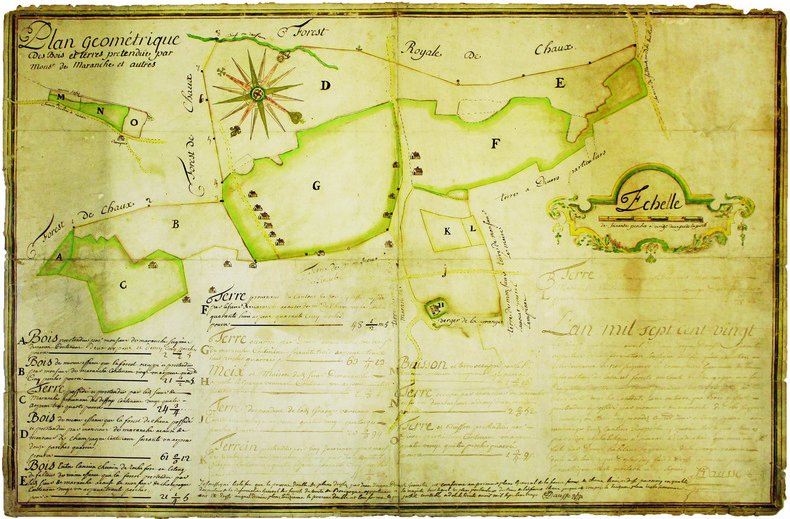
DAUSSE (Jean-Jacques). MANUSCRIT.
Plan géométrique des bois et terres prétendue par Monsr de Maranche et autres.
1720. 510 x 778 mm, monté sur toile.
書籍販売業者の参照番号
: LBW-4140
|
|
|
DAUPHINÉ par Paul VEYRET, R. AVEZOU, R. FERNANDAT, P. VAILLANT ...
Visages du Dauphiné. Richement documenté (héliogravures, planches en couleurs, figures, cartes).
Paris, éd. Horizon de France 1949. Bel exemplaire broché, pet. in-4 carré, 207 pages + planches.
書籍販売業者の参照番号
: AUB-4575
|
|
|
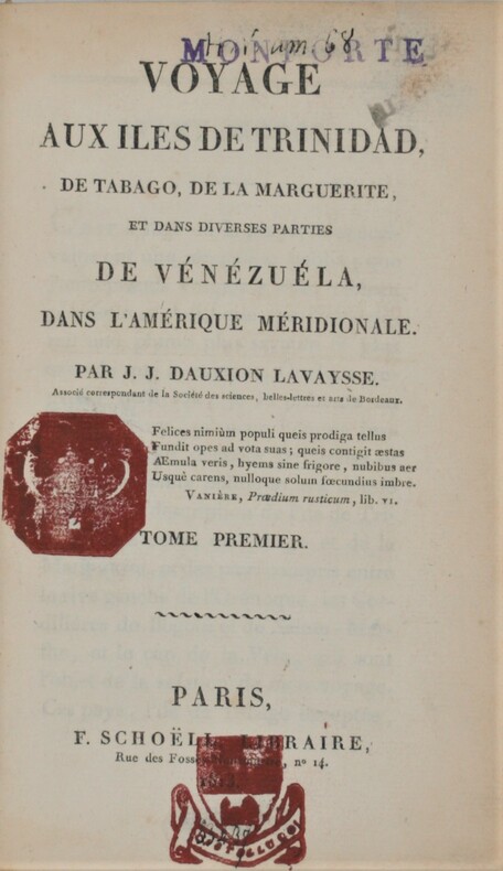
Dauxion-Lavaysse , Jean-Joseph
Voyage aux îles de Trinidad, de Tabago, de la Marguerite et dans diverses parties de Vénézuéla, dans l'Amérique méridionale.
Paris, F. Schoëll, Libraire, 1813. In-8 (20,5 x 13,5 cm),XXVI-411 pp.,3ff-480pp-4ff (table et errata), illustré de 3 cartes déplantes et 5 tableaux dépliants .Reliure de l'époque demi-basane havane, dos lisse orné, manque au dos ,un plat détaché ,charnières faibles, cachets répétés, déchirure au pli à 1 carte. Édition très rare.
書籍販売業者の参照番号
: PHO-844
|
|
|
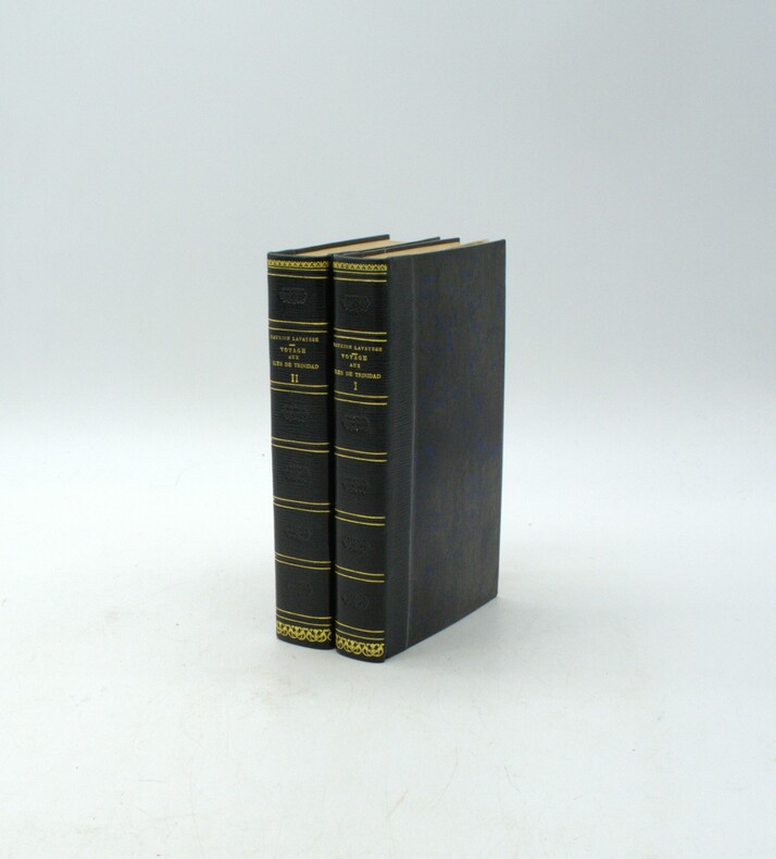
DAUXION-LAVAYSSE, Jean-Joseph
Voyage aux îles de Trinidad, de Tabago, de la Marguerite et dans diverses parties de Vénézuéla, dans l'Amérique méridionale.
Paris, F. Schoëll, Libraire, 1813. In-8 (20,5 x 13,5 cm), XXVI-411 pp.,3ff-480pp-4ff (table et errata), illustré de 3 cartes dépliantes et 6 tableaux dépliants, demi-maroquin moderne à long grain bleu nuit, dos lisse, auteur, titre et tomaison dorés, filet et roulette dorés, fers à froid rousseurs.
書籍販売業者の参照番号
: PHO-1916
|
|
|
Dauphin County Parks.
COMPREHENSIVE PARK, RECREATION AND OPEN SPACE PLAN FOR DAUPHIN COUNTY.
np. Zerox copy. Illustrated with photographs and large folding maps. 4to. Original spiral bound wraps. PA PAMPH 20_7 BX2
|
|
|
Davenport, Bishop.
A NEW GAZETTEER, OR GEOGRAPHICAL DICTIONARY. Of North America And The West Indies. A New Edition With Alterations And Additions.
536 p. LACKS folding map. Lacks front fly leaves. Text illustrations. XLib blind stamp of A. Herr Smith Memorial Library on title page. XLib stamp of Free Public Library, Lancaster, PA on title page. XLib stamp on all edges. First three signatures damp stained on bottom corner. Foxed. First four leaves including title page chipped at edges. 8vo. 235 mm. Original full leather binding, worn. Front board fragile. Hardbound. Fair. S&S/AI 55257. PAIMP 10
|
|
|
David Biggs
This is Cape Town
No marks or inscriptions. A very clean very tight copy with bright unmarked boards and no bumping to corners. Dust jacket not price clipped or marked or torn with rubbing to top of spine and minor traces of storage. 160pp. A lavishly illustrated study of Cape Town in South Africa beginning with a detailed profile of the city and superb colour photographs showing the landscape and seascape, the culture, the buildings and the people.

|
|
|
David Butler; Photos, Maps [Illustrator]
The Fall of Saigon: Scenes from the Sudden End of a Long War
Simon & Schuster 1985-04-01. Hardcover. New. New. In shrink wrap. Looks like an interesting title! Simon & Schuster hardcover
書籍販売業者の参照番号
: Q-0671466755 ISBN : 0671466755 9780671466756
|
|
|
David, Joy (editor)
The Hidden Places of North Yorkshire
No marks or inscriptions to contents. No creasing to front cover or to spine, small crease to lower corner of rear cover. A very clean very tight copy with bright boards, slight damp effect to part of rear fore-edge and no bumping to corners. Fold-out map at rear in excellent condition. 216pp. An easily used book which takes you on a gentle meander through the beautiful countryside of North Yorkshire. As well as some of the well-known tourist attractions are those little known features which are so easily missed.

|
|
|
Davidson, Marshall B. and McTigue, Bernard.
TREASURES OF THE NEW YORK PUBLIC LIBRARY.
304 p. Numerous photographic illustrations by Jonathan Wallen. 4to. Original full cloth binding. Dust jacket. First Edition. Published at $60.00. Fascinating tour through the collections of one of the greatest American libraries. The New York Public Library houses more than 8 million volumes, 23 million manuscripts and half a million recordings. Includes: Washington's Farewell Address; the first Gutenberg B ible ever brought to this hemisphere; rare globes and maps; musical scores; and much more. A lavish history. **PRICE JUST REDUCED! REF1
|
|
|
DAVIS, Lieu-Col T B & FLOWER, JOHN (Illus/Maps)
The Story of 98th Field Regiment Surrey and Sussex Yeomanry Q. M. R. R. A. T. A. and 144th Field Regiment Surrey and Sussex Yeomanry r. a. T. A. 1939-1946
Ditchling Press 1980. Octavo red heavy card boards gilt lettering to spine gilt military motifs to front board illus eps frotnispiece xvii 370pp folding maps throughout VG light creasing & bruising to spine extrems & board corners light foxing to page edges & eps in d/w VG light creasing to edges moderate sun fading to spine light chafing & soiling to covers price clipped Ditchling Press 1980 hardcover
書籍販売業者の参照番号
: 252090
|
|
|
Davison, Brian K.
The Observer's Book of Castles
185 pages. Most people are attracted by the brooding majesty or picturesque ruins of castles. This work provides a wealth of detailed information about them, often illustrated by fascinating historical anecdotes. With 46 line drawings, 12 black and white illustrations and 3 maps. Dust jacket bright with light wear and price clipped. Book
|
|
|
Dawson, Joan
The Mapmakers' Legacy: Nineteenth (19th) Century Nova Scotia Through Maps
152 pages. Bibliography. Index. Wonderfully illustrated, often in colour. Printed upon glossy stock. Handsomely produced. "Plot's Nova Scotia's growth through the careful examination and analysis of maps from the nineteenth century. An exciting time in Nova Scotia's history, this period saw the first serious attempts to gain knowledge of the entire province, its resources and its inhabitants. Traces developments in our province that today are taken for granted." - from back cover. Clean, bright and unmarked with light wear. A high-quality copy. Book

|
|
|
Dawson, Robert K [maps]"
Collection of 18 English County Maps Plus Reports for Cumberland Lancashire Leicestershire Norfolk Northamptonshire Northumberland Nottinghamshire Shropshire Somersetshire Staffordshire & Suffolk"
collection of 18 hand coloured folding maps including Derbyshire Devonshire Durham Essex Hampshire Kent Lancashire Leicestershire Norfolk Northamptonshire Northumberland Nottinghamshire Shropshire Somersetshire Staffordshire Suffolk Surrey & Sussex each are by Robert K. Dawson 1798‱861 - an English surveyor and cartographer. Plus reports from some of the counties reports signed L. B. Allen or J. G. S. Lefevre" hardcover
書籍販売業者の参照番号
: 61842
|
|
|
Day Brothers
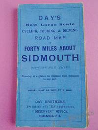
DAY'S NEW LARGE SCALE CYCLING TOURING & DRIVING ROAD MAP OF FORTY MILES ABOUT SIDMOUTH With One Mile Circles Showing at a Glance the Distance from Sidmouth to any Part
Sidmouth: Day Brothers 1900. Map. Very Good. Unframed. New Edition. Undated but circa 1900 Engraved map main roads coloured orange 445 x 575 mm folding down to 150 x 85 mm with printed blue covers published by Day Brothers "Printers Stationers & Booksellers Observer Office Sidmouth". Generally in very good condition with light general wear and some rubbing to edges of covers. An attractive map. Scarce. Day Brothers unknown
書籍販売業者の参照番号
: 033970
|
|
|
Day, J.H.; Farstad, L.; Laird, D.G.
Soil Survey - Southeast Vancouver Island and Gulf Islands, British Columbia
104 page softcover book plus three large colour maps entitled: Soil Map of Vancouver Island - Duncan/Nanaimo; Courtenay/Campbell; Qualicum/Alberni. Stored in slip case. Report No. 6 of the British Columbia Soil Survey 1959. Gift inscription upon front panel of slip case. Prior owner's name upon each component of contents. Average wear to maps and book. Taped tear along bottom edge of slip case which remains functional. Good working copy of this excellent reference. Book
|
|
|
de VAUCHELLES.
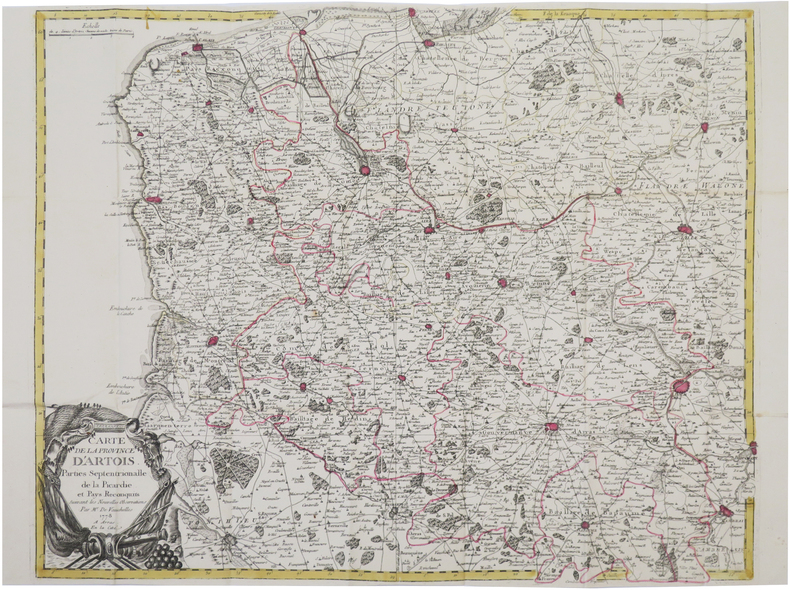
[ARTOIS] Carte de la province d'Artois, parties septentrionalles de la Picardie et Pays reconquis, suivant les nouvelles observations. Par M.r de Vauchelles.
Arras, En la Cité, 1778. 540 x 659 mm ; repliée sous couverture cartonnée recouverte de papier bleu de l'époque (202 x 130 mm) ; étiquette sur le premier plat portant le titre manuscrit à l'encre.
書籍販売業者の参照番号
: LBW-8442
|
|
|
de VAUCHELLE.
[PICARDIE] Carte de la Picardie divisée en ses différentes juridictions.
Amiens, Agnes, 1778. 525 x 665 mm.
書籍販売業者の参照番号
: LBW-7185

|
|
|
DE VARIGNY C.
ASIE
Nouvelle géographie moderne des cinq parties du monde. ASIE un volume in 4 demi-chagrin bleu à nerfs et à coins, titre, fers dorés. Faux-titre, frontispice, titre, 324 pages, tranches marbrées. Complet des 10 cartes, hors-texte, en couleurs ; Nombreuses gravures hors-texte, et en tête. Asie Mahométane (ouest) Asie Anglaise, Asie Russe, Asie bouddhiste (Est) Empire de Chine- Thibet-Mongolie-Turkestan chinois-Mongolie-Mandchourie-Corée-Empire du Japon-Indo-Chine (Annam, Tonkin, Cochinchine, Cambodge, Siam, Birmanie. Coins légèrement émoussés sinon bon exemplaire. Librairie illustrée 1890.
書籍販売業者の参照番号
: 12039

|
|
|
DE VAUGONDY Robert, Géographe Ordinaire du Roy - gravée par E. DUSSY
CARTE DE L'IRLANDE, par Robert de Vaugondy, tiré du "Nouvel atlas portatif destiné principalement pour l'instruction de la jeunesse, et précédé d'un discours sur l'étude de la géographie", par le S. Robert de Vaugondy, 1762 Paris : chez l'Auteur ( Robert de Vaugondy) Editeur,
Paris chez l'Auteur ( Robert de Vaugondy) Editeur, 1762 carte ancienne colorée d'époque en vert , rouge et jaune, cartouche non coloré, gravée par E. DUSSY. Format total : 27 centimètres de haut par 39,8 centimètres de large, 1762 Paris : chez l'Auteur (Robert de Vaugondy) Editeur,
書籍販売業者の参照番号
: 27383
|
|
|
DE VAUGONDY Robert, Géographe Ordinaire du Roy - gravée par E. DUSSY
CARTE DE LA LOMBARDIE, LE DUCHÉ DE TOSCANE, L'ÉTAT DU St SIÈGE ET L'ISLE DE CORSE, par Robert de Vaugondy, tiré du "Nouvel atlas portatif destiné principalement pour l'instruction de la jeunesse, et précédé d'un discours sur l'étude de la géographie", par le S. Robert de Vaugondy, 1762 Paris : chez l'Auteur ( Robert de Vaugondy) Editeur,
Paris chez l'Auteur ( Robert de Vaugondy) Editeur, 1762 carte ancienne colorée d'époque en vert , rouge et jaune, cartouche non coloré, gravée par E. DUSSY. Format total : 27 centimètres de haut par 39,8 centimètres de large, 1762 Paris : chez l'Auteur (Robert de Vaugondy) Editeur,
書籍販売業者の参照番号
: 27384
|
|
|
DE VAUGONDY Robert, Géographe Ordinaire du Roy - gravée par E. DUSSY
CARTE DE LA HONGRIE, TURQUIE D'EUROPE, par Robert de Vaugondy, tiré du "Nouvel atlas portatif destiné principalement pour l'instruction de la jeunesse, et précédé d'un discours sur l'étude de la géographie", par le S. Robert de Vaugondy, 1762 Paris : chez l'Auteur ( Robert de Vaugondy) Editeur,
Paris chez l'Auteur ( Robert de Vaugondy) Editeur, 1762 carte ancienne colorée d'époque en vert , rouge et jaune, cartouche non coloré, gravée par E. DUSSY. Format total : 27 centimètres de haut par 39,8 centimètres de large, 1762 Paris : chez l'Auteur ( Robert de Vaugondy) Editeur,
書籍販売業者の参照番号
: 27385
|
|
|
DE VAUGONDY Robert, Géographe Ordinaire du Roy - gravée par E. DUSSY
CARTE DES CERCLES DE HAUTE SAXE ET DE BASSE SAXE, par Robert de Vaugondy, tiré du "Nouvel atlas portatif destiné principalement pour l'instruction de la jeunesse, et précédé d'un discours sur l'étude de la géographie", par le S. Robert de Vaugondy, 1762 Paris : chez l'Auteur ( Robert de Vaugondy) Editeur,
Paris chez l'Auteur ( Robert de Vaugondy) Editeur, 1762 carte ancienne colorée d'époque en vert , rouge et jaune, cartouche non coloré, gravée par E. DUSSY. Format total : 27 centimètres de haut par 39,8 centimètres de large, 1762 Paris : chez l'Auteur ( Robert de Vaugondy) Editeur,
書籍販売業者の参照番号
: 27386
|
|
|
DE VAUGONDY Robert, Géographe Ordinaire du Roy - gravée par E. DUSSY
CARTE : LES SUISSES ET LES GRISONS AVEC LEURS ALLIÉS ET LEURS SUJETS, par Robert de Vaugondy, tiré du "Nouvel atlas portatif destiné principalement pour l'instruction de la jeunesse, et précédé d'un discours sur l'étude de la géographie", par le S. Robert de Vaugondy, 1762 Paris : chez l'Auteur ( Robert de Vaugondy) Editeur,
Paris chez l'Auteur ( Robert de Vaugondy) Editeur, 1762 carte ancienne colorée d'époque en vert , rouge et jaune, cartouche non coloré, gravée par E. DUSSY. Format total : 27 centimètres de haut par 39,8 centimètres de large, 1762 Paris : chez l'Auteur ( Robert de Vaugondy) Editeur,
書籍販売業者の参照番号
: 27387
|
|
|
DE VAUGONDY Robert, Géographe Ordinaire du Roy - gravée par E. DUSSY
CARTE DES CERCLES DE BAVIÈRE ET D'AUTRICHE, par Robert de Vaugondy, tiré du "Nouvel atlas portatif destiné principalement pour l'instruction de la jeunesse, et précédé d'un discours sur l'étude de la géographie", par le S. Robert de Vaugondy, 1762 Paris : chez l'Auteur ( Robert de Vaugondy) Editeur,
Paris chez l'Auteur ( Robert de Vaugondy) Editeur, 1762 carte ancienne colorée d'époque en vert , rouge et jaune, cartouche non coloré, gravée par E. DUSSY. Format total : 27 centimètres de haut par 39,8 centimètres de large, 1762 Paris : chez l'Auteur ( Robert de Vaugondy) Editeur,
書籍販売業者の参照番号
: 27388
|
|
|
DE VAUGONDY Robert, Géographe Ordinaire du Roy - gravée par E. DUSSY
CARTE DU ROYAUME DE NAPLES, par Robert de Vaugondy, tiré du "Nouvel atlas portatif destiné principalement pour l'instruction de la jeunesse, et précédé d'un discours sur l'étude de la géographie", par le S. Robert de Vaugondy, 1762 Paris : chez l'Auteur ( Robert de Vaugondy) Editeur,
Paris chez l'Auteur ( Robert de Vaugondy) Editeur, 1762 carte ancienne colorée d'époque en vert , rouge et jaune, cartouche non coloré, gravée par E. DUSSY. Format total : 27 centimètres de haut par 39,8 centimètres de large, 1762 Paris : chez l'Auteur ( Robert de Vaugondy) Editeur,
書籍販売業者の参照番号
: 27389
|
|
|
DE VAUGONDY Robert, Géographe Ordinaire du Roy - gravée par E. DUSSY
CARTE DE JUDÉE OU TERRE SAINTE, par Robert de Vaugondy, tiré du "Nouvel atlas portatif destiné principalement pour l'instruction de la jeunesse, et précédé d'un discours sur l'étude de la géographie", par le S. Robert de Vaugondy, 1762 Paris : chez l'Auteur ( Robert de Vaugondy) Editeur,
Paris chez l'Auteur ( Robert de Vaugondy) Editeur, 1762 carte ancienne colorée d'époque en vert , rouge et jaune, cartouche non coloré, gravée par E. DUSSY. Format total : 27 centimètres de haut par 39,8 centimètres de large, 1762 Paris : chez l'Auteur ( Robert de Vaugondy) Editeur,
書籍販売業者の参照番号
: 27390
|
|
|
DE VAUGONDY Robert, Géographe Ordinaire du Roy - gravée par E. DUSSY
CARTE DE BOHÈME, SILESIE, MORAVIE, LUSACE, par Robert de Vaugondy, tiré du "Nouvel atlas portatif destiné principalement pour l'instruction de la jeunesse, et précédé d'un discours sur l'étude de la géographie", par le S. Robert de Vaugondy, 1762 Paris : chez l'Auteur ( Robert de Vaugondy) Editeur,
Paris chez l'Auteur ( Robert de Vaugondy) Editeur, 1762 carte ancienne colorée d'époque en vert , rouge et jaune, cartouche non coloré, gravée par E. DUSSY. Format total : 27 centimètres de haut par 39,8 centimètres de large, 1762 Paris : chez l'Auteur ( Robert de Vaugondy) Editeur,
書籍販売業者の参照番号
: 27391
|
|
|
DE VAUGONDY Robert, Géographe Ordinaire du Roy - gravée par E. DUSSY
CARTE DU PARAGUAY, CHILI, TERRE MAGELLAN, par Robert de Vaugondy, tiré du "Nouvel atlas portatif destiné principalement pour l'instruction de la jeunesse, et précédé d'un discours sur l'étude de la géographie", par le S. Robert de Vaugondy, 1762 Paris : chez l'Auteur ( Robert de Vaugondy) Editeur,
Paris chez l'Auteur ( Robert de Vaugondy) Editeur, 1762 carte ancienne colorée d'époque en vert , rouge et jaune, cartouche non coloré, gravée par E. DUSSY. Format total : 27 centimètres de haut par 39,8 centimètres de large, 1762 Paris : chez l'Auteur ( Robert de Vaugondy) Editeur,
書籍販売業者の参照番号
: 27392
|
|
|
DE VAUGONDY Robert, Géographe Ordinaire du Roy - gravée par E. DUSSY
CARTE DE L'ÉCOSSE, par Robert de Vaugondy, tiré du "Nouvel atlas portatif destiné principalement pour l'instruction de la jeunesse, et précédé d'un discours sur l'étude de la géographie", par le S. Robert de Vaugondy, 1762 Paris : chez l'Auteur ( Robert de Vaugondy) Editeur,
Paris chez l'Auteur ( Robert de Vaugondy) Editeur, 1762 carte ancienne colorée d'époque en vert , rouge et jaune, cartouche non coloré, gravée par E. DUSSY. Format total : 27 centimètres de haut par 39,8 centimètres de large, 1762 Paris : chez l'Auteur ( Robert de Vaugondy) Editeur,
書籍販売業者の参照番号
: 27393
|
|
|
DE VAUGONDY Robert, Géographe Ordinaire du Roy - gravée par E. DUSSY
CARTE DE L'EMPIRE D'ALLEMAGNE, par Robert de Vaugondy, tiré du "Nouvel atlas portatif destiné principalement pour l'instruction de la jeunesse, et précédé d'un discours sur l'étude de la géographie", par le S. Robert de Vaugondy, 1762 Paris : chez l'Auteur ( Robert de Vaugondy) Editeur,
Paris chez l'Auteur ( Robert de Vaugondy) Editeur, 1762 carte ancienne colorée d'époque en vert , rouge et jaune, cartouche non coloré, gravée par E. DUSSY. Format total : 27 centimètres de haut par 39,8 centimètres de large, 1762 Paris : chez l'Auteur ( Robert de Vaugondy) Editeur,
書籍販売業者の参照番号
: 27394
|
|
|
DE VAUGONDY Robert, Géographe Ordinaire du Roy - gravée par E. DUSSY
CARTE DE LA JUDÉE OU TERRE SAINTE SOUS LES TURCS, par Robert de Vaugondy, tiré du "Nouvel atlas portatif destiné principalement pour l'instruction de la jeunesse, et précédé d'un discours sur l'étude de la géographie", par le S. Robert de Vaugondy, 1762 Paris : chez l'Auteur ( Robert de Vaugondy) Editeur,
Paris chez l'Auteur ( Robert de Vaugondy) Editeur, 1762 carte ancienne colorée d'époque en vert , rouge et jaune, cartouche non coloré, gravée par E. DUSSY. Format total : 27 centimètres de haut par 39,8 centimètres de large, 1762 Paris : chez l'Auteur ( Robert de Vaugondy) Editeur,
書籍販売業者の参照番号
: 27395
|
|
|
DE VAUGONDY Robert, Géographe Ordinaire du Roy - gravée par E. DUSSY
CARTE DU ROYAUME DE FRANCE, par Robert de Vaugondy, tiré du "Nouvel atlas portatif destiné principalement pour l'instruction de la jeunesse, et précédé d'un discours sur l'étude de la géographie", par le S. Robert de Vaugondy, 1762 Paris : chez l'Auteur ( Robert de Vaugondy) Editeur,
Paris chez l'Auteur ( Robert de Vaugondy) Editeur, 1762 carte ancienne colorée d'époque en vert , rouge et jaune, cartouche non coloré, gravée par E. DUSSY. Format total : 27 centimètres de haut par 39,8 centimètres de large, 1762 Paris : chez l'Auteur ( Robert de Vaugondy) Editeur,
書籍販売業者の参照番号
: 27396
|
|
|
DE VAUGONDY Robert, Géographe Ordinaire du Roy - gravée par E. DUSSY
CARTE DE : FLANDRE FRANCOISE, PICARDIE ET ARTOIS, ISLE DE FRANCE, ORLÉANOIS, CHAMPAGNE, LORRAINE, ET ALSACE, par Robert de Vaugondy, tiré du "Nouvel atlas portatif destiné principalement pour l'instruction de la jeunesse, et précédé d'un discours sur l'étude de la géographie", par le S. Robert de Vaugondy, 1762 Paris : chez l'Auteur ( Robert de Vaugondy) Editeur,
Paris chez l'Auteur ( Robert de Vaugondy) Editeur, 1762 carte ancienne colorée d'époque en vert , rouge et jaune, cartouche non coloré, gravée par E. DUSSY. Format total : 27 centimètres de haut par 39,8 centimètres de large, 1762 Paris : chez l'Auteur ( Robert de Vaugondy) Editeur,
書籍販売業者の参照番号
: 27397
|
|
|
DE VAUGONDY Robert, Géographe Ordinaire du Roy - gravée par E. DUSSY
CARTE DE LA GAULE, par Robert de Vaugondy, tiré du "Nouvel atlas portatif destiné principalement pour l'instruction de la jeunesse, et précédé d'un discours sur l'étude de la géographie", par le S. Robert de Vaugondy, 1762 Paris : chez l'Auteur ( Robert de Vaugondy) Editeur,
Paris chez l'Auteur ( Robert de Vaugondy) Editeur, 1762 carte ancienne colorée d'époque en vert , rouge et jaune, cartouche non coloré, gravée par E. DUSSY. Format total : 27 centimètres de haut par 39,8 centimètres de large, 1762 Paris : chez l'Auteur ( Robert de Vaugondy) Editeur,
書籍販売業者の参照番号
: 27398
|
|
|
DE VAUGONDY Robert, Géographe Ordinaire du Roy - gravée par E. DUSSY
CARTE DE L'ITALIE, par Robert de Vaugondy, tiré du "Nouvel atlas portatif destiné principalement pour l'instruction de la jeunesse, et précédé d'un discours sur l'étude de la géographie", par le S. Robert de Vaugondy, 1762 Paris : chez l'Auteur ( Robert de Vaugondy) Editeur,
Paris chez l'Auteur ( Robert de Vaugondy) Editeur, 1762 carte ancienne colorée d'époque en vert , rouge et jaune, cartouche non coloré, gravée par E. DUSSY. Format total : 27 centimètres de haut par 39,8 centimètres de large, 1762 Paris : chez l'Auteur ( Robert de Vaugondy) Editeur,
書籍販売業者の参照番号
: 27399
|
|
|
DE VAUGONDY Robert, Géographe Ordinaire du Roy - gravée par E. DUSSY
CARTE DES ISLES BRITANNIQUES , par Robert de Vaugondy, tiré du "Nouvel atlas portatif destiné principalement pour l'instruction de la jeunesse, et précédé d'un discours sur l'étude de la géographie", par le S. Robert de Vaugondy, 1762 Paris : chez l'Auteur ( Robert de Vaugondy) Editeur,
Paris chez l'Auteur ( Robert de Vaugondy) Editeur, 1762 carte ancienne colorée d'époque en vert , rouge et jaune, cartouche non coloré, gravée par E. DUSSY. Format total : 27 centimètres de haut par 39,8 centimètres de large, 1762 Paris : chez l'Auteur ( Robert de Vaugondy) Editeur,
書籍販売業者の参照番号
: 27400
|
|
|
DE VAUGONDY Robert, Géographe Ordinaire du Roy - gravée par E. DUSSY
CARTE DE LA PARTIE SEPTENTRIONALE DE LA RUSSIE EUROPENNE, par Robert de Vaugondy, tiré du "Nouvel atlas portatif destiné principalement pour l'instruction de la jeunesse, et précédé d'un discours sur l'étude de la géographie", par le S. Robert de Vaugondy, 1762 Paris : chez l'Auteur ( Robert de Vaugondy) Editeur,
Paris chez l'Auteur ( Robert de Vaugondy) Editeur, 1762 carte ancienne colorée d'époque en vert , rouge et jaune, cartouche non coloré, gravée par E. DUSSY. Format total : 27 centimètres de haut par 39,8 centimètres de large, 1762 Paris : chez l'Auteur ( Robert de Vaugondy) Editeur,
書籍販売業者の参照番号
: 27402
|
|
|
DE VAUGONDY Robert, Géographe Ordinaire du Roy - gravée par E. DUSSY
CARTE DU BERRI, NIVERNOIS, BOURBONOIS, LYONOIS, BOURGOGNE, BRESSE ET FRANCHE-COMTÉ, par Robert de Vaugondy, tiré du "Nouvel atlas portatif destiné principalement pour l'instruction de la jeunesse, et précédé d'un discours sur l'étude de la géographie", par le S. Robert de Vaugondy, 1762 Paris : chez l'Auteur ( Robert de Vaugondy) Editeur,
Paris chez l'Auteur ( Robert de Vaugondy) Editeur, 1762 carte ancienne colorée d'époque en vert , rouge et jaune, cartouche non coloré, gravée par E. DUSSY. Format total : 27 centimètres de haut par 39,8 centimètres de large, 1762 Paris : chez l'Auteur ( Robert de Vaugondy) Editeur,
書籍販売業者の参照番号
: 27403
|
|
|
DE VAUGONDY Robert, Géographe Ordinaire du Roy - gravée par E. DUSSY
CARTE DE LA TURQUIE D'ASIE, ARABIE, PERSE, TARTARIE INDÉPENDANTE par Robert de Vaugondy, tiré du "Nouvel atlas portatif destiné principalement pour l'instruction de la jeunesse, et précédé d'un discours sur l'étude de la géographie", par le S. Robert de Vaugondy, 1762 Paris : chez l'Auteur ( Robert de Vaugondy) Editeur,
Paris chez l'Auteur ( Robert de Vaugondy) Editeur, 1762 carte ancienne colorée d'époque en vert , rouge et jaune, cartouche non coloré, gravée par E. DUSSY. Format total : 27 centimètres de haut par 39,8 centimètres de large, 1762 Paris : chez l'Auteur (Robert de Vaugondy) Editeur,
書籍販売業者の参照番号
: 27427
|
|
|
DE VAUGONDY Robert, Géographe Ordinaire du Roy - gravée par E. DUSSY
CARTE DES PREMIERS AGES DU MONDE - GÉOGRAPHIE ÉCCLÉSIASTIQUE DE LA TURQUIE D'ASIE ET DE LA PERSE par Robert de Vaugondy, tiré du "Nouvel atlas portatif destiné principalement pour l'instruction de la jeunesse, et précédé d'un discours sur l'étude de la géographie", par le S. Robert de Vaugondy, 1762 Paris : chez l'Auteur ( Robert de Vaugondy) Editeur,
Paris chez l'Auteur ( Robert de Vaugondy) Editeur, 1762 carte ancienne colorée d'époque en vert , rouge et jaune, cartouche non coloré, gravée par E. DUSSY. Format total : 27 centimètres de haut par 39,8 centimètres de large, 1762 Paris : chez l'Auteur (Robert de Vaugondy) Editeur,
書籍販売業者の参照番号
: 27428
|
|
|
DE VAUGONDY Robert, Géographe Ordinaire du Roy - gravée par E. DUSSY
CARTE DU CANADA, LOUISIANE, POSSESSIONS ANGLAISES par Robert de Vaugondy, tiré du "Nouvel atlas portatif destiné principalement pour l'instruction de la jeunesse, et précédé d'un discours sur l'étude de la géographie", par le S. Robert de Vaugondy, 1762 Paris : chez l'Auteur ( Robert de Vaugondy) Editeur,
Paris chez l'Auteur ( Robert de Vaugondy) Editeur, 1762 carte ancienne colorée d'époque en vert , rouge et jaune, cartouche non coloré, gravée par E. DUSSY. Format total : 27 centimètres de haut par 39,8 centimètres de large, 1762 Paris : chez l'Auteur (Robert de Vaugondy) Editeur,
書籍販売業者の参照番号
: 27429
|
|
|
DE VAUGONDY Robert, Géographe Ordinaire du Roy - gravée par E. DUSSY
CARTE DU POITOU, AUNIS, SAINTONGE ET ANGOUMOIS, LA MARCHE, LIMOSIN, ET AUVERGNE par Robert de Vaugondy, tiré du "Nouvel atlas portatif destiné principalement pour l'instruction de la jeunesse, et précédé d'un discours sur l'étude de la géographie", par le S. Robert de Vaugondy, 1762 Paris : chez l'Auteur ( Robert de Vaugondy) Editeur,
Paris chez l'Auteur ( Robert de Vaugondy) Editeur, 1762 carte ancienne colorée d'époque en vert , rouge et jaune, cartouche non coloré, gravée par E. DUSSY. Format total : 27 centimètres de haut par 39,8 centimètres de large, 1762 Paris : chez l'Auteur (Robert de Vaugondy) Editeur,
書籍販売業者の参照番号
: 27430
|
|
|
DE VAUGONDY Robert, Géographe Ordinaire du Roy - gravée par E. DUSSY
CARTE DU CONGO, CAFRERIE par Robert de Vaugondy, tiré du "Nouvel atlas portatif destiné principalement pour l'instruction de la jeunesse, et précédé d'un discours sur l'étude de la géographie", par le S. Robert de Vaugondy, 1762 Paris : chez l'Auteur ( Robert de Vaugondy) Editeur,
Paris chez l'Auteur ( Robert de Vaugondy) Editeur, 1762 carte ancienne colorée d'époque en vert , rouge et jaune, cartouche non coloré, gravée par E. DUSSY. Format total : 27 centimètres de haut par 39,8 centimètres de large, 1762 Paris : chez l'Auteur (Robert de Vaugondy) Editeur,
書籍販売業者の参照番号
: 27431
|
|
|

 検索結果のメールを受信する
 PDFファイルの検索結果をダウンロード
 RSSフィード
 パーマネントリンク


