|
DELAMARE Nicolas
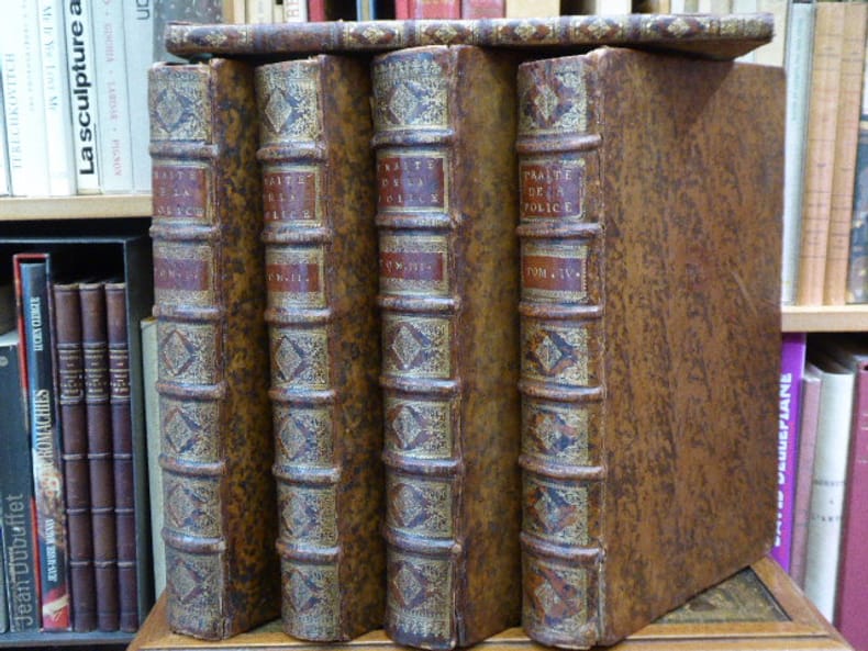
TRAITE DE LA POLICE où l'on trouvera l'histoire de son établissement, les fonctions et les prérogatives de ses magistrats, toutes les lois et tous les règlements qui la concernent. On y a joint une description historique et topographique de Paris...
Cot - Brunet - Hérissant Paris 1735-1738 4 volumes + 1 volume de supplément in-folio. Reliures de l'époque pleine veau havane, dos à nerfs ornés de caissons de double filet doré richement et finement fleuronnés, pièces de titre et de tomaison en maroquin grenat, roulettes dorées sur coupes, toutes tranches rouges. Le supplément est en demi-reliure de l'époque. Orné de vignette sur titre répétée aux armes et chiffres royales, 10 en-têtes et lettrines historiées, et bien complet de ses 8 plans dépliants dont le plan des fontaines de la ville des faubourgs de Paris. Le supplément concerne les livres 1 et 2. Des cartes avec petites déchirures mais sans manque, divers défauts aux coiffes et mors mais l'ensemble reste solide et fort décoratif. BEL EXEMPLAIRE, peu commun
书商的参考编号 : 278472
|
|
|
Delorme Jacques
Vacances Bridge I
Editions du Rocher Dos carré collé 1998 In-12 (10,5 x 15 cm), dos carré collé, 92 pages ; plats jaunis, bon état général. Livraison a domicile (La Poste) ou en Mondial Relay sur simple demande.
书商的参考编号 : qs795
|
|
|
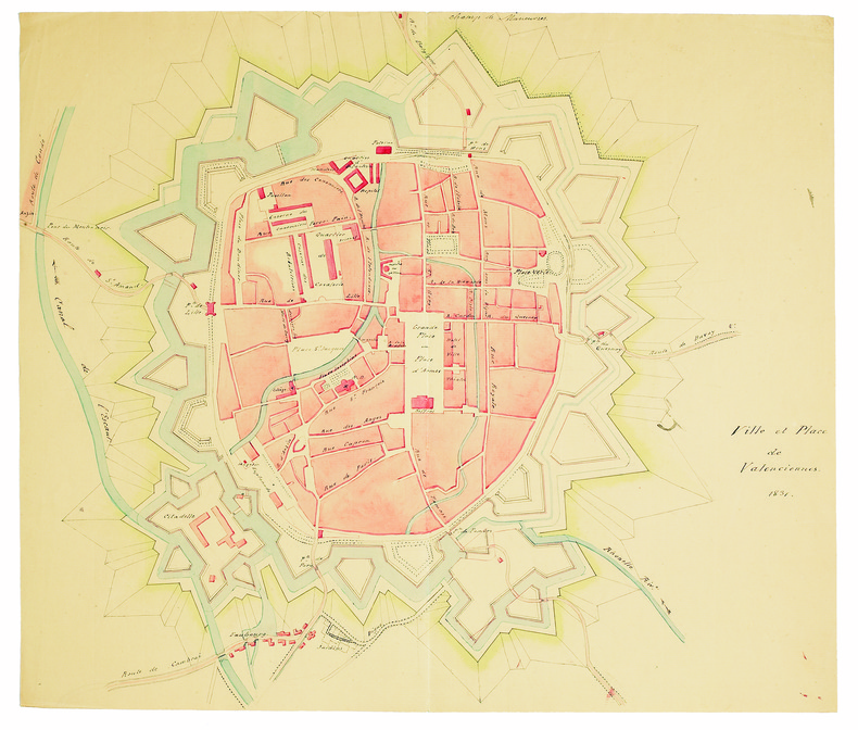
DELÉCEY de CHANGEY (Louis-Charles). MANUSCRIT.
Ville et place de Valenciennes.
1831. 345 x 410 mm, sur papier vergé.
书商的参考编号 : LBW-4144
|
|
|
DELEGORGUE Adulphe
Voyage dans l’Afrique Australe
notamment dans le territoire de NATAL,dans celui des Cafres Amazoulous et Makatisses et jusqu’au tropique du Capricorne exécuté durant les années 1838 1839 1840 1841 1842 et 1844. Avec une introduction par M.ALBERT-MONTEMONT.Deux tomes en un volume in 8 demi-chagrin rouge époque,titre,fer,filet, roulette dorés,filets à froid.Tome 1:faux-titre,portrait de l’auteur lithographié par GRENIER,sous serpente;titre,XVI, 580 pages,5 lithographies hors-texte,y compris le frontispice.Une carte dépliante pour l’intelligence du voyage(une tache brun-clair)Tome 2:faux-titre,titre,622 pages,3 lithographies hors-texte,une carte de chasse, dépliante,indiquant les lieux qu’habitent les diverses espèces d’animaux paris A.René & Cie 1847,quelques rousseurs éparses;Sinon très bon état.Un des premiers grands voyages cynégétiques sur le continent africain.Il explora pendant 6 année l’Afrique Australe partant de Cape Town,il visita d’abord la plaine désertique du Grand Karou puis prenant Port Natal comme base de départ,il se rendit en Cafrerie,remonta vers le nord en longeant la chaîne du Drakensberg,qu’il traversa. Il visita ensuite le Natal, le Zoulouland,franchit le Waal et parcourut les territoires de la baie de Delagoa appartenant aux portugais.Il effectua de nombreuses parties de chasse dans le but de reunir des spécimens rares,destinés aux musées d’histoire naturelle. Thiébaud 259 Gay 3215
书商的参考编号 : 5666

|
|
|
Delobbe Georges
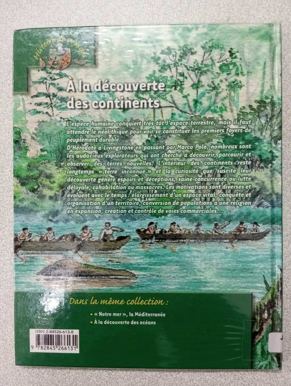
À la découverte des continents
PEMF 2006 20x0 8x25 4cm. 2006. album.
书商的参考编号 : 500091437
|
|
|
DELAGRIVE Abbé
Plan de la banlieue ouest-parisienne
- S.n., s.l. s.d. [circa 1750], 100x68cm, une feuille repliée. - First edition. This large folded map shows the cities of villes de Saint-Cloud, Sèvre, Marly, Saint-Germain en Laye, Le Vézinet, Suresnes, Nanterre... Some skillful repairs to the back. [FRENCH VERSION FOLLOWS] Edition originale. Cette grande carte dépliante présente les villes de Saint-Cloud, Sèvre, Marly, Saint-Germain en Laye, Le Vézinet, Suresnes, Nanterre... Quelques habiles restaurations au verso.

|
|
|
DELAMARCHE Charles François (1740 – 1817)
Imperii Romani Tabula
Carta storico-geografica tratta dal Recueil de cartes sur la géographie ancienne et moderne, à l'usage des élèves de l'Ecole Royale Militaire de Saint-Cyr, stampatp a Parigi e pubblicato in varie edizioni tra il 1806 e il 1825. Charles François Delamarche (1740 – 1817) è stato un geografo e cartografo francese. Fu uno dei più importanti geografi e cartografi francesi della seconda metà del Settecento. Successore di Nicolas Sanson (1600-1667), Robert de Vaugondy (1686-1766) e Rigobert Bonne (1727-1794), ne ristampò gli atlanti. Si dedicò all'insegnamento della geografia. Tra le sue opere, oltre alle carte e ai globi, va ricordato un trattato sull'uso della sfera, dei globi celesti e dei terrestri (Traité de la sphère et de l'usage des globes, 1790), in cui egli illustra, oltre al sistema tolemaico, anche quello copernicano, enumerando inoltre tutte le costellazioni antiche e moderne. Suo figlio Félix ne continuò l'opera. Charles François Delamarche acquisì la collezione di Didier Robert de Vaugondy nel 1778, dopo aver collaborato con lui nell'edizione di diversi atlanti. Acquaforte, impressa su carta vergata coeva, coloritura coeva dei contorni, in ottimo stato di conservazione. Historical-geographical map taken from the Recueil de cartes sur la géographie ancienne et moderne, à l'usage des élèves de l'Ecole Royale Militaire de Saint-Cyr, printed in Paris and published in several editions between 1806 and 1825. Charles-François Delamarche (August 1740 – 31 October 1817) was a French geographer and mapmaker. One of the most important French geographers and mapmakers of the second half of the eighteenth century. Successor to Nicolas Sanson (1600 – 1667), Robert de Vaugondy (1686 – 1766), and Rigobert Bonne (1727 – 1794), whose atlases he reprinted. Also taught geography. In addition to maps and globes, his works include a treatise on the use of the sphere and celestial and terrestrial globes. In the treatise, he illustrates both the Ptolemaic and Copernican systems, as well as listing all the ancient and modern constellations. His son Félix Delamarche continued his work. Charles François Delamarche acquired Didier Robert de Vaugondy's collection in 1778, after having collaborated with him in the edition of atlases. Etching, printed on contemporary laid paper, contemporary outline coloring, in excellent condition.

|
|
|
Delaney, Frank
Betjeman Country
No marks or inscriptions. A very clean very tight copy with bright unmarked boards and no bumping to corners. Dust jacket price clipped but not marked or torn with light creasing to front. 233pp. An affectionate journey through many of the places immortalised in verse by John Betjeman. The description and history of the places is accompanied by the relevant verse.

|
|
|
DELAROCHETTE, L. S.
Italy with the Addition of the Southern Parts of Germany as far as Pettau in Stiria ; Murlakia, Dalmatia, the adjacent countries, and all the Illyric Islands. 2d edition Jan. 1st 1802 (Map of Italy - First Part)
Carte dépliante en couleurs entoilée, au format 1120 x 635 mm, Published by Will. Faden, London, 2d edition, Jany 1st 1802 Partie nord de la carte composite en deux feuilles. Belle carte anglaise dans sa seconde édition datée d 1er janvier 1802 (la première édition datant du 12 septembre 1800). Phillips 6010, 6013, 6047 Anglais

|
|
|
Delderfield, Eric
The Observer's Book of Devon & Cornwall
No marks or inscriptions. No creasing to covers or to spine. A very clean very tight copy with unmarked lightly tanned boards, and no bumping to corners. 184pp. A guide to the two counties in England's West Country.

|
|
|
DELISLE, Guillaume ; [ De L'Isle, Guillaume ]
Carte des Pays Bas Catholiques dressée sur un grand nombre de cartes particulières faites sur les lieux où les limites sont exactement marquées, suivant les derniers Traitéz
Carte au format 66 x 48 cm, frontières rehaussée en couleur, par Guillaume De l'Isle, de l'Académie Royale des Sciences à Paris, Chez l'Auteur sur le Quai de l'Horloge, 1702 Bon état (3 très petites taches d'encre) pour cette belle carte établie et imprimée par Delisle. Français

|
|
|
DELISLE, Guillaume ; [ De L'Isle, Guillaume ]
Carte du Comté de Flandres dressée sur differens morceaux levez sur les lieux fixéz par les Observations Astronomiques.
carte au format 645 x 49 cm., frontières rehaussée en couleur, par Guillaume De l'Isle, de l'Académie Royale des Sciences à Paris, Chez l'Auteur sur le Quai de l'Horloge, 1704 Etat satisfaisant (marges rognées au maximum, petites salissures). Français

|
|
|
DEMIÈGE (Jean-Baptiste).
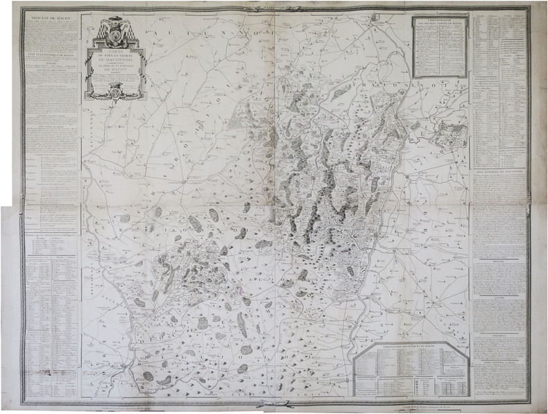
[MÂCONNAIS] Carte du Pays et Comté du Maconnois comprenant le diocese et bailliage de Macon.
1775. En 4 feuilles jointes formant une carte de 1,12 x 1,29 m.
书商的参考编号 : LBW-8928
|
|
|
Demeulemeester, Trees; Jongen, Majke
Warme wensen voor de koudste dagen: 100 jaar kerst- en nieuwjaarskaarten: 100 kerst- en nieuwjaarskaarten
2012 Davidsfonds Uitgeverij Hardcover
书商的参考编号 : 016516
|
|
|
Demeude, Hugues
Israel
Possibly unread. No marks or inscriptions. A little storage creasing to covers, none to spine. A very clean very tight copy with bright unmarked boards and no bumping to corners. 159pp. A journey to the Promised Land with its history, customs, fertile valleys, desert and holy places. Lavish photographs with captions and an associated descriptive text throughout.

|
|
|
Dempsey, Hugh A.
Glenbow, November (Nov.) - December (Dec.), 1971, Vol. 4, No. 6 - Robert Rundle Papers
8 pages. Features: Robert Rundle Papers; Rare 1841 Map of Banff Area; New Exhibition of instruments and machines which were used to titillate, entertain, and amuse; Annual Report. Black and white reproductions of archival photos. Average wear. Unmarked. A sound copy. Book

|
|
|
Dempster Thomas (Scozia, a Cliftbog, presso Aberdeen, 1579 -Bologna, 1625)
Descriptio Urbis Romae, à Romulo conditae.
Pianta di Roma antica a proiezione verticale con alzato. Tra i pochi monumenti riprodotti alcuni sono recenti, come il torrione di Niccolò V in Vaticano, la basilica di S. Paolo, la villa di Giulio III (costruita fra 1551-1553). Orientata con il Nord a sinistra.Questa pianta originariamente è inserita, ripiegata, da Bernardo Gamucci nei suoi “Libri quattro dell’antichità della città di Roma raccolte sotto brevità da diversi antichi et moderni scrittori”, prima edizione apparsa a Venezia, appresso Varisco & Compagni, nel 1565.La stessa pianta, con vari errori nei toponimi, con l’aggiunta della cornice decorativa e del testo in latino, si trova inserita anche nell’aggiornamento dell’opera di Johannes Rosinus (Johann Rossfeld) “Antiquitatum Romanorum corpus absolutissimum…” (I edizione 1585) edita da Thomas Dempster, stampata a Ginevra nel 1612 a spese di Samuel Chouët, che conobbe varie edizioni (1613, 1620, 1632, 1645, 1662, 1701, 1743). La pianta edita dal Dempster viene realizzata mediante un nuovo intaglio in legno, arricchito da una bordura ornamentale di stile nordico.Silografia, tracce delle pieghe editoriali, in ottimo stato di conservazione. Rara. Map of ancient Rome; vertical projection with elevation. Among the few monuments reproduced some are recent, such as the tower of Niccolò V in the Vatican, the basilica of S. Paolo, the villa of Giulio III (built between 1551-1553). Oriented with North to the left. This map is originally inserted, folded, by Bernardo Gamucci in his "Libri quattro dell’antichità della città di Roma raccolte sotto brevità da diversi antichi et moderni scrittori”, first edition published in Venice, Varisco & Compagni, in 1565. The same map, with various errors in the toponyms, with the addition of the decorative frame and the Latin text, is also included in the update of the work by Johannes Rosinus (Johann Rossfeld) "Antiquitatum Romanorum corpus absolutissimum ..." (1st edition 1585) published by Thomas Dempster, printed in Geneva in 1612 by Samuel Chouët, who went through various editions (1613, 1620, 1632, 1645, 1662, 1701, 1743). The map printed by Dempster is created by a new wood block, enriched by an ornamental border of Nordic style. Woodcut, traces of editorial folds, in excellent condition. Rare. cfr. Frutaz XVIII, Tav. 35; Scaccia Scarafoni, p. 26, n. 16.

|
|
|
DENIS (Louis) & PASQUIER (Jacques-Jean).
[FORÊT de FONTAINEBLEAU] Carte de la forest de Fontainebleau et de ses environs divisée en ses huit gardes.
Paris, Denis et Pasquier, 1786. En 18 sections montées sur toile et pliées, formant une carte de 540 x 685 mm.
书商的参考编号 : LBW-3219

|
|
|
DENIS, Louis - BRUÉ, H.
Atlas topographique de l'ancienne province de Normandie et pays limitrophes, dédié en 1770 à M. Thiroux de Crosne. Revu, corrigé et augmenté en 1817, par H. Brué Géographe de S. A. R. Monsieur.
1 17 ff. de Titre (à double page) Paris, J. Goujon, 1817, in-folio de 17 feuilles, dont le Titre, montées sur onglets, reliure moderne demi-basane tabac glacée, titre or en long, gardes de papier marbré moderne, couvertures conservées, grande pièce de titre ornée contrecollée à la première de couverture ; fine restauration angulaire au titre, quelques pâles piqûres marginales à la planche 10.
书商的参考编号 : 10508
|
|
|
DENIS Fernand; FAMIN M. C:
Brésil - Colombie et Guyanes.
Paris, Firmin Didot frères, 1837. In-8 de [4]-384-[2] et 32 pages, demi-veau glacé prune, dos à nerfs orné de filets dorés, tomaison de la collection au dos.
书商的参考编号 : 15830
|
|
|
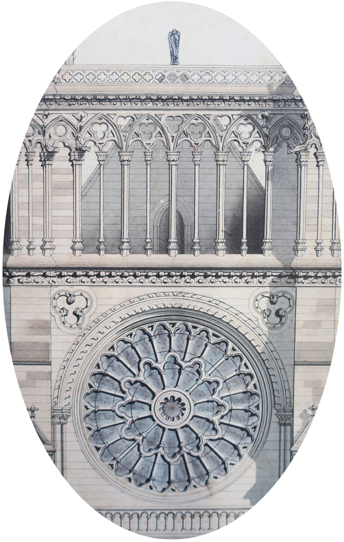
DENDIEVEL (Emile).
Notre Dame de Paris.
1875. 87 x 60 cm, monté sur carton et entouré d'un passe-partout sur lequel sont remontés la date, le nom de l'auteur et le titre.
书商的参考编号 : LBW-7465
|
|
|
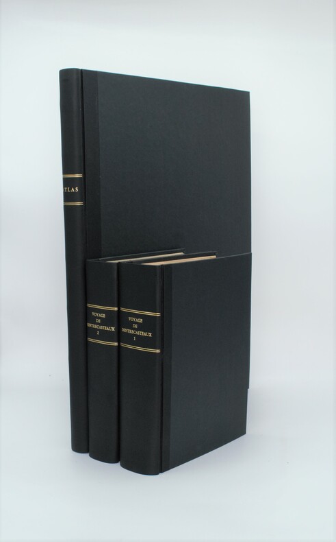
DENTRECASTEAUX (Antoine-Raymond-Joseph de Bruny) , ROSSEL (Édouard de)
Voyage de Dentrecasteaux, envoyé à la recherche de La Pérouse. Publié par ordre de sa Majesté l’Empereur et Roi, sous le ministère de S. E. le vice-amiral Decrès, comte de l’Empire. Rédigé par M. de (Édouard de) Rossel, ancien capitaine de vaisseau.
A Paris, Dépôt général des Cartes et Plans de la Marine et des Colonies, 1807 et De L’Imprimerie Impériale, 1808 RARE ENSEMBLE COMPLET en 3 volumes TEXTE ; 2 forts vol. in-4° ; (2)-LVI-704 pp.-32 pl. h.-t. repliées in-fine (I-XXXII)/(2)-VIII-692 pp.-1 pl. h.-t. Repliée sur papier bleuté , relié demi cuir , dos lisse avec titre et tomaison , tranches mouchetées , mouillure angulaire sur 7 planches, petites rousseurs sur les planches . ATLAS ; 1 volume grand in-folio (560x445) ,page de titre-1 fnch. (Table )-39 cartes et vues h.-t. , dont 29 à double page ,dressées par l'ingénieur hydrographe C. F. Beautemps Beaupré et gravées sur cuivre par E. Collin , relié demi cuir , dos lisse ,cachets répétés , petites rousseurs .
书商的参考编号 : PHO-1
|
|
|
Denison, Allen T.; Huntington, Wallace K.
Victorian Architecture of Port Townsend Washington
Book is in excellent condition. Binding is solid and square, covers have sharp corners, exterior shows no blemishes, text/interior is clean and free of marking of any kind. Dust jacket has numerous small tears at edges, now wrapped in clear protective cover. 176 pages with large b&w photos throughout, mostly exteriors, some interior, many detail shots, of commercial and public buildings, churches, residences, and misc. structures, maps, drawings; 49 individual structures featured with photos and a detailed description. Buildings include the: Fowler building, Bartlett, Waterman and katz, C.F. Clapp, Franklin House, Capt. Tibbals, Fowler-Caines, Hastings, N.D. Hill, James and Hastings, Terry, Siebenbaum, etc.
|
|
|
Dennis G Casebier; Neal Johns; Maps By Bob Martin; Illustrations By Ted Jensen; Etc
Guide To The East Mojave Heritage Trail: Ivanpah To Rocky Ridge
Norco: Tales Of The Mojave Road Publishing Company 1988. 1st Edition 1st Printing. Hardcover. Near Fine. Maps Photographs Cartoons. 305 Pp. Red Boards Gilt. First Printing. Very Near Fine. <br/> <br/> Tales Of The Mojave Road Publishing Company hardcover
书商的参考编号 : 045015 ???????? : 0914224131 9780914224136
|
|
|
Dennis G Casebier; Road Log By Neal Johns; Maps By R N "Bob" Martin; Illustrations By Ted Jensen (D Ratt)
Guide to the East Mojave Heritage Trail: Fenner to Needles Tales of the Mojave Road
Essex Ca: Tales Of The Mojave Road Publishing Company 1990. 1st Edition 1st Printing. Hardcover. Near Fine. 303 Pp. First Printing. Gold Cloth Stamped In Brown. First Printing. Very Near Fine. <br/> <br/> Tales Of The Mojave Road Publishing Company hardcover
书商的参考编号 : 045014 ???????? : 0914224190 9780914224198
|
|
|
Denoyer-Geppert social science maps, A19
Lines of Transportation. map
Chicago: Denoyer-Geppert Social Science Maps 1963. Book. Very Good. No Binding. 1 map : color ; 69 x 105 cm folded to 42 x 28 cm. showing transport routes America wide.main lines and secondary routes divided in sections and laid on canvas eyelets for hanging very good conditionScale ca. 1:4500000 Denoyer-Geppert social science maps A19. Denoyer-Geppert Social Science Maps unknown
书商的参考编号 : 1125558442
|
|
|
Denton, V.L.
The Far West Coast
297 pages including bibliography and index. "...into the heart of the vast Pacific the tale shall lead us, where men and ships are dwarfed to veriest specks which crawl laboriously a little space and then are lost to view." - from Introduction. Subjects include: the Straits of Anian; How the Russians crossed Siberia; Vitus Bering; James Cook; John Meares; George Vancouver; Quadra; and more. With 12 illustrations and 7 maps. Binding intact. Soiled but not overly so. Moderate lean to spine. Decorated biege boards. Gift greetings upon front endpaper else unmarked. Remains a decent copy. Book
|
|
|
DEPOT-GENERAL DE LA MARINE;
[BRESIL] Carte réduite des attérages du port de Maranham situés à la côte du Brésil.
Paris 1826 613 x 913 mm.
书商的参考编号 : LBW03952
|
|
|
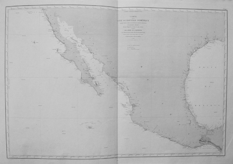
DEPOT des CARTES et PLANS de la MARINE;
[CALIFORNIE/TEXAS/MEXIQUE] Carte de la côte occidentale d'Amérique comprise entre le port de San Diego et le golfe de Tehuantepec (Vlle Californie, Mexique).
Paris 1863-1877 606 x 906 mm.
书商的参考编号 : LBW0359e
|
|
|
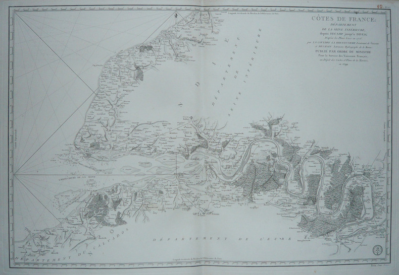
DEPOT des CARTES et PLANS de la MARINE.
[HAUTE-NORMANDIE] Côtes de France : Département de la Seine Inférieure, depuis Fécamp jusqu'à Dives.
Paris, 1792. 585 x 862 mm.
书商的参考编号 : LBW-1732
|
|
|
DEPOT des CARTES et PLANS de la MARINE.
[INDONESIE] Carte du détroit de Macassar.
Paris, 1864. 915 x 620 mm.
书商的参考编号 : LBW03578

|
|
|
DEPOT des CARTES et PLANS de la MARINE.
[PATAGONIE] Havre Grappler (Côte occidentale de Patagonie).
Paris, 1870-1880. 474 x 314 mm.
书商的参考编号 : LBW007a6

|
|
|
DEPOT des CARTES et PLANS de la MARINE.
[PATAGONIE] Plan du havre Eden (Côte occidentale de Patagonie).
Paris, 1869-1881. 640 x 470 mm.
书商的参考编号 : LBW007a7
|
|
|
DEPOT des CARTES et PLANS de la MARINE.
[PATAGONIE] Plan de la baie de l'Isthme (Isthmus Bay) (Côte occidentale de Patagonie).
Paris, 1869-1870. 641 x 468 mm.
书商的参考编号 : LBW007a9
|
|
|
DEPOT-GENERAL DE LA MARINE.
[PAYS BASQUE] Carte réduite des côtes de France, depuis le bassin d'Arcachon jusqu'à Fontarabie, et d'Espagne jusqu'au cap Machichaco.
1818. 598 x 900 mm.
书商的参考编号 : LBW03579
|
|
|
DEPOT de la GUERRE.
[PROVENCE] Marseille.
Paris, 1875. 525 x 820 mm.
书商的参考编号 : LBW0395d
|
|
|
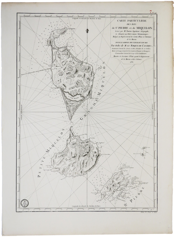
DEPOT GENERAL des CARTES PLANS et JOURNAUX de la MARINE.
[SAINT-PIERRE ET MIQUELON] Carte particulière des îles de St. Pierre et de Miquelon.
[Paris], Dépôt Général des Cartes, Plans et Journeaux de la Marine, 1782. 580 x 412 mm.
书商的参考编号 : LBW0393e
|
|
|
DEPOT-GENERAL DE LA MARINE.
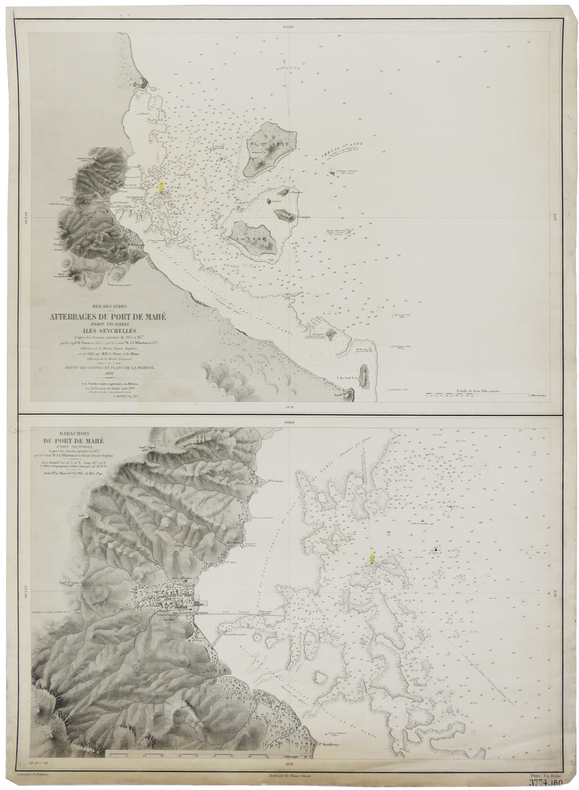
[SEYCHELLES] Mer des Indes. Atterrages du port de Mahé, Port Victoria, Iles Seychelles. - Barachois du port de Mahé, Port Victoria.
Paris, 1880. 630 x 463 mm.
书商的参考编号 : LBW-2419
|
|
|
DEPOT des CARTES et PLANS de la MARINE.
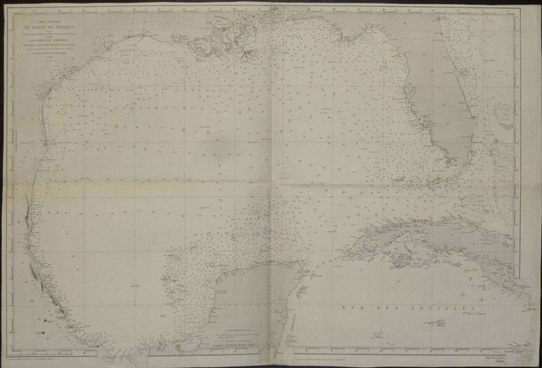
[TEXAS et FLORIDE] Carte générale du golfe du Mexique dressée d'après les travaux américains, anglais et français les plus récents.
Paris, 1865-1882. 635 x 945 mm.
书商的参考编号 : LBW02e51
|
|
|
DEPOT des CARTES et PLANS de la MARINE.
[VENEZUELA et GUYANE] Amérique méridionale. Côtes du Vénézuéla et des Guyanes. Du golfe de Paria au cap d'Orange.
Paris, 1871-1881. 623 x 918 mm.
书商的参考编号 : LBW03956

|
|
|
DEPOT-GENERAL DE LA MARINE.
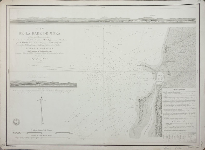
[YEMEN] Plan de la rade de Moka.
Paris, 1843. 427 x 577 mm.
书商的参考编号 : LBW-2412
|
|
|
DEPOT des CARTES et PLANS de la MARINE.
[YEMEN] Côte d'Arabie. Aden et baies adjacentes.
Paris, 1872. 611 x 892 mm.
书商的参考编号 : LBW-2421

|
|
|
Depping (G.-B.)
Les jeunes voyageurs en France.
1824 Etienne Ledoux Libraire Editeur, Paris, 1824. 6 volumes in-12, reliure plein veau marbré, dos lisse orné de frises et de dentelles en queue, pièces de titre et tomaison maroquin rouge, plats ornés de filets et dentelles en encadrement, dentelles intérieures et tranches jaspées, orné de 100 cartes coloriées ou vues de ville en noir hors-texte par A.M. Perrot, gravées par Blanchard, 279, 263, 303, 241, 246 et 238 pages. Rousseurs, néanmoins bel exemplaire.
书商的参考编号 : 2750
|
|
|
Department of State; Administrative Subdivisions of Japan.
[ATLAS]. APPENDIX TO "ADMINISTRATIVE SUBDIVISIONS OF JAPAN". Department of State Publication 2749, Far Eastern Series 19.
Atlas. 47 large color folding maps. XLib. A few maps have XLib stamps in margins, otherwise maps very clean. Large folio. Spiral bound. Original stiff printed wraps, some wear. WWII 2
|
|
|
Depot des cartes et plans de la Marine:
Antilles - Ilde de la Grenade
Paris 1873. French naval chart sheet 3273 sheet size 105.5 x 72 cm engraved by Nyon black and white centrefold one or two marginal nicks and tears blank verso. This detailed chart of Grenada was derived from British Admiralty surveys. Map unknown
书商的参考编号 : 9509
|
|
|
Depot des cartes et plans de la Marine:
Antilles - Ile de Culebra ou du Passage
Paris 1873. French naval chart sheet 3256 sheet size 72.5 x 105 cm engraved by Delamare black and white with coastal profiles in the lower part of the chart centrefold one or two marginal nicks and tears blank verso. This detailed chart of Isla Culebra now an island-municipality of Puerto Rico was derived from British Admiralty surveys. With no permmanent population for centuries the island was settled by the Spanish in the 1880s and ceded to the United States after the Spanish-American War. Map unknown
书商的参考编号 : 9508
|
|
|
Depot des cartes et plans de la Marine:
Antilles - Ile de Montserrat
Paris 1873. French naval chart sheet 3119 50 x33 cm black and white blank verso. Chart of the island of Montserrat in the British West Indies featuring coastal profiles dominated by the Soufrière Hills volcano and an inset of Plymouth the former capital of the island which was destroyed in the volcanic eruptions of the mid 1990s. Map unknown
书商的参考编号 : 8667
|
|
|
Depot des cartes et plans de la Marine:
Japón - Cote Est de Yesso - Baie Akishi
Paris 1873. French naval chart sheet 3245 sheet size 51 x 36 cm engraved by Régnier after a British Admiralty chart of 1871 black and white blank verso. Akkeshi Bay located in Kushiro Subprefecture on the east coast of Hokkaido the most northerly of the main islands of Japan. Map unknown
书商的参考编号 : 8669
|
|
|
Depot des Cartes et Plans de la Marine
Mer Méditerranée partie est. Massive cloth backed set of 1914 edition sheets.
Paris: Dépôt des Cartes et Plans de la Marine 1914. Cloth Backed. Very good. This extensive uncolored sea chart provides comprehensive coverage of the entire Eastern Mediterranean Sea in multiple panels which have been assembled and backed with cloth to form a large composite map. Published by the official French hydrographic office in Paris the "Dépôt des Cartes et Plans de la Marine" which became the Service Hydrographique de la Marine around this time the chart is a practical navigational aid rather than a decorative one. It features a dense network of hydrographic data including numerous soundings indications of sea bed composition and detailed representations of coastlines and harbors. The chart's functional uncolored style is typical of official government maritime surveys designed for practical use by mariners with details corrected and augmented over time to reflect the most current surveys. Sheet dimensions: 76 cm x 107 cm approx. assembled from multiple sheets. Condition: Very Good. Sound paper uncolored as issued minimal signs of wear along seams where sheets are joined. Please see photos for full appraisal of condition. Dépôt des Cartes et Plans de la Marine unknown
书商的参考编号 : 005933
|
|
|
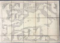
Depot des Cartes et Plans de la Marine
Mer Méditerranée partie ouest. Massive cloth backed set of 1914 edition sheets.
Paris: Dépôt des Cartes et Plans de la Marine 1914. Loose Sheet. Very good. This extensive uncolored sea chart provides comprehensive coverage of the entire Western Mediterranean Sea in multiple panels which have been assembled and backed with cloth to form a large composite map. Published by the official French hydrographic office in Paris the "Dépôt des Cartes et Plans de la Marine" which became the Service Hydrographique de la Marine around this time the chart is a practical navigational aid rather than a decorative one. It features a dense network of hydrographic data including numerous soundings indications of sea bed composition and detailed representations of coastlines and harbors. The chart's functional uncolored style is typical of official government maritime surveys designed for practical use by mariners with details corrected and augmented over time to reflect the most current surveys. Sheet dimensions: 76 cm x 107 cm approx. assembled from multiple sheets. Condition: Very Good. Sound paper uncolored as issued minimal signs of wear along seams where sheets are joined. Please see photos for full appraisal of condition. Dépôt des Cartes et Plans de la Marine unknown
书商的参考编号 : 005930
|
|

 ?????????
 ?????PDF???
 RSS feed
 ??
??


