|
Dewdney, Selwyn
The Map That Grew
32 pages. A story which teaches young readers about mapmaking. Front free endpaper removed. Usual library markings. Worthy working copy. Book

|
|
|
DEYROLLE (Émile) & BERNARD (Albert).
Carte agricole n°9. Géographie économique et agricole. Animaux domestiques. Espèce bovine, ses produits.
Paris, Les Fils d'Émile Deyrolle, [1925]. 793 x 845 mm.
Référence libraire : LBW-7229

|
|
|
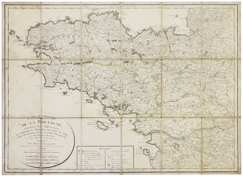
DEZAUCHE (Jean-Claude).
[BRETAGNE] Carte itinéraire de la Bretagne contenant les départemens du Finistère, du Morbihan, des Côtes du Nord, d'Isle et Vilaine et de la Loire Inférieure.
Paris, chez l'auteur, An 8 [1800]. En 18 sections montées sur toile et pliées, formant une carte de 528 x 716 mm.
Référence libraire : LBW-5355
|
|
|
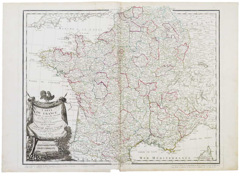
DEZAUCHE (Jean-Claude).
Carte de France suivant sa nouvelle division en CVIII départements, avec les préfectures et sous-préfectures.
Paris, chez l'auteur, An XI-1803. 510 x 621 mm.
Référence libraire : LBW-5410
|
|
|
DEZ.G
POITIERS EN CARTE POSTALES ANCIENNES
BIBLIOTHEQUE EUROPEENNE - ZALTBOMMEL. 1974. In-8. Relié. Bon état, Couv. convenable, Dos satisfaisant, Intérieur frais. environ 115 pages augmentées de nombreuses photos en noir et blanc, situées. . . A l'italienne. Classification Dewey : 741.68-Illustrations des cartes postales
Référence libraire : R320099599
|
|
|
DEZ.G
POITIERS EN CARTE POSTALES ANCIENNES
BIBLIOTHEQUE EUROPEENNE - ZALTBOMMEL. 1974. In-8 Carré à l'italienne. Relié. Bon état. Couv. convenable. Dos satisfaisant. Intérieur frais. environ 115 pages augmentées de nombreuses photos en noir et blanc, situées
|
|
|
DEZAUCHE, J. C. ; DELISLE, Guillaume ; BUACHE, Philippe
Germania Antiqua in diversos populos qui eam coluerunt distincta. [ Carte de l'Allemagne sous l'Antiquité ]
Ex Itinerariis Locupletissimis que Antiquis Auctoribus, qui de hac Regione disseruerunt, et ex Mappis Geographicis Guillelmi Delisle Excerpta, 1 carte au format 83 x 58,5 cm, frontières rehaussées en couleur, Delisle et Buache, Dézauche, Paris, 1796 Bon état Latin

|
|
|
DHEULLAND (Guillaume);
[ALESSANDRIA/TORTONA] Environs d'Alessandrie, et de Tortone.
Paris 1748 230 x 310 mm.
Référence libraire : LBW002af
|
|
|
DHEULLAND (Guillaume);
[BOBIO/PONTREMOLI] Environs de Bobio, et Pontremoli.
Paris 1748 230 x 310 mm.
Référence libraire : LBW002ae
|
|
|
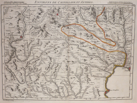
DHEULLAND (Guillaume);
[CASTELLANE/ANTIBES] Environs de Castellane, et Antibes.
Paris 1748 227 x 308 mm.
Référence libraire : LBW004e3
|
|
|
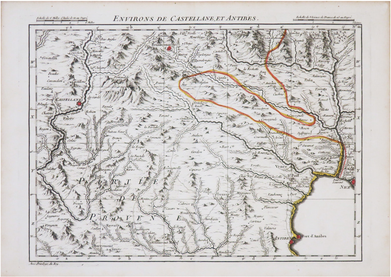
DHEULLAND (Guillaume).
[CASTELLANE & ANTIBES] Environs de Castellane, et Antibes.
[Paris, Dheulland, 1748]. 225 x 307 mm.
Référence libraire : LBW-8970
|
|
|
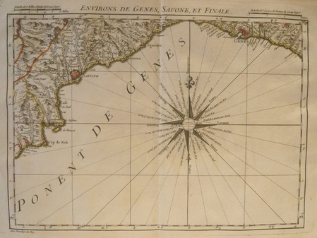
DHEULLAND (Guillaume);
[GENES] Environs de Gênes, Savone, et Finale.
Paris 1748 230 x 310 mm.
Référence libraire : LBW002ac
|
|
|
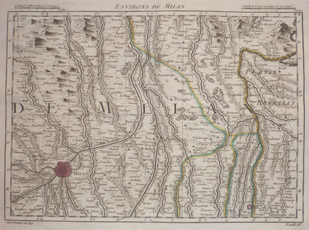
DHEULLAND (Guillaume);
[MILAN] Environs de Milan.
Paris 1748 230 x 310 mm.
Référence libraire : LBW002b5
|
|
|
DHEULLAND (Guillaume).
[NOVARE] Environs de Novare et de Mortara.
Paris, 1748. 230 x 310 mm.
Référence libraire : LBW002b2
|
|
|
DHEULLAND (Guillaume);
[PAYS-BAS/ROTTERDAM] Carte particulière des environs de Rotterdam et Schiedam.
Paris 1747 225 x 303 mm.
Référence libraire : LBW04168

|
|
|
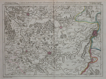
DHEULLAND (Guillaume);
[PAYS-BAS/MAASTRICHT] Carte particulière des environs de Hasselt Maestricht et Tongres.
Paris 1747 227 x 305 mm.
Référence libraire : LBW04184
|
|
|
DHEULLAND (Guillaume);
[PAYS-BAS/UTRECHT] Carte particulière des environs d'Utrecht Goude et Woerden.
Paris 1747 228 x 305 mm.
Référence libraire : LBW0419f
|
|
|
DHEULLAND (Guillaume);
[PAYS-BAS/LA HAYE] Carte particulière des environs de La Haye Leyden et Delft.
Paris 1747 227 x 306 mm.
Référence libraire : LBW041a0
|
|
|
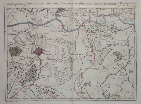
DHEULLAND (Guillaume);
[PAYS-BAS/BREDA] Carte particulière des environs de Breda et Geertruydenberg.
Paris 1747 227 x 305 mm.
Référence libraire : LBW041a1
|
|
|
DHEULLAND (Guillaume).
[SESTO/BIAGRASSO] Environs de Sesto, et de Biagrasso.
Paris, 1748. 230 x 310 mm.
Référence libraire : LBW002b8
|
|
|
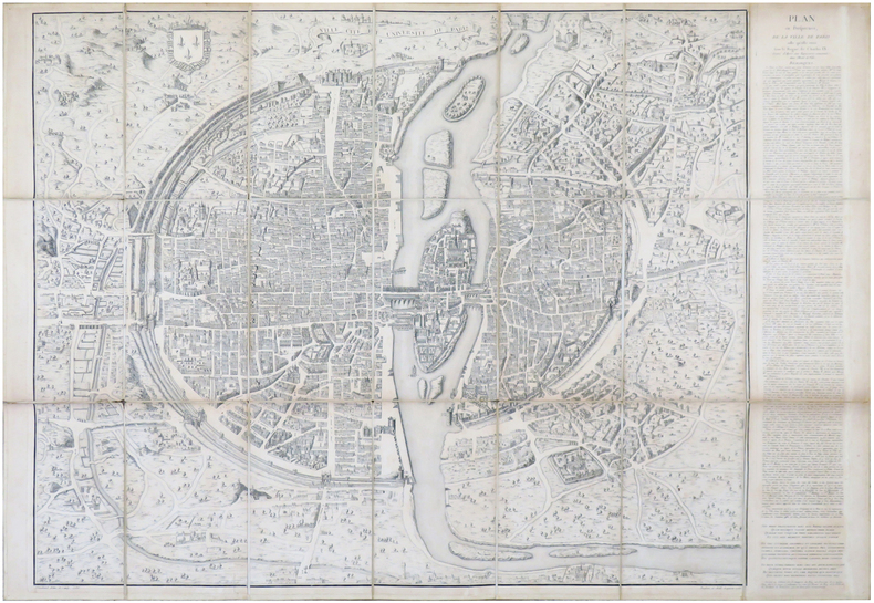
DHEULLAND (Guillaume) & ANDROUET du CERCEAU (Jacques).
Ville, Cité, et Université de Paris. Plan en perspective, de la ville de Paris telle qu'elle étoit sous le règne de Charles IX.
Paris, [1552-1756-milieu du XIXe]. En 21 sections montées sur toile et pliées, formant un plan de 694 x 991 mm ; étiquette au dos de l'éditeur Charles Simonneau.
Référence libraire : LBW-6930
|
|
|
DI MARIA (Yves).-
Guide pratique de la carte postale.
1981 Numéro Hors Série du "Collectionneur Français", 1981, in 4° broché, 70 pages ; importante iconographie ; couverture illustrée.
Référence libraire : 79172
|
|
|
DIAZ (Gérard).
Carte de voeux illustrée d'une gravure originale signée.
Paris Société des peintres-graveurs français 1986 1 vol. Broché Carte de voeux dépliante sur Arches illustrée d'une eau-forte (15 x 9 cm) signée et datée par Gérard Diaz. En parfait état.
Référence libraire : 109092
|
|
|
DIAZ (Gérard).
Carte de voeux illustrée d'une gravure originale signée.
Paris Société des peintres-graveurs français 1986 1 vol. Broché Carte de voeux dépliante sur Arches illustrée d'une eau-forte (15 x 9 cm) signée et datée par Gérard Diaz. En parfait état.
Référence libraire : 109092
|
|
|
DIAZ (Gérard).
Carte de voeux illustrée d'une gravure originale signée.
Paris Société des peintres-graveurs français 1995 1 vol. Broché Carte de voeux dépliante sur Arches illustrée d'une eau-forte en couleurs (diamètre 13 cm) signée par Gérard Diaz. En parfait état.
Référence libraire : 109107
|
|
|
DIAZ (Gérard).
Carte de voeux illustrée d'une gravure originale signée.
Paris Société des peintres-graveurs français 1995 1 vol. Broché Carte de voeux dépliante sur Arches illustrée d'une eau-forte en couleurs (diamètre 13 cm) signée par Gérard Diaz. En parfait état.
Référence libraire : 109107
|
|
|
DIAZ (Gérard).
Menu illustré d'une gravure originale signée.
Paris Les Amis du livre contemporain et Automobile-Club de France 1993 1 vol. Broché Menu dépliant sur Arches illustré d'une eau-forte (27 x 21 cm) dédicacée par Gérard Diaz et justifiée 9/100. En parfait état.
Référence libraire : 109109
|
|
|
DIAZ (Gérard).
Menu illustré d'une gravure originale signée.
Paris Les Amis du livre contemporain et Automobile-Club de France 1993 1 vol. Broché Menu dépliant sur Arches illustré d'une eau-forte (27 x 21 cm) dédicacée par Gérard Diaz et justifiée 9/100. En parfait état.
Référence libraire : 109109
|
|
|
DIAZ (Gérard)
Menu illustré d'une gravure originale signée.
Paris Société Les Amis Bibliophiles 1985 1 vol. Broché Menu dépliant sur Arches illustré d'une eau-forte (11.5 x 6.5 cm) signée par Gérard Diaz. En parfait état.
Référence libraire : 109142
|
|
|
DIAZ (Gérard)
Menu illustré d'une gravure originale signée.
Paris Société Les Amis Bibliophiles 1985 1 vol. Broché Menu dépliant sur Arches illustré d'une eau-forte (11.5 x 6.5 cm) signée par Gérard Diaz. En parfait état.
Référence libraire : 109142
|
|
|
Dichand Hans:
Jugendstilpostkarten Die bibliophilen Taschenbücher.
Dortmund, Harenberg-Kommunikation, 1984 Carnet de cartes postales au format. . . carte postale. Infime trace de pli au second plat, pour le reste à l'état de neuf.
Référence libraire : 20486

|
|
|
DICTA et FRANCOISE
TAROT DE MARSEILLE
1987 cartonné violet éditeur (editor hard-back) in-octavo carré, premier plat illustré en couleurs (front cover illustrated in colours), tranches lisses (smooth edges), illustrations en noir, 189 pages, 1987 à Paris Mercure de France,
Référence libraire : 12454
|
|
|
Dickens, AG
The East Riding of Yorkshire with Hull and York
No marks or inscriptions. No creasing to covers or to spine. A lovely clean crisp very tight copy with bright boards and no bumping to corners. Slight browing to page edges. No dust jacket. 131pp. With twenty four black and white photographs. A character sketch of the old East Riding covering the land East of York, Malton and Selby, north of the Humber and reaching up to Filey on the coast.

|
|
|
Dickens, Charles
Nicholas Nickleby: Volume I
511 pages, illustrated, introduction by George Gissing, page edges foxed, top page edges gilt. eng
|
|
|
Dickens, Charles
Nicholas Nickleby: Volume II
viii,499 pages, illustrated by R.J. Williams, introduction by George Gissing, notes by F.G. Kitton, page edges foxed, top page edges gilt. eng
|
|
|
Didier Richard Maps
Pays du Mont-Blanc-Beaufortain, Avavis-Val D'Arly (FRANCAIS) Carte – Carte pliée, décembre 1997
Institut Geographique National (décembre 1997)
Référence libraire : lc_10774
|
|
|
DIEULEFILS P.-
Carte postale annonce: Les Mangeurs de Poux en Famille. Tonkin. Hanoï. 659.-
La partie droite laissée libre de cette carte postale est utilisée à une annonce intitulée Étrennes utiles, proposant un joli album gratuit à tout acheteur d'une collection de 100 cartes postales au prix de 13 francs ou 6 piastres...Le petit mot adressé à un collectionneur précise qu'il s'agit de sa nouvelle collection. Hanoï. Photographie Dieulefils. Non datée, sans doute expédiée sous enveloppe. Carte postale (140 x90mm), cliché de 81 x 55mm, très net. Bel état.
Référence libraire : ORD-3163
|
|
|
DIERKENS Alain
Inventaires des cartes, plans et registres divers (fin XIXe - début XXe siècle).
Bruxelles, Archives Générales du Royaume, 1980. 20 x 29, 55 pp., broché, très bon état.
Référence libraire : 21894
|
|
|
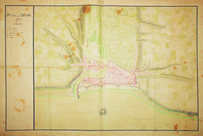
DIEPPE. MANUSCRIT.
Plan de Dieppe.
1730. 600 x 905 mm.
Référence libraire : LBW-4156
|
|
|
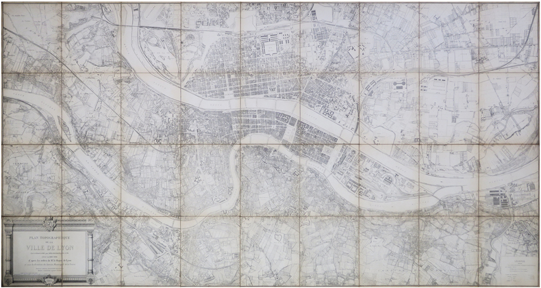
DIGNOSCYO (Laurent de) & DIGNOSCYO (Claude de).
[LYON] Plan topographique de la ville de Lyon levé et dressé en 1863 par M.M.rs Dignoscyo père et fils, révisé en 1883-1884.
1886. En 36 sections montées sur toile et repliées, formant un plan de 1,12 x 2,12 m.
Référence libraire : LBW-8141
|
|
|
DIJON SUD-EST
Carte au 1/80 000e.
Une feuille 53,5x34,5 cm.
|
|
|
Dikenman, Johann Rudolf (1832-1888)
Berne prise de l'Enge.
Zürich, chez R. Dikenman, Peintre, um 1857. Kol. Aquatinta. Bildgrösse: 7,5 x 11,2 cm. Blattgrösse: 13 x 16 cm. + Wichtig: Für unsere Kunden in der EU erfolgt der Versand alle 14 Tage verzollt ab Deutschland / Postbank-Konto in Deutschland vorhanden +, Bild
Référence libraire : 595BG

|
|
|
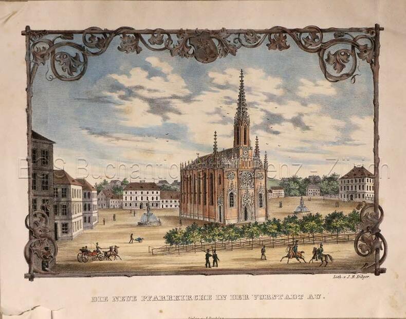
Dilger, J.B.:
Die neue Pfarrkirche in der Vorstadt Au (heute in München).
(München, Jesef Deschler Verlag, um 1940. Altkolorierte Lithographie. Bildgrösse: 14,5 x 21,5 cm. Blattgrösse: 19 x 24 cm.
Référence libraire : 769CG
|
|
|
Dilger, J.B
Die neue Pfarrkirche in der Vorstadt Au (heute in München).
(München, Jesef Deschler Verlag, um 1940. Altkolorierte Lithographie. Bildgrösse: 14,5 x 21,5 cm. Blattgrösse: 19 x 24 cm. + Wichtig: Für unsere Kunden in der EU erfolgt der Versand alle 14 Tage verzollt ab Deutschland / Postbank-Konto in Deutschland vorhanden +, Abb.
Référence libraire : 769CG

|
|
|
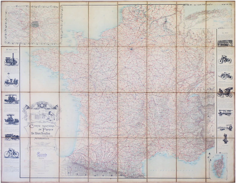
DION BOUTON.
Carte routière de France de Dion Bouton spéciale pour automobiles.
Paris, J. Barreau, 1900. En 32 sections montées sur toile et repliées, formant une carte de 1,28 x 1,56 m.
Référence libraire : LBW-7922
|
|
|
DIRECCION de HIDROGRAFIA;
[NICARAGUA] Costa de Mosquitos - Puerto y boca del rio de S. Juan de Nicaragua.
1818 184 x 261 mm.
Référence libraire : LBW02e4a

|
|
|
DIRICKX Frères
Commémoration du Centenaire de la Belgique (1830-1930), album souvenir de l'Exposition internationale d'Anvers, 1930/Herdenking van Belgïe's Eeuwfeest (1830-1930), Gedenk-album der Wereldtentoonstelling, Antwerpen 1930.
Anvers, Dirickx Frères, 1930. 20 x 15, sans pagination, plusieurs illustrations, cartonnage d'édition imprimé, bon état.
Référence libraire : 28016
|
|
|
Direzione Generale del Censo
Pianta Topografica di Roma pubblicata dalla Direzione Generale del Censo ed aggioranta a tutto il corrente anno MDCCCLXVI
Rara pianta della città, a proiezione verticale, orientata con il nord in alto.La pianta fu pubblicata per la prima volta nel 1829: "La pianta del Censo è senz'altro la più accurata e significativa pianta della Roma Papale nel sec. XIX. Gli edifici sono campiti a tratteggio; chiese e monumenti principali sono rappresentate con la pianta interna. L'orografia è chiaramente leggibile così come il disegno del verde. Ampia legenda sul lato sinistro ed in basso a destra elenco dei XIV rioni. È raffigurata la sola città entro il perimentro delle mura che risalta pertanto nitidamente sul fondo bianco. Il Cardinale Cesare Guerrieri, primo presidente della Congregazione dei Catasti (poi Censo) dal 1816 al 1832, fece incidere e pubblicare questa pianta, basandosi sulle mappe manoscritte del Catasto Urbano ordinate da PIO VII nel 1818 e completate nel 1822" (cfr. Marigliani p. 323). Una seconda stesura dell'opera viene alla luce nel 1854, ristampa delle lastre originali, che contiene l'indicazione del ponte di ferro costruito accanto a Ponte Rotto. La pianta fu poi definitivamente emendata nel 1866 - questa nostra edizione."E' la più accurata immagine della città subito prima che diventasse capitale. Compare il ponte di ferro a San Giovanni dei Fiorentini (1863) ed è indicata la fabbrica dei tabacchi (1863) con l'antistante Piazza Matai (1864). Ci sono le linee ferroviarie a Termini (1862) mentre manca ovviamente il fabbricato die viaggiatori (1867). È riportato infine il primo tratto di via Nazionale (fino a via Quattro Fontane), tracciata proprio nel 1866" (cfr. Marigliani p. 411).Acquaforte, stampata da 4 lastre su altrettanti fogli di carta coeva, tagliati, applicati su tela e montati ad astuccio. Tela leggermente lesionata nelle pieghe, per il resto in buono stato di conservazione.Esemplare con ex-libris della libreria di Ulderico Bossi, che aveva sede in Roma a via del Corso 401.BibliografiaA. P. Frutaz, "Le piante di Roma", n. 191; C. Marigliani, "Le Piante di Roma delle collezioni private", n. 354; Scaccia Scarafoni, "Le Piante di Roma", n. 312. Rare map of the city, with vertical projection, oriented with the north at the top.The map was published for the first time in 1829, and is undoubtedly the most accurate and significant map of Papal Rome in the nineteenth century. Wide key-legend on the left side and at the bottom right list of the XIV districts. It is represented the only city within the perimeter of the walls that stands out clearly on the white background. Cardinal Cesare Guerrieri, first president of the Congregazione dei Catasti (later Censo) from 1816 to 1832, had this map engraved and published, based on the manuscript maps of the Catasto Urban ordered by PIO VII in 1818 and completed in 1822. A second issue of the map comes to light in 1854, reprint of the original plates, which contains the indication of the iron bridge built next to Ponte Rotto. The map was then definitively amended in 1866 - our edition.It is the most accurate image of the town just before it became capital of Italy. The iron bridge appears in San Giovanni dei Fiorentini (1863) and the tobacco factory (1863) is indicated with the opposite Piazza Matai (1864). There are the railway lines at Termini (1862) while the travellers' building (1867) is obviously missing. Finally, shows the first part of Via Nazionale, traced in 1866.Etching, printed from 4 plates on 4 sheets of contemporary paper, cut, applied on canvas and mounted in a box. Canvas slightly damaged in the folds, otherwise in good condition.Exemple with ex-libris of the book seller Ulderico Bossi, which was based in Rome in via del Corso 401.BibliografiaA. P. Frutaz, "Le piante di Roma", n. 191; C. Marigliani, "Le Piante di Roma delle collezioni private", n. 354; Scaccia Scarafoni, "Le Piante di Roma", n. 312. A. P. Frutaz, "Le piante di Roma", n. 191; C. Marigliani, "Le Piante di Roma delle collezioni private", n. 354; Scaccia Scarafoni, "Le Piante di Roma", n. 312.

|
|
|
Disney Walt:
Mickey Mouse - petite sérigraphie.
Christian Desbois, 1999. Rare petite sérigraphie au format 15 x 22, avec sa serpente muette. A l'état de neuf.
Référence libraire : 828

|
|
|
Disney Walt:
Mickey Mouse - petite sérigraphie.
Christian Desbois, 1999. Rare petite sérigraphie au format 15 x 22, avec sa serpente muette. A l'état de neuf.
Référence libraire : 24997

|
|

 Recevoir par e-mail
 Télécharger en PDF
 Flux RSS
 Lien permanent


