|
|
|
Engers, Joe: Editor
The Great Book of Wildfowl Decoys
320 pages. Presents decoys in the most sensible and comprehensive way: by region, with each region discussed by a recognized expert in that area. Thus the entire range of decoys is covered, from Canada down the Atlantic Coast and inland along streams and rivers to Louisiana and up the Mississippi to the Great Lakes and across to California and Oregon. Also included are chapters on European decoys, the history of decoys, how decoys were made, and how to go about collecting decoys. A list of public collections of decoys, a bibliography, a record of top auction prices, maps of waterfowl flyways, and an index complete the package. Beautifully illustrated with colour photography throughout. Gift greetings upon front endpaper else book clean, bright and unmarked with very light wear. Dust jacket bears tape-repaired tear to central portion of front panel and large chunk missing from base of back flap. A small part of this chunk is from bottom corner of back panel. Other than this, dust jacket is bright and attractive with moderate wear. Overall, a nice copy of this most substantial work. Book
|
|
|
Engineering Maps KK Saichi Nonoyama
basic mechanics
Engineering Maps KK Saichi Nonoyama 1964. Soft Cover. Fine. The book is in fine condition. Engineering Maps KK Saichi Nonoyama paperback
Referentie van de boekhandelaar : 2083002116200859
|
|
|
Engle, Eloise; Paananen, Lauri
The Winter War: The Russo-Finnish Conflict, 1939-40
176 pages including index, bibliography and appendices. Black and white illustrations. Maps. "For months the Finns, who received scant help from an admiring world of sympathizers and avowed allies, held on. Yet the holding could only last until the Russians gathered themselves. When that happened and Red wheel-to-wheel artillery attacks and new hordes of troops and tanks again took their toll, the Finns bowed to the inevitable defeat... Describes the big picture and relates the stories of many individual Finns and Russians in combat. The result is a fascinating and moving book." - from dust jacket. Usual library markings. Above-average wear. Worthy reading copy. Book
|
|
|
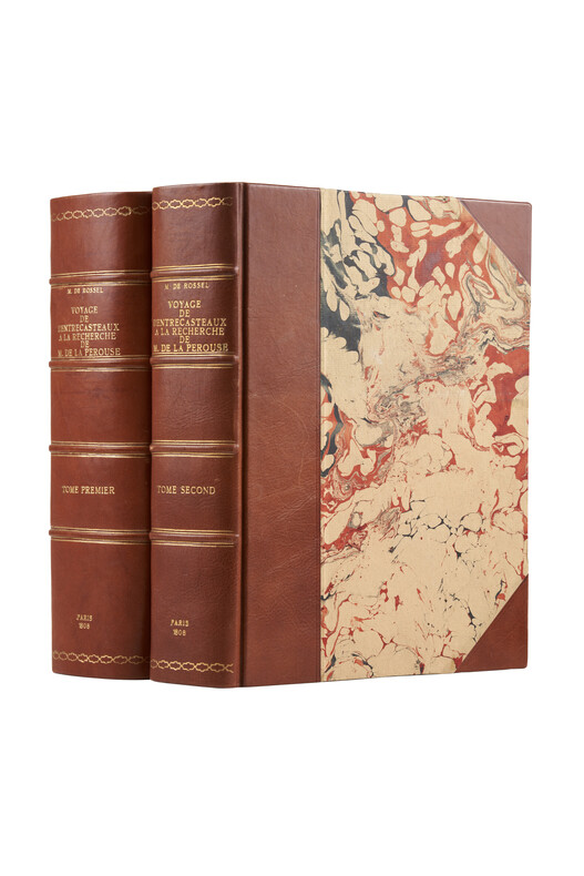
ENTRECASTEAUX (Dentrecasteaux ,J.-A. de Bruni, d'), ROSSEL (Éd. De, rédacteur)
Voyage de Dentrecasteaux, envoyé à la recherche de La Pérouse, publié par ordre de Sa Majesté l'Empereur et Roi, sous le ministère de S. E. le vice-amiral Decrès, comte de l'Empire.
Paris, Imprimerie impériale, 1808. 2 grands et forts volumes in-4 (32x24), lvi, 704 p., 33 pl. ; viii, 692 p., relié demi basane et coins moderne, dos avec auteur, titre, tomaison, lieu et date, exlibris en page de garde, non rogné, tome 2 non coupé, petite mouillure au tome 2, petites rousseurs aux illustrations du tome 1. Exemplaire sur papier bleuté, complet de son illustration mais sans son atlas de cartes
Referentie van de boekhandelaar : PHO-1626
|
|
|
Environment Canada
British Columbia Land Capability for Wildlife - Waterfowl: 1:1,000,000 - Canada Land Inventory: Two Fold-out Maps
Catalogue No. En 64-14w/7N-7S. Folds open to reveal two large fold-out maps. Average wear. Minimal markings. A sound working copy. Book

|
|
|
ENVIRONS DE ROUEN
Carte au 1/80 000?me. Sans date.
Une feuille. 62x44 cm.
|
|
|
Erfurt:
Charte vom Königlich Preussischen Regierungsbezirk Erfurt nach seiner Eintheilung in 9 Kreise. Lithographie.
Karte: 34 x 38 cm. Blattgröße (mit Texterläuterungen): 46 x 57 cm. *Zeigt den Regierungsbezirk Erfurt mit Weimar, Gotha, Erfurt im Zentrum. Die Karte ist umgeben von Texterläuterungen, statistischen und geographischen Angaben. - Etwas gebräunt und mehrfach gefaltet. Landkarten de
|
|
|
ERHAN ÖNER.
A journey through maps from the Ottoman world to the Republic of Turkey. From Constantinople to Istanbul between the 15th and the 20th centuries. The cartographic collection of Erhan Öner. 4 volumes set. Vol. 1:
New New English Original bdg. Dust wrapper. In publisher's special box. 4to. (1934, [4] p.), color and b/w ills. A journey through maps from the Ottoman world to the Republic of Turkey. From Constantinople to Istanbul between the 15th and the 20th centuries. The cartographic collection of Erhan Öner. 4 volumes set. A project of passion and patience: For four decades Erhan Öner has been painstakingly collecting maps of Turkey, assembling a cartographic collection that is now one of the largest and most comprehensive of the area. His maps range in date from the 15th century, the early days of the Ottoman Empire, through to the 20th century and the early days of the Republic, and encompass historical, military, marine and archaeological maps, and even postcards with maps on them. Examples by the renowned cartographers Abraham Ortelius, Gerardus Mercator, Jodocus Hondius, Homann Heirs, Freres Lotter, Visscher Family, Sanson Family, John Speed and Frederick de Wit are among the highlights. A project of passion and patience, Öner's collection is finally being published in a four-volume catalogue. Displaying as many as 1,500 maps on 2,000 pages, it will be an important reference work for academics, researchers and fellow collectors. At the same time it is a visual feast, with beautiful illustrations, engravings and vignettes. Contents: Vol. 1: HISTORICAL MAPS OF TURKEY. 15th - 16th Centuries, 17th Century, 18th Century, 19th Century, 20th Century. TURKEY IN EUROPE. Vol. 2: REGIONAL MAPS. Black Sea, Thrace, Sea of Marmara Dardanelles, Aegean Archipelago. Mediterranean Sea, Central, Eastern and South East of Turkey,Middle East, Serial. OTTOMAN VILAYETS AND SANCAKS Postcard Maps, Yumni Maps. Other Vilayet Maps PORT PLANS. RAILWAYS. RELIGION RELATED MAPS, THE RETREAT OF THE TEN THOUSAND MAPS. GEOLOGICAL MAPS. POSTCARD MAPS. CLIPPINGS. Vol. 3: MILITARY MAPS. War and Peace Maps and Plans Maps of Erkan-¿ Harbiye. Harita Umum Müdürlügü, Milli Müdâfaa Vekâleti. Harita Genel Müdürlügü, Harita Genel Direktörlügü Maps of War Office & Ordnance Survey Office, Henri & Richard Kiepert Maps. ATLASES. Vol. 4: ISTANBUL NECIP BEY MAPS OF ISTANBUL: Societe Anonyme, Ottomane d'etudes et d'entreprises Urbanies. KESFlYÂT VE ¿NSAAT TÜRK ANON¿M S¿RKETl, TURKISH SURVEY AND CONSTRUCTION COMPANY UNFINISHED MAP OF ¿STANBUL, INSURANCE PLANS OF ISTANBUL. ARCHEOLOGICAL MAPS. OTHER CITIES. INFORMATION ABOUT CARTOGRAPHERS. ENGRAVERS AND BOOK PUBLISHERS.
|
|
|
Erich Bachman, Burkard von Roda and Werner Hemlbeger (editors)
The Wurzburg Residence and Court Gardens
Book in mint condition. 200pp. History and description of the German Palace in Wurzburg between Frankfurt and Nuremberg, considered to be the most beautiful Palace in the country. Very well illustrated.

|
|
|
Erna Fergusson, SIGNED & INSCRIBED by Author, End papers are nautical maps of the Hawaiian Islands surrounded by the Pacific Oce
Our Hawaii of this history and travelogue through Hawaii
A.A. Knopf New York 1942 HARDBACK NODustjacket 1942 Stated 1st EDITION First Printing NF/NF NOJACKET Dates Match on title & Copyright pg bound in GREEN buckram cloth with Gilt design & title 304 pages of clean bright highly illustrated text with no dust jacket Title and a decoration device are embossed into the front cover in bright gilt. Title Author's name as well as two decorative devices are embossed into the spine in bright gilt. Interior nice tight clean Light Wear Fox Index. Signed by Authors. 1st Edition. Hardcover. Near Fine/No Jacket. A.A. Knopf, New York, hardcover
Referentie van de boekhandelaar : 27092
|
|
|
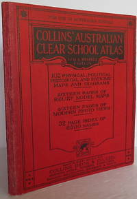
Ernest A Manchester (maps)
Collins' Australian Clear School Atlas New and Revised Edition : 102 physical political historical and economic maps 16 relief model maps 23 modern photo-views complete Index
Sydney: Collins. Softcover. Published Sydney: Collins 1930. Small 4to. wrappers 7 3/8" x 8 3/4" vii 92pp32pp. illustrated with b/w photos maps some color. Stiff red boards and red cloth. Very good plus clean attractive. . Very Good Plus. Soft cover. 1930. Collins paperback
Referentie van de boekhandelaar : 009775
|
|
|
Escher, Arthur; Watt, W. Stuart: Editors. Ellitsgaard-Rasmussen, K. (Preface)
Geology of Greenland
603 pages. Index. Footnotes. Black and white photos. Fold-out maps. Printed upon glossy stock. "Aims to provide a concise modern account of nearly all aspects of Greenland's geology." - from Preface. Small inkstamp atop front free endpaper, otherwise unmarked with light wear. Binding sound. A quality copy of this highly-informative academic work. Book

|
|
|
ESCOLANO UTRILLA, Severino (Director).
Atlas de Geografía de Aragón.
Zaragoza, Institución Fernando el Católico, 1995. Folio; 99 dípticos y trípticos con texto, gráficos y mapas, encartados en estuche en cartoné.

|
|
|
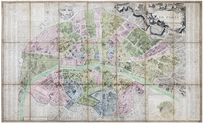
ESNAUTS (Jacques) & RAPILLY (Michel).
Nouveau plan routier de la ville & faubourgs de Paris divisé en 48 sections d'après le décret de l'Assemblée N.ale.
Paris, Esnauts et Rapilly, 1792. En 21 sections montées sur toile et pliées, formant un plan de 0,67 x 1,09 m.
Referentie van de boekhandelaar : LBW-6241
|
|
|
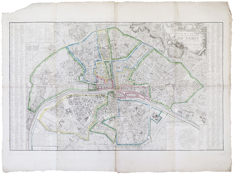
ESNAUTS (Jacques) & RAPILLY (Michel).
Nouveau plan routier de la ville & faubourgs de Paris divisé en 12 arrondissemens ou municipalités.
Paris, Esnauts et Rapilly, 1797. 0,65 x 1,05 m.
Referentie van de boekhandelaar : LBW-6291
|
|
|
Esposito, Vincent J. (ed.)
West Point Atlas of the Civil War
14" wide x 10.5" tall book in excellent condition.with very handsome blue spine and grey cloth covers with large gilt print. Binding is solid and square, covers have sharp corners, exterior shows no blemishes, text/interior is clean and free of marking of any kind with full page very detailed maps on heavy paper, text on opposite page. Dust jacket shows edge wear, small tears, price clipped. From flyleaf: "Utilizing a technique revolutionary in military writing, that of combined map and adjoining text, Col. Esposito and his staff present clearly and concisely, ., the events of the military campaigns and the factors that influenced the course of action and the outcome of the civil War. The battle maps do not merely portray static situations; they are dynamic, with many map sequences clearly showing the movements of the opposing forces from day to day, sometimes from hour to hour. Moreover, each map is accompanied by text on the opposite page; while the theme is developed in the map, this supplementary narrative explains and comments on the situation pictured. The nineteen major campaigns of the war are carefully detailed in this manner. Explanatory symbols in color make clear troop movements, time sequences, numerical strength of units, boundaries, fortifications, and all the other elements necessary for an understanding of the strategies and tactics involved in the campaigns and specific battles." Chronological chart, large bibliography, plus maps of the Colonial wars, Revolutionary War, 1812, Mexicqn war,

|
|
|
ESQUER, Gabriel.
Iconographie historique de l’Algérie depuis le seizième siècle jusqu’à 1871. (Collection du Centenaire de l’Algérie, 1830 – 1930).
Paris : Plon, 1929. 3 grands volumes in-folio ; 354 planches dont 18 en couleurs, tables des noms et des matières. En feuilles sous chemise cartonné à lacets. Quelques rousseurs sur les feuillets de texte préliminaire.TomeI: Texte. Planches I à 66 (XVIesiècle-1826); TomeII: Planches 67 à 217 (1827-1837); TomeIII: Planches 218 à 354 (1838-1871) Les planches rassemblent plus de mille illustrations constituées par des peintures, dessins, estampes, images populaires, sculptures, médailles, représentant des portraits, vues de ville et vues du pays.
Referentie van de boekhandelaar : PHO-1046

|
|
|
ESQUIMAUX POLAIRES de THULE par Jean MALAURIE.
Les derniers rois de Thulé. Avec les esquimaux polaires, face à leur destin. 89 illustrations ; 11 cartes.
CFL/Plon 1986 (4e éd.). Bel exemplaire relié, jaquette, fort in-8, 642 pages + planches.
Referentie van de boekhandelaar : AUB-6306
|
|
|
Esso
Esso road map : Northern England
Revised edition. 1 folded map. Very Good condition. (Section ; no. 5). 50977. eng
|
|
|
Esso Staff
Esso Guia Turistica De America Del Sur (Esso South American Road Map)
24" x 34". Text in Spanish. Back side shows the continent overlaid with small color illustrations of dozens of items of local interest. Undated but appears to be circa late 1950s. Library markings. Average wear. A sound copy. Book

|
|
|
ESTEBE (Léon-Mary).
Villeneuve de Berg.
Villeneuve de Berg, association-Services "le Prieuré", s.d. (années 80 ou 90), 1 carte postale de 10 x 15 cm ;
Referentie van de boekhandelaar : 7535
|
|
|
ESTIVALS (Robert), GAUDY (Jean-Charles).
La Bibliologie graphique. L'évolution graphique des plans de Paris (1530-1798)
Paris, Société de bibliologie et de schématisation, 1983 in-8, 296 pp., impression en partie sur papier rouge, en partie sur papier bleu, avec des illustrations dans le texte, broché.
Referentie van de boekhandelaar : 227987

|
|
|
Estournelles de Constant, Paul Henri Benjamin, Baron d' (1852-1924).
LES ETATS-UNIS D'AMERIQUE.
pp. ix, 536 + Folding map. 12mo. Handsome contemporary leather backed marbled boards binding. An interesting and wide-ranging study of important aspects of American life before World War One. Scarce. **PRICE JUST REDUCED! FR5
|
|
|
Et des Cartes Geographiques, Gravures, Lithographi
Bibliographie de la France ou Journal Général de l'Imprimerie Et de la Libraire 1835 Vol. 24
paperback. Good. Access codes and supplements are not guaranteed with used items. May be an ex-library book. paperback
Referentie van de boekhandelaar : 1390716589.G ISBN : 1390716589 9781390716580
|
|
|
Etablissements LABOUCHE Frères
Nouveau Plan De Toulouse avec Les Nouvelles Dénominations De Certaines Voies Publiques Courant Avril 1946 après L'impression Du Plan
Très beau plan lithographié et plié de 53 cm X 70 cm en couleurs à l'échelle 1/10 000°de la ville de Toulouse . Quelques défauts d'usages sur la couverture mais le plan est parfait .- 1 p. , 250 gr.
|
|
|
Etablissements LABOUCHE Frères
Nouveau Plan De Toulouse avec Les Nouvelles Dénominations De Certaines Voies Publiques Courant Avril 1946 après L'impression Du Plan
Toulouse Labouche Frères 1946 In 16 Très beau plan lithographié et plié de 53 cm X 70 cm en couleurs à l'échelle 1/10 000°de la ville de Toulouse . Quelques défauts d'usages sur la couverture mais le plan est parfait .- 1 p. , 250 gr.
Referentie van de boekhandelaar : 007288

|
|
|
Etang de Berre.Dépôt général de la Marine ,1848.
Côtes de France. Etang de Berre. Carte levée en 1844, publiée en 1848
1844 Côtes de France. Etang de Berre. Carte levée en 1844, publiée en 1848 Imp. du Sémaphore. Gravure, 1848. 63 x 50 cm.
Referentie van de boekhandelaar : 22824
|
|
|
EUGÈNE-HENRI FRICX
Table des cartes des Pays Bas et des frontieres de France, avec un recueil des plans des villes, siéges et batailles données entre les hauts allies et la France.
Brussels, 1712. Folio (512 x 315 mm). In contemporary half calf with seven raised bands. Spine and hindges with wear. Leather brittle and upper and lower 10 cm hindges detached. Two library labels pasted on to pasted down front end-paper. Upper margin of first three leaves blind-stamped. Handwritten (19th century hand) index mounted in on verso of first map and each map numbered. With 75 maps and plans, many double-page or folding: 24 cartes des Pays Bas, Carte générale de Brabant, Carte du Pays de Waes, Carte des Postes d'Allemagne, 48 plans des Villes, Sièges & Batailles (complete). 3 maps with minor marginal tear (outside plate), 2 with minor split to lower part of middle folding. A few maps at end with browning. A few plates (primarily 61, 50, 33, 25) heavily trimmed with slight loss to upper margin. An overall fine and clean copy.
|
|
|
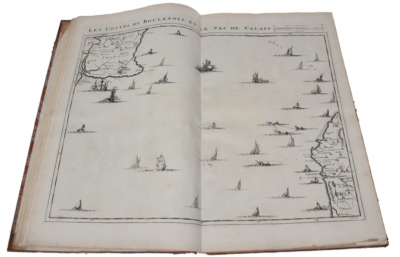
EUGÈNE-HENRI FRICX
Table des cartes des Pays Bas et des frontieres de France, avec un recueil des plans des villes, siéges et batailles données entre les hauts allies et la France. - [ONE OF THE MOST IMPORTANT MAP PUBLISHERS IN THE SOUTHERN NETHERLANDS]
Brussels, 1712. Folio (512 x 315 mm). In contemporary half calf with seven raised bands. Spine and hindges with wear. Leather brittle and upper and lower 10 cm hindges detached. Two library labels pasted on to pasted down front end-paper. Upper margin of first three leaves blind-stamped. Handwritten (19th century hand) index mounted in on verso of first map and each map numbered. With 75 maps and plans, many double-page or folding: 24 cartes des Pays Bas, Carte générale de Brabant, Carte du Pays de Waes, Carte des Postes d'Allemagne, 48 plans des Villes, Sièges & Batailles (complete). 3 maps with minor marginal tear (outside plate), 2 with minor split to lower part of middle folding. A few maps at end with browning. A few plates (primarily 61, 50, 33, 25) heavily trimmed with slight loss to upper margin. An overall fine and clean copy.
Referentie van de boekhandelaar : 60165
|
|
|
EULER Leonhard (Basilea 1707 - San Pietroburgo 1783)
Tabula Geographica Hemisphaerii Australis...
Carta a proiezione polare dell'emisfero australe, pubblicata per la prima volta nel 1753 da Leonhard Euler.Mostra la Tasmania e la Nuova Guinea ancora uniti all'Australia; il Sud Africa e il Sud America. Include un cartiglio decorativo con titolo e stemmi.La carta è pubblicata nel raro Atlas geographicus omnes orbis terrarum regiones in XLI tabulis exhibens : jussu Academiae regiae scient. et eleg. litt. Boruss. ad emendatiora, quae adhuc prodiere exempla descriptus atque ad usum potissimum scholarum et institutionem juventutis editus = Atlas geographique representant en XLI cartes toutes les regions de la terre : gravé par ordre de l'Académie royale des sciences et belles lettres de Prusse d'apres les meilleurs exemplaires qui ayent paru jusqu'icy a l'usage principalement des ecoles. Berolini : Ex officina Michaelis MDCCLIII (1753). Incisione in rame, bella coloritura coeva, in ottimo stato di conservazione. Hand colored copperplate engraving map of Southern Hemisphere on 2 sheets, extracted from a geographical atlas first published in 1753 by Leonhard Euler. Relief shown pictorially. Shows Tasmania and New Guinea still joined to Australia, South Africa, South America. Published in the rare Atlas geographicus omnes orbis terrarum regiones in XLI tabulis exhibens : jussu Academiae regiae scient. et eleg. litt. Boruss. ad emendatiora, quae adhuc prodiere exempla descriptus atque ad usum potissimum scholarum et institutionem juventutis editus = Atlas geographique representant en XLI cartes toutes les regions de la terre : gravé par ordre de l'Académie royale des sciences et belles lettres de Prusse d'apres les meilleurs exemplaires qui ayent paru jusqu'icy a l'usage principalement des ecoles. Berolini : Ex officina Michaelis MDCCLIII.Copperplate with fine origibal colour, very good condition.

|
|
|
EULER Leonhard (Basilea 1707 - San Pietroburgo 1783)
Tabula Geographica Hemisphaerii Borealis…
Carta a proiezione polare dell'emisfero boreale, estratta dall'atlante geografico pubblicato per la prima volta nel 1753 da Leonhard Euler.Mostra un vasto sistema fluviale nella zona dei Grandi Laghi che forma un Passaggio a Nord-Ovest.La carta è pubblicata nel raro Atlas geographicus omnes orbis terrarum regiones in XLI tabulis exhibens : jussu Academiae regiae scient. et eleg. litt. Boruss. ad emendatiora, quae adhuc prodiere exempla descriptus atque ad usum potissimum scholarum et institutionem juventutis editus = Atlas geographique representant en XLI cartes toutes les regions de la terre : gravé par ordre de l'Académie royale des sciences et belles lettres de Prusse d'apres les meilleurs exemplaires qui ayent paru jusqu'icy a l'usage principalement des ecoles. Berolini : Ex officina Michaelis MDCCLIII (1753). Incisione in rame, bella coloritura coeva, in ottimo stato di conservazione. Hand colored copperplate engraving map of Northern Hemisphere, extracted from a geographical atlas first published in 1753 by Leonhard Euler. Relief shown pictorially. Shows extensive river system connecting it with the Great Lakes and thus forming a Northwest Passage.Published in the rare Atlas geographicus omnes orbis terrarum regiones in XLI tabulis exhibens : jussu Academiae regiae scient. et eleg. litt. Boruss. ad emendatiora, quae adhuc prodiere exempla descriptus atque ad usum potissimum scholarum et institutionem juventutis editus = Atlas geographique representant en XLI cartes toutes les regions de la terre : gravé par ordre de l'Académie royale des sciences et belles lettres de Prusse d'apres les meilleurs exemplaires qui ayent paru jusqu'icy a l'usage principalement des ecoles. Berolini : Ex officina Michaelis MDCCLIII.Copperplate with fine origibal colour, very good condition.

|
|
|
EURE
Carte d?partementale en couleurs. Sans date.
Une feuille 80x60 cm.
|
|
|
Europcar
Nederland Road Map
Scale 1: 300000, colour map, no publication date (1980s?). eng
|
|
|
EUROPE
L'Europe méridionale par Élisée RECLUS. Richt documenté (74 gravures, 4 cartes en couleurs, 174 cartes dans le texte). Grèce, Turquie, Roumanie, Italie, Espagne et Portugal).
Paris, éd. Hachette 1879. Bon exemplaire relié, reliure demi cuir ornée d'éd., fort et pet in-4, IV + 1012 pages + planches.
Referentie van de boekhandelaar : AUB-5688
|
|
|
Eustache Hérisson
Carte de Paris et ses environs par Eustache Hérisson, vers 1810
Jolie carte de Paris et ses environs contenant le département de la Seine et une partie du département de la Seine et Oise. Par Hérisson, à Paris chez Lenoir Dans un petit livret cartonné, 12x7cm, la carte dépliée 42,5x31cm, petite coupure et restauration au dos, sinon bel état, sans date vers 1820.
Referentie van de boekhandelaar : CZC-13062

|
|
|
Eustache Hérisson
Carte de Paris et ses environs par Eustache Hérisson, vers 1810
Jolie carte de Paris et ses environs contenant le département de la Seine et une partie du département de la Seine et Oise. Par Hérisson, à Paris chez Lenoir Dans un petit livret cartonné, 12x7cm, la carte dépliée 42,5x31cm, petite coupure et restauration au dos, sinon bel état, sans date vers 1820.
Referentie van de boekhandelaar : CZC-13062
|
|
|
Evans, Lindsay
The Castles of Wales
No marks or inscriptions. A lovely clean very tight copy with bright unmarked boards and no bumping to corners. Dust jacket not price clipped or marked or torn with minor crease near top of sunned spine. 273pp. A study of the strongholds of the Edwardian Conquest in North Wales and the Norman defences in South Wales. Well illustrated.

|
|
|
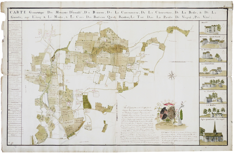
EVEN. MANUSCRIT.
Carte géométrique des mettayries d'Houzillé, du Boisroux, de la Couvenancière, de la Chenevettière, de la Brosse, & de la Guenesse, avec l'étang & le moulin, & le cours des ruisseaux qui s'y rendent ; le tout dans la paroisse de Vergeal, près Vitré.
Houzillé, 3 avril 1778. 670 x 1020 mm.
Referentie van de boekhandelaar : LBW-2821
|
|
|
EVEREST
Les premi?res cartes de l'Everest. Article (1 page, 2 cartes) dans L'Illustration.
Num?ro sans publicit?s.
|
|
|
EVOLUTION HUMAINE, ouvrage publié sous la dir. de M. LAHY-HOLLEBECQUE.
L'évolution humaine des origines à nos jours. Richement documenté (Planches en couleurs, cartes, héliogravures, gravures, figures).
Paris, A. Quillet 1951. 4 beaux volumes reliés, reliures demi cuir ornées d'éd., forts in-4, plus de 2000 pages.
Referentie van de boekhandelaar : AUB-3999
|
|
|
Ewert, Henry
The Story of the B.C. Electric Railway Company
336 pages including index. "The British Columbia Electric Railway consisted of 111 route miles of streetcar operations in four cities: seven interurban lines totaling 141 route miles; 40 million passengers carried in 1910, and almost 146 million in 1947. For 68 years - 1890 to 1958 - the streetcars and trams dominated and defined urban and interurban transportation in the most populated areas of B.C. Today only traces remain of this fascinating and well-run system that once brought people from all over the world to examine its operation. Includes over 270 fascinating illustrations, plans of rolling stock, tickets, transfers, beautiful route maps, public schedules, employee's timetables, rosters of rolling stock and old Buzzers." - from dust jacket. An amazing, and perhaps unbelievable, reference for residents of the now grid-locked lower mainland. Very heavily worn. Front hinge partially open. Usual library markings. A worthy reading copy. Ex-Library

|
|
|
Ewert, Henry
The Story of the B.C. Electric Railway Company
336 pages including index. "The British Columbia Electric Railway consisted of 111 route miles of streetcar operations in four cities: seven interurban lines totaling 141 route miles; 40 million passengers carried in 1910, and almost 146 million in 1947. For 68 years - 1890 to 1958 - the streetcars and trams dominated and defined urban and interurban transportation in the most populated areas of B.C. Today only traces remain of this fascinating and well-run system that once brought people from all over the world to examine its operation. Includes over 270 fascinating illustrations, plans of rolling stock, tickets, transfers, beautiful route maps, public schedules, employee's timetables, rosters of rolling stock and old Buzzers." - from dust jacket. A wonderful and almost unbelievable reference for residents of the now grid-locked lower mainland of British Columbia. Very light wear. Clean, bright and unmarked. Partial lean to spine. Short opening to back panel of dust jacket which is now preserved in a glossy new archival-grade Brodart cover. A high-quality copy. Book

|
|
|
Exem (ill.):
20 opercules « L’eau c’est la vie ».
Association pour la sauvegarde du Léman (ASL), sans date. Ensemble de 20 opercules illustrés par Exem (un doute plane sur l'illustrateur de l'un seul d'entre eux), issus de la campagne « L’eau c’est la vie » de l’Association pour la sauvegarde du Léman.
Referentie van de boekhandelaar : 25282

|
|
|
EXNER, Christof:
Erläuterungen zur geologischen Karte der Umgebung von Gastein 1:50.000 (Ausgabe 1956).
Oktav, 23.3cm. [IV],168 S., 3 gefalt. Karten und 5 gefalt. Taf. mit Profilen in Tasche, 8 Abb. im Text, Bibliogr. Priv.-Halbleinen, Kurztitel auf Rücken, Vorderteil des Orig.-Umschlages aufgeklebt. Sehr gutes Exemplar. - Ohne die eigentliche Karte 1:50.000 (wie erschienen).
|
|
|
EXPILLY Jean-Joseph (Abbé)
LE GEOGRAPHE MANUEL, contenant la description de tous les pays du monde, leurs qualités, leur climat, le caractère de leurs habitants, leurs villes capitales, avec leurs distances de Paris, & les routes qui y menent, tant par terre que par mer ; les changes & les monnoies des principales places de l'Europe, en correspondance avec Paris ; la manière de tenir les écritures de chaque nation ; la réduction de toutes les espèces au pied courant de France, de la Livre & des poids des différents pays à ceux de Paris ; les différentes mesures, &c.
1774 un volume, reliure plein veau havane (reliure de l'époque) raciné in-24 (binding full calfskin 24mo - A book that is up to 5 " tall.) (13,5 X 8,5 cm), dos à nerfs (spine with raised bands), décoré or (gilt decoration) filets or (gilt line) et filets à froid (blind-stamping line decoration) - entre-nerfs à fleuron au fer plein (between the raised bands floweret with full blocking stamp) - titre frappé or (gilt title) - pièce de titre sur fond havane clair avec filet or (label of title with gilt line), 2 coins écornés (corners dog-eared), roulettes sur les coupes (fillets on the cuts) manque de dorure (blurred gilding), tête lisse (top edge smooth), toutes tranches lisses (all smooth edges) rouges (all red edges), orné de 6 cartes dépliantes hors-texte (full page engraving) gravées sur Bois en noir (engraving-wood), 471 Pages, 1774 Paris Bauche Editeur,
Referentie van de boekhandelaar : 12738
|
|
|
EXPLORATEURS par Jean-Pierre CARTIER.
Explorateurs et explorations. Richement documenté (planches en couleurs, cartes, figures).
Ed. Larousse 1975. Bel exemplaire relié, reliure pleine toile et jaquette ornée d'éd., fort in-4, 400 pages.
Referentie van de boekhandelaar : AUB-6774
|
|
|
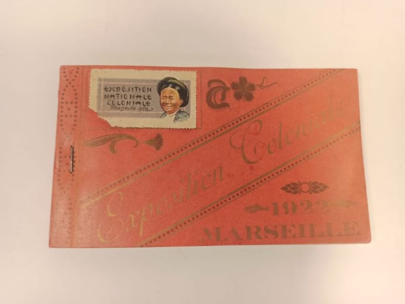
EXPOSITION COLONIALE)
Carnet complet de 24 poastales éditées à l'occasion de l'exposition coloniale de 1922, à Marseille.
1922 Format oblong broché (90 x 155 mmn) couverture rouge imprimée.
Referentie van de boekhandelaar : 23662
|
|
|
EXTENSION 60 CARTES
DE DES PREMIERS MOTS LES ALIMENTS
PASSE-TEMPS EDITIONS
Referentie van de boekhandelaar : SLIVCN-9990316700545
|
|
|
EXTENSION 60 CARTES
DE DES PREMIERS MOTS LES ANIMAUX
PASSE-TEMPS EDITIONS
Referentie van de boekhandelaar : SLIVCN-9990316700538
|
|
|
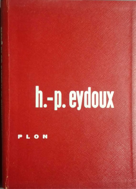
EYDOUX Henri-Paul 42 illustrations et cartes in-texte et 30 illustrations hors-texte.
Monuments et trésors de la Gaule. Les récentes découvertes archéologiques.
Couverture rigide. Cartonnage de l'éditeur. 267 pages.
Referentie van de boekhandelaar : 137286
|
|
|

 De zoekresultaten per email ontvangen
 Zoekresultaten downloaden als PDF
 RSS feed
 Permanente link


