|
Esso Staff
Esso Guia Turistica De America Del Sur (Esso South American Road Map)
24" x 34". Text in Spanish. Back side shows the continent overlaid with small color illustrations of dozens of items of local interest. Undated but appears to be circa late 1950s. Library markings. Average wear. A sound copy. Book

|
|
|
ESTIVALS (Robert), GAUDY (Jean-Charles).
La Bibliologie graphique. L'évolution graphique des plans de Paris (1530-1798)
Paris, Société de bibliologie et de schématisation, 1983 in-8, 296 pp., impression en partie sur papier rouge, en partie sur papier bleu, avec des illustrations dans le texte, broché.
书商的参考编号 : 227987

|
|
|
ESTEBE (Léon-Mary).
Villeneuve de Berg.
Villeneuve de Berg, association-Services "le Prieuré", s.d. (années 80 ou 90), 1 carte postale de 10 x 15 cm ;
书商的参考编号 : 7535
|
|
|
Estournelles de Constant, Paul Henri Benjamin, Baron d' (1852-1924).
LES ETATS-UNIS D'AMERIQUE.
pp. ix, 536 + Folding map. 12mo. Handsome contemporary leather backed marbled boards binding. An interesting and wide-ranging study of important aspects of American life before World War One. Scarce. **PRICE JUST REDUCED! FR5
|
|
|
Etang de Berre.Dépôt général de la Marine ,1848.
Côtes de France. Etang de Berre. Carte levée en 1844, publiée en 1848
1844 Côtes de France. Etang de Berre. Carte levée en 1844, publiée en 1848 Imp. du Sémaphore. Gravure, 1848. 63 x 50 cm.
书商的参考编号 : 22824
|
|
|
Etablissements LABOUCHE Frères
Nouveau Plan De Toulouse avec Les Nouvelles Dénominations De Certaines Voies Publiques Courant Avril 1946 après L'impression Du Plan
Toulouse Labouche Frères 1946 In 16 Très beau plan lithographié et plié de 53 cm X 70 cm en couleurs à l'échelle 1/10 000°de la ville de Toulouse . Quelques défauts d'usages sur la couverture mais le plan est parfait .- 1 p. , 250 gr.
书商的参考编号 : 007288

|
|
|
Etablissements LABOUCHE Frères
Nouveau Plan De Toulouse avec Les Nouvelles Dénominations De Certaines Voies Publiques Courant Avril 1946 après L'impression Du Plan
Très beau plan lithographié et plié de 53 cm X 70 cm en couleurs à l'échelle 1/10 000°de la ville de Toulouse . Quelques défauts d'usages sur la couverture mais le plan est parfait .- 1 p. , 250 gr.
|
|
|
Eugene Villiod
comment on nous vole au jeu
Paris , Imprimerie Waltener 1909
书商的参考编号 : 466
|
|
|
EUGÈNE-HENRI FRICX
Table des cartes des Pays Bas et des frontieres de France, avec un recueil des plans des villes, siéges et batailles données entre les hauts allies et la France. - [ONE OF THE MOST IMPORTANT MAP PUBLISHERS IN THE SOUTHERN NETHERLANDS]
Brussels, 1712. Folio (512 x 315 mm). In contemporary half calf with seven raised bands. Spine and hindges with wear. Leather brittle and upper and lower 10 cm hindges detached. Two library labels pasted on to pasted down front end-paper. Upper margin of first three leaves blind-stamped. Handwritten (19th century hand) index mounted in on verso of first map and each map numbered. With 75 maps and plans, many double-page or folding: 24 cartes des Pays Bas, Carte générale de Brabant, Carte du Pays de Waes, Carte des Postes d'Allemagne, 48 plans des Villes, Sièges & Batailles (complete). 3 maps with minor marginal tear (outside plate), 2 with minor split to lower part of middle folding. A few maps at end with browning. A few plates (primarily 61, 50, 33, 25) heavily trimmed with slight loss to upper margin. An overall fine and clean copy.
书商的参考编号 : 60165

|
|
|
EUGÈNE-HENRI FRICX
Table des cartes des Pays Bas et des frontieres de France, avec un recueil des plans des villes, siéges et batailles données entre les hauts allies et la France.
Brussels, 1712. Folio (512 x 315 mm). In contemporary half calf with seven raised bands. Spine and hindges with wear. Leather brittle and upper and lower 10 cm hindges detached. Two library labels pasted on to pasted down front end-paper. Upper margin of first three leaves blind-stamped. Handwritten (19th century hand) index mounted in on verso of first map and each map numbered. With 75 maps and plans, many double-page or folding: 24 cartes des Pays Bas, Carte générale de Brabant, Carte du Pays de Waes, Carte des Postes d'Allemagne, 48 plans des Villes, Sièges & Batailles (complete). 3 maps with minor marginal tear (outside plate), 2 with minor split to lower part of middle folding. A few maps at end with browning. A few plates (primarily 61, 50, 33, 25) heavily trimmed with slight loss to upper margin. An overall fine and clean copy.
|
|
|
EULER Leonhard (Basilea 1707 - San Pietroburgo 1783)
Tabula Geographica Hemisphaerii Australis...
Carta a proiezione polare dell'emisfero australe, pubblicata per la prima volta nel 1753 da Leonhard Euler.Mostra la Tasmania e la Nuova Guinea ancora uniti all'Australia; il Sud Africa e il Sud America. Include un cartiglio decorativo con titolo e stemmi.La carta è pubblicata nel raro Atlas geographicus omnes orbis terrarum regiones in XLI tabulis exhibens : jussu Academiae regiae scient. et eleg. litt. Boruss. ad emendatiora, quae adhuc prodiere exempla descriptus atque ad usum potissimum scholarum et institutionem juventutis editus = Atlas geographique representant en XLI cartes toutes les regions de la terre : gravé par ordre de l'Académie royale des sciences et belles lettres de Prusse d'apres les meilleurs exemplaires qui ayent paru jusqu'icy a l'usage principalement des ecoles. Berolini : Ex officina Michaelis MDCCLIII (1753). Incisione in rame, bella coloritura coeva, in ottimo stato di conservazione. Hand colored copperplate engraving map of Southern Hemisphere on 2 sheets, extracted from a geographical atlas first published in 1753 by Leonhard Euler. Relief shown pictorially. Shows Tasmania and New Guinea still joined to Australia, South Africa, South America. Published in the rare Atlas geographicus omnes orbis terrarum regiones in XLI tabulis exhibens : jussu Academiae regiae scient. et eleg. litt. Boruss. ad emendatiora, quae adhuc prodiere exempla descriptus atque ad usum potissimum scholarum et institutionem juventutis editus = Atlas geographique representant en XLI cartes toutes les regions de la terre : gravé par ordre de l'Académie royale des sciences et belles lettres de Prusse d'apres les meilleurs exemplaires qui ayent paru jusqu'icy a l'usage principalement des ecoles. Berolini : Ex officina Michaelis MDCCLIII.Copperplate with fine origibal colour, very good condition.

|
|
|
EULER Leonhard (Basilea 1707 - San Pietroburgo 1783)
Tabula Geographica Hemisphaerii Borealis…
Carta a proiezione polare dell'emisfero boreale, estratta dall'atlante geografico pubblicato per la prima volta nel 1753 da Leonhard Euler.Mostra un vasto sistema fluviale nella zona dei Grandi Laghi che forma un Passaggio a Nord-Ovest.La carta è pubblicata nel raro Atlas geographicus omnes orbis terrarum regiones in XLI tabulis exhibens : jussu Academiae regiae scient. et eleg. litt. Boruss. ad emendatiora, quae adhuc prodiere exempla descriptus atque ad usum potissimum scholarum et institutionem juventutis editus = Atlas geographique representant en XLI cartes toutes les regions de la terre : gravé par ordre de l'Académie royale des sciences et belles lettres de Prusse d'apres les meilleurs exemplaires qui ayent paru jusqu'icy a l'usage principalement des ecoles. Berolini : Ex officina Michaelis MDCCLIII (1753). Incisione in rame, bella coloritura coeva, in ottimo stato di conservazione. Hand colored copperplate engraving map of Northern Hemisphere, extracted from a geographical atlas first published in 1753 by Leonhard Euler. Relief shown pictorially. Shows extensive river system connecting it with the Great Lakes and thus forming a Northwest Passage.Published in the rare Atlas geographicus omnes orbis terrarum regiones in XLI tabulis exhibens : jussu Academiae regiae scient. et eleg. litt. Boruss. ad emendatiora, quae adhuc prodiere exempla descriptus atque ad usum potissimum scholarum et institutionem juventutis editus = Atlas geographique representant en XLI cartes toutes les regions de la terre : gravé par ordre de l'Académie royale des sciences et belles lettres de Prusse d'apres les meilleurs exemplaires qui ayent paru jusqu'icy a l'usage principalement des ecoles. Berolini : Ex officina Michaelis MDCCLIII.Copperplate with fine origibal colour, very good condition.

|
|
|
EUROPE
L'Europe méridionale par Élisée RECLUS. Richt documenté (74 gravures, 4 cartes en couleurs, 174 cartes dans le texte). Grèce, Turquie, Roumanie, Italie, Espagne et Portugal).
Paris, éd. Hachette 1879. Bon exemplaire relié, reliure demi cuir ornée d'éd., fort et pet in-4, IV + 1012 pages + planches.
书商的参考编号 : AUB-5688
|
|
|
EURE
Carte d?partementale en couleurs. Sans date.
Une feuille 80x60 cm.
|
|
|
Euro Maps
Romania Moldavia. Scale 1:800000. Euro Country Map
GeoCenter 1995. First Edition. Softcover. Fine map in protective card-board folded case. Series; Euro maps 33228. Physical description; Map. Genre; Miscellany. Notes; Scale 1:800 000 Includes index. Subjects; Map. Romania. Genre; Euro maps. GeoCenter paperback
书商的参考编号 : 232724 ???????? : 3575332282 9783575332288

|
|
|
Europcar
Nederland Road Map
Scale 1: 300000, colour map, no publication date (1980s?). eng
|
|
|
Eustache Hérisson
Carte de Paris et ses environs par Eustache Hérisson, vers 1810
Jolie carte de Paris et ses environs contenant le département de la Seine et une partie du département de la Seine et Oise. Par Hérisson, à Paris chez Lenoir Dans un petit livret cartonné, 12x7cm, la carte dépliée 42,5x31cm, petite coupure et restauration au dos, sinon bel état, sans date vers 1820.
书商的参考编号 : CZC-13062

|
|
|
Eustache Hérisson
Carte de Paris et ses environs par Eustache Hérisson, vers 1810
Jolie carte de Paris et ses environs contenant le département de la Seine et une partie du département de la Seine et Oise. Par Hérisson, à Paris chez Lenoir Dans un petit livret cartonné, 12x7cm, la carte dépliée 42,5x31cm, petite coupure et restauration au dos, sinon bel état, sans date vers 1820.
书商的参考编号 : CZC-13062
|
|
|
Evans, Lindsay
The Castles of Wales
No marks or inscriptions. A lovely clean very tight copy with bright unmarked boards and no bumping to corners. Dust jacket not price clipped or marked or torn with minor crease near top of sunned spine. 273pp. A study of the strongholds of the Edwardian Conquest in North Wales and the Norman defences in South Wales. Well illustrated.

|
|
|
EVEREST
Les premi?res cartes de l'Everest. Article (1 page, 2 cartes) dans L'Illustration.
Num?ro sans publicit?s.
|
|
|
Everhart, William C. & Photos & Maps
Vicksburg
National Park Service. Near Fine. 1954. Paperback. 60 pp; Cover lightly rubbed and a little shelf wear light crease on upper front corner illustration in great shape original price stamped on front cover 25 cents no names pages unmarked. A very nice clean tight pamphlet. . National Park Service paperback
书商的参考编号 : 791966
|
|
|
EVOLUTION HUMAINE, ouvrage publié sous la dir. de M. LAHY-HOLLEBECQUE.
L'évolution humaine des origines à nos jours. Richement documenté (Planches en couleurs, cartes, héliogravures, gravures, figures).
Paris, A. Quillet 1951. 4 beaux volumes reliés, reliures demi cuir ornées d'éd., forts in-4, plus de 2000 pages.
书商的参考编号 : AUB-3999
|
|
|
Ewert, Henry
The Story of the B.C. Electric Railway Company
336 pages including index. "The British Columbia Electric Railway consisted of 111 route miles of streetcar operations in four cities: seven interurban lines totaling 141 route miles; 40 million passengers carried in 1910, and almost 146 million in 1947. For 68 years - 1890 to 1958 - the streetcars and trams dominated and defined urban and interurban transportation in the most populated areas of B.C. Today only traces remain of this fascinating and well-run system that once brought people from all over the world to examine its operation. Includes over 270 fascinating illustrations, plans of rolling stock, tickets, transfers, beautiful route maps, public schedules, employee's timetables, rosters of rolling stock and old Buzzers." - from dust jacket. An amazing, and perhaps unbelievable, reference for residents of the now grid-locked lower mainland. Very heavily worn. Front hinge partially open. Usual library markings. A worthy reading copy. Ex-Library

|
|
|
Ewert, Henry
The Story of the B.C. Electric Railway Company
336 pages including index. "The British Columbia Electric Railway consisted of 111 route miles of streetcar operations in four cities: seven interurban lines totaling 141 route miles; 40 million passengers carried in 1910, and almost 146 million in 1947. For 68 years - 1890 to 1958 - the streetcars and trams dominated and defined urban and interurban transportation in the most populated areas of B.C. Today only traces remain of this fascinating and well-run system that once brought people from all over the world to examine its operation. Includes over 270 fascinating illustrations, plans of rolling stock, tickets, transfers, beautiful route maps, public schedules, employee's timetables, rosters of rolling stock and old Buzzers." - from dust jacket. A wonderful and almost unbelievable reference for residents of the now grid-locked lower mainland of British Columbia. Very light wear. Clean, bright and unmarked. Partial lean to spine. Short opening to back panel of dust jacket which is now preserved in a glossy new archival-grade Brodart cover. A high-quality copy. Book

|
|
|
Exem (ill.):
20 opercules « L’eau c’est la vie ».
Association pour la sauvegarde du Léman (ASL), sans date. Ensemble de 20 opercules illustrés par Exem (un doute plane sur l'illustrateur de l'un seul d'entre eux), issus de la campagne « L’eau c’est la vie » de l’Association pour la sauvegarde du Léman.
书商的参考编号 : 25282

|
|
|
EXNER, Christof:
Erläuterungen zur geologischen Karte der Umgebung von Gastein 1:50.000 (Ausgabe 1956).
Oktav, 23.3cm. [IV],168 S., 3 gefalt. Karten und 5 gefalt. Taf. mit Profilen in Tasche, 8 Abb. im Text, Bibliogr. Priv.-Halbleinen, Kurztitel auf Rücken, Vorderteil des Orig.-Umschlages aufgeklebt. Sehr gutes Exemplar. - Ohne die eigentliche Karte 1:50.000 (wie erschienen).
|
|
|
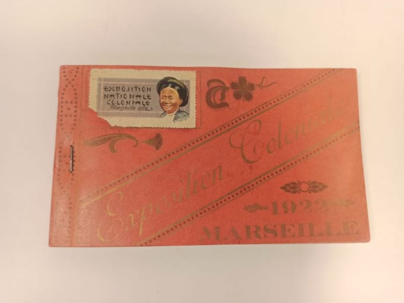
EXPOSITION COLONIALE)
Carnet complet de 24 poastales éditées à l'occasion de l'exposition coloniale de 1922, à Marseille.
1922 Format oblong broché (90 x 155 mmn) couverture rouge imprimée.
书商的参考编号 : 23662
|
|
|
EXPLORATEURS par Jean-Pierre CARTIER.
Explorateurs et explorations. Richement documenté (planches en couleurs, cartes, figures).
Ed. Larousse 1975. Bel exemplaire relié, reliure pleine toile et jaquette ornée d'éd., fort in-4, 400 pages.
书商的参考编号 : AUB-6774
|
|
|
EXPILLY Jean-Joseph (Abbé)
LE GEOGRAPHE MANUEL, contenant la description de tous les pays du monde, leurs qualités, leur climat, le caractère de leurs habitants, leurs villes capitales, avec leurs distances de Paris, & les routes qui y menent, tant par terre que par mer ; les changes & les monnoies des principales places de l'Europe, en correspondance avec Paris ; la manière de tenir les écritures de chaque nation ; la réduction de toutes les espèces au pied courant de France, de la Livre & des poids des différents pays à ceux de Paris ; les différentes mesures, &c.
1774 un volume, reliure plein veau havane (reliure de l'époque) raciné in-24 (binding full calfskin 24mo - A book that is up to 5 " tall.) (13,5 X 8,5 cm), dos à nerfs (spine with raised bands), décoré or (gilt decoration) filets or (gilt line) et filets à froid (blind-stamping line decoration) - entre-nerfs à fleuron au fer plein (between the raised bands floweret with full blocking stamp) - titre frappé or (gilt title) - pièce de titre sur fond havane clair avec filet or (label of title with gilt line), 2 coins écornés (corners dog-eared), roulettes sur les coupes (fillets on the cuts) manque de dorure (blurred gilding), tête lisse (top edge smooth), toutes tranches lisses (all smooth edges) rouges (all red edges), orné de 6 cartes dépliantes hors-texte (full page engraving) gravées sur Bois en noir (engraving-wood), 471 Pages, 1774 Paris Bauche Editeur,
书商的参考编号 : 12738
|
|
|
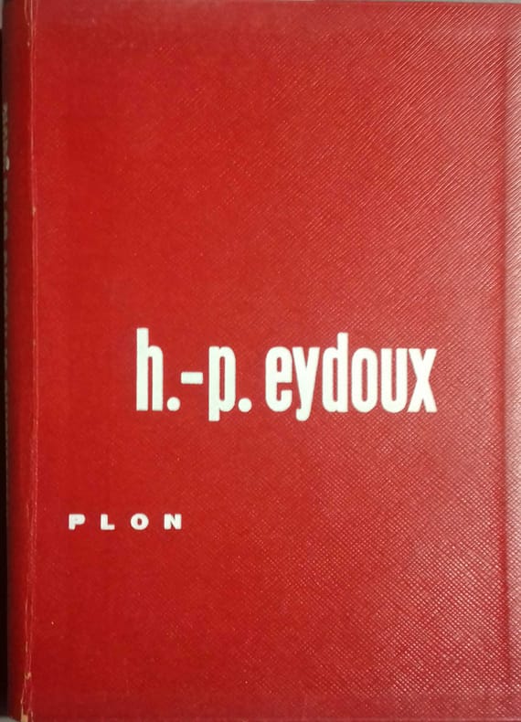
EYDOUX Henri-Paul 42 illustrations et cartes in-texte et 30 illustrations hors-texte.
Monuments et trésors de la Gaule. Les récentes découvertes archéologiques.
Couverture rigide. Cartonnage de l'éditeur. 267 pages.
书商的参考编号 : 137286
|
|
|
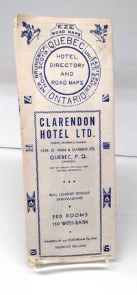
EZE Road Maps
Quebec-Ontario Hotel Directory and Road Map
nd. 1940s. Very good. Fold-out map shows southern Ontario and Quebec Maritimes and northern New York Ohio New England. Blue ink on white background. Reverse has various roads in segments. Some hotel listings not exhaustive. A little soiling. <br/><br/> unknown
书商的参考编号 : 152565
|
|
|
F J Monkhouse & H R Wilkinson:
MAPS AND DIAGRAMS Their compilation and Construction
VG (original green cloth, a little faded and marked, no dj) Octavo 432pp Profusely illustrated, many foldouts. Comprehensive
|
|
|
F. Cartes.
Semana Nacional Del Libro Infantil Y Juvenil. Exhibition Poster.
Madrid: National Institute of Spanish Books ca. 1970. Large format color print poster 25†x 12â€. Very Good. Minor creasing on top and bottom edges. Scarce. Text in Spanish.From the collection of the late Frederick Ruffner Jr. founder of Gale Research Detroit. Madrid: National Institute of Spanish Books, [ca. 1970] unknown
书商的参考编号 : 19-8996

|
|
|
FABUS Elie
CONFERENCE GRIMALDIENNE montage et exécution récréatifs de coups gagnants à tous les jeux de cartes : Ecarté - Manille - Piquet - Rams - Belotte - Poker - Bridge - Baccara - Banque - Bonneteau - etc. -
1970 broché petit in-octavo, couverture verso : manque la partie de queue, 39 pages, sans date Paris H. Billy Editeur,
书商的参考编号 : 4221
|
|
|
Fabrizio Mancinelli
The Sistine Chapel
Probably unread. No marks or inscriptions. Very tiny creasing to lower corner of front cover, none to spine. A lovely clean very tight copy with bright unmarked boards and no bumping to corners. 112pp. The history and the art of the Sistine Chapel at the Vatican. We do not use stock photos, the picture displayed is of the actual book for sale. Every one of our books is in stock in the UK ready for immediate delivery.

|
|
|
FADEN (William).
[LONDRES] A new pocket plan of the cities of London & Westminster; with the borough of Southwark: comprehending the new buildings and other alterations to the year 1795.
London, William Faden, 1795. En 20 sections montées sur toile et pliées, formant un plan de 468 x 915 mm.
书商的参考编号 : LBW-5421

|
|
|
FAIN Baron:
Manuscrit de Mil huit cent treize, contenant le précis des événemens de cette année, pour servir à l’histoire de l’empereur Napoléon.
Paris, Delaunay, 1829. 2 volume in-8 de VI-493 + 556 pages, demi-basane marron, dos lisses ornés. Coiffes et dos légèrement frottés, pâle auréoles sur quelques feuillets.
书商的参考编号 : 1765

|
|
|
Fairgrieve, J. & Ernest Young
The British Isles
252 pages, maps, figures, appendix, index, name of a previous owner on the front endpaper. (The Human Geographies Secondary Series ; Book 1) eng
|
|
|
Fajana A. & B. J. Biggs illustrations by C. Pearson maps by G. Woodman
Nigeria in history
Ikeja: Longman Nigeria Ltd 1977. Paperback. viii 230p. preface appendices illustrations maps lightly-worn reprint trade paperback in red pictorial wraps. Longman Nigeria Ltd paperback
书商的参考编号 : 170527 ???????? : 0582602424 9780582602427

|
|
|
Fajana A. & B. J. Biggs illustrations by C. Pearson maps by G. Woodman
Nigeria in history
Ikeja: Longman Nigeria Ltd 1977. Paperback. viii 230p. preface appendices illustrations maps lightly-worn reprint trade paperback in red pictorial wraps. Longman Nigeria Ltd paperback books
书商的参考编号 : 170527 ???????? : 0582602424 9780582602427
|
|
|
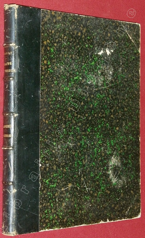
FALCOT, P.
Atlas des Planches d'Armures, brefs, dessins et mises en cartes, faisant suite au Traité de la Fabrication des Tissus, par P. Falcot, dessinateur.
A Elbeuf (sur Seine), chez l'Auteur, à Mulhouse, chez J.P. Risler, Libraire, 1852, 1 volume de 220x280x20 mm environ, complet de 89 planches+ pl. de titre, demi basane bleu marine, dos à 5 nerfs portant titres dorés, gardes marbrées. Mors internes en partie fendus, frottements sur le cuir et le cartonnage, coupes et coiffes émoussées, intérieur bon état.
书商的参考编号 : 82982
|
|
|
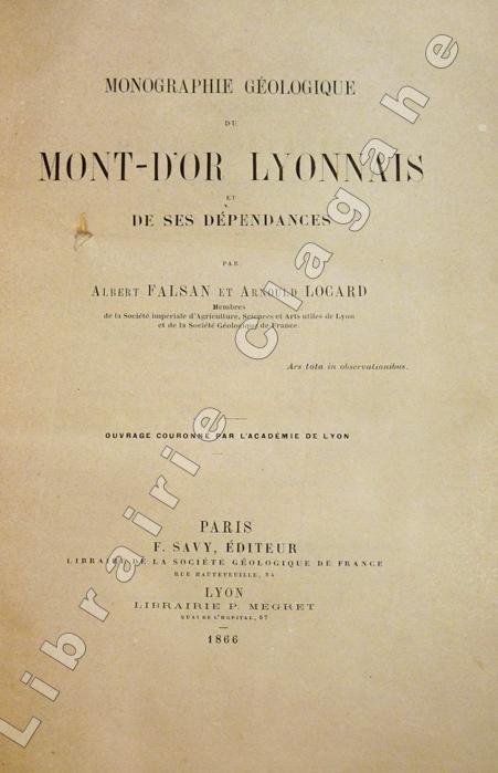
Falsan, Albert et Locard, Arnould :
Monographie géologique du Mont-d'Or lyonnais et de ses dépendances.
Paris, Savy et Lyon, P. Mégret (Lyon, Imprimerie Pitrat Aîné), 1866 ; in-8 ; demi-veau glacé bronze, dos à nerfs, titre doré, exemplaire juste ébarbé (reliure de l'époque) ; 499, (1) pp., 6 tableaux dépliants dont 1 très grand sur les étages géologiques, 4 planches hors-texte lithographiées dont 2 dépliantes et 1 grande carte géologique dépliante lithographiée en couleurs qui indique aussi les carrières, sablières, mines et emplacements de fossiles.
书商的参考编号 : 5649
|
|
|
Falk Plan Maps
Hamburg City Plan Falk Plan German Edition
map. Good. Access codes and supplements are not guaranteed with used items. May be an ex-library book. unknown
书商的参考编号 : 3884451057.G ???????? : 3884451057 9783884451052

|
|
|
Falls, Cyril (comp.) [A. F. Beck (maps)]
Military Operations Macedonia: from the Spring of 1917 to the End of the War
London / Nashville: Imperial War Museum / Battery Press 1930. 1st ed. thus. New Book. octavo. orig. cloth xvi 365pp. maps& plans appends. indexes Official History of the Great War. Facsimile of the original 1935 edition. Large folding map in rear pocket Imperial War Museum / Battery Press hardcover
书商的参考编号 : 65119
|
|
|
FALSAN, Albert, & LOCARD, Arnould.:
Carte géologique du Mont-d'Or Lyonnais et de ses dépendances.
Chromolithographed map, scale 1:20,000, meas. 68x66cm, dissected and mounted on linen, folding back to 23x23x14.3cm. -Rare detailed map published along with (and belonging to?) the rare "Monographie géologique du Mont-d'Or Lyonnais" (Paris 1866).
|
|
|
FANTASIO
Cannes, chandelles et baguettes magiques.
Strasbourg, Editions du Spectacles, 1984. 15 x 22, 91 pp., 135 figures, broché, bon état.
书商的参考编号 : 36713
|
|
|
FANTINI E
LE POKER COMMENT JOUER COMMENT GAGNER COMMENT CONJURER LE MAUVAIS SORT
de Vecchi De Vecchi 191976. In-8 broché de 142 pages.Bon état
书商的参考编号 : 36080
|
|
|
Fanlac, Pierre (editor)
The Font de Gaume Cave - in Perigord
Booklet is 'as new' condition. 48pp. The history of the prehistoric cave paintings at the Font-de-Gaume cave near Les Eyzies in Perigord, France.

|
|
|
FANTINI E
LE POKER COMMENT JOUER COMMENT GAGNER COMMENT CONJURER LE MAUVAIS SORT
De Vecchi 191976. In-8 broché de 142 pages.Bon état
|
|
|
FARRERE Claude - CHACK Paul 5 cartes.
Combats et batailles sur mer. (Septembre 1914 - Décembre 1914).
Couverture souple. Broché. 283 pages. Papier bruni.
书商的参考编号 : 148024
|
|
 ?????????
 ?????PDF???
 RSS feed


